The medieval church of Seskinane/Seskinan is located in the townland of Knockboy Co Waterford about 3/4 mile from Bearys cross, just off the Clonmel-Dungarvan road. Although a little out-of-the-way the site is signposted from the Clonmel-Dungarvan road so can be found relatively easily.

Location map showing the site of Seskinane church
In medieval times this church functioned as the parish church for the parish of Seskinane and was part of the prebend of Lismore. It is located in the ancient territory of Sliabh gCua. By the late sixteenth century it was in a state of ruin and was recorded as derelict in 1588.
According to Power (1952, 56) the placename Seskinane signifies “Little Sedgy Moor. The townland today is made up of rough pasture.

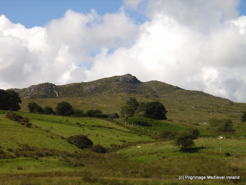
View of mountains from carpark
Medieval Parish Church
The church is found at the end of a long narrow winding bohereen. It is surrounded by a historic graveyard enclosed by a modern earth and stone bank.

Seskinane medieval parish church surrounded by a historic graveyard
The graveyard surrounding the church is filled with graves ranging in date from the 18th century to the present and it possesses quiet a number of very finely carved 18th and early 19th century gravestones. The interior of the church is also filled with gravestones of 18th and 19th century date.
This slideshow requires JavaScript.
The church has a rectangular plan without any internal division. The west gable had a double belfry with pointed arches. The belfry was badly damaged in storm in the early 1990s and what remains is covered in ivy. The majority of the wall is still standing although without some intervention it is difficult to know for how much longer. The west gable wall is in poor condition and slightly bowed, the ivy that covers it is probably holding it together. The wall has a sign ‘danger falling stones from church building’ . The sign tells of the risk to anyone approaching the church. Those who access the site and enter the church do so at their own risk.

One of several signs at the sight illustrating the dangers of falling masonry from the church walls.
The west wall is lit by two ogee-headed windows, placed one above the other.

Old photo of the double belfry taken in the late 19th century

Interior of west gable circa 2013

Exterior of west gable of Seskinane church 2015
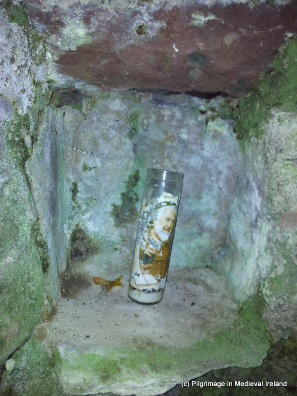
The east gable of the church is lit by a central ogee head window and the lower section of this window has been turned into a small shrine incorporating a statue of the blessed virgin.

Exterior of east gable of the church

The exterior of the east widow of church

The interior of the east window of the church
The walls of the church are built of rubble stone with dressed stones used for windows and doors. Two opposing pointed doorways provide access into the interior of the church in the north and south walls. At present door in the north wall is partially blocked with masonry from the church.

Doorway in the south wall of the church
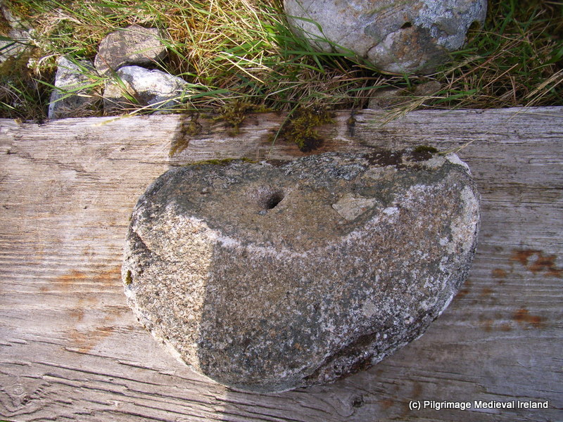
Windows survive at the eastern end of the north and south walls. Other features include a cut water stoup inside the south door and an amubrey at the east end of the south wall.

View of the south door in the interior of the church and holy water stoup.
Ogham Stones
This little ruined church is very special as it incorporates six o
gham stones within its fabric.
The presence of these ogham stones has led some to suggest the church stands on the site of an earlier church. In the late 19th century traces of a possible ecclesiastical enclosure, no longer upstanding, were recorded in the field to the south of the church and within the graveyard (Brash 1868-9, 127; Power 1898, 84). There is also very pronounced curve in the field boundary to the east of the church that along with the 19th century evidence may tentatively suggest the presence of an enclousure.
The majority of ogham stones at Seskinane were reused as lintels and are found in the windows in the north, south and west walls and in the south door. Two other free-standing stones were also found at the site only one of which is still present at the site. The inscriptions from the stones were transcribed by Brash (1868-9) and Macalister (1945, vol. 1, 286-9).
The South Wall
A large greenstone ogham stone acts as the lintel of the southern doorway. The ogham script is visible along the lower edge of the stone. A circular hole pierces the stone at the western end it appears to post date the ogham script as it cuts the some of the ogham letters. Macalister (1945, 287) records the inscription as
Q[E]CC[IAS] M[U]C [OI B] R[O] E[ NIONAS]

Ogham stone used as a lintel in the southern doorway. The ogham script is found on the lower edge of the stone.
This slideshow requires JavaScript.
A second ogham stone has been used as a lintel in the southern window beside the east gable. Macalister (1945, 286) transcribed the inscription as
…]RG[…]BRENE [….
One of the voussoirs that make up relieving arch above this lintel also features some ogham script which Macalister transcribed as CROB (Macalister 1945, 287).

Ogham stone used as lintel in the southern window beside east gable. The second voussoir on the left also has ogham script.
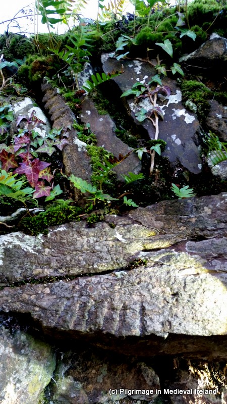
Close up of ogham script on the lintel and voussoir in the southern window.
The North Wall
The window at the east end of the north wall of the church also incorporates a ogham stone of as a lintel. Macalister (1945, 286)recorded the inscription as
…]ER[A]T[I] M[U]C[OI] NETA-S [EGAM] ONAS

Window at eastern end of the north wall

Close up of Ogham script on lintel of window in the north wall
The West Wall
The west wall of the church is covered in thick ivy at present. It contains two windows both of which have ogham stones as lintels.
Macalister (1945, 287-288) noted the upper stone of the top window had the inscription
…]CIR MAQI MUC[…..
and the lower window had the inscription
VORTIGURN

Interior of west gable circa 2013

View of the lower window of the west gable of the church.

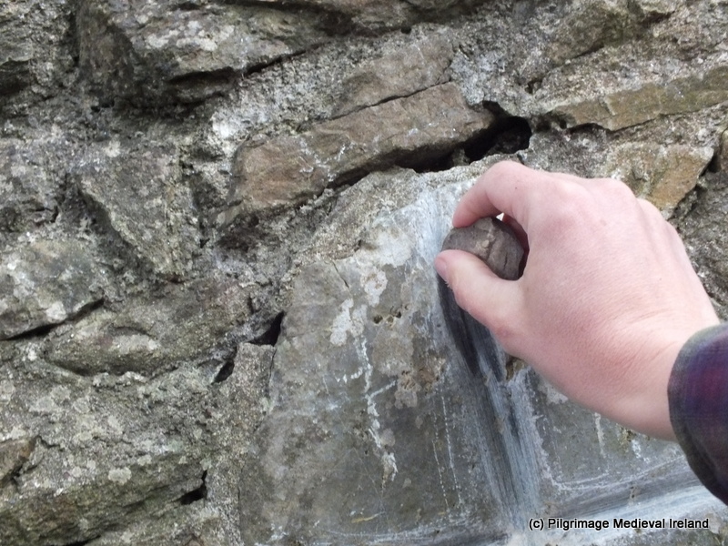
Ogham inscription of the lower window of the west gable
A seventh ogham stone is located in the northwest corner of the church. Macalister (1945, 286) recorded the inscription as
…]ER[A]T[I] M[U]C[OI] NETAS[EGAM]ONAS
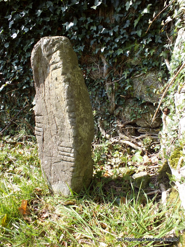
Ogham stone in the northwest corner of the church
There was an eight ogham stone at the site, in the past it was moved to a house near Cappoquin but it has since been lost. It was read by Redmond (1885-6, 418-19) as OMONG EDIAS MAQI MUI BITE, and by Macalister (1945, vol. 1, 289) as [MAQI?] MOnEDIAS MAQI MUIBITI
The Church and Community in modern times
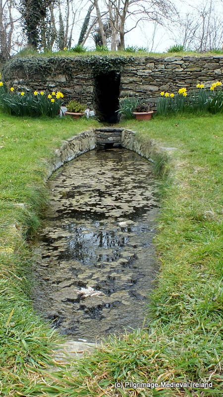
The parish of Seskinane was dedicated to the Blessed Virgin. In the past a pattern was held here, it was known locally as La Féilé Mhuire Chnoc Bhuí and it was celebrated on the 8th of September but over time the tradition died out.
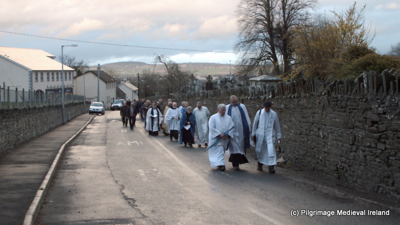
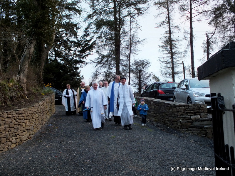
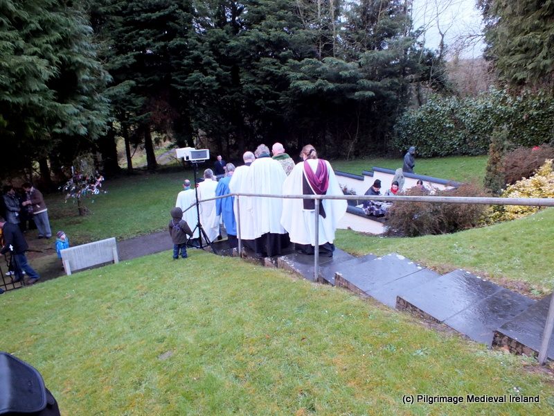
Since 1978 the local community has celebrated mass outside the ruins of church on or as close to the 8th of September (the feast of the nativity of the Blessed Virgin) as possible. It is also a time for the local communities to visit their graves.
This slideshow requires JavaScript.
Local Folk Tale: Seskinane Church and the Bell
A local folk tale recounts that when this the church was built it lacked a bell
to call the faithful to Mass. It was decided to take a bell from the nearby church at Kilkeany (this church has not survived to the present although its location is still remembered) and use it at Knockboy. Thus the bell was removed from the belfry of Kilkeany church and brought to the church at Knockboy.
However, when the bell was brought to Knockboy, it was found that no matter how hard it was rung the well would not chime. It was said that the bell broke from where it was hung and made its way back to Kilkeany, in the middle of the night, chiming the length of the journey and that shrieks of mocking laughter could be heard (Keane 2015, 36).
To sum up
Seskinane church preserves physical evidence of medieval devotional practices within the medieval parish of Seskinane. The presence and survival of such a large collection of ogham stones is culturally significant at a local and national level. The presence of the ogham stones within the fabric of the church also tells us a little about medieval ideas of re-use and recycling. Given the state of the fabric of the church and the constant barrage of storms our country is currently experiencing, I do worry for the future of the site, I really feel that this site is significant to warrants a program of conservation.
If anyone is interested in finding out more about ogham stones check out the wonderful
Ogham in 3D website. The site details the work of the Ogham in 3D project that is currently carrying out a laser-scan of as many as possible of the approximately four hundred surviving Irish Ogham stones and to make these 3D models available online. The results of the project to date can be seen on the website.
References
Brash, R. R. 1868-9 ‘On the Seskinan ogham inscriptions, County of Waterford’, JRSAI 10, 118-30.
Keane, T. 2015. ‘Churches Old and New ‘ Sliabh gCua Annual No.21, 35-36.
Macalister, R. A. S. (1945) (reprint 1949) Corpus inscriptionum insularum Celticarum, 2 vols. Stationery Office, Dublin.
Moore, F. 1999. Archaeological Inventory of County Waterford. Dublin: Stationery Office.