The Tybroughney Pillar Stone Co Kilkenny

The Tybroughney pillar, an early medieval pillar stone in the townland of Tybroughney/Tibberaghny, Co Kilkenny is one of the most interesting early medieval carvings in Ireland.

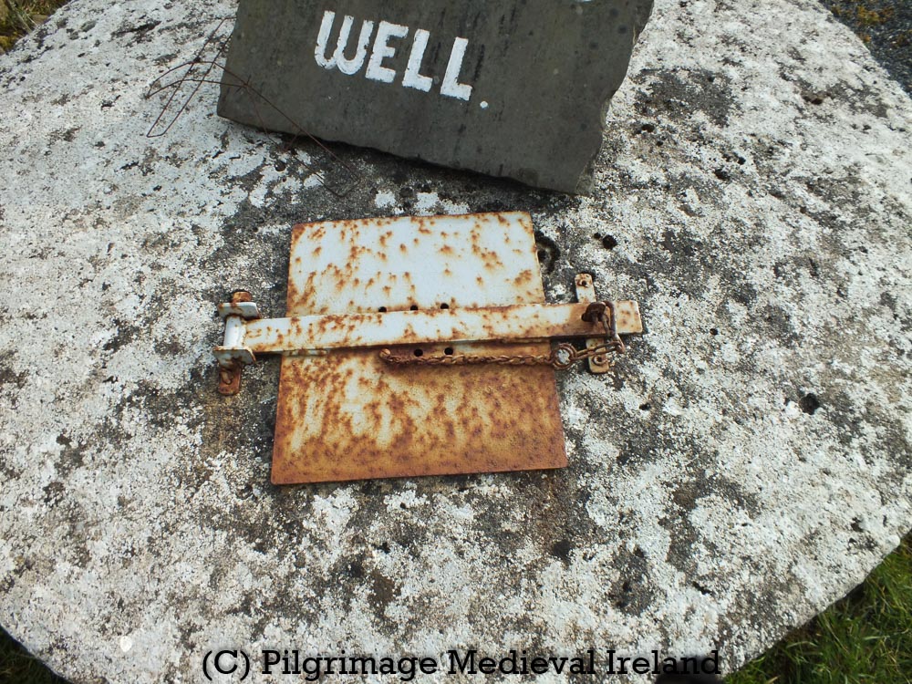
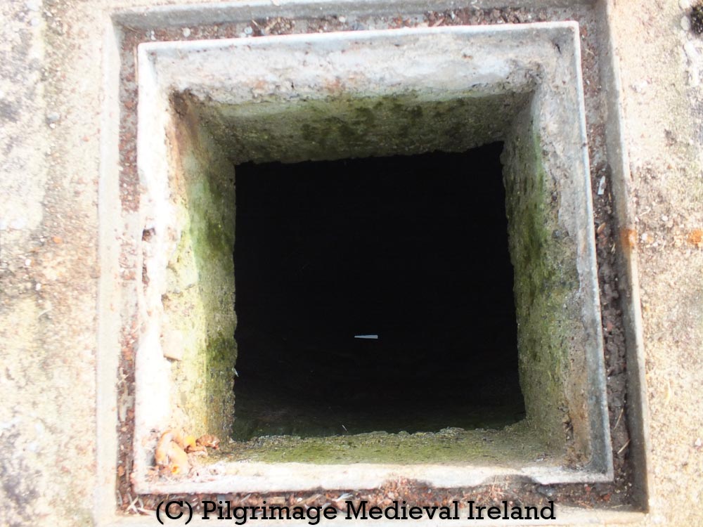
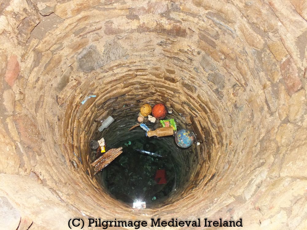
The townland of Tybroughney is associated with two saints. The first is St Fhachna, who is tthe patron of a holy well that gives its names to the townland. The name Tybroughney Tiobra Fhachna translates as St Fhachna’s holy well.

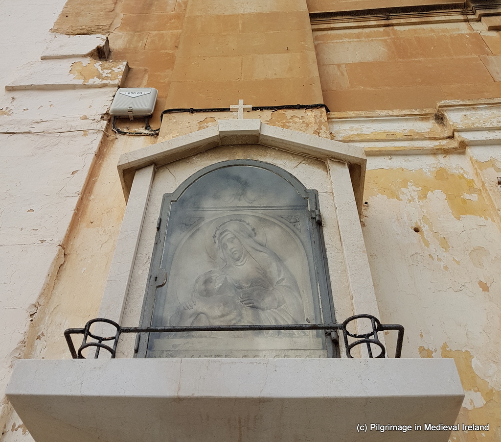
The second saint is St Modomnoc a hermit who founded a monastery here in the sixth century. The former monastery is said to be located at the ruins of the medieval church of Tybroughney.

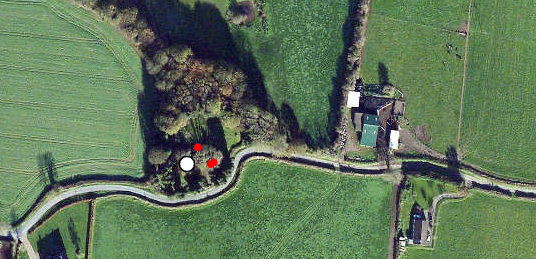
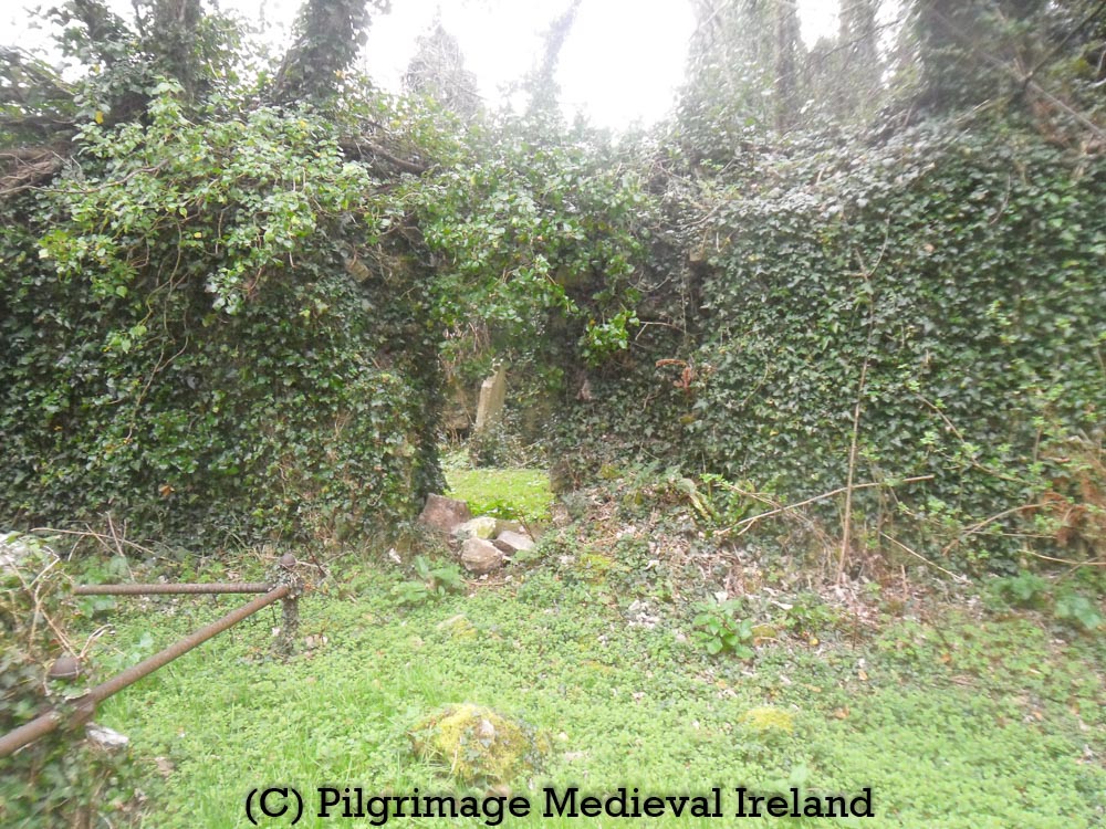
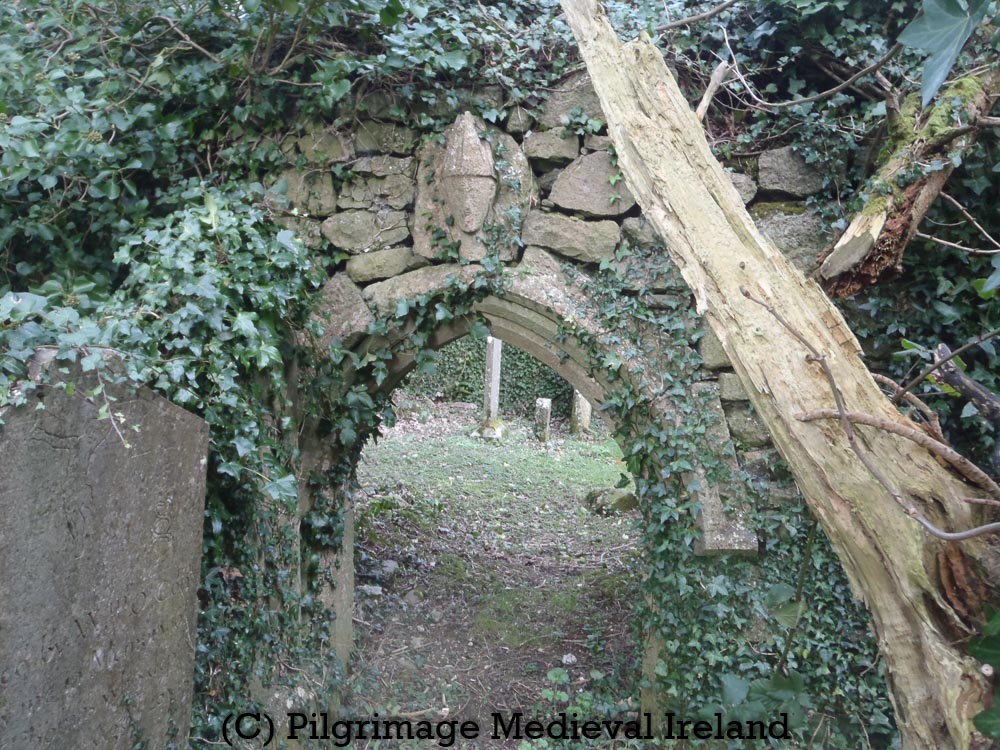
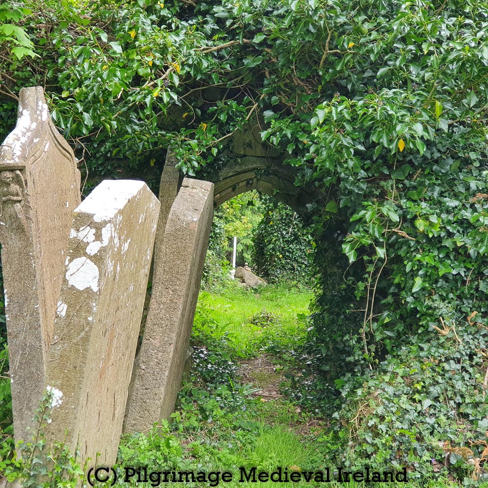
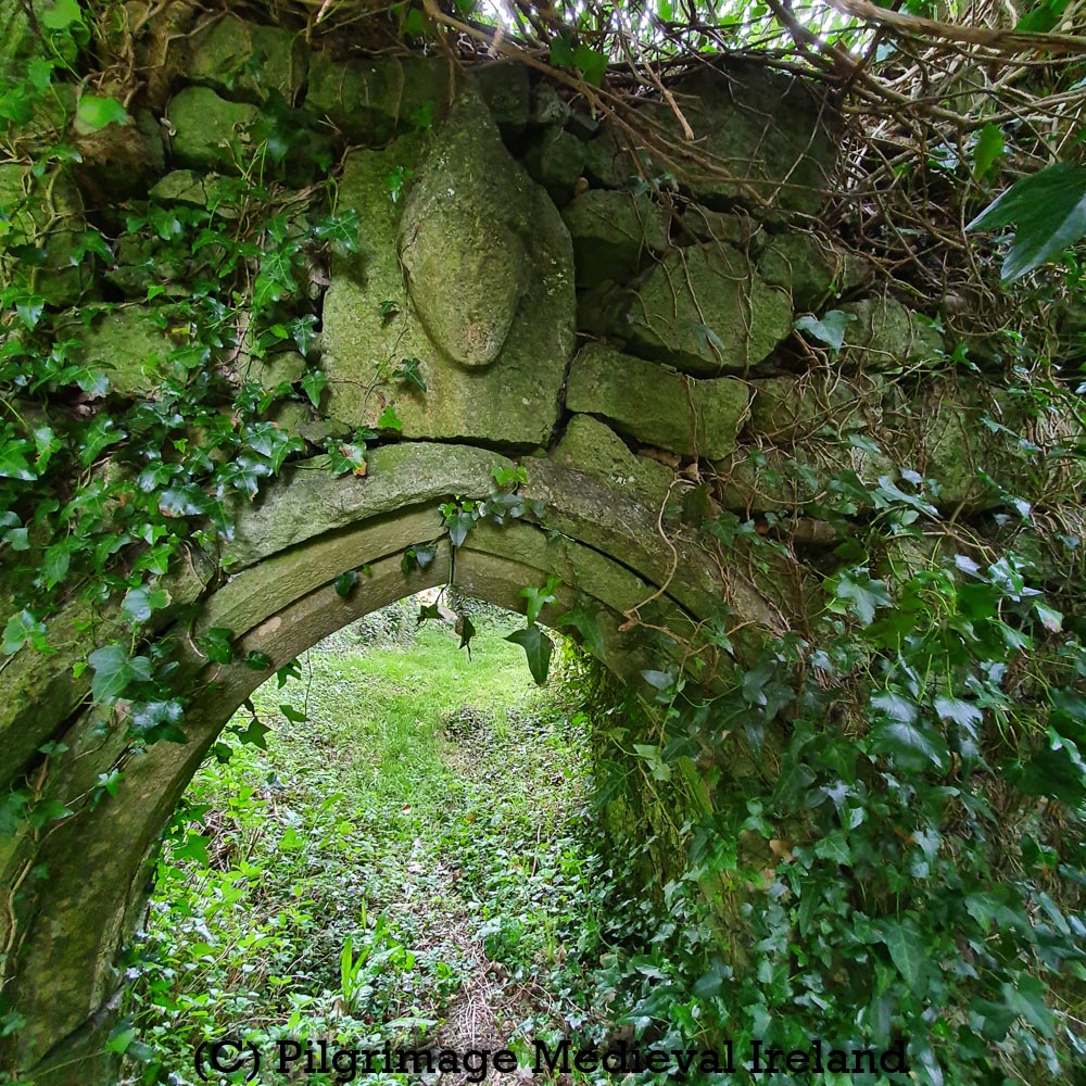
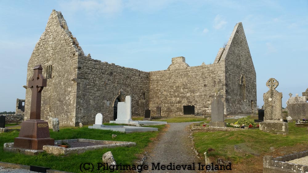
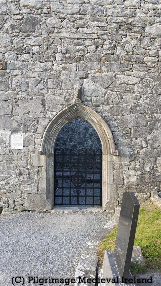
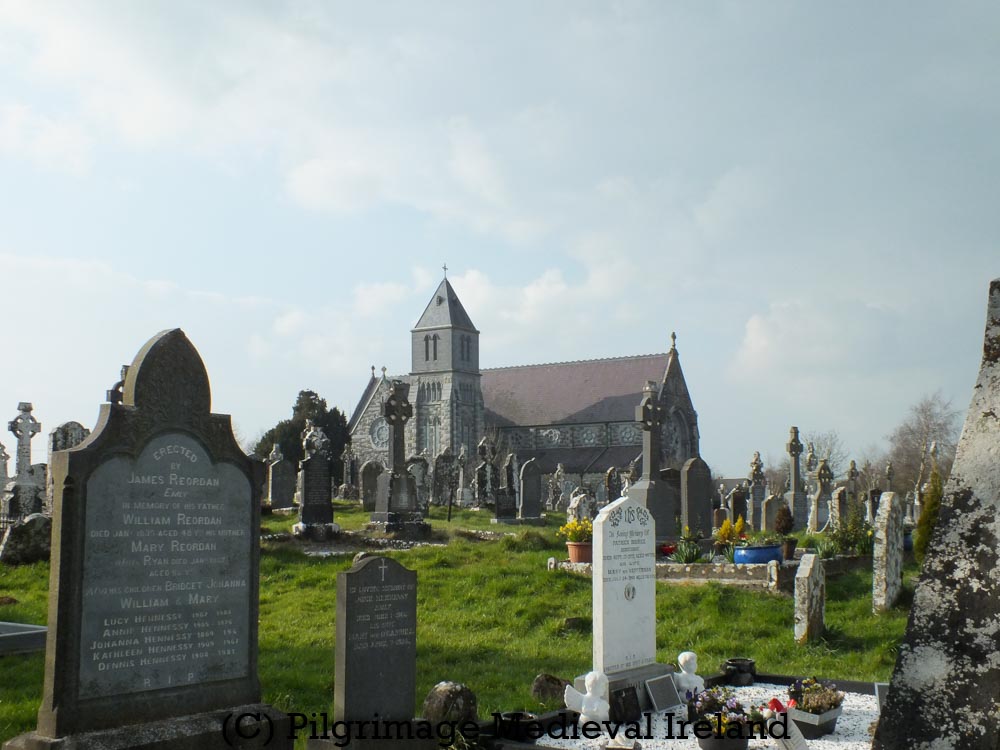
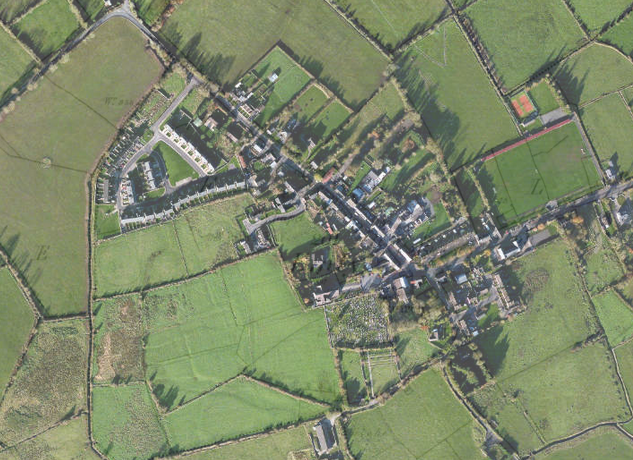
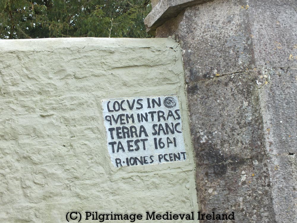
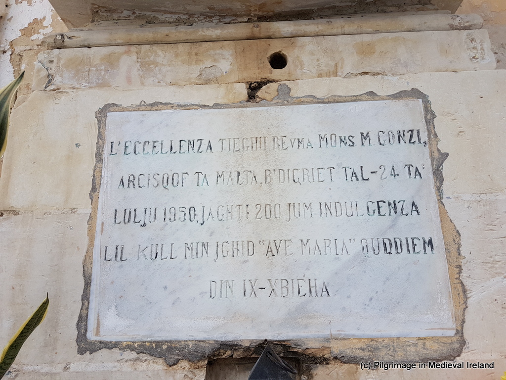
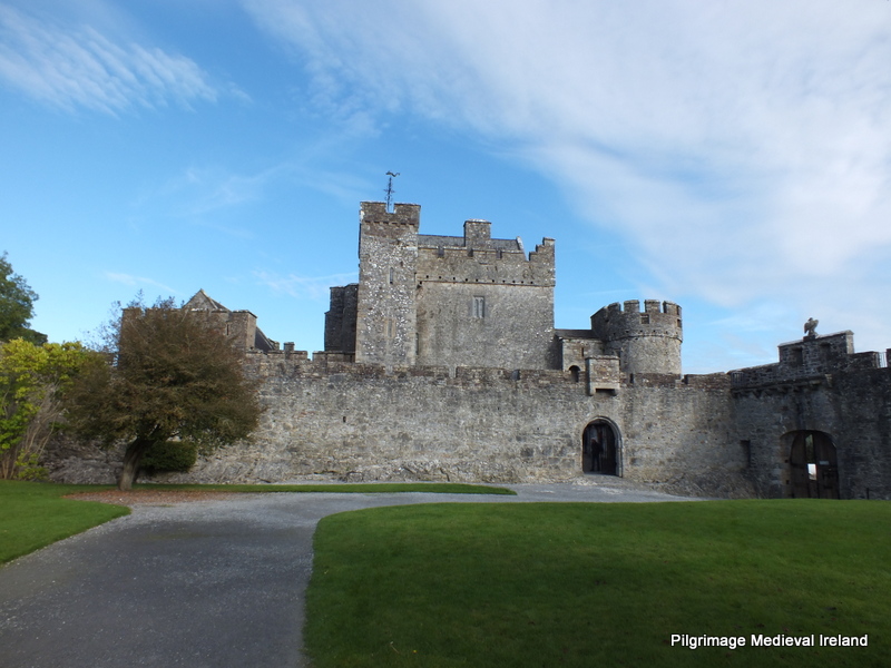
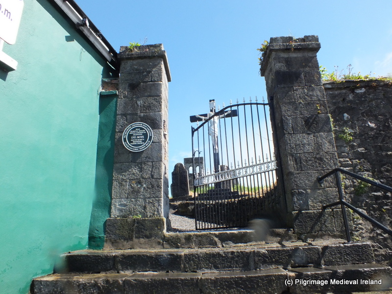
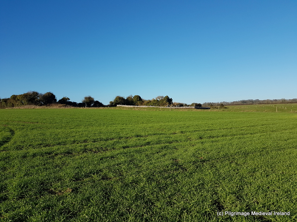
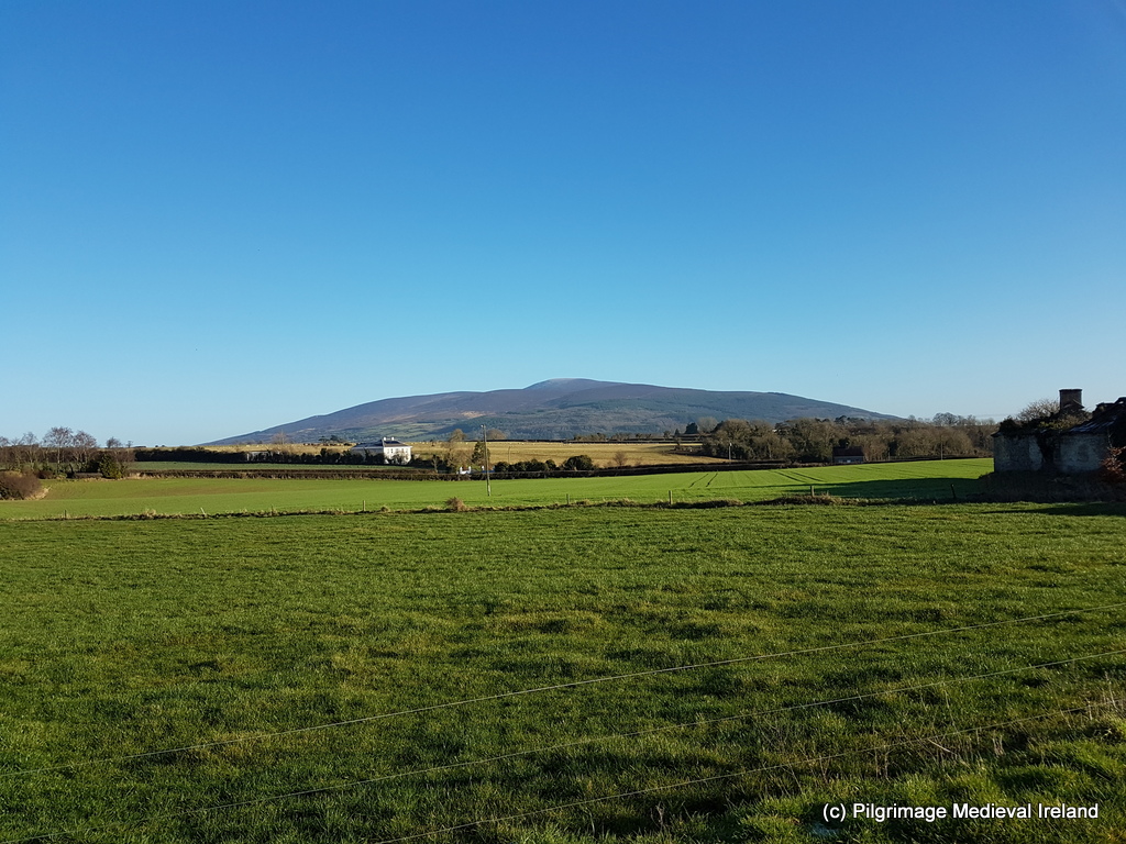
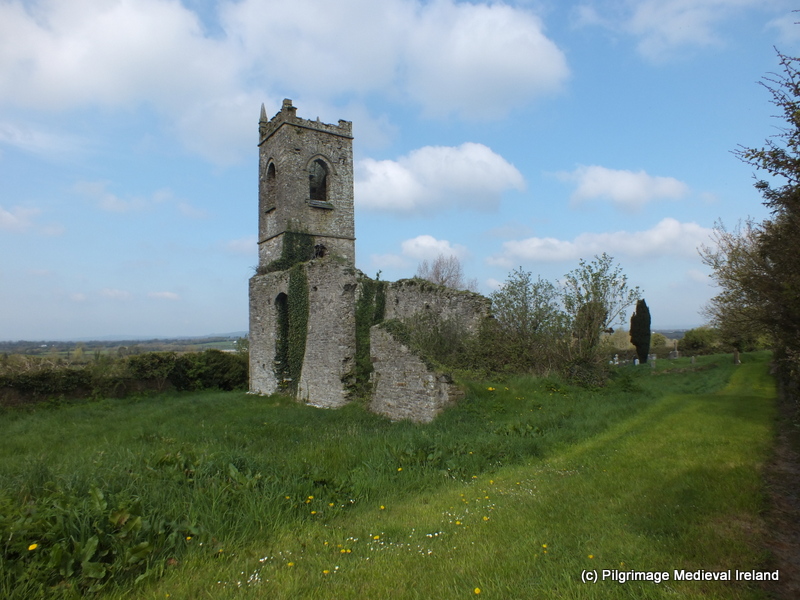
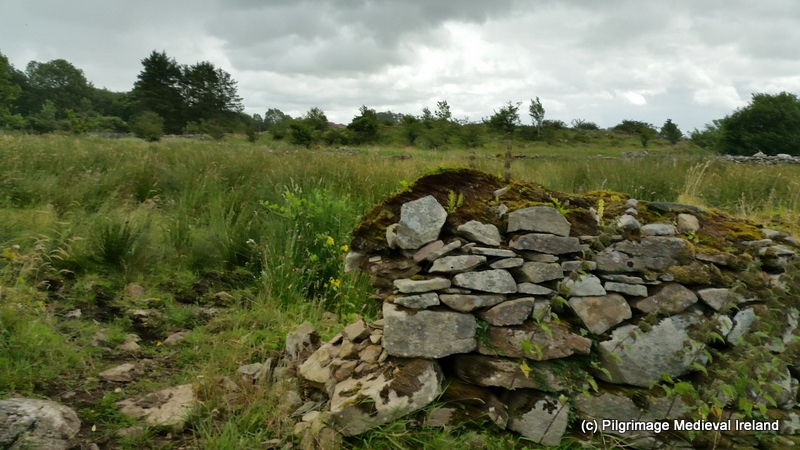
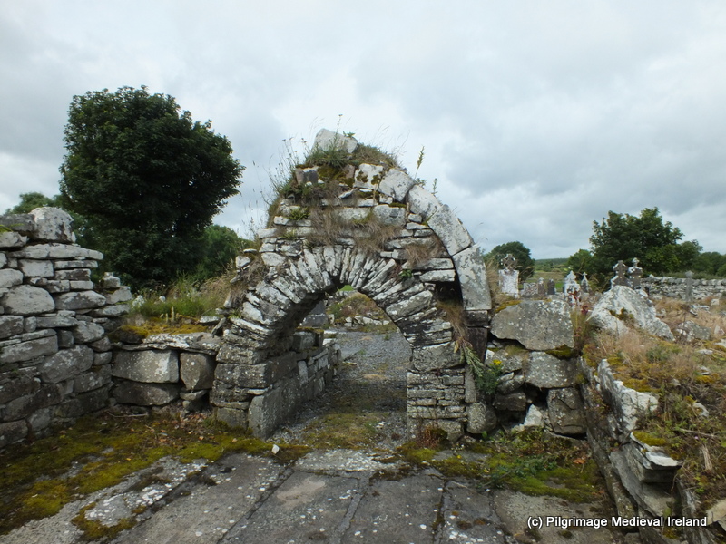
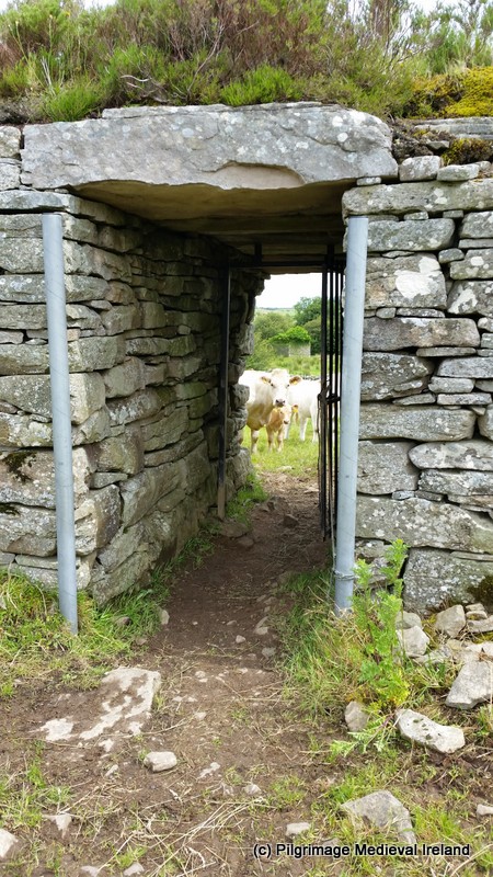
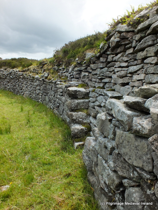
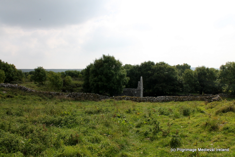
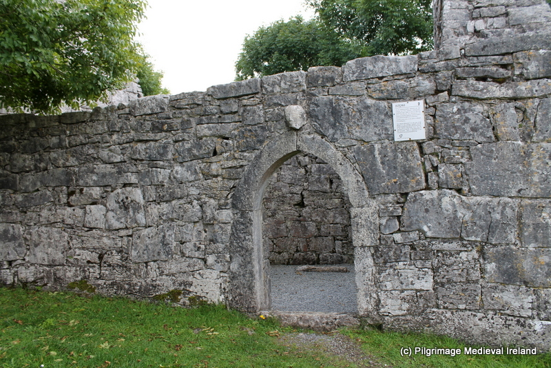
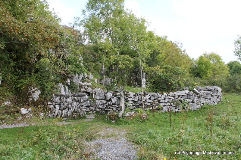
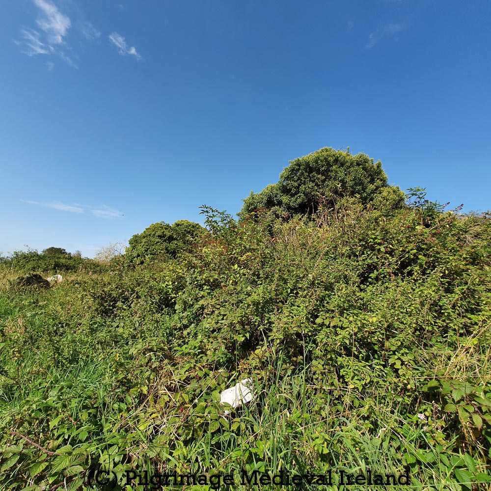
Tybroughney church is located close to the site of a medieval castle and the main Waterford-Clonmel railway line. You have to cross a field to get to the church and graveyard. A fine stone gateway into the field has a plaque on commemorating St Modomoc,

Tybroughney Graveyard and Church in Ruin. 6th century monastery of St Modomnoc who brought the first bees to Ireland.

Information sign of the on pillar leading to Tybroughney church and graveyard.

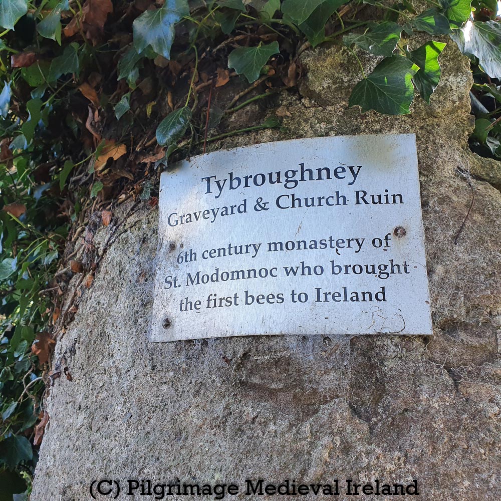
Like St Gobnait, St Modomnoc has a strong connection with bee keeping and bees.

The patron saint of Tybroughney is St Modhomhnoc. He is said to have been the first to introduce bees into Ireland. During his sojourn with St David, in Menevia, he had charge of the bees of the monastery, and attended them with the greatest care, so much that they were fruitful of honey in his hands. When he was returning thence to Ireland, and had biddin farewell to the holy abbot and monks, and had entered the coracle, to set sail, the bees, forming a large swarm came and settled in the boat along with him. Modhomhnoc, unwilling to the monastery of this treasure, brought them back to their hive. A second time, however, as he again entered the boat, they followed him, and, when he again brought them back, they repeated the same a third time. St David hearing this told him to bring the bees with him to Erin

The Schools’ Collection, Volume 0843, Page 345

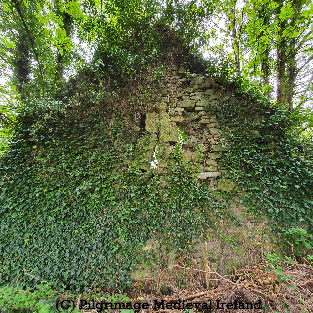
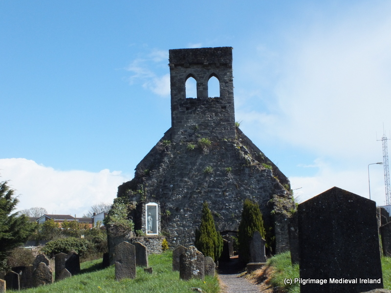
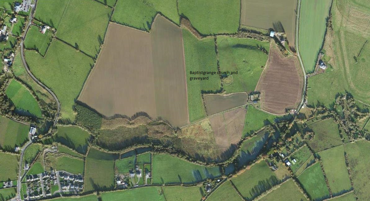
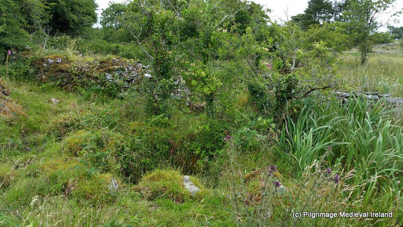
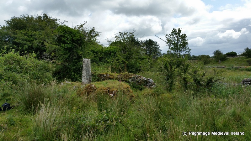
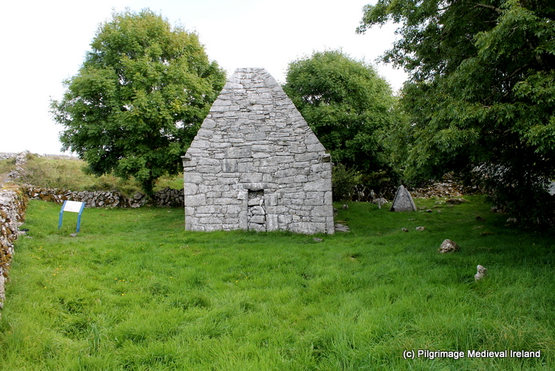
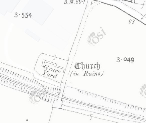
The church is found beside railway gates. It is difficult to examine the church and surrounding graveyard as it is very overgrown. The 1st edition Ordnance Survey map dating to the 1840s, shows the church as a rectangular building while the later 25″map shows it as a nave and chancel church.

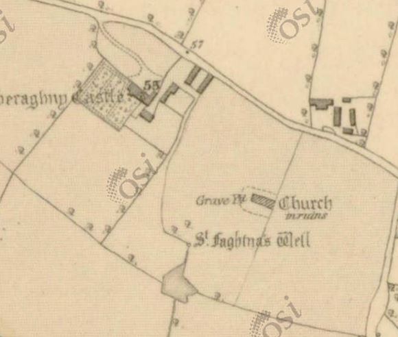
The Ordnance Survey Letters of Kilkenny 1839 described the church

The ruins of the church of Tiobtrait Fachtna (Note added: Tybroughney) stand in the Townland of that name and consist of Nave and Choir, the former 50 feet 8 inches by 30 feet 10 inches, the Choir 28 feet 9 inches by 18 feet 10 inches. The northern half of the west gable remains to about the height of 20 feet and half the north wall attached to it about 14 feet high, south wall and middle gable level with the ground…..The walls of the Nave are built of middle sized limestown and mortar, 2 1/2 feet think and not older I should think the 16th century, but the wall of the Choir are built of very large well formed, tho irregularly laid blocks of granite, and 3 feet 2 inches thick, very much resembling the wall of the Church of Kilcroney near Bray, in the County Wicklow.

(Herity 2003, 155).

Manning (2012, 154) describes the church as a medium-sized with antae. The west gable is still upstanding but it is very hard to say much else about the church.

Tybroughney medieval parish church is covered in thick vegetation

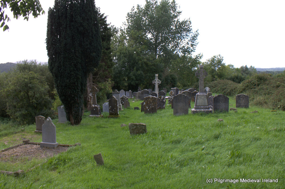
Part of the graveyard that surrounds the church was destroyed in 1851 when the by railway line was built. This event was clearly remember decades later locally. The Schools Collection for Piltown School,

The railway line now runs through this old graveyard. It was constructed in 1851. When it was being made the workmen came upon a large number of human skeletons. The skeletons lay along under the surface in single file and were so close together that there were no coffins used in their interment. This shows there was an ancient monastery here or if not it was the resting place of warriors slain in some local battle.

The Schools’ Collection, Volume 0842, Page 288
View of Tybroughney medieval church and graveyard from across the railway tracks

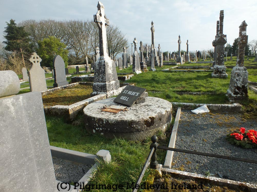
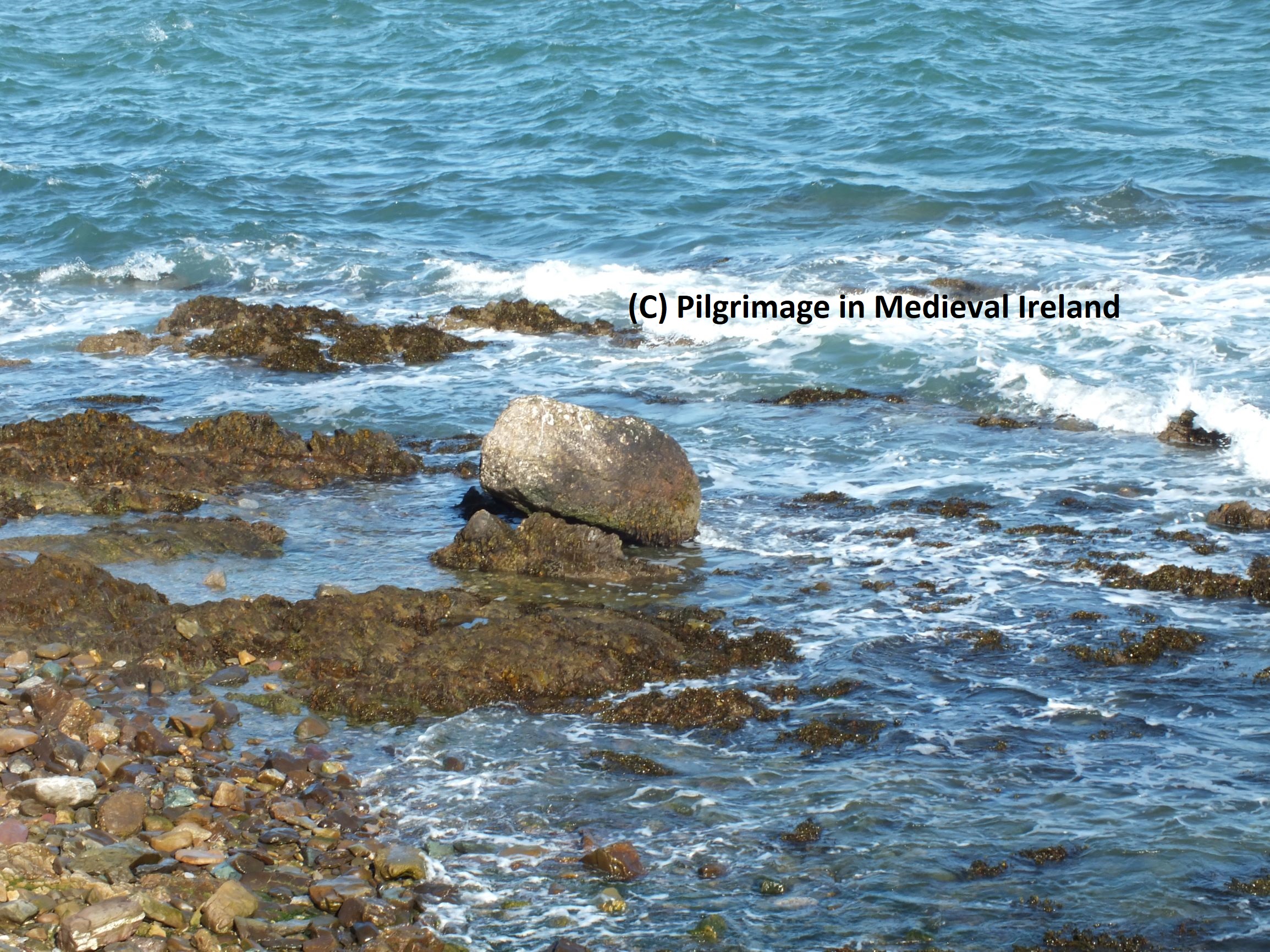
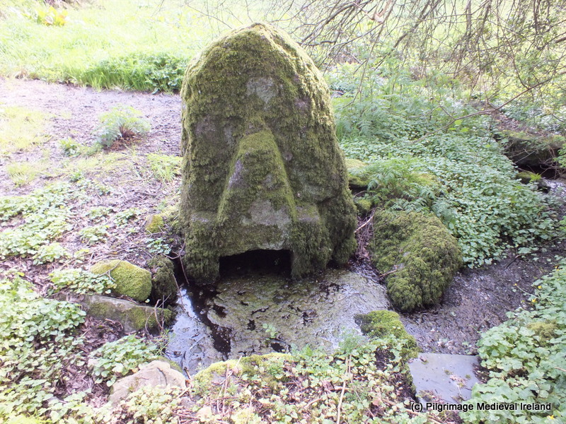
The holy well which gives its name to the townland is located on the other side of the railroad tracks in scrub. I didn’t have time to search for the well on my visit here but will hopefull get back there soon. In the early nineteenth century a pattern day was held here on the13th February (Herity 2003, 157).

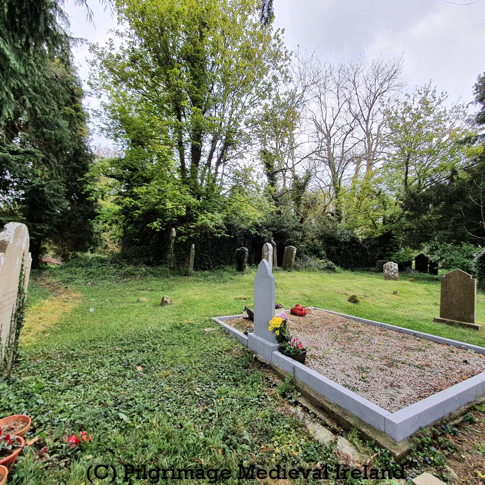
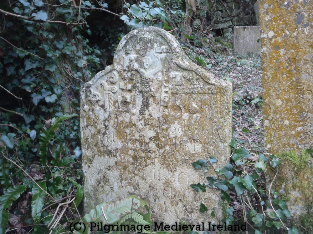
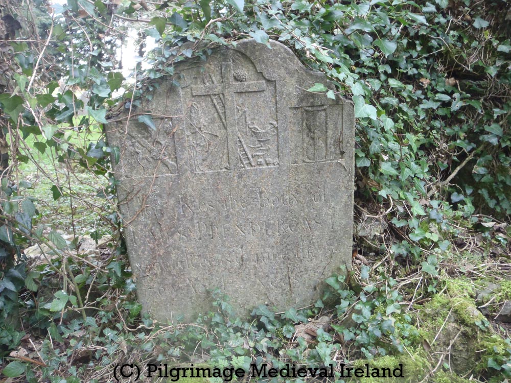
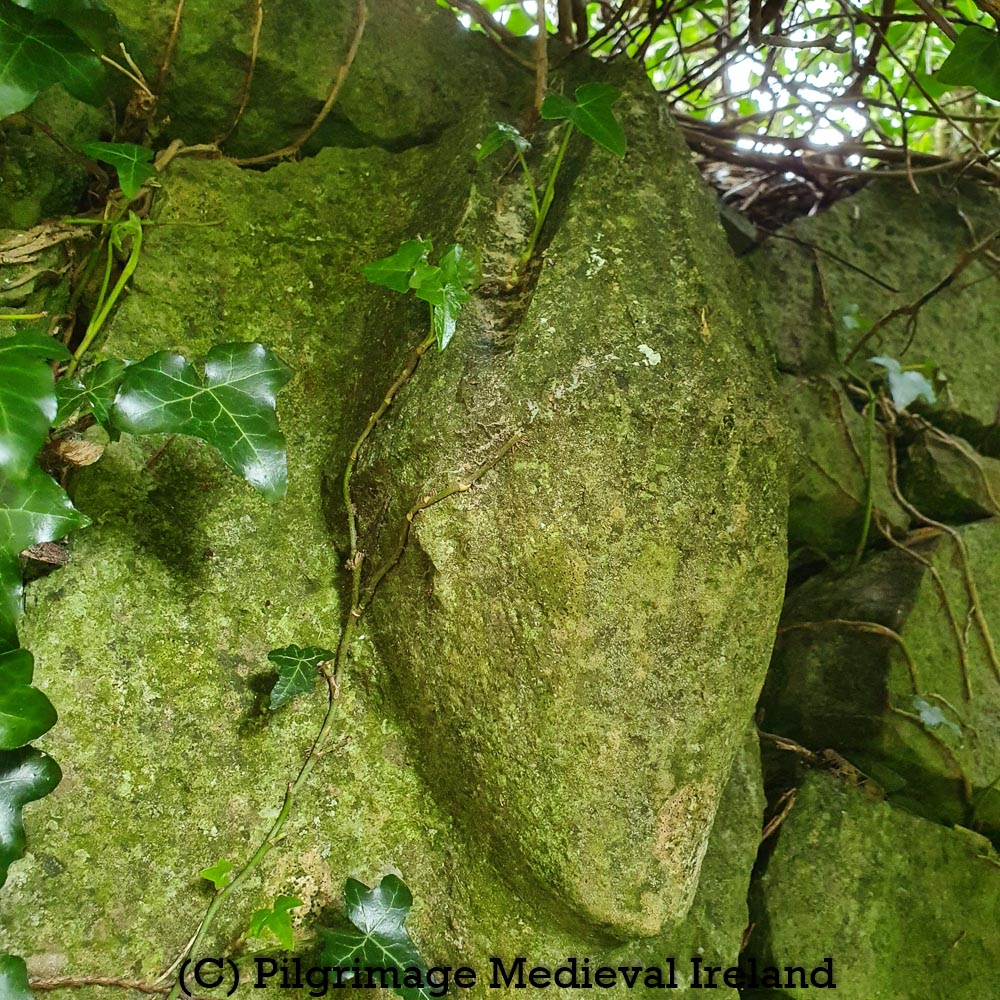
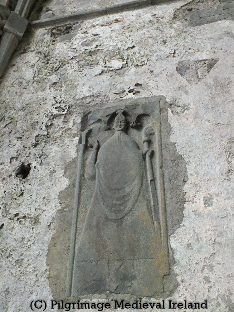
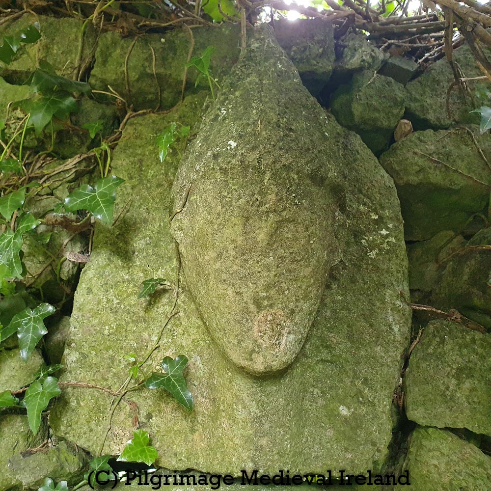
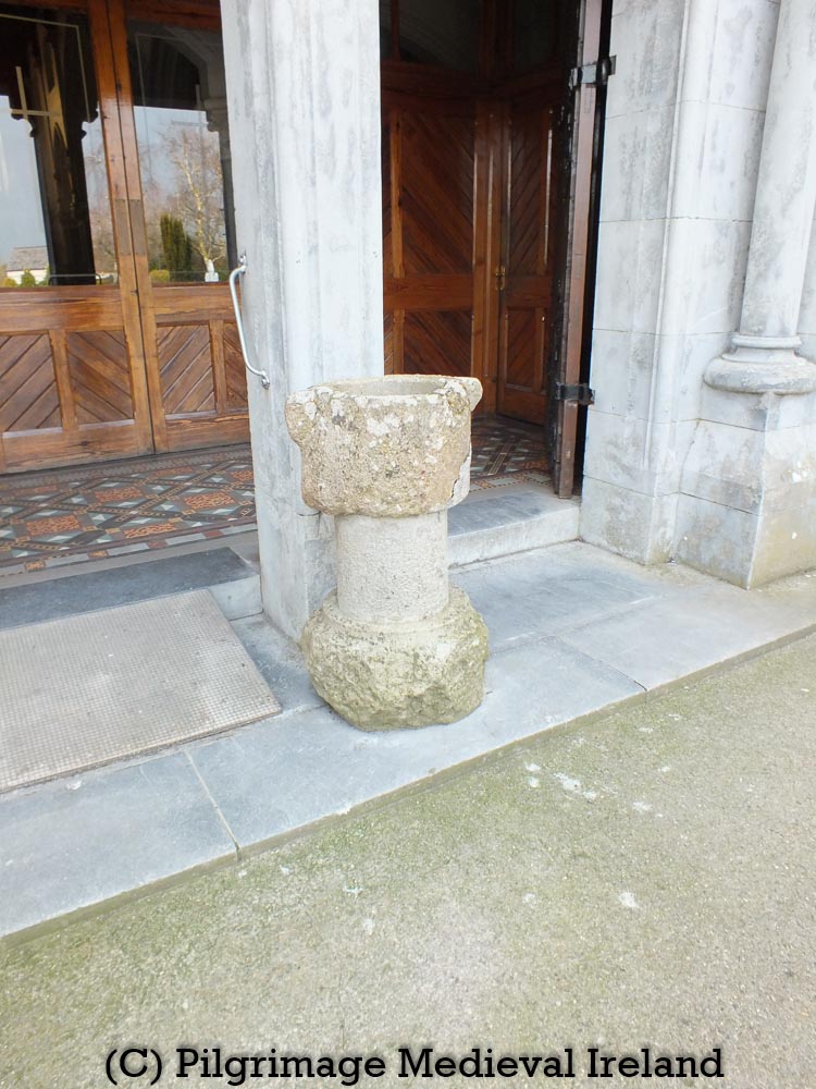
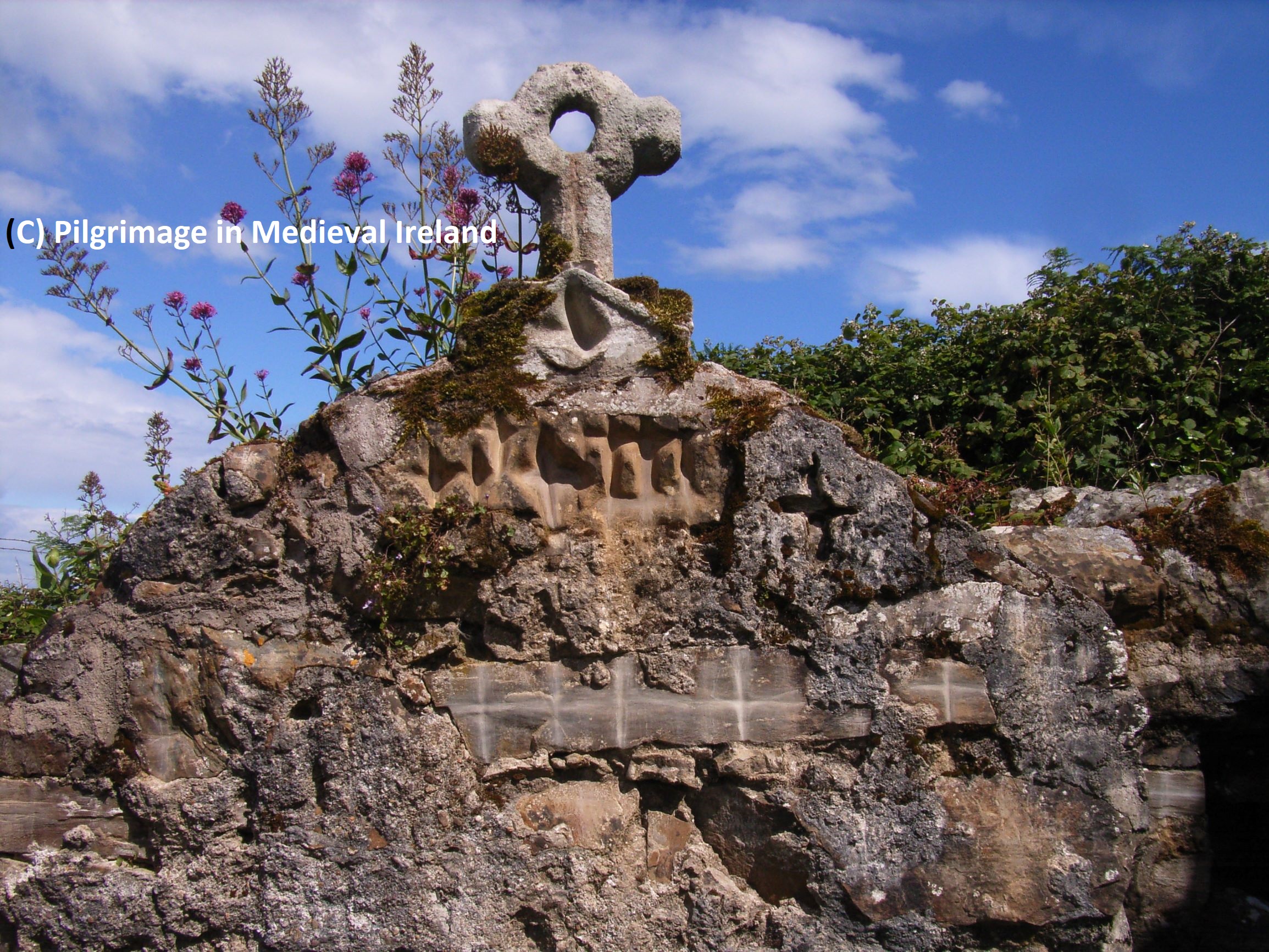
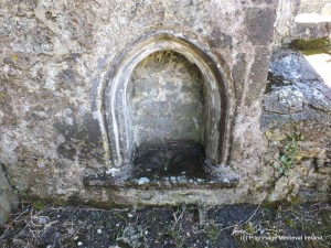
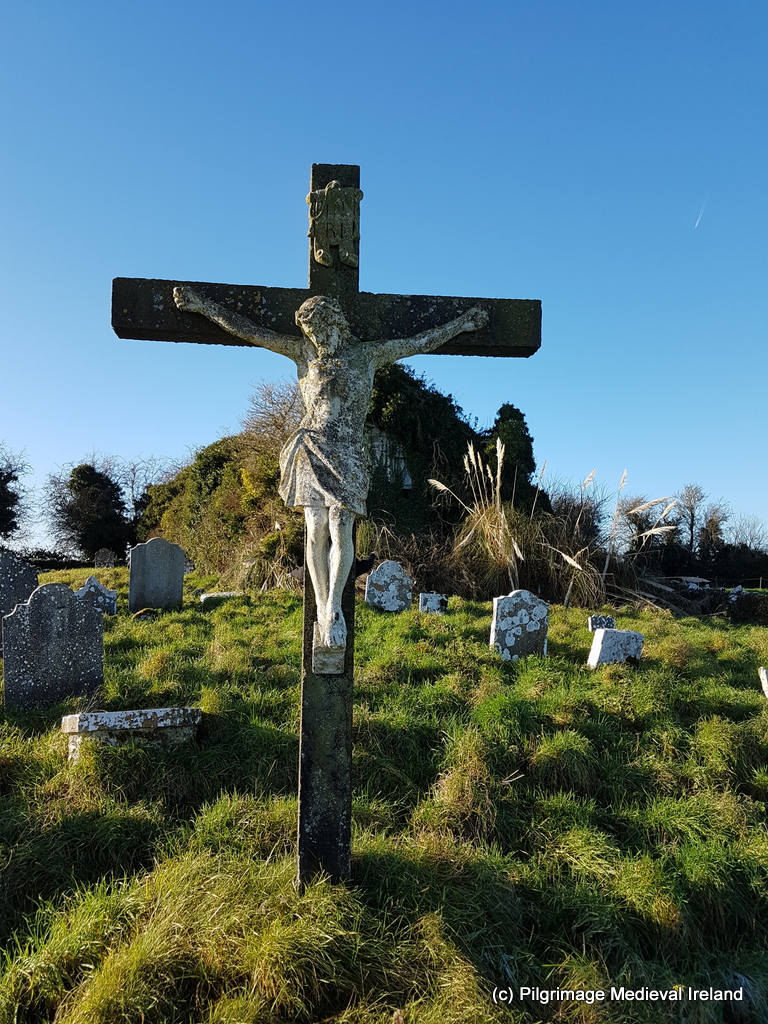
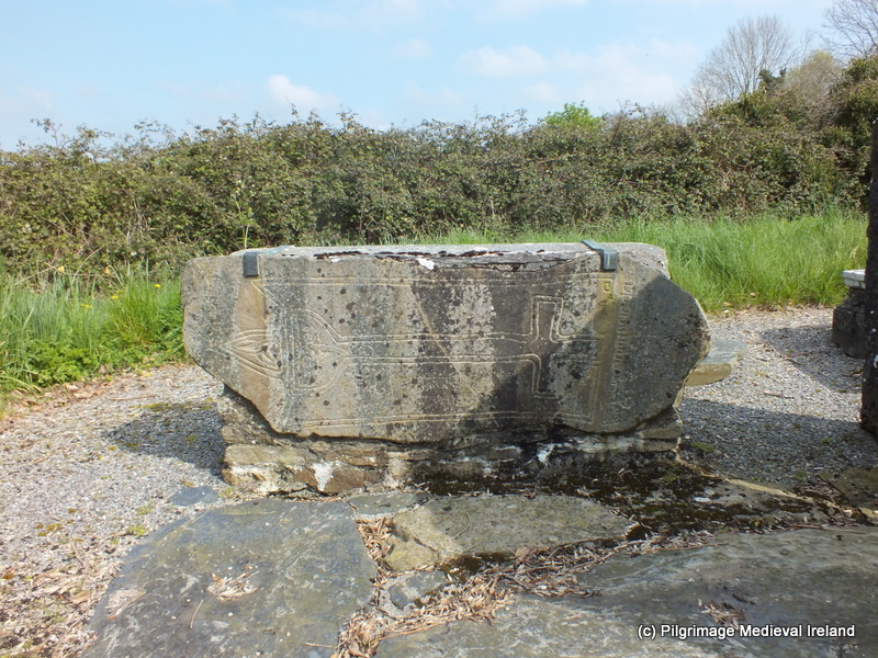
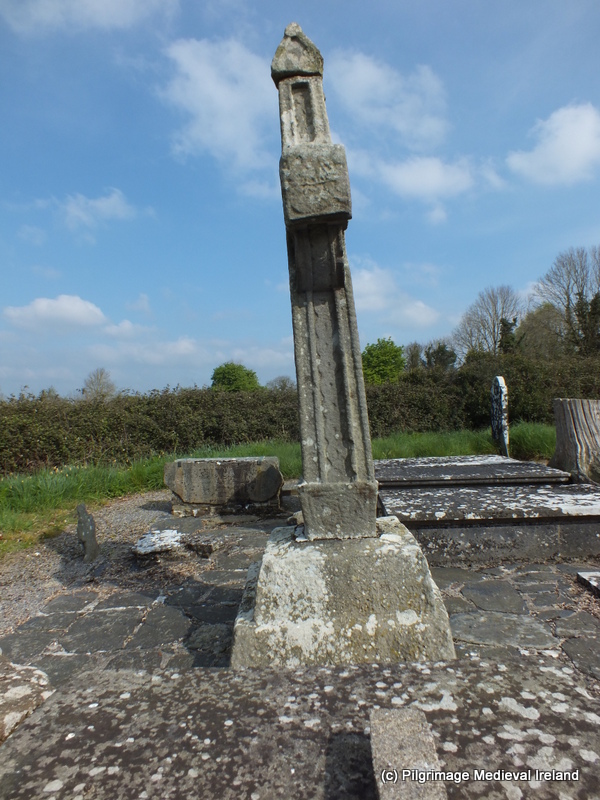
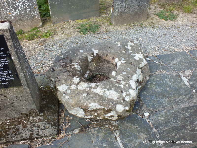
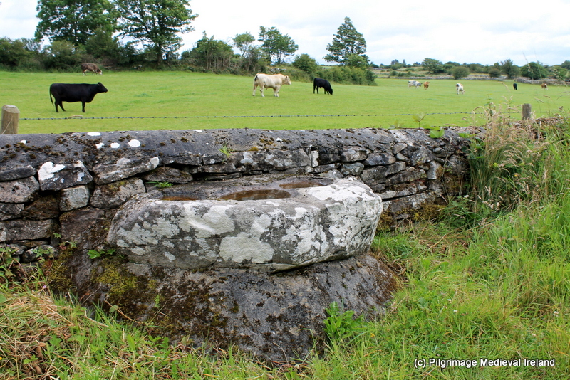
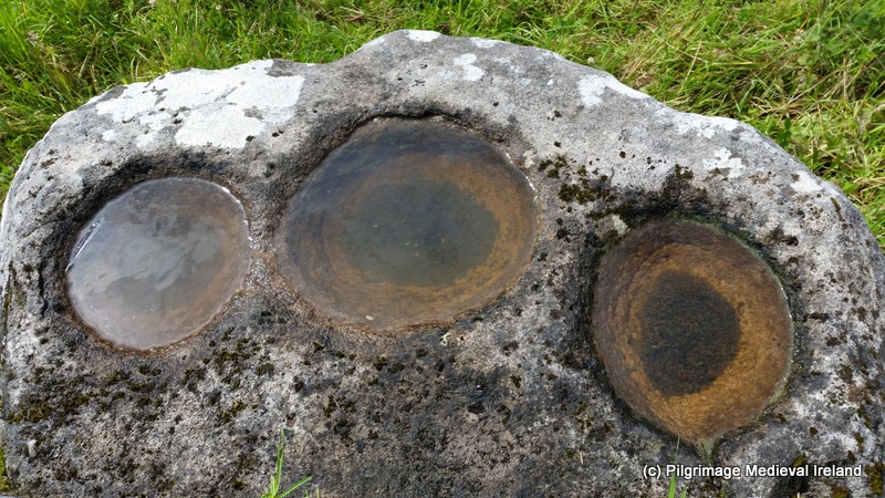
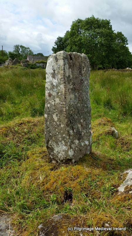
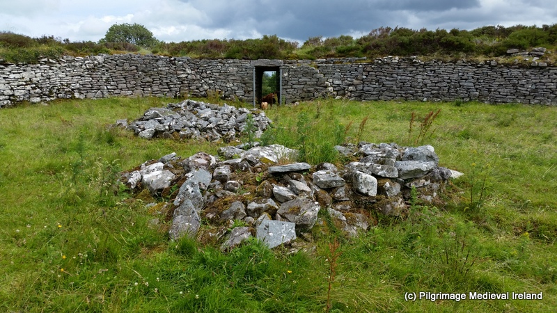
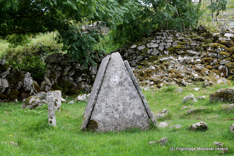
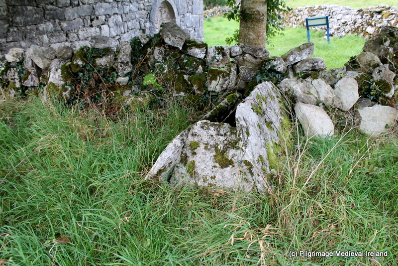
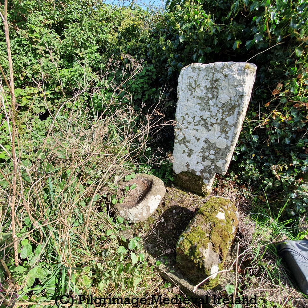
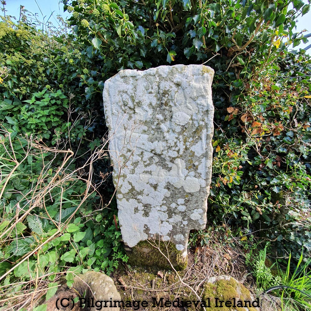
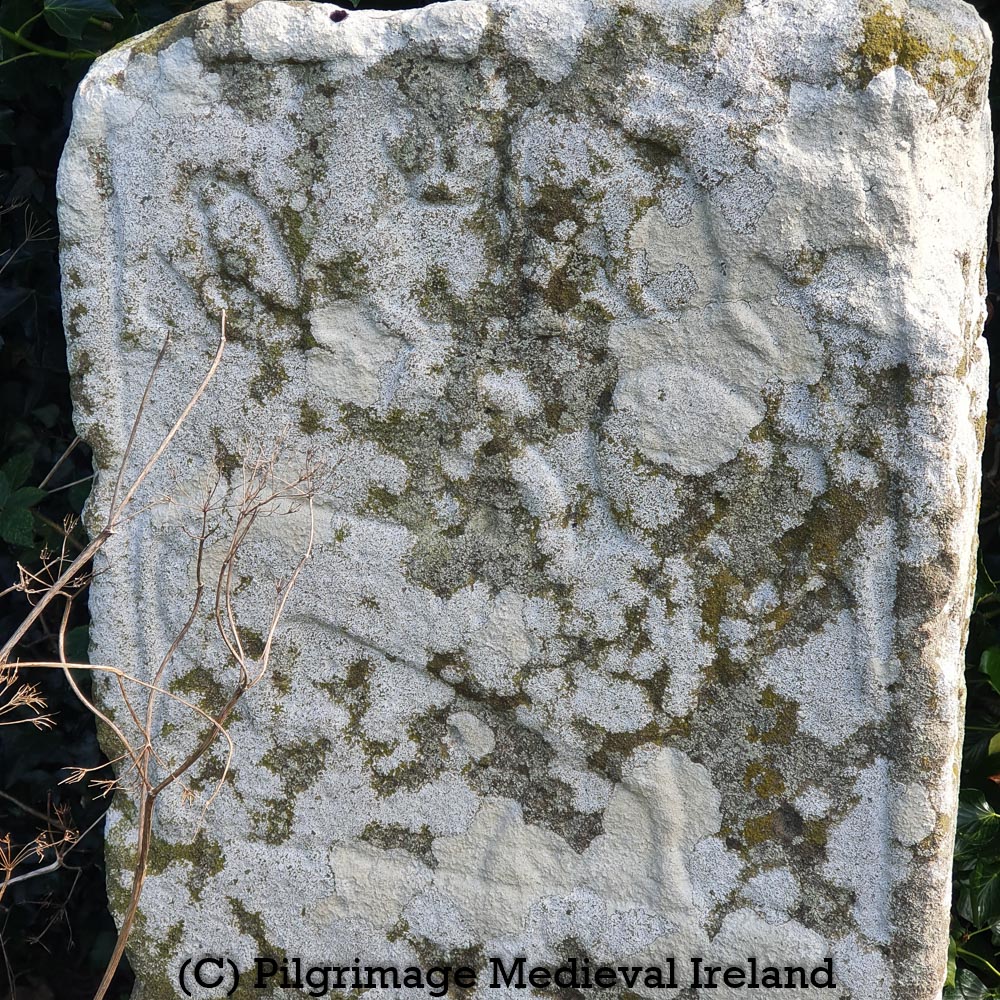
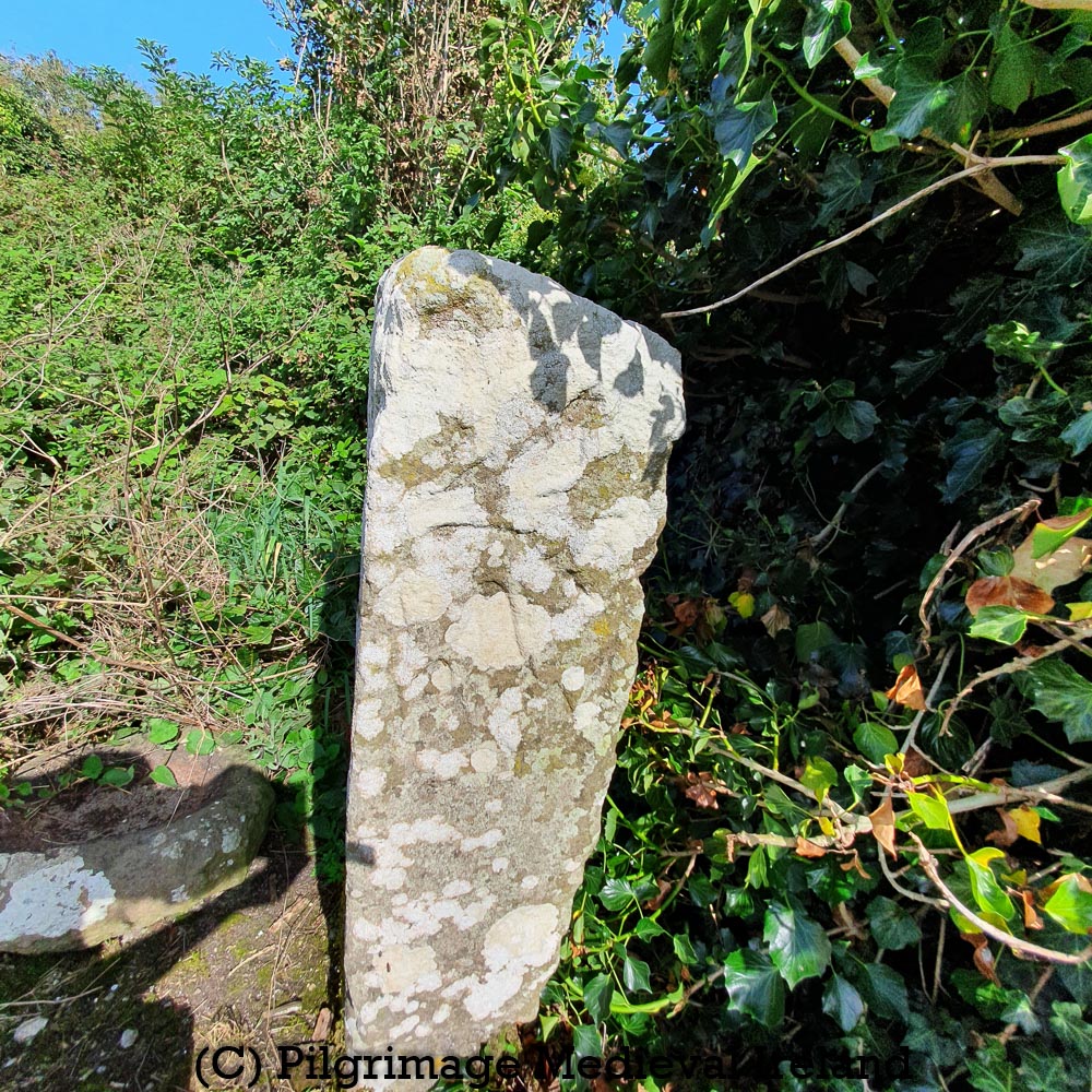
The Tybroughney pillar stone sits beside the church ruins, on a small patch of ground defined by low curbing. This area also contains a plain undercoated stone with an oval shaped hollow and seems to be font. There is also a rectangular stone covered in moss.

Carved pillar and font at Tybroughney medieval church

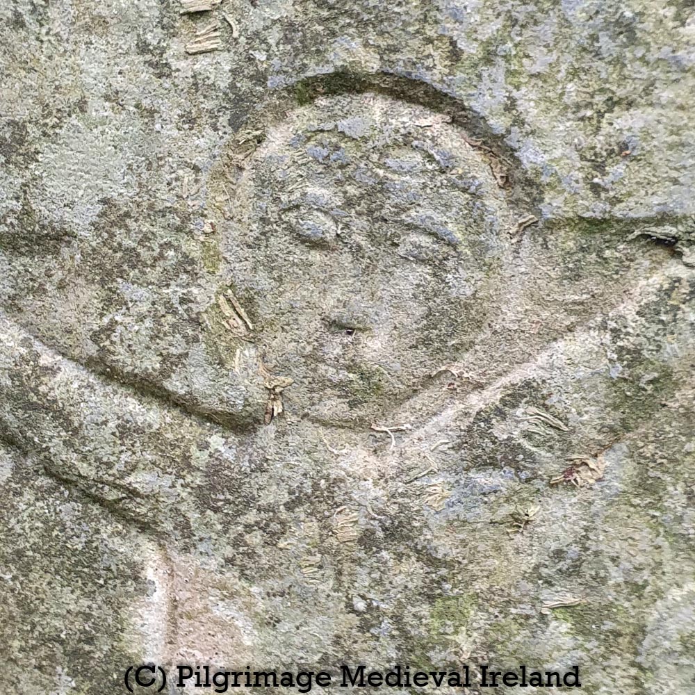
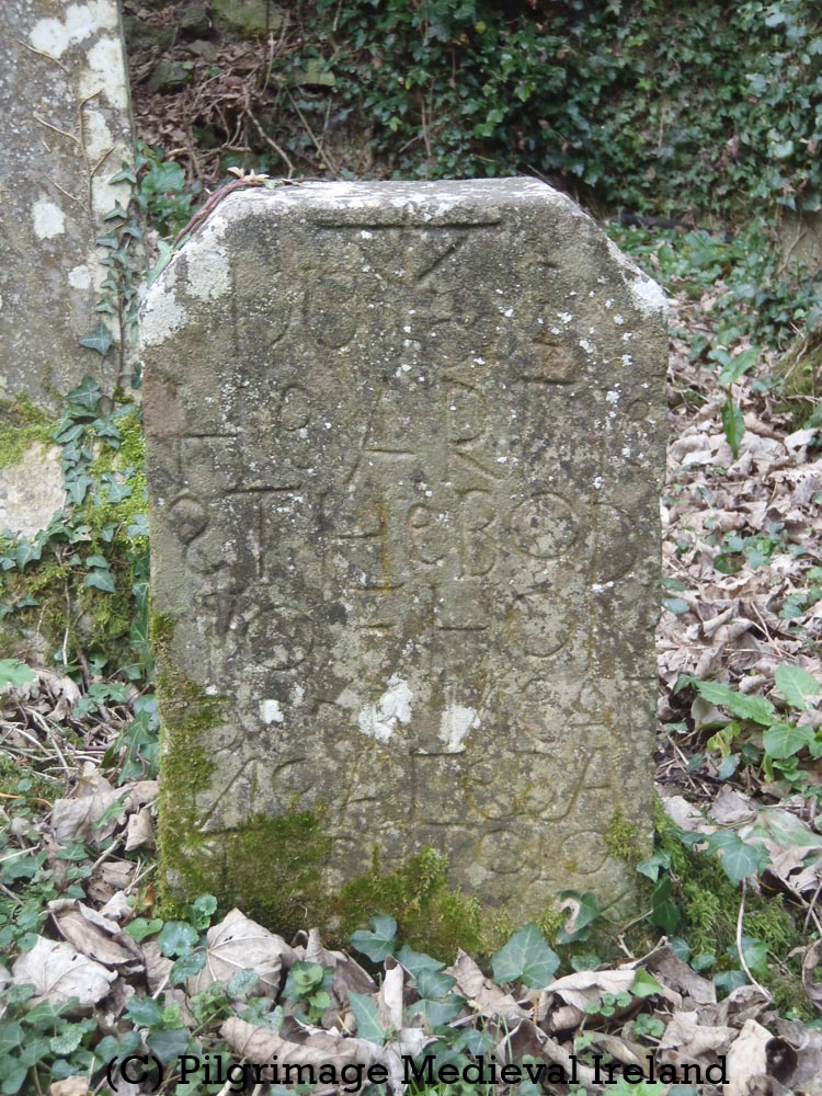
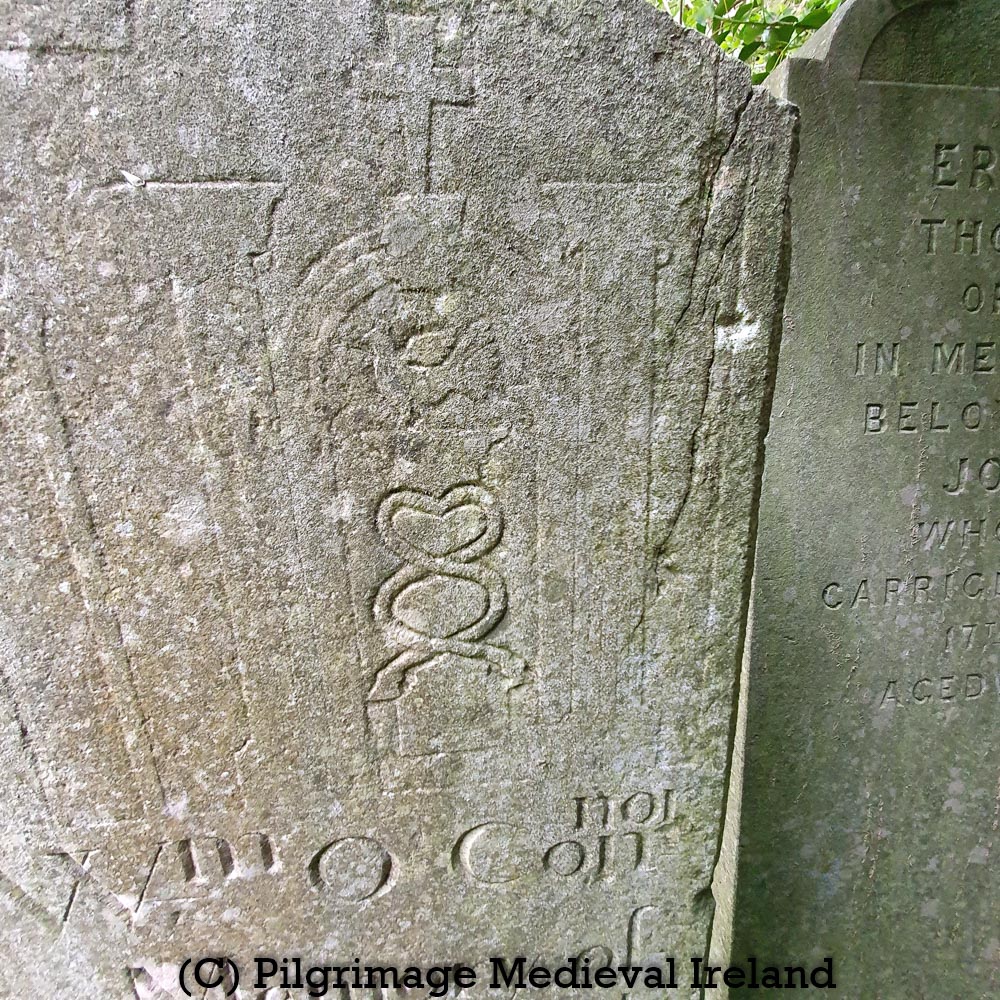
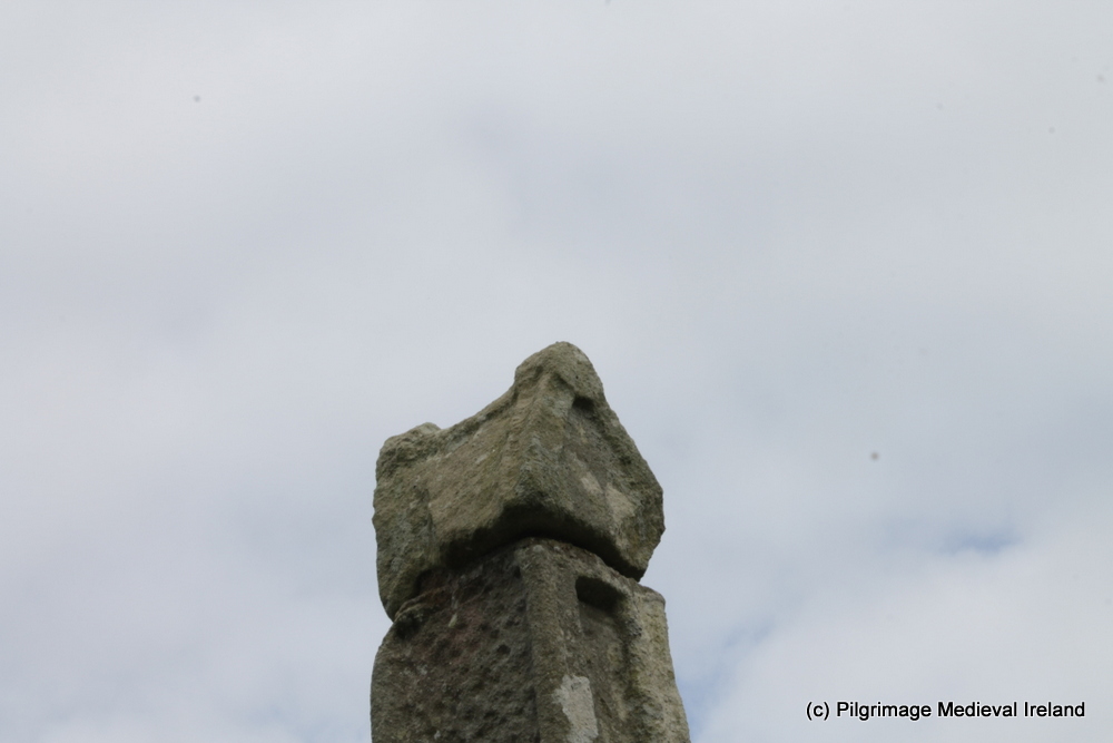
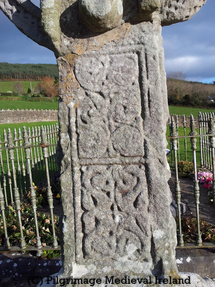
The pillar stone is decorated on all four sides with very elaborate and unusual carvings. The top of the stone appear to have been damaged in antiquity. Unfortunately my photos don’t do justice to the carving on the pillars but at different times of the day the light does brings out many of its details.

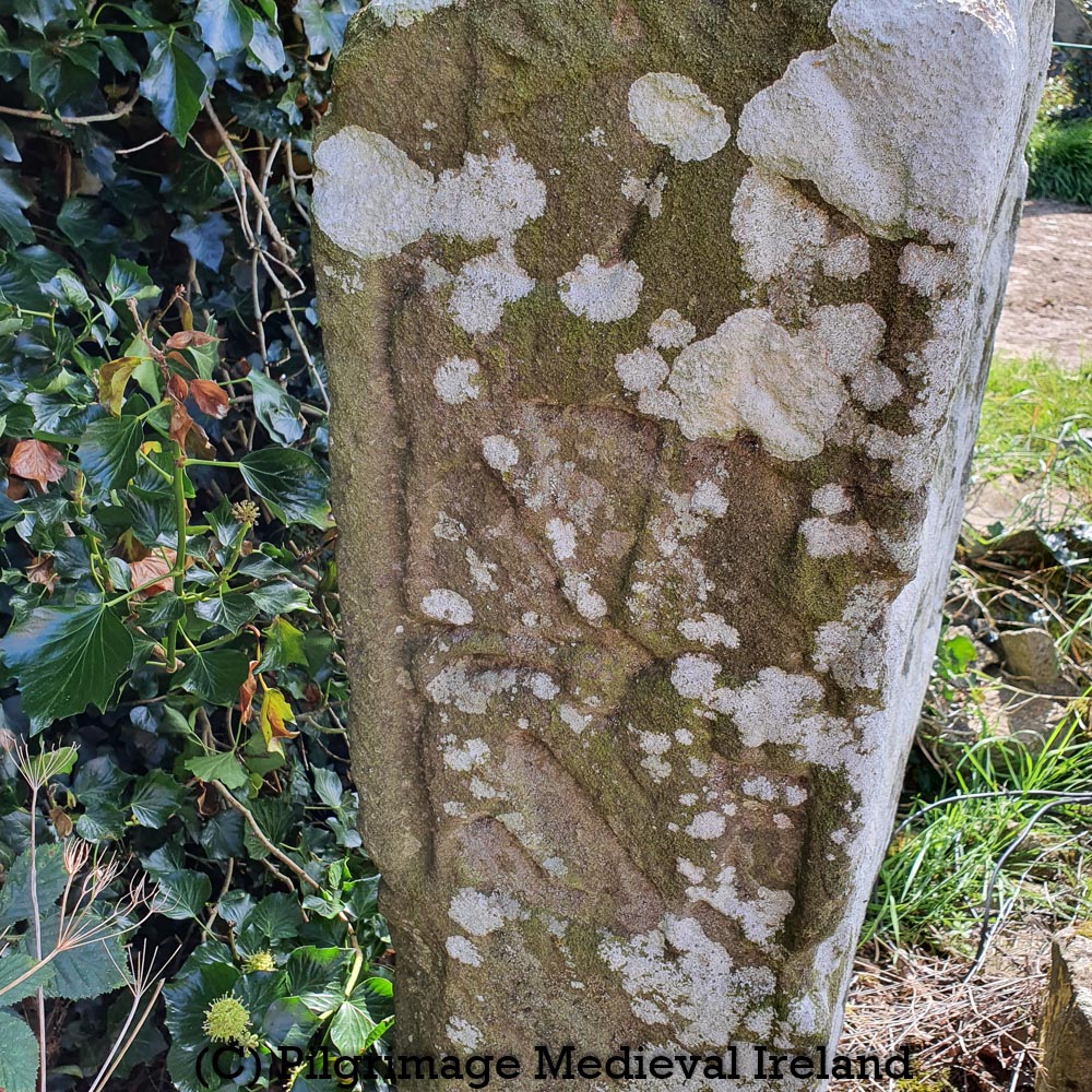
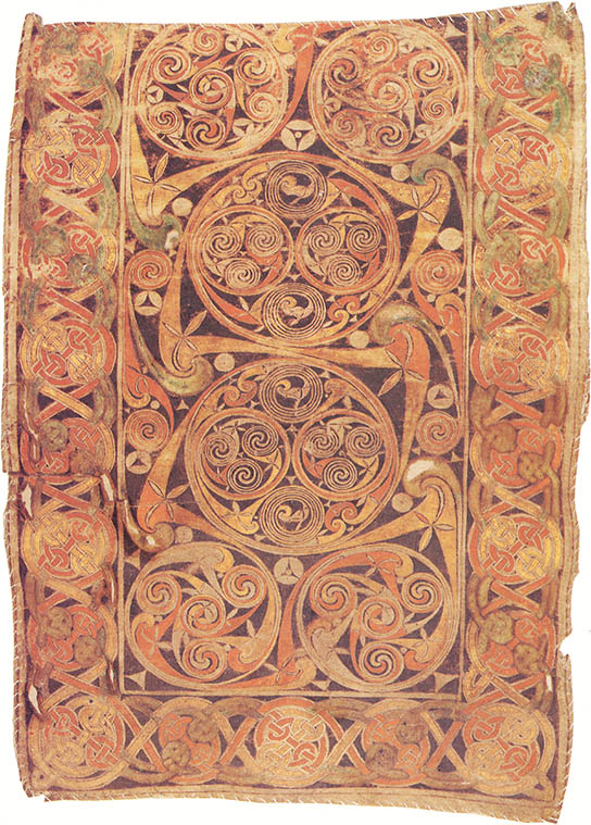
The east face face of the pillar decorated with an elaborate pattern of spirals. The pattern brings to mind spiral designs on one of the carpet pages in the beautiful Book of Durrow.

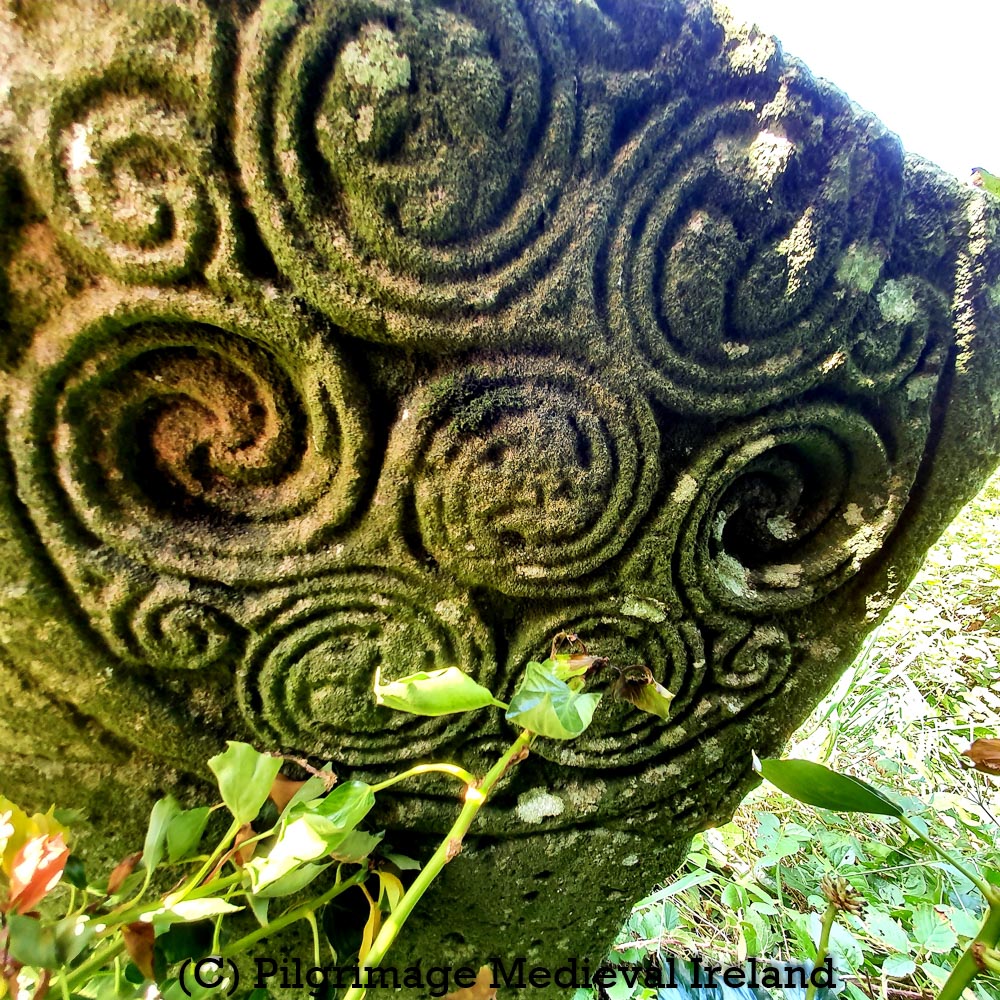
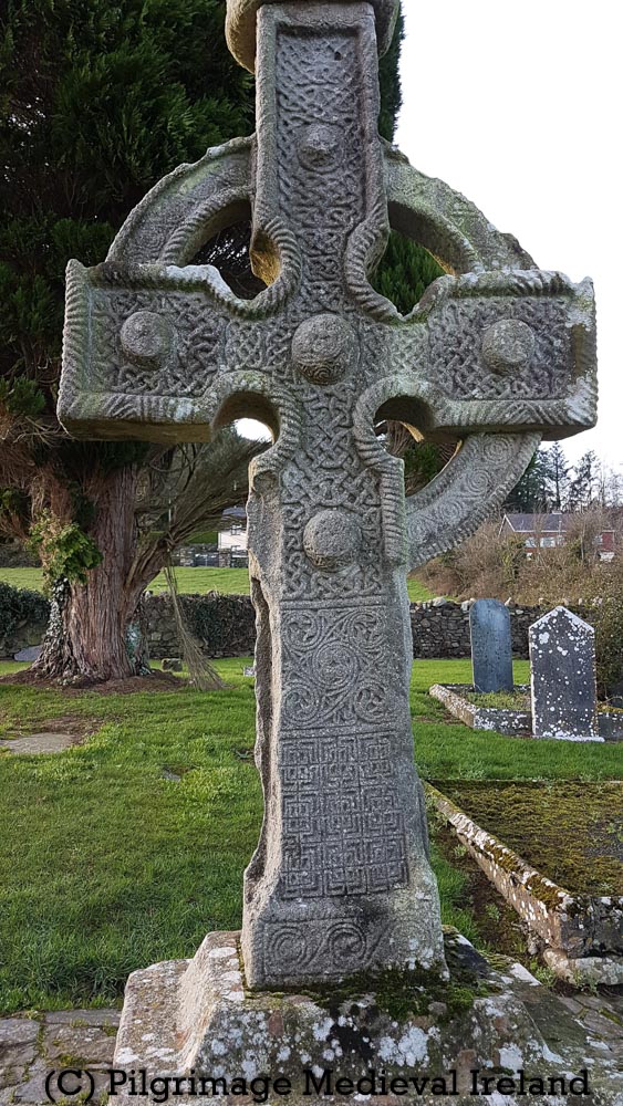
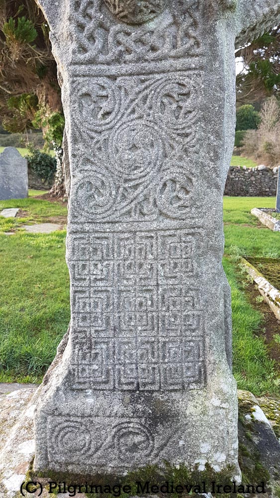
Similar spiral patterns also appear on the nearby early medieval high crosses at Ahenny Co Tipperary and Kilkieran Co Kilkenny.

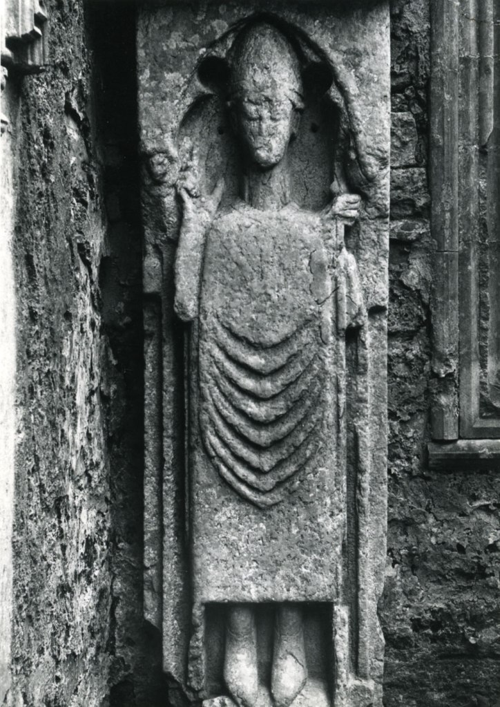
The pillar was drawn in 1908 by Henry Crawford for his article ‘Description of a Carved Stone at Tybroughney, Co. Kilkenny.’ The pillar was also photographed by Helen Role for the book The High Crosses of Western Ossory.

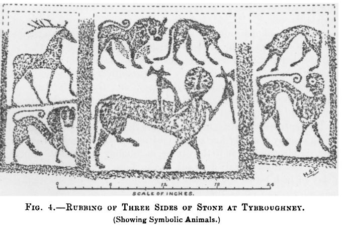
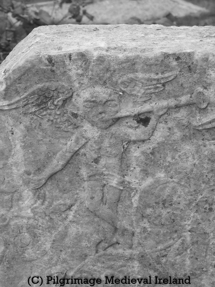
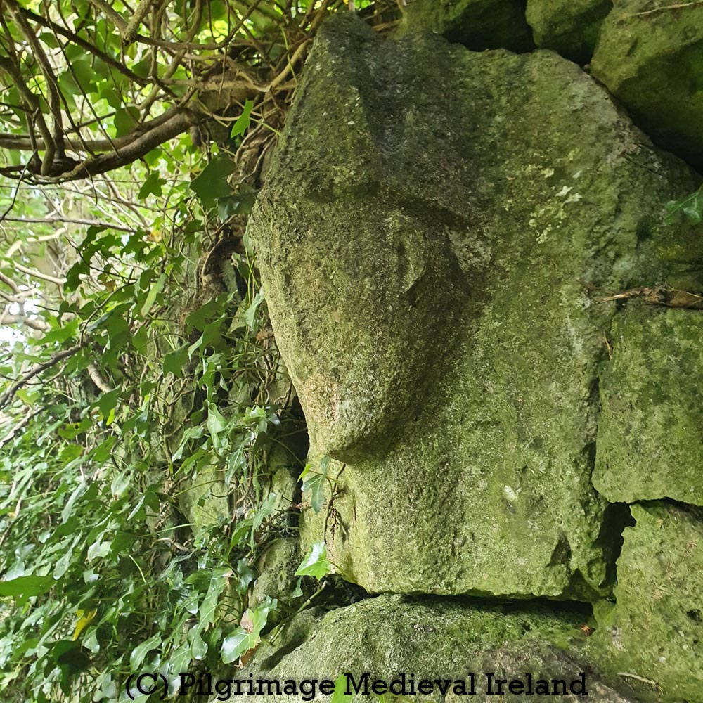
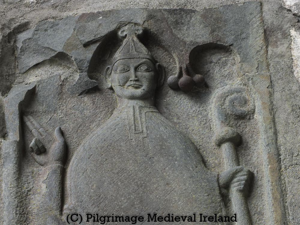
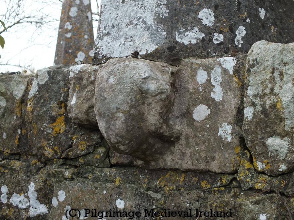
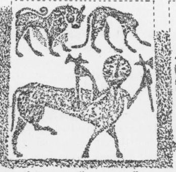
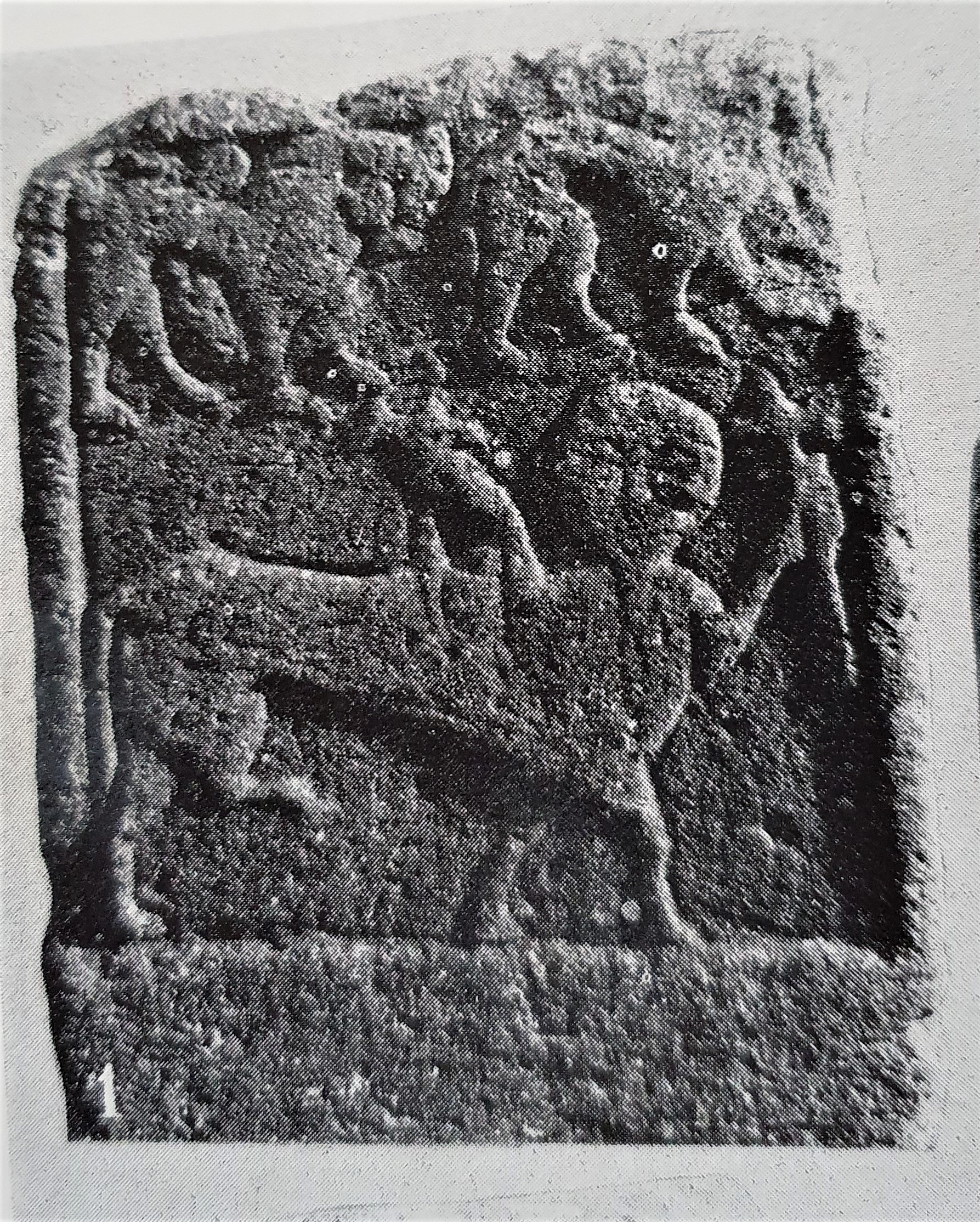
The west face of the Tybroughney pillar has a large creature possible a centaur – a half man and half horse- holding an axe in both its hands. A centaur ‘ by his dual nature was held to symbolise the conflict between Good and Evil’ ( Roe 1962, 33).

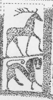
Two smaller creatures stand above the main figure, one is a lion and the other is whippet like creature.

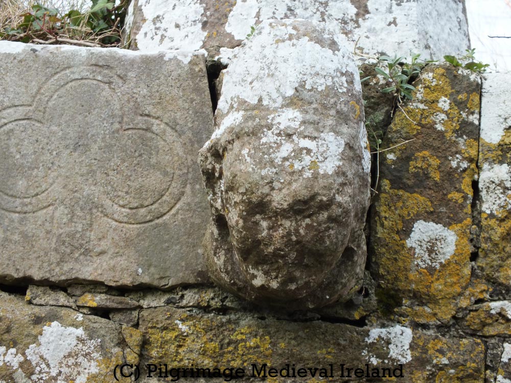
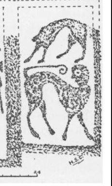
The southern side of the pillar closest to the railway tracks, his two mythical creatures. The lower figure is a manticora – the body of a lion and the head of a man- above the manticore is a ‘whippet-like creature’ ( Roe 1962, 33).

This may possibly be the Hyaena of the Bestiary, which scavenges in burial places and consequently was taken as a symbol of the Devil who battens the flesh of sinners.

(Roe 1962, 33)

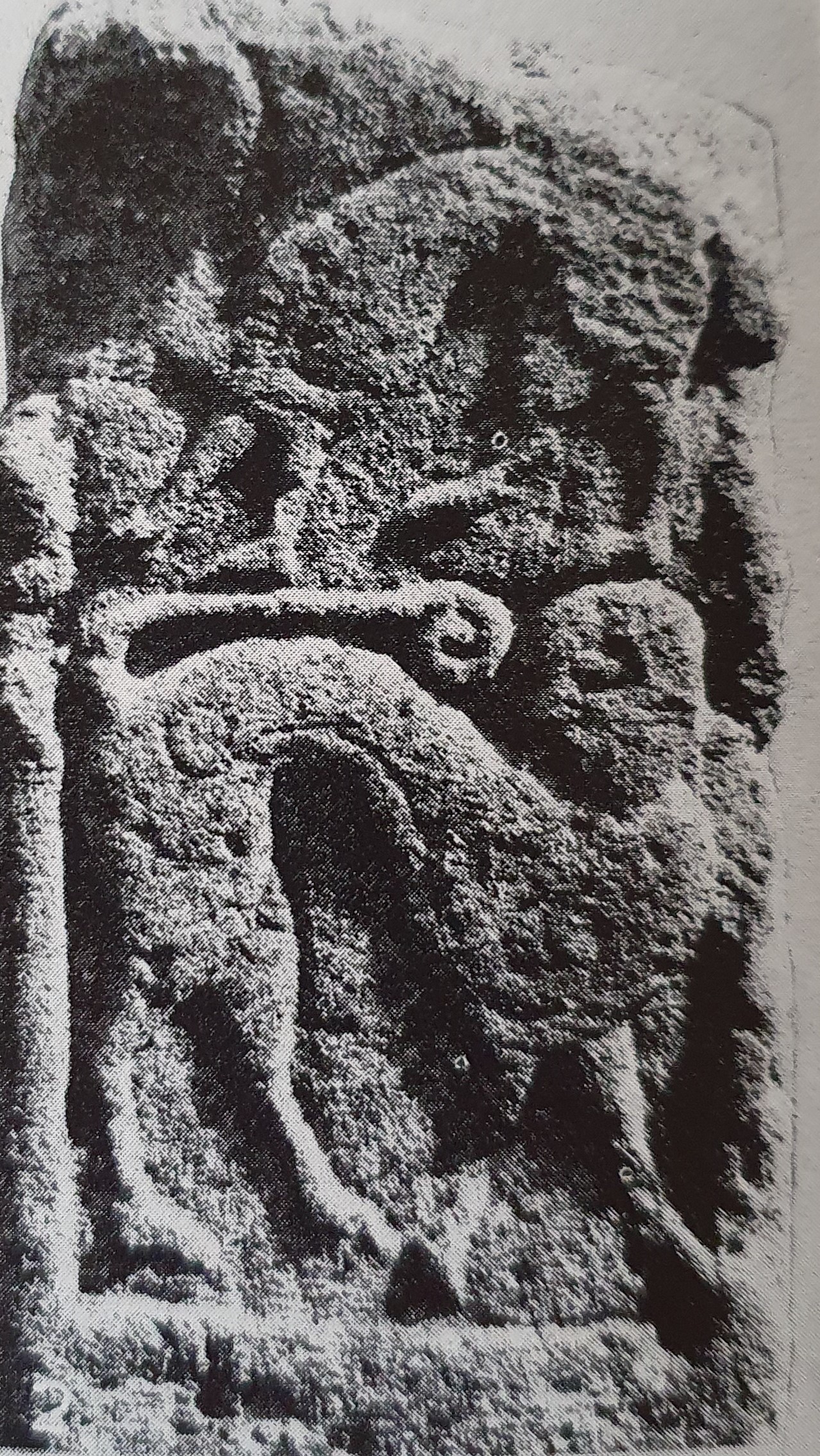
The north face of the pillar has two figures, a stag and a lion. The stag ‘has various association, chief of which is as a symbol of Christ and his victory over Satan’ (Roe 1962, 33).

I really think this pillar would be a great candidate for photogrammetry. I hope to pay another visit here again soon to see the holy well so will keep you posted.

Bibliography

Crawford, H. (1908). Description of a Carved Stone at Tybroughney, Co. Kilkenny. The Journal of the Royal Society of Antiquaries of Ireland, 38(3), fifth series, 270-277.

Manning, Conleth. “Kilferagh, Co. Kilkenny: a Medieval Parish and Its Church.” The Journal of Irish Archaeology, vol. 21, 2012, pp. 139–156. JSTOR, http://www.jstor.org/stable/jirisarch.21.139. Accessed 10 May 2021.

O’Kelly, O. 1985. The Place-Names of County Kilkenny- The Kilkenny Archaeological Society Rothe House Kilkenny.

Roe, H. M. 1962. High Crosses of Western Ossory. Kilkenny: Kilkenny Archaeology Society,

http://www.megalithicireland.com/Tybroughney%20Pillar%20Stone,%20Kilkenny.html

https://www.kilkennypeople.ie/news/your-community/71035/Tybroughney-Castle—Bastion-of.html

The bishop over the door. A medieval carving at Tullaghmelan Medieval Parish Church Co Tipperary

The medieval parish church and graveyard at Tullaghmelan is one of my favorite places to visit in south Tipperary. The name Tullaghmelan means the hillock of Maolán. Tradition holds that Maolán was a saint who had founded a church here in the early medieval period.

There is no visible early medieval features sat the site although a pronounced curve in the road that borders the graveyard may perhaps preserve an earlier enclosure.

Aerial view of Tullaghmealan church and graveyard.

The church is listed in a dispute between the Archbishop of Cashel and the Bishop of Lismore in 1260. In 1302-1306 it is recorded in the ecclesiastical taxation records of the diocese of Lismore (CPL; CDI).

At first glance Tullaghmelan is a typical medieval parish church a with rectangular plan, surrounded by a historic graveyard.

View of Tullaghmealan medieval parish church and historical graveyard (photo taken 2021)

This lovely place is anything but ordinary. The graveyard is filled with some extraordinary eighteenth and early nineteenth century gravestones.

The east gable has largely collapsed and a number of mature trees are growing out of the wall. The west gable is still standing and still retains a central ogee-headed window, now in very poor condition. I’m not sure how much longer the window will survive as the surrounding wall is very damaged.

The church fabric is built of roughly coursed limestone and sandstone rubble (Farrelly 2014). It is hard to examine the fabric of the church as it is covered with think ivy. The church is entered by two opposing doorways in the north and south walls. Opposing doorways are also found at the nearby medieval parish church at Newcastle and are a common feature in medieval churches.

Unfortunately much of the northern doorway had collapsed but the lower section of the door still preserves carved stones hidden under the ivy.

Northern doorway at Tullaghmelan parish church (photo taken 2012)

The door in the southern wall is in a much better state of preservation. The doorway is finely carved pointed doorway, with hood-moulding. Hood-moulding dates to between the fifteenth to seventeenth centuries and is a common architectural feature of later medieval buildings.

Sitting above the doorway is a carving of a medieval bishop’s head.

The head is elongated with a pointed chin and small lug ears. It is held up be a long narrow neck. On top of the head is a type of head dress/hat worn by a bishop called a mitre.

The bishops face is badly weathered. It is still possible to see the almond-shaped eyes of the face. In the right light you can still just about make out the nose and mouth. The mitre has a conical in shape, with three vertical ridges running to the point at the top. There is a thick band with a herring-bone pattern, running around the base of the hat.

Carving of bishops head at Tullaghmelan medieval parish church.

The head was recorded by Gary Dempsey of Digital Heritage Age. Gary produced a in a 3D photogrammetery model which can be view on sketchfab with the Tipperary3D page.

3D Model of the bishops head at Tullaghmelan medieval parish church.

Portrait heads like the Tullaghmealan bishop are found at other ecclesiastical sites in Ireland. The parish church of St. Molleran in Carrick-on-Suir was built in the nineteenth century on the site of a Franciscan Friary. The building, incorporates the tower, part of the north wall and west doorway of the original friary church. The west gable retains fourteenth century pointed doorway. The head of a bishop wearing a conical mitre is carved in the column on the north side of the door.

Carved head of bishop’s head in column beside the doorway at St. Molleran’s church formerly the Franciscan friary, founded in 1336 by James Butler, first Earl of Ormond.

Two carved heads of bishop’s heads are found in at medieval ecclesiastical site at Kilfenora Co Clare. One of the heads, a stern looking figure, sits above a pointed door way in the west end of the southern wall of what was the nave of the cathedral church. The door leads into a porch where there are three effigial tombstones also depicting bishops and clerics.

The second carved head is found in the north wall of the cathedral chancel. The head sits above a sedilia with a very elaborate tracery design.

Another medieval carved head of a bishop is found at the cathedral church of Kilmacduagh, Co Galway. The carving is very similar to the head over the sedila at Kilfenora, perhaps the two stones were carved by the same mason. The Kilmacduagh head sits over a finely carved pointed doorway in the south wall of nave of the cathedral church.

A large effigy of a bishop is found in the wall of the presbytery in the church at Corcomroe Cistercian monastery, Co Clare. The figure is built in the wall above the tomb of Conor na Siudaine O’Brien, King of Munster (d. 1267).

At Ennis Friary, Co Clare, a finely carved head of bishop forms a corbel/supports of the central tower in the church. According to the Monastic Ireland website

Images of bishops, abbots and archbishops in this location are often intended to depict the prelate who presided over building works. The presence of flanking angels suggests that the individual in question was deceased at the time of carving.

http://monastic.ie/tour/ennis-ofm-friary/#4
Carved head of bishop at Ennis Friary

A carved head of a bishop also graces one of the corbels on the wall of the church at Holycross Abbey in Co Tipperary.

Bishop’s head in monastic church at Holycross Abbey Co Tipperary

Its very interesting that all of the examples of portrait carvings of bishops listed above are found at monastic and cathedral churches. Tullaghmealan was not a particularly wealthy parish church. Perhaps it enjoyed a wealthy patron at the time the carved stone and doorway were made.

The Tullaghmelan bishop was drawing by George Du Noyer in the 1800s. He wrote the following about the stone

This drawing is offered as a characteristic example of the doorways of most of our old churches, which are so plentifully scattered over the eastern and south-eastern portions of Ireland. It is taken from the old church of Tullaghmelan, near Knocklofty, Co. Tipperary; the arch is of the depressed pointed form, the drip-moulding very prominent and broad; the entire door-head consists of only six stones, viz., two for the principal arch, and four for the drip moulding surmounting it. At the apex of the arch is a somewhat rude representation of the head of a bishop, crowned with a mitre of an exceedingly old form, and which was most generally in use during the twelfth century. The mitre looks as if formed of an external framework of metal, the ribs of which stood prominently out, and within which was the cap or head covering. The helmets most commonly in use in England, as well as on the Continent, during the thirteenth century, as we find in Stoddart’s “Vetusta Monumenta,” and from the Painted Chamber at Westminster, were constructed on this principle; the framework is mostly coloured yellow, as if to re present brass or metal, the intervening spaces being red or purple, as if to indicate the inner cap, called by the Romans “cudo” or ” galerus,” of dyed leather, cloth, or felt. I should not be surprised if on research we found that many of the mitres of our medieval ecclesiastics were constructed on precisely this principle.

Du Noyer 1857, 312-313;

The carving is also mentioned in the Ordnance Survey Letters where it is noted that the head is ‘supposed to represent ‘Maolan, Eapscop. [Bishop] 25 Dec‘ (O’Flanagan 1930, vol.1, 26).

I am by no means an expert of medieval building or architecture but I find it odd that the Tullaghmelan bishop is carved onto a flat stone (the back of the stone is visible in the interior wall). I would have expected the stone should have more of a wedge shaped if designed to be as an architectural feature. This makes me wonder if it could be a recycled fragment of a sepulchral effigy. I am struct by the similarity between this carving and one of the graveslabs at St. Fachtna’s Cathedral, at Kilfenora. The top of the stone also looks broken. I wonder if the carving could be a recycled graveslab? I really think this bishop requires further study.

Unfortunately the church building and the door have deteriorated structurally since my last visit and I worry that without some sort of intervention, the door and other parts of the church will collapse in the coming years. At the moment the ivy is holding the structure together. Sadly this is a common problem for medieval building across the country. I hate the thought of the bishop over the door not being there greet visitors to the graveyard into the future.

References

Du Noyer, George V. “Description of Drawings of Irish Antiquities Presented by Him (Continued).” Proceedings of the Royal Irish Academy (1836-1869), vol. 7, 1857, pp. 302–316. JSTOR, http://www.jstor.org/stable/20489878. Accessed 3 May 2021.

Hunt, J. 1974 Irish medieval figure sculpture 1200-1600, 2 vols. Dublin. Irish University Press.

Nugent, L. ‘A note on medieval figure sculpture at the medieval parish church of Tullaghmelan, Co Tipperary’ Decies 68, 17-23.

O’ Flanagan, Rev. M. (Compiler) 1930. Letters containing information relative to the antiquities of the county of Tipperary collected during the progress of the Ordnance Survey in 1840. Bray.

http://www.tara.tcd.ie/handle/2262/11728?show=full

Home

http://webgis.archaeology.ie/NationalMonuments/FlexViewer

St Ailbe’s Holy Well, Emly Co Tipperary

Over the last few years, I’ve visited alot of holy wells all over around Ireland. St Ailbe’s holy well in the village of Emly Co Tipperary is one of the most interesting.

The village of Emly can trace its origins back to a monastery founded by the Pre-Patrican saint known as Ailbe. The saint’s death is recorded for the year 528 in the Irish annals.

Repose of Ailbe of Imlech Ibuir

The Annals of Ulster 528

His monastery known as Imleach Iubhair ‘the lakeside at a yew tree’ went on to become one of the most important ecclesiastical sites in Munster and in later centuries Emly became a Diocesan centre.

The ecclesiastical site was located at the modern Catholic church and graveyard. Unfortunately little of the early or medieval ecclesiastical remains have survived.

St Ailbe’s Catholic Church Emly

The annals provide some insight into what Emly would have looked like. In 1058 the great stone church (daimhliag) and the round tower (cloictheach) were burnt.

Imleach-Ibhair was totally burned, both Daimhliag and Cloictheach.

Annals of the Four Masters 1058

A circular enclosure surrounded the main ecclesiastical buildings. The outline of the enclosure is still preserved in the modern road and field pattern surrounding the catholic church (Farrelly 2014).

Aerial view of the village of Emly Bing Maps

Further traces of the medieval past survive in architectural fragments incorporated into the modern graveyard wall. A stone plaque close to the main entrance to the graveyard and church which bears the inscription

LOCVS IN QVEM INTRAS TERRA SANCTA EST 1641 R. IONES PCENT

The inscription roughly translates as ‘The place wherein you enter is holy ground’ (Farrelly 2014 after pers. comm. Gerard Crotty).

Plaque with inscription LOCVS IN QVEM INTRAS TERRA SANCTA EST 1641 R. IONES PCENT’ located close to the entrance to Emly church and graveyard.

A medieval stoup, ‘consisting of bowl, shaft and base, composed of a conglomeration of sandstone, granite and quartz’ sits at the east door to the modern church (Farrelly 2014).

Medieval Stoup at eastern doorway at St Ailbe’s church Emly

The wall to the right of the entrance to the east end of the church incorporates two carved heads from the former medieval cathedral, along with the base of a medieval graveslab. All date to the 13th/14th-century (Farrelly 2014).

St Ailbe’s holy well can be found in the north-eastern corner of the graveyard. It was probably used as a water source for the religious community. In 1898 the well supplied the surrounding village with water.

Image of St Ailbe’s holy well 1898 from Journal of the Cork Historical and Archaeological Society, 1898, Vol. 4, No. 39 page 174.

St Ailbe’s well is a very deep spring found at the base of 5m deep circular dry-stone lined shaft (internal diameter of 1.2m). The Ordnance Survey Letter for County Tipperary written in the 1840’s suggests the well was 7m deep.  The upper section of the shaft was replaced in the nineteenth century by a cut limestone surround. Accounts from the late 1890s recall that a railing surrounded the well.

St Ailbe’s holy well Emly

During the twentieth century the top of the well was covered by low concrete capping, incorporating a metal door/hatch. Today hatch provides a view into the interior of the well.

St Ailbe’s holy well

Due to the depth of the well a torch is required to see the interior in any detail . At the base of the well you can still see the water.

View into St Ailbe’s holy well

According to folklore the well was formed when

St. Ailbe jumped from the top of the hill of Knockcarron to where the well stands now and that is what caused the well to be there.

Archival Reference
The Schools’ Collection, Volume 0580, Page 013

The well is still visited by local people throughout the year but rounds are no longer performed.

I have not come across any medieval references to pilgrimage at the well. Rounds were performed by pilgrims up to the middle of the twentieth century. Local folk memory recalls that a pattern day was held at the well on the 12th of September, the feast of St Ailbe.

Local memory and historical sources suggest that in the past the pilgrimage rituals were focused on the holy well and an early medieval cross, known as St Ailbe’s Cross. The cross is located a short distance from the well.

St Ailbe’s Cross Emly

Tradition held that the cross marked the saints grave (The Schools’ Collection, Volume 0580, Page 011). The cross is made of sandstone and has an imperforate ringed cross. A small stone sits on top of the cross.

In the past pilgrims traditionally visited the holy well on the feast day of St Ailbe or within the Octave of his feast day.

In the 1930’s, pilgrims began their prayers by saying five Our Fathers and Hail Marys at the holy well. They then recited three rosaries while walking around the graveyard.  If the pilgrim visited on a day other than the feast they carried out the same prayers at the holy well but recited nine rosaries while walking clockwise around the graveyard.  Other accounts recall pilgrims walking around the well nine times and every three times they circle the well they say the rosary. They then made five rounds around the graveyard reciting the rosary on each round.

Pilgrims also visited St Ailbe’s cross. Its was tradition for all who passed the cross to make Sign of the Cross.

The Sign of the Cross is made by the people on it with three stones which are laid on top of it. Long ago the people used swear by the Holy Stone of Emly. Every time people respect it as they pass it by carving a cross on it with stones.

The Schools’ Collection, Volume 0580, Page 016

The cross was also said to cure back pain when the back was pressed against the cross and a prayer to the saint uttered. People without back pain performed the same ritual to strengthen their backs.

When a person has a pain in his back he would get it cured by putting his back against the stone and praying to St Ailbe. When a person has no pain in his back and to do the same it would strengthen his back.

The Schools’ Collection, Volume 0580, Page 016

The waters of the well are said to be a cure for rheumatism and also to repeal birds from damaging crops.

People take the water from the well to drink. When St Ailbe was young he was sent into a garden to keep birds off of it and since that people go to the well, and take water from it and sprinkle it on the corn to keep the birds away.

The Schools’ Collection, Volume 0580, Page 013

Although there are no records relating to pilgrimage during medieval times, Emly would surely have possessed relics of the saint and attracted pilgrims. Perhaps the tradition of devotion to the holy well and cross may be much older then the nineteenth century.

Bibliography

Farrelly, J. 2014. TS065-013 (Emly) https://maps.archaeology.ie/HistoricEnvironment/

Long, R. H. 1998. ‘Cashel and Emly Diocese. With a pedigree of Cellachan, king of Cashel, and an account of some other kings of Munster’ Journal of the Cork Historical and Archaeological Society, 1898, Vol. 4, No. 39, 170-­185.

O’Dwyer, M. and O’Dwyer, L. 1987. The parish of Emly: its history and heritage.

O’Flanagan, Rev. M. (Compiler) 1930 Letters containing information relative to the antiquities of the county of Tipperary collected during the progress of the Ordnance Survey in 1840. Bray.

Irish Tourist Association, ‘Emly Irish Tourist Association Report,’ Tipperary Archive, accessed November 8, 2020, http://www.tippstudiesdigital.ie/items/show/1147.

Websites

Schools Collections https://www.duchas.ie

https://www.logainm.ie

Pilgrimage to St Declan’s Holy Well at Ardmore, 1910

Pilgrimage in honour of St Declan at Ardmore, Co Waterford, can be traced back to the early medieval period.  During the nineteenth and early twentieth century, Ardmore was one of the most important pilgrim sites in the southeast of Ireland, attracting 1000’s of pilgrims for the annual pattern day celebrations.

Pilgrim rituals during this period have been extensively discussed by Dr Stiofán Ó Cadhla’s  in his excellent book The Holy Well Tradition. The Pattern of St Declan, Ardmore County Waterford, 1800-2000.

BooksTheHolyWellTradition

Although the numbers of pilgrims have fallen over the years, the saint and the celebration of his feast day (24th of July) are still a very important part of village life in Ardmore.

The nineteenth century pilgrim landscape was quiet extensive and included St Declan’s grave (at the eary medieval monastery),  St Declan’s stone and St Declan’s holy well (see map on below).

Capture

Image taken Google Earth showing location of the St Declan’s grave,  St Declan’s stone and St Declan’s Holy Well, nodal points in pilgrim landscape at Ardmore.

Today modern devotions are almost exclusively focused on St Declan’s holy well. They   include a prayer vigil on St Declan’s eve at the well, along with the traditional rounds on the feast day.

During the course of my research I came across a wonderful film on the Ardmore  pattern day, which I want to share with you. This short film was created by Horgan Brothers’ films in 1910. The Horgan’s began their careers as photographers and later worked with film, opening a cinema in their home town of Youghal, Co. Cork. It was here they screened their newsreel style short films, which they named the Youghal Gazette many of which can be seen on the Irish Film Institute Website.

It is most unusual for an Irish pilgrimage of this period to have been filmed, let alone  available to a wide audience today (through the Irish Film Institute).  I am very grateful to the Horgan Brothers for their efforts as their work provides a wonderful window into devotional activity in Waterford in the 1900’s.


The film opens at  St Declan’s holy well  the last station in the early modern pilgrimage.  There are many accounts which allow us to reconstruct the early modern pilgrimage at Ardmore but to see real pilgrims moving through the landscape is truly fascinating.

The photo below shows the location where the Hogan brothers set up their camera. They choose a position that over looked the well and church and also the approach route from the village.

Capture2

Image of St Declan’s Holy Well showing the site where the Horgans filmed the pilgrimage image from Waterford Co Museum Photographic Collection


As the film opens, directly in front of cameras are a group of six people, engaged, in what can only be described as people watching. Closest to the camera is  gentleman in straw boater hat.  He watches as people walk along the path to the well and is caught in the embarrassing act of picking his nose. Next to the man, is a lady dressed in a light coloured dress with a parasol.  It seems to have been a warm sunny day as many of the ladies present have parasols. The young woman relaxes on the grass after fixing her parasol behind her head to provide some shade. Again her position allows her to  comfortably view all who approach and leave. The remaining people in the vicinity of the camera are four ladies standing beside a wall adjacent to the entrance. They are watching the pilgrims complete their rounds and prayers with great interest.

At the time pilgrims began their prayers  in front of the well. They then walked clockwise around the church and well while reciting three decades of the rosary. They would then knee before the well, finishing  the rosary before moving to the well to say more prayers and take the water.

The film shows  people in different stages of their  pilgrimage. A cluster of people  are in front of St Declan’s Holy Well, they must have completed their rounds, while the stream of men and women, make a clockwise circuit of the holy well and  its adjacent church saying the rosary are only half way through theirs. It’s interesting to note the majority of men have removed their hats during the pilgrimage as a sign of respect for the place and the saint.

The landscape of the well has changed little since 1910. Below is a contemporary photo of the front of St Declan’s holy well which is obscured from view in the film.  The structure of well has changed little  over the years with the exception of the theft of the smallest of three medieval carved crucifix (on the left side of the photo) incorporated into the top of well superstructure.


Photo of three women at St Declan’s Holy Well  taken 1910 from Waterford Co Museum Photographic Archive

Part of the pilgrim rituals at the holy well involved  pilgrims carving crosses into the wall of the church and parts of the well superstructure. These actions are also caught by the camera. This practice is not unique to Ardmore but here as at the other sites,  it is unlikely to have begun earlier then the nineteenth century.

066 3

Crosses carved by pilgrims into the walls of the church at St Declan’s Holy Well

From the well  the film then cuts to St Declans’ Stone,  an erratic boulder located at the southern end of the strand some 500m to the east of the holy well. According to tradition  the stone carried St Declan’s bell and vestments, floating across the sea from Wales to Ardmore. The stone was used as a penitential station by past pilgrims.

DSCF2376 3

View of St Declan’s Stone as the tide comes in

In the film we see a woman wearing a Kinsale clock,  a traditional  garment worn up until the early twentieth century,  standing beside the stone. A man wearing a long trench coat can be seem crawling out from under the stone. Traditional devotions at the stone involved the pilgrim saying set prayers before crawling under the rock. Given its located on the shore devotions could only take place when the tide was out. Outside of the pattern day the stone was also visited for healing and was thought to be particularly beneficial for those with backache or rheumatism. The stone was a central part of the pattern day devotions until the mid-twentieth century but  pilgrimage has now ceased here.

The film then ends abruptly as the woman kneels in prayer and we do not get to see her crawled under the stone but she surely did.

climbing out of the srtone

Pilgrims performing rounds at St Declan’s stone (still from Horgan Brothers Film)


I plan to write a more detailed post about the post medieval and medieval pilgrimage rituals at Ardmore in the new year. I will also be discussing the site at an upcoming lecture for the Waterford Historical and Archaeological Society in February of 2019 so please come along if you want to find out more.

If you find this film interesting you may also want to check out some of the other films by the Horgan Brother that are on the Irish Film Institute website  at https://ifiplayer.ie/category/horgan/

References

https://ifiplayer.ie/the-horgan-brothers-collection-declans-well/


The Statue Niches of Malta

I recently spent some time  Malta. A unique feature of the Maltese architecture is the   tradition of statute niches found on the exteiror walls and corners of buildings.

Some of the niches are covered  while others are free-standing. The statues that they contain also come in a variety of sizes and generally depict Christ, the Blessed Virgin or the saints, while some show the souls of purgatory.

Valletta the capital city of Malta has a large number of corner niches, many of which were built in the 16th century during the rebuilding of the capital by the Order of the Knights of Saint John.

20171229_140331

Niches serve several functions. Firstly, they offer the opportunity for faithful to express their beliefs in public. The locals decorate these niches with flowers and lit candles (Camilleri 2015, 24).

20171227_160615
Lady lighting candle at statue of the Blessed Virgin at Triq il-kbira, L-Imdina, Malta.

According to  A Taste of Maltese Folklore

Another function is that of providing a familiar landmark to locals. Whenever someone wishes to meet another person, they would often decide on a particular niche as a meeting place, as this would be well known by  the locals (Camilleri 2015, 24).

Many of the statues are  associated with a plaque that details the

… number of days’ indulgence granted to those who stop for a while to offer a prayer (Camilleri 2015, 24).

20171226_155045
Statue niche and plaque in Sliema, Malta

I also noticed a number of niches that contained  paintings or religious images.  Below is an elaborate wall plaque from a street in Valletta.  I forgot to make note of the street name.  Above the plaque is the date 1752.

20171223_132540(0)
Image of the Blessed Virgin in niches in Valletta

I came across another at Lvant in Valletta, with a   a plaque and small altar filled with   fresh flowers underneath.

I noticed a similar  one at Sliema with three alters filled with fresh flowers beneath the image of the Blessed Virgin at Sqaq Guaz Fava.

So if you ever make it to Malta make sure you keep your eyes pealed for these wonderful statue niches.

References

Camilleri. J. C. 2015. A taste of Maltese Folkore traditions and heritage. BDL Publishing.

The St Mary’s medieval parish church, Cahir Co Tipperary

Each year thousands of tourist come to to the town of Cahir in Co Tipperary  primarily to see the wonderful castle.

dscf2131

Cahir Castle

The town has many other amazing historic sites including  St Mary’s Priory and St Mary’s parish church.

St Mary’s  church  is  tucked away at the bottom of Chapel Street just off the town square. The church sits at the centre of a large historic graveyard, entered through an imposing gateway with large limestone built pillars.

dscf4810

Entrance to St Mary’s church and graveyard in Cahir

The  church is a multi-period building, rectangular in shape. The  change and nave are divided by a chancel arch. This was the medieval church for the town and  the reformation   the building was used as a place of worship by the established church  and continued as such until 1820 (Killanin and Duignan 1967, 133). Interestingly Catholic  worship also continued here too and the church was divided to accommodate both Protestant and Catholic worship (Farrelly 2011).

The church building is of multi-period date. Some of the  fabric  dates to the 13th-century  and there is also evidence of extensive rebuilding in the 15th/16th century.  The church has a number of interesting features. The western end is dominated by a double bellcote.

dscf4815

St Mary’s Parish Church Cahir

The east gable has traces of early windows. These windows were  replaced in the 15th/16th century by a mullion and transom four-light limestone window. This window  has three interlace patterns, possible masons marks, carved on the external side of the masonry. The interlace patterns are very similar to others found at Cahir Priory  and the Augustinian Abbey in Fethard.

The interior of the church is filled with  modern burials  and their are a number of interesting architectural features such as  a corbel depicting the head of a cleric and a finely carved piscina. Following the reformation the church was later altered and divided to accommodate both Protestant and Catholic worship (Farrelly 2011).

dscf4838

Piscina in St Mary’s Parish Church

The corbel  with the head of a cleric is my favourite feature at the site. It is very finely carved but the nose and mouth are now damaged.

Here are some photos of the rest of the church.

This slideshow requires JavaScript.

The graveyard that surrounds the church has many interesting historic graves which I think deserve a post of their own. This would be a wonderful graveyard for Historicgraves.ie project.

This slideshow requires JavaScript.

References

Farrelly, Jean. 2011.’ TS075-048003, church Townparks’ http://webgis.archaeology.ie/historicenvironment/( accessed 05/01/2017).

Killanin, M.M. and Duignan, M.V. 1967 (2nd ed.) The Shell guide to Ireland. London. The Ebury Press.

Save

Save

Save

Save

Save

‘Achadfada’ Baptistgrange, a medieval monastic grange in Co Tipperary

A few weeks back I paid a flying visit to the site  Baptistgrange  the site of a medieval  monastic grange or farm located a short distance from the village of Lisronagh, in Co Tipperary. Baptistgrange is often referred to as Achadfada or Achfada in historical sources.

The grange was owned by  the Augustinian monastery of St John the Baptist, Dublin (Power 1938, 6; Gwynn and Hadcock 1988, 216). Food and other raw materials were produced here in Tipperary for consumption in at the main monastery at St John’s in Dublin.

20170102_130309

Church and graveyard at Baptistgrange

As with most places in south Tipperary the grange enjoys a great view of  wonderful Slievenaman.

20170102_130408

View of Slievenaman from Baptistgrange

I didn’t get much time to walk around the site. The remains of a deserted village are located to the northwest of the grange church while a the site of a castle is located to the west .  The Civil Survey (1654-6) refers to this castle as ‘an old broken stump of a Castle with an old broken Bawne’ (Simington 1931, vol.1, 193).

baptistgrange

Aerial view of Baptistgrange taken from Bing Maps

Following the dissolution  the grange was leased out and in 1541 it leased to the countess of Ormond (Simington 1931, vol.1, 193). By the  16th century Baptistgrange was described as having a

‘fortilage or castle, with a hall, etc. 51 acres and 12 cottages, leased in 1541 to the countess of Ormond at £4’ (Gwynn and Hadcock 1988, 216).

The grange church still survives and it situated at the centre of a historic graveyard.

20170102_130615

Church and graveyard at Grangebaptist

The church is covered in dense vegetation so it was impossible to inspect closely.  Only part of the west gable is visible but as the west end of the  church is very close to a field boundary it was difficult to photograph.

According to Power the church  was divided between the nave and chancel with ‘a triple chancel arch’ which had collapsed by 1930’s.

At either side of the former altar, in north and south side walls respectively, is the usual lighting ope. An unusual detail at this place is a projecting slab evidently a credence or a statue plinth; this is set in the east gable…corbels project from the side walls near their western end; these, instead of putlocks, supported wooden gallery beams… (Power 1938, 60).

The presence of a triple chancel arch is very rare  in Ireland and it is such a pity that  the Baptistgrange  arch is no longer intact. Power (1938, 60) goes on to say

By triple arch here is not meant as an arch of three receding orders as in so many Hiberno-Romanesque example, but an arcade, or series of three arches, which run right across the church interior to form division into nave and chancel. Only two other examples of this arrangement are known to the writer, scil: in the Cathedral of Clonmacnoise and in the ruined church of Templeoan, Co Cork, respectively. Doubtless there are other Irish examples unrecorded.

capture

Image of triple arch at Baptistgrange taken from Power, P. 1938 ‘Some old churches of Decies’, JRSAI, Vol.68, 55-68 Fig.2

References

Gwynn, A., & Hadcock, R.N., 1970. Medieval religious houses of Ireland. Dublin. Irish Academic Press.

Power, P. 1938 ‘Some old churches of Decies’, JRSAI, Vol.68, 55-68.

Simington, R.C., 1931. The Civil survey, AD 1654-1656. Vol I: county of Tipperary: eastern and southern baronies. Dublin. Irish Manuscripts Commission.

Save

Save

Save

Save

Save

Save

Save

Save

Save

Save

Save

Save

Save

Killamery High Cross Co Kilkenny

The Killamery  high cross is  a wonderful hidden gem,   just off the main Clonmel to Kilkenny Road, about 5 miles south of Callan. The  cross is located at the site of the early medieval monastery of Killamery. Today  the site is dominated by a Firsts Fruits church, dedicated to St Nicholas. The church was  built in the year 1815 with a gift of £900 from the Board of First Fruits and was in use until the early 1900’s. During the 19th century it was a rectory, in the diocese of Ossory and it  formed the corps of the prebend of Killamery, in the gift of the Bishop; the tithes amount to £280.

dscf6738

St Nicholas First Fruits Church at Killamery

Killamery or Chill Lamraí  in Irish translates as the Church of Lamraighe and it gives its name to the townland and the civil parish where the site is located.

The patron saint the early medieval monastery was St Gobán. The Martyrology of Óengus  records the saints feast day as the 6th of December. In later centuries the site became associated with another saint, St Nicholas of Myra whose feast day is also on the 6th of December. Little is know about the early history of the site  and it is not until the 11th century  that it appears in the historical records. The Annals of Four Masters in 1004  record the death of Domhnall son of Niall the abbot of Cill-Laimhraighe. During the later medieval period site appears to a have had a parochial status. An Anglo-Norman Motte is located c.100m to the southwest of the site.Mottes were earth and timber castles composed of a large artificial pudding bowl shaped earthen mound with a wooden palisade around the summit, enclosing a timber tower known as a bretasche (Farrelly & O’Brien 2006, 289).

According to Grey (2016, 278)

The townland of Killamery appears to have been See lands from an early date, until the bishop exchanged the townland with William Marshal for the townland of Stonycarthy, between 1192 and 1231. Marshal granted the townland to de Albin (Tobin) and it remained in the hands of the Tobins (Brooks 1950, 252-61), until it was forfeited in Cromwellian times by James Tobin. The church of Killamery became the prebendary of the diocese of Ossory on the establishment of the chapter and continued to form the corps of the diocesan chancellor until at least the fifteenth century (Carrigan 1905, iv, 311-20).

Today little remains of the earlier church settlement. During the 19th century much of the remains relating to the early medieval and medieval of Killamery  was destroyed. The Ordnance Survey Letters of Kilkenny (1839, 120) state

The foundation, between three and four feet high, remains on the south-east side of the churchyard or burying ground, measuring 23 feet by 18, walls 2 feet nine inches thick; this part would appear to have been the Quire of the Church, as vestiges of  some more extensive building may be traces, projecting to the west from it. There is a yew three within the area of the choir five feet in circumference , and two white thorns of good growth near it (Herity 2003, 120).

In 1853 the Kilkenny Archaeological Journal recorded a visit by  Mr Dunne who described

A portion of the ancient chancel wall which enclosed the tombs of the family of Lee had been destroyed only the week before he visited it, and the stones had been used for a wall near the police barrack. The body of this ancient place of worship, with its ivy-covered arch, had been taken down in the year 1815 to serve for material for the present parish church, and the moss-covered stones that were uprooted on this occasion were thrown into a common shore (Stokes & Westropp, 1896/1901, 572).

A small number of early medieval features are found in the graveyard beside the First Fruits church. They include an early medieval, cross slab, a bullaun stone, high cross and a holy well.

006

Historic graveyard at Killamery containing  high cross, cross slab and bullaun stone.

The cross slab a large rectangular slab of stone with a large  latin cross set within a frame above the cross is the inscription  OR AR THUATHA. The  slab is set on its side against a large block of stone.

dscf6755

The high cross dates to the ninth century it is elaborately decorated and sits on a stone plinth.

dscf6745

East face of the cross at Killamery

A panel on the base of the western face seems to contain an inscription which MacAlister  transcribed as OR DO  MAELSECHLAILL. “OR DO”  means pray for and he identified Maelsechnaill as high king of Ireland who reigned  AD 846 to 862 (Harbison 1994, 78).

016.JPG

West face of high cross at Killamery

Above the whorl at the centre of the head of the west face is a panel showing one figure holding a child as another approaches from the right-perhaps Adam and Eve at Labour. Beneath the whorl is a figure flanked by angels, possibly God creating the Seventh  Day…The hunting scenes on the arms of the cross (Harbison 1994, 79).

The eastern face of the  high cross depicts interlaced animals.

The sides of the cross are also highly decorated. The ends of the arms  have scenes from the bible the southern arm  Noah in the Ark and the northern arm a scenes from  the life of St John the Baptist.

dscf6769

Northern side of the high cross at Killamery

According to the Ordnance Survey Letters (1839) stations were performed  there on Good Friday during the mid 19th century. It was

frequently visited by persons afflicted with head ache, on which occasion the mitre, which is loose is taken off the cross and put three times on the patient’s head, at the time reciting some prayers, after which a cure may be expected to follow (Herity 2003, 120)


021

The ‘mitre’ cap stone on top of the high cross was used to cure headaches in the 19th century.

A large bullaun stone  is located close to the high cross. Its base is worn through . Megalithic Ireland blog makes note of a second bullaun stone at the site which I did not see. I really hope I missed it and it has not disappeared from the site.


dscf6749

Stokes & Westropp (1896/1900, 378) recounted the presence of a third bullaun stone at the site and that it marked the grave of St Gobban.

There is a tradition that a bullaun, i.e. a cup-marked stone, probably
a rude font, lay at the side of the grave of Saint Goban at one time, but
that it was broken in pieces by the Palatines of New Birmingham, in the
County Tipperary.
A small and very unusual holy well is found on the north side of the graveyard.
The well is marked by a large granite boulder. One side of the  stone has been shaped in to  gable shape over a recess.

dscf6773

St Nicholas holy well Killamery 2014

When I visited the site in the summer of 2016 the well  was dry and a rectangular recess normally filled with water from the well was visible at the base.  The well was dedicated to St Nicholas of Myra. In the past a pattern or patron day was held here on December 6th  the feast day of the saint. The tradition of pilgrimage here has long died out. Evidence of the saints importance to the area is illustrated by dedications of the nearby church and school at Winegap to the saint. Interestingly the feast day of the founder St Gobán, coincided with that of Saint Nicholas of Myra. St Nicholas was a very popular Norman saint and it is possible that his association  with the site was linked to the establishment of the Anglo-Norman  settlement of Killamery and  was used to replace the earlier cult of St Gobán.

Although not directly related to the early medieval monastery. In 1850’s a sliver pin brooch was found  by a labourer digging in a field within the parish of Killamery. It was said the man accidental broke the pin with a blow from the spade.The broach dates to the ninth century and was made in Ireland but the design was influenced by Viking design (Whitfield & Oskasha 1991).  The pin shows evidence of Viking-style stamped ornament on the pin. The broach  has an inscription  on the back which probably reads: CIAROD[UI]RMC[.R]. According to  Whitfield & Oskasha (1991, 59) ‘text contains a male personal name, probably CIAROD[UI]R MAC [.R]. It can be interpreted as ‘[the possession] of Ciarodur son of [-]’ It is likely Ciarodur was the owner of the broach (ibid, 60).

c_brooch_killamery_2

Killamery Broach from  The History and Antiquities of the Diocese of Ossory http://rootsweb.ancestry.com/~irlkik/pics/index.htm

Reference

Crawford, H. 1913. A Descriptive List of Early Cross-Slabs and Pillars (Continued). The Journal of the Royal Society of Antiquaries of Ireland, 3(3), sixth series, 261-265.

Farrelly, J. & O’Brien, C. 2002.  Archaeological inventory of County Tipperary.  Vol. I, North Tipperary.  Dublin: The stationary office.

Grey, R. 2016.Settlement clusters at parish churches in Ireland, c. 1200-1600 AD. Thesis NUI Galway.https://aran.library.nuigalway.ie/handle/10379/6061

Harbison, P. 1994. Irish High Crosses.Drogheda: The Boyne Valley Honey Company.

Herity, M. 2003. Ordnance Survey Letters of Kilkenny. Vol.1 & 2. Dublin: Fourmasters Press.

Whitfield, N., & Okasha, E. (1991). The Killamery Brooch: Its Stamped Ornament and Inscription. The Journal of Irish Archaeology, 6, 55-60.

Lewis,  1837 Topographical Dictionary of Ireland Vol. 1, 123.

Stokes, M. & Westropp, T. J/ 1896/1901.’Notes on the High Crosses of Moone, Drumcliff, Termonfechin, and Killamery. (Plates XXVIII. to LI.)The Transactions of the Royal Irish Academy , Vol. 31 (1896/1901), pp. 541-578.

A Day Trip to the Parish of Kilmovee Co Mayo

Last summer I spent a day exploring some of the archaeology sites in the parish of Kilmovee Co Mayo. Kilmovee is located a short distance from the town of Ballaghadreen in  Co Roscommon.  Local man, Tommy Horan  was kind enough to act as my guide for the day.

The parish gets its name from St Mobhí. Kilmovee or Cill Mobhí in Irish, means the church of St Mobhí. It is said he  came to the area as a missionary, continuing on the work of St Patrick.

IMG_8447

Bullaun stone known as Na Trí Umar Bheannaith in townland of Rushes

The day began in the townland of Rusheens West with a visit to one of the largest bullaun stones I have ever seen. The stone is known as Na Trí Umar Bheannaithe/The Three Holy Water Fonts.  The  bullaun stone is a large boulder with three large depressions.  It sits on a plinth against a wall at the side of a small byroad. Folklore tells that the stone was transported from Killericín and placed in its current position.

255

Bullaun stone known as Na Trí Umar Bheannaith in townland of Rusheens West

From the bullaun stone we travelled on to the site of a holy well called Tober na Bachaille/The Well of the Crozier. The holy well is located in marshy field. As the site is  on  a working farm so permission should be sought before gaining access.

205

Field where Tober na Bachaille/ The Well of the Crozier is located.

Folklore tells that when St Mobhí came to the area as a missionary he needed somewhere to baptise new converts.  Not having a suitable water source the saint struck the ground three times with his crozier and three wells sprung up on the spot.

It is thought there was originally three wells  here but today only one well is visible.  The well is very overgrown  and a small blackthorn tree  grows beside it. The well is a spring  enclosed by a low stone wall.  The location of single well is marked on the 1st ed. (1839) OS 6-inch maps which could suggest that the three springs are within the well enclosure. Unfortunately the Ordnance Survey Letters  relating to Mayo fail to mention the well.  The Folklore Commission National Schools Essays provides an origin tale for what it calls the three Blessed Wells in the parish.

St Movee’s sister was a nun and she lived in Sligo. One day she came to Kilmovee to see her brother and the church. She was passing down through Barralackey and there was a boy minding cows. He told her he would help her and he told her that the Ardeull people thought she was a witch and that they were to follow her. He said he would go with her to the church only he had a long way to bring water to his cows. She was very thankful to him and said he would never again be short of water and she — [can’t read the word] on a rock and water filled in it and is there still. In three long steps she reached the church and every step she gave a well sprang up three well in succession and these are called the ‘Blessed Wells’ (NFSC  Cloonierin 114:52).


Tober na Bachaille is no longer visited by pilgrims and as a result it has become overgrown.  Local knowledge may shed more light on the well(s) and traditions relating to pilgrimage.

View Tobar na Bachaille.

View of Tobar na Bachaille

To the north of the well is a large stone built penitential cairn or leacht. Sitting on top of the cairn is a stout Ogham Stone.

View of penitental cairn with ogham stone beside Tobar na Bachaile

View of penitential cairn with ogham stone beside Tobar na Bachaile

Macalister noted that the ogham stone, once acted as a ‘kneeling stone’ and sat on the low wall surrounding the holy well. The stone had moved to its current position by the 1940’s (Macalister 1945, 7-9).  An ogham inscription is found along one of the edges of the stone. Macalister identified this inscription as AlATTOS MAQI BR…. He also suggests that the top of the stone was deliberately cut away by a mason during the building of the wall around the well (ibid).

Ogham stone beside Tobar na Bachaile

Ogham stone beside Tobar na Bachaile

From the holy well we  traveled on to  the ruins of a medieval parish church called An Teampall Nua also known as St Patrick’s church.  Local folklore recalls that  when the church was first built it was called the ‘New Temple’.

This slideshow requires JavaScript.

All that remains of the church are the chancel and parts of the nave walls. The walls of the church have been rebuilt and incorporated architectural fragments of windows and doors.  A chancel arch still survives in relatively good condition and appears to have been remodelled in the past. The original arch was rounded and built of cut sandstone, it was later altered and filled with masonry and replaced with a smaller  to a pointed arch defined by vousoirs. The exterior of the church is surrounded by rubble masonry that likely came from the church. In 1838 the Ordnance Survey Letters for Mayo described the church as on

on the East gable of which there is a window about 6 feet and 6 inches broad. Part of side walls remain, West gable is perfect (Herity 2009, 288).

DSCF2062

The church is surrounded by a historic graveyard and mass is said here once a year.

Our day concluded with a visit to a large ringfort called  An Caiseal located in the townland of Kilcashel/Coill an Chaisil, which means ‘the wood of the stone fort’.

The ringfort is very well-preserved and is on private land so permission must be obtained before entering.  The fort   measures 30m in diameter and is constructed of a single circular wall which is 5m thick and 3m high.

View of exterior of Caiseal ringfort

View of exterior of Caiseal ringfort

The fort is entered through a formal linteled entrance.

Linteled entrance

Linteled entrance

The interior contains the ruins of two house sites and a souterrain.

379

The top of the walls are accessed from the interior via four sets of V shaped stone steps.

Stone steps in interior walls of ringfort

Another interesting feature of the fort is  a creep-way that links two internal wall-chamber within the walls.

The wall  chambers appear to be aligned to the morning sun.

For three mornings, light goes into the back of the chambers which are two meters deep and joined at the back by a six meter passage way. Each morning the new sun has moved on half a meter on the back of the wall. There is about 20meters of the back wall (of the Caiseal) that is traversed by the sun. This means that the sun shines only for about  40 days  on the back wall twice a year. This is between Winter solstice and both equinoxes…  The first  chamber was lit on the 5th of October, the Second was lit on or about the 21st of October, but due to the curvature of the wall it is still in the chamber on the 24th …

Two months later the sun will again be shining in the this chamber on the 20/21 February as the days lengthen (Mac Gabhann no date 10-11).

20160330_104123

Image of the chamber being illuminated by light (Mac Gabhann no date 10-11)

For a more detailed discussion of the archaeology of this site see the Kilcashel project website. My day in Kilmovee was a brilliant experience and  it reminded me of the  wealth of local archaeological and historical sites that are to be found within and around all Irish villages. So really you don’t need to travel very far to find wonderful historic and archaeological sites to visit.

As many of the sites we visited were on private land, permission was always obtained before going to the sites.  If anyone is interested in visiting the area please contact the Kilmovee Community & Heritage Centre, the people who work here are so helpful and will be able to help you find out if  access is possible. Contact details and opening hours can be found on the Kilmovee website  and Facebook page (see links below). The community centre also houses a wonderful Heritage Centre called ‘Cois Tine’ (beside the fire). The  centre is design is based  on a traditional Irish cottage  and holds lots of information, photographs about the parish history, archaeological sites and folklore connected to the area. I recommend a visit to the Heritage Centre  before any exploring as it is a great way to begin a trip around the parish.

If you are in the area I would also highly recommend a visit to Urlaur Abbey located just a few miles from Kilmovee. Located on the edge of Urlaur lake the Friary built circa 1432 is one of Ireland’s best kept secrets.  Its setting alone is worth a visit.

References and useful links

Herity, M. 2009 (ed) Ordnance Survey Letters of Mayo. Dublin: Fourmasters Press.

Macalister, R. A. S. 1945. Corpus Inscriptionum Insularum Celticarum,Vol I. Dublin: Stationery Office.

Mac Gabhann, S. no date. Cill Mobhí. A handbook on local history and Folklore.

NFSC  Cloonierin 114:52 after http://www.duchas.ie/en/cbes/4427915/4357560

http://www.kilcashel.com/archaeology.html

http://www.mayo-ireland.ie/en/about-mayo/archaeology/archaeology-overview.html

Save

Save

Save

Save

Save

Save

Save

Save

Save

Save

Save

Templecronan and the Relics of St Cronan Co Clare

Templecronan  is one of my favourite pilgrim sites.  The site is an early medieval monastic settlement dedicated to St Cronan.  It is located on farmland in Co Clare near the village of Carran. To get to the ruins you need to cross through some fields but a number of signposts guide the way.

IMG_4470

View of Temple Cronan Co Clare

Very little is known about the history of Templecronan or  the people who lived here and most of what we know about the site  is gleamed from the archaeological record.  The  site  is located  in a townland  called Termon/ An Tearmann  which means church or glebe lands.

Today the most prominent feature at the site is a small rectangular shaped multi-period church. The fabric of the walls  contain traces of cyclopean masonry, a common masonry style for churches in early medieval Ireland  and  a  blocked up linteled west doorway with inclined jambs. These features, suggest an early stone church was  at the site  and was remodelled in during the  Romanesque period (1020-1170 A.D).

IMG_4475

View of the  west gable of Templecronan church

Romanesque features within the church include a round-headed  window in the east gable and corbels decorated with Hiberno-Romanesque animal heads in the west gable. There are also a number of Romanesque heads incorporated into the fabric of the walls.

Further remodelling was carried out in the fifteenth century with the addition of a pointed  finely carved doorway in the north wall.


IMG_4477

Fifteenth century doorway in the north wall of Templecronan

Traces on an ecclesiastical enclosure can still be found in the surrounding landscape.

This slideshow requires JavaScript.

Archaeological evidence for pilgrimage at Templecronan is represented by two outdoor reliquaries located  close to the church.  Outdoor reliquaries were  built to house the relics of a saint or holy person who was normally the founder saint. Some may have been built over the original grave of the saint.  At Templecronan the reliquaries/shrines are a type known as  gable shrine. They are triangular-shaped structure made up of two long flat flag stones and two smaller triangular-shaped stones arranged like a tent and orientated east-west. The short length of the shrines suggests they were used to house disarticulated skeletons/corporeal remain (Edwards 2002, 240).

Most  scholars agree that the gable shrines are among of the earliest types of outdoor reliquary and suggest a date of seventh or eighth century.  However  Carlton Jones (2006, 138-139) suggest that both the shrines at Templecronan  were  contemporary with Romanesque carving at oratory. Only targeted excavation would answer this question definitively although excavation of a gable shrine at Illaunloughlan Island, Co. Clare  dated the shrine to  second half of the eighth century .

IMG_4499

View of  gable shrine known as St Cronan’s Bed at Templecronan.

The shrine located southeast of the church is known as St Cronan’s Bed and local tradition holds this was  the burial -place of St Cronan.  The second shrine is found  northeast of the church in the adjacent field defined by modern field boundaries.

IMG_4516

Gable shrine to the northeast of the Templecronan church

The presence of the gable shrines strongly suggests that pilgrimage was taking place here as early as the eight century  and the construction of the shrines represents a period of great devotion to the saints associated with the site. The site appears to have fallen out of use in the late medieval period and devotion the the shrines gradually ceased.

Further evidence of pilgrimage is found at a holy well located a short distance from the church. The well is  also dedicated to St Cronan and known as  St Cronan’s holy well/Tobar Chronain.

IMG_4522

Pathway leading to St Cronan’s holy well

The holy well is  located at the base of a rock outcrop and defined by a dry-stone circular wall.

IMG_4525

Stone wall surrounding St Cronan’s holy well

The  holy well  is a simple spring. A large  penitential cairn of unknown date  is found beside the well within the enclosure. It is not possible to know if the well was part of early medieval pilgrimage at Templecronan but it was a place of pilgrimage in the nineteenth century.

This slideshow requires JavaScript.

The Ordnance Survey Letters for Clare 1839 state that ‘stations are performed but no distinct patron day is remembered‘. A quick search of nineteenth century sources has failed to turn up any further information about the well.  Today the well and its surrounding are well cared and I noticed some coins left beside a small modern religious statue which suggests it may be still visited.

Templecronan is one of many wonderful site in Co Clare and is certainly worth spending some time exploring.

References

Edwards, N. 1999. The Archaeology of Early Medieval Ireland. London: Routledge.

Jones, C. 2004. The Burren and The Aran Islands. Exploring The Archaeology. Cork: The Collins Press.

Marshall, J. & Walsh, C. 2005. Illaunloughan Island: An Early Medieval Monastery

  in County Kerry. Bray: Wordwell.

http://www.clarelibrary.ie/eolas/coclare/folklore/folklore_survey/chapter14.htm


Save

Save

Save

Save

Save

Save

Save

Save

Save