Holy Cow. The Miraculous Animals of the Irish Saints: Part 6, The Magical Cows of Kilmalkedar

Last year I began a series of post on the saints and their animals. Continuing with this theme this post will look at the folklore and legends of cows associated with the great ecclesiastical complex of   Kilmalkedar /Cill Maoilchéadair in the Dingle Peninsula, Co Kerry.

Unicode

Kilmalkedar medieval church part of the the Kilmalkedar Ecclesiastical Complex

The site of Kilmalkedar  consists of  a large ecclesiastical complex with archaeological remains dating from the early medieval to late medieval period.  It is dedicated to a little known saint called  Maolcethair, whose death was recorded in the martyrology of Donegal (Cuppage 1986, 308). The site was also linked to St Brendan and was  part of the  pilgrim landscape of the Mount Brandon. Unlike the previous tales about the saints and their animals ( Ita and her donkey, Patrick and his cow, Ciaran and his cow, Manchan and his cow), St Maolcethair  is not directly associated with any animal  but ecclesiastical complex has two interesting folk tales that relate to miraculous events associated with cows. These stories are embedded in the physical landscape.

The Cow and Thief’s Stone

One of the stories concerns the theft of a cow, a familiar theme from  the earlier posts in this series. The story goes that a thief tried to steal a cow from the community at Kilmalkedar. The cow bellowed, which woke up one of the monks.  One of the monks

‘caused the thief to stick in the stone  which he was climbing and the hoof of the cow to get embedded in the stone on which she had alighted from the fence. The thief set up a howling form pain and fright and prayed humbly for mercy and forgiveness. The holy man released him and warned him to sin no more. The imprints of the thief’s knees are to be seen to the present day and the impress of the cow’s hoof is also discernible’ ( Dingle Survey Files  after mss of John Curran, unpublished  OPW file).

kilmalkedar

1st ed OS map of Kilmalkedar (1842) showing the site of the Cow stone and Theifs stone.

Until 1967 two stones  known as the cow  and thief stone were located on either side of the road close to the church and graveyard at Kilmalkedar,  they were set 150m south of the graveyard and some 350 yards northeast of (KE042-028). Both were recorded on the 1st edition OS map of 1842. Unfortunately the cow stone  has now disappeared, both stones  were set on either side of the roadway until at least 1967.  The  cow stone (KE042-02701) was located on the west side of the road and the thief stone (KE042-027) on the east. Killanin & Michael (1967, 96) described the two stones as standing stones and the Dingle Survey notes that the theif stone ‘stood 0.81m high at the base’ (Cuppage 1986, 323). However descriptions in the Dingle Survey Files suggest that the  cow stone was a flat stone.

Unicode

View of the road outside if Kilmalkedar Graveyard the Cow and Thiefs Stones were located 150m to the south.

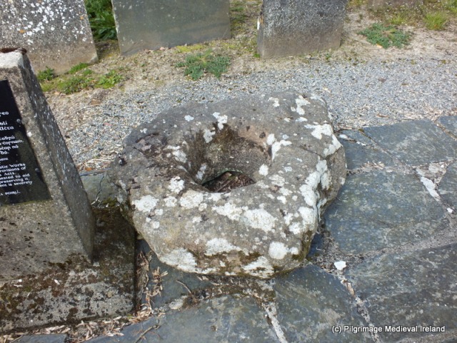
A story recounted  by Mary Jane Leadbeater Fisher in her book Letters from the Kingdom of Kerry: In the year 1845 also records the tale but in her account the story is linked to another archaeological feature of the landscape, a large multi basin bullaun stone know as the Keelers or na Beirtí (Milk Coolers).

A cow is the subject of this legend—a cow of size and breed suited to provide milk for the giant race of those days. We saw the milk vessels, and if she filled them morning and evening, she was indeed a marvellous cow. In a huge flat rock were these milk pans; six large round holes, regular in their distances from each other, and nearly of equal size; they could each contain some gallons of liquid. This said cow gave sufficient milk for one whole parish; and was the property of a widow—her only wealth. Another parish and another clan desired to be possessed of this prize; so a marauder, endued with superior strength and courage, drove her off one moonlight night. The widow followed wailing, and he jeered her and cursed her as he proceeded. The cow suddenly stopped; in vain the thief strove to drive her on; she could neither go on, nor yet return; she stuck fast. At length, aroused by the widow’s cries, her neighbours arrived, and the delinquent endeavoured to escape. In vain—for he too stuck fast in the opposite rock; he was taken and killed. The cow then returned to her own home, and continued to contribute her share towards making the parish like Canaan, “a land flowing with milk and honey.” The prints of her hoofs, where the bees made their nests, are still to be seen in one rock ; and those of the marauder’s foot and hand in another, where he was held fast by a stronger bond than that of conscience (Leadbeater Fisher 1847, 48).

The ‘huge  flat rock’ she refers to seems to be  a large stone known as the Keelers or ‘Beirti’.  This is a large irregular, shaped bullaun stone (KE042-026007)  located 50-60m northwest of the Romanesque church at Kilmalkedar. The stone  has seven depressions of oval and circular shape with depths of 0.04-0.25 diameters 0.22-0.42m diameter. This stone is associated with a magical cow known who is known in folklore form other parts of the country.

Unicode

Unicode

The  legendary cow was the  Glas Ghoibhneach,  she was said to a have been a marvellous milker.  The Glas Ghoibhneach translates as ‘the grey of Goibhniu’. Goibhniu was a mythical smith who likely derived from a god of the same name. The legend of the cow  is  very old and widespread across Ireland. According to O’hOgain

legend told of her all over Ireland describes how she filled with milk every pail put under her by her unnamed owner. However, a jealous woman claimed that she had a vessel which the Glas could not fill, and accordingly she brought a sieve and began to milk the great cow. The Glas yielded a continuous stream of milk, enough to fill a lake, but it all ran through the sieve. Eventually, she became exhausted by the effort and died.

The tradition from Kilmalkedar tells that the glas was milked into the basins of the rock by the monk from the monastery (An Seabhac 1939, 117). Interestingly additional stones associated with the magical cow are found a few miles to the southwest, the stones are  a pair of standing stones known as ‘Geata an Glas Ghaibhleann’ or the gate of Glas Ghaibhleann.

I would like to thank the wonderful archaeologist Isabel Bennett  for all her help with  pointing out sources for these  stones

References

An Seabhac. 1939. Triocha-Chéad Chorca Dhuibhne. Cuid IV. Dublin: An Cumann

le Béaloideas Éireann, 117.

Cuppage, J. 1986. Archaeological Survey of the Dingel peninsula. A description of

  the field antiquities from the Mesolithic Period to the 17th century A.D. Oidhrecht

  Chorca Dhuibhne. Ballyferriter: Oidhreacht Chorca Dhuibhne, 308

Dingle Survey Files.

Ó hÓgáin, D. 1991. Myth, legend & romance an encyclopaedia of the Irish folk tradition

New York: Prentice Hall Press.

Killanin, M. & Duignan, M. 1967. The Shell guide to Ireland. London: Ebury Press.

Leadbeater Fisher, M. J in her book Letters from the Kingdom of Kerry: In the year 1845. pub 1847. Dublin: Webb and Chapman

The Gate of the Cow; Kilmalkedar Keelers Stone

O’H

Save

Save

Save

Save

Save

Save

Save

Save

Save

Save

Save

Save

Save

Save

Save

Save

Save

Save

Save

Save

Save

Save

Killamery High Cross Co Kilkenny

The Killamery  high cross is  a wonderful hidden gem,   just off the main Clonmel to Kilkenny Road, about 5 miles south of Callan. The  cross is located at the site of the early medieval monastery of Killamery. Today  the site is dominated by a Firsts Fruits church, dedicated to St Nicholas. The church was  built in the year 1815 with a gift of £900 from the Board of First Fruits and was in use until the early 1900’s. During the 19th century it was a rectory, in the diocese of Ossory and it  formed the corps of the prebend of Killamery, in the gift of the Bishop; the tithes amount to £280.

dscf6738

St Nicholas First Fruits Church at Killamery

Killamery or Chill Lamraí  in Irish translates as the Church of Lamraighe and it gives its name to the townland and the civil parish where the site is located.

The patron saint the early medieval monastery was St Gobán. The Martyrology of Óengus  records the saints feast day as the 6th of December. In later centuries the site became associated with another saint, St Nicholas of Myra whose feast day is also on the 6th of December. Little is know about the early history of the site  and it is not until the 11th century  that it appears in the historical records. The Annals of Four Masters in 1004  record the death of Domhnall son of Niall the abbot of Cill-Laimhraighe. During the later medieval period site appears to a have had a parochial status. An Anglo-Norman Motte is located c.100m to the southwest of the site.Mottes were earth and timber castles composed of a large artificial pudding bowl shaped earthen mound with a wooden palisade around the summit, enclosing a timber tower known as a bretasche (Farrelly & O’Brien 2006, 289).

According to Grey (2016, 278)

The townland of Killamery appears to have been See lands from an early date, until the bishop exchanged the townland with William Marshal for the townland of Stonycarthy, between 1192 and 1231. Marshal granted the townland to de Albin (Tobin) and it remained in the hands of the Tobins (Brooks 1950, 252-61), until it was forfeited in Cromwellian times by James Tobin. The church of Killamery became the prebendary of the diocese of Ossory on the establishment of the chapter and continued to form the corps of the diocesan chancellor until at least the fifteenth century (Carrigan 1905, iv, 311-20).

Today little remains of the earlier church settlement. During the 19th century much of the remains relating to the early medieval and medieval of Killamery  was destroyed. The Ordnance Survey Letters of Kilkenny (1839, 120) state

The foundation, between three and four feet high, remains on the south-east side of the churchyard or burying ground, measuring 23 feet by 18, walls 2 feet nine inches thick; this part would appear to have been the Quire of the Church, as vestiges of  some more extensive building may be traces, projecting to the west from it. There is a yew three within the area of the choir five feet in circumference , and two white thorns of good growth near it (Herity 2003, 120).

In 1853 the Kilkenny Archaeological Journal recorded a visit by  Mr Dunne who described

A portion of the ancient chancel wall which enclosed the tombs of the family of Lee had been destroyed only the week before he visited it, and the stones had been used for a wall near the police barrack. The body of this ancient place of worship, with its ivy-covered arch, had been taken down in the year 1815 to serve for material for the present parish church, and the moss-covered stones that were uprooted on this occasion were thrown into a common shore (Stokes & Westropp, 1896/1901, 572).

A small number of early medieval features are found in the graveyard beside the First Fruits church. They include an early medieval, cross slab, a bullaun stone, high cross and a holy well.

006

Historic graveyard at Killamery containing  high cross, cross slab and bullaun stone.

The cross slab a large rectangular slab of stone with a large  latin cross set within a frame above the cross is the inscription  OR AR THUATHA. The  slab is set on its side against a large block of stone.

dscf6755

The high cross dates to the ninth century it is elaborately decorated and sits on a stone plinth.

dscf6745

East face of the cross at Killamery

A panel on the base of the western face seems to contain an inscription which MacAlister  transcribed as OR DO  MAELSECHLAILL. “OR DO”  means pray for and he identified Maelsechnaill as high king of Ireland who reigned  AD 846 to 862 (Harbison 1994, 78).

016.JPG

West face of high cross at Killamery

Above the whorl at the centre of the head of the west face is a panel showing one figure holding a child as another approaches from the right-perhaps Adam and Eve at Labour. Beneath the whorl is a figure flanked by angels, possibly God creating the Seventh  Day…The hunting scenes on the arms of the cross (Harbison 1994, 79).

The eastern face of the  high cross depicts interlaced animals.

The sides of the cross are also highly decorated. The ends of the arms  have scenes from the bible the southern arm  Noah in the Ark and the northern arm a scenes from  the life of St John the Baptist.
dscf6769

Northern side of the high cross at Killamery

According to the Ordnance Survey Letters (1839) stations were performed  there on Good Friday during the mid 19th century. It was

frequently visited by persons afflicted with head ache, on which occasion the mitre, which is loose is taken off the cross and put three times on the patient’s head, at the time reciting some prayers, after which a cure may be expected to follow (Herity 2003, 120)


021

The ‘mitre’ cap stone on top of the high cross was used to cure headaches in the 19th century.

A large bullaun stone  is located close to the high cross. Its base is worn through . Megalithic Ireland blog makes note of a second bullaun stone at the site which I did not see. I really hope I missed it and it has not disappeared from the site.


dscf6749

Stokes & Westropp (1896/1900, 378) recounted the presence of a third bullaun stone at the site and that it marked the grave of St Gobban.

There is a tradition that a bullaun, i.e. a cup-marked stone, probably
a rude font, lay at the side of the grave of Saint Goban at one time, but
that it was broken in pieces by the Palatines of New Birmingham, in the
County Tipperary.
A small and very unusual holy well is found on the north side of the graveyard.
The well is marked by a large granite boulder. One side of the  stone has been shaped in to  gable shape over a recess.
dscf6773

St Nicholas holy well Killamery 2014

When I visited the site in the summer of 2016 the well  was dry and a rectangular recess normally filled with water from the well was visible at the base.  The well was dedicated to St Nicholas of Myra. In the past a pattern or patron day was held here on December 6th  the feast day of the saint. The tradition of pilgrimage here has long died out. Evidence of the saints importance to the area is illustrated by dedications of the nearby church and school at Winegap to the saint. Interestingly the feast day of the founder St Gobán, coincided with that of Saint Nicholas of Myra. St Nicholas was a very popular Norman saint and it is possible that his association  with the site was linked to the establishment of the Anglo-Norman  settlement of Killamery and  was used to replace the earlier cult of St Gobán.
Although not directly related to the early medieval monastery. In 1850’s a sliver pin brooch was found  by a labourer digging in a field within the parish of Killamery. It was said the man accidental broke the pin with a blow from the spade.The broach dates to the ninth century and was made in Ireland but the design was influenced by Viking design (Whitfield & Oskasha 1991).  The pin shows evidence of Viking-style stamped ornament on the pin. The broach  has an inscription  on the back which probably reads: CIAROD[UI]RMC[.R]. According to  Whitfield & Oskasha (1991, 59) ‘text contains a male personal name, probably CIAROD[UI]R MAC [.R]. It can be interpreted as ‘[the possession] of Ciarodur son of [-]’ It is likely Ciarodur was the owner of the broach (ibid, 60).
c_brooch_killamery_2

Killamery Broach from  The History and Antiquities of the Diocese of Ossory http://rootsweb.ancestry.com/~irlkik/pics/index.htm

Reference

Crawford, H. 1913. A Descriptive List of Early Cross-Slabs and Pillars (Continued). The Journal of the Royal Society of Antiquaries of Ireland, 3(3), sixth series, 261-265.

Farrelly, J. & O’Brien, C. 2002.  Archaeological inventory of County Tipperary.  Vol. I, North Tipperary.  Dublin: The stationary office.

Grey, R. 2016.Settlement clusters at parish churches in Ireland, c. 1200-1600 AD. Thesis NUI Galway.https://aran.library.nuigalway.ie/handle/10379/6061

Harbison, P. 1994. Irish High Crosses.Drogheda: The Boyne Valley Honey Company.

Herity, M. 2003. Ordnance Survey Letters of Kilkenny. Vol.1 & 2. Dublin: Fourmasters Press.

Whitfield, N., & Okasha, E. (1991). The Killamery Brooch: Its Stamped Ornament and Inscription. The Journal of Irish Archaeology, 6, 55-60.

Lewis,  1837 Topographical Dictionary of Ireland Vol. 1, 123.

Stokes, M. & Westropp, T. J/ 1896/1901.’Notes on the High Crosses of Moone, Drumcliff, Termonfechin, and Killamery. (Plates XXVIII. to LI.)The Transactions of the Royal Irish Academy , Vol. 31 (1896/1901), pp. 541-578.

A Day Trip to the Parish of Kilmovee Co Mayo

Last summer I spent a day exploring some of the archaeology sites in the parish of Kilmovee Co Mayo. Kilmovee is located a short distance from the town of Ballaghadreen in  Co Roscommon.  Local man, Tommy Horan  was kind enough to act as my guide for the day.

The parish gets its name from St Mobhí. Kilmovee or Cill Mobhí in Irish, means the church of St Mobhí. It is said he  came to the area as a missionary, continuing on the work of St Patrick.

IMG_8447

Bullaun stone known as Na Trí Umar Bheannaith in townland of Rushes

The day began in the townland of Rusheens West with a visit to one of the largest bullaun stones I have ever seen. The stone is known as Na Trí Umar Bheannaithe/The Three Holy Water Fonts.  The  bullaun stone is a large boulder with three large depressions.  It sits on a plinth against a wall at the side of a small byroad. Folklore tells that the stone was transported from Killericín and placed in its current position.

255

Bullaun stone known as Na Trí Umar Bheannaith in townland of Rusheens West

From the bullaun stone we travelled on to the site of a holy well called Tober na Bachaille/The Well of the Crozier. The holy well is located in marshy field. As the site is  on  a working farm so permission should be sought before gaining access.

205

Field where Tober na Bachaille/ The Well of the Crozier is located.

Folklore tells that when St Mobhí came to the area as a missionary he needed somewhere to baptise new converts.  Not having a suitable water source the saint struck the ground three times with his crozier and three wells sprung up on the spot.

It is thought there was originally three wells  here but today only one well is visible.  The well is very overgrown  and a small blackthorn tree  grows beside it. The well is a spring  enclosed by a low stone wall.  The location of single well is marked on the 1st ed. (1839) OS 6-inch maps which could suggest that the three springs are within the well enclosure. Unfortunately the Ordnance Survey Letters  relating to Mayo fail to mention the well.  The Folklore Commission National Schools Essays provides an origin tale for what it calls the three Blessed Wells in the parish.

St Movee’s sister was a nun and she lived in Sligo. One day she came to Kilmovee to see her brother and the church. She was passing down through Barralackey and there was a boy minding cows. He told her he would help her and he told her that the Ardeull people thought she was a witch and that they were to follow her. He said he would go with her to the church only he had a long way to bring water to his cows. She was very thankful to him and said he would never again be short of water and she — [can’t read the word] on a rock and water filled in it and is there still. In three long steps she reached the church and every step she gave a well sprang up three well in succession and these are called the ‘Blessed Wells’ (NFSC  Cloonierin 114:52).


Tober na Bachaille is no longer visited by pilgrims and as a result it has become overgrown.  Local knowledge may shed more light on the well(s) and traditions relating to pilgrimage.

View Tobar na Bachaille.

View of Tobar na Bachaille

To the north of the well is a large stone built penitential cairn or leacht. Sitting on top of the cairn is a stout Ogham Stone.

View of penitental cairn with ogham stone beside Tobar na Bachaile

View of penitential cairn with ogham stone beside Tobar na Bachaile

Macalister noted that the ogham stone, once acted as a ‘kneeling stone’ and sat on the low wall surrounding the holy well. The stone had moved to its current position by the 1940’s (Macalister 1945, 7-9).  An ogham inscription is found along one of the edges of the stone. Macalister identified this inscription as AlATTOS MAQI BR…. He also suggests that the top of the stone was deliberately cut away by a mason during the building of the wall around the well (ibid).

Ogham stone beside Tobar na Bachaile

Ogham stone beside Tobar na Bachaile

From the holy well we  traveled on to  the ruins of a medieval parish church called An Teampall Nua also known as St Patrick’s church.  Local folklore recalls that  when the church was first built it was called the ‘New Temple’.

This slideshow requires JavaScript.

All that remains of the church are the chancel and parts of the nave walls. The walls of the church have been rebuilt and incorporated architectural fragments of windows and doors.  A chancel arch still survives in relatively good condition and appears to have been remodelled in the past. The original arch was rounded and built of cut sandstone, it was later altered and filled with masonry and replaced with a smaller  to a pointed arch defined by vousoirs. The exterior of the church is surrounded by rubble masonry that likely came from the church. In 1838 the Ordnance Survey Letters for Mayo described the church as on

on the East gable of which there is a window about 6 feet and 6 inches broad. Part of side walls remain, West gable is perfect (Herity 2009, 288).

DSCF2062

The church is surrounded by a historic graveyard and mass is said here once a year.

Our day concluded with a visit to a large ringfort called  An Caiseal located in the townland of Kilcashel/Coill an Chaisil, which means ‘the wood of the stone fort’.

The ringfort is very well-preserved and is on private land so permission must be obtained before entering.  The fort   measures 30m in diameter and is constructed of a single circular wall which is 5m thick and 3m high.

View of exterior of Caiseal ringfort

View of exterior of Caiseal ringfort

The fort is entered through a formal linteled entrance.

Linteled entrance

Linteled entrance

The interior contains the ruins of two house sites and a souterrain.

379

The top of the walls are accessed from the interior via four sets of V shaped stone steps.

Stone steps in interior walls of ringfort

Another interesting feature of the fort is  a creep-way that links two internal wall-chamber within the walls.

The wall  chambers appear to be aligned to the morning sun.

For three mornings, light goes into the back of the chambers which are two meters deep and joined at the back by a six meter passage way. Each morning the new sun has moved on half a meter on the back of the wall. There is about 20meters of the back wall (of the Caiseal) that is traversed by the sun. This means that the sun shines only for about  40 days  on the back wall twice a year. This is between Winter solstice and both equinoxes…  The first  chamber was lit on the 5th of October, the Second was lit on or about the 21st of October, but due to the curvature of the wall it is still in the chamber on the 24th …

Two months later the sun will again be shining in the this chamber on the 20/21 February as the days lengthen (Mac Gabhann no date 10-11).

20160330_104123

Image of the chamber being illuminated by light (Mac Gabhann no date 10-11)

For a more detailed discussion of the archaeology of this site see the Kilcashel project website. My day in Kilmovee was a brilliant experience and  it reminded me of the  wealth of local archaeological and historical sites that are to be found within and around all Irish villages. So really you don’t need to travel very far to find wonderful historic and archaeological sites to visit.

As many of the sites we visited were on private land, permission was always obtained before going to the sites.  If anyone is interested in visiting the area please contact the Kilmovee Community & Heritage Centre, the people who work here are so helpful and will be able to help you find out if  access is possible. Contact details and opening hours can be found on the Kilmovee website  and Facebook page (see links below). The community centre also houses a wonderful Heritage Centre called ‘Cois Tine’ (beside the fire). The  centre is design is based  on a traditional Irish cottage  and holds lots of information, photographs about the parish history, archaeological sites and folklore connected to the area. I recommend a visit to the Heritage Centre  before any exploring as it is a great way to begin a trip around the parish.

If you are in the area I would also highly recommend a visit to Urlaur Abbey located just a few miles from Kilmovee. Located on the edge of Urlaur lake the Friary built circa 1432 is one of Ireland’s best kept secrets.  Its setting alone is worth a visit.

References and useful links

Herity, M. 2009 (ed) Ordnance Survey Letters of Mayo. Dublin: Fourmasters Press.

Macalister, R. A. S. 1945. Corpus Inscriptionum Insularum Celticarum,Vol I. Dublin: Stationery Office.

Mac Gabhann, S. no date. Cill Mobhí. A handbook on local history and Folklore.

NFSC  Cloonierin 114:52 after http://www.duchas.ie/en/cbes/4427915/4357560

http://www.kilcashel.com/archaeology.html

http://www.mayo-ireland.ie/en/about-mayo/archaeology/archaeology-overview.html

Save

Save

Save

Save

Save

Save

Save

Save

Save

Save

Save

Balla Co Mayo

Balla in Co Mayo  has very ancient roots, and was once the site of a thriving pilgrimage.   Balla was also located along the route  of the well-known pilgrim road/route  the TocharPhádraig. Tradition holds that Tóchar was  a medieval road  that linked Croagh Patrick to important settlements such as Aghagowel,  Ballintubber and Balla and used by pilgrims up until the 19th century when travelling to Croagh Patrick.

Despite its connections with the Croagh Patrick pilgrimage, Balla was not founded by St Patrick but folklore tells that the saint rested here while travelling through Mayo. The  modern village developed around the site of a seventh century monastery founded by St Crónán also known as a Mo-Chúa. The saint was educated by St Comghall of Bangor and  he died in AD 637.  Like St Laserian, Crónán choose to settle  at Balla because of a divine sign. It was said that a cloud guided the saint to Balla  and upon his arrival a spring  burst from the ground. Such signs confirmed to the saint that this was where his church was meant to be. We know little of the early settlement established by Crónán. It was seldom mentioned in historical sources and  all that survives of the early monastery are the partial remains of a round tower  found within a historic graveyard.

Galaxy s5 CP 284

Balla Round Tower

The tower survives to a height of circa 10m. During the nineteenth century it was used as a bell tower for the local catholic church. Lalor estimates it once stood at a height of 30m.  The tower has two doors the lower of which appear to be a late medieval insertion.  The lintel of this door  re-used an early medieval cross slab. Today the slabs  decoration is quite faded and difficult to see. The upper door has traces of Romanesque moulding on its lower course suggesting  a 12th century date for the construction for the tower. The  changes in masonry  style and the stones size within the upper door and the surrounding masonry suggest  this section was a later rebuild (O Keeffe 2004, 79-80).  Apart from the re-used cross slab the fabric of the tower also incorporates two bullaun stone  within the walls.

This slideshow requires JavaScript.

In the 1830s a church was recorded in the vicinity of the tower, the church has  long since disappeared although a late medieval altar still survives to the north-east of the tower.

The site of the spring which burst forth from the ground on the arrival of Crónán also survives and is located to the west of the graveyard along a small lane that runs along the side of graveyard from the carpark in the community centre.  The holy well  which burst forth to welcome Crónán to Balla is today known as  Tobair Mhuire (Lady Well).  When I visited the site in 2014 the well was choked up with silt and the rest house was in a poor state of preservation.

Galaxy s5 CP 309

Tobar Mhuire Holy Well at Balla

The ruins of a 17th century building that was built as a shelter for blind and lame pilgrims  is located beside the well.

Galaxy s5 CP 300

Bath House at Balla Holy Well

There are no historical accounts of pilgrimage during the medieval period but the well and monastery were the focus of a very popular post medieval pilgrimage. The post medieval pilgrimage likely developed from an older pilgrimage tradition. The construction of  the rest house in the 17th century suggests a sizeable flow of pilgrims here at the time. The well was probably once dedicated to St Cronán/Mo Chúa but by the 17th century, if not long  before, its was firmly associated with the Blessed Virgin and stations were performed here on the 15th of August. A pattern day festival was also held on this date.  Lewis in 1837 noted the well

is attended by great numbers of the peasantry at patrons held on the 15th of August and  8th of September(Lewis 1837, 102).

The waters of the well were held to have healing properties and were especially good for sore eyes.

According to the Ordnance Survey Letters of Mayo of 1838

There  are also two little pillars, of mason work , called by the people, Station monuments (Leachta), and used as such, on top of which, are two small stone crosses, one on each, and in which are fixed (in the work of which are placed) two stones, one in each, with inscriptions on them, dated 1733; both are written in English, and under one of them are the words ‘Sun tuum praesidium fugimus, sancta Dei genitrix’. that is – Under your protection, we fly, Holy Mother of God.

These pillars and crosses appear to have acted as pilgrim stations but are no longer present at the site.   The pillars may have been replaced  two cairns of stones which also acted as pilgrim stations. The cairns were recorded by The Schools Manuscripts Essays for Balla (roll no. 1146, 178 ) in 1937 beside the well but are no longer present at the site

are two heaps of stones with a cross on each lying down. Beneath those heaps two priests are supposed to be buried. St Cronan himself is said to be buried somewhere near the spot (Balla B roll no. 1146, p 178).

The The Schools Manuscripts Essays state to obtain a cure

sight has been restored to some people who perform the stations. Several Our Fathers and Hail Marys have to be repeated at each heap of stones and at the well (Balla B roll no. 1146,  p 178)

As devotion to the well ceased the cairns of stones were removed in the ensuing years.

This slideshow requires JavaScript.

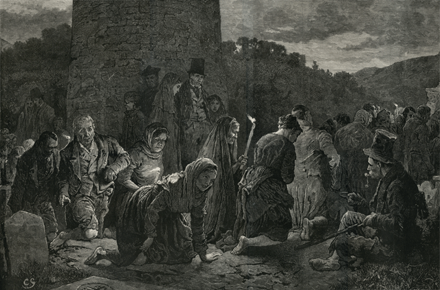
The 19th century devotional rituals engaged in by pilgrims were quiet complex and know as the Long Station. It was said that 15,000-20,000 people would attend the main days of pilgrimage arriving on the eve of the feast during this period (Rynne 1998  183).

pattern day Balla

Charles Green, An Irish ‘Patern’ at Balla County Mayo – The ‘Long station’, engraved by Eugène Froment, in The Graphic 11 (23 January 1875), between pp. 96 and 97. Ill. 899 [899]. Green himself described the churchyard scene on p. 78. (Image taken http://www.maggieblanck.com/Mayopages/Irishancestors.html)

Prayers began in the graveyard among the  tombstones  the bare foot pilgrims  would kneel and say a Pater, Ave and Gloria ( Our Father, Hail Mary and Glory be to the Father)  seven times, they then crawled on their kneels to what was known as the high altar (the altar from the medieval church) within the graveyard ,  one Pater and fifteen Aves  were recited as they made their way to the altar. At the altar they said the litany of the Blessed Virgin, seven Aves and seven Glories. The pilgrims  then walked around the graveyard seven times  saying fifteen decades of the rosary. Returning to  the altar they said the  Pater, Ave and Goria five times.  From here they continued to the well and at each  cairn(mound) near the well they said five Pater Ave and Gloria.  The pilgrims then entered the rest house and said a Pater Aves and Gloria five times, after which they turned three times around. The pilgrim rest house was described as unroofed in the Ordnance Survey Letters in 1838. Leaving the rest house pilgrims  then went to the well and made the sign of the cross with its waters saying one ave each time. This  completed the stations (Rynne 1998, 183).

The Schools Manuscripts Essays for Balla  also recount a version of the Long Station and it appears by the early 20th centurythe  penitential aspect of the pilgrimage had lessened slightly with people now wearing shoes for most of the station.

The rounds are done by the people on the knees from a particular slab to the altar on the opposite side of the graveyard saying while doing seven Our Father, seven Hail Marys and seven Glories. Them the people walk around the graveyard even times and they repeat the same prayers. When the people reach the graveyard gate they go on their knees to the altar again and they go down to the Blessed well  and take off their shoes and stockings and walk around the well three times  and then drink the water. After  that they make the sign of the cross on a stone nearby so that the station would be blessed (Balla C roll no. 1146, p 34-35.)

Relevant to the decade of commemorations and showing how in times of crisis holy wells and local saints were turned to for help and protection

During the Black and Tan regime people from Balla did the stations for the protection of Cronan for Balla  (Balla B roll. no. 1146)  p179

This reaction of the people of Balla to seek protection from their saint  is not surprising when one considers in June 20th 1921  the Black and Tans burned the town of Knockcroghery in Co Roscommon.

The rise of pilgrim sites like Knock in the later 1800’s sent the  pilgrimage at Balla into a steady decline and today the  pilgrimage that took place here is a distant memory.

If you visit Balla be sure to go to the local community centre where there is a great display dedicated to the history of the site and the area.

References

The Schools Manuscripts Essays, Ball Áluinn (Balla) (roll number 1146) http://www.duchas.ie/en/cbes/4427833

Green, C. 1875. ‘An Irish ‘Patern’ at Balla County Mayo – The ‘Long station’’, engraved by Eugène Froment,  The Graphic 11 (23 January 1875), between pp. 96 and 97. Ill. 899 [899].

Herity, M. 2009. (eds.) Ordnance Survey Letters Mayo. Fourmasters Press.

Lalor, B. 1999. The Irish Round Tower. The Collins Press.

O’Keeffe, T. 2004. Ireland Round Towers.  Tempus Press.

Rynne, E. 1998. ‘The Round Tower, Evil ye, and Holy Well at Balla Co Mayo’s’  in C Manning (ed) Dublin and Beyond the Pale. Studies in honour of Paddy Healy. Bray: Wordwell in association with Rathmichael Historical Society pages 177-184


St Berrihert’s Kyle Co Tipperary Part 1: The Archaeological remains

The 18th of February is the feast day of St Berrihert/Berrahert of the parish of Ardane, Co Tipperary.  An Anglo-Saxon saint, he is traditionally believed to have  come to Ireland in the seventh century following the  Synod of Whitby. To mark the saint’s feast  this two-part blog post will explore the  archaeological remains and the evidence  pilgrimage  at a site associated with the site, known as St Berrihert’s Kyle in Co Tipperary.

BH

1st ed OS map of St Berrahert’s Kyle/Berrihert’s Kyle 1840

Location

St Berrihert’s Kyle  is  one of Tipperary’s best hidden treasure.  The site is located in the townland of Ardane, in the parish of Templeneiry. It is difficult to find as there is no signposting.  It is located close to the village of Ardane.


From the main road, you will see a sign for “Golden Mile, Winner 2003”, turn left on the opposite road. Half a mile down this road is a gate with a no parking sign. Go through this gate and cross the first field (Be aware that there might be cows or bulls!). From there you will find the wooden trail that will lead you to the Kyle and the Well (visitballyhoura.com).

Who is St Berrihert?

It is suggested that St Berrihert  came to Ireland following the Synod of Whitby (Ó HÉaildhe 1967, 104).  He is  named in some documents  as brother of the Saxon saint Garailt of Mayo (Ó Riain 2011, 103).  He is associated with a number of places in the south of Ireland mainly around  Co Cork.  He is likely also to be the same saint as St Berichter the patron of an early medieval ecclesiastical site at  Tullylease in the barony of Duhallow, Co Cork.  An interesting cross slab of 8th/9th century date survives at Tullylease. The stone has an elaborate decorated cross and  the text of  with a prayer  for  Beirchachtuire an Irish version of  the Anglo-Saxon Beorhtwine.

tullylease

Tullylease Cross slab. Image taken from http://www.irishmegaliths.org.uk/crosspillars2.htm

The Annals of the Four Masters  records the death of a cleric with this name at the site in 839,

Berichtir of Tulach Leis died on the 6th of December.

The Martyrologies of Donegal and Gorman record the saint feast day as the 6th of December. His feast was honoured on the 18th of February at St Berrihert’s Kyle, the subject of this post, and at  the 15th of February in West Kerry.  The variation of feast day  perhaps  indicates ‘ that the cult had  become entwined with that of Bearach of Termonbarry‘ whose feast is on the 15th of February (Ó Riain 2011, 102).

St Berrihert’s Kyle 

St Berrihert’s Kyle  is located on farm land. To approach the site you must cross through two fields.  The land is boggy but a timber path marks the way. There are often horses or cattle in the field.

1-DSCF4316

Path approaching the St Berrihert’s Kyle

The Kyle through the years

The Kyle is the oval area enclosed by an earthen bank and contains a large number of early medieval cross slabs.  The landscape of this area has changed  in the last 100 years or so.

In 1907 Crawford described the area as  ‘a circular enclosure in a field west of the well and greatly overgrown with oak tress and thorn bushes‘.  He also noted that all the carved stones, which he counted 22 have been collected and built into a station (Crawford 1907, 61).

ber

Cross slab at St Berrihert’s Kyle in 1907 ( after Crawford 1907)

The photo above dates  to 1907, it  shows the site as very overgrown with a large number of the cross slabs placed in front of a small tree covered in rags.  Crawford( 1907, 62) mentions  the tree was a thorn-bush and  that a series of  offerings were left here including  statuettes, vases, cups and toy-teapots.

A second photo from the Limerick City Museum collection show that the cross slabs had been moved and built up into a station in front of a wall.  A large rectangular stone was placed in front of the crosses .  This photo is dated to between  1896-1910 and on the reverse image in pencil ‘Berrihert’s Kyle Co. Tipp. 1936’.

62088_ca_object_representations_media_7392_mediumlarge

Photo of Crosses at St Berrihert’s Kyle  dated 1936 ( from http://museum.limerick.ie/index.php/Detail/Object/Show/object_id/8087)

The site today

Today the landscape of the site owes much to work carried out in 1946 by  the Office of Public Works/OPW who  “cleaned up the site”.  They cleared the enclosure of bushes and vegetation. Then they collected all the crosses and built them into a circular  stone structure which incorporates a large oak tree, to protect the crosses from cattle at the south end of the site. The walls are full of cross slabs and it has an ancient look to it.

1-DSCF4372

Stone structure built by OPW in 1946

The stone structure is entered via a style,  beside a large oak tree.  Ó HÉailidhe (1967, 103)  recorded 72 cross inscribed stone at the site but only 67 were noted  by the Tipperary Survey in 2011 suggesting some may be missing.

1-DSCF4373

Interior of stone enclosure showing the stone crosses incorporated into the walls.

The majority of the crosses depict a simple Latin cross on a single face.  A small number have decoration on both faces.

1-DSCF7053

Close up of cross slabs at St Berrihert’s Kyle.

A larger rectangular stone  with one  hollow depression is found within the stone enclosure, in front of the head of a high cross which is incorporated into the  wall.  The surface of the bullaun stone is covered by trinkets left by pilgrims and includes holy statues, small toys, coins and crystals .

1-DSCF4347

Bullaun stone in interior of circular stone enclosure at St Berrihert’s Kyle

A large egg-shaped  stone sits in the hollow of the bullaun stone.  These egg stones occurs at other pilgrim sites and are known as cursing stones.

1-DSCF7070

Egg shaped stone in the bullaun stone.

A  holly tree  within the enclosure is covered rags and ribbons tied by modern pilgrims.

1-676

Rag tree within circular stone structure at St Berriherts Kyle.

The presence of such a large number of  cross slabs at the site may suggest the presence of a monastic settlement.  There are no upstanding remains of any buildings at the site.  If this was a monastic site it is  possible the buildings were built of wood.  In the 1940’s the ground surface of the Kyle was lowered and the soil  from this area was used to build a causeway across the bog to the nearby St Berrihert’s well.  The OPW recorded no trace of walls when lowering the ground level at the site.  It is impossible to know what damage this act did to any sub-surface archaeological remains that may have been present.

Around the edge of the Kyle are a number of small stone cairns surmounted by a cross slab.  These cairns were created  in 1940’s  to mark stations of the cross but there were not part of the original pilgrim stations at the site .

1-DSCF4474

Cairn with cross slab built in 1946.

The central area of the Kyle is defined by stone curbing which demarcate a children’s burial ground.

1-DSCF4361

Kerbing at the site.

St Berrihert’s holy well

The nearby holy well is dedicated to St Berrihert  and is located a short distance from the Kyle. The path is marked by a timber track through marshy ground.

1-DSCF7126

Path leading from the Kyle to the nearby St Berrihert’s holy well.

The path continues crossing over a small bridge.

1-DSCF7131

Bridge over stream to on way to St Berrihert’s holy well

The  well is a large  circular pool is found in a  surrounded by trees and defined by an earthen bank in the NE-NW.

1-DSCF4406

St Berrihert’s holy well.

Some of the trees are decorated offering left by  modern pilgrims and range from ribbons, rags, socks and toys.

1-DSCF7138

Rag tree at St Berrihert’s Kyle.

The well is formed from limestone springs  and the waters bubble forth giving it a really magical appearance. This was very likely a place of prehistoric pilgrimage.

1-DSCF4410

Bubbling water at St Berrihert’ well.

Coming soon is part II of this post, which will look at the history of pilgrimage at the site.

References

Crawford, H. S. 1907. ‘A descriptive list of the early Irish crosses’, JRSAI 37, 187-239.

ÓHÉailidhe, P. 1967. ‘The crosses and slabs at St Berrihert’s Kyle in the Glen of Aherlow’ in Rynne, E. North Munster Studies. Limerick: The Thomond Archaeology Society, 102-126.

1987.0727, Limerick Museum Catalogue, http://museum.limerick.ie/index.php/Detail/Object/Show/object_id/8087http://museum.limerick.ie/index.php/Detail/Object/Show/object_id/8087


St Colmcille’s well Disert Donegal

Today is the feast day of St Colmcille who along with St Patrick and St Brigit he is one of the three patron saints of Ireland. In 2008  my good friend Fiona Beglane  brought me to  see  a holy well  associated with the saint. The well in question is located   in the townland of Disert, in the parish of Inver, in Co Donegal. Over the last few years I have been to a lot of pilgrim sites but  this is  one of the most beautiful place  that I have spent time.

Location

St Colmcille’s well  is situated in rough pasture at  the foothill of the  Carnaween hill and the Bluestack  mountains close to the banks of  the Eanybeg river.  As you can see from the photo below this is  the most glorious of  locations.

26-RIMG1175

The site consists of a holy well located close to a small graveyard that is surrounded by a stone wall and the remains of  megalith and associated enclosure.   All three  monuments  are points in  the pilgrim landscape of the site.

24-RIMG0299

The Eanybeg river

Meaning of Placename

The townland name Disert (Dísert in Irish) comes from the Latin word desertum meaning desert. During the 4th century  there was a movement of hermits in the East (Syria and Egypt)  retreating into the desert to live a life of isolation and prayer. It is probable that the idea of  living as a hermit came to Ireland from the East  via Gaul and Britain. The Irish placename ‘Dísert,’ and its variants ‘Dysert,’ and placenames of which ‘Dísert’ is a component, for example, Dísert Diarmata, Castledermot, bear witness to the existence of hermits and hermitages in  Ireland. There is no visible evidence of an early or  late church here but  according to tradition St Colmcille blessed the well here which was already of local importance.

History of the Site

The earliest references to Disert  dates to the 17th century.  The History of the Diocese of Raphoe mentions that Hugh Roe O’Donnell, chief of Tir Chonaill gave an estate at Disert to the Franciscans around the year 1460. Yet according to Meehan (1997, 14)   the Franciscans have no record of their order in the parish of Inver. Local tradition held that the Franciscans  who fled their monastery at Donegal after the Plantation of Ulster lived east of Disert in the townland of Friary and made their way between Killymard and Glenfinn along Casan na mBrathar.  Local tradition does states  seven monks were buried in the ‘garden’ or enclosure at Disert (ibid).

According to the Ordnance Survey letters for 1835 & the Annals of the Four Masters in the year 1611

Niall O’Boyle Bishop of Raphoe died at Gleann Eidhnighe on the 6th of February and was interred at Inis Caoil (Inish Keel).

Meehan(1994, 14) and the notice board at the site state it was at  Disert that the bishop died and  was carried out of the hills to his Kiltoorish for burial.

St Colmcille’s Well

03-RIMG0278

St Columcille’s well is located within the enclosing fence

The  holy well is fenced off by wire railing.  The well covered by a  trap door which need to be opened to access the water.  The well shaft/hole is lined with roughly coursed stones and the well very little water when I visited it  in the summer of 2008. There are two cairns beside the well which have kind of merged together and are covered with vegetation.

02-RIMG0277

St Columcille’s well

The graveyard

Close to the well is a wedge shaped graveyard which is defined by a stone wall. The graveyard was used  for  the burial of  adults  until the 1840’s  and for unbaptised  babies until the 1930.  Within  the enclosure  is a stone altar with a metal cross beside an old tree.

15-RIMG0290

Interior of graveyard with holy well in the background

Sitting on the altar are a number of holy stones one of which  is a quern stone. There are a number of  low stones  in the grass which act as graves marker  and    four low stone mounds or  penitential cairns scattered about the graveyard. According to  Walking Ireland Website the site was used during penal times as a safe place to say mass.

The priest was said to travel up and down the river Eany between the Alt in Ardaghey saying mass in each, on alternate Sundays. The bullaun stones were said to have been used as candle holders. Fr. Dominic Cannon was parish priest of Inver from the 1770″s until his death in 1801.

05-RIMG0280

Altar within the graveyard

St Colmcille’s Arch

St Colmcille’s Arch  is another part of the pilgrim landscape. The arch is  what appears to be the remains of  a  ‘Megalith’  it consists of  two orthostats (upright stones) approximately 1m high with a lintel stone resting on them.  Piled on the lintel stone are small stones which form a pyramid.

56-RIMG1205

St Colmcille’s arch

When you pass through the arch you enter a  sub oval enclosure roughly 5m by 6m.

The Turas at Disert was noted for its cures. East of the megalith is a large slab or concave stone. The penitents lay on this flag and pressed their back into the cavity. This was a noted cure for backache. The well water was said to cure toothache. The water in the bullaun stone was said to cure warts. It was also used to cure eye complaints. In those days people came to the Turas at Dysert on June 9th – the Feast of Colmcille – from far and wide. (Meehan 1997)

Modern pilgrimage

According to the notice board at the site in former times people came here on the 9th of June the feast of the saint. In modern times mass is said in the graveyard on the first Sunday of July followed by the  traditional climb  of the nearby Carnawee Mountain. In the past  at the  top  people meet those from the Glenties side of the mountain for an afternoon  &  evening of dancing and singing.  Fiona Belgane carried out a detailed survey of the site called Disert: St Colmcille’s Well and Megalith, which states

pilgrims traditionally start at the  well with prayers as they walk around the  stones barefoot whilst praying. They then walk to the altar, over the hill whilst saying the rosary. At the altar they circumnavigate the stones found there before mass is said. 15 decats of the rosary are said whilst walking around the well. ( Unpublished project by Fiona Beglane)

Meehan (1997, 14-15) states

As well as prayers being said at the well the Rosary was recited and Paters and Aves were said as the pilgrim made his or her way round the heaps or cairns walking on the right hand or deiseal and placing a pebble on top of the cairn as the prayers were said.

Disert  is renowned for cures,  and I have already mentioned  the healing stone east of the megalith where penitents lay on the flag and pressed their back into the cavity, to cure backache. The stone reminded me of  St Kevin’s chair at Hollywood. Penitents would also crawl through the megalith (St Colmcille’s arch)  and  rub the affected part of the body against the stone. The water of the well was a cure for tooth ache. The water in the bullaun stone was a cure for warts. The quern stone was used to cure eye complaints, the pilgrim would hold the stone up to their eye and look through  the hole at its centre.

06-RIMG0281

Quern stone known as the “Cure”.

Local tradition  has it that a test of male virility was to carry two stones from the altar in the graveyard to the well and back three times, whilst holding them from the top.

07-RIMG0282

On the left of the photo are the stones carried to the holy well and back.


The soil from Disert   is reputed to be holy and to have certain powers.  Like other Columban sites in Donegal, such as Gartan and Tory, the clay at Disert is said to banish rats. The clay must be lifted from the right hand side of the altar and in former times great stress was laid on it being asked for and received with great reverence. Newspaper reports have suggested that uranium in the clay caused it to banish rats but these reports haven”t lessened the belief in its power. Until recently Disert clay was often put in the foundation when houses were being built  (Meehan 1997, 17)

References

Anon. Information Board at the Site.

Beglan, F.(unknown) Disert: St Colmcille’s Well and Megalith.unpublished.

Meehan, H. 1997. ‘Disert in the Blue Stacks.’ Donegal Annual, Vol. 49, 12-23.

O’Donovan, J. 1835. Ordnance Survey Letters Donegal.

The Disert Circular Walk http://www.walkingireland.ie/section-2.aspx?item_id=140

St Mary’s Priory Cahir

The town of Cahir one of the stops on the  The Butler Trail,  a new historical trail that links three of Tipperary’s medieval towns Clonmel, Cahir and Carrick-on-Suir  and a series of historic sites associated with the Anglo-Norman Butler family.

The town of Cahir is probably best know for its magnificent castle which attracts thousand of tourist each year. The castle has also been used in the filming of movies and TV series such as the Tudors.

The town also has some beautiful medieval churches which are often overlooked. This post will focus on the impressive  remains of St Mary’s Priory, known locally as Cahir Abbey.

100-DSCF4709

St Mary’s Priory Cahir

The priory is located a  short distance from the castle past the Supervalu and Aldi supermarkets,  on the Limerick road out-of-town. The Augustinian Priory of  St Mary’s  is situated on the banks of the river Suir opposite Cahir Saw mills and can be approached  from the main road by a small lane.

The priory  was  founded c.1220 by a Norman knight named Geoffrey de Camvill and given to the order the of the Augustinian Canons Regular (Gwynn & Hadcock, 1970, 162).  In 1540 the prior Edmund Lonergan surrendered the monastery to Henry VIII (ibid). It appears that at the time  the main monastic church   was being used as a parish church so it was not taken by the crown  but the surrounding  monastic buildings  were granted to Sir Thomas Butler the Baron of Cahir ( Hodkinson 1995, 148; Farrelly 2011).

If you want to find out more about the priory’s history  see Hodkinson’s article  The medieval priory of St Mary’s, Cahir  in the journal of the Tipperary Historical Society (reference below).

043-DSCF4652

Cloister and  domestic buildings on the south side of the Church

Today the remains of the  priory consist of a church with a large tower , a cloister  and  domestic buildings on the south side of the church. Like many  medieval buildings  St Mary’s priory is a multi phased, with evidence of the original 13th century buildings  and further alterations and additions  in the 15th and 16th/17th centuries.

Today  priory church is entered through two doors in the north wall. The western most door is a simple pointed limestone door. On either side of the interior of the door are  two elaborate masons marks. Masons mark are marks made by  medieval stonemasons who cut the blocks, built walls, carved windows in medieval building. Each mason had his own distinctive mark and some like those at Cahir priory were very elaborate .

105-DSCF4714

Western most masons mark inside the door in the north wall

There are a number of masons marks scattered throughout the building so keep your eyes peeled. Today the church consist of a large chancel and a  5 story tower, which appear to have been remodeled in the 15th -16th century. The tower is  built over the crossing where the nave and chancel would have joined. The nave  is no longer extant  and Farrelly (2011) suggests the nave may have been  destroyed when the tower was remodeled.

The windows are a mix of carved limestone and  sandstone. There are two very elaborate 15th century windows, one in the east gable of the church and the other in the north-east end of the north wall. The  windows are carved of limestone and decorated with  hooded molding  and the carved heads of clerics.

182-DSCF4792

The exterior of the east window in the east gable

The east window is  very ornate and the exterior has hooded molding with three carved heads and a  large  masons mark of a Celtic knot .

014-DSCF4623

Detail of the carved heads in the interior of the north-east window of the church.

The church tower  is  very well-built and is  accessible to the public.

008-DSCF4617

Facing west view of crossing tower from within the church

The tower  is entered through a  carved limestone pointed doorway.029-DSCF4638To get to the upper stories of the  tower you climb a finely carved  spiral staircase. The steps are a late addition and  are surprisingly wide and easy to climb compared to  narrow steps of earlier stairs at other monastic sites and castles.

038-DSCF4647

At the top of the stairs  is a rounded  ceiling.   There is evidence of  the wicker work frame used to support the ceiling as it was being constructed in the plaster.

039-DSCF4648

Ceiling at top of stairs

The upper floors are accessed through a pointed doorway at the top of the stairs.

152-DSCF4761

Doorway leading into the upper floors of the  tower

As you enter this floor look down at the base of the door and there you will see  a fine example of  a masons mark.

Masons mark in door jamb

Masons mark in door jamb

The upper floors of the building were likely used for domestic purposes and two fine examples of fire places are seen in the  east wall.

048-DSCF4657

East wall of the upper stories of the tower showing two  finely carved fire places

The windows of the tower offer fantastic views  of the church and the other monastic buildings. The  monks would have  had access to the cloister and its surrounding buildings through a doorway, now blocked up, in the  south wall of the chancel.  At present the buildings  surrounding the cloister are not accessible to the public.

The following photos were taken a  few years ago .  Along the east side of the cloister area are a series of vaulted rooms and south of these buildings is  another  a barrel-vaulted room which may have functioned as the chapter room (Farrelly 2011).

OLYMPUS DIGITAL CAMERA

Vaulted room on the east side of the cloister

At the south-east corner of the cloister  is a tall narrow 4 story high tower which was used as a domestic building .

OLYMPUS DIGITAL CAMERA

East wall of narrow tower showing elaborate fire-place.

Another building possibly a refectory was built on to the west side of this tower . Part of the south wall remains. This wall has three sandstone windows.

OLYMPUS DIGITAL CAMERA

Tower and wall of refectory

Like the church the domestic building were also altered in the 15th century.

The priory is surrounded  by a 19th century graveyard on the north and east side and it was here that I found a bullaun stone. The stone originally  had three hollows, one intact and two damaged.  As I have mentioned in previous posts,   bullaun stones are believed to be early medieval in date and may in some case have been associated with pilgrims.

176-DSCF4785There is also a holy well know as Lady’s well a short distance away but time did not allow for a visit and I plan to return soon   to find the well and will post more information then. This post has only really just touched on the story of the priory, its history and its complex architectural remains but I hope it has given you a taste  of what  a wonderful place it is and you might be encouraged to visit and read more.

References

Hodkinson, B. J. 1995. The medieval priory of St. Mary’s Cahir Tipperary Historical Journal, 148-50.

Farrelly, J. 2011. ‘TS075-048002- Cahir Priory’  http://webgis.archaeology.ie/NationalMonuments/FlexViewer/ accessed 25th April 2013.

Gwynn, A. & Hadcock, R. N. 1970. Medieval Religious Houses in Ireland. Dublin:   Irish Academic Press.

Salter, M. 2009. Abbeys and Friaries of Ireland. Worcester: Folly Publications.

http://www.discoverireland.ie/thebutlertrail

Pilgrimage to St Gobnait at Ballyvourney, Co. Cork

Saint Gobnait: first impressions

I first came across St Gobnait when I wandered in to the Honan Chapel  around 14 years ago.  The Honan chapel is  very  beautiful  church located on the campus of University College Cork. It has many splendid stained glass windows by Harry Clarke, who in my opinion was Ireland’s finest stain glass artist.

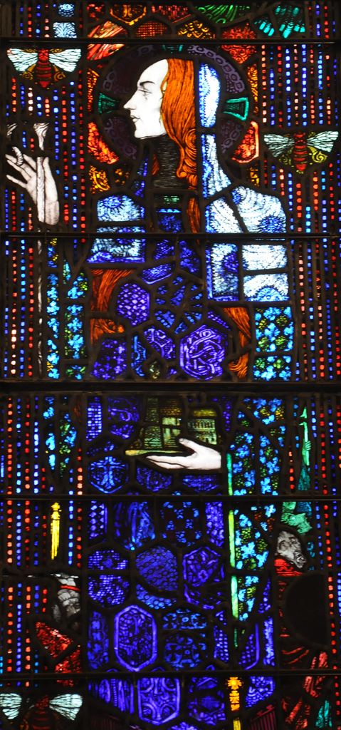
As I wandered around the chapel I looked up at one of the many windows which depicted various Irish saints and there was Gobnait. Her window is one of the most beautiful depictions of a saint I had ever seen. The window shows  Gobnait of Baile Bhúirne/Ballyvourney adorned in blue robes and surrounded by bees, at her feet  are two men with   fearful expressions.  My curiosity immediately demanded that I find out who this saint was, where she came from and most importantly what was the connection with the bees?

http://www.flickr.com/photos/feargal/6388195535/

Stain glass image of St Gobnait in the  Honan Chapel . Taken by Fergal of Clabbagh (http://www.flickr.com/photos/feargal/6388195535/)

Who was Gobnait and where did she come from?

Much of what we know about Gobnait comes from folklore. Unlike many other Irish saints, Gobnait’s  life story was not written down during the medieval period. Tradition  and  links with  St Abban (also associated with Ballyvourney) suggests  she lived during the 6th century.  Today the main centres of devotion to Gobnait are  on  Inis Oírr/Inisheer ( one of  the Aran Islands), Dún Chaoin in West Kerry, Kilshanning, Co. Cork  and Baile Bhúirne/Ballyvourney near the Cork/Kerry border, where the local people venerate the saint on her feast day,  the 11th of February. Evidence of the saint’s cult  is also found in the dedications of churches and holy wells in the counties of Cork, Kerry, Limerick and Waterford.

There are two  folk versions of the  saints life. One  tells us that Gobnait was born in  Co Clare and due to a family feud fled of to the island of Inisheer where she founded a church. One day an angel appeared to her  and told her to head inland and  to find the  place of her resurrection. She was told she  would know this spot as it would be marked by  the presence of 9 white deer. She travel south in search of  this place and her  many stops  are marked by  churches and  holy wells dedicated to her, such as the medieval church at Kilgobnet,  Co Waterford.

At various stages of her journey Gobnait met  with white deer of varying numbers but it was only when she reached Ballyvourney that  she found the nine deer grazing  and it was here she  ended of her journey. In a Kerry version of her life, Gobnait  was said to be the daughter of a pirate who came ashore at Fionntraigh (Ventry, Co. Kerry).  Once ashore an angel appeared to her and  told her to go forth and search for the site  of her resurrection  and to travel on until she saw nine white deer grazing, which she did in Ballyvourney.

I will post more in the coming months about  Gobnait’s journey around Ireland and the other sites associated with her.  This post  will focus on the  evidence of  pilgrimage at Ballyvourney.

Metal working and bees

Gobnait was likely the patron saint of iron workers. The hypocoristic (pet name) form of her name Gobba come from Gabha which means smith.  Excavations  St Gobnait’s House/Kitchen at her shrine in Ballyvourney  in  the 1950’s,  prior to the erection of the modern statue of St Gobnait, revealed evidence  of iron working (smithing and smelting).

Gobnait was also the patron saint of bee keepers and kept her own bees.  There are a number of  legend  in which she unleashes her bees to attack enemies. In one  story soldiers came to Ballyvourney and stole livestock, as they left the village the saint  let loose her honey-bees upon them.  Another version of this tale has a band of robbers stealing her cattle and she sends her bees  after them and they promptly return the  cattle. It is this legend that inspired the Harry Clarke window. Many modern depictions of the saint  associate her with bees such as the  statue at her shrine in Ballyvourney by  Séamus Murphy.
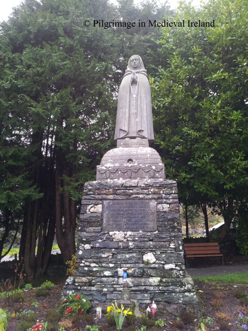
20130211_152850

St Gobnait in the rain. Statue of St Gobnait created by Seamus Murphy in the 1950s.

Medieval Pilgrimage at Ballyvourney

Gobnait is not the only saint associated with Ballyvourney. St Abban had established a monastery here prior to her arrival. Abban gave her land and  helped she established a nunnery here. The traditional  site of Gobnait’s nunnery is the old graveyard and medieval parish church known as Teampall Ghobhatan ( the church of Gobnait).   I will come back to St Abban and his links to Ballyvourney in another post.

There is  little evidence  to suggest when pilgrims first began to come here. Unfortunately the archaeological and historical sources tell us nothing about pilgrimage prior to the 17th century.  Given the popularity of the saints cult  in the 17th century it is likely pilgrimage  likely  began many centuries prior to this date.

The silence of the historical and archaeological record concerning pilgrimage at Ballyvourney, should not be seen as  evidence that pilgrimage was not taking place in the early or later medieval period. Pilgrimage is seldom mentioned in the historical records and the act of pilgrimages  in most cases leaves little physical trace behind.

The earliest written reference to pilgrimage at Ballyvourney dates to the early 1600’s.   In 1601 Pope Clement VIII granted a special indulgence  of 10 years to those who, on Gobnait’s  feast day, visited the parish church, went to Confession and Communion and who prayed for peace among  ‘Christian princes’ , expulsion of heresy and the exaltation of the church’.  It is clear from this and other 17th century references,  such as the  poetry  of Dáibhidh Ó Bruidar, the writings of Don Philip Ó Súilleabháin and Seathrún Céitinn, that Gobnait’s  cult  was strong and popular during this period.

In 1603 Donal Cam Ó Súilleabháin during  his flight from Béara  stopped at Ballyvourney with his men to pray at Gobnait’s shrine, to offer gifts and to ask for her protection. The importance of Gobnait’s cult  is also attested by the  visited of  the Papal Nunico Rinuccini   in 1645 (Ó hÉaluighthe 1958, 47).

Devotion to Gobnait is again mentioned in the writings of Sir Richard Cox  in 1687,  who stated

Ballyvorney, a small village, considerable only for some holy relick (I think of Gobbonett) which does many cures and other miracles, and therefore there is great resort of pilgrims thither.

The relic  described by Cox is  a small  13th century medieval statue of St Gobnait, now in the care of the parish priest of Ballyvourney.
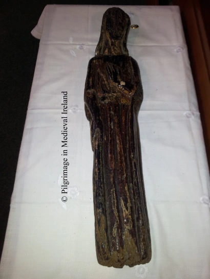
20130211_132934

Medieval statue of St Gobnait

Gobnait’s statue was again mentioned in 1731 when it is noted that

this Parish is remarkable for the superstition paid to Guibnet ‘s image  on Gubinet’s Day.

The literary sources suggest that  the hereditary keepers of the shrine and relics of Gobnait (the statue) were the  O’ Hierlihys family. Many of the relics of Irish saints  survived the reformation as they were kept  by individual families and passed down from generation to generation. These families were descendants of the family of stewards, or airchinnaigh, who controlled monastic lands and were often remunerated with a specific plot of land and fees when the relic was used. During the 18th & 19th century many of these families  fell on hard times and sold the relics some have been lost but thankfully many are now in the National Museum of Ireland. The statue of Gobnait continued to be cared for by the O’Herlihy family until 1843 when the statue was given into the care of the parish priest and it remains  in the care  to  church of Ballyvourney to this day.

John Richardson, a protestant gentleman with a low opinion of pilgrimage, gives an account of the 18th century pilgrimage at Ballyvourney in his book The Great Folly of Pilgrimage.  His account suggests that  devotion was focused on the aforementioned statue of St Gobnait  and makes no mention to any of the stations visited by modern pilgrims.

An Image of Wood, about two Foot high, carves and painted like a Women, is  kept in the Parish of Ballyvourney, in the Diocese of Cloyne, and the County of Cork; it is called Gubinet. The pilgrims resort to it twice a year, viz on Valintine’s Eve and on Whitsun Thursday…. it is set up for adoration on the old ruinous walls of the church. They go around the image trice on their knees saying a certain number of Paters, Aves and Credos. Then following prayer in Irish ‘A Gubinet, tabhair slan aon Mbliathan shin, agus sábháil shin o gach geine agus sórd Egruas, go speicialta on Bholgach’ and they conclude with kissing the idol and making an offer to it every one according to his ability, which generally amounts in the whole to 5 or 6 pounds.  The image is kept by one of the family of the O’ Herlihy’s and when anyone is sick of the small-pox, they send for it and scarifice a sheep to it, and wrap the skin about the sick person, and the family eat the sheep. But the Idol hath now much lost its Reputation, because two of the O Herlihys died lately of the Small pox. The Lord Bishop of Cloyne was pleased to favour me with the narrative of his rank idolatory, to suppress which he hath taken very proper and effectual methods (Richardson 1723, 70).

He goes on to say

Pilgrims kissed the statue, rubbed aching limbs to it, tied handkerchiefs about its neck, to be worn afterwards as a preventative against sickness (Richardson 1723, 71).

Richardson’s writings are very anti Catholic and written at a time when pilgrim was viewed as superstitious and backward by the established church, despite his negative tone his writing provides one of  the most detailed of the early accounts of pilgrimage at Ballyvourney.   During the  18th and 19th century pilgrimage was not just under pressure from the established church, many Irish pilgrimages were suppressed by the Catholic clergy  but thankfully the efforts of the then Bishop of Cloyne  to eradicate the pilgrimage at  Ballyvourney were in vain.

The modern pilgrimage at Ballyvourney on the saint’s feast day

I have been to Ballyvourney  on a number of occasions,  but this year was the first time I attended a pilgrimage. I arrived in the village around 10.30 am.   I was  told by some people i meet that was mass in honour of Gobnait, would be said at   11.30am  &  16.00pm  and that a rosary would be said at the shrine at 15.00 pm.  I was also informed  that people  visit the statue of Gobnait and  the shrine &  holy well to do their ’rounds’ (pilgrim prayer) throughout the day .

I headed first to the church to see the medieval statue of St Gobnait. The statue is a treasure possession of the parish of Ballyvourney and it is fascinating to think that it has survived here in this parish since the 13th or 14th century. Made of oak, it is approximately 27 inches/ 68 cm tall. The back is hollowed out from the shoulder to the feet. The face is now very worn and traces of  paint can be seen  on the front of the statue.  The folds of the saint’s dress and a belt are still visible. The feature of her face are now undiscernible but the details of her hands  (one hand is raised  to her chest and the other by her side) are clearly visible.
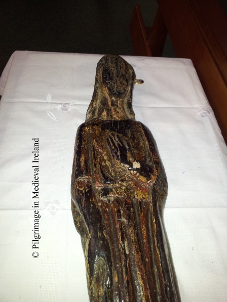
St Gobnait's Statue showing detail of hands

St Gobnait’s Statue, photo  showing detail of hands & robe

On the saint’s feast day the statue is displayed within the church. On the occasion of my visit it  was placed on a small table in the church in front of the altar.  A table with a large jar of colourful ribbons, key rings and booklets about Gobnait (all for sale) was located a few meters away  from the medieval statue in front  of a modern plaster statue of the saint.  People queued up and purchased fistful of ribbons and formed orderly lines to approach the medieval statue. The pilgrims armed with their ribbons (which they had brought with them or just  purchased) , were  no ready to  perform the ritual called St Gobnait’s measure. This is a practice  were pilgrims use the ribbons  to ‘measure’ the statue.
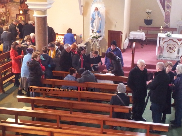
20130211_120807

Pilgrim’s taking ‘St Gobnait’s measure’ after mass in Ballyvourney church.

The ribbon(s) is held along the length of the statue and then wrapped around the neck, then the  waist and finally the feet of the statue. Some pilgrims make the sign of the cross when this is done, others pick up the statue and kiss it, while  others bless themselves with the statue.  The ribbon or in most cases ribbons are  then brought home and  used to ward off and to cure sickness.  Farmers often  placed  the ribbons in outhouses where there is livestock. As I sat in the church waiting for mass there was a constant line of people waiting to get to the statue. The scene reminded me of Richardson’s description  of pilgrims in 1723,  which tells of pilgrims tieing  handkerchief to the statue and then wearing them about the neck  as a preventative against illness.  It was fascinating to see that  modern pilgrims  are interact with  the statue in much the same manner as their ancestors almost 300 years before.  The church soon filled to capacity and a  mass was said in Irish.  There was a mix of people from within and outside the parish in attendance. Many  people had travelled some distance to get  here  and I heard one man say he came  that morning with his son from Killorglin in Co Kerry.

After  mass a new group of  people lined up  to visit the statue with their ribbons. I was told people would come throughout the day to visit the statue but the main burst of activity focused around mass times. When I passed by the church later at 16.15 the car park was again chock-a-block with cars.

Pilgrim stations at St Gobnait’s shrine.

A short distance from the village is St Gobnait’s shrine,  the other focus of devotion for pilgrims to Ballyvourney. As I mentioned above St Gobnait’s shrine is the traditionally held to be the site of St Gobnait’s nunnery and the burial-place of the saint. Throughout the year it  attracts pilgrims on a daily basis. The main peaks in pilgrimage are Whitsun, the feast of St Gobnait, on the 11th of February and an open air mass in July.

StGobnait'sair004

Aerial shot of St Gobnait’s shrine (taken from http://www.leevalleywalking.com/about.htm)

The landscape of the shrine is divided  in two  with  St Gobnait’s house, holy well and statue  separated from  the other stations by a  modern road.  During the course of my visit  I meet another  blogger  Richard Scriven  (Geography UCC)  who is currently doing PhD research  on the modern pilgrimage at Ballyvourney. For more details of Richard’s research check out his blog http://liminalentwinings.com/.

The day was  very cold with light to heavy showers but during the time I was here there was a constant  stream of pilgrims. Most  pilgrims  were  in  small groups of two or three and many were alone.  A small crowd gathered  at  15.00, for the rosary ,  in the area beside St Gobnait’s house.  Many of the people here who attended  the rosary  left afterwards perhaps to catch the 16.00 mass, while a small group remained to do the stations.
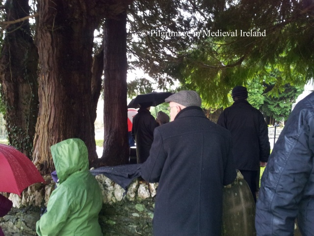
Pilgrim's at the Rosary  at Ballyvourney

Pilgrim’s  hiding from the rain during the recitation  of the rosary at Ballyvourney

Modern  information boards  are found  beside all the  pilgrim stations and detail the required prayers for each stations.
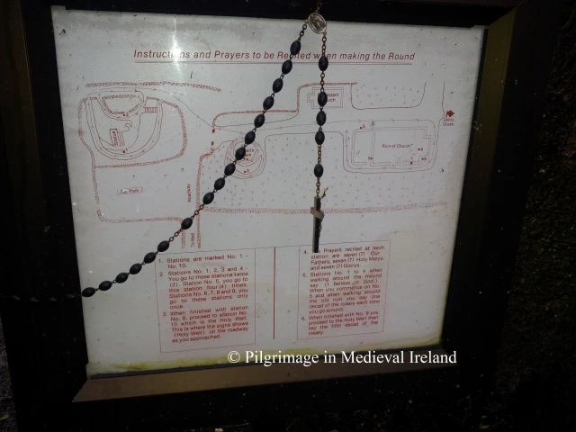
20130211_145224

One of the modern notice boards located at the shrine.

The  following details of the rounds is taken from the book  Saint Gobnait of Ballyvourney by  Bernie Donoghue Murphy written in c. 2007.

Pilgrimage begins in front of the  statue of Gobnait.  The  pilgrim recites  7 Our Fathers, 7 Hail Mary’s and 7 Gloria,  then walks clockwise ‘ ar deiseal’  around the outer path (around the periphery of the site) reciting the Apostles Creed. The practice of  pilgrims walking in a clockwise circuit can be traced back to early medieval times and  continued in post medieval and modern times.
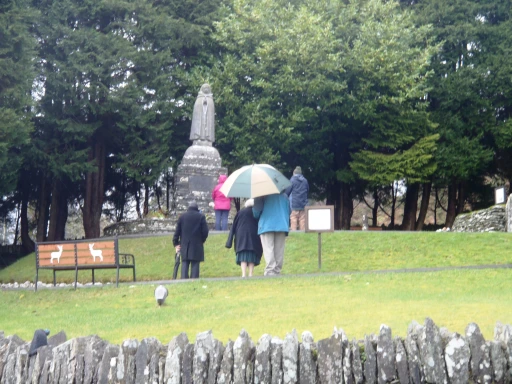
???????????????????????????????

Pilgrims beginning their round  before the modern statue of St Gobnait.

At St Gobnait’s House (station 2)  the pilgrim recites 7 Our Fathers, 7 Hail Mary’s and 7 Gloria.  The pilgrim  walks clockwise around the  station reciting the apostles creed. I also saw people go inside the hut and walk clockwise around the interior and finish by marking a modern pillar with a cross.
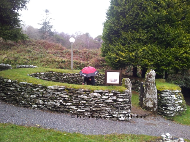
20130211_152925

Pilgrim within St Gobnait’s house marking the centre pillar with a cross.

This station  was in ruins  1950s. It was restored   following an  excavation of the site by M. J. O’Kelly  and rebuilt  to its current state. The results of this excavation suggests the structure was used for craft working in the early medieval period. Large amounts of slag (the waste product of  iron smelting),  a crucible  and other artifacts connected with iron working were recovered. Two  bullaun stones (stones with man-made depressions), artifacts which many scholars believe were used to grind metal ores are found close by at the site of Gobnait’s grave.
20130215_135753

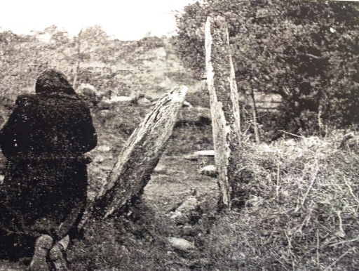
Pilgrim praying at St Gobnait’s house (Ó hÉaluighthe 1958, Pl. 2)

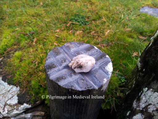
Modern pilgrims  have marked  stones around the  shrine  with crosses as part of their prayers.  The two entrance stones to St Gobnait’s house are marked by crosses,  as are the  modern  cylinder shaped pillars within the  hut and various stone in St Gobnaits church. This practice is seen at other pilgrim sites such as St Declan’s well at Ardmore. Such activity dates to  post medieval and modern times. Small pebbles are left on top of these stone for  pilgrims to  incise the sign of the cross.
20130211_153121

Crosses marked on the top of the modern pillar.

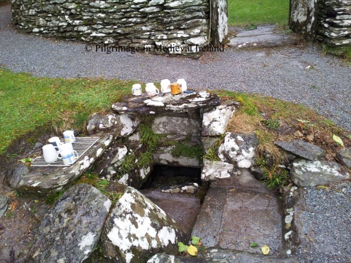
Having finished the prayers at station 2 ,  the pilgrim goes to the near by holy well , one of two wells associated with Gobnait at the shrine. The pilgrim then kneels down and  drinks some water from the holy well.
20130211_135140

Holy well beside St Gobnait’s house.

The remaining stations are  found  within the old graveyard. The pilgrim then crosses the road and enters the old graveyard.
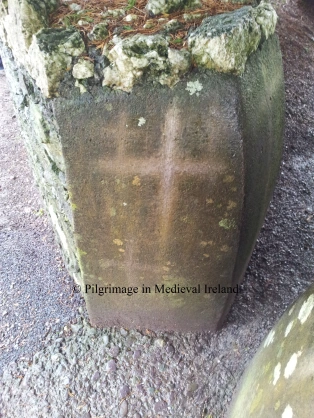
20130211_153157

Crosses etched on the modern styles

Station 3 & 4 are located beside each other, close to the main entrance to the graveyard.  At station 3  the pilgrim  recites 7 Our Fathers, 7 Hail Mary’s and 7 Gloria. The pilgrim  walks  twice clockwise around the this station ( station 4 is at the centre of this path) reciting the apostles creed.
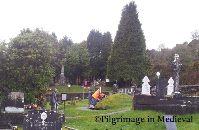
20130211_142618

Pilgrims praying at Station 3 & 4.

Station 4  is a sod-covered mound of loosely packed stones (4m N-S; 5.6m E-W; H 1.3m) known as  St Gobnait’s grave. The pilgrim recites 7 Our Fathers, 7 Hail Mary’s and 7 Gloria.  The pilgrim then walks  twice clockwise around  this station reciting the apostles creed.
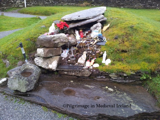
20130211_154604

Station 4 St Gobnait’s grave.

On top of the mound is a large flat slab which pilgrims  have  incised with a  cross. A small pebble is left beside the cross. This station is very colourful and eye catching. Pilgrims have  left  behind votive offerings such as  holy statues, medals,  rosary beads & crucifixes.
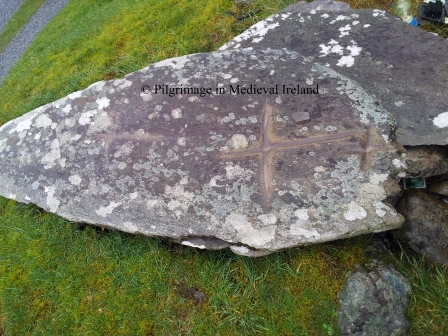
20130211_153327

Cross incised by pilgrims on slab on top of St Gobnait’s grave.

From here the pilgrim walks past the 19th century Church of Ireland to Station 5, located at the corner of the  old church. The pilgrim  recites 7 Our Fathers, 7 Hail Mary’s and 7 Gloria.  The pilgrim  then walks  around St Gobnait’s church 4 times, reciting at each  circuit,  one decade of the Rosary.
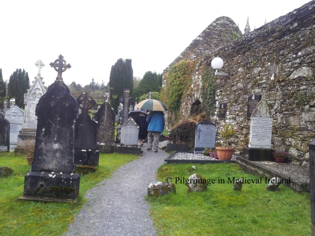
20130211_141859

Pilgrim’s doing rounds of the church.

The pilgrim then enters the interior of the church. Station 6  is located  at the east gable of the church.  The pilgrim recites 7 Our Fathers, 7 Hail Mary’s and 7 Gloria .
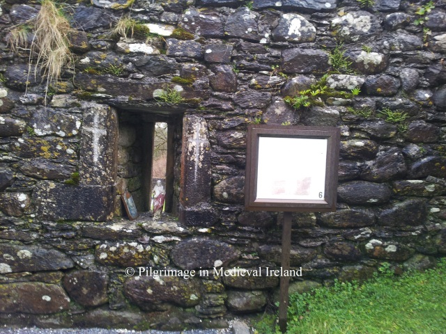
20130211_141501

Station 6 in the interior of the church.

Modern pilgrims have left there mark within the church. There are statues placed in putlog holes ( small square holes used to hold wooden beams,  used in the initial  building of the church) some of the stone in the fabric of the church and   two 19th century grave stones have  had  crosses incised on them.

The pilgrim then moves on to station 7, located at the window at  east end of the south wall of the church. A  rectangular recess (cupboard) has been filled over the years by pilgrims  with statues and beads and other religious memorabilia.  The pilgrim recites 7 Our Fathers, 7 Hail Mary’s and 7 Gloria.
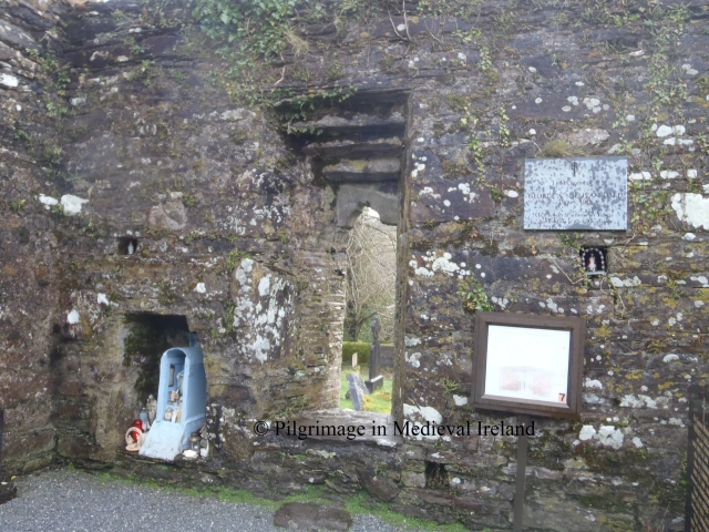
OLYMPUS DIGITAL CAMERA

Station 7

On completion of prayers  the pilgrim reaches out through the window and makes the sign of the cross above the top lintel on a piece of  medieval sculpture known as  Sheela-na -gig. Sheela  are  figurative carvings  of naked women, usually bald and emaciated, with lug ears,  squatting and pulling apart their vulva.  These carvings are found many medieval churches, sometimes castle sites in  Ireland and England. There is much uncertainty as to their original function some think, they were used to ward off evil, warn against lust or even fertility figure.
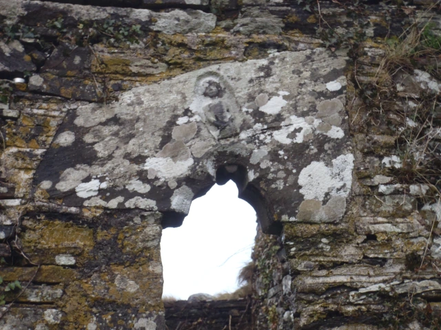
OLYMPUS DIGITAL CAMERA

Window with Sheela-na-gig

The pilgrim then moves outside of the church to station 8, which is known as the  priest’s grave.  The grave marks the burial of Fr Daniel O’Herlihy  was buried here in 1637. The pilgrim then  recites 7 Our Fathers, 7 Hail Mary’s and 7 Gloria  at this station.
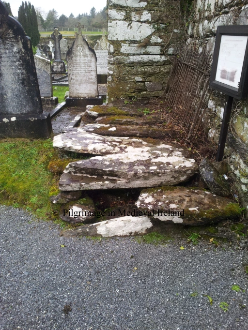
20130211_140812

Station 8, the priest’s grave

Station 9 is at the southwest corner of  the west gable of the church. The focus of devotion  is a polished  agate stone ball, call the bulla. The ball is located in a rectangular recess and  is renowned for its healing power. The  pilgrim  recites  7 Our Fathers, 7 Hail Mary’s and 7 Gloria. Some pilgrims had left a religious medals  and a  piece  of paper probably with a petition to the saint beside the ball.
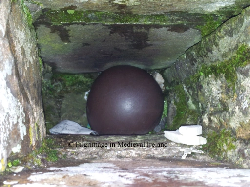
20130211_143031

Station 9  the polished agate ball surrounded by votive offerings.

There is a folktale associated the with the stone.  Legend has it an invader decided to build a castle in the area. Gobnait could see the castle walls from her church.  Throwing the bulla  at the castle  she razed the castle walls to the ground.  The stone then miraculously returned to the saints hand. Each time the walls of the castle were rebuilt the saint would knock them down again with the bulla. Finally the invaders gave up and move away.

To complete the pilgrimage the pilgrim walks down the road to St Gobnait’s well (Station 10). The pilgrim recites 7 Our Fathers, 7 Hail Mary’s and 7 Gloria,  one decade of the rosary and drinks the water from the well.
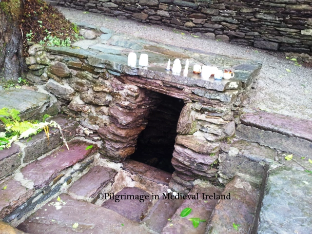
20130211_145404

St Gobnait’s well

Like many holy wells in Ireland  St Gobnait’s well is associate with a  rag tree and there is a tradition of leaving votive offerings at this tree. Below is a photo of the tree taken when I last visited here in 2006,  as you can see is covered rags and bead  and tokens left be pilgrims. I think it  looks quiet lovely.   Since my last visit   most of these offering have been removed but a few are still to be found.
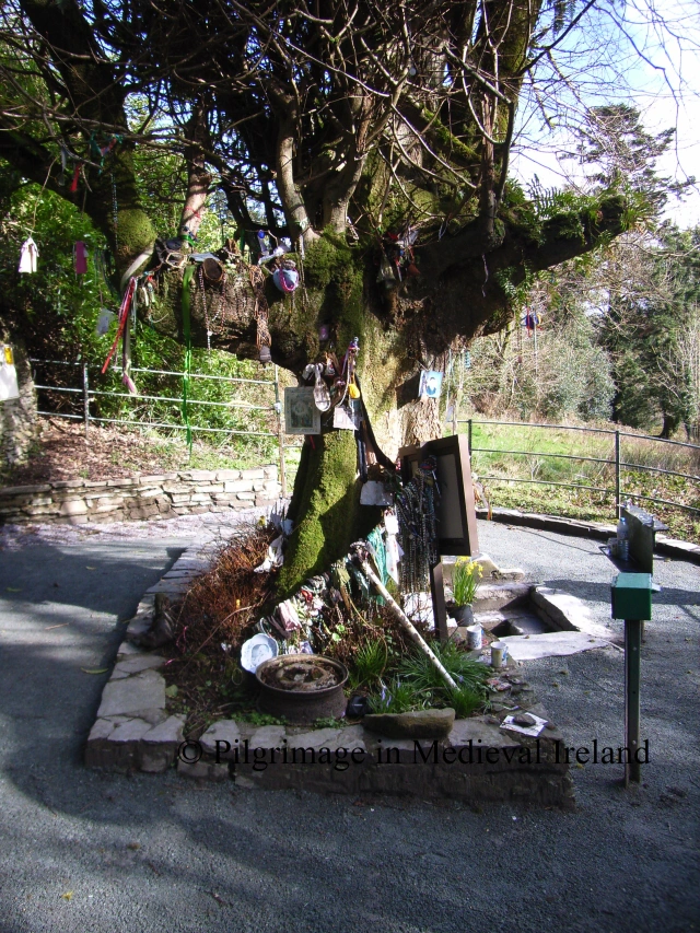
RIMG1830

Tree beside St Gobnait’s well taken in 2006.

I came across another book  called Saint Gobnait  of Ballyvourney by  Eilís Uí Dháiligh written in 1983. This book notes that many pilgrims begin there stations with the traditional prayer

Go mbeannaí Dia Dhuit, a Ghobnait Naofa,

Go mbeannaí Muire faoi mar a bheannaím féin dhuit.

Is chughatsa a thána ag gearán mo scéal leat,

Go dtabharfá leigheas i gcuntais Dé dom.

May God and Mary bless you,

O Holy Gobnait, I bless you too,

and come to you with my complaint.

Please cure me for God’s sake.

She also notes the traditional finishing prayer is

A Ghobnait an dúchais

do bhiodh i mBaile Mhuirne

Go dtaga tú chugamsa

le d’chabhair is le d’ chúnamh

(O St Gobnait of Ballyvourney, come to my aid).

Uí Dháiligh  gives instructions for  the pilgrimage as follows (taken directly from her book pages 25-26).

There are five  Stations or Ulacha and each has a particular significance.

I The First Station or Ula Uachtarach is the site of Gobnait’s House. (Stop 1 & 2).

II The Second Station or Ula láir is her grave (stop 3 & 4).

III The Third Station brings us to her Church (stops 5 & 6).

At each of the three stations the pilgrim walks ar deiseal, that is clockwise, and prays. The  customary practice is to say seven Paters; seven Aves; and either seven Glorias or the Apostles’ Creed at the outer ring of each Station which is traversed twice. The same is repeated around the inner circles twenty-eight Paters; twenty-eight Aves; and either twenty-eight Glorias or four Creeds in all.
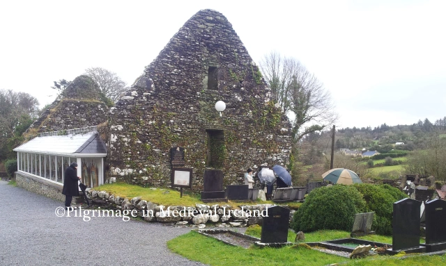
20130211_142533

Pilgrim praying at Station 5 and a group of pilgrims praying at Station 9 the bulla stone

IV The Fourth Station (Stops 7 & 8) is inside the church where one pater; one Ave; and either one Gloria or one Creed is said. The pilgrim pauses at the south window in honour of the effigy over the window head through by some to be an old image of Gobnait herself.

V The Fifth Station consists of a visit to the Priest’s Grave which lies outside the right corner of the East Gable, where one pater; one Ave, and one Creed are said (stop 9); a visit to the bulla in the south corner of the west gable (Stop 10) and the journey to the well (Stop 11). The pilgrim goes down the main road a little distance and enters the grove where he will find the old Well. Here he says one Pater, one Ave, and one final creed. He drinks the water and says a final prayer.
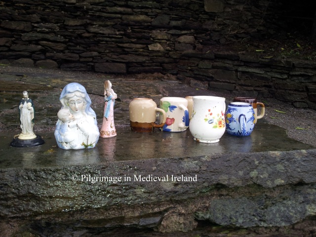
20130211_145311

Cups and statues left on top of St Gobnait’s well.

Conclusion

Despite the lack of  evidence for pilgirmage in the medieval period, I have no doubt that pilgrims were coming to Ballyvourney from an early date. Gobnait’s reputation as a healer and miracle worker  would have attracted pilgrims from the immediate locality and further afield. We can never know how medieval pilgrims interacted with the shrine, but the  pilgrim rituals would not have been  static and  would have  constantly evolved as evident from the slight variation of the accounts of the modern stations described above.  The  medieval pilgrims to Ballyvourney like those in the 17th , 18th century  would have  come here for much the same reasons as modern pilgrims, to ask for help from the saint and in search of  healing.  Above all it is  the devotion to Gobnait  through the  little wooden  statue  that links the people of Ballyvourney with their medieval forefathers.

© Louise Nugent 2013

References

Chaomhánach, E. ”The Bee, its Keeper and Produce, in Irish and other Folk Traditions’. Department of Irish Folklore.http://www.ucd.ie/pages/99/articles/chaomh.pdf accessed 8/07/2012.

Power, D. 1997. Archaeological Inventory of County Cork: Mid Cork v. 3. Dublin: Stationary Office.

Henry, F. (1952) The decorated stones at Ballyvourney, Co. Cork. Journal of the Cork Historical and Archaeological Society, 57, 41-42.

MacLeod, C.  1946.  ‘Mediaeval figure sculpture in Ireland’ JRSAI Vol. LXXVI, Part II.

Harris, D. 1938. ‘Saint Gobnet, Abbess of Ballyvourney’, JRSAI Vol. LXVIII, 272-277.

Ó’ h-Éaluighthe, M. A. 1958. ‘St. Gobnet of Ballyvourney’, JCHAS Vol. LVII,  43-62.
O’Kelly, M. J. (1952) St Gobnet’s House, Ballyvourney, Co. Cork. Journal of the Cork Historical and Archaeological Society, 57, 18-40.

Richardson, J. 1727. The great folly, superstition, and idolatry, of pilgrimages in Ireland; especially of that to St. Patrick’s purgatory. Together with an account of the loss that the publick sustaineth thereby; truly and impartially represented. Dublin: Printed J. Hyde

http://www.dioceseofkerry.ie/page/heritage/saints/st_gobnait/ (accessed 21/01/2013).

http://www.seandalaiocht.com/1/post/2010/11/st-gobnets-house-ballyvourney-co-cork.html (accessed 18/02/2012).

The modern pilgrimages at Faughart on the feast day of St Brigit

Last week I managed to make it to Faughart, one of Irelands most interesting of pilgrim sites. My visit coincided with  the feast of St Brigit the patron of the area. Faughart  claims to be the birth place of St Brigit and the landscape of the area has a strong cult association with the saint.

dundalk

Map showing Faughart in relation to Dundalk (after google maps)

This has been one of the most difficult posts I have written. It was difficult as  there is so much to say regarding the cult of Brigit,  the history and the archaeology of the pilgrimage at Faughart. After a lot of thought,  I decided to focus on my experience at this years St Brigit’s day pilgrimage and at a later date to write another post on  the origins and history of pilgrimage at Faughart and the cult of Brigit.

Location

Before I begin to describe my pilgrimage  just some words on the location of the site. Faughart is situated about 1-1.5 miles outside of Dundalk. The modern pilgrimage landscape stretches between the old graveyard  at Faughart hill with its medieval church and holy well dedicated to St Brigit  and St Brigit’s shrine a series of station,  holy stones and modern oratory  located along the  banks of the a small stream know as St Brigit’s stream.

new map

Map showing the old graveyard and St Brigits shrine at Faughart

The distance between the two sites is about half a mile.

Faughart is a very popular pilgrim shrine and  pilgrims come here each day throughout the year.  It  is renowned as a place of  healing. The main days of  group/mass devotion  are the 1st of February, the feast day of Brigit and the 1st  sunday in July,  a  day of the national pilgrimage.

My visit coincided with  on the 1st of February. I return also on the 3rd of February when I joined a group of pilgrims walking from Dundalk to Faugart. This second pilgrimage was part of the annual ‘Brigid of Faughart Festival’, a four-day  annual event with lectures, workshops and pilgrimages that  focuses on Brigit . The festival  is a celebration of Brigit, both Goddess and Saint.   For more information  about the event see the link http://www.doloreswhelan.ie/events/brigid-faughart-festival/ .  St Brigit is very important to the people of Louth and  because of her pre-christian origins she bridges the gap between the christian and pagan world. She is a very interesting saint  and I will discuss her cult further at a later date.

St Brigit’s Day at Faughart/pilgrimage part I

Faughart is the other end of the country from where I live, so I travelled up to  Dublin on St Brigit’s eve and headed to Faughart the morning of the 1st of February. I had been to Faughart once before in 2006  but my memory of how to get there was a little rusty.  I decided to stopped first at Dundalk and get directions at the tourist information office .  A big thank you to Sinead who works there for all her help.  I also dropped in to the County Museum where the staff were equally helpful.

I eventually arrived about mid day to St Brigit’s shrine which is the main attraction for modern pilgrims. This site consists of a series of holy stone located on the banks of St Brigit’s stream. The shrine fills  a long rectangular field divide in two by a road. The stream known as St Brigit’s stream runs through its centre.

shrine

Map showing the landscape of the shrine of St Brigit. The shrine is located within the tree covered area and the field showing the stream channel (after google maps).

The  car park was full to capacity  so I packed along the side of the road with the other cars . There was a constant stream of people coming and going . The area of the shrine is quiet large so its easy to underestimate the numbers.  One of the first things I noticed  was   people selling St Brigit’s crosses, candles and  holy mementoes and like any good pilgrim I left with about four St Brigit’s crosses which I have since  distributed among friends and family .

20130201_125554

A vendor selling religious memorabilia and St Brigit’s crosses

Dotted about the shrine  are set instructions for the traditional  stations at the shrine  and   many pilgrims still adhere to them  but others  seem to follow their own  route around the shrine.  As I arrived the day was dry and sunny but it soon turned into  a ‘fine soft day’ Irish code for  a constant light rain.

Instuctions for the traditional stations

Instructions for the traditional stations at the lower end of the shrine

Pilgrimage  begins at the upper shrine.  This is  a lovely place  with lots of  mature trees and a  stream running  through the centre. During the main day of pilgrimage relics of St Brigit (owned by Kilcurry parish) are kept in a simple oratory dedicated to the saint  and many begin their pilgrimage here entering through the main gates and  climb the steps to the oratory past the statues of SS Patrick, Colmcille, Malachy and Oliver Plunkett.

???????????????????????????????

A pilgrim climbing  the steps to St Brigit’s oratory

Pilgrims then pause in front of the oratory to  pray.   For St Brigit’s day a priest in charge of the relic,  is in the oratory during set times  and the  pilgrims can go to  be  blessed by the relic of St Brigit if they wish. The  relic is a  tiny piece of bone (skull)  kept   in a small box with glass lid. The story of the relic  is an interesting one and I will come back to it in another post.

20130201_143632

Pilgrims praying at oratory

The reliquary ( which  holds relic) is place on forehead  of the pilgrim and prayers recited by the priest who asks  St Brigit  to pray for and bless the pilgrims.

The traditional stations begin at the fountain  a stone structure    that reminded me of the corbelled well  (St Brigit’s well) at the nearby old graveyard.  Water from the stream that flows through the site is pipe into the structure  and flows into a large  stone with a hollow  which like many of the other hollowed stones at the site may be  possible bullaun stones.

20130201_143129

Pilgrims praying at station 1

This structure has been renovated since my last visit and  two concrete paths  placed across the once open stream  just opposite it.  At station  1 the pilgrim is to recite one Our Father, one Hail Mary and one Gloria.  I saw many  queue  up here to take the water  home in plastic bottles and to simply bless themselves.

RIMG1587

Station 1 taken in 2006 not the open stream bed in the background which leads to station 2.

Station 2  is located beside station 1 and the pilgrim  must walk a few steps and cross to the  far side of steam. The stream   is railed on either side and the pilgrim must recites one Our Father, one Hail Mary and one Gloria .

RIMG1586

Photo of station 2 & 3 & 4 taken in 2006

Station 3  is a stone located at the center  of the stream bed, the pilgrim recites one Our Father, one Hail Mary and one Gloria here .

RIMG1585

Station no 3 taken in 2006

The photo above shows station 3 in 2006.  Since this date the stone has been incorporated into the concreted  path (mentioned above) to link the two banks.  I wonder was this done for insurance reasons to make the crossing safer for those who are unsteady on their feet ?  Unfortunately it is not as aesthetically pleasing as before, but I suppose it is safer.  The rest of the site seems unchanged.

Once station 3 is complete the pilgrim crosses over  to the other side of the  stream and begins Station 4 . This station is  at the modern looking celtic cross. Here the pilgrim is to perform 10  circuits  reciting one Our Father, one Hail Mary and one Gloria at each circuit . Most of the people I observed just prayed in front of the cross, although I did see some people do the circuits.

The pilgrim continues south along the east bank of the stream, they pray at the  stations of the cross which are dotted along the bank. Some also stop and pray at   a grotto dedicated to the Our Lady.

Pilgrims praying at the stations of the cross

Pilgrims praying at the stations of the cross

This route takes the pilgrims  across the road   into the lower shrine which is much more open and landscaped. One lady I meet told me in the past there was a lot more bushes and trees here which she felt gave more privacy for pilgrims praying.

As one enters the lower part of the shrine  on the left is a small chapel.  According to the noticeboard on the 1st of February mass was said here at 10.30, 12.00 and 13.00.

The stream  continues down slope.  I also notices a modern well type structure built over the stream. Pilgrims  made their way down slope  stopping  to pray at the stations of the cross and some at the well structure  and some people also collected water from here in plastic bottles.

pilgrims saying stations of the cross

Pilgrims at the lower shrine

Pilgrims begin station 5  at the point  just where the stream turns and heads east  along the field boundary wall  of the shrine.  Again the   pilgrim recites one Our Father, one Hail Mary and one Gloria .

OLYMPUS DIGITAL CAMERA

View of pilgrims at stations 5-10.

Close by is station 6,  which is  known as the  hoof stone.  Again pilgrims recites one Our Father, one Hail Mary and one Gloria.

Hoof stone

Station 6 the hoof stone

Stations 6-10 are all invested with origin legends connected with St Brigit.  If I remember correctly, folk tradition states that St Brigit was living with her sister at Faughart but a young prince wanted to marry her and wouldn’t take no for an answer. One night she decided to run away to escape him  and  as she was making her way out of Faughart following the stream the prince  who had heard about her leaving came  in pursuit.  Brigit knelt down to pray beside the stream leaving her knee prints in the stone. She then plucked out one of her eyes to make herself less attractive and unrecognisable.   The prince caught up with her but didn’t recognise her and the hoof mark of his horse was left behind in the  stone known as the hoof stone.

Station 7  is  the knee stone, which marks the spot where the saint knelt to pray. It is a large rock with two hollow. The pilgrim kneels in the hollows of the  stone  and  then on top of the stone while reciting one Our Father, one Hail Mary and one Gloria .

knee stone

Station 7, the knee stone

Others  simply  recite their prayers standing beside the stone.

Pilgrim kneeling in the knee stone

Pilgrim praying in the knee stone on the 3rd February

The pilgrim continues  along the modern path to station 8  which is known as the waist stone . I noticed that some pilgrims sat on the stone but most stood by it . The pilgrim is required to recite one Our Father, one Hail Mary and one Gloria .

waiste stone

Station 8 the waist stone

Station 9  is called the eye stone ( this supposed to be  the eye the saint plucked from her head, a similar stone was said to have existed in Dunleer). The traditional prayers require  here are ten circuits of the stone while reciting one Our Father, one Hail Mary and one Gloria at each circuit.

Eye Stone and modern Grotto

Eye Stone and modern grotto

I saw some pilgrims sit/lie on the stone  they then blessed themselves with water from a little hollow on top of the stone.

Pilgrim sitting on eye stone

Pilgrim sitting on eye stone 3rd February

Many pilgrims also pray at the  modern grotto beside this stone. The final station (station 10)  the head stone  is a large stone with a hollow whose outline has been pained in white.  The stone is part of the boundary wall and rags and tokens, the same type of thing you get on rag trees, are tied onto the fence  in the boundary bank. The pilgrim places his/her  head in the stone  and recites  one Our Father, one Hail Mary and one Gloria.

20130201_142209

Station 10 the head stone.

This ends the  pilgrimage at St Brigit’s shrine and stream. I noticed that many pilgrims stated  at the headstone and ended their prayers at the eye stone, reminding me that pilgrim rituals are fluid.  I will delve more into the history of the shrine and these stones in my next post on Faughart.

St Brigit’s Holy well on Faughart hill

St Brigit’s well is located in the nearby graveyard,  it is also a focus of pilgrimage in the area, although on a much smaller scale. I  headed up to the old graveyard at Faughart hill around three. There were significantly fewer people here but again there was a constant flow of people coming and going .  Buckets  of water from the well had  been place outside the walls of the graveyard  for those too busy to go to the well.  I saw several people arrive  armed with plastic bottles , some filled them from the buckets and then left .  Others went into the graveyards and followed the path down to the holy well  located below the ruins of a 12th century church.

OLYMPUS DIGITAL CAMERA

Water from St Brigit’s well by the wall at Faughart old graveyard

During the 19th century pilgrimage at  the well was much more popular.  The well  a corbelled structure is entered by walking down steps (added in the 1930’s) .

St brigit's well

St Brigit’s well.

Pilgrims continue to come here and take water away with them and  pray. The  bushes that surround the well are covered with rags and rosary beads showing that pilgrims still come here to ask  Brigit for help.

Local lady carring water from the well

Local lady carrying water from the well

Also at the site  are two  penitential  station  which were visited by 19th century pilgrims, again I will discuss these further in the next post on Faughart. One is a circular mound surrounded by kerbing  is called St Brigit’s pillar. The base of a medieval cross sits on top of the cairn.

20130201_152610

St Brigit’s pillar

The second station is a horse-shoe shaped   mound with two upright stones at the entrance, it is known as  St Brigit’s  bed.

OLYMPUS DIGITAL CAMERA

St Brigit’s Bed

I didn’t see anyone visit these  two stations  during my time here, generally people left after visiting the well and collecting  their water. A local man I meet, told me that no one does prayers at them anymore.

So I headed back for some food and  came back again to Faughart for part II of my pilgrimage  the annual torch-light procession.

Torch Light proscession/pilgrimage part II

The procession  is a night walk  from the old graveyard at Faughart to the shrine of St Brigit. This year it began at  8 o’clock and I roped my friend Nikolah  into coming along. It had been a wet day and but when we arrived at Faughart Hill  the night was cold with a clear sky full of shining stars. The lights from Dundalk and the motorway below were spectacular. The procession is really an event for the local community to connect with Brigit and people of all ages from tiny tots to the elderly were there. Everyone was in good spirits despite the cold and I spotted some very fancy lanterns.  The procession began with the  priest reciting a prayer to St Brigit, then   two men carrying a large processional St Brigit’s cross and flags set off  down the road,  those carrying the reliquary containing the saints relics fell in behind and then everyone else assembled on the hill  fell in behind them  and we headed off on our pilgrimage.

20130201_201025

  Finding our way in the dark wasnt as difficult as I had thought. There was something very relaxing about walking under the stars. You have to be aware of those around you so you didn’t trip or trip someone who was walking at a slower pace. Prayers and songs were sung and the journey  felt like no time at all.  When we  arrived at St Brigit’s shrine there were many people already  there. We all lined up along the banks of the stream at the upper shrine , while the reliquary was brough to the small shrine mentioned earlier. The parish priest  stood at the shrine gave blessing to all present and he also blessed the St Brigit’s crosses , which most people had brought along with them. Prayers were recited in English and Irish. It’s hard to gage how many people were there but there were 100’s  one estimate  I heard was 600 people.  There were also guardaí present to make sure there were no traffic or crowd control problems. The atmosphere was great and I really enjoyed  the experience.

Pilgrims at the end of the Torch light procession

Pilgrims at the end of the torch light procession

Many of those present  proceeded to do the pilgrim stations in the dark before heading home. The procession was one of the nicest pilgrim experiences I have  had. It has been running for the last 37 years . Night pilgrimage and vigils were very important in the medieval world and it is really lovely to see this  tradition being adapted  in the modern world.

Saturday was my day of rest  but Sunday was the last  day of  my pilgrimage.

Sunday Imbolc Festival Pilgrimage walk/Pilgrimage  part III

The final part of my pilgrimage to Faughart took place on Sunday the 3rd.  As I mentioned earlier this pilgrimage walk from Dundalk to Faughart was organised as part of the  St Brigid of Faughart Festival 2013 (link to their site in references). The walk was  followed by a historical tour of Faughart given by local historian Pat O’Rourke.

The walk began at the peace shrine at Linenhall Street in Dundalk.  The group was made up of around 20  women, our local historian Pat O’Rourke and a sheepdog called tara .  I couldn’t have met a more lovely bunch of people. The walk leader Dolores Wheelan, one of the organisers of the Imbolc festival  gave an introduction to the walk and the ethos of the  pilgrimage.  A candle which had been brought from Kildare on St Brigit’s eve  was lit in front of the peace monument  and was then  carried at the front of the group  as we walked along.  Each member of the group  got to carry the torch and lead the group.

20130203_101214

The walk  was about 1-2mile to shrine. This would have been the traditional route chosen by pilgrims from Dundalk to Faughart. The road heads out of Dundalk and  crosses over the motorway by a foot bridge.  Members of the group were free to  engage in the pilgrimage walk as  they wished, some chatted to  each other, others walked in silence , while some chanted a simple  line Oscalite mo Chroí  (Open my heart). We were asked simply to think of Brigit and any prayer that we had  for her while walking along  and to be respectful to other people.

20130203_105929

Once we crossed over the motorway we were walked along quiet county roads.  As we neared the shrine  most people around me  fell silent and were deep in contemplation.

20130203_112012

Pilgrim leading group  while carrying the  light of Brigit

When we reached Faughart  we were treated to hot tea, coffee and soup and  tea  brack.  A very welcome treat for the pilgrims.  After our refreshments Dolores  brought us around the lower shrine  and explained the significance of all of the holy stones and we were all given the opportunity to do our own pilgrimage around the shrine.

The final stage of our  journey was  a historical tour of  old Faughart given  by Pat O’Rourke .  Pat explain about Faughart’s past, from pre-historic to modern times. He  brought us around Old Faughart graveyard  and pointed out many interesting  facts about the well, the church and the penitential stations.

20130203_140817

Historical tour of old Faughart graveyard

I must say I had a very enjoyable day. The group also called my attention to a new pilgrimage walk planned for the summer called Slí Bhride.

During the summer Faughart will  be part of a new exciting pilgrim walk.  A new pilgrimage walk is planned on the 7th July -15th of July  2013  called Slí Bhride. The walk will start at  Faughart in Co. Louth, pass through Louth, Meath and Kildare and end in Kildare Town. I will keep you all posted as I find out more  but  if anyone is interested in finding out more check out  www.brigidsway.ie

or email

eolas@doloreswhelan.ie

I am going to write more about Faughart in the coming months so watch the space

© Louise Nugent 2013

References

http://www.doloreswhelan.ie/events/brigid-faughart-festival/( accessed 2/02/2013).

http://www.createlouth.ie/brigid-festival-dundalk (accessed 2/02/2013).

http://j2.catholicireland.net/mass-times?task=churchbyparish&ParishID=1300 (accessed 25/01/2013).

http://www.faughart.com/local-history-page26988.html (accessed 27/01/2013) excellent source for the history of the site.

Save

Two stones dedicated to St Patrick, in South Co. Tipperary

Over the course of my research on pilgrimage in south County Tipperary, I came across two curious stones associated with St Patrick.

Map showing the location of St Patrick stones and Cahir town in Co. Tipperary, taken from Google maps


The first, St Patrick’s stone at Grangemore  is located in the middle of a T-junction of a small by-road leading the Cahir Equestrian centre, a short distance from the town of Cahir. The stone is embedded in a diamond-shaped island in the middle of the junction, probably not the safest place for such an ancient monument. I could see traces of green paint on the stone, suggesting it was painted green to make it more visible.

St Patrick’s stone in diamond-shaped island

The stone is a what archaeologist call a ‘bullaun stone’. Bullaun stones are artificial basins or hollows/depressions in rocks, boulders and stone and are held to be of early medieval date. The majority are found at early medieval ecclesiastical sites but some like this stone are found in isolation. There is some question over the original use and function of bullaun stones in early medieval times. Some scholars believe that they are medieval pilgrimage stations/ monument pestles to ritual or devotional use of turning stones within the hollows. Others advocate a more practical use such as grinding metal ores or herbs. Whatever their original use many of these stones over time developed associations with saints. St Patrick’s stone has two,  circular depression, the largest (diam. 0.19m x 0.2m; depth c. 0.1m) and the smaller (diam. 0.17m x 0.15m; depth c. 0.7m).

St Patrick’s stone, a bullaun stone with two hollows


As its name suggest the stone is associated with St Patrick the national saint. According to Power in 1908,  the stone was held with veneration  as it was believed to have been  used  as a cushion by St Patrick and the depressions were made by his knees.

St Patrick’s stone, Killaidamee townland

A few miles away close the ruin medieval church of Ballybacon, is another stone known as St Patrick’s stone located in the townland of Killaidamee. It is located opposite the junction of the Ardfinnan to Goatenbridge road and the Ballybacon road, it is not a bullaun stone but a natural shaped limestone e boulder  c.  .40m in height and  .70m in length.  It has a natural shallow curved groove in the upper surface on top of the stone.

The upper surface of St Patrick’s stone Killaidamee


It was formerly located in the ground in a roadside location and an OS bench mark is located on the side. It was moved to its present location, a concrete slab  when the road was widened in the 1980s. There is no tradition of local veneration of the stone.


Both stones are located in isolation and there is no  tradition of  modern pilgrimage to either stone, although we know the Grangemore stone was held in some regard in the early 1900’s  however the  stones do represent the spread of the cult of St Patrick in South Tipperary.