Pilgrimage Conference- Encountering The SACRED: THE ARCHAEOLOGY AND HERITAGE OF PILGRIMAGE

Its so exciting  a conference devoted to the pilgrimage will take place in Ireland on Saturday, 5 October 2019 at The Printworks Event and Exhibition Centre in Dublin Castle.

A one-day conference Encountering the Sacred: The Archaeology and Heritage of Pilgrimage, will explore a wide range of pilgrimage topics from prehistory to the present day and have an Irish and International focus.Encountering—Logo

The conference has a great line up of speakers:

  • Professor Robin Coningham, UNESCO Chair in Archaeological Ethics and Practice in Cultural Heritage, Department of Archaeology, Durham University
  • Dr Lee Clare, German Archaeological Institute, Berlin.
  • Frank Coyne, Aegis Archaeology.
  • Dr Robert Hensey, Archaeologist.
  • Pat Holland, Archaeologist, former museum curator, and annual participant on pilgrimages across Europe.
  • Dr Małgorzata Krasnodębska-D’Aughton, Department of History, UCC.
  • Dr Louise Nugent (Archaeologist & Blogger)
  • Dr Tomás Ó Carragáin, Department of Archaeology, UCC.
  • Br Colman Ó Clabaigh, OSB, Glenstal Abbey.
  • Professor Ruth Van Dyke, Department of Anthropology, Binghamton University, New York.

Tickets are still available here from eventbrite

Encountering The Sacred: The Archaeology and Heritage of Pilgrimage conference is presented by the National Monuments Service of the Department of Culture, Heritage and the Gaeltacht in partnership with the Office of Public Works and organised by Archaeology Ireland.

St Mac Duagh’s Hermitage Co Clare


St Mac Duagh’s Hermitage is located in the townland of Keelhilla(Kinallia’Kinahulla) in the Burren Co Clare.  According to tradition, the site was chosen by St Colmán Mac Duagh as a hermitage because of its isolation and solitude. The saint lived  here as a hermit for seven years before leaving and setting up his great monastic foundation at Kilmacduagh.

img_4644

‘What a dismal and gloomy spot!’  wrote Eugene Curry when speaking of St Mac Duagh’s Hermitage.  These remarks were recorded in the Ordnance Survey Letters of Co Clare in 1839. In my experenece this description could not be more further from the truth.   I consider  St Mac Duagh’s hermitage to be a very scenic, peaceful and beautiful place.

Curry visited  St Mac Duagh’s Hermitage on the 23rd October  1839 when carrying out his survey of the antiquities of  Co Clare.  He set off from Corofin and headed across the a karst limestone landscape of the Burren. The ground he travelled over was ‘uneven surface of limestone rock‘. The experience left Curry ‘fatigued‘ mentally and physically by the time he arrived at the ‘dismal valley‘.  The hermitage is located at the base of  Slieve Carrana cliff face in the townland of Keelhilla.  It is very clear from  his writing that his spirits were low by the time he arrived

What a dismal and gloomy spot! I walked thither on the 15th October from Corofin and I never felt so fatigued after having walked for miles across that country on the uneven surface of the limestone rocks. What an enthusiastic recluse St Colman, the son of Duach must have been to have retired from the busy scenes of life to contemplate eternity and uncertainty of human fate in the dismal valley then thickly wooded and haunted by wolves!

img_4750

View of the  Burren Co Clare from the path leading to St MacDuagh’ s Hermitage

The site has little changed from the time of the Ordnance Survey with the exception of the growth of  scrub and trees surrounding  the site.


The archaeological features at the hermitage are  surrounded by a low wall composed of large moss-covered boulders.

img_4668

View of enclousure surrounding church at St Mac Duagh’s Hermitage

The most imposing remains at the site are the remains of a small church or chapel, The Ordnance Survey Letters  described the structure as

The little oratory of Mich Duach in this wild valley  through much dilapidated is still easily recognised to be a church of his time. It was very small, and only one gable and one side wall remain.

Today the church is in poor condition only the east gable stands intact, the other  walls remain in a varying state of preservation. Ní Ghabhláin (1995, 73) dates the church to  late medieval period and there is no sign of later alterations.


Above the church  is a small cave found in the cliff face. The cave was  ‘called Mac Duach’s Bed or Leaba Mhic Duach‘ as the St Comán was ‘accustomed to sleep every night‘  (Ordnance Survey Letters).


I’m not sure  you could call St Colmán a true hermit as during his  retreat from the world he was accompanied by his servant. There is a lovely story about St Colmán’s servant.

One  day his servant  complained that he was hungry and St Mac Duagh replied that God would provide.  There was a banquet at the time King Guaire’s castle in Kinvarra and at that moment  the dishes of food suddenly rose and floated out  the window. The surprised king and his men followed the dishes and were led to St Mac Duagh and his servant. But when the king’s party arrived at the hermitage  their feet became rooted to the stone and they couldn’t move.  Luckily for the king and his men, St Mac Duagh was able to perform a miracle and free them, whereupon the king was so impressed with St Mac Duagh he asked him to found the monastery of Kilmacduagh on the lowlands near Gort. While this was taking place St Mac Duagh’s servant was eating King Guaire’s food with gusto but unfortunately had grown so accustomed to the meagre diet he received in the service of St Mac Duagh that the banquet food killed him. Theses traditions are preserved to this day in the name of the track that leads to the hermitage, Bóthar na méisel, or  ‘way of the dishes’, and the nearby  ‘Grave of the Saint’s Servant’ (Jones 2006, 93).

The road  Bóthar na Méisel is still pointed out in the landscape running towards the hermitage as is the site of the servant’s grave. The bóthar is not a made road rather a distinct weathering of the limestone and  the name may possibly remember an earlier pilgrim route from the west.

map of st mac duagh

1st edition Ordnance Survey map (1842) depicting the Boher na mias and the grave of St Mac Duagh’s Servant.

An early medieval bullaun stone  is one of the earliest features at the site.


IMG_4687

Bullaun stone at St Mac Duagh’s hermitage


There are no historical records to suggest pilgrimage occured at the site during the early or late medieval period.   However pilgrim is seldom recorded during the early/late medieval period so the silence of the records cannot be seen as definitive evidence of pilgrim not taking place. St Colmán was a significant saint with a very strong cult in the region. Close to the church are two leachta (leacht singular), low,  rectangular, drystone-faced cairn.  This type of monument occurs at other early medieval ecclesiastical sites known to have been places of pilgrimage such as Innishmurray Co Sligo.  Leacht seem to have had a variety of  funtions  some may have marked a special grave, such as that of the site’s founder saint, and others may have served as a focal point for outdoor services and others were penitianal stations. We known that the leachta  at St Mac Duagh’s  were used during the 19th century  as penitiential stations. Ní Ghabhláin (1995, 73) notes that one of the leachta was built over the rubble on the medieval church suggesting that its construction may be post medieval. It could also represent the  rebuilding of an earlier structure during this period.


Westopp in the early 1900’s  recorded a number of round stone on top of one of the leachta.

we find several of these stones and a flat slab with two parallel shallow flutings (each with one end rounded), lying on the altar.


11_2_charms

Image of stones formerly located on on the leacht at St Mac Duagh Hermitage (Westropp 2000, 36).


Unfortunately the whereabouts of the stones are at present unknown but  they may have functioned in the pilgrim rituals of post medieval pilgrims. Westropp noted

St. John’s altar at Killone ‘Abbey,’ and those at Kinallia and Ross, appear to be used only as a rude rosary to keep count of the prayers and ‘rounds’ offered at these shrines.

Another focus for pilgrims to the site, at least in the 19th century if not  long before,  was  the holy well dedicated to St Colmán Mac Duagh, known  as Tobermacduagh. The well is still an active place of pilgrimage and the water is believed to cure back ache and sore eyes.

The well is a natural spring encloused by a circular wall with a gap allowing access to the water. The  gap/entrance to the well interior is covered by a large flat stone which acts as a lintel.  The well is over shadowed by a tree covered in an eclectic mix of votive offerings.


The Ordnance Survey Letter’s for Clare (1839) state

Immediately to the east of Templemacduagh at Kinallia is Tobermacduagh, at which Stations are performed and a “Pattern” held on St. Mac Duagh’s Day, said to be last day of summer, but this must be an error, as St. Colman Mac Duagh’s Day is the 3rd of February.

and that

There are also here two altars or penitential Stations at which pilgrims perform their turrises or rounds on the “Pattern Day” or on any day they wish.

This short decription suggest pilgrims circled the leachta in prayer as part of the pilgrim rituals.

Westropp (2000, 36) writing in the early  1900’s  recorded that

on the last day of summer rounds are performed at the two altars of the oratory of St Colman Mac Duagh at Kinallia.

Both  reference to pilgrimage taking place on the last day of summer may impy that it was once a Lughnasa site.

Frost (1893) in The history and topography of the county of Clare, from the earliest times to the beginning of the 18th century  records pilgrimage taking place  on the 3rd  of February.

The place is still visited by pilgrims on the Saint’s day, February 3rd.

This date coincides with the begining of Spring and the festival of Beltane. It is possible that the times of the pilgrimage changed from the site the Summer to Spring or that Frost was taking on board what the Ordnance Survey Letters had said  and changing the date to correspond their thinking.

I’ve been told  a communtiy  pilgrimage still takes place here   on the feast day of the saint 29th of October. I’m hoping to investigate this further.

The holy well is visted throughout the year. The tradition of tieing rags and other items  to the tree beside the well is pretty recent. The practice also has a destructive effect on the holy well as  people climb on the wall enclosing the well and loosen stones damaging the walls. Tony Kirby has written a very interesting report on the practive of votive offerings at the site  and you can read this report by following the links embedded here and in reference section.  The report notes other damage at the site such as graffiti carved on the church walls and on the rag tree caused by a minority of pilgrims and tourists.

As pilgrims and visitors to holy places like St Mac Duagh Hermitage we need to consider how our visits can impact the site and others like it. We should all avoid damaging walls by climbing on them, resist the urge to carve out names on stones and trees and if attaching offerings to  trees use biodegradable materials  and avoid plastic, wire etc items which could in the long-term damage the tree.


Reference

Frost, J. 1893.  The history and topography of the county of Clare, from the earliest times tot he beginning of the 18th century. Dublin, Printed for the author by Sealy, Bryers & Walker.

Jones, C. 2006. The Burren and The Aran Islands. Exploring the Archaeology. Cork. The Collins Press.

Kirby, T. 2016 VOTIVE OFFERINGS DEPOSITION AT ST COLMAN MAC DUAGH’S HERMITAGE, EAGLE’S ROCK, KEELHILLA.Prepared for the Burren/Cliffs GeoparkLIFE project March 2016

Ní Ghabhláin, S. 1995. Church and Community in Medieval Ireland: The Diocese of Kilfenora. The Journal of the Royal Society of Antiquaries of Ireland, 125, 61-84.
O’Donovan, J. &  Curry, E. 1939. The Ordnance Survey Letters of Co Clare.

Westropp, T. 188-1901. The Churches of County Clare, and the Origin of the Ecclesiastical Divisions in That County. Proceedings of the Royal Irish Academy (1889-1901), 6, 100-180. Retrieved from http://www.jstor.org/stable/20488773

Westropp, T. reprint 2000. Folklore of Clare: a folklore survey of County Clare and County Clare folk-tales and myth. Clasp Press.

Click to access rian-na-manach-a-guided-tour-of-ecclesiastical-treasures-in-co-clare-8938.pdf


Save

Save

Save

Save

Save

Pilgrimage at Clonmore Co Carlow

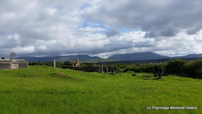
Clonmore, Co Carlow is located 3½ miles south of Hacketstown and 9 miles east of Tullow in the north-east corner of the county, close to the Wicklow border. The modern village developed around the site of an early medieval ecclesiastical settlement.

20130205_125721

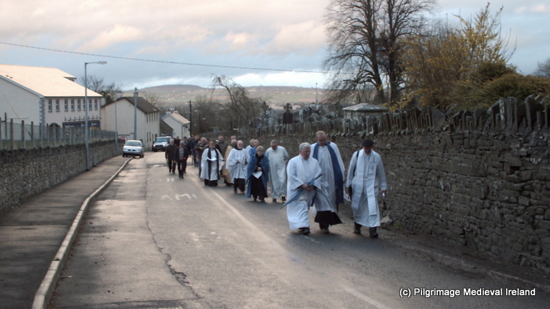
View of St Johns Church of Ireland Church Clonmore and road that runs through the monastic site.

Clonmore was founded some time in the sixth century, by St Maodhóg also known as ‘Mogue’. The saint was a member of the Ua Dúnlaing tribe who were the  ancestors of the Uí Dhúnlainge Kings of Leinster. He is not the same as St Maodhóg of Ferns and the two are often confused because they had the same name.  Maodhóg of Clonmore was mentioned with other Leinster saints in poem attributed to St Moling as the ‘golden vessel’ (Ó’Riain, 2011 431). His feast day seems to 11th of April (ibid , 432).

Little is know about the early history of Clonmore. The deaths of abbots of Clonmore are recorded in the Annals of the Four Masters in the years  771, 877, 886, 919, 920 and 972 . The annals also record that the monastery was burned in 774, attacked by the  Vikings in 834 and 835 and in 1040 by Diarmait mac Mael-na-mBó.

The site appears to have been a place of pilgrimage during the early medieval period. An early medieval poem written by Brocán  Cráibhtheach tells that Clonmore housed a vast collection of relics of the saints of Ireland. The collection included the little finger of St Maodhóg cut from  the saint while alive at the request of Onchú a saintly relic collector who amassed a vast collection of relics of Irish saints. St Maodhóg agreed to part with his finger  on the condition Onchú’s collection of relics remained at Clonmore. Onchú was also said to have been buried here at Clonmore. His feast day was recorded as the 8th of February. Interestingly local tradition identifies the area where Onchú was supposed to be buried in Clonmore graveyard. Clonmore was also associated with St Fíonán Lobhar.

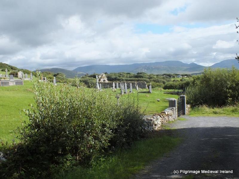
The site of Maodhóg’s monastery  is  believed to be located  on the west side of the village beside a small stream. A  modern road runs through the centre.  A historic graveyard containing a large collection of early medieval crosses is found on the south site of the road. St John’s Church of Ireland  church and  churchyard is located on the north side of the road. There are no surviving  traces of the monastic enclousre or  buildings.

St John’s church was built  c. 1812 it  is surrounded by a triangular shaped graveyard. To the west of the church is a large solid ringed granite high cross known as ‘St. Mogue’s Cross’.


Killanin & Dugnan (1967, 304) mention an ‘ancient stone tough’ in the vicinity of the cross but I on  my visit I could not find it and  I hope it has not been stolen.

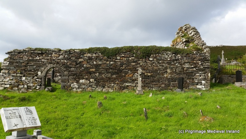
The historic graveyard on the south side of the road  is a rectangular area enclosed by a wall and it  contains a large number of early medieval cross slabs.  Some of the crossslabs are set in lines among rows of 18th and 19th century gravestones.  According to Harbison (1991, 179),  in 1975 all the loose stones crosses and cross slabs were gathered up by a local work party under the supervision of the then County Engineer, Michael O’Malley, and set upright in neat rows within a small paved area enclosed by kerbing at the north-western corner of the graveyard.

376

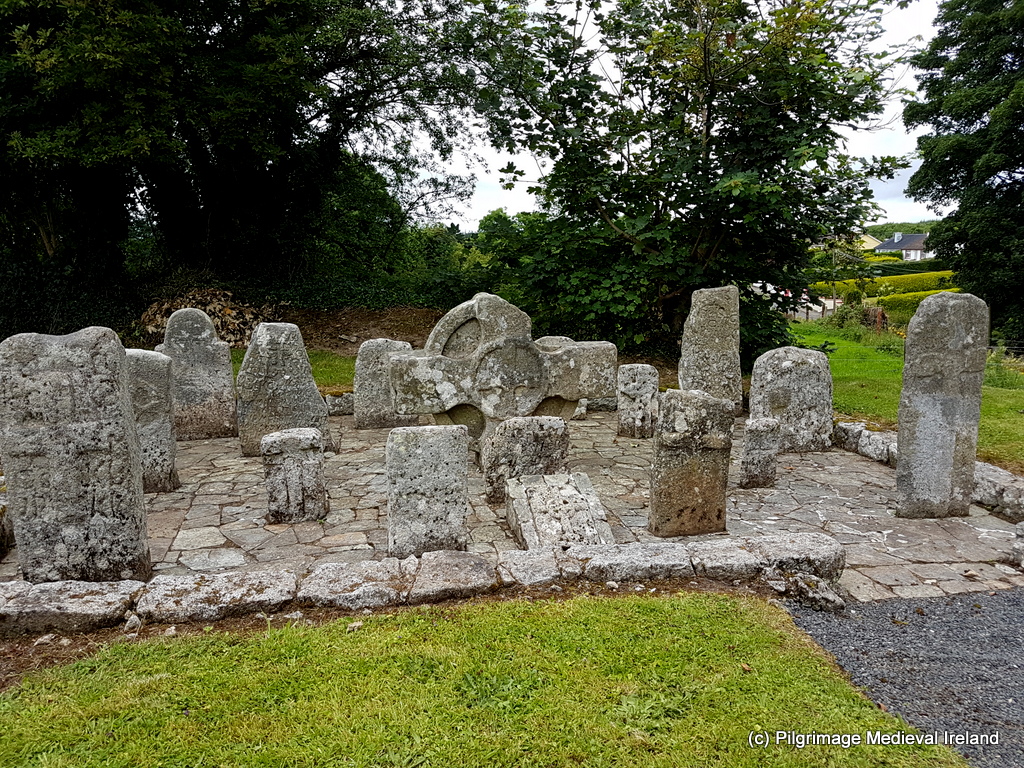
Paved area containing early medieval cross slabs at the north-western corner of Clonmore graveyard.

The head of second high cross is found in this paved area and the shaft and base are located a few meters to the northeast. According to Ryan in the History and Antiquities of the County of Carlow local people in the 19th century believed the cross had been destroyed by Cromwell.


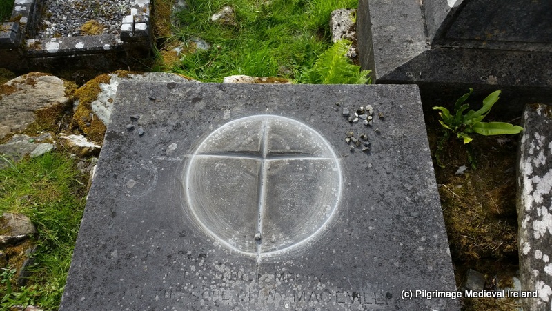
Harbison (1991) has identified  24 early medieval  cross slabs in the graveyard. The crosses  include Greek crosses with expanded terminals incised or sunk into the surface, Latin crosses incised and carved in relief (by far in the majority) and  4 ringed crosses.


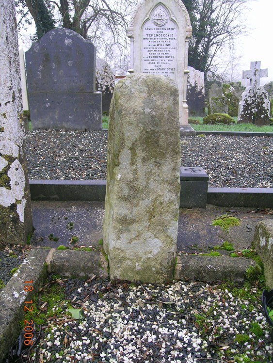
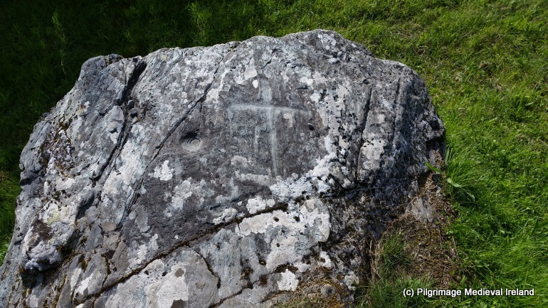
An ogham stone is also found in the graveyard Harbison believes it to be located in its original position  and noted that

Eddie McDonald has pointed out to me that local tradition places the tomb of St Onchuo between it and the South Cross less than 2m away from it (Harbison 1991, 177).

CW009-028021- E face

Clonmore Ogham Stone/CW009-028021 image taken from http://webgis.archaeology.ie/historicenvironment/  (White 2016).

The stone has been analysised by the wonderful Oghan in 3D project who state that

Faint traces of Ogham lettering on the SE angle … much worn and clogged with lichen’. ‘[The first two strokes of] R are lost by the fracture, and the I is broken and hard to recognise’ (Macalister 1945, 18). With the naked eye alone it is difficult to be certain that any inscription survives today. On the 3D model it is possible to make out faint traces of ogham. The 3D data was analysed by Dr Thierry Daubos of the Protecting the Inscribed Stones of Ireland project in Galway in an attempt to clarify the text (3D Analysis). Unfortunately, the scores and notches are too worn for any certainty except to confirm the presence of an ogham inscription. Macalister’s E is possible but the N may be an S and his final I looks more like a consonant, possibly C, with scores to the left of the stemline. Nevertheless, Macalister’s reading is given below as certainty is no longer achievable and it is possible that the inscription was less worn when he read it.

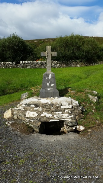
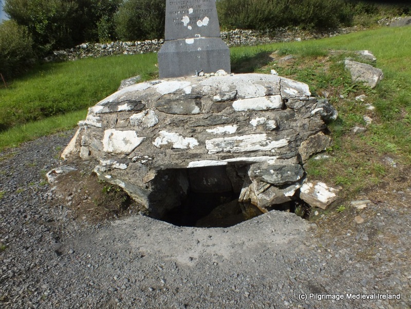
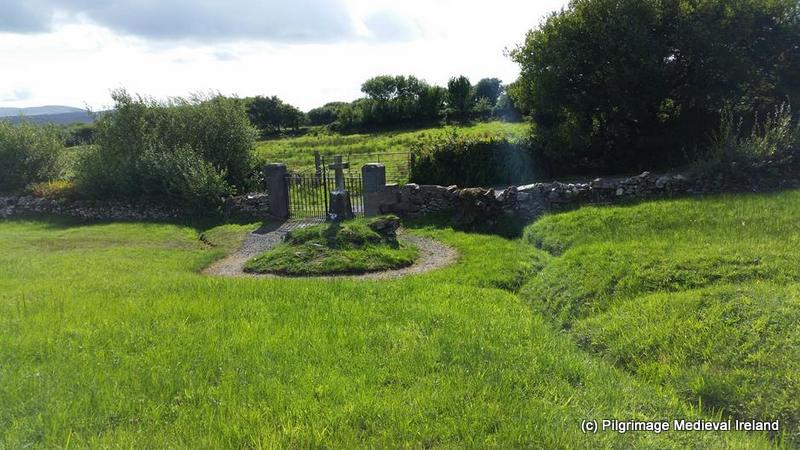
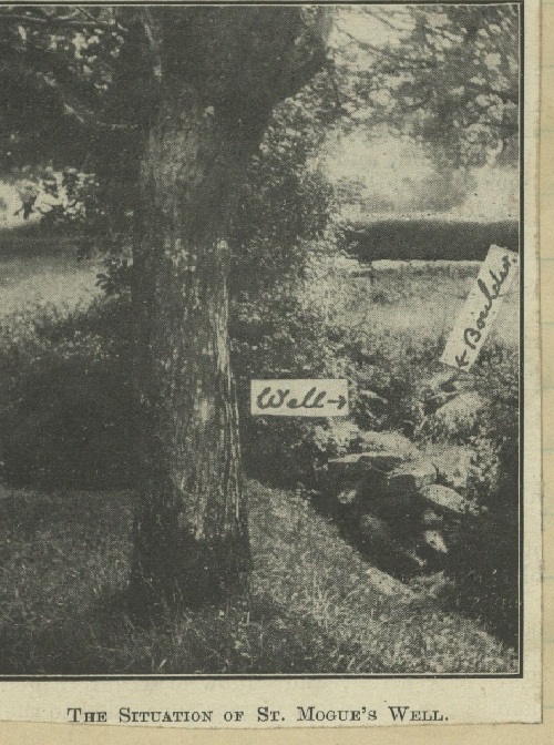
During the 18th and early 19th century St Mogue’s (Maodhóg) holy well  was the focus of pilgrimage. The well is located a few meters from the high cross beside St Johns Church ,on the north side of the road the bisects the monastic site, Today the holy well  sits within a landscaped community prayer garden. In times past the well was the site of a pattern on the 31st of January/1st February, the same day as the feast of the saints name sake St Maodhóg of Ferns, during the 18th century.  The Ordnance Survey Name books  for Carlow written in 1839, describe the well as

a small well with a stream running therefrom. A patron used to be  held here on Saint Mogue’s day, the 1st  of February but has been discontinued  30 years past.


The Antiquities and History of Cluain-Mor-Maedhoc published in 1862

it was until recently resorted to by peasantry for miles around for the cure of many diseases, it is now nearly unknown and neglected, and suffered to choke up with grass and weeds.

The Schools Collections  in 1939 stated that

The well is resorted to at the present time for the cure of sore eyes, warts or any skin growths -even for cancer (Clonmore School The Schools’ Collection, Volume 0909, Page 165).

For cures to be affective, water was taken from the well and applied to the hurt

This has to be done on three successive Fridays according to some; others say that it may be done on any day (Clonmore School The Schools’ Collection, Volume 0909, Page 165).

The earlier descriptions of the well make no mention of a well house and a photo in the Schools Collections from the 1939  shows the well as being open and enclosed by a low stone wall with the bullaun stone known as the wart stone sitting on the side of the wall surrounding the well.

PageProxy.aspx

St Mogue’s well  taken The Schools’ Collection, Volume 0909, Page 166

Today the  well is covered by a well house and the small bullaun stone/wart stone is found within the  house ( built post 1930).  To cure warts it was said the pilgrim needed to take  from the well and pour it into the hallow of the stone and then apply to  the afflicted area (O’Toole 1933, 114; Clonmore School The Schools’ Collection, Volume 0909, Page 111).

Directly opposite the well and prayer garden in the field on the south side of the road is a large four basin bullaun stone. The stone was once located at the centre of the field but was moved  to the easten edge during land improvements and now  sits at side of stream known as Church Brook.


The stone is a large granite boulder  about 2m in lenght with three deep depression about 30cm in diameter , the fourth is  a shallow depression.

According to folklore the stone was originally located at the monastic site but following raids by the Danes( Vikings) it jumped three times.  In the first jump it landed at the site of the St Mogue’s holy well and causes the well spring up,  the stone then jumped to the castles and from here to its former location in the field.

At that time all the land around there was poor and wet but when it lighted there it said:-
“Here I will stay till the destruction of the world and I vow that his farm will turn into fertile land, the most fertile in the parish of Clonmore and no one will interfere with me, and no grass will grow over me and I will be here till the end of time”. (Clonmore School The Schools’ Collection, Volume 0909, Page 111)

Apart from the early medieval remains Clonmore also has a large Anglo-Norman Motte and a stunning 13th century castle.

363

Clonmore castle located a short distance from  the site of  Clonmore  monastery

References

Brindley, A.L. and Kilfeather, A. 1993 Archaeological Inventory of County Carlow. Dublin. Stationery Office.

McCall, J. 1862. The Antiquities and History of Cluain-Mor-Maedhoc. Dublin : O’Toole

DEPARTMENT OF FOLKLORE, U.C.D Schoolbook vol 0909, Clonmore (1939)

Harbison, P. 1991. ‘Early Christian Antiquities at Clonmore, Co. Carlow’ Proceeding of the Royal Irish Academy Vol.91 C, 177-200.

Killanin, M. & Duignan, M. 1967. The Shell guide to Ireland. London: Ebury Press.

Macalister, R.A.S. 1945 Corpus inscriptionum insularum celticarum. Dublin. Stationery Office.

O’Toole, E. 1933. ‘The Holy Wells of County ‘, Béaloideas, Iml. 4, Uimh 2 pp. 107-133.

Ordnance Survey Letters for Co Carlow. http://www.askaboutireland.ie/reading-room/digital-book-collection/digital-books-by-subject/ordnance-survey-of-irelan/

Ryan, J. 1833. The history and antiquities of the county of Carlow. Dublin: Richard Moore Tims.

White, N. 2016.  ‘CW009-028021 , Ogham Stone Clonmore’ http://webgis.archaeology.ie/historicenvironment/( accessed 24/01/2018).


Cranavane Holy Well Co Carlow

Carnavane/Crann a Bhán (white tree) holy well, is located near the village of Kildavin  in Co Carlow a short distance from the Wexford/Carlow border.

DSCF6394

View of Carnavane holy well

The well has no patron but it was likely at one time dedicated to St Finian who was born at nearby Myshall.  A stone beside the lower holy well is said to bear the foot print of the saint.  Local tradition also holds that the ruins of a nearby medieval church at Barragh mark the site of a monastery was founded by St Finian.

102

Stone said to bear the mark of St Finian’s foot.

Barragh church  lies some 400 metres to the west of the holy well and is located beside an circular enclosed  historic graveyard.

061

View of Barragh holy well

Only the north and east walls of the church survives to any great height.

This slideshow requires JavaScript.

Cranavane Holy Well (s)

There are two well at Carnavane. The larger of the two  is covered by a  rectangular shaped dry-stone well house.


This slideshow requires JavaScript.

A large stone lined a coffin-shaped trough is located in front of the entrance to the lower holy well. In the nineteenth and early twentieth centuries it was a custom of bath sick or weak children in waters of the trough. There was also a tradition of dipping coffins in the trough before taking for them for  burial  in Barragh graveyard.

DSCF6404

Coffin shaped trough in front of  Cranavane holywell.

The 1839  1st OS 6-inch’ map shows a building,  farm-yard and gardens located  beside the wells. The  footprints of the building and  associated garden walls  and lane way still remain.   The second  holy well  is located a few meters behind the lower well it is also covered with a dry stone well house of a simpler construction.

DSCF6419

The second holy well behind the main holy well at Carnavane

O’Donovan in the Ordnance Survey Letters records that a ‘patron’ or pattern day  was held here until the year  1798 , on the 3rd of May when it was then banned by the authorities (OSL 1839, 119).  He noted that pilgrims continued  to visit the well for cures of sore eyes and limbs in 1839.   There seems to have been a revival of pattern in the early 1800’s but the event was banned again in the 1870’s by the parish priest due to faction fighting.

Pilgrimage continued at a local level  to the well but over time the traditional prayers and rounds were forgotten.  Up until the twentieth century many people from the townland  would visit the well each Sunday during the month of May and the rosary was usually recited.

By the late 1990s the  holy wells  had  become over grown and the local community cleaned away the scrub and landscaped the site.  The wells were kept as they were and a stone cairn  which may have been a pilgrim station, was rebuilt.  In the early 2000’s a community mass began to be held at the well during the month of May. The mass is often held on the 3rd of May but this is  date is not strictly adhered to.

20160322_134839

Stone cairn rebuilt by local community during restoration works at Cranavane

People from the area surrounding the well still visit here during the month of May and it is also a popular tourist attraction throughout the rest of the year.

086

Mass at Cranavan holy well on 11th of May 2016.


Cranavane is  a great place to visit  for anyone seeking peace and tranquillity and it is also on the Carlow trail of the saints.


Save

Save

Save

Save

Save

Save

Pilgrimage at Kilgeever Church and Holy Well Co Mayo

Last year I was delighted to write a  guest blog post about of  the pilgrim site of Kilgeever in Co Mayo. This post was a guest blog for the very informative heritage blog The Standing Stone.ie. This is a great blog and worth checking out as it has lots of varied and interesting content. At the moment I am working  on some research concerning this area of Mayo and as the site is fresh in my mind  I have decided to repost my guest post.

Pilgrimage at Kilgeever Co Mayo.  Originally posted on the Standing Stone Blog

Kilgeever/Cill Ghaobhair is located in the most scenic of setting on the slopes of Kinknock around 3km outside of Louisburg in Co Mayo. The site is part of the Clew Bay Archaeological Trail.

Fig 1

View of the medieval church at Kilgeever from the small laneway that leads to the site.

Local folklore holds that St Patrick came to Kilgeever having completed his fast of forty days and nights on the summit of Croagh Patrick. It is said that Patrick decided to build a church here and that he later sent St Iomhair one of his disciples completed the task. Some traditions would suggest that “Kilgeever” is the anglicised version of “Cill Iomhair” or the church of Iomhair. The Ordnance Survey Letters of 1838 translates the name as St. Geever’s Church.  Curiously neither variants of the saint’s name are found in Ó’Riain’s Dictionary of Irish Saints.

Alternatively the name may derive from Cill gaobhar, ‘the near Church’ (Corlett 2001, 130) or as the Schools’ Manuscripts Essays  for Louisburg(1937/38) state

Kilgeever- according to the interpretation of most people means “the windy church”.

Fig.2

View of Kilgeever Church and graveyard.

Almost nothing is known about the history of the site but it appears to have functioned as a parish church in the late medieval period. Today the site consists of the ruins of a multi-period medieval church surrounded by a historic graveyard, a holy well and penitential stations. At least three early medieval cross slabs are associated with the site suggesting some sort of early medieval activity. If there was an early medieval monastic settlement here as the name ‘abbey’ would imply no physical remains survive above ground.

Traditionally pilgrims visited here on the 15th of July the Feast of the Apostles and on Sundays.  The Ordnance Survey Letters of 1838 refer to a pattern formerly held on the 15th of July. There was also a tradition of visiting the site on the last Sunday of July. For some pilgrims it is a key component of their pilgrimage to Croagh Patrick and having completed their pilgrimage on the summit of Croagh Patrick they descend the mountain and end their pilgrimage at Kilgeever.  The ITA Files 1944 also makes reference to pilgrims visiting here from the 15th of August to the 8th of September with the annual pilgrimage day being the 15th of August.

Fig.3

Holy well at Kilgeever

The main focus of devotion at Kilgeever is a small holy well located in the northwest corner of the historic graveyard that surrounds the medieval church.

The Ordnance Survey Letters of 1838 state

It is a good spring and much frequented by pilgrims especially for Sundays and on the 15th of July when a pattern is held, now at Louis Borough but which was formally held at the this well.

The traditional pilgrim stations begin at this holy well, located just inside the entrance to the historic graveyard. The well is known locally as “Tobar Rí an Dhomhnaigh” or “Our Lord’s Well of the Sabbath” and the 1st ed. (1839) Ordnance Survey Map record the name of the well as Toberreendoney (Anglicisation of the former).

The Pilgrim Rounds

The pilgrimage begins with the pilgrim walking clockwise around the well forming his/her intentions. The pilgrim then kneels at the well and recites 7 Our Fathers (Paters) & 7 Hail Mary’s (Aves) and the Creed.

Fig. 4

Holy well Kilgeever

The pilgrim stands and circles the well 7 times while reciting 7 Our Fathers, 7 Hail Marys and the Creed.  Once the perambulation is completed, the pilgrim kneels again at the well and recites 7 Our Fathers, 7 Hail Marys and the Creed. It was not uncommon for pilgrims to pick up 7 stones from the well as an aid to counting the rounds dropping one stone as each circuit of the well was completed.  The use of stones to count prayers is a common practice at Irish many Irish pilgrim sites especially those with complex prayer rituals.

The pilgrim then walks to the three flagstones located to the south of the well where he/she recites 5 Our Fathers, 5 Hail Marys and the creed while kneeling.

The pilgrim then proceeds to a small rock outcrop known as St Patrick’s rock where he/she kneels and rites 3 Our Fathers, 3 Hail Marys and the Creed. This stone is reputed to bear the tracks of St Patrick’s Knees (ITA Files). In modern times some pilgrims have inscribed crosses on this rocks and others around where the stations are performed.

Fig.5

St Patrick’s Rock

The pilgrim then walks to and enters the medieval church at the centre of the graveyard.

Fig.6

Kilgeever church is a multi-period church with a fifteenth doorway.

Within the interior of the church the pilgrim kneels and again recites 7 Our Fathers, 7 Hail Marys and the creed and pray for the souls of the dead.  In the 1940s it was common for pilgrims to leaving the church following along the west wall (ITA Files).

Fig.7

Pilgrim cross carved by modern pilgrims on 19th century graveslab within Kilgeever Church.

Some pilgrims continue a modern practice of scratching a cross into a late 19th century graveslab belonging to  the Mac Evilly family. When I visited the site in 2014, a number of  tiny stones were left on the edge of the slab. Other accounts suggest that in the mid-twentieth century pilgrims were in the habit of leaving votive offering in the aumbry within the church. This tradition was not noticed on my visit but a number of religious objects were left at the well.

Fig.8

Some votive offerings left at the Kilgeever Holy Well

Having left the church the pilgrim walks back to the well via a stream that runs the length of the western side of the graveyard.  If the pilgrim’s stations are being performed on behalf of a living person the pilgrim is to walk in the waters of the stream to the well. If the pilgrimage is being performed for the dead, the pilgrim walks along the edge of the stream.

Fig.10

Stream running along the western side of the site.

The pilgrimage is completed when the pilgrim circles the well a further 3 times prayer in honour of the Blessed Trinity. Before leaving the Holy Well pilgrims  are invited to pray for Henry Murphy of Castlebar who had the cross erected over the well (as indicated by an inscription on the cross).

A photo dating to the 1890s and part to the Wynne Collection at Mayo County Library shows pilgrims kneeling in prayer at the holy well in bare feet. This photo confirms what was a common practice at the time for people to complete such pilgrimages barefoot and even today at a small number of pilgrim sites pilgrims continue this practice.  The photo also shows that the well has changed little over the years with the exception of the  addition of the  cross which now surmounts it.

Fig.11

Early Medieval Cross Slab with an outline Greek cross found at Kilgeever. This is one of three cross slabs from the site.

Kilgeever is one of the most peaceful and tranquil places  to visit and it is just one of many interesting sites around Clew Bay area.

Fig.9

View of the east gable of Kilgeever church.

References

Corlett, C. 2001. Antiquities of west Mayo: The Archaeology of the Baronies of Burrishoole and Murrish. Bray: Wordwell.

Higgins & Gibbons 1993: J.G. Higgins & Michael Gibbons. ‘Early Christian monuments at Kilgeever, Co Mayo’. Cathair na Mart, 13, 32–44.

Irish Tourist Association Files for Mayo 1944.

The Schools Collection, Louisburgh (roll number 5128/9), Volume 0137, Page 005, 006,  026, 027 (http://www.duchas.ie/en/cbes/4428011/4368055)

http://www.louisburgh-killeenheritage.org/page_id__85.aspx

http://www.logainm.ie/en/37369

http://www.thestandingstone.ie


Walking The Saints’ Road in Co Kerry

Mount Brandon in Dingle Co Kerry is one of my favourite pilgrim sites. Traditionally pilgrims climbed in pilgrimage to the summit of the mountain on the 16th of May the feast of St Brendan.

Unicode

View of Mount Brandon from Reenchonail

I have just mapped the route of the Saints’ Road an old pilgrim path running from Ventry to the Summit of Mount Brandon using StoryMapJS.  So if for  virtual walk along the Saints’ Road follow the links below.

MB3


Pilgrimage to Croagh Patrick in 1910

A few months ago I came across some wonderful images of pilgrims climbing Croagh Patrick. These images were taken some time in the first decade of the 20th century. The photographs were assembled by Fr. Angelus Healy OFM Cap. (1873-1953) a Capuchin friar known as the ‘Guardian of the Reek’, in honour of his long association with the pilgrimage. The images  have recently been digitised from a collection of glass plate negatives held in the  Irish Capuchin Provincial Archives, and the archives  have kindly given me permission to reproduce the images for this blog post.  I recommend a visit to the Irish Capuchin Archives Facebook page  were you will find wonderful images and documents associated with early 20th century Irish history.

This slideshow requires JavaScript.

The photos reminded me of a contemporary account I had read some years ago of a pilgrimage to the summit of Croagh Patrick  undertaken in 1910, on the main pilgrimage day to the mountain, the last Sunday of July often called Reek Sunday. The story of the pilgrimage was  recounted in the article entitled ‘A Pilgrimage to Croagh Patrick’ and was written by a cleric who gives his name as E.O’L and was published in the Irish Monthly magazine.  The article recounts the priests ascent of the mountain, the weather conditions and encounters with pilgrims.  I have climbed Croagh Patrick a number of times most recently on  Reek Sunday in 2014 and it struck me that the 1910 account has a number of parallels to  the modern pilgrimage in particular the  physicality of journey to the summit, the dangers faced by pilgrims and weather conditions.

I found it very interesting that the article advises against wearing poor footwear when climbing this holy mountain and over a hundred years later this advise is still sound. I have often seen pilgrims and tourist attempt to climb Croagh Patrick in flipflops  or other inappropriate footwear or clothing. Mayo Mountain rescue advises those planning to climb Croagh Patrick and other mountains in the area to wear appropriate clothing and footwear  and to be aware that temperatures at the top of the mountain can be up to 10 degrees colder than at sea level.

In 1910 the author of the article advise  pilgrims to avoid poor footwear stating

Low, thin-soled shoes are not the thing where one frequently sinks above the ankles in  wet, boggy turf loam, and ladies’ fashionable high-heeled  boots are, to say the very least of them, quiet at a discount where loose, sharp  rocks and stones, and heaps of them, covering  long and steep stretches of the ” Pilgrim’s Path,” have to  be got over somehow (E. O’L 1910, 539)


The article advises gentlemen in 1910 to wear

 …good, thick-soled boots (not shoes), with a few spikes or nails to prevent slipping, leggings of some sort, a light, rainproof cape, and a good, long, reliable walking-stick or pilgrim’s staff (E. O’L 1910, 539).

For  ladies

With regard to a suitable dress or outfit for ladies, we shall attempt to give only very little and very negative advice, namely, in the first place, not to wear light-soled, high-heeled shoes or boots; and, in the second place, not to wear over-long skirts, which cling about the feet, and, when the mountain is wet under foot or when there is rain and mist (which seems to be oftener the case than not), soon become very bedraggled and uncomfortable (E. O’L 1910, 539).

The author of the article undertook his pilgrimage on the last Sunday of July and tells us that

morning broke dull and grey, and heavy rain clouds and mist and fog enveloped and concealed the upper heights of the holy mountain almost all day long (E.O’L 1910, 587).

Unicode

View of Croagh Patrick from base of the mountain covered in cloud and mist.

Traveling with companions, he left Westport by car  and  traveled on  to Murrisk.  En-route the group passed

 group after group of young and old, boys and girls, men and women, on foot, all walking with zealous haste towards the holy mountain ; great numbers of cyclists also were to be seen, and a long line of brakes and cars of every description. Still everything was quiet and orderly, and the demeanour of the people was simply admirable (E.O’L 1910, 390).

Upon arrival at Murrisk the group immediately began their ascent of the mountain along the pilgrim path known as the Casán Phádraig/St Patrick’s path.

12028655_893128667444593_549660858885477807_o

Pilgrims beginning their ascent of Croagh Patrick circa 1910. Image courtesy of the Irish Capuchin Provincial Archives.

Large numbers of pilgrims were already climbing the mountain and the scene described below is very similar to that of the modern pilgrimage on Reek Sunday.

Lifting up our eyes we saw before and above us an irregular and unbroken line of pilgrims winding, in long curves, up the mountain slopes, and higher up still, on an elevated ridge of the mountain leading to the cone proper, we could clearly see the unbroken line of pilgrims slowly advancing and silhouetted sharply against the sky-line; and higher and higher up still they could be seen, until they passed on into the heavy clouds, which hid them and all the upper reaches of the holy mountain from our sight (E. O’L 1910, 591).

12038717_893129174111209_7900366421035646691_o

Pilgrims climbing Croagh Patrick circa 1910. Note the ladies in their long skirts in the foreground. The image is courtesy of the Irish Capuchin Provincial Archives.

The modern pilgrimage as we know it derives from efforts made by the  Archbishop of Tuam Dr. Healy in 1903 to revive the pilgrimage which was at the time in sharp decline. Dr Healy was also responsible for building the oratory on the summit of the mountain.  The numbers of pilgrims have steadily increased in the last hundred years  but in 1910 the pilgrimage was popular enough to attract pilgrims in their thousands.

12038047_893129430777850_2983721830635395845_n

Pilgrims taking a brake while climbing Croagh Patrick circa 1910. Image is courtesy of the Irish Capuchin Provincial Archives.

Until the 1970’s it the was the norm for a large portion of  pilgrims on Reek Sunday to climb Croagh Patrick by torch-light the night before or in the hours before dawn.

An hour into the climb E. O’L and his companions

 began to meet many of those who had already been to the summit and were now returning. Some of the older people had gone up the evening before, and had spent the night on the mountain side, or praying around the Oratory on the summit, and indeed they must have suffered greatly throughout that wet and dreary night, and no wonder they should look weary and faint and worn after having been ” buffeted at will by rain and storm ” all night long during their vigil on such a wild and shelterless mountain.

As they made their way up the mountain pilgrims descending  greeted them with

Bravo ! you’re getting on grand, you have only a few hundred yards more to climb,” or, ” Take your time, alanna, and you’ll soon be at the top,” etc.

Modern pilgrims to Croagh Patrick on Reek Sunday will often give words of encouragement to those ascending the mountain.

Croagh Patrick can be a dangerous mountain much of the route, in particular the latter stages along the conical top  of the mountain, is covered by loose shale which moves under foot and can be very slippery in wet weather.   The terrain is difficult especially in the final stages. Each year people fall, sprain and brake limbs while ascending and descending the mountain. So it’s not surprising that in 1910 the group also  met a man ‘with a handkerchief tied around his head and blood oozing from underneath it‘, who had slipped and fell among the rocks  while descending the mountain. The video below shows the pilgrimage on Reek Sunday on a day with similar weather conditions  to those described in 1910 and it highlights how dangerous the climb can be and the amazing work that Mayo Mountain Rescue and the Order of Malta do to help pilgrims on this day.

The author and his companion reached the summit

clothes drenched with rain, our feet wet, our boots and lower garments covered with clammy turf-mould.

???????????????????????????????????????????????????????????????

Pilgrims descending Croagh Patrick is wet and overcast conditions, similar to those described in the article.

As is the case with Reek Sunday today mass in St Patrick’s Oratory and confession was a big part of the pilgrimage rituals  in 1910.

The priests who said their Masses early heard a good many of the pilgrims’ confessions afterwards, and at the time we entered the little Oratory of Templepatrick, rows of pious pilgrims were receiving Holy Communion, and there were pilgrims for Communion at Masses until mid-day (E. O’L 1910, 593).

The evening before a rota was organised to ensure that masses were completed in an orderly fashion

 the priests who wished to say Mass on the summit entered their names in a register kept at the presbytery, Westport, and both the hour and the altar at which each priest was to say Mass in the Oratory were appointed (E. O’L 1910, 585).

12004769_893129697444490_637497387979905819_n

Pilgrims on the summit of Croagh Patrick circa 1910. Courtesy of the Irish Capuchin Provincial Archives.

After their masses the group enjoyed

some sandwiches and a warm cup of tea nicely prepared… by two or three young ladies from the Technical School, Westport (E.O’L 1910, 593).

On my pilgrimage in 2014 I noticed  many pilgrims bought a packed lunch and others bought refreshments and tea from the stalls on the periphery of the summit.


12038111_893129560777837_325191260537632567_n

Courtesy of the Irish Capuchin Provincial Archives.

Having enjoyed the refreshments and

 listened to the excellent sermon of the Very Rev. Father M’Grath for the occasion, and having received the special Papal Benediction at its close, and after hearing the Acts devoutly read in Irish before the twelve o’clock Mass, we began our laborious descent, in fog and rain, over loose rough stones and through boggy turf-mould and slush, and our heads were moved with compassion especially for the poor weary pilgrims struggling up against us, and we consoled and cheered them as best we could…. (E. O’L 1910 594).

As they descended the cone

 the clouds and mist all cleared away quite suddenly, or rather we had left them behind or above us. The sun shone out brilliantly, and land and sea and sky all seemed to rejoice with and for us on our happy and safe return from the Holy Summit. And looking down upon the pleasant land of promise that lay basking in the sunlight far below us, the hardships of the mountain and the wilderness were very soon forgotten (EO’L 1910 594).

Unicode

View of the summit of Croagh Patrick covered in cloud and fog. Image taken from the Tóchar Phádraig pilgrim path in 2008.

I hope this post by combining early 20th century and modern images with an early account of pilgrimage gives you a sense of what it was like to be part of the pilgrimage to Croagh Patrick in 1910. It is also interesting to compare the dress of the pilgrims, the ladies in long skirts and fancy hats, the men dressed in suits some even wear top hats, it’s a far cry from waterproof jackets  and hiking boots worn by the majority of modern pilgrims. We also see that then as now some pilgrims performed their pilgrimage barefoot. Yet we are also reminded  while clothing has changed the modern pilgrim walks along the same path and endures the same physical hardships and weather conditions as those who have gone before.

References

Images from the photographic collection of Fr. Angelus Healy OFM Cap. (1873-1953), now part of the Capuchin Archives collection. Reproduced in this blog courtesy of the Irish Capuchin Provincial Archives.

E. O’L. 1910. ‘A Pilgrimage to Croagh Patrick: July 31, 1910’,  The Irish Monthly, Vol. 38, No. 448 (Oct., 1910), pp. 585-596.

http://www.mayomrt.com/

Reek Sunday 2014: my pilgrimage to Croagh Patrick

http://www.learnaboutarchives.ie/index.php/archive-services/archive-services-pdf/item/irish-capuchin-provincial-archives-2


Pilgrimage at St Patrick’s Holy Well Marlfield Clonmel

Last week on the 25th of June I attended an event at St Patrick’s holy well at Marlfield Clonmel.  This is one of my favour holy wells and it has a rich history which I have discussed in a previous post.

DSCF1677

St Patrick’s Holy Well Marlfield, Clonmel

The well is visited throughout the year but each Summer the people from the village of Marfield and surrounding parishes in Clonmel  town, come to the well for an annual gathering that takes the form of a mass.

This year the mass was held at 8pm and a large crowds  attended. Mass was celebrated by Bishop Cullinan, the new Bishop of the Diocese of Waterford and Lismore.

DSCF1729

Bishop Cullinan the new Bishop of the Diocese of Waterford and Lismore.

People gathered in front of the old medieval church others sat around the holy well and the boundary walls.

DSCF1718

People gathered in front of the old medieval church

The waters of the well  were bubbling forth  in the background , birds singing. Despite the crowds the site was very peaceful.

DSCF1700

People standing around the well during mass.

The large crowds emphasized the size of the area around the well which really is quiet vast. There was a real festive feeling with lots of singing and live music.

DSCF1717

Pilgrims at St Patrick’s holy well

I look forward to returning to the well later in the summer .


Reek Sunday 2014: my pilgrimage to Croagh Patrick

This year I joined with thousands of pilgrims  in the annual pilgrimage to  Croagh Patrick. For those of you who might not know,  Croagh Patrick is a holy mountain  located on the western coast of May on of the southern shores of Clew Bay associated with St Patrick.  The mountain is  764m (2510 ft) in height.  Pilgrimage can place throughout the year but the main focus for pilgrims takes place the last weekend of August.  The  Friday of this weekend is generally the day local  people climb the mountain and the  Sunday often called Reek Sunday is the main day for pilgrims from a wider geographical hinterland.  Each year on this weekend thousands of people  make pilgrimage and ascend the mountain to pray at its summit.  There is a long history of pilgrimage at this site  which I have discussed in a previous post.

1-IMG_1835

Croagh Patrick in Co Mayo

Pilgrimage to Croagh Patrick  2014

On  the morning of  the  27th of  July  I joined with circa twenty thousands  pilgrims in the annual pilgrimage  to the summit of Croagh Patrick. There are a number of approach route the summit. The majority of pilgrim climb from  the townland of Murrisk following a track worn by centuries of feet known as the Cásan Phádraig (the Path of Patrick).

I arrived  by car to the base of the mountain  about 10.00am.  An early start for a Sunday but not at Croagh Patrick, where pilgrims had begun climbing in the early hours of the morning to arrive at  6 am on the summit.  I parked my car in one of the fields converted into temporary car parks to cope with the influx of traffic  and paid a  5 Euro fee for the  day.    As I pulled on my walking boots and pack my rucksack with food and water,  I noticed many of the  people  in my car park were having picnics out of their cars , tea and sandwiches, a reward for a pilgrimage completed or perhaps fuel for the climb ahead.  To begin my climb   I a short distance to a small laneway located beside  the car park of the Croagh Patrick  visitor centre.

1-DSCF1815

Pilgrims begin their climb at the car park at the base of the mountain.

I have  climbed this mountain many times over the years  in various weather condition while doing research for my PhD thesis  but this was my first climb with actual pilgrims.  I was slightly apprehensive.  I am not a fan of very large crowds  and knowing how difficult the terrain of the mountain is I worried  crowds the  would make the climb uncomfortable however  once I began my fears were soon allayed but I was conscious throughout the climb of what was going on about me.

On the main pilgrimage day  Mountain Rescue groups and the Order of Malta have a very visible presence and  they do really excellent work to help pilgrims get up and down the mountain safely.  Croagh Patrick can be a dangerous mountain.  Much of the route  and in particular the conical top  of the mountain  is covered by loose shale which moves under foot and can be very slippery in wet weather.   The terrain is difficult especially in the final stages.  The weather conditions on the summit can be very changeable  and temperatures at the top of the mountain can be up to 10 degrees colder than at sea level.  It is very important to be prepared for the climb and to  have good footware, appropriate clothing water and a stick.  As I walked to the summit I noticed blood on some of the stones on the path and I witnessed at least 3 people fall  and many more stumble but retain their balance because of their sticks.

The following day I read that there had been 17 casualties on this years pilgrimage   with four people  taken off the mountain via stretcher, and two helicopter evacuations. On my way up I saw one person being carried by stretcher from the cone of the mountain and one person being  air lifted from the mountain during my decent.

1-DSCF2102

Helicopter getting ready to take an injured person off the mountain


The Cásan Phádriag

The pilgrim climb in Murrisk begins at the  base of the mountain at a small laneway on the east side of the carpark of the visitor centre.   This path  takes you passed numerous  stalls  such as the legion of Mary  as well as vendors selling religious items.

1-IMG_1840

Vendor selling religious items.

At the top of the lane  you come face to face with a large statue  of   St Patrick and get a great view of the mountain looming behind. The weather conditions were pretty good it was a warm day with a slight refreshing breeze.  During my climb summit of the mountain was covered with low-lying  cloud, that cleared  intermittently to reveal the top. I could see  people  on the summit who from a distance looked like tiny colourful ants.


1-IMG_1842

Statue of St Patrick at the base of Croagh Patrick.

On the way up the path was very busy with  a constant stream of people coming up and down the mountain passing each other by. The pilgrims were made up of  all age groups from  as young as 7/8 to  people in their 80’s.  Some people walk alone while others  walk in small  groups of friends or family.

1-IMG_1849

Pilgrims climbing the lower sections of the Cásan Phádraig.

People climb and participate in Reek Sunday for  many reasons some for religious and spiritual reasons, others to carry on family traditions and other to  experience this unique occasion and to enjoy the amazing scenery.  As I walked along I saw a wide range  of human emotions; a father and his small child  quarrelling about the climb, a woman sitting down and spontaneously crying, children racing along like mountain goats and a woman helping bandage the hand of a stranger who had fallen and cut his fingers.  There was a great sense of  comradery among pilgrims. I noticed  people would often stop and help people who slipped or ask others  who stopped for their breath, if they were ok.  In the final stages of climbing the cone those coming down the mountain would offer words of encouragement “your nearly there now”  “Nearly at the top now”.   I also noted a handful of people climbing the mountain in their bare  feet as part of their penitential pilgrimage.

1-DSCF1819

Pilgrims walking the lower section of the Cásan Phádraig

Climbing the Croagh Patrick on such a busy day means that you must pay extra attention to where you walk. One often needs to   manoeuvre and avoid  walking in the path of those  coming down  the mountain  as well as those walking  ahead at a slower pace  or those who  stop suddenly in front of you. You also need to be aware of where to put your feet and to try and choose the best path ahead.

1-IMG_1864

Views of Clew bay from the lower section of Croagh Patrick

Depending on your level of fitness and weather conditions it can take anywhere between 1.5 to 2/3  to reach the summit.  It took me ages as I was constantly stopping to take photos.

1-DSCF1875

Cásan Phádraig as it levels out before reaching the cone.

1-DSCF1863

Pilgrims approaching the cone of Croagh Patrick

At the base of the cone of the mountain pilgrims encounter the pilgrim station known as Leacht Mionnáin/Benan. This is a large cairn of stones probably of 19th century date.


1-DSCF1920

Pilgrims walking in prayer around Leacht Benan a the base of the cone.

Pilgrims preforming the rounds (traditional prayer focused on a number of holy foci ) walk in a clockwise direction around the cairn reciting the following prayers; 7 Our Fathers, 7 Hail Mary’s and  the Creed. Having finished they embark on the final climb  to the summit. The steepness of this section of the route and the movable terrain underfoot  make this the most difficult section of the climb.

1-IMG_1981

Pilgrims starting to climb the cone of the mountain the final stages of the ascent.

As I climbed upward the summit was hidden from by the clouds. The final stage of the climb is very steep and lots of concentration is needed to keep your balance but  almost without realising it the ground suddenly becomes flat and you realise you have made it in one piece to the summit.

1-IMG_1897

Some pilgrims perform their pilgrimage barefoot

The first thing I did was to sit down and catch my breath. I was sitting on the left hand side of the church  lots of pilgrims were sitting down in this area too.    It wasn’t long before I noticed the cold air and I was very glad of the fleece top I had packed at the bottom of my rucksack.  The summit is a large flat area enclosed by a dry stone wall  in poor condition on the top are  toilets,  a small church and a number of pilgrim stations.

The pilgrimage rituals on the summit include  visiting the remaining stations or foci of devotion,  as well as attending mass and confession. The first station is an unnamed cairn of stones.

1-IMG_2052

The pilgrim kneels at the cairn and recites 7 Hail Marys, 7 Our Fathers, and 1 creed.  Next the  pilgrim prays near the modern chapel for the Pope’s intentions and walks 15 times round the oratory reciting 15 Our Fathers, 15 Hail Marys and 1 Creed.

1-IMG_2007

The back the oratory on the summit of Croagh Patrick

Finally, the pilgrim proceeds to the station known as Leabha Phádraig/Patrick’s bed. This is a small hollow defined by a metal railing. The pilgrim walks clockwise around  reciting  7 Our Fathers, 7 Hail Marys and 1 Creed.

1-DSCF1973

The small chapel on the summit provided the sacrament of confessions begin on the summit at 7:30am and continuing until 2:00pm.   The first Mass on the summit began  at 8:00am and every half hour thereafter until the last Mass which at 2:00pm.


1-IMG_2024

Pilgrims attending mass on the summit.

Traditionally  the final pilgrim station of the pilgrimage was a visit to large possible Bronze age enclosure called Roiling Mhuire (Virgin’s Cemetery) on the western side of the mountain. Three cairns of stones are found within the enclosure and the pilgrim walked 7 times round each cairn, saying 7 Our Fathers, 7  Hail Mary’s and 1 Creed and finally go round the whole enclosure seven times praying.  The majority of modern pilgrims skip this final stage and finish their pilgrimage on the summit.


While the pilgrims pray and perform their rounds  other pilgrims take the opportunity to relax after their arduous climb many  take the opportunity to sit and eat the food they have brought with them or purchased at the food stall that sells tea and sandwiches.

1-IMG_2001

Stall selling food and hot drinks on the summit.

The summit was covered in cloud but intermittently the cloud would clear to reveal the stunning scenery and let the sun warm the weary pilgrims.

1-IMG_2010

Views of Clew Bay from the summit.

I also notice people taking selfies on their mobile photos in front of the church or  Leabha Phádraig  while others posed beside a signs placed here in 2013  which says Croagh Patrick Ireland’s Holy Mountain. I am not sure sure why you need a sign to tell you your are on the summit  but those who were photographed beside it seem to like it.

1-IMG_2029

Sign on top of Croagh Patrick.


The final part of the pilgrimage is the decent.  Climbing back down is as difficult if not more so then the ascent. This is also when most accidents take place.  It was here that I found my trusty  stick  most useful.

1-IMG_1972

Climbing down Craogh Patrick.

Taking part in this pilgrimage was a wonderful experience and I hope I will be lucky enough to take part again in the future. Pilgrims  who climb here should also be aware that the constant foot fall of pilgrims and tourists whose numbers can be up to 100, 000  during the year  is causing sever erosion of the mountain. To find out more about this check out  Mountaineering Ireland website.

Having returned safely down the mountain I  ended my pilgrimage here by  visiting the nearby sites of Glaspatrick and Kilgeever-   posts to follow.

Further reading on this years pilgrimage.

http://www.irishmirror.ie/news/irish-news/croagh-patrick-pilgrimage-17-people-3922909

http://www.rte.ie/news/2014/0727/633338-croagh-patrick/

http://www.mountaineering.ie/aboutus/news/2013/default.aspx?iid=305

An overview of the history of pilgrimage to Croagh Patrick

http://liminalentwinings.com/path-croagh-patrick/


2013 Pattern day at Old Leighlin Co Carlow

Last year I attended the pattern/patron day celebration in honour of St Laserian  at Old Leighlin, Co Carlow.  I had planned to write this post the following day but life got in the way as it so often does, and before I new it days, weeks, months and over a year had gone by.  So better late than never.

Old Leighlin is a small sleepy village  a short distance from Carlow town.  St Gobban founded a monastery here in the  7th century.  He was succeeded by St Laserian  also known as Molaisse , who became the patron saint of the site and surrounding area.  In 630 AD, during Laserian’s  rule, a synod was held here to consider the correct time for the celebration of Easter (see my post on the Easter Controversy). Laserian died in AD 639 and tradition holds he was buried  here  and it is likely his grave was visited by pilgrims from an early date, although the site of his grave has long been forgotten.

Following Laserian’s death the  settlement  prospered and grew in strength and influence, becoming one of the foremost churches in Leinster.   By the 12th century it became the see of the diocese to which it gives its name. All that remains of the  medieval settlement are  the medieval Cathedral church, a holy well, bullaun stone,  two early medieval cross slabs and early medieval stone cross.  Following the reformation the Old Leighlin Cathedral came into the possession of the Church of Ireland and  it continues to function as a place of worship.  I will discuss the medieval and post-medieval evidence for pilgrimage  at a later date.

1-DSCF5038

St Laserian’s Cathedral church at Old Leighlin, much of the fabric dates to the late 13th century.

Modern Pilgrimage

Today as in  medieval times St. Laserian is the focus of a yearly pilgrimage at Old Leighlin  on the 18th of April.  The modern pilgrim celebrations at Old Leighlin  takes place each day  on the saint’s feast day, when an ecumenical  service  is held at  the Church of Ireland Church (medieval cathedral of Old Leighlin) followed by a procession to the nearby holy well dedicated to St Laserian. This year in 2014 the feast day fell on Good Friday and it was held Easter Sunday.

The service is normally presided over by two bishops,  the Anglican Bishop of the United Diocese of Cashel , Ferns, Leighlin, Lismore, Ossory and Waterford and the Catholic  Bishop of Kildare and Leighlin, highlighting the importance of St Laserian within both diocese.

1-DSCF4271

Doorway in the south wall of the cathedral nave.

In 2013 the ecumenical service was held  in the evening  at around 7.30pm.  The Cathedral which is dedicated to St Laserian  is a very beautiful structure.

1-032

The cathedral with a magnificent stained glass window behind the alter.

The Cathedral has many interesting features such as a  magnificent stain glass  window designed  by Catherine O’Brien, in the east gable.  The window depicts Irish and Universal saints  Moling, Bridget, Fiach, Canice, Patrick, John, Paul and  Laserian.

The 2013  service was presided over  by Right Reverend Michael Burrows, the Anglican Bishop of Cashel, Waterford, Lismore, Ferns, Ossory and Leighlin, as the Catholic diocese of Kildare and Leighlin was without a Bishop at the time.  As well as commemorating St  Laserian  with prayers and hymns, 2013 marked a special occasion for Old Leighlin, with the unveiling of an icon of St Laserian that had been specially commissioned for the Cathedral.

1-DSCF4287

The unveiling of the icon of St Laserian in 2013

The Old Leighlin pilgrimage is one of only a handful  of modern Irish pilgrimages that incorporates a procession.  Following  service all of  those present lined up and walked behind  by the bishop(s) and clergy of both churches in a  processional walk, from the Cathedral along the main road which skirts alongside the north wall of the Cathedral graveyard  to St Laserian’s  holy well.

1-DSCF4290

Pilgrims leaving the church following the ecumenical service.

The procession began outside the church leaving via the main church gates and on to  St Laserian’s  holy well a  few hundred metres to the west of the church.

1-DSCF4293

2013 processional walk to St Laserian’s holy well.

As the procession approached the holy well a  band who had been waiting patiently in the car park, beside the holy well, began to play music as the pilgrims approached.

1-DSCF4301

Procession as it approached the holy well.

The well is located within a landscaped green  field that slopes  sharply to the south.   The  clergy gathered at the well, located at the base of the slope.  Most pilgrims  gathered at the top of the slope  with a second group  standing around the rag tree near the holy well.

1-DSCF4304

Pilgrims begin to gather for the blessing of the waters.

Once everyone was assembled a short prayer service then took place and the waters of the wells  were blessed.

1-271

Blessing of the waters of St Laserian’s holy well.


1-DSCF4308

Pilgrims gathering for the blessing of the well.

Following the blessing of the water, and despite the rain  most of the pilgrims  assembled at the well to drink  or take home its water.  Many pilgrims had brought plastic bottles with them to carry the water home.

1-049

Pilgrims taking water from St Laserian’s holy well.

1-047

Pilgrims taking water from St Laserian’s holy well.

The  evening ended  on a very social note  with most people  heading to the nearby local community hall for a very welcome cup of  tea, cake and a chat.

Each summer from mid June until the end of August  the Old Leighlin Cathedral is  open to the public from  Monday-Friday from 10.a.m. until 4 p.m  so I hope this post might encourage some of you to visit, as it is an amazing place.    I plan to write another post about  history of the Cathedral the  more ancient  pilgrimage traditions at the site  later in the year so watch the space.


Links to information on Old Leighlin

http://www.carlowcountymuseum.com/carlow-county/pages/old-leighlin-cathedral.aspx

http://carlowtourism.com/st-laserians-cathedral-3/

http://cashel.anglican.org/information/diocese/cathedrals/leighlin.html