Kilmolash Church Co Waterford

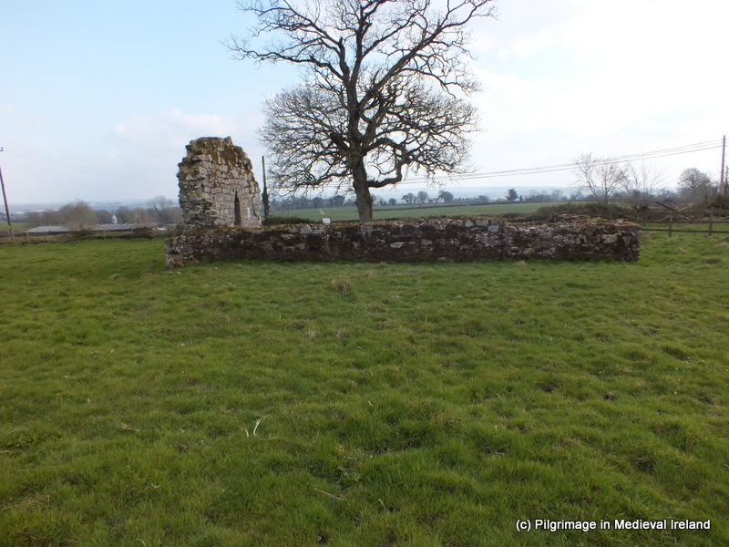
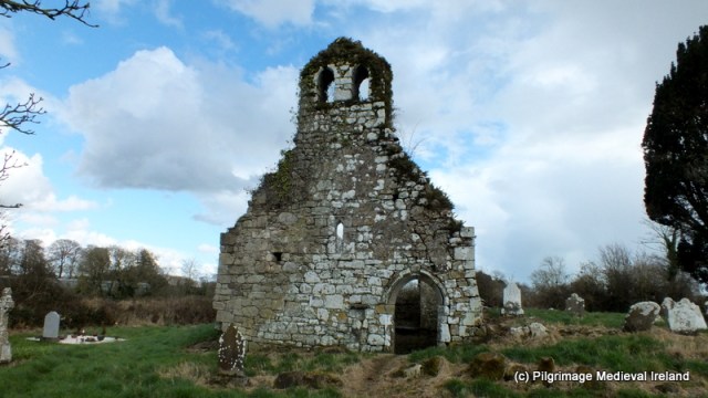
Kilmolash church  is  one of my favourite  places to visit. It is located close to the Cásan na Naomh (path of the saints) an off-shoot of the ancient road from Lismore to Ardmore called  St Declan’s Road. Its roughly  about  5 or 6 miles from the historic town of Lismore,  the site of the great monastery of St Cathage/Mochuada .  Kilmolash started out its life as an early ecclesiastical site dedicated to St Molaise who was  venerated locally on the 17th of January.  There is no evidence written or physical  to suggest that the site was at any time a place of pilgrimage, although this can not be ruled out completely. The annals record that the site was plundered by Norsemen in AD 833.  In AD 912 Cormac Mac Cuileannan, bishop and vice abbot of Lismore, King of Déisi is also recorded as the abbot of Cell-Mo-Laise (Kilmolash).  Suggesting Kilmolash was in the sphere of influence of Lismore.  By the later medieval period the church had become the parish church for the parish of  Kilmolash.

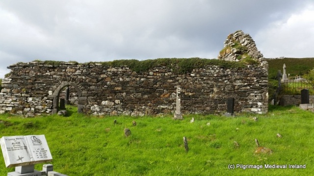
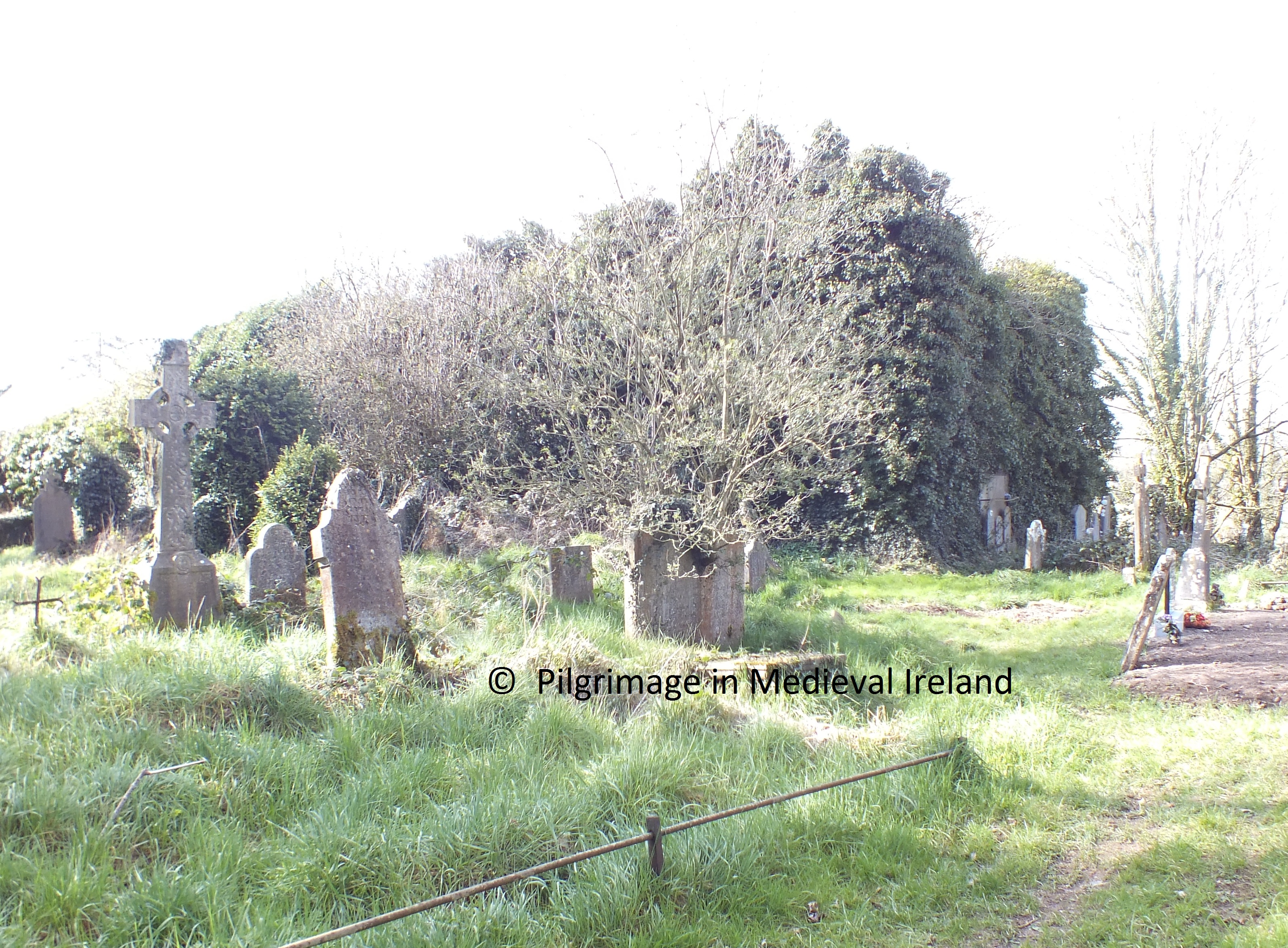
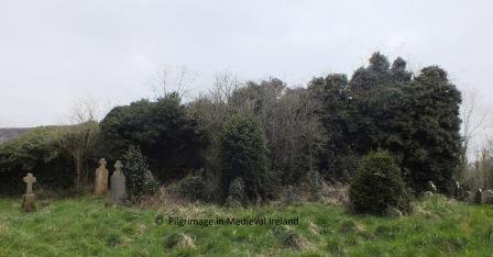
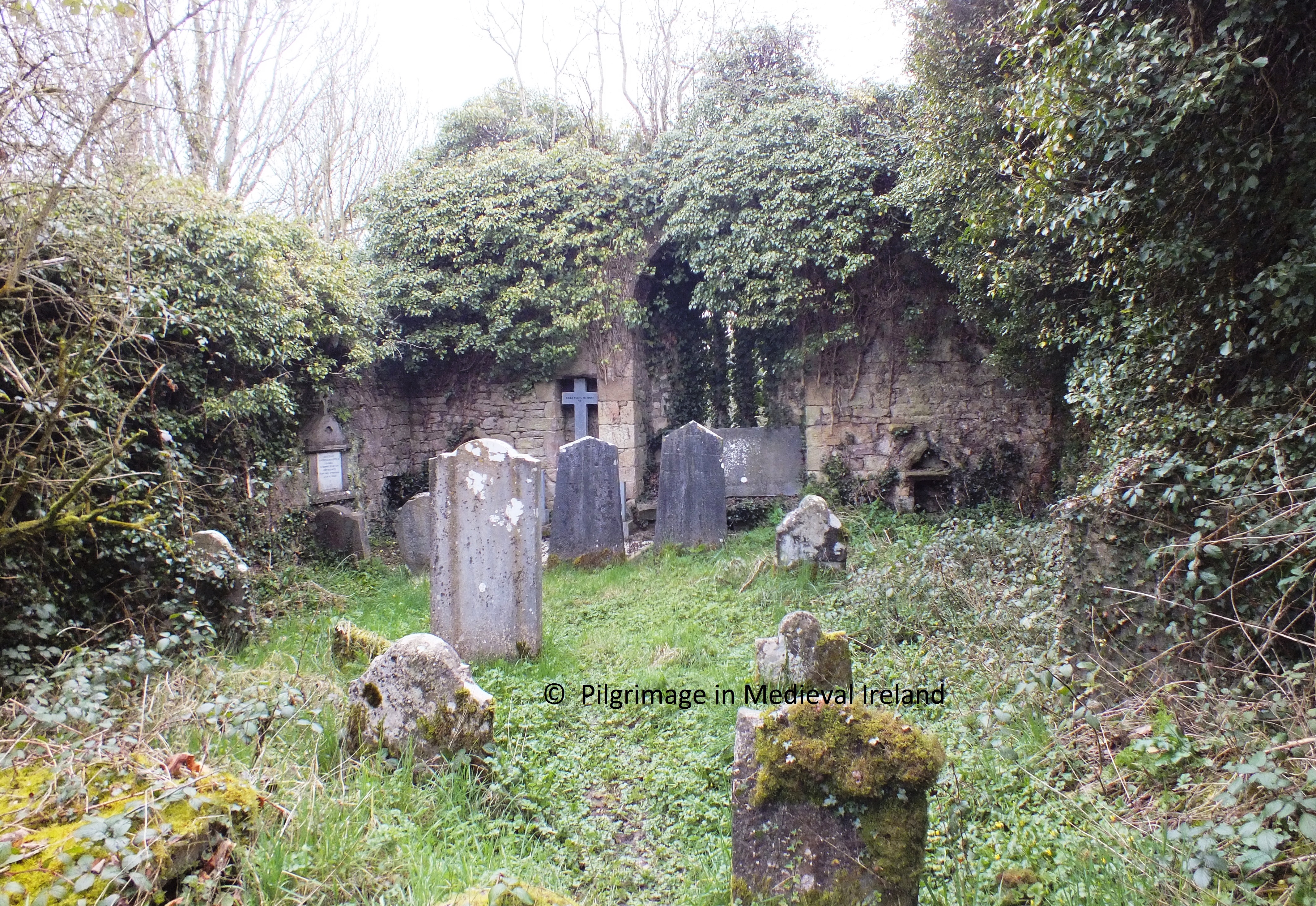
Today the site consists of the ruins of a  multi-period church surrounded by a  D-shaped graveyard. The graveyard is defined by a  wooden fence and an earth and stone bank. The   modern by-road follows the curve of the graveyard.

006

Kilmolash church Co Waterford

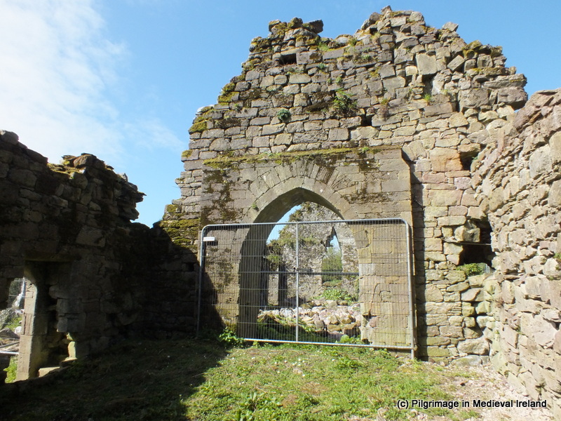
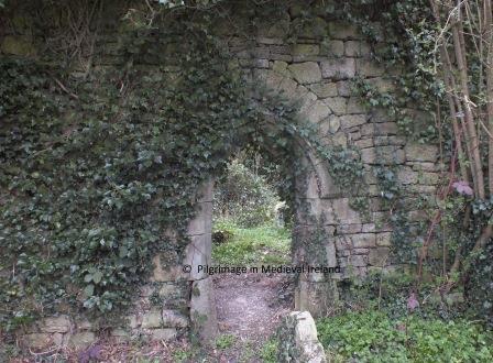
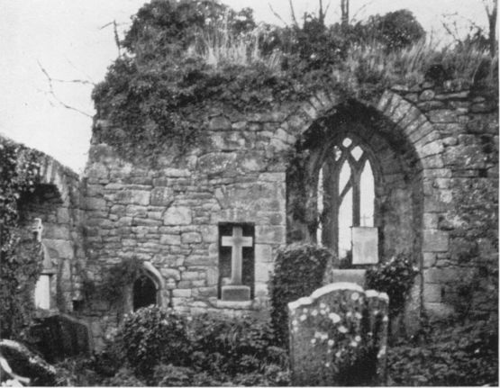
The church  is  rectangular in shape and consists of a nave and chancel divided by a rounded chancel arch.  The nave and east wall are largely late medieval in date while the chancel walls appear to be much earlier,  possibly even 12th century in  date (O’Keeffe 2003, 171).

This slideshow requires JavaScript.

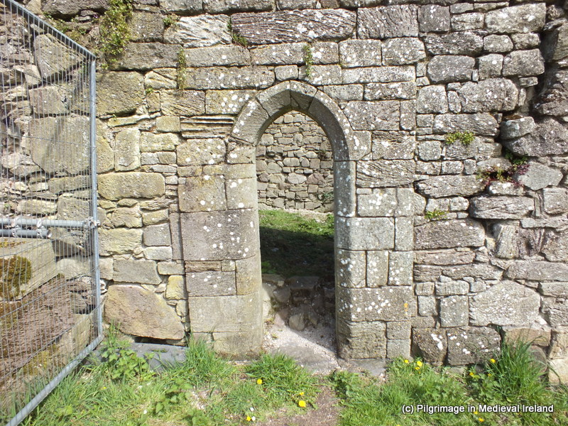
This little church has many interesting architectural features and the west wall is particularly striking with its finely carved doorway with hooded moulding and  holy water stoup.

DSCF6615

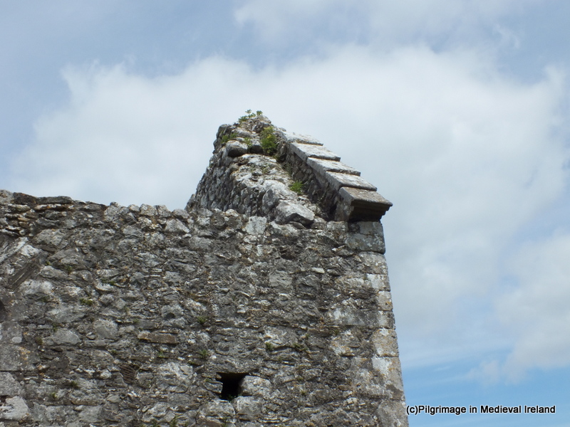
West gable of Kilmolash church

The  fabric of the building is constructed from sandstone and is in a poor state of repair and in need of some form of conservation especially the north and south walls.


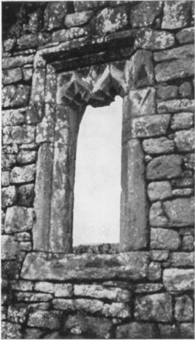
A  double belfry  survives in the west gable  positioned  over an ogee-headed gallery window.

DSCF6616


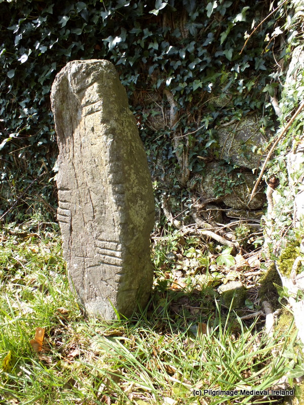
The nave and chancel are divided by a chancel arch. The  arch is made of dressed stones, one of which bears  the  inscription Feare God, Honer the Kinge, Anno Dom 1635. Beneath the chancel arch is a large ogham stone. The inscription is worn but only the letters   ‘NN’ can be identified (MacAlister 1945, vol. 1, 285-6). The stone also has two  inscribed crosses located close to the ogham text. For more information on ogham stones  visit Ogham in 3D project website.

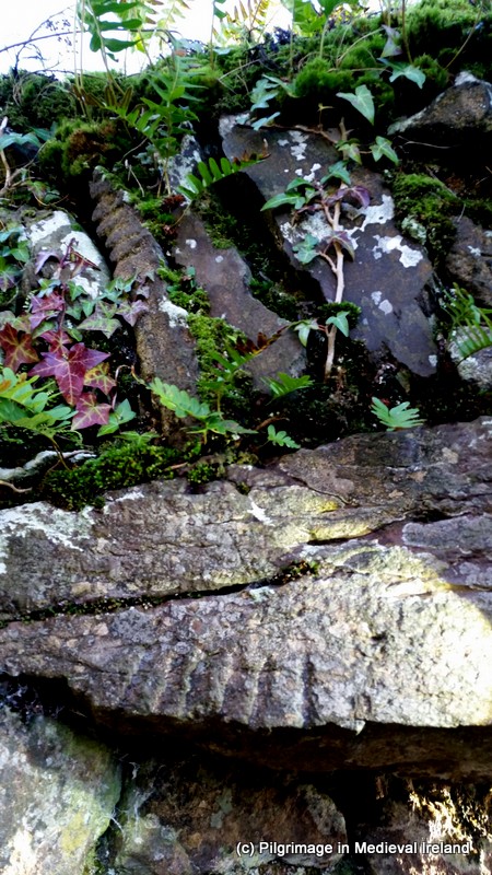
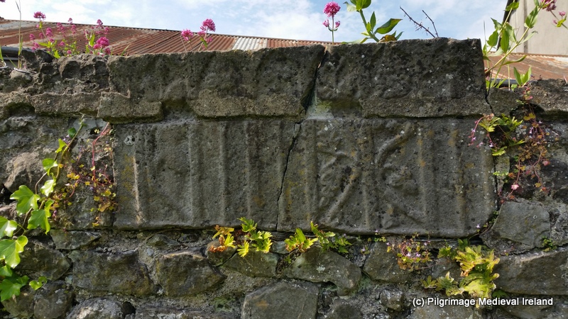
The most unusual feature at the church is rare piece of Romanesque sculpture positioned  over a flat linteled door  in  the west end of the north wall.  The carving in question is a finely carved rosette stone (Power 1898, 91; O’Keeffe 1994, 129-32).  A similar type rosette stone is found at Coole Abbey.

022

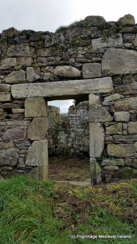
A flat lintel door in the north wall of the church. Note rosette stone over the lintel

Unfortunately the  rosette stone is not in-situ and was it was originally part of a larger composition. The carving is ‘rendered in low relief, the flower is carved onto a block of square stone and was highly stylized  within a frame of  beads‘  (O’Keeffe 2003, 171).  The stone likely dates to first part of the 12th century.
024

Rosette stone at Kilmolash church

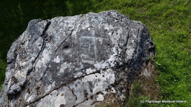
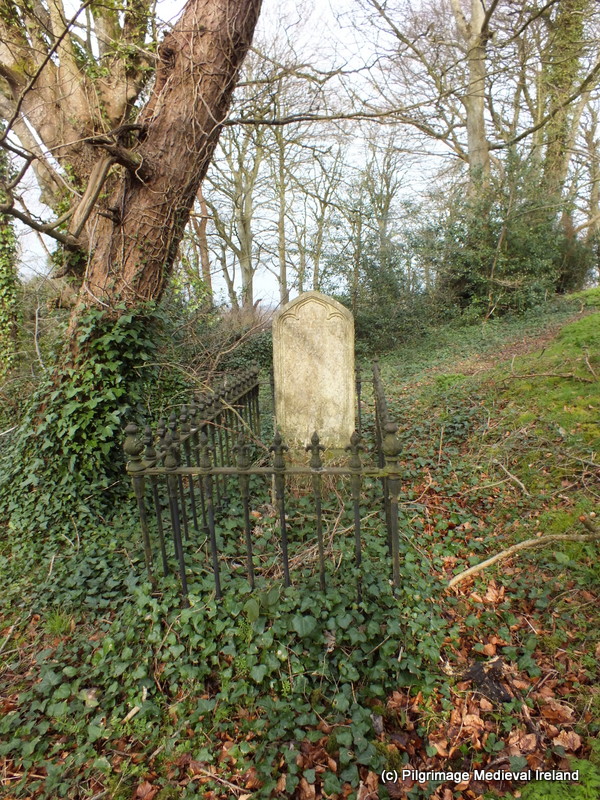
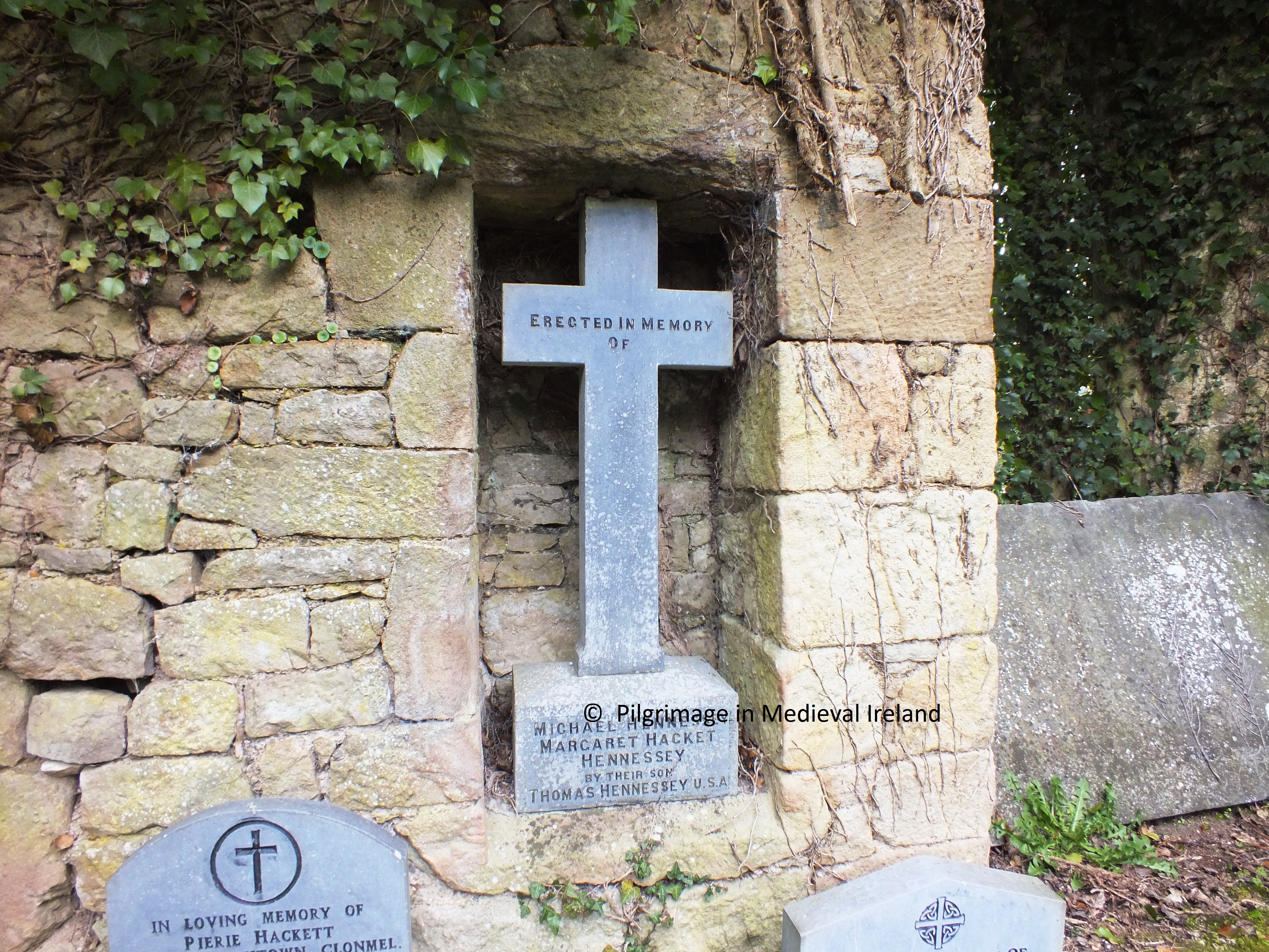
The graveyard surrounding the church contains many fine examples of eighteenth and nineteenth century gravestones and one late medieval gravestone with a figure carved on it found on the north side of the church. Today only the head can be discerned with some difficulty. The ITA files state that the head was believed to be the head of St Molaise (ITA files).


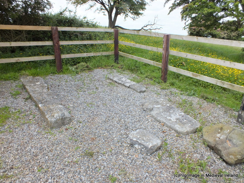
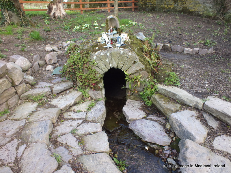
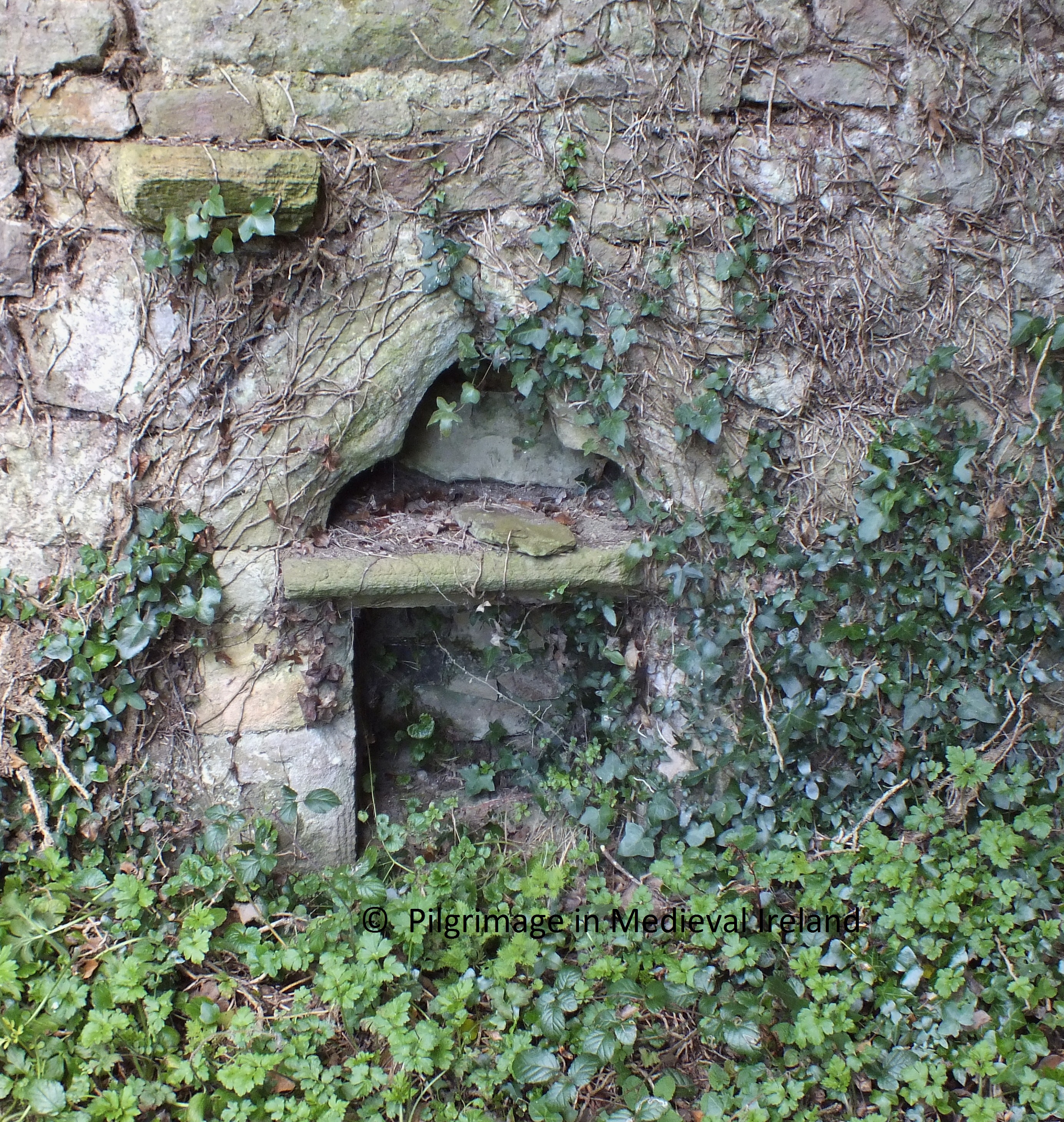
A fragment of a font is also  found in the graveyard and likely the same as the one identified by Buckley in 1898  and found in the graveyard wall  and  kept in the church (Power 1898, 92). In 1894 Redmond recorded that ‘… a holy well exists in a field adjoining the church, but that it was covered in many years ago, and now no trace of it can be found’ (Redmond 1894-95, 155).

DSCF6647

Fragment of medieval font in the graveyard at Kilmolash

Given its roadside location Kilmolash is easy to get too and a wonderful place to pass a some time and I highly recommend a visit.

References

Buckley, M. J. C. (1896) Notes on Kilmolash Church, Near Cappoquin, Co. Waterford, WAJ vol. 2, 212-20.

Buckley, M. J. C. (1896) Notes on Kilmolash Church, Near Cappoquin, Co. Waterford, WAJ vol. 2, 212-20.
Buckley, M. J. C. (1899) Ecclesiological gleanings and jottings in Waterford and elsewhere. (continued) WAJ vol. 5, 44-8.

Macalister, R. A. S. (1945)  Corpus inscriptionum insularum Celticarum, 2 vols. Stationery Office, Dublin.

O’Keeffe, T. (1994) Lismore and Cashel: reflections on the beginnings of Romanesque architecture in Munster. JRSAI vol. 124, 118-52.

O’Keeffe, T. 2003. Architecture and Ideology In the Twelfth Century.  Dublin: Four Courts Press.
Power, Rev. P. (1898) Ancient ruined churches of Co. Waterford, WAJ vol. 4, 83-95, 195-219.

ITA Files

http://www.crsbi.ac.uk/site/2317/

http://www.libraryireland.com/topog/K/Kilmolash-Decies-Without-Drum-Waterford.php

Save

Save

Save

The Pilgrim sites of Myshall Co Carlow

Carlow is a wonderful county full of amazing archaeology  and historic sites.  I recently visited the village of  Myshall  located at the foothills of the Blackstairs Mountains a short distance from the Carlow/Wexford Border. Myshall is  traditionally held to be the birthplace of the great Irish saint St Finian, founder of the celebrated monastery of Clonard in Co. Meath.  An early medieval church dedicated to the saint sits at the centre of the  village.

DSCF6376

St Finian’s  church at Myshall

The church now in ruins is a pre-Norman  structure and only the west gable of the church survives to any great height. Within this wall is a very fine semicircular arch doorway.

The site is also associated with St Brigit. A short distance from the church is  two-basin bullaun stone known as St Brigit’s Stone.

DSCF6382

Bullaun stone at Myshall

Local folklore  connects this stone to a series of parallel ridges called the ‘Witch Slide’ on the nearby Blackstairs Mountains.

1024px-Blackstairs3

Blackstairs Mountain overlooking Ballymurphy, County Carlow. By Sarah777 (Own work) [Public domain], via Wikimedia Commons.

It was said that a Carlow witch had a falling out with her neighbour in Co Wexford and she decided to throw a stone at her. As she began to throw the stone she slipped and fell creating the ridges.  A standing stone in the townland of Clonee was said to be the stone she was trying to throw. It was said the  marks of her knees where she  landed were preserved in the bullaun stone at Myshall.

This slideshow requires JavaScript.

Outside the graveyard circa 18m from the church is a holy well dedicated to St Brigit. The  well is now dry and its structure has been incorporated into a modern grotto. Both the well and grotto are dedicated to St Brigit.  The Ordnance Survey Letters for Co Carlow state that a  pattern was held here annually on the 14th of September the feast of the exultation of the Holy Cross, the Titular feast of Myshall. The pattern day coincided with the Myshall Sheep fair which was held in the village up to the 1960’s. By the 1930’s  all memory of the traditions of stations or cures had been lost (O’Toole 1933, 13).

DSCF6369

St Brigid’s holy well at Myshall

According to O’Toole writing in 1933,  the spring from which the well was supplied came from the graveyard and the spring water flowed from here through a drain under the boundary wall. Three stone steps lead down to the well, and there was a large opening for the overflow.

A few yards from the well there is a large flag set obliquely in the ground; in the centre of this flag there is a round aperture, which apparently was meant to let water pass through while at the same time, acting as a dam (O’Toole 1933, 13).

The area around the well has undergone some landscaping and it is now a feature of an amenity park which incorporates a large pond and water wheel.


DSCF6368

Shrine and holy well at Myshall

References

O’Toole, E. 1933. The Holy Wells of County Béaloideas, Iml. 4, Uimh 1 pp. 3-23

Ordnance Survey Letters for Co Carlow. http://www.askaboutireland.ie/reading-room/digital-book-collection/digital-books-by-subject/ordnance-survey-of-irelan/

Save

Save

Save

Save

The Birthplace of St Colmcille

Tradition holds St Colmcille was born at  Gartan in Co Donegal. The exact location of the saints birthplace is open to discussion. One tradition says the saint was born on a stone called the Leac na Cumha in the townland of Lacknacoo.

Leac na Cumha or the Stone of Sorrow is stone set into a large  oval-shaped mound with a U-shaped setting of stones that opens to the north.

20160316_120036

Leac na Cumha in Lacknacoo

The Leac na Cumha is located along th south-eastern edge of the mound. It is a flat slab of stone and its surface is covered in prehistoric rock art. The art  consists of cup-marks c. 0.1m in diameter.

DSCF6069

Leac na Cumha is covered in rock art

It is here on this stone that the saint is said to have been born.  The site was marked on the 1st ed. (1836) OS 6-inch map as St Colmcille’s stones. Close to the mound is an enormous stone cross erected by Cornelia Adair in 1911.

DSCF6078

Stone cross at Leac na Cumha in Lacknacoo

In the nineteenth century

it became commonplace for emigrants to spend their last night here on the Leac na Cumhadh – the Stone of Sorrows. As Colmcille had decided to exile himself to Scotland, they thought that sleeping here – where he was born – would make their sadness easier to bear (http://www.colmcille.org/gartan)


A short distance away are the ruins of an early medieval ecclesiastical site at Churchtown – Ráth Cnó . Tradition holds this was the  place where St Colmcille’s family lived.  It was said his family gave this land  to the church so that a monastic settlement could be built here. The site over looks  Lough Akibbon and Lough Gartan.

The site is still used as a turas by pilgrims who walk barefoot between the five marked stations. Believers follow the turas between Colmcille’s feast day on 9th June and the end of the turas season on 15th August, performing a series of prayers and actions at each stop (http://www.colmcille.org/gartan/3-03).

The most prominent features on the site is a small church marked as St Colmcille’s chapel on the 1st ed (1836) OS 6-inch map.

DSCF6083

Medieval church at Gartan

According to the Donegal Archaeological Inventory this is probably the chapel described in 1622 as being in repair and having a thatched roof.

To the north of the church is a graveyard, at the  centre of which  are the foundations of a building  said to be a monastic building.

DSCF6123

Possible foundations of a monastic building

Two stone crosses also survive at the site and are part of the pilgrim stations.


Below the site is a holy well dedicated to the saint.

DSCF6113 (1)

St Colmcille’s holy well at Gartan


Both of these sites are part of the Slí Cholmcille  and directions can be found on this website.

Useful Links

http://www.colmcille.org/gartan/3-03

http://www.colmcille.org/gartan/3-02

Pilgrimage at Kilgeever Church and Holy Well Co Mayo

Last year I was delighted to write a  guest blog post about of  the pilgrim site of Kilgeever in Co Mayo. This post was a guest blog for the very informative heritage blog The Standing Stone.ie. This is a great blog and worth checking out as it has lots of varied and interesting content. At the moment I am working  on some research concerning this area of Mayo and as the site is fresh in my mind  I have decided to repost my guest post.

Pilgrimage at Kilgeever Co Mayo.  Originally posted on the Standing Stone Blog

Kilgeever/Cill Ghaobhair is located in the most scenic of setting on the slopes of Kinknock around 3km outside of Louisburg in Co Mayo. The site is part of the Clew Bay Archaeological Trail.

Fig 1

View of the medieval church at Kilgeever from the small laneway that leads to the site.

Local folklore holds that St Patrick came to Kilgeever having completed his fast of forty days and nights on the summit of Croagh Patrick. It is said that Patrick decided to build a church here and that he later sent St Iomhair one of his disciples completed the task. Some traditions would suggest that “Kilgeever” is the anglicised version of “Cill Iomhair” or the church of Iomhair. The Ordnance Survey Letters of 1838 translates the name as St. Geever’s Church.  Curiously neither variants of the saint’s name are found in Ó’Riain’s Dictionary of Irish Saints.

Alternatively the name may derive from Cill gaobhar, ‘the near Church’ (Corlett 2001, 130) or as the Schools’ Manuscripts Essays  for Louisburg(1937/38) state

Kilgeever- according to the interpretation of most people means “the windy church”.

Fig.2

View of Kilgeever Church and graveyard.

Almost nothing is known about the history of the site but it appears to have functioned as a parish church in the late medieval period. Today the site consists of the ruins of a multi-period medieval church surrounded by a historic graveyard, a holy well and penitential stations. At least three early medieval cross slabs are associated with the site suggesting some sort of early medieval activity. If there was an early medieval monastic settlement here as the name ‘abbey’ would imply no physical remains survive above ground.

Traditionally pilgrims visited here on the 15th of July the Feast of the Apostles and on Sundays.  The Ordnance Survey Letters of 1838 refer to a pattern formerly held on the 15th of July. There was also a tradition of visiting the site on the last Sunday of July. For some pilgrims it is a key component of their pilgrimage to Croagh Patrick and having completed their pilgrimage on the summit of Croagh Patrick they descend the mountain and end their pilgrimage at Kilgeever.  The ITA Files 1944 also makes reference to pilgrims visiting here from the 15th of August to the 8th of September with the annual pilgrimage day being the 15th of August.

Fig.3

Holy well at Kilgeever

The main focus of devotion at Kilgeever is a small holy well located in the northwest corner of the historic graveyard that surrounds the medieval church.

The Ordnance Survey Letters of 1838 state

It is a good spring and much frequented by pilgrims especially for Sundays and on the 15th of July when a pattern is held, now at Louis Borough but which was formally held at the this well.

The traditional pilgrim stations begin at this holy well, located just inside the entrance to the historic graveyard. The well is known locally as “Tobar Rí an Dhomhnaigh” or “Our Lord’s Well of the Sabbath” and the 1st ed. (1839) Ordnance Survey Map record the name of the well as Toberreendoney (Anglicisation of the former).

The Pilgrim Rounds

The pilgrimage begins with the pilgrim walking clockwise around the well forming his/her intentions. The pilgrim then kneels at the well and recites 7 Our Fathers (Paters) & 7 Hail Mary’s (Aves) and the Creed.

Fig. 4

Holy well Kilgeever

The pilgrim stands and circles the well 7 times while reciting 7 Our Fathers, 7 Hail Marys and the Creed.  Once the perambulation is completed, the pilgrim kneels again at the well and recites 7 Our Fathers, 7 Hail Marys and the Creed. It was not uncommon for pilgrims to pick up 7 stones from the well as an aid to counting the rounds dropping one stone as each circuit of the well was completed.  The use of stones to count prayers is a common practice at Irish many Irish pilgrim sites especially those with complex prayer rituals.

The pilgrim then walks to the three flagstones located to the south of the well where he/she recites 5 Our Fathers, 5 Hail Marys and the creed while kneeling.

The pilgrim then proceeds to a small rock outcrop known as St Patrick’s rock where he/she kneels and rites 3 Our Fathers, 3 Hail Marys and the Creed. This stone is reputed to bear the tracks of St Patrick’s Knees (ITA Files). In modern times some pilgrims have inscribed crosses on this rocks and others around where the stations are performed.

Fig.5

St Patrick’s Rock

The pilgrim then walks to and enters the medieval church at the centre of the graveyard.

Fig.6

Kilgeever church is a multi-period church with a fifteenth doorway.

Within the interior of the church the pilgrim kneels and again recites 7 Our Fathers, 7 Hail Marys and the creed and pray for the souls of the dead.  In the 1940s it was common for pilgrims to leaving the church following along the west wall (ITA Files).

Fig.7

Pilgrim cross carved by modern pilgrims on 19th century graveslab within Kilgeever Church.

Some pilgrims continue a modern practice of scratching a cross into a late 19th century graveslab belonging to  the Mac Evilly family. When I visited the site in 2014, a number of  tiny stones were left on the edge of the slab. Other accounts suggest that in the mid-twentieth century pilgrims were in the habit of leaving votive offering in the aumbry within the church. This tradition was not noticed on my visit but a number of religious objects were left at the well.

Fig.8

Some votive offerings left at the Kilgeever Holy Well

Having left the church the pilgrim walks back to the well via a stream that runs the length of the western side of the graveyard.  If the pilgrim’s stations are being performed on behalf of a living person the pilgrim is to walk in the waters of the stream to the well. If the pilgrimage is being performed for the dead, the pilgrim walks along the edge of the stream.

Fig.10

Stream running along the western side of the site.

The pilgrimage is completed when the pilgrim circles the well a further 3 times prayer in honour of the Blessed Trinity. Before leaving the Holy Well pilgrims  are invited to pray for Henry Murphy of Castlebar who had the cross erected over the well (as indicated by an inscription on the cross).

A photo dating to the 1890s and part to the Wynne Collection at Mayo County Library shows pilgrims kneeling in prayer at the holy well in bare feet. This photo confirms what was a common practice at the time for people to complete such pilgrimages barefoot and even today at a small number of pilgrim sites pilgrims continue this practice.  The photo also shows that the well has changed little over the years with the exception of the  addition of the  cross which now surmounts it.

Fig.11

Early Medieval Cross Slab with an outline Greek cross found at Kilgeever. This is one of three cross slabs from the site.

Kilgeever is one of the most peaceful and tranquil places  to visit and it is just one of many interesting sites around Clew Bay area.

Fig.9

View of the east gable of Kilgeever church.

References

Corlett, C. 2001. Antiquities of west Mayo: The Archaeology of the Baronies of Burrishoole and Murrish. Bray: Wordwell.

Higgins & Gibbons 1993: J.G. Higgins & Michael Gibbons. ‘Early Christian monuments at Kilgeever, Co Mayo’. Cathair na Mart, 13, 32–44.

Irish Tourist Association Files for Mayo 1944.

The Schools Collection, Louisburgh (roll number 5128/9), Volume 0137, Page 005, 006,  026, 027 (http://www.duchas.ie/en/cbes/4428011/4368055)

http://www.louisburgh-killeenheritage.org/page_id__85.aspx

http://www.logainm.ie/en/37369

http://www.thestandingstone.ie


Seskinane Church at Knockboy Co Waterford

The medieval  church of  Seskinane/Seskinan is located in the townland of Knockboy Co Waterford about 3/4 mile from Bearys cross, just off the Clonmel-Dungarvan road.  Although a little out-of-the-way the site is signposted from the Clonmel-Dungarvan road so can be found relatively easily.
map seskinan

Location map showing the site of Seskinane church

In medieval times this church functioned as the parish church for the parish of Seskinane and was part of the prebend of Lismore. It is located in the ancient territory of  Sliabh gCua. By the late sixteenth century it was in a state of ruin and was recorded as derelict in 1588.
According to Power (1952, 56) the placename  Seskinane signifies “Little Sedgy Moor. The  townland today is made up of rough pasture.
516

View of mountains from carpark

Medieval Parish Church

 The church is found at the end of a long  narrow winding bohereen.  It is surrounded by a historic graveyard enclosed by a modern earth and stone bank.
521

Seskinane medieval parish church surrounded by a historic graveyard


The graveyard  surrounding  the church  is filled with graves ranging in date from the 18th century to the present and it possesses  quiet a number of  very finely carved 18th and early 19th century gravestones. The interior of the church is also filled with gravestones of 18th and 19th century date.

This slideshow requires JavaScript.

 The church has a rectangular plan  without any internal division. The west gable had a double belfry with pointed arches.  The belfry was badly damaged in storm in the early 1990s and what remains   is covered in ivy. The majority of the wall is still standing although without some intervention it is difficult to know for how much longer.  The west gable wall is in poor condition and slightly bowed,  the ivy that covers it is probably holding it together. The wall has a sign ‘danger falling stones from church building’ . The sign tells of the risk to anyone approaching the church. Those who access the site and enter the church do so at their own risk.
531

One of several signs at the sight illustrating the dangers of falling masonry from the church walls.

The  west wall is lit by two ogee-headed windows, placed one above the other.
The east gable of the church is  lit by a central ogee head window and the lower section of  this window has been turned into a small shrine incorporating a  statue of the blessed virgin.
 The walls of the church are built of rubble stone with dressed stones  used for windows and doors.  Two  opposing pointed doorways  provide access into the interior of the church in the north and south walls. At present door in the north wall is partially blocked with masonry from the church.
DSCF3649

Doorway in the south wall of the church


Windows survive at the eastern end of the  north and south walls.  Other features include a  cut water stoup inside the south door and an amubrey at the east end of the south wall.


DSCF2681

View of the south door in the interior of the church and holy water stoup.

Ogham Stones

This little ruined church is very special as it incorporates six ogham stones within its fabric.
The presence of these ogham stones  has led some  to suggest the  church stands on the site of an earlier church. In the late 19th century traces of a possible ecclesiastical enclosure, no longer  upstanding, were recorded in the field to the south of the church and within the graveyard (Brash 1868-9, 127; Power 1898, 84). There is also very pronounced curve in the field boundary  to the east of the church that along with the 19th century evidence may tentatively suggest the presence of an enclousure.
The majority of  ogham stones at  Seskinane were reused as lintels  and are found in the windows in the north, south and west walls and  in the south door. Two other free-standing stones were also found at the site only one of which is still present at the site. The inscriptions  from the stones were transcribed by Brash (1868-9) and Macalister (1945, vol. 1, 286-9).

The South Wall 

A large greenstone ogham stone acts as the lintel of the southern doorway.  The ogham script is visible along the lower edge of the stone.  A circular hole  pierces the stone at the western end it appears to post date the ogham script as it cuts the some of the ogham letters. Macalister (1945, 287) records the inscription as
Q[E]CC[IAS] M[U]C [OI   B] R[O] E[ NIONAS]
DSCF3770

Ogham stone used as a lintel in the southern doorway. The ogham script is found on the lower edge of the stone.

 seskinane ogham

This slideshow requires JavaScript.

A second ogham stone has been used as a lintel in the southern window beside the east gable. Macalister (1945, 286)   transcribed the inscription as
…]RG[…]BRENE [….
One of the voussoirs that make up relieving arch above this lintel also features some ogham script which Macalister transcribed as   CROB (Macalister 1945, 287).
DSCF3731

Ogham stone used as lintel in the southern window beside east gable. The second voussoir on the left also has ogham script.

025

Close up of ogham script on the lintel and voussoir in the southern window.

 The North Wall

The  window at the east end  of the north wall of the  church also incorporates a ogham stone of as a lintel. Macalister (1945, 286)recorded the inscription as
…]ER[A]T[I] M[U]C[OI] NETA-S [EGAM] ONAS

The West Wall

The west wall  of the church is covered in thick ivy at present. It contains two windows both of which have ogham stones as lintels.
Macalister (1945, 287-288) noted the upper stone of the  top window had the inscription
…]CIR   MAQI   MUC[…..
and the lower window had the inscription
VORTIGURN
A seventh ogham stone is  located in the northwest corner of the church. Macalister (1945,  286)  recorded the inscription as
…]ER[A]T[I] M[U]C[OI] NETAS[EGAM]ONAS
DSCF3693

Ogham stone in the northwest corner of the church

There was an eight ogham stone at the site, in the past it was moved to a house near Cappoquin but it  has since been lost. It was read by Redmond (1885-6, 418-19) as OMONG EDIAS MAQI MUI BITE, and by Macalister (1945, vol. 1, 289) as [MAQI?] MOnEDIAS MAQI MUIBITI

 The Church and Community in modern times

 The parish of Seskinane was dedicated to the Blessed Virgin.  In the past a pattern was held here, it was known locally as La Féilé Mhuire Chnoc Bhuí  and it was celebrated on the 8th of September but over time the tradition died out.
Since 1978 the local community has celebrated mass outside the ruins of church on or as close to the 8th of September (the feast of the nativity of the Blessed Virgin) as possible. It is also a time for the local communities to visit their graves.

This slideshow requires JavaScript.

Local Folk Tale:  Seskinane Church and the Bell

A local folk tale recounts that when this the church  was  built it lacked a bell
  to call the faithful to Mass.  It was decided to take a bell from the nearby church at Kilkeany (this church has not survived to the present although its location is still remembered) and  use it at Knockboy. Thus the bell was removed from the belfry of Kilkeany church  and brought to the church at Knockboy.
However, when the bell was brought to Knockboy, it was found that no matter  how hard it was rung the well would not chime. It was  said  that the bell broke from where it was hung and made its way back to Kilkeany, in the middle of the night, chiming the length of the journey and that shrieks of mocking laughter could be heard (Keane 2015, 36).

 To sum up

Seskinane church  preserves  physical evidence of medieval devotional practices within the medieval parish of Seskinane.    The presence and survival of such a large collection of ogham stones is culturally significant at a local and  national level. The presence of the ogham stones within the fabric of the church also tells us a little about medieval ideas of re-use and recycling. Given the state of the fabric of the church and the constant barrage of storms our country is currently experiencing, I do worry for the  future of the site, I really feel that this site is significant to warrants a program of conservation.
If anyone is interested in finding out more about ogham stones check out the wonderful Ogham in 3D website. The site  details the work of the Ogham in 3D project  that is currently  carrying out a  laser-scan  of as many as possible of the approximately four hundred surviving Irish Ogham stones and to make these 3D models available online.  The results of the project to date can be seen on the website.
References
Brash, R. R. 1868-9 ‘On the Seskinan ogham inscriptions, County of Waterford’, JRSAI 10, 118-30.
Keane, T. 2015. ‘Churches Old and New ‘ Sliabh gCua Annual  No.21, 35-36.
Macalister, R. A. S. (1945) (reprint 1949) Corpus inscriptionum insularum Celticarum, 2 vols. Stationery Office, Dublin.
Moore, F. 1999. Archaeological Inventory of County Waterford. Dublin: Stationery Office.
Ogham in 3D:  https://ogham.celt.dias.ie/menu.php?lang=en&menuitem=00
Power, Rev. P. 1898 ‘Ancient ruined churches of Co. Waterford’, WAJ 4, 83-95, 195-219.
Redmond, G. 1885-6. Proceedings – ‘Remarks on an ogham stone lying in Salterbridge Demesne’, JRSAI 17, 418-9.

Writing on walls in 18th century Kilkenny

I was sorting through old photos and came across this one of  graffiti dating to the 18th century  on the wall of St Mary’s church in Kilkenny city.  Most of the writing are initials HL MG  JD  but there is one name and date,  T Hoyne Feb 1777.  A second stone has the initials T.H.

1319

Graffiti in the wall of St Mary’s  Cemetery surrounding St Mary’s church Kilkenny city

1322-001

Part of a tomb in wall of St Mary’s cemetery.

I am going to do some investigating to see if I can find out anything about T Hoyne and I will keep you posted on what I find.  Another interesting feature in the graveyard wall is part of late medieval  tomb.

At present the site is off limits to the public as St Mary’s church is currently being restored and a team of archaeologists led by Cóilín Ó Drisceoil of Kilkenny Archaeology are currently excavating at St. Mary’s in advance of a new museum being constructed.


A flying visit to Ballymore Eustace

Last weekend I paid a visit to  a number of sites located along the  Wicklow/ Kildare border.  I began my mini road trip,  which was cut short by the rain, with a visit to Ballymore Eustace. This is a small village located  in Co Kildare.

os map bally

Ballymore Eustace village

During the medieval period Ballymore was  part of a manor under the control of  the Archbishop of Dublin and the land around the eastern edge of the village is still known as Bishop’s land.  Historical sources record that a castle was built here in the 12th century.  In the 14th century  Thomas FitzEustace was appointed by the then archbishop as the constable of the castle.  This position was held by a number of his descendant and so  began the areas association with the family.   Ballymore was no backwater and was situated in a strategic location linking Kildare and the Wicklow mountains.  A  parliament was held here in the year 1389.  The castle no longer survives but evidence for an early medieval monastic settlement and later medieval church, is found  on the eastern outskirts of the village, at the site of the  modern Church of Ireland church, dedicated to St John. The earliest historical reference to a church at Ballymore dates to  1192.  Historical sources indicate this medieval church was  dedicated to the Blessed Virgin.  The presence of two high crosses and a number of early medieval grave slabs indicate that there was an important religious settlement  located at this site  from a much earlier  date.

eustace

25″ OS Map of St John’s Church of Ireland church at Ballymore Eustace

Today the site consists of a 19th century church built in 1820  surrounded by a  historic graveyard and mature trees.  This  is a very picturesque site and I would love to come back here on a sunny day.

1-20140330_102135

St John’s church at Ballymore Eustace

The early medieval remains are scattered around the graveyard.   The most spectacular is a large granite high cross over 2m in height, located on the north side of the 19th century church.   The cross  has a narrow  shaft that  holds up  a solid ring and short arms and  it sits in a large undecorated rectangular base.

1-DSCF6115

West face of high cross located on north side of church

The west face of the cross  has a central boss located at the centre of the  ring  of the cross head and a second boss at the top of the shaft.   A secondary inscription was inscribed onto the head of the cross and reads (anticlockwise) AMEN/NO (r) THE 9 ERECTED in 16/89/ BY/ AM WALL/ IHS.  The inscription  commemorates the crosses re-erection in 1689.

1-DSCF6117

Inscription on west face of intact high cross

The east face of the cross  is plain with a boss at the top of the shaft  and moulding around the circle of the cross head.

1-20140330_103820

A second  smaller high cross is located to the southeast  of the modern church.  This plain cross is also made of granite  but is not in as good repair as the larger cross.  The head of the cross was broken in the past and all that remains today is  the rectangular   shaft  which sits in a triangular base.

1-DSCF6174

High cross at SE of graveyard at Ballymore Eustace

Traces of the medieval church  mentioned above still survive with  the footing of a wall in the south and a fragment of part of a window opening in the east wall still visible.  The  church was described as  being in good repair in the accounts of the Royal  Visitation of 1615 but it deteriorated greatly over the centuries.

1-DSCF6136

Partial remains of a window in of the east wall of medieval church. Fragments of the window mounding found beside wall.

Along with the high crosses and the church there are  seven  early medieval grave slabs located around the graveyard.  The stones are very similar to those found    in the nearby graveyard of St Kevin’s Church of Ireland church and date to  around the 12th century.  One of the nicest examples is found close to the west wall of the modern church.

1-DSCF6192

Early medieval cross slab at Ballymore Eustace

Apart from the  early medieval remains there are many interesting 18th and 19th century graves stones scattered around  the graveyard including the burial place of  the uncle of the Irish revolutionary Theobald Wolfe Tone  (1763 –1798).

1-DSCF6187

The grave of Wolf Tone’s uncle at Ballymore Eustace

There are also  a number of  distinctive granite crosses  dating to the early 19th century.  I have seen similar  examples at other graveyards in the area.

1-DSCF6111

19th century grave marker made of granite

Finally at the east end of the graveyard there  is a small stone,  located beside a large table top tomb,which looks like the base of a cross.  The water  from the stone   was used by local people as a folk cure to cure warts   (pers comm CJ Darby).

1-DSCF6151Unfortunately my  time here was brief but I look forward to returning again and spending more time looking  around . According to an information plaque at the site within the 19th century church there are additional medieval features  such as  a medieval font  which came from Coughlanstown and a  16th century effigy of a FitzEustace knight  brought here  from Old Kilcullen.  Unfortunately the church was not open on my visit but I hope to arrange a visit another day.

References

Corlett, C. 2003, The Hollywood Slabs – some late medieval grave slabs from west Wicklow and neighbouring Counties, Journal of the Royal Society of Antiquaries of Ireland, 133, 86-110.Corlett, C. 2003, The Hollywood Slabs – some late medieval grave slabs from west Wicklow and neighbouring Counties, Journal of the Royal Society of Antiquaries of Ireland, 133, 86-110.

Grogan, E & Kilfeather, A. 1997. Archaeological Inventory of County Wicklow. Dublin: The Stationery Office.


The Derrynaflan Monastery and Easter Pilgrimage

Derrynaflan is best known for its medieval metal work, including a two-handled chalice known as the Derrynaflan chalice, on display in the  National Museum of Ireland.

derrynaflan-hoard

The Derrynaflan hoard (the chalice and associated ecclesiastical objects)

The  chalice along with a paten, a liturgical strainer and basin were part of a hoard of treasure found by metal detectorist on land close to the  monastery of Derrynaflan Co Tipperary.  The complications, surrounding their discovery, helped to instigate Ireland’s current metal detecting laws which make it illegal for anyone to engage in metal detecting without a licence.

As a child I remember going on a school trip to the National Museum at Kildare St. After all these years I still remember  this visit clearly, along with  our teacher pointing out this treasure (Derrynaflan Chalice) found in my home county. I also purchased a small booklet in the museum shop on the chalice which I still have, once a nerd always a nerd.  The craftsmanship of the chalice and other objects  is  true breathtaking.

Derrynaflan

Decoration on the Derrynaflan paten (a plate used to hold the host during the celebration of the Eucharist).

Location

The hoard is associated with the monastery of Derrynflan.  The monastery  sits on an island  in Littleton  raised bog,  in the townland of Lurgoe, approx 11km from the  modern town of Thurles in Co Tipperary.

Derrynaflan_01721

Aerial shot of Derrynaflan (from the Slieveardagh Rural Development http://www.slieveardagh.com/history/towns-and-villages/derrynaflan/).

In early medieval times  it was located close to the territorial boundary of the territories of the Éile and the Éoghanact.  As you can see from the photo above much of the surrounding bog has been processed and removed by Board na Mona, giving the land a desolate and unappealing vista.  One can only imagine what his site and its surrounding landscape would have looked like in medieval times.

Although  built-in the middle of a bog, Derrynaflan was far from isolated and recent archaeological excavations in the surrounding bogland, has revealed the presence of several bog roads and trackways, some of which line up with the site.  These roads and tracks linked the monastery to the wider world.

The Irish and Latin Lives of St Ruadhán  recounts an interesting tale concerning one of these roads.  St Colmán Mac Dáirne of the monastery of  Daire Mór  decided to bring a gift of butter to St Ruadhán who at the time was residing at Derrynaflan. Conn Manning (1997) has identified the monastery of Daire Mór   as Longfordpass alias Durrihy, located north of Thurlas.   Colmán placed the butter in a vessel which was carried by two oxen and set off on his journey. We are told that he two monasteries were divided by bog but Our Lord miraculously made a road spring up through the bog so that Colmán could deliver the butter.

Founding Saints

Derrynaflan was  founded by  St Ruadhán of Lorrha in  the 6th century (Harbison 1970, 226) but the site gets its name from  two other saints who lived here during the 9th century.  In Irish Derrynaflan  is Doire na bhFlann,  in English the name means ‘the wood of the two Flanns’.  This placename  remembers two  saints both called Flann (meaning red or blood-red) who are associated with the site.  The saints were Flann son of Foircheallach and Flann son of Dubh Tuinne (Conna), both acted as co patrons of the area. The calendars of Irish saints note Flann Foircheallach died in  825 and his feast was commemorated in the 21st of December.

The monastery acquired its present name by the association with two prominent clerics of the early 9th century, Fland mac Duib Thuinne of Dairinis who died in 821 and Fland mac Fairchellaig, abbot of Lismore who died in 825 (ibid.).

Derrynaflan was linked to the Ceilí Dé movement  and the annals suggest links to other Céili Dé churches at  Lismore, Emly and Cork.  Additionally it is included in a list of sites in ‘union’  with Máel Ruain, and the asceticism practices by Flann son of Dubh Tuinne is elsewhere specified  in the rule attributed to  Máel Ruain who was the patron of Tallaght (Ó’Riain 2011, 345).

The site today

The approach to the Derrynaflan is little bit difficult but so worth the effort.  I visited here during the summer with Conor Ryan of the South Tipperary Development Company who is currently working in a project to develop an   The Derrynaflan trail  linking this site and other church sites such as Holy Cross Abbey in east Tipperary Slieveardagh area.

We approached the site from the north  the townland of Liskeveen and  followed a small  surfaced bog road  and then headed cross county  through some scrub.  It is also possible to  approach  the site from the  south.

1-DSCF8985

Approach to Derrynaflan from the south

After a little bit of  walking  we came to the base of a hill  and were rewarded with view of the ruins of the monastery sitting on top of a hill.   The monastic site  consists of a series of earth work and the ruins of a church and  a single wall of another monastic  building.  The island was originally enclosed by a bank and outer fosse (ditch) which is visible only in places and the eastern side of the enclosing bank and fosse are now covered by a build up of bog and peat (Ryan 1980, 10).

1-DSCF8990

View of Derrynaflan church

Today the most visible remains are the church. This is a nave and chancel church with two phases of construction. The nave of the church appears to be pre-Norman, a separate church in its own right. In the 13th century the chancel was added on this earlier church then became the nave of the new building.

Interior of Derrynaflan Church

Interior of Derrynaflan Church

Only the  walls of the chancel  in the north, south and east survive to any great height .  The earlier church (nave) was built of coursed Cyclopean limestone masonry (large blocks), of which only the lower courses of the south wall survive (Ryan 1980, 11).

The east gable contains two single-light trefoil-headed windows, while there are three single-light trefoil-headed windows in the south wall.  At the east end of the south wall  there is a re-used Romanesque window which was used to frame a decorated sandstone piscina.

1-DSCF9007

Romanesque window reused to frame the piscina

Within the  interior of the church  there is a triangular-shaped gable finial with socket for a cross belonging to the original roof of the 13th-century church.

1-DSCF9016

Stone roof slates

Along the top of the north side of the east gable are stone roof slates,  additional stone roof slates from the medieval chancel were also found during previous excavations (Ó Floinn 1985, 37).

1-DSCF9032

East gable of Derrynaflan church

Gobán Saor

Derrynaflan is also associated with a mythical figure called the Gobán Saor.  The Gobán  was a highly skilled smith or architect in Irish history and legend.  Tradition holds he was responsible for  building  many of Ireland’s castles and churches including Holy Cross Abbey.

Local tradition holds that the Gobán Soar was buried at Derrynaflan and the 1st edition Ordnance Survey map marks the site of  his grave to the north-east of the church.

1st ed Ordnance Survey map of Derrynaflan from http://maps.osi.ie/publicviewer/#V1,617960,649614,6,8

1st ed. Ordnance Survey map of Derrynaflan (from http://maps.osi.ie/publicviewer/#V1,617960,649614,6,8)

Farrelly (2011) notes that White writing in  1892 say

‘further down the slope to the north, are the graves of the Gobann and his wife and two children. Stones of coffin shape mark the place and bear quaint figures and curious celtic tracery. Heretofore, these relics were religiously preserved, but latterly they have suffered in some ways. A barabarian smashed one of the stones some years ago and obliterated the tracves with a chisel’. Traditionally the Gobaun was said to have been Grand Master of the ancient order of Freemasons in Ireland (ibid).

Today the area  is  an area defined by a timber fence.   Inside the fence are three  very worn medieval grave slabs one which is held to mark the Gobán’s grave. I will come back to the Gobán again in the new year as I think this very interesting character is deserving of his own blog post.

1-DSCF9035

Grave of Gobán Saor

  Easter Pilgrimage

This quiet site is transformed into an annual place of pilgrimage at Easter time when there is a celebration of a dawn mass on Easter Sunday. The tradition was started by Canon Liam Ryan, PP, Killenaule-Moyglass, in the 1990s and attracts large numbers of pilgrims from the surrounding areas.  I am hoping to attend this pilgrimage in 2014.

My friends at Abarta Heritage have a great a audio guide for this and some of the other sites in the area .

References

Byrne, F. J. 1980 Derrynavlan: the historical context. In JRSAI 110, 116-26.

Farrelly, J. 2011. ‘Derrynaflan’ http://webgis.archaeology.ie/NationalMonuments/FlexViewer/
Ó Floinn, R. 1987 ‘Derrynaflan’, Lurgoe: Monastic settlement. In I. Bennett (ed.), Excavations 1986: summary accounts of archaeological excavations in Ireland, 33. Bray. Wordwell.
Ó Floinn, R. 1988 ‘Derrynaflan’, Lurgoe: Monastic settlement. In I. Bennett (ed.), Excavations 1987: summary accounts of archaeological excavations in Ireland, 24-5. Bray. Wordwell.

Manning, C.  1997.  ‘Daire Mór identified’ Peritia 11, 359-69.
Ryan, M. 1980 An Early Christian hoard from Derrynaflan, Co. Tipperary. NMAJ 22, 9-26.

http://www.abartaheritage.ie

http://www.abartaheritage.ie/product/derrynaflan-trail-audio-guide/

http://www.nationalist.ie/news/your-community/easter-sunday-dawn-mass-planned-for-famed-derrynaflan-site-1-4929037

Coole Abbey Co Cork

Coole Abbey  is a really interesting site, located about 4-5 miles outside of the scenic town of Castlelyons in Co Cork.  The site of an early medieval  monastery,  founded  by St Abban in the 6th century,  today  all that remains of  the early monastery  are two churches and a holy well. Of the surviving churches the  smaller of the two  sits in a field beside the road from Conna to Castlelyons. The  larger church is located c. 200m to the northeast  in an  historic graveyard.

map coole

Location map of the churches and Holy well at Coole (taken from Bing Maps)

Placename Evidence

Cúil  is the Irish for Coole and it translates as corner or nook.  Early medieval documents  refer to the abbey as Cúil  Chollaigne.

The Saints Associated with Coole

Coole is associated with two saints  Abban (Abán)  and Dalbach.

St  Abban  was born into the Uí Chormaic (Dál gCormaic ) dynasty in Leinster. He is associated with the churches of Mag Arnaide (‘Moyarney’/Adamstown, near New Ross, Co. Wexford) and Cell Abbáin (Killabban, Co. Laois) . In Munster  he established a monastery at  Ballyvourney, Co Cork  which he later surrendered to St Gobnait. He is also associated with Killagh Abbey near Milltown Co Kerry and Kilcrumper near Fermoy and  he founded  the church at Coole  (Cúil Chollaigne). Abban has two feast days the 16th of March and the 27th October (O’Riain 2012, 51-52; 254).

The second saint  association with Coole is St Dalbach. Dalbach  and the church at Coole were associated with the anchorite movement known as the ‘Céili Dé’ (clients of God)  who flourished in Ireland  between 750-850. The saints pedigree links him to a Cork based tribe known as the Uí Liatháin. The saints obit was entered in the annals for the year 800 and his feast was assigned to the 23rd October ( O’ Riain 2012 ,254).

There are few  early medieval historical references to the site. One that is of interest is found in Mac Carthaigh’s Book a collection of annals that date from 1114 to 1437.  The annals for the year  1152  states the churches of

 Cork, Imleach Iubhair (Emly), Lismore, and Cúil Chollainge (Coole) were burned in the same year.

The Annals of the Four Masters also record that in 1151

Gillagott Ua Carrain, lord of Ui-Maccaille, was killed at Cuil-Colluinge, by the Ui-Mictire

Architectural remains

The Cork Archaeological Survey mentions the  presence of a  low curving earthen bank   that can be picked out  c. 70m north of the smaller church. The bank  curves northwest – eastnorthwest  in the field and it may  represent evidence of an early  ecclesiastical enclosure.

The two surviving churches date to the  12th & 13th centuries. The smaller  church is  built of sandstone and most of the fabric dates to the 12th century. It  is rectangular in shape, with  only the east gable surviving to any great height.

Smaller church beside the road

Smaller church beside the road

A modern style has been inserted into the west gable.  The church has some pre-Romanesque feature such as antae which  project from the  east ends of the north and south wall. It is thought antae which are corner projections  found on some early stone churches  were attempts to imitate  wooden churches  which  had stout corner posts jutting out beyond the gable-wall. Another early feature is  a gable headed (triangular headed) east window with exterior rebate  which is found in the east gable.

06-DSCF2046

East gable of church showing gable headed window and antae

Archaeologist Tomás Ó Carragáin (2010, 102-103)  suggests the gable headed window  dates to the  11th century.  Within the church there is a stone altar which sits in front of east window.  It is likely it was  restored at some point in the past by the office of public works (ibid., 336). There is  also a local traditionally that  mass was said here in penal times .

Altar in front of the wast window

Altar in front of the east window

The second church is larger in size and  it functioned as the parish church in late medieval times. Today it  is situated within a historic  graveyard  filled with 18th and 19th century gravestones.

Larger church at Coole

Larger church at Coole

The  church consist of a nave and chancel.  The nave appears to be Romanesque  c. 12th century  in date  and the west wall has traces of a roll-moulded jambs in the lower course of the door. The nave  is a later addition and dates to the 13th century.  The east gable of the nave has a piece of Romanesque sculpture in the form of  a finely carved  rosette.  Similar rosettes stone in England date 12thc century. This stone was  probably re-used from an earlier church here.   A similar type stone is found c. 20 miles away  at another small monastic site at  Kilmolash in Co Waterford.

Rosette  carving in the -- gable

Rosette carving  east gable

A large  well carved pointed arch,  which appears to be  a later insertion, joins the nave and chancel.

Arch between  chancel and nave

Arch between chancel and nave

The  chancel  is later then the nave and was  added in the late medieval period  (Ó Carragáin 2010,  307).

Door into ----

Pointed doorway in the south wall of the  church

Records dating to 1615 state the church’s nave  was ruinous but  the chancel was in repair. The building ( chancel) was in use until the 18th century  when it was finally abandoned.

Relics of Coole

The Pipe Rolls  of Cloyne  mention a relic  called the Coole missal  upon whose page margins  important memoranda of the lands and rights of the church were recorded (Power  1919, 47)

Waters (1927, 53) writing in 1927  mentions that a relic of Saint Patrick’s tooth was kept here but he does not say where he came across this information and I cant find any reference to this relic in the   Lives of Abbán  etc or in antiquarian books relating to Cork. If there was a relic of  St Patrick’s tooth here it is likely to have come here in the  later medieval, as Patrician links in Munster  for the early medieval period are minimal or its equally possible it is folklore that developed around the site in the post medieval period. These are just some initial thoughts and I will delve into this  more deeply in the coming weeks and keep you posted on what I find out.

Holy well

Below the church is  a lovely holy well. There is little information about the well  but it is  still in use as a number of statues and votive offerings sit on top of the small corbelled well house that covers the well.

The well is marked simply as  holy  well  on the 1st edition OS  maps and Power in 1919 who is usually most detailed in his recording of sites also refers to the site as simply the holy well (Power  1917, 51) and  that  it was ‘still venerated’

013-DSCF5262

The information plaque at the sites  connects the well to St Devlet  and suggests this is an Anglicisation of St Dalbach. The plaque gives the following  folk tale of the origin  for the well.

Long ago the blessed well at Coole was just a spring. A female inhabitant of Coole Abbey House was reputed to have  seen a monk praying at this spring and she ordered an oratory to be built over it.

It also states that the waters here hold a cure for sore eyes and warts but one has to visit the well and ‘pray at  each of the seven kneeling  stones exposed around the outside  of the well chamber’.

Id love to hear from anyone who knows more about the well and the traditions associated with it. If anyone does have any information you can email me at pilgirmagemedievalireland@gmail.com.

References

Thanks to Terry O’Hagan the author of the blog Vox Hibernionacum  for discussing the cult of St Patrick in Munster, but any omissions or misunderstandings are my own.

http://www.askaboutireland.ie/learning-zone/secondary-students/art/irish-churches-monastic-b/early-monastic-churches/

http://www.castlelyonsparish.com/history/historical-areas/coole-abbey/

Ó Carragáin, T. 2010. Churches in Early Medieval: Architectural, Ritual and Memory. Yale Press.

O’Keeffe, T.  2003. Architecture and Ideology in the Twelfth Century Romanesque Ireland Dublin: Four Courts press.

 O’Keeffe, T 1994 “Lismore and Cashel: Reflections on the Beginnings of Romanesque Architecture in Munster “JRSAI 124, 1 18-52.

Ó Riain, P. 2011. A Dictionary of Irish Saints. Dublin: Four Courts Press.

Power, Rev. P 1919. ‘The Churches of Coole County Cork’ JRSAI Vol.1 , 47-54.

Kilronan medieval church & holy well at Glebe, Co Waterford.

A few days ago, I visited one of County Waterford’s hidden treasures, the medieval  parish church of Kilronan.  I am in the process of doing some historical research into this site but  here are some of my initial  observations.

DSCF2555

Kilronan medieval parish church at Glebe, Co. Waterford.

Location

Kilronan church is located in the townland of Glebe,   in the barony of Glenihery, close to the Tipperary Waterford country boundary. It is a short drive from the town of Clonmel (c. 6km), just off the  Dungarvan-Clonmel near the crossroads at Kilmanahan.  This area is in the diocese of Waterford and Lismore, which came in to existence in the later medieval period following the amalgamation of  the dioceses of Waterford, Lismore and Ardmore .

kilronan

Map showing Kilronan church and holy well taken from Bing maps.

Placename

The name  Kilronan or Cill Rónáin means the Church of Ronan which suggests there was an early medieval church of some sort in the area.   There are several saints called Ronan listed in the early medieval calendars of  Irish saints, however there is no way of knowing which of them was connected to this area.   There is no trace of an early medieval church at the site or anywhere else in the parish. The diocesan system in Ireland came into being in the 12th century and the present  church was built after the 12th century,  it may be possible it was built on an earlier church. The townland name Glebe, refer’s to church land. Glebe  land  was used to support the parish priest.  According the  Ordnance Survey Letters of the 1840’s the church  was remodeled in the 15th century, when it and the parish were re-dedicated to St Laurence.

The Church

Kilronan church  sits  in a rectangular graveyard with  gravestones range from  late 1700’s to modern times.   19th century farm buildings are built  against the church on the north and west side. It is surprising that there has been little academic discussion of Kilronan as it has some very unusual  and interesting architectural features.

East gable and south wall of Kilronan church

East and south wall of Kilronan church

As you can see from the photo above a  layer of very thick  ivy  covers much of the  walls of the church.  It is difficult to accurately date the church as it is so over grown but it is mentioned in a document written by Pope Nicholas’s   in 1291, which suggests it was constructed prior to the late 13th century. The original building was altered   in the 15th century  and  a number of  new windows and a door  were added.

The church is built of sandstone and is entered through a door at the west end of the south wall.  The door way is a lovely 15th  century hooded  moulded doorway. If you look closely at the photo you can see the  door way was inserted into an earlier larger doorway.

Doorway in the south wall of the church

Doorway in the south wall of Kilronan church

It is difficult to see all the windows with the ivy. Rev. P.  Power, the former head of Archaeology at UCC, writing in 1938 counted 6 windows and suggest there was at least one more.  I noticed  two window (one blocked) on the  west side of the doorway, and a twin-light, cusped ogee-headed window at the east end of the south wall. There is a blocked windows in the north wall. All the windows have very wide embrasures.

Kilronan windows

Photo of the ogee head window at the east end of the south wall in 1938 (Power 1938, 63)

The largest  and most elaborate window  is found in east  wall of the church. It is a  three lights window with switch line tracery. Today it is  covered in ivy so  below is a photo of the east wall and window taken in 1938.

Image of east wall of church taken in 1938

Image of east wall of church taken in 1938 (Power 1938, 63).

The church has a simple rectangular plan, the interior it is now filled  with 18th and 19th century burials and heavy vegetation growth. There is no evidence of any internal division between the chancel and nave.

View of east wall of church

View of east wall of church

The Archaeological Inventory of   Co. Waterford  noted there was  ‘ traces of rood-screen sockets towards the E end of the long walls’ .  In the south-east corner of the church,  the  ivy free sections of the wall shows the upper courses leaning inwards which may suggest evidence of  vaulting.

Power noted that notable individual details is the evidence of a former double roof; this is voussoirs of the inner vault plainly visible on the south side (interior) of the building. No doubt there was, as in Cormac’s Chapel, a chamber for lodging of the priest, above the barrel vault, and in this connection, note the putlog beside the entrance door, clearly the door way  was fastened from within, i.e., the ecclesiastic lived in the church.

If Power is correct then the priest live within the church  above a vaulted ceiling.  In medieval times the priest  often lived at or in the church,  in accommodation above the west and sometime the east end of the church,  in an upper story apartment  or in accommodation attached to one side of the gable end of the church, or in residential towers attached to the church (Birmingham 2006, 169).  Less commonly the priest could live in a free-standing house were also used (ibid.). The use of vaulting is not unheard of in creating an upper floor for the priest residence  and examples of vaulted medieval parish churches are found at Kilbride Co. Offaly,  Gallon and Raffony, Co Cavan & Leighmore Co Tipperary (ibid., 173-174).

DSCF2515

Piscina in the east wall of Kilronan church

The east wall of the church is the least affected by ivy which is fortuitous as some of the  churches most interesting features are located within this wall. At the south end is a piscina,  a recess with a shallow basin used to  wash the communion vessels. The upper section of the Kilronan piscina has an elaborate trefoil-head, a shelf  and the basin  has an   incised petal  design.

Modern memorial cross inserted into aumbry in east wall

Modern memorial cross inserted into aumbry in east wall

At the north side of the main east window  a modern memorial cross has been inserted into one of several   aumbry that are found within the church.  An aumbry is  a fancy word for a  cupboard. There is a small pointed finely cut sandstone door way which leads into a tiny room (dims. 2.03m x 0.85m) that is built into the east wall.

DSCF2525

The room is tiny, a stone seat is built against the north wall  and aumbry (cupboard) is found in the eastern corner of the south wall. The room is roofed with flat lintels and  small square window is found in the center of the east wall.  This is a very unusual feature which I have not found at any other church perhaps the  closest parallel  I can find is  Okyle church and anchorite cell.  I am very curious as to what the function of this room.  It is a tiny room  so would an anchorite be able to stay here ? Does it have a penitential purpose?  I plan to look into this further and I will keep you posted on my findings.

Holy Well

Close to the church c.  60-70 m away   is lovely looking holy well.  The well is  a  semi circular superstructure with a large brick cross on top.

Kilronan Holy Well

Kilronan Holy Well

The  Ordnance Survey Letters of 1840  do not record   any saint associated with the well  nor does Power writing in the early 20th century.  It is always simply referred to as the ‘Holy Well’. According to Power the holy well was venerated up to the 1930’s but he gives no further information. The stagnant water within the well suggests is no longer visited.

I would love to hear from anyone who  knows any history of the well or its traditions and I will come back to Kilronan again and share any new findings on its history and architecture.

© Louise Nugent 2013

References

Birmingham. H. 2006, ‘Priests’ residences in later medieval Ireland’, in Fitzpatrick, E. & Gillespie, R. (ed.) The Parish in Medieval and Early Modern Ireland.Dublin: Four Courts Press, 168-185.

O’ Flanagan, Rev. M. (Complier) 1929. Letters containing information relative to the   

  antiquities of the county of Waterford collected during the progress of the

  Ordnance Survey in 1841. Bray: Typescript.

Moore, M. 1999. Archaeological Inventory of County Waterford. Dublin: Stationery

Office.

Power, Rev. P. 1937. Waterford and Lismore; a compendious history of the united

  dioceses. Cork: Cork University Press.

Power, P. 1938. ‘Some Old Churches of Decies’, JRSAI, Vol. 8, 55-68.