St Patrick’s well and Cloghaphuill in the parish of Rathvilly Co Carlow

The parish of Rathvilly ( Ráith Bilech  ‘fort of the old tree’) in Co Carlow has two really interesting pilgrimage sites,  still venerated by local people; St Patrick’s well in Rathvilly townland and  Clogh-a-phuill (the stone with a hole), a roadside shrine,  in neighbouring townland of Ladystown.

rathvilly

Location map of St Patrick’s well and Cloghaphuill ( from Google Earth)
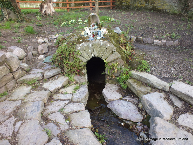
St Patrick’s well

St Patrick’s well is located  on private land in the townland of Patrickswell (Tobar Phádraig) at the bottom of a long sloping field.

1-20130318_123957

St Patrick’s well at Patrickswell, Rathvilly Co Carlow

According to tradition St Patrick baptised Crimthann the  King of Leinster along with his wife and child at this spot.

1-20130318_124038

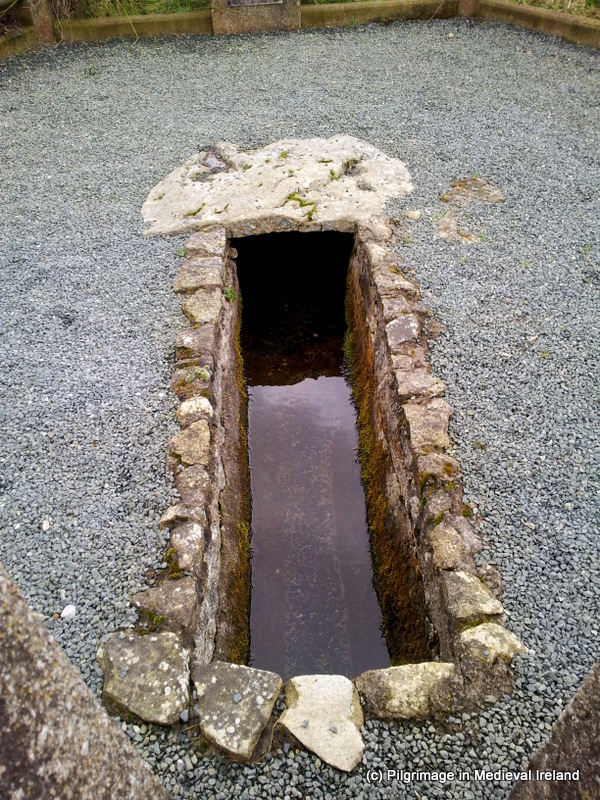
The large flat capstone which covers St Patrick’s well

The well itself is a natural spring capped by  a large flat slab. The water follows  away from the well through a stone lined channel.  The area surrounding the  well was  enclosed in 1953 with a hexagonal fence. More recently the  ground surface surrounding the well was covered in gravel.  I didn’t see any drinking cups or votive offerings at the site but there were some coins in the waters of the well. The wells water is renowned as a cure for warts. People still visit the well especially around St Patrick’s day.  I am currently looking into the medieval and post-medieval pilgrimage at the site so I will keep you posted on what I find out.

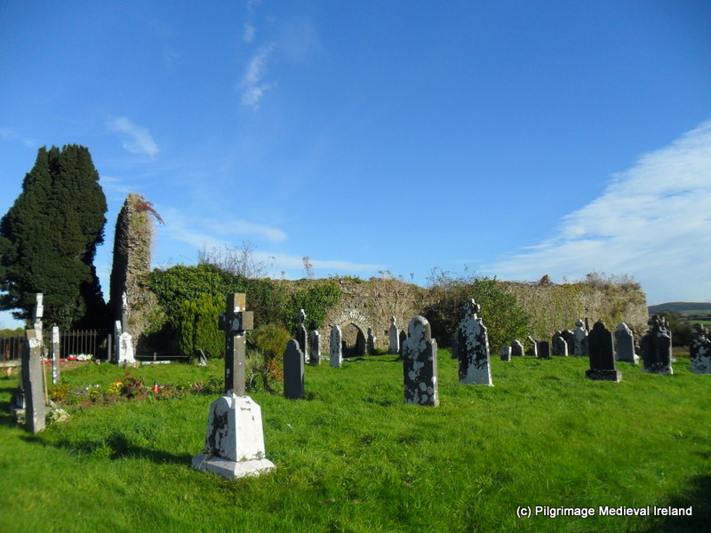
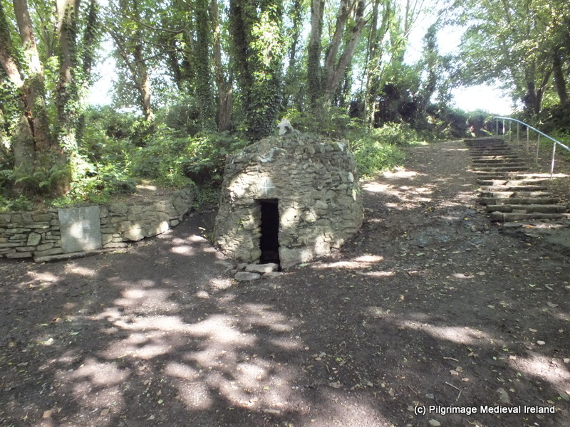
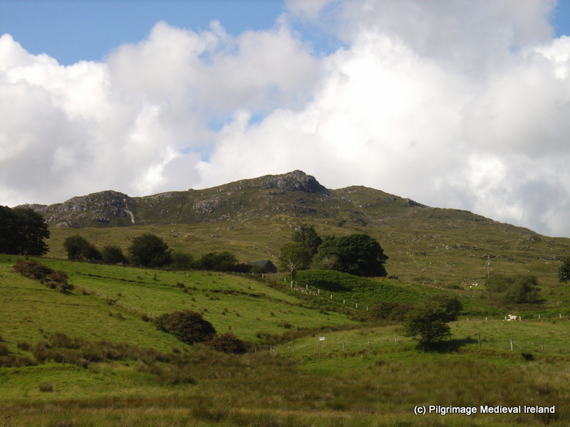
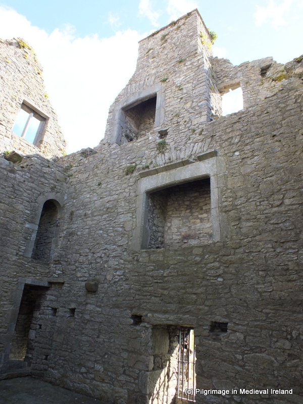
Waterstown church & Cloghaphuill

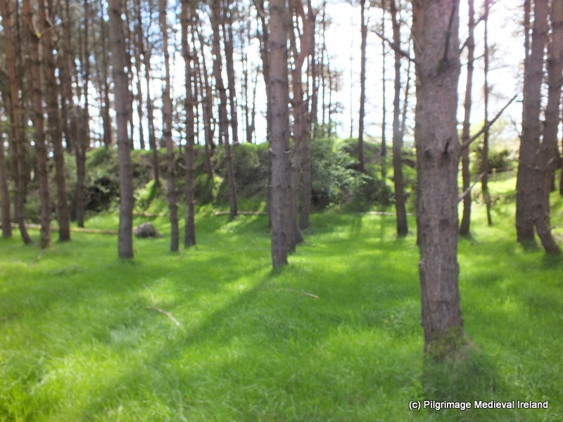
A short distance from St Patrick’s well is  the ruins of a medieval church at Waterstown. On the 1st edition ordnance survey map of Co Carlow 1840 the site is recorded as church, graveyard and cross.  The map shows the  church  as a rectangular building within a rectangular enclosure. The Ordnance Survey  25 inch map for the area recorded in the early 1900’s, shows the site as sub-oval mound with a cross at the summit.

In  Ryan’s  The History and Antiquities of the  County Carlow  in 1883 the site is described as  follows

is a rude stone cross, embedded in a socket of like material and about seven feet in height. It is supposed that  the parish church formerly stood at this place.

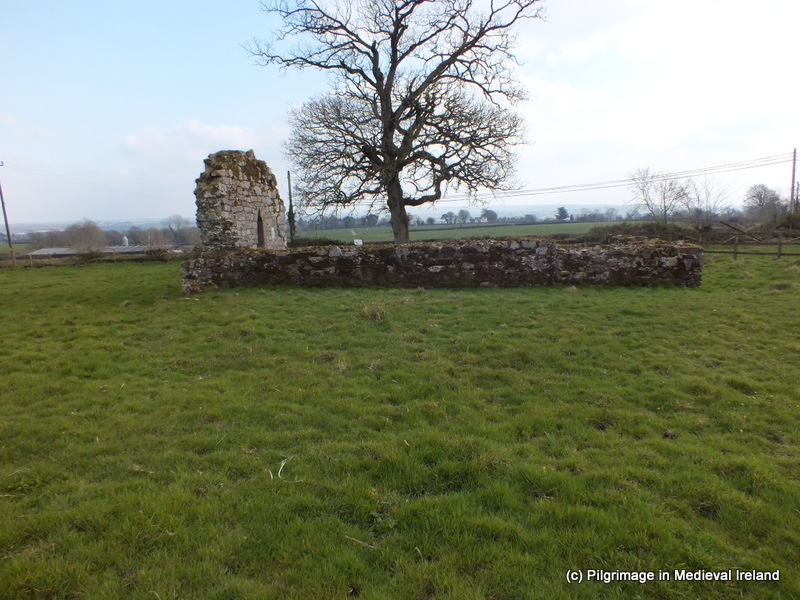
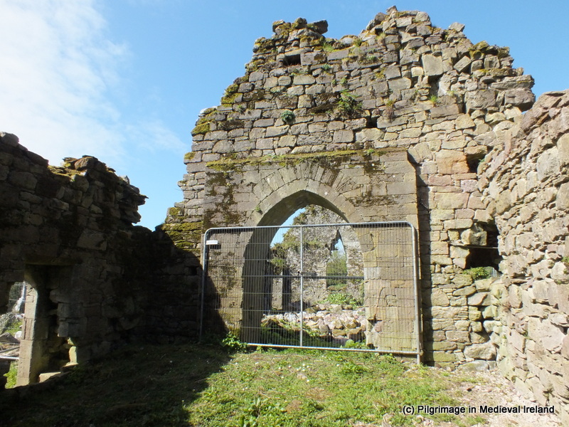
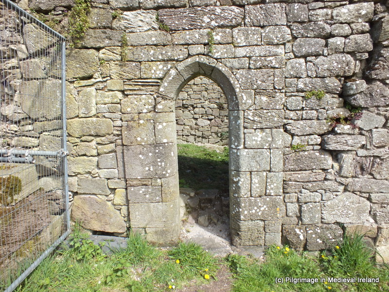
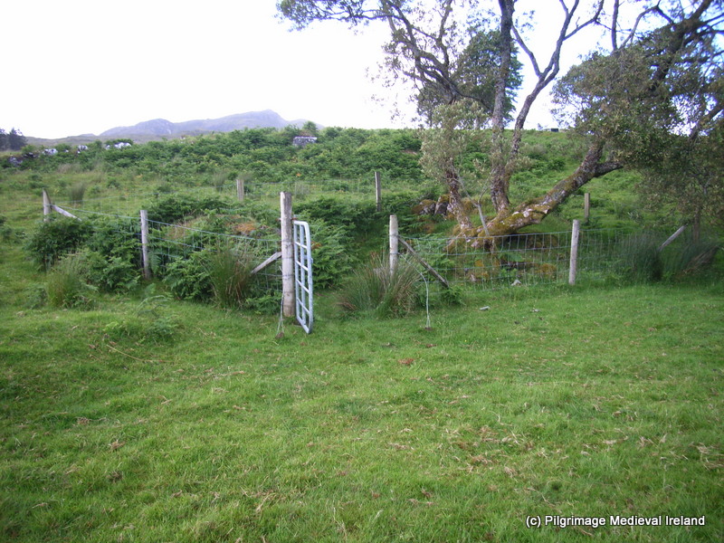
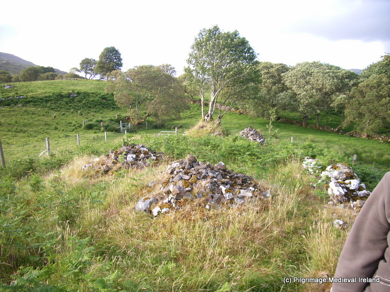
Today the site  is a mound  covered in thick vegetation with two crosses on the summit. On the southeast side of this mound are traces of walls of a structure (most likely the church).

1-DSCF1186

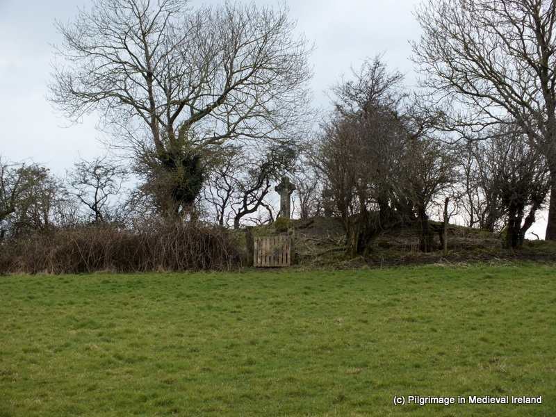
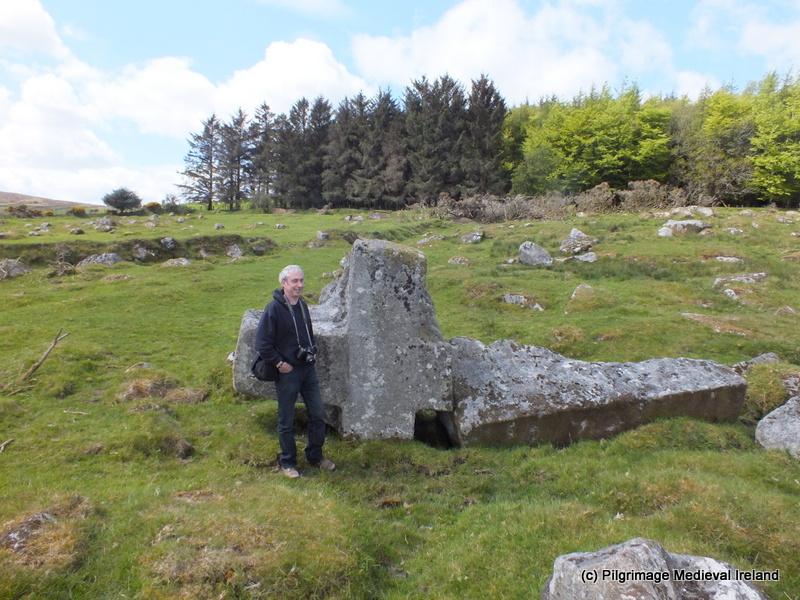
Waterstown church in the parish of Rathvilly

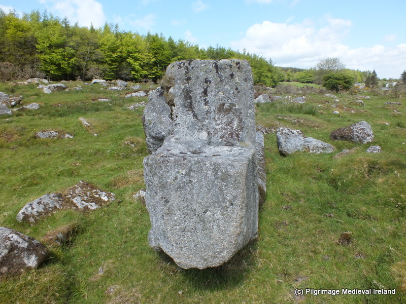
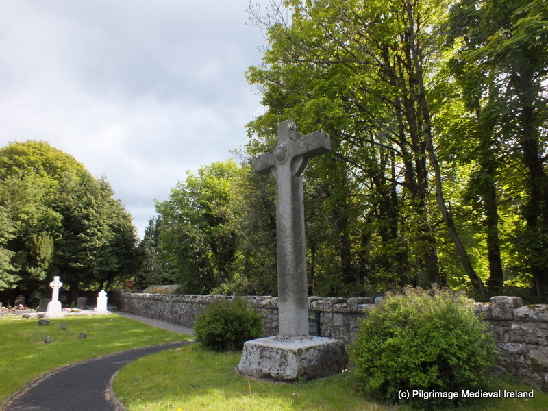
On the summit of the mound are two  medieval crosses. The larger of the two,  is a high cross made of granite, it is undecorated cross with a solid wheel and edge moulding and sits in  a large rectangular cut stone.

1-20130318_131445

Granite high cross at Waterstown

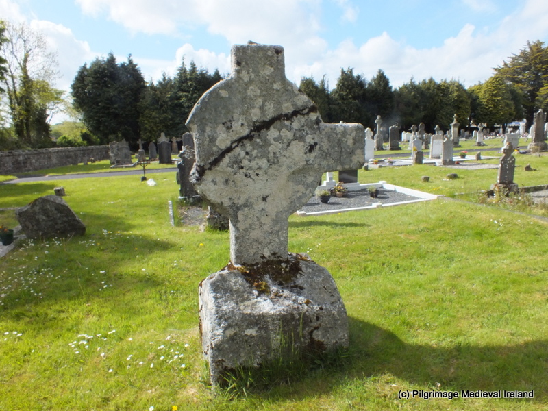
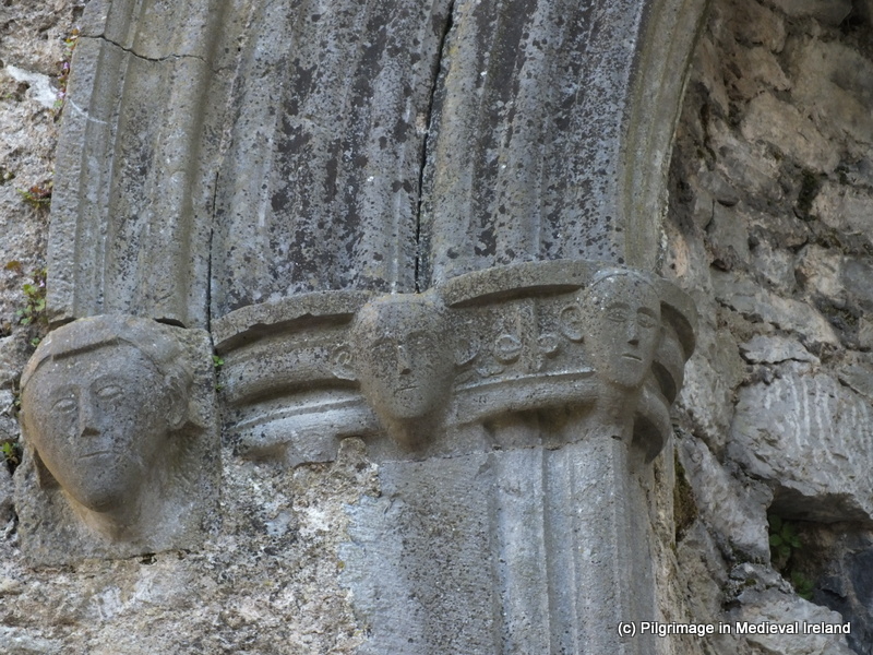
The second smaller cross  is made of limestone. It  has a solid wheel but the arms of the cross have been damaged and it is decorated on both sides.  The front face depicts the crucifixion of Christ and back has an abstract design. The cross sits in a large earth-fast boulder.

1-20130318_132737

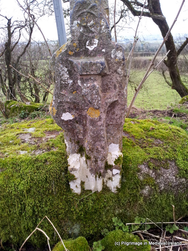
Late Medieval cross at Waterstown

These two crosses may suggest that this was more then just a parish church in  the early medieval. I have not come across  any reference to pilgrimage taking place here at Waterstown or  a dedication to a saint  but given the areas connection with St Patrick perhaps we can speculate the  site was associated this saint.

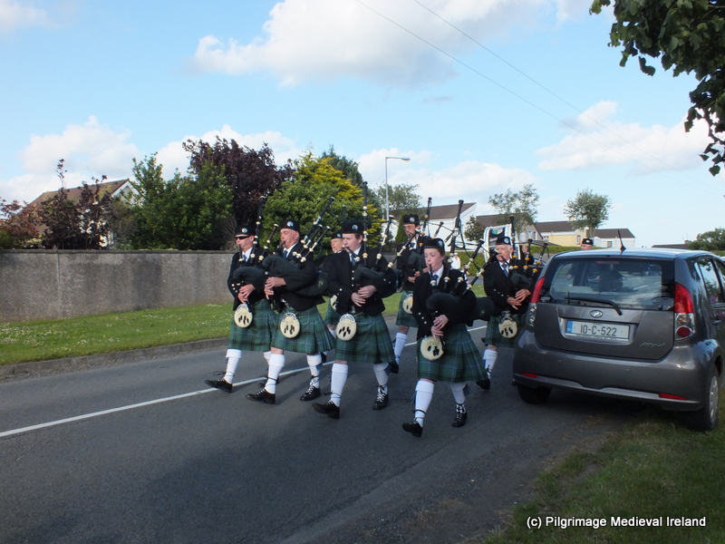
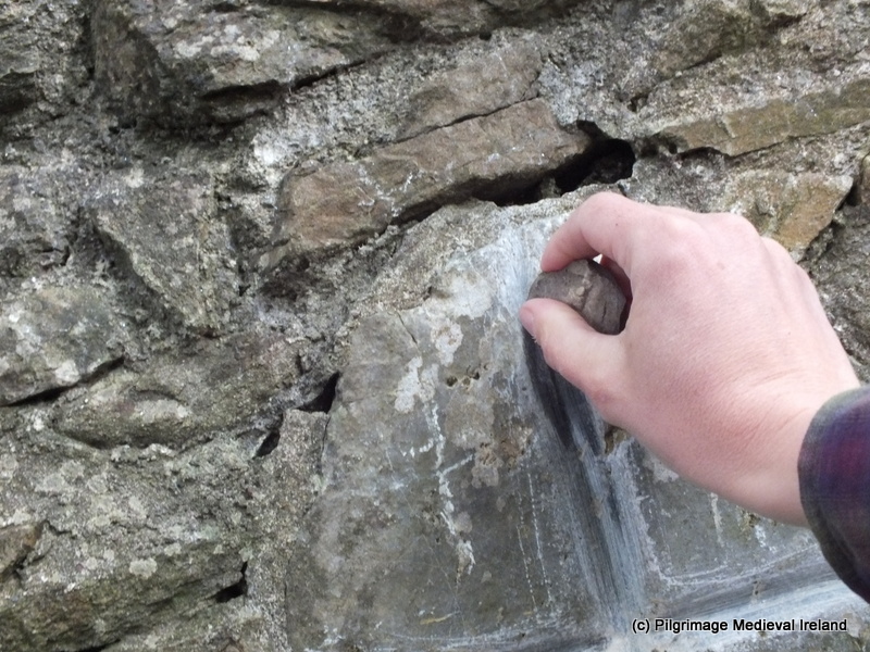
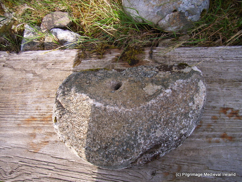
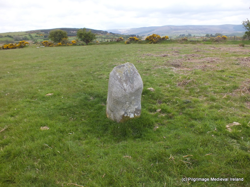
A short distance away in the townland of Ladystown at the side of the  Rathvilly-Balintglass  road is the  shrine  called Clogh-a-phuill  (stone with the hole). The shrine is the base of a cross that  most  likely came from the nearby church site at Waterstown. It may even have  supported smaller decorated cross mentioned above.

1-DSCF1172

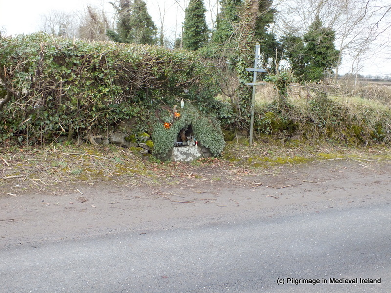
Clogh-a-phuill the wayside shrine at Ladystown in the parish of Rathvilly

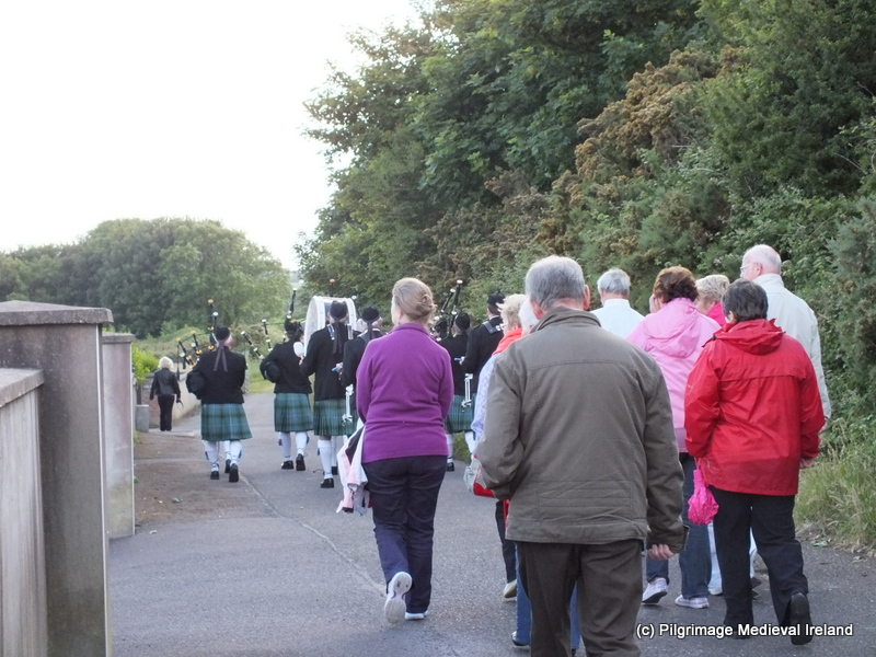
The shrine is still visited by people and while  I was at the site a man came along and stopped his car, got out and said some prayers here before heading away .

1-DSCF1173

Clogh-a-phuill

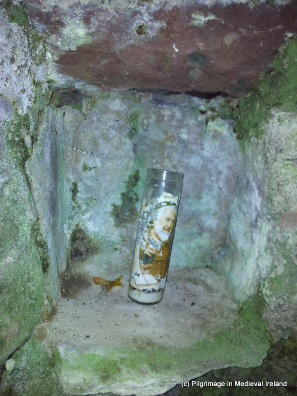
There is an array of votive offerings  holy statues, rosary beads and coins left here by pilgrims.

1-DSCF1175

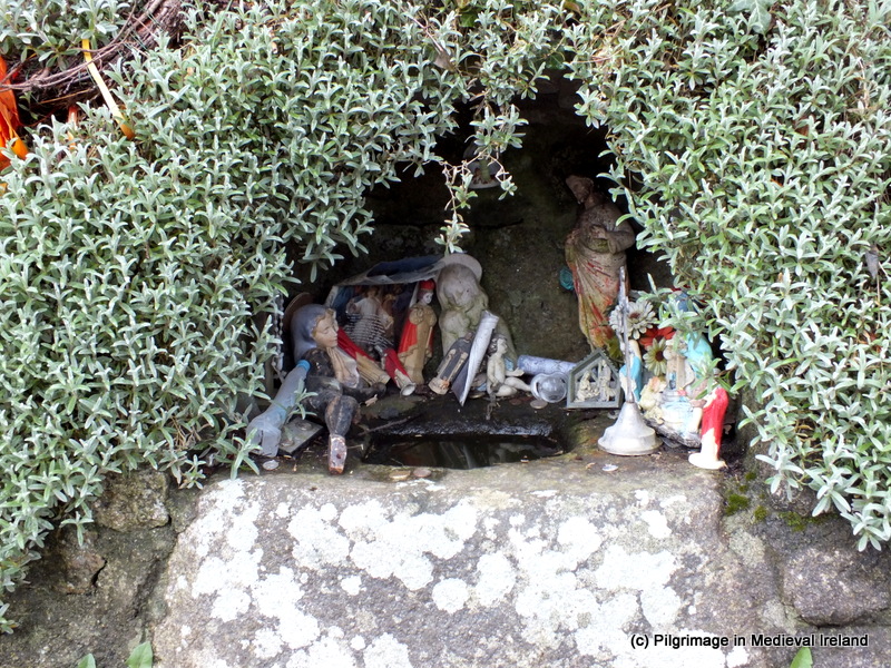
Votive offerings at Clogh-a-phuill, Ladystown

I am continuing to do research on this site so I will keep you posted on any new findings. I would also be delighted to hear from anyone who has any information on the modern pilgrimage at either site

References

Ryan, J. 1838. The History and Antiquities of the County of Carlow. Dublin: Richard Moore.

My photos on exhibition at Eigse festival in Newcastle

Each year the village of Newcastle in South Tipperary has a festival called the Éigse  festival which celebrates the   life in the Breac Gaeltacht of Newcastle. This weekend event consists of lectures, walks and music events  relating to Gaelic language, ecology and heritage or the area.

1-SAM_1631

Medieval parish church of Newcastle

My contribution to this years event was a talk on the  Historic Graveyard  at Newcastle  and  also many of my photos,  that were taken during the  graveyard recording  late last year, formed part of an exhibition at the local community hall.

1-67

One of the oldest gravestones at Newcastle dating 1778

A big thank you to the organisers of the event, especially Michael Desmond  and to all who turned out to the talk and to see the photos.


Coole Abbey Co Cork

Coole Abbey  is a really interesting site, located about 4-5 miles outside of the scenic town of Castlelyons in Co Cork.  The site of an early medieval  monastery,  founded  by St Abban in the 6th century,  today  all that remains of  the early monastery  are two churches and a holy well. Of the surviving churches the  smaller of the two  sits in a field beside the road from Conna to Castlelyons. The  larger church is located c. 200m to the northeast  in an  historic graveyard.

map coole

Location map of the churches and Holy well at Coole (taken from Bing Maps)

Placename Evidence

Cúil  is the Irish for Coole and it translates as corner or nook.  Early medieval documents  refer to the abbey as Cúil  Chollaigne.

The Saints Associated with Coole

Coole is associated with two saints  Abban (Abán)  and Dalbach.

St  Abban  was born into the Uí Chormaic (Dál gCormaic ) dynasty in Leinster. He is associated with the churches of Mag Arnaide (‘Moyarney’/Adamstown, near New Ross, Co. Wexford) and Cell Abbáin (Killabban, Co. Laois) . In Munster  he established a monastery at  Ballyvourney, Co Cork  which he later surrendered to St Gobnait. He is also associated with Killagh Abbey near Milltown Co Kerry and Kilcrumper near Fermoy and  he founded  the church at Coole  (Cúil Chollaigne). Abban has two feast days the 16th of March and the 27th October (O’Riain 2012, 51-52; 254).

The second saint  association with Coole is St Dalbach. Dalbach  and the church at Coole were associated with the anchorite movement known as the ‘Céili Dé’ (clients of God)  who flourished in Ireland  between 750-850. The saints pedigree links him to a Cork based tribe known as the Uí Liatháin. The saints obit was entered in the annals for the year 800 and his feast was assigned to the 23rd October ( O’ Riain 2012 ,254).

There are few  early medieval historical references to the site. One that is of interest is found in Mac Carthaigh’s Book a collection of annals that date from 1114 to 1437.  The annals for the year  1152  states the churches of

 Cork, Imleach Iubhair (Emly), Lismore, and Cúil Chollainge (Coole) were burned in the same year.

The Annals of the Four Masters also record that in 1151

Gillagott Ua Carrain, lord of Ui-Maccaille, was killed at Cuil-Colluinge, by the Ui-Mictire

Architectural remains

The Cork Archaeological Survey mentions the  presence of a  low curving earthen bank   that can be picked out  c. 70m north of the smaller church. The bank  curves northwest – eastnorthwest  in the field and it may  represent evidence of an early  ecclesiastical enclosure.

The two surviving churches date to the  12th & 13th centuries. The smaller  church is  built of sandstone and most of the fabric dates to the 12th century. It  is rectangular in shape, with  only the east gable surviving to any great height.

Smaller church beside the road

Smaller church beside the road

A modern style has been inserted into the west gable.  The church has some pre-Romanesque feature such as antae which  project from the  east ends of the north and south wall. It is thought antae which are corner projections  found on some early stone churches  were attempts to imitate  wooden churches  which  had stout corner posts jutting out beyond the gable-wall. Another early feature is  a gable headed (triangular headed) east window with exterior rebate  which is found in the east gable.

06-DSCF2046

East gable of church showing gable headed window and antae

Archaeologist Tomás Ó Carragáin (2010, 102-103)  suggests the gable headed window  dates to the  11th century.  Within the church there is a stone altar which sits in front of east window.  It is likely it was  restored at some point in the past by the office of public works (ibid., 336). There is  also a local traditionally that  mass was said here in penal times .

Altar in front of the wast window

Altar in front of the east window

The second church is larger in size and  it functioned as the parish church in late medieval times. Today it  is situated within a historic  graveyard  filled with 18th and 19th century gravestones.

Larger church at Coole

Larger church at Coole

The  church consist of a nave and chancel.  The nave appears to be Romanesque  c. 12th century  in date  and the west wall has traces of a roll-moulded jambs in the lower course of the door. The nave  is a later addition and dates to the 13th century.  The east gable of the nave has a piece of Romanesque sculpture in the form of  a finely carved  rosette.  Similar rosettes stone in England date 12thc century. This stone was  probably re-used from an earlier church here.   A similar type stone is found c. 20 miles away  at another small monastic site at  Kilmolash in Co Waterford.

Rosette  carving in the -- gable

Rosette carving  east gable

A large  well carved pointed arch,  which appears to be  a later insertion, joins the nave and chancel.

Arch between  chancel and nave

Arch between chancel and nave

The  chancel  is later then the nave and was  added in the late medieval period  (Ó Carragáin 2010,  307).

Door into ----

Pointed doorway in the south wall of the  church

Records dating to 1615 state the church’s nave  was ruinous but  the chancel was in repair. The building ( chancel) was in use until the 18th century  when it was finally abandoned.

Relics of Coole

The Pipe Rolls  of Cloyne  mention a relic  called the Coole missal  upon whose page margins  important memoranda of the lands and rights of the church were recorded (Power  1919, 47)

Waters (1927, 53) writing in 1927  mentions that a relic of Saint Patrick’s tooth was kept here but he does not say where he came across this information and I cant find any reference to this relic in the   Lives of Abbán  etc or in antiquarian books relating to Cork. If there was a relic of  St Patrick’s tooth here it is likely to have come here in the  later medieval, as Patrician links in Munster  for the early medieval period are minimal or its equally possible it is folklore that developed around the site in the post medieval period. These are just some initial thoughts and I will delve into this  more deeply in the coming weeks and keep you posted on what I find out.

Holy well

Below the church is  a lovely holy well. There is little information about the well  but it is  still in use as a number of statues and votive offerings sit on top of the small corbelled well house that covers the well.

The well is marked simply as  holy  well  on the 1st edition OS  maps and Power in 1919 who is usually most detailed in his recording of sites also refers to the site as simply the holy well (Power  1917, 51) and  that  it was ‘still venerated’

013-DSCF5262

The information plaque at the sites  connects the well to St Devlet  and suggests this is an Anglicisation of St Dalbach. The plaque gives the following  folk tale of the origin  for the well.

Long ago the blessed well at Coole was just a spring. A female inhabitant of Coole Abbey House was reputed to have  seen a monk praying at this spring and she ordered an oratory to be built over it.

It also states that the waters here hold a cure for sore eyes and warts but one has to visit the well and ‘pray at  each of the seven kneeling  stones exposed around the outside  of the well chamber’.

Id love to hear from anyone who knows more about the well and the traditions associated with it. If anyone does have any information you can email me at pilgirmagemedievalireland@gmail.com.

References

Thanks to Terry O’Hagan the author of the blog Vox Hibernionacum  for discussing the cult of St Patrick in Munster, but any omissions or misunderstandings are my own.

http://www.askaboutireland.ie/learning-zone/secondary-students/art/irish-churches-monastic-b/early-monastic-churches/

Coole Abbey & Church

Ó Carragáin, T. 2010. Churches in Early Medieval: Architectural, Ritual and Memory. Yale Press.

O’Keeffe, T.  2003. Architecture and Ideology in the Twelfth Century Romanesque Ireland Dublin: Four Courts press.

 O’Keeffe, T 1994 “Lismore and Cashel: Reflections on the Beginnings of Romanesque Architecture in Munster “JRSAI 124, 1 18-52.

Ó Riain, P. 2011. A Dictionary of Irish Saints. Dublin: Four Courts Press.

Power, Rev. P 1919. ‘The Churches of Coole County Cork’ JRSAI Vol.1 , 47-54.

Pilgrimage to St John’s well at Mushera Mountain Co Cork.

On Monday evening last on mid summers day  I headed to the annual  pilgrimage at St John’s holy well on the slopes of Mushera Mountain.  So after work armed with directions from my friend Cork based archaeologist Flor Hurley, I headed off to find the well and got very lost …. Nothing to do with Flor’s directions and a bit to do with my bad sense of direction  but I  did find my way eventually. My short unplanned diversions helped me to appreciate  that this is truly a beautiful part of the country. I noticed a lot of signposts for wedge tombs, stone circles and standing stones in my travels  so I will have to take a trip back to do some exploring.

The well

The holy well sits at the edge of a forestry plantation close to the road through the mountains.

1-DSCF9573

St John’s well and surrounding landscape

The well is a natural spring that is cover by a large grotto.   Within  is a statue niche with a large statue of St John. There were lovely bunches of wild flowers and  some cups left beside the statue. The well is accessed through a rectangular opening below the statue and I noticed that some coins had been thrown in. There was also a box for petitions or notes what would be written by pilgrims to ask the Saint to intercede on their behalf.

1-DSCF9575

Statue of St John and recess for access to Holy Well

A circular area has been tarred in front of the grotto/well and  twelve stations of the cross are found along the edge of this area. This circular area is linked to a lower car park and the main road via a small tarred roadway.

1-DSCF9572

Station of the cross along the edge of the car park in front of the well

The modern grotto was erected in the 1950’s and the car park and stations of the cross are also a recent creation. There are a number of benches which have been donated by families in memory of loved ones which make for a peaceful place to sit.

The site looked very different  in the past as this photo from the 1920s shows  it consisted of a small corbelled structure set in heath land.

1-DSCF9570

St John’s well in 1920

Traditional Stations at the Well

Those partaking in the traditional pilgrim rituals at the well  are said to be “paying of the rounds” this is an expression I haven’t heard before as  at other well sites the pilgrim is described as “doing the rounds”.  The rounds consist of  Seven Our Fathers and Seven Hail Mary’s and Seven Gloria said while kneeling in front of the well. Then one decade of the rosary is said three times as the pilgrim circles the well. The prayers conclude with the Rosary being said in front of the well.  I noticed two flat portable stones with crosses incised by pilgrims on the step in front of the grotto. The incising of the crosses appear to be part of the modern pilgrim traditions here.

1-DSCF9582

Stone incised with crosses made by pilgrims

This well is one of   three holy wells located on Mushera mountain. All three  are called St Johns’s Well and all dedicated to the same saint. One is in the adjoining  parish of  Aghina  on top of the mountain and the   second is located on the old Butter road   in Banteer parish.  The well discussed here is  found is  in the parish of Millstreet.  Devotion to the other wells has waned over the years and now  the well in the parish of Millstreet is the main focus for devotion in the area. Time didn’t allow for me to visit the other wells but I do plan to head back before the end of the summer.

Like many other Irish wells the waters here are believed to have a cure . The wells waters are reputed to cure warts and one lady I spoke with at the pilgrimage mass told me her son had been cured of warts after coming to the well.

Folklore of the Saint

Tradition holds that  the saint came to the  Muskerry hills with  his three sisters.   His  three sisters  were saint’s  Lasair,  Ingean Bhuide and Latiaran who I discussed  earlier in the year on Facebook page. The feast days of the sisters   were honoured at quarterly periods and may be associated with pre Christian religion. The connection with the well here with mid summer may also suggest that St John like his sisters evolved from pre Christian deity at the well when an earlier cult at the well was Christianised.

Past Pilgrimage & the Pattern Day Tradition

Like many  holy wells this was the focus  of a pattern day festival

The Millstreet.ie blog  gives the following  discussion of the pattern day

June 24th is the feast day of St John and down through the ages it has been a big occasion on the mountainside.  Up to about 1940, St John’s Day had a pattern as will.  The pattern consisted of tents set up abut a mile and a half from the well on the Macroom side, in the townland of Moulnahourna.  There were sweet and cake stalls, lemonade, cigarettes and porter tents, and of course the indefatigable three-card-trick men.  Occasions for celebration at that time were few and far between, Christmas, St John’s Day and March fair which lasted three days in Millstreet.  Due to this and the presence of the porter, these occasions rarely ended without a fight, these may have been faction fights.Two sisters from Millstreet, Han and Judy Murphy sat on either side of the Well “selling the water”.  One of them would fill a saucepan with water from the Well and received payment for it.  Pilgrims wisited the Well in the morning.  It was normal practice from Ballinagree and Rylane areas to visit the Well on top of the mountain in their own parish.  Most other pilgrims visited the Well  on the Millstreet side as is the case today.  After doing the “round” they continued on to the pattern to enjoy the remainder of the day.  An old character from Ballinagree, Bill O’Dea always turned up to entertain the crowd with his songs.  Another man from Bawnmore, nicknamed   St Joseph because of his long white beard also sang to the crowds.  His real name was Lucey.  Over the years the crowds got smaller at the pattern until eventually it was no longer held.  The dancehalls took over at that time, but local people still come to pay their “rounds” as usual.

Modern Pilgrimage at St John’s Well

This years  pilgrimage consist of mass which began at 8pm at the well on the 24th of June.  Many people visited the well before and after mass and took water home in bottles.  Despite it being June it was really cold probably due to the altitude of the site.

1-DSCF9611-001

Pilgrims assemble for mass at St John’s Well

Many of the older people parked in the area in front of the well and some stayed in their cars throughout. The rest of the people gathered around the edge of the  circular carpark.

1-DSCF9602

The Priest saying mass

Three priests  officiated at the mass Canon Jackie Corkery, Fr Frances Manning and Fr James McSweeney. The Millstreet Pipe band and the choir provided music throughout.

1-DSCF9641

The Millstreet Pipe Band at St John’s well

This is a real community  event and people from all the surrounding areas assemble here each year. I look forward to returning to find the other Holy Wells and seeing what I can find out about the history of the site.

References

St Johns Well

Pilgrimage to St John’s well Carrigaline, Co. Cork

The 24th of June is the feast of St John the Baptist. This day also coincides with the pagan celebration of mid summer and many pagan traditions continue even down to modern times such as the tradition of lighting bonfires.  There are many holy wells around Ireland dedicated to St John the Baptist and pilgrimage is still undertaken on the saints feast day at a large number of them.

Location Map of St John's well at the edge of Carrigaline town (taken from Google Earth).

Location Map of St John’s well at the edge of Carrigaline town (taken from Google Earth).

On  Sunday  last, St John’s Eve I attended the annual pilgrimage to St John’s well in the town of  Carrigaline, Co Cork. St John’s well or Tobar Eoin Óg  is  located in small wood in the townland of Ballinrea on the outskirts of the town of Carrigaline.  Also attending the  pilgrimage was  Richard Scriven  (Geography UCC)  who is currently doing very interesting PhD research  on modern pilgrimage in Ireland. For more details of Richard’s research check out his blog liminal entwinings.

St John’s Well

The 1st ed Ordnance Survey map of 1840  records the  well as  St Rinoge’s well elsewhere it is called Renogue’s well . Rinoge/Renogue  is likely a corruption of Eoin Óg  the Irish name for the well.

The site consists of  a spring well covered by a corbelled structure, beside the well is a large tree surrounded by a low circular wall with a stone plaque which  provides a short history of the site.

1-DSCF9538

St John’s well

A number of benches are located  at the site and  steps made of railway sleepers make the site more accessible. A small stone altar is located opposite the well.

Lewis’s Topographical Dictionary of Ireland  dating to 1837 gives the following account of the well

At Ballinrea there is a mineral spring, which is considered to be of the same kind as that of Tunbridge Wells, and has been found efficacious in cases of debility; and near it is a holy well, dedicated to St Renogue, which is resorted to by the country people on the 24th of June.

The Carrigaline Parish websites states that

According to tradition the well was discovered by a blind man whose sight was restored. In gratitude he built the beehive shaped stone surround, which can be still seen today.

It is recorded that in the early 19th century huge crowds  of people attended a  patron/pattern day  on St  John’s Eve (23th June) at the well.

According to the plaque at the well, the water  has healing powers and it is customary for pilgrims to say a decade of the rosary at each of the inscribed crosses  that are found in the walls of the well house. The practice of incising crosses is seen at many other pilgrim site such as St Declan’s well at Ardmore, Co Waterford and the practice seems to be a post medieval and  modern tradition.

1-DSCF9502

Well house showing one of the incised pilgrim cross over the door of the well.

Modern Pilgrimage on St John’s Eve

It is an annual tradition for the people of Carrigaline and the surrounding area to visit St Johns well on the eve of the saints feast.  It’s a tradition which likely goes back generations.  Pilgrimage in 2013 began with pilgrims  gathered on the Ballintrea road close to the Dun Eoin housing estate  at 7.15 pm.  People stood around and  chatted and waited for others to arrive. When a crowd had gathered at 7.30 the Carrigaline  pipe band  began a processional walk to the well. The band was immediately  followed by the  parish priest who was then followed by the rest of the people ( pilgrims). The Procession headed along a lane way with a signpost for the well, past some house,  then on to a grassy lane which leads down into a grove of trees. The band played throughout the procession and were really excellent.

009-DSCF9326 (1)

The Carrigaline Pipe Band heading the procession to St John’s well.

039-DSCF9342 (1)

Pilgrims in procession to the well

The walk  was very pleasant and took about 5-10 minutes to complete.  When we all arrived at the well the band took a well deserved brake  and lines up beside the alter. The rest of the people assembled around the clearing facing the stone alter opposite the holy well . There were  two priest from the parish of Carrigaline present to lead the prayers.

1-DSCF9435

The prayers began with the  sorrowful mysteries (five decades of the rosary an explanation of rosary is in the references below).  The parish priest lead the prayers  and  moved around the well clockwise, in the same manner as any pilgrim visiting the well to perform the stations would do.

128-DSCF9389

The a cross was incised with a small stone at each of the crosses around the well.

When each decade of the rosary is begun the pilgrim takes a stone and  scratches a cross into the incised  stone.

1-DSCF9524

Pilgrim incising cross on one of the stones

These stones five in total are located around the well and have deeply incised crosses. The crosses have been created by generations of pilgrims who visited the well.

1-DSCF9534

Cross incised by pilgrims at back of the well

Following the rounds of the well  there was a ceremony called Benediction of the Blessed Sacrament  for those of you who don’t know  what that is it is a devotional ceremony, the sacrament (host) is displayed in a monstrance  in this case  on the small stone altar opposite the well.  The  a priest blesses the congregation with the Eucharist at the end of a period of  prayer.

113-DSCF9381 (1)

A number of  hymns were sung by the choir and played by the pipe band such as ‘Faith of our Fathers’. When the ceremony finished  many of those present lined up and took water from the well. Some of them incised the cross over the well door. Unlike other sites people didn’t seem to bring water bottles with them.

300-DSCF9482 (1)

I returned to the well the following morning,  to see what it was like without the hustle and bustle of people.   It really is one of the most beautiful wells I have visited and so peaceful with lots of singing of the birds.

References

http://www.carrigalineparish.ie/index.php/parishhistory/

http://www.carrigalineparish.ie/index.php/parishhistory/

http://en.wikipedia.org/wiki/Benediction_of_the_Blessed_Sacrament

http://en.wikipedia.org/wiki/Rosary

St Colmcille’s well Disert Donegal

Today is the feast day of St Colmcille who along with St Patrick and St Brigit he is one of the three patron saints of Ireland. In 2008  my good friend Fiona Beglane  brought me to  see  a holy well  associated with the saint. The well in question is located   in the townland of Disert, in the parish of Inver, in Co Donegal. Over the last few years I have been to a lot of pilgrim sites but  this is  one of the most beautiful place  that I have spent time.

Location

St Colmcille’s well  is situated in rough pasture at  the foothill of the  Carnaween hill and the Bluestack  mountains close to the banks of  the Eanybeg river.  As you can see from the photo below this is  the most glorious of  locations.

26-RIMG1175

The site consists of a holy well located close to a small graveyard that is surrounded by a stone wall and the remains of  megalith and associated enclosure.   All three  monuments  are points in  the pilgrim landscape of the site.

24-RIMG0299

The Eanybeg river

Meaning of Placename

The townland name Disert (Dísert in Irish) comes from the Latin word desertum meaning desert. During the 4th century  there was a movement of hermits in the East (Syria and Egypt)  retreating into the desert to live a life of isolation and prayer. It is probable that the idea of  living as a hermit came to Ireland from the East  via Gaul and Britain. The Irish placename ‘Dísert,’ and its variants ‘Dysert,’ and placenames of which ‘Dísert’ is a component, for example, Dísert Diarmata, Castledermot, bear witness to the existence of hermits and hermitages in  Ireland. There is no visible evidence of an early or  late church here but  according to tradition St Colmcille blessed the well here which was already of local importance.

History of the Site

The earliest references to Disert  dates to the 17th century.  The History of the Diocese of Raphoe mentions that Hugh Roe O’Donnell, chief of Tir Chonaill gave an estate at Disert to the Franciscans around the year 1460. Yet according to Meehan (1997, 14)   the Franciscans have no record of their order in the parish of Inver. Local tradition held that the Franciscans  who fled their monastery at Donegal after the Plantation of Ulster lived east of Disert in the townland of Friary and made their way between Killymard and Glenfinn along Casan na mBrathar.  Local tradition does states  seven monks were buried in the ‘garden’ or enclosure at Disert (ibid).

According to the Ordnance Survey letters for 1835 & the Annals of the Four Masters in the year 1611

Niall O’Boyle Bishop of Raphoe died at Gleann Eidhnighe on the 6th of February and was interred at Inis Caoil (Inish Keel).

Meehan(1994, 14) and the notice board at the site state it was at  Disert that the bishop died and  was carried out of the hills to his Kiltoorish for burial.

St Colmcille’s Well

03-RIMG0278

St Columcille’s well is located within the enclosing fence

The  holy well is fenced off by wire railing.  The well covered by a  trap door which need to be opened to access the water.  The well shaft/hole is lined with roughly coursed stones and the well very little water when I visited it  in the summer of 2008. There are two cairns beside the well which have kind of merged together and are covered with vegetation.

02-RIMG0277

St Columcille’s well

The graveyard

Close to the well is a wedge shaped graveyard which is defined by a stone wall. The graveyard was used  for  the burial of  adults  until the 1840’s  and for unbaptised  babies until the 1930.  Within  the enclosure  is a stone altar with a metal cross beside an old tree.

15-RIMG0290

Interior of graveyard with holy well in the background

Sitting on the altar are a number of holy stones one of which  is a quern stone. There are a number of  low stones  in the grass which act as graves marker  and    four low stone mounds or  penitential cairns scattered about the graveyard. According to  Walking Ireland Website the site was used during penal times as a safe place to say mass.

The priest was said to travel up and down the river Eany between the Alt in Ardaghey saying mass in each, on alternate Sundays. The bullaun stones were said to have been used as candle holders. Fr. Dominic Cannon was parish priest of Inver from the 1770″s until his death in 1801.

05-RIMG0280

Altar within the graveyard

St Colmcille’s Arch

St Colmcille’s Arch  is another part of the pilgrim landscape. The arch is  what appears to be the remains of  a  ‘Megalith’  it consists of  two orthostats (upright stones) approximately 1m high with a lintel stone resting on them.  Piled on the lintel stone are small stones which form a pyramid.

56-RIMG1205

St Colmcille’s arch

When you pass through the arch you enter a  sub oval enclosure roughly 5m by 6m.

The Turas at Disert was noted for its cures. East of the megalith is a large slab or concave stone. The penitents lay on this flag and pressed their back into the cavity. This was a noted cure for backache. The well water was said to cure toothache. The water in the bullaun stone was said to cure warts. It was also used to cure eye complaints. In those days people came to the Turas at Dysert on June 9th – the Feast of Colmcille – from far and wide. (Meehan 1997)

Modern pilgrimage

According to the notice board at the site in former times people came here on the 9th of June the feast of the saint. In modern times mass is said in the graveyard on the first Sunday of July followed by the  traditional climb  of the nearby Carnawee Mountain. In the past  at the  top  people meet those from the Glenties side of the mountain for an afternoon  &  evening of dancing and singing.  Fiona Belgane carried out a detailed survey of the site called Disert: St Colmcille’s Well and Megalith, which states

pilgrims traditionally start at the  well with prayers as they walk around the  stones barefoot whilst praying. They then walk to the altar, over the hill whilst saying the rosary. At the altar they circumnavigate the stones found there before mass is said. 15 decats of the rosary are said whilst walking around the well. ( Unpublished project by Fiona Beglane)

Meehan (1997, 14-15) states

As well as prayers being said at the well the Rosary was recited and Paters and Aves were said as the pilgrim made his or her way round the heaps or cairns walking on the right hand or deiseal and placing a pebble on top of the cairn as the prayers were said.

Disert  is renowned for cures,  and I have already mentioned  the healing stone east of the megalith where penitents lay on the flag and pressed their back into the cavity, to cure backache. The stone reminded me of  St Kevin’s chair at Hollywood. Penitents would also crawl through the megalith (St Colmcille’s arch)  and  rub the affected part of the body against the stone. The water of the well was a cure for tooth ache. The water in the bullaun stone was a cure for warts. The quern stone was used to cure eye complaints, the pilgrim would hold the stone up to their eye and look through  the hole at its centre.

06-RIMG0281

Quern stone known as the “Cure”.

Local tradition  has it that a test of male virility was to carry two stones from the altar in the graveyard to the well and back three times, whilst holding them from the top.

07-RIMG0282

On the left of the photo are the stones carried to the holy well and back.


The soil from Disert   is reputed to be holy and to have certain powers.  Like other Columban sites in Donegal, such as Gartan and Tory, the clay at Disert is said to banish rats. The clay must be lifted from the right hand side of the altar and in former times great stress was laid on it being asked for and received with great reverence. Newspaper reports have suggested that uranium in the clay caused it to banish rats but these reports haven”t lessened the belief in its power. Until recently Disert clay was often put in the foundation when houses were being built  (Meehan 1997, 17)

References

Anon. Information Board at the Site.

Beglan, F.(unknown) Disert: St Colmcille’s Well and Megalith.unpublished.

Meehan, H. 1997. ‘Disert in the Blue Stacks.’ Donegal Annual, Vol. 49, 12-23.

O’Donovan, J. 1835. Ordnance Survey Letters Donegal.

The Disert Circular Walk http://www.walkingireland.ie/section-2.aspx?item_id=140

The ‘Deer Stone’ a 19th century pilgrim station at Glendalough

Today is the feast of St Kevin of Glendalough. In recent months I have been doing some work on the 18th and 19th century Patron ( pronounced Pattern) Day celebration at Glendalough. Given the day that is in it, I will briefly talk about one of the post medieval stations visited by pilgrims to Glendalough called the ‘Deer Stone’.

1-20120828_123153

The Deer Stone at Glendalough

Location
The ‘Deer Stone’ is located beside the main ecclesiastical settlement at Glendalough. It sits on the south side of the Glenealo River, directly opposite ruins of St Ciarán’s church,
beside the green road leading to the upper lake.

Picture1

Ordnance Survey 25 ” map showing location of the Deer stone

What is the The Deer Stone ?
The Deer stone is a bullaun stone. It is one of a large cluster found around the main monastic settlement and the lower reaches of St Kevin’s road. I have explained what bullaun stones are in earlier post but just to recap. Bullaun stones are artificial basins or hollow/depressions in rocks, boulders and stones. They are thought to date to the early medieval period. The majority are found at early medieval ecclesiastical sites but some are found in isolation.

There is a lot of debate as to their original use and function. Some argue that they are medieval pilgrimage stations/monument pestles of ritual or devotional use for  turning stones within the hollows. Others think they has a more practical use such as for grinding metal ores or herbs.It is interesting that an archaeological excavation carried out in 1979 prior to the construction of a car park for the visitor centre revealed large amounts of slag. Slag is a waste product of metal processing and its presence implies an iron working industry at Glendalough.

Whatever their original use many of these stones over time developed associations with the saints and were part of the post medieval pilgrim rituals.

1-20120828_123200

The basin of the Deer Stone at Glendalough

The Deer Stone is a large granite boulder ( .77m by .86m by .30m) with a single conical depression or basin. It is not mentioned in medieval sources but it was a point of devotional object for post medieval pilgrims.

Where did the stone get its name?

The stone derives its name from a legend associated with St Kevin. The legend hold that the wife of one of the saint’s workmen died giving birth to twins. The workman came to the saint to ask for help. St Kevin  set about solving the problem and having prayed to God for help  a doe came to a certain spot and everyday shed milk into a hollow in a stone while the workman sat on a nearby boulder. Legend has it that the man’s finger prints caused the hollow in the boulder  which was hence forth known as the ‘Deer Stone’.

The origin legend of the stone appears to be an adaptation of a story mentioned in the Saint’s Life. St Kevin fostered  a  boy child called Foelán. Fostering began when the boy was still a baby. To feed the baby a  doe came down from the mountain each day and waited until she had been milked by one of the monks. The child thrived  and ultimately inherited his father’s estate.

Evidence for Pilgrimage

Glendalough was a place of pilgrimage from the time of St Kevin’s death and pilgrimage is recorded sporadically throughout the early and  late medieval period, it is generally expected that Glendalough was a centre of regional if not national pilgrimage during this period. Following the reformation  pilgrimage continued within the valley and the main burst of pilgrimage activity were focused on the saint’s feast day the 3rd of June. Like the patron day celebration elsewhere in Ireland St Kevin’s day at Glendalough was a mix of pious devotion and boisterous merriment hat involved eating and drinking, dancing and something fighting.  The day also attracted tourist who came to observe the patron day celebrations. In 1813 Joseph Peacock painted  the patron day at Glendalough and it shows the secular side of the celebration.

The patron day celebration  was suppressed by Cardinal Cullen in 1862 as part of a movement by high-ranking Catholic clergy to wipe out the celebration. They believed that the secular elements brought the religion into disrepute and that the religious devotions  rounding, walking in bare feet or crawling in bare knees were backward and superstitious.

Accounts of the pilgrimage from the 19th century suggest that the devotional landscape of the pilgrimage was confined to the area between the upper and the lower lake ( main monastic cluster).  Bullaun stones and holy wells played a central part of the 19th century pilgrim landscape at Glendalough. The Deer Stone was one of several devotional stations for pilgrims.

I am still in the process of researching  this landscape  and the Deer Stone but here are some comments on the stone.

Writing in 1873 William Wilde

The Deer Stone was visited by strangers and pilgrims, and always found to contain water.

Fitzgerald writing in 1906 noted

There is  said to be a cure obtained from the water lodged in the hollow in “Deer Stone”; but to be effective, it should be visited fasting before sunrise on a Sunday, Tuesday and Thursday in the same week and on each occasion a part of the ceremony is to crawl round it seven times  on the bare knees with the necessary prayers.

315348_519201294781728_1756404293_n

Woman in prayer at the Deer Stone (Photo taken the Roundwood & District Historical & Folklore Society Facebook page)


An exciting day out in the King’s River Valley

On Saturday I gave a lecture on St Kevin’s road  at  the Hollywood  Co Wicklow . The  audience  was great  and made me feel so welcome.   While having a cup of tea and a chat afterwards   I was told about a number crosses and old roads at the northwest end of the King’s River Valley.  The following  morning I set off to see some of these sites  in the company of  four local people  C.J, Ite, Francis and John,  who kindly gave up their Sunday to  show me around.

So armed with out maps we headed up the Johnstown road  to Valleymount to the townland of Ballintubber.

11-DSCF6873

View of Poulaphouca Reservoir from the Johnstown road

In Ballintubber is one of the most amazing archaeological site I have ever visited. The site is an enormous broken  granite cross.

30-DSCF6892

Broken high cross with Francis who is 5 ft 7″ acting as a scale

This large cross was in the process of being moved onto its side  when it broke and was abandoned. As I looked at this  broken cross  I couldn’t help but wonder what the mason said when it broke, I imaging given the effort involved in get the cross  to its semi completed state there was a lot of cursing. The cross was carved from a single piece of rock  probably a large boulder like those scattered around the field.

35-DSCF6897

Top of the cross

The shaft of the cross is approx. 3m in length and the head is 1.95m. This makes the entire cross approx 5 m tall.  Tool  marks left by the mason  are on the upper face of the cross. The cross really puts into perspective the efforts involved in creating the many high crosses that are found on monastic sites around the county.

For a detailed discussion of this cross see Chris Corlett’s  excellent  article   ‘The abandoned cross at Ballintubber,  Hollywood, Co Wicklow’ (complete reference below).

The next site we visited was a set of stepping-stones on the Kings River in the townland of Walterstown.  These stones could very well be part of an ancient route used by travellers and  pilgrims. They are marked on the 1st edition Ordnance Survey Map of 1840.

25-DSCF6941

Stepping-stones across the King’s River

Directly opposite the stepping-stones  within a modern forest is  a large flat top mound which may possibly  be a small  Anglo-Norman motte . The site is marked as an enclosure on the RMP maps but  it clearly isn’t one and is a flat topped mound.  If this is  an Anglo-Norman motte its  presence could confirm an ancient route in the area.

18-DSCF6934

Possible Anglo-Norman Motte close to the stepping-stones on the King’s River

From  the stepping-stones  we headed on to see a standing stone also in the townland of Walterstown.  This stone  is directly in line with a mountain pass and may also have acted as a route marker for a prehistoric route.

54-DSCF6970

Standing stone in Walterstown

After a fantastic day  I   said goodbye to my companions   and I headed home via Blessington where I  stopped to see  two high crosses.  Geographically these crosses are the closest  to the Ballintubber cross that I  visited earlier.

The  two crosses were formerly located at Burgage More church and graveyard  but moved to there present locations at the graveyard in Blessington when the  Liffey Valley was flooded. The larger cross is known as   St Mark’s cross,  it is very tall and has unusually long arms and a central boss design. It stands 3.95m high.

80-DSCF6996

St Mark’s cross in Blessington

The Ordnance survey letters  (1840) refer to the name of the cross as St Mark’s or  St Baoithin’s cross.

The second cross is broken with one of the arms missing and  is  more squat.

66-DSCF6982

Smaller cross at Blessington

So all in all I had a great weekend and can highly recommend a trip to west Wicklow.

Reference

Corlett, C. 2011.  he abandoned cross at Ballintubber,  Hollywood, Co Wicklow’. Archaeology Ireland, Vol. 25,  No. 2, 26-28.

St Laurence’s well Clonmult, Co. Cork

A few days ago  while driving  to Cork, I took a small detour to the village of Clonmult. Clonmult, Co. Cork  is best know as the site of  an IRA ambush which took place on  the 20 February 1920 during the war of Independence.  On the outskirts of the village  is a lovely holy well dedicated to St Laurence.

St Laurence’s well is located in the townland of Garrylaurence/Garraí Labhráis meaning Field/Garden of Laurence.  It is located in a small enclosure  beside a narrow road that runs through the  townland.

St Laurence's well situated beside road

St Laurence’s well situated beside road

The well consists of a  natural spring  with a circular well house, with a corbelled roof  covered in concrete. The well house looks like it was built in the 19th century.  A plaque over the doorway states ‘St Laurence’s  Holy Well Renovated by Clonmult Muintir na Tíre 10. August 1969‘.

St Laurence's well

St Laurence’s well

The well is accessed through a narrow doorway . There is  a step  down into the water and inside the door on the left  is a small recess.  Power writing in 1917  mentions the recess kept an iron drinking-ladle attached to a chain.  On my visit there was a  small candle with Padre Pio  in the recess.

44-751

Recess inside the well house at St Laurence’s Well

A large statue of St Laurence and a small stone cross bearing the inscription INRI Saint Laurence  and  the date 1824, sit on top of the roof.

The  holy well looks  well maintained and appears to be still in use.  Beside the well is a small monument with an iron cross.

21-DSCF5498

Monument beside the holy well

Past Pilgrimages

St Laurence is Laurence O’ Toole a 12th century Irish saint who was abbot of Glendalough and later Bishop of Dublin. He died in the monastery at Eu, in Normandy and  his tomb in Eu  became a place of pilgrimage and many miracles were attributed to his intercession. He was canonized in 1225 by Pope Honorius and his remains were translated to a tomb in front of the High Altar on the 10th of May.The nearby church  church at Clonmult is also dedicated to the saint.

The saints feast day is the 14th of November , but  the 9th of August  was the main day for pilgrimage at Garrylaurence.

The Ordnance Survey Namebooks written in 1841 state

A holy well called ‘St Laurence Well’ where paterns were annually held some years since on the 9th of August…

In 1917 Power records that rounds were made here chiefly on August the 9th and  votive offering of ‘usual character ‘ on the tree branches ‘which are immediately over the scared fountain’.

References
Ordnance Survey Name books of Cork (http://www.logainm.ie/Place.aspx?PlaceID=12246)
Power, P. 1917. ‘Place-names and Antiquities of S.E.  Cork II’, PRIAI,  184- 230.

St Mary’s Priory Cahir

The town of Cahir one of the stops on the  The Butler Trail,  a new historical trail that links three of Tipperary’s medieval towns Clonmel, Cahir and Carrick-on-Suir  and a series of historic sites associated with the Anglo-Norman Butler family.

The town of Cahir is probably best know for its magnificent castle which attracts thousand of tourist each year. The castle has also been used in the filming of movies and TV series such as the Tudors.

The town also has some beautiful medieval churches which are often overlooked. This post will focus on the impressive  remains of St Mary’s Priory, known locally as Cahir Abbey.

100-DSCF4709

St Mary’s Priory Cahir

The priory is located a  short distance from the castle past the Supervalu and Aldi supermarkets,  on the Limerick road out-of-town. The Augustinian Priory of  St Mary’s  is situated on the banks of the river Suir opposite Cahir Saw mills and can be approached  from the main road by a small lane.

The priory  was  founded c.1220 by a Norman knight named Geoffrey de Camvill and given to the order the of the Augustinian Canons Regular (Gwynn & Hadcock, 1970, 162).  In 1540 the prior Edmund Lonergan surrendered the monastery to Henry VIII (ibid). It appears that at the time  the main monastic church   was being used as a parish church so it was not taken by the crown  but the surrounding  monastic buildings  were granted to Sir Thomas Butler the Baron of Cahir ( Hodkinson 1995, 148; Farrelly 2011).

If you want to find out more about the priory’s history  see Hodkinson’s article  The medieval priory of St Mary’s, Cahir  in the journal of the Tipperary Historical Society (reference below).

043-DSCF4652

Cloister and  domestic buildings on the south side of the Church

Today the remains of the  priory consist of a church with a large tower , a cloister  and  domestic buildings on the south side of the church. Like many  medieval buildings  St Mary’s priory is a multi phased, with evidence of the original 13th century buildings  and further alterations and additions  in the 15th and 16th/17th centuries.

Today  priory church is entered through two doors in the north wall. The western most door is a simple pointed limestone door. On either side of the interior of the door are  two elaborate masons marks. Masons mark are marks made by  medieval stonemasons who cut the blocks, built walls, carved windows in medieval building. Each mason had his own distinctive mark and some like those at Cahir priory were very elaborate .

105-DSCF4714

Western most masons mark inside the door in the north wall

There are a number of masons marks scattered throughout the building so keep your eyes peeled. Today the church consist of a large chancel and a  5 story tower, which appear to have been remodeled in the 15th -16th century. The tower is  built over the crossing where the nave and chancel would have joined. The nave  is no longer extant  and Farrelly (2011) suggests the nave may have been  destroyed when the tower was remodeled.

The windows are a mix of carved limestone and  sandstone. There are two very elaborate 15th century windows, one in the east gable of the church and the other in the north-east end of the north wall. The  windows are carved of limestone and decorated with  hooded molding  and the carved heads of clerics.

182-DSCF4792

The exterior of the east window in the east gable

The east window is  very ornate and the exterior has hooded molding with three carved heads and a  large  masons mark of a Celtic knot .

014-DSCF4623

Detail of the carved heads in the interior of the north-east window of the church.

The church tower  is  very well-built and is  accessible to the public.

008-DSCF4617

Facing west view of crossing tower from within the church

The tower  is entered through a  carved limestone pointed doorway.029-DSCF4638To get to the upper stories of the  tower you climb a finely carved  spiral staircase. The steps are a late addition and  are surprisingly wide and easy to climb compared to  narrow steps of earlier stairs at other monastic sites and castles.

038-DSCF4647

At the top of the stairs  is a rounded  ceiling.   There is evidence of  the wicker work frame used to support the ceiling as it was being constructed in the plaster.

039-DSCF4648

Ceiling at top of stairs

The upper floors are accessed through a pointed doorway at the top of the stairs.

152-DSCF4761

Doorway leading into the upper floors of the  tower

As you enter this floor look down at the base of the door and there you will see  a fine example of  a masons mark.

Masons mark in door jamb

Masons mark in door jamb

The upper floors of the building were likely used for domestic purposes and two fine examples of fire places are seen in the  east wall.

048-DSCF4657

East wall of the upper stories of the tower showing two  finely carved fire places

The windows of the tower offer fantastic views  of the church and the other monastic buildings. The  monks would have  had access to the cloister and its surrounding buildings through a doorway, now blocked up, in the  south wall of the chancel.  At present the buildings  surrounding the cloister are not accessible to the public.

The following photos were taken a  few years ago .  Along the east side of the cloister area are a series of vaulted rooms and south of these buildings is  another  a barrel-vaulted room which may have functioned as the chapter room (Farrelly 2011).

OLYMPUS DIGITAL CAMERA

Vaulted room on the east side of the cloister

At the south-east corner of the cloister  is a tall narrow 4 story high tower which was used as a domestic building .

OLYMPUS DIGITAL CAMERA

East wall of narrow tower showing elaborate fire-place.

Another building possibly a refectory was built on to the west side of this tower . Part of the south wall remains. This wall has three sandstone windows.

OLYMPUS DIGITAL CAMERA

Tower and wall of refectory

Like the church the domestic building were also altered in the 15th century.

The priory is surrounded  by a 19th century graveyard on the north and east side and it was here that I found a bullaun stone. The stone originally  had three hollows, one intact and two damaged.  As I have mentioned in previous posts,   bullaun stones are believed to be early medieval in date and may in some case have been associated with pilgrims.

176-DSCF4785There is also a holy well know as Lady’s well a short distance away but time did not allow for a visit and I plan to return soon   to find the well and will post more information then. This post has only really just touched on the story of the priory, its history and its complex architectural remains but I hope it has given you a taste  of what  a wonderful place it is and you might be encouraged to visit and read more.

References

Hodkinson, B. J. 1995. The medieval priory of St. Mary’s Cahir Tipperary Historical Journal, 148-50.

Farrelly, J. 2011. ‘TS075-048002- Cahir Priory’  http://webgis.archaeology.ie/NationalMonuments/FlexViewer/ accessed 25th April 2013.

Gwynn, A. & Hadcock, R. N. 1970. Medieval Religious Houses in Ireland. Dublin:   Irish Academic Press.

Salter, M. 2009. Abbeys and Friaries of Ireland. Worcester: Folly Publications.

http://www.discoverireland.ie/thebutlertrail