New Book On Historic Sites of Ireland’s Ancient East

Last week I got a copy of  Ireland’s Ancient East. A Guide to its Historic Treasures written by Neil Jackman.

010

New guide-book Ireland’s Ancient East. A Guide to its Historic Treasures

The is a guide-book that covers over 100 sites located within the area of Bord Fáilte’s new Ancient East which includes the counties of Louth Monaghan, Cavan, Longford, Westmeath, Meath, Kildare, Offaly, Laois, Carlow, Wicklow, Kilkenny Tipperary, Wexford, Waterford and parts of East Limerick and Cork.

I must confess a copy of the old Shell Guide to Ireland published in 1967  lives in my car but I will now have to make room for Ireland’s Ancient East guidebook.

I must say I love this book and I can see myself using it a lot when visiting historic sites within the aforementioned counties. The book covers a wide range of sites ranging from 19th Century Historic Houses, medieval church sites to passage tombs.  Some of the sites are well-known such as  Clonmacnoise, Newgrange and the Rock of Cashel,  but the author also includes equally impressive but lesser known sites such as  Athassel Abbey near Golden in Co Tipperary and  the Gaulstown Dolmen in Waterford.

As a guide-book the information for each site is researched to a high standard and  the author hits the right balance between providing detailed historical information on of each site without overloading the reader with too much information. It also provides useful information about parking,  clear directions and the location of the nearest town.

Last Saturday I took the book with me when visiting Lismore Castle in Co Waterford. I was able to sit in Lismore Castle gardens and read a concise history of the development of Lismore from its origins as an Early Medieval monastic settlement to its development into a Anglo Norman centre and later an estate town. It also alerted me to other sites within the town such as Lismore Cathedral.

143

View of Lismore Castle from gardens.

The book also includes a very nice entry on one of my favourite sites and one of the best kept secrets of Co Waterford a place called The Towers at Ballysaggartmore located a few miles from Lismore on the Ballyduff-Lismore road.

165

The Towers Ballysaggartmore Co Waterford

The “Towers” are  two ornate entrance lodges one of which is also a bridge that are situated on the former Ballysaggartmore Demesne commissioned by  Arthur Kiely Ussher, one of the most hated men in 19th century Waterford.

163

Part of what is known as the Towers, an entrance into Ballysaggartmore Demesne.

This book would make a great present for anyone interested in exploring the Irish countryside. If you want to pick up a copy of the books its available in most large  bookshops and on line at Amazon and Collins Press.  It is also for sale at a discount  on the Collins Press Website.

Useful web addresses

http://www.collinspress.ie/irelands-ancient-east.html

Home


Walking The Saints’ Road in Co Kerry

Mount Brandon in Dingle Co Kerry is one of my favourite pilgrim sites. Traditionally pilgrims climbed in pilgrimage to the summit of the mountain on the 16th of May the feast of St Brendan.

Unicode

View of Mount Brandon from Reenchonail

I have just mapped the route of the Saints’ Road an old pilgrim path running from Ventry to the Summit of Mount Brandon using StoryMapJS.  So if for  virtual walk along the Saints’ Road follow the links below.

MB3


Balla Co Mayo

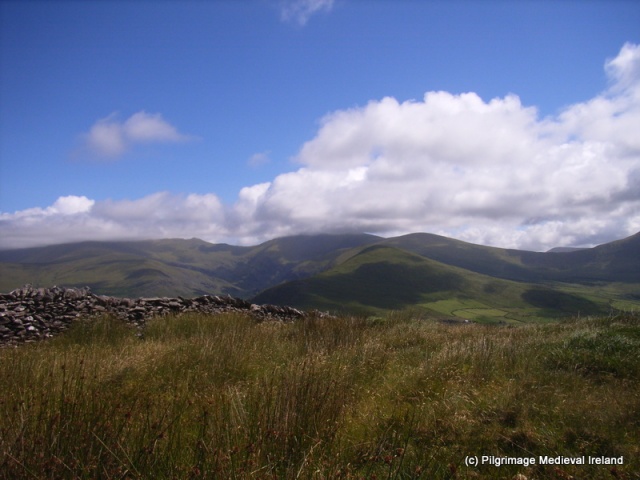
Balla in Co Mayo  has very ancient roots, and was once the site of a thriving pilgrimage.   Balla was also located along the route  of the well-known pilgrim road/route  the TocharPhádraig. Tradition holds that Tóchar was  a medieval road  that linked Croagh Patrick to important settlements such as Aghagowel,  Ballintubber and Balla and used by pilgrims up until the 19th century when travelling to Croagh Patrick.

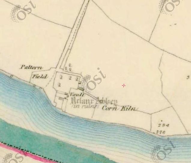
Despite its connections with the Croagh Patrick pilgrimage, Balla was not founded by St Patrick but folklore tells that the saint rested here while travelling through Mayo. The  modern village developed around the site of a seventh century monastery founded by St Crónán also known as a Mo-Chúa. The saint was educated by St Comghall of Bangor and  he died in AD 637.  Like St Laserian, Crónán choose to settle  at Balla because of a divine sign. It was said that a cloud guided the saint to Balla  and upon his arrival a spring  burst from the ground. Such signs confirmed to the saint that this was where his church was meant to be. We know little of the early settlement established by Crónán. It was seldom mentioned in historical sources and  all that survives of the early monastery are the partial remains of a round tower  found within a historic graveyard.

Galaxy s5 CP 284

Balla Round Tower

The tower survives to a height of circa 10m. During the nineteenth century it was used as a bell tower for the local catholic church. Lalor estimates it once stood at a height of 30m.  The tower has two doors the lower of which appear to be a late medieval insertion.  The lintel of this door  re-used an early medieval cross slab. Today the slabs  decoration is quite faded and difficult to see. The upper door has traces of Romanesque moulding on its lower course suggesting  a 12th century date for the construction for the tower. The  changes in masonry  style and the stones size within the upper door and the surrounding masonry suggest  this section was a later rebuild (O Keeffe 2004, 79-80).  Apart from the re-used cross slab the fabric of the tower also incorporates two bullaun stone  within the walls.

This slideshow requires JavaScript.

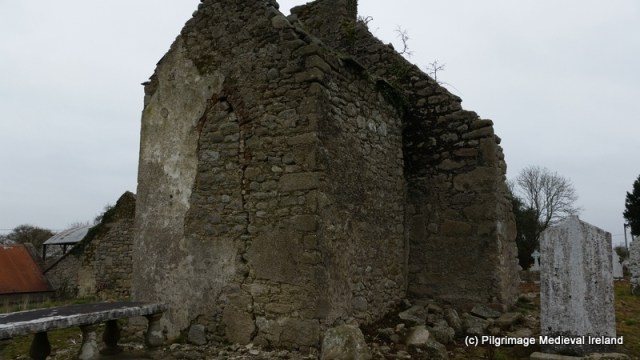
In the 1830s a church was recorded in the vicinity of the tower, the church has  long since disappeared although a late medieval altar still survives to the north-east of the tower.

The site of the spring which burst forth from the ground on the arrival of Crónán also survives and is located to the west of the graveyard along a small lane that runs along the side of graveyard from the carpark in the community centre.  The holy well  which burst forth to welcome Crónán to Balla is today known as  Tobair Mhuire (Lady Well).  When I visited the site in 2014 the well was choked up with silt and the rest house was in a poor state of preservation.

Galaxy s5 CP 309

Tobar Mhuire Holy Well at Balla

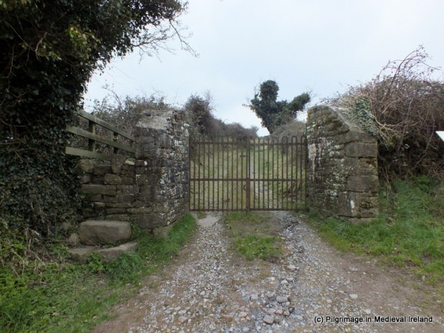
The ruins of a 17th century building that was built as a shelter for blind and lame pilgrims  is located beside the well.

Galaxy s5 CP 300

Bath House at Balla Holy Well

There are no historical accounts of pilgrimage during the medieval period but the well and monastery were the focus of a very popular post medieval pilgrimage. The post medieval pilgrimage likely developed from an older pilgrimage tradition. The construction of  the rest house in the 17th century suggests a sizeable flow of pilgrims here at the time. The well was probably once dedicated to St Cronán/Mo Chúa but by the 17th century, if not long  before, its was firmly associated with the Blessed Virgin and stations were performed here on the 15th of August. A pattern day festival was also held on this date.  Lewis in 1837 noted the well

is attended by great numbers of the peasantry at patrons held on the 15th of August and  8th of September(Lewis 1837, 102).

The waters of the well were held to have healing properties and were especially good for sore eyes.

According to the Ordnance Survey Letters of Mayo of 1838

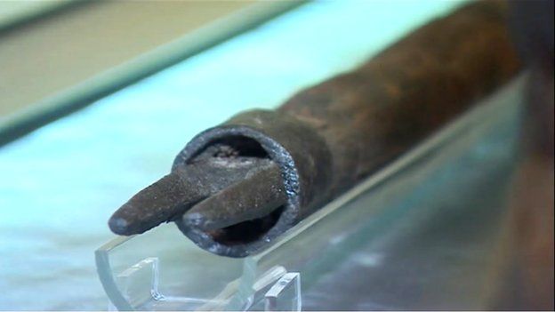
There  are also two little pillars, of mason work , called by the people, Station monuments (Leachta), and used as such, on top of which, are two small stone crosses, one on each, and in which are fixed (in the work of which are placed) two stones, one in each, with inscriptions on them, dated 1733; both are written in English, and under one of them are the words ‘Sun tuum praesidium fugimus, sancta Dei genitrix’. that is – Under your protection, we fly, Holy Mother of God.

These pillars and crosses appear to have acted as pilgrim stations but are no longer present at the site.   The pillars may have been replaced  two cairns of stones which also acted as pilgrim stations. The cairns were recorded by The Schools Manuscripts Essays for Balla (roll no. 1146, 178 ) in 1937 beside the well but are no longer present at the site

are two heaps of stones with a cross on each lying down. Beneath those heaps two priests are supposed to be buried. St Cronan himself is said to be buried somewhere near the spot (Balla B roll no. 1146, p 178).

The The Schools Manuscripts Essays state to obtain a cure

sight has been restored to some people who perform the stations. Several Our Fathers and Hail Marys have to be repeated at each heap of stones and at the well (Balla B roll no. 1146,  p 178)

As devotion to the well ceased the cairns of stones were removed in the ensuing years.

This slideshow requires JavaScript.

The 19th century devotional rituals engaged in by pilgrims were quiet complex and know as the Long Station. It was said that 15,000-20,000 people would attend the main days of pilgrimage arriving on the eve of the feast during this period (Rynne 1998  183).

pattern day Balla

Charles Green, An Irish ‘Patern’ at Balla County Mayo – The ‘Long station’, engraved by Eugène Froment, in The Graphic 11 (23 January 1875), between pp. 96 and 97. Ill. 899 [899]. Green himself described the churchyard scene on p. 78. (Image taken http://www.maggieblanck.com/Mayopages/Irishancestors.html)

Prayers began in the graveyard among the  tombstones  the bare foot pilgrims  would kneel and say a Pater, Ave and Gloria ( Our Father, Hail Mary and Glory be to the Father)  seven times, they then crawled on their kneels to what was known as the high altar (the altar from the medieval church) within the graveyard ,  one Pater and fifteen Aves  were recited as they made their way to the altar. At the altar they said the litany of the Blessed Virgin, seven Aves and seven Glories. The pilgrims  then walked around the graveyard seven times  saying fifteen decades of the rosary. Returning to  the altar they said the  Pater, Ave and Goria five times.  From here they continued to the well and at each  cairn(mound) near the well they said five Pater Ave and Gloria.  The pilgrims then entered the rest house and said a Pater Aves and Gloria five times, after which they turned three times around. The pilgrim rest house was described as unroofed in the Ordnance Survey Letters in 1838. Leaving the rest house pilgrims  then went to the well and made the sign of the cross with its waters saying one ave each time. This  completed the stations (Rynne 1998, 183).

The Schools Manuscripts Essays for Balla  also recount a version of the Long Station and it appears by the early 20th centurythe  penitential aspect of the pilgrimage had lessened slightly with people now wearing shoes for most of the station.

The rounds are done by the people on the knees from a particular slab to the altar on the opposite side of the graveyard saying while doing seven Our Father, seven Hail Marys and seven Glories. Them the people walk around the graveyard even times and they repeat the same prayers. When the people reach the graveyard gate they go on their knees to the altar again and they go down to the Blessed well  and take off their shoes and stockings and walk around the well three times  and then drink the water. After  that they make the sign of the cross on a stone nearby so that the station would be blessed (Balla C roll no. 1146, p 34-35.)

Relevant to the decade of commemorations and showing how in times of crisis holy wells and local saints were turned to for help and protection

During the Black and Tan regime people from Balla did the stations for the protection of Cronan for Balla  (Balla B roll. no. 1146)  p179

This reaction of the people of Balla to seek protection from their saint  is not surprising when one considers in June 20th 1921  the Black and Tans burned the town of Knockcroghery in Co Roscommon.

The rise of pilgrim sites like Knock in the later 1800’s sent the  pilgrimage at Balla into a steady decline and today the  pilgrimage that took place here is a distant memory.

If you visit Balla be sure to go to the local community centre where there is a great display dedicated to the history of the site and the area.

References

The Schools Manuscripts Essays, Ball Áluinn (Balla) (roll number 1146) http://www.duchas.ie/en/cbes/4427833

Green, C. 1875. ‘An Irish ‘Patern’ at Balla County Mayo – The ‘Long station’’, engraved by Eugène Froment,  The Graphic 11 (23 January 1875), between pp. 96 and 97. Ill. 899 [899].

Herity, M. 2009. (eds.) Ordnance Survey Letters Mayo. Fourmasters Press.

Lalor, B. 1999. The Irish Round Tower. The Collins Press.

O’Keeffe, T. 2004. Ireland Round Towers.  Tempus Press.

Rynne, E. 1998. ‘The Round Tower, Evil ye, and Holy Well at Balla Co Mayo’s’  in C Manning (ed) Dublin and Beyond the Pale. Studies in honour of Paddy Healy. Bray: Wordwell in association with Rathmichael Historical Society pages 177-184


Political rallies at Irish Holy wells 1917-1918

Holy wells were often and some continue to be the focus of  large  gatherings  of pilgrims, especially on special days of devotion such as the saints feast day/pattern day.  In the 19th century and early 20th century some holy wells could attract hundreds even thousands of pilgrims, large gatherings  could provide politicians/political groups with a captive audience and occasionally political meetings  and  rallies were organised to coincide with pilgrimages.

In the aftermath of the 1916 rebellion a number of pilgrimages at holy wells coincided with political meetings and anti-conscription rallies. In August 1917  the Irish Times ( 7th Aug 1917) tells  that the Meath Sinn Fein Clubs held a public meeting on the pattern day of  St Ciaran’s Holy Well (on the 1st Sunday of August), Caranross, Kells. Co Meath.  Its was said  upward of 8000 people were present and following prayers at the oratory beside the holy well, the  Sinn Fein meeting was held in a field close by.  The meeting was addressed by Countess Markievicz  and Seam Milroy  and  ‘a large number of priests were present on the platform’.

Paddy Healy in his book   Knocklyon Past and Present noted that at St Colmcille’s holy well at Knocklyon, Co Dublin  was also the scene of a political rally,  with a special pilgrimage organised to beg the saint’s intercession to avert conscription in Ireland.

AntiConscription1918

Anti Conscription Rally at Ballaghadreen Co Roscommon Image taken http://www.irishhistorian.com/Selections/September_2013_Selection.html

DSCF1241

St Colmcille’s Holy Well Knocklyon

In August 1918 the Derry Journal (19th August 1918) recorded the arrests of a number of Sinn Féin  member’s for speaking at holy wells.

Thomas Murphy the Secretary of the Bray Sinn Fein Club was arrested in connection to speeches allegedly delivered at St Patrick’s Holy Well, Ballina, Co Mayo.  John Moylett President of the the North Mayo Sinn Fein and Patrick Melvin of Ballina were also arrested in connection with this event.

ballina holy well

St Patrick’s Holy Well Ballina. The well has been landscaped in recent years so would not have looked like this at the time of the rally. Image taken from Google Street View ( https://www.google.ie/maps/@54.121087,-9.162681,3a,75y,66.71h,75.83t)/data=!3m6!1e1!3m4!1seNpn-Nibz9EjA_oxQ5TvIA!2e0!7i13312!8i6656


The same paper also noted that

A large number of police had been drafted into Ballina in anticipation of a meeting but political speeches were delivered at the Holy Well to which a procession, said to be a pilgrimage, took place.

This statement indicates Sinn Fein either  instigated a pilgrimage to the well or took advantage of an already organised religious gathering, to continue with the planned meeting.

The same article also mentions that John Curran secretary of the Letterkenny  Sinn Fein club was arrested due to the reading of the Sinn Fein  Executive proclamation at a meeting held at  Conwal Holy Well a few miles outside of Letterkenny. The well is dedicated to St Catherine and was an active pilgrim site at the time of the meeting.

This is a topic I will return to again  it is very interesting see these places of prayer becoming places where  political  messages could be communicated to a large audience and the act of pilgrimage used to mask a political agenda. I am sure there are  other examples of this type of activity from elsewhere in the country and  from earlier times , so I will keep you all posted on what I find out.

St Laserian at Lorum Co Carlow

I was hoping to have this post ready for the feast day of St Laserian  on the 18th of April   but better late then never.  St Laserian has strong associations with Co Carlow and I have discussed  the modern pilgrimage to St Laserian  at Old Leighlin Co Carlow in previous posts. The saint is also  associated with a place called Lorum  in Co Carlow.

According to folklore  when St Laserian returned to Ireland from Rome he set out in search of a location to build a monastery.  When he came  Lorum  (a few miles south-east of Muinebheag (Bagenalstown)) he stopped on top of a large hill . The saint was so impressed by the area that he decided to build a monastery here. God however had other plans for him, and while he knelt in prayer an angel  proclaimed ‘ Go where you shall see the first shinning, and there shall your religious house be established’ ( O’Toole 1933, 17).  Taking heed of the angel the saint  set off again on his search which ended when he arrived  Old Leighlin  which became the site of his  monastery.

Lorum (Leamdhroim in Irish) appears to have been the site of a religious foundation. Gwynn and Hadcock (1970, 397) recorded that Lorum was an early medieval monastery dedicated to  St. Laserian . Brindley notes in 1204 the Bishop of Leighlin was confirmed of his possession of lands including ‘Lenidruim’ (Lorum) (Cal. papal letters, 18). The church  at Lorum was valued at 3 marks in the 1302-06 ecclesiastical taxation of Ireland (Cal. doc. Ire., 250) and by the late 16th century it was in ruins.  The Ordnance Survey Letters for Carlow recorded Steward, writing in 1795, noted that the 18th of April, the feast of Laserian was celebrated at Lorum and  until  the  1830s a  pattern day was held here.

062

Loram Church of Ireland Church

All trace of this monastery and medieval church have long disappeared.  Today Lorum  consists a stunning Church of Ireland Church  built circa 1830 with a historic graveyard  on its western side . The  curve in the road on the east side of this church may tentatively reflex the line of an earlier medieval enclosure.

lorum

View of Lorum Hill showing the curve in the road on the east side of the church (taken http://map.geohive.ie/mapviewer.html)

Within the historic graveyard are the ruins of  a post medieval church. The structure is  in poor condition  and with the exception  of the west gable only the foot prints of the other walls survive.  The upstanding gable appears to incorporated  stones from an earlier church.

20160322_113324-001

Ruins of  post medieval church at Lorum.

The remains of an 18th century porch with red brick  in the fabric is  attached to the  exterior of west gable of the church.


20160322_113808

Porch attached to west gable of Lorum Church

In 1837 Lorum church was described as ‘an old building, containing two modern tombs of the Rudkin family, has been recently repaired’ (Lewis 1837, 312).  The Ordnance Survey Letters  for Carlow (1837-40) recorded that at ‘

Lorum, there was, it is said, an old Church before the present Parish one, which is now falling to ruin, was erected. The spot where it stood is shown in a field, a few perches to the northeast corner of the Parish Church  and a few yards to southwest corner of a Church (C of I church) which is now in progress of being built (O’Flanagan 1934, 311).

The ITA Survey of 1945 identifys the ruined church as the remains of an 18th century Church of Ireland Church and the medieval church as being located as a low-rise of ground inside the graveyard. Both churches were replaced by a  seven-bay Gothic Revival Church with buttresses and parapet built c. 1838 and designed  by Frederick Darley.

063

Church of Ireland Church at Lorum built 1838

Close to the church are the ruins of a small post medieval house which shows signs of rebuilding and alterations.

20160322_115906-001

Post medieval building at Lorum

A plain granite base of a high cross provides the only physical evidence of early medieval  activity at the site.

20160322_113540

Base of high cross at Lorum

The remains of a second  early medieval cross are found 200m to the west of Lorum graveyard. The  cross is located on the north side of  east-west running bohereen.

20160322_115128

Bohereen leading to Lorum cross and cairn

The monument consists of  a medieval cross shaft set in a cross base  sitting on top of a cairn of stones and earth.


This slideshow requires JavaScript.

Lorum is associated with two holy wells. According to ITA Survey (1945),  a well dedicated to St Laserian was located to the north  the old graveyard. The well was not recorded on the 1st ed OS 6-inch map for the area but the files state it was covered by well house  and located northnorthwest of the  church.  The farmer who owns the land the well was located on told me there was no longer a well here and he had not heard of a holy well in this location before.

A holy well dedicated to St Molaise ( the Irish for Laserian) is located to the east of the old church.  The 1st ed OS 6-inch  marked the well as St Molappoge’s well. The well which is now dry is  stone-lined  and rectangular in shape. It is  covered by  a  large lintel stone. The well is in reasonable condition but is no longer visited by pilgrims.


20160322_121324

St Molappoge’s  holy well


St Laserian is no longer  venerated in the area and all focus of the saint has moved to Old Leighlin.  This is a lovely place to visit and you can see why St Laserian wanted to settle here.

References

Brindley, A. 1993. Archaeological Inventory of County Carlow. Dublin: Stationery Office.

Gwynn, A. & Hadcock, R. N. 1970. Medieval Religious Houses in Ireland. Dublin: Irish Academic Press

ITA Survey of Carlow 1945

Lewis, S. A. 1995. A topographical dictionary of Ireland:London : S. Lewis & Co

http://www.buildingsofireland.ie/niah/search.jsp?type=record&county=CW&regno=10301911

O’Flanagan, Rev. M. (Compiler) 1934 Letters containing information relative to the antiquities of the County of Carlow collected during the progress of the Ordnance Survey in 1839. Bray.


The Worcester Pilgrim Burial

In 1987 during excavations of the base of the south tower at Worcester Cathedral, a very unusual burial was uncovered.  According to the excavator

to our surprise, the first indication of a body was the appearance of two leather toe-caps poking up through the soil. We continued to excavate with great
care and finally revealed the body of a fully clothed person wearing woollen garments and knee-length leather boots.. . . Beside the body lay a long wooden staff, with a double-pronged iron tip… (Lubin 1990, 5).
image of pilgrim

Fresco of a later medieval pilgrim (taken from http://finca-al-manzil.blogspot.ie/2009/01/va-de-la-plata.html).

A 15th century date has been suggested for the burial. Unfortunately the head and neck of the skeleton had been removed with the insertion of a later burial but otherwise the rest of the body remained in good condition. The physical remains of the skeleton suggest this was a male of stocky build approximately 5 feet 7 inches in height.  He was buried fully dressed in woollen garments and knee-length walking boots.  As noted above, beside the body was a wooden staff  and a perforated cockle shell. The staff was made of ash wood and had a double pronged iron spike at one end and a traces of a horn tip at the other.  The staff was coated in a purple paint. The paint was made by mixing ‘bone-black with a costly dye called kermes, made from the bodies of female oak-gall producing insects’.  Kermes was an expensive dye  and not widely available (Lack 2005, 114). The burial has been interpreted as that of a pilgrim due to its dress and the presence of a perforated cockle shell within the burial.  Other pilgrim burials have been recovered in Ireland,  Britain and the Continent, identified by the presence of a pilgrim badge or ampullae within the burial but  it is the survival of  clothing and pilgrim equipment within the Worcester burial that makes it unique. Lank  believes the cockleshell  is not a specific emblem for a particular shrine  ‘merely a general symbol of pilgrimage’ (Lank 2005, 116). The pilgrim staff and satchel, known as a scrip were a key component of the pilgrim equipment and had a practical function but also came to have a special symbolic significance as signi peregrinationis / signs of pilgrimage. By the late 11th century  special ceremonies existed for long distance pilgrims, where the staff and scrip were blessed and  presented  to the pilgrim  from the altar. The ceremony normally took place before the pilgrim departed on pilgrimage. With this in mind it’s not surprising the staff was included within the burial and was likely placed within the burial as a symbol of past pilgrimage.

Osteological analysis of the skeleton  suggests that the man had done a great deal of walking during his life, and wear on the joints especially his left his shoulder, elbow and hand, was consistent with someone having exerted continuous pressure on a staff while walking. The man was in his 60’s at the time of death and  suffered from sever arthritis making movement painful.  Following his death he was dressed in clothing typical of that worn by pilgrims at the time.  His boots were cut down the back to fit his legs which were likely swollen at time of death. The clothing and staff marked the burial clearly as a pilgrim and perhaps he was dressed this way to be  more easily recognisable on judgement day. The burial within the cathedral also suggests he was a wealthy man.

worcester-pilgrim-image-4-boot-after-treatment-e1410966092889-692x350

Worcester-pilgrim’s boot following conservation image taken http://www.yorkarchaeology.co.uk/case-studies/worcester-pilgrim/

There is a compelling case that the pilgrim may be Robert Sutton who died in 1454. Sutton was a Dyer and  Baliff in Worcester,  so would have had access and funds to use the rare purple pigment that was used for the paint on  the staff. In his will  he also requested to be buried within the cathedral (Lank 2005).

The artefacts recovered from the burial are now on display at Worcester Cathedral. These artefacts provide physical link to this medieval pilgrim, while also shedding light on pilgrim attire and burial customs.

worcester pilgrim boots

15th century boots found in Worcester Pilgrim Burial image taken http://www.bbc.com/news/uk-england-hereford-worcester-26925774


worcester pilgrimage staff

Tip of walking staff found in Worcester Pilgrim Burial image taken from http://www.bbc.com/news/uk-england-hereford-worcester-26925774

Worcester was also an important pilgrim shrine  to find out more about its links with Irish pilgrims  see my post

Irish pilgrims and the medieval shrine of St Wulstan at Worcester

References

Lack, K.  2005. Dyer on the Road to Saint James: An Identity for
‘The Worcester Pilgrim’? Midland History, 30:1, 112-128.
Lubin, H. 1990. The Worcester Pilgrim. Worcester: Worcester Cathedral Publications 1.

http://www.bbc.com/news/uk-england-hereford-worcester-26925774

http://www.worcesternews.co.uk/news/11132143.Unique_artefacts_returned_home_to_Worcester_Cathedral/

http://www.yorkarchaeology.co.uk/case-studies/worcester-pilgrim/

http://www.pilgrimsprogress.org.uk/skeletal.htm

http://finca-al-manzil.blogspot.ie/2009/01/va-de-la-plata.html

http://www.tandfonline.com/doi/pdf/10.1179/mdh.2005.30.1.112

http://btsarnia.org/2014/05/29/pilgrimage-from-what-is-now-gloucestershire-during-the-middle-ages/

Urlaur Abbey Co Mayo

Urlaur Friary,  a Dominican foundation,  on the shores of Urlaur Lake in Co Mayo is one of Ireland’s best kept secrets.

289

Urlaur Friary Co Mayo

The friary was founded  around the year 1430 and was dedicated to St. Thomas.  The friary survived the  Reformation and in the early 17th century, the property was confiscated and handed to Viscount Dillon, a local loyal landlord. The community continued to reside here and the last friar of Urlaur, Patrick Sharkey, died in 1846. He lived in a cottage beside the ruins of friary and he sometimes said mass within the church.

The church is entered through the west gable via a pointed doorway with hooded moulding. A carved  head in poor condition sits above its apex.

DSCF2104

West gable of Urlaur Church

Above the door is a small elaborate triple light window with hooded moulding.

The interior of the church is quiet plain and the floor is covered with gravel.

298

View of interior of Urlaur church facing the east gable.

The north side of the nave of the church appears to have been extended to accommodate an aisle. The remains of an arch  on the north side of the west gable wall suggests the aisle may have been divided from the nave by arches and columns.

The east gable is also well preserved and  has the remains of  an elaborate tracery window.

The domestic buildings for the friary also survive and abutts the east end of the  south wall of the  church.

345

The east gable of Urlaur Church and domestic buildings for friary.

A pointed doorway in the south wall of the church leads into a vaulted room (part of the domestic building) abutting the exterior south wall of the church.

A second door in the middle of the  south wall provides access to the exterior of the church and the domestic buildings.

DSCF2166

View of doorway in the south wall of the church.

The remains of the domestic building consist of a north-south aligned two storey building. The ground floor has a number of vaulted rooms.

Access to the second floor of the building is provided by a stone stairs.

327

Stone stairs leading to the upper floor of the domestic buildings

The upper floor is unroofed and may have been the dormitory for the friars.

316

A square tower for want of a better word is built against the south wall. This is probably the garderobe.


During the 19th century Urlaur was the scene of a pattern day held the on 4th of August, the feast of St Dominic. A field beside the church was marked as the pattern field on the 1839 1st ed OS 6-inch maps for Co Mayo.

urlaur

1st ed. OS 6-inch map of 1838 depicts a field known as the Pattern field beside the abbey.

The pattern despite some ups and downs has continued to the present day and an  annual mass  reintroduced in 1914 is still held here each year on the  4th of August.


A stroll along the shores of Lough Derg, Co Donegal

This is Pilgrim Paths week which reminded me of a recent visit to the shores of Lough Derg, Co Donegal.  Lough Derg lake is home to St Patrick’s Purgatory (located on Station Island) one of Ireland’s oldest and most popular pilgrim sites. Each year large numbers of pilgrims travel to the Island during pilgrim season that runs from May to September  to partake in an arduous penitential pilgrimage which can last up to three days.

A modern walk skirts along the shores of the lake and is open all year round.  This walk is a part of the Pilgrim Paths network of walking routes.  The network of routes known as pilgrim paths are a group of modern Irish walking routes that in many cases incorporate sections of or follow closely the route of older pilgrim routes some of which may be of medieval date. In 2014 National Pilgrim’s Paths Day was held to promote these routes by hosting a series of organised walks. The event proved very successful and  was repeated in 2015. As interest in the pilgrim paths has steadily grown in popularity the organisers will this year  host a series of walks that will extend from the 22nd March to  29th March.

The Lough Derg pilgrim path runs for 12km (7 miles) along the edge of the lake.

20160321_094659

Guidebook for the Lough Derg Pilgrim Path

A  few weeks back on a flying visit to Lough Derg, I walked a short section of this path. The pilgrim path beings in the car park of the visitor centre.  Its worth taking the time to stand and look out at Station Island.

DSCF6130

View of St Patrick’s Purgatory on Station Island in Lough Derg from visitor car park.

From the car park the path runs along a modern forestry tracks that hugs the lake edge  until it reaches  a point opposite Saints Island. In in medieval times this island was the site of an Augustinian monastery and acted as a gateway for pilgrims  who wanted to make pilgrimage to St Patrick’s Purgatory.

DSCF6133

View of Lough Derg Pilgrim Path.

I am working on a post about the medieval pilgrimage at Lough Derg, so I wont go into too much detail.   St Patrick’s Purgatory, the focus of the  medieval pilgrimage was a deep  artificial cave or pit into which pilgrims entered for a set period of time in the belief they would experience the torments of purgatory.  The cave has since been destroyed but the tradition of  making pilgrimage here survived and evolved to its current form.

The walk is not a very challenging one but every now and then you are rewarded with views of the lake and its islands.  There are also a number of interesting spots along the way. After walking for about 1.15km,  I came to a sign for  St Brigid’s chair. At this point I  left the main the track and follow a path down to the lakes edge.  The fencing along the path and the lakes edge is in poor state of repair so care is needed.  The chair is a large  rock at the water’s edge.

This slideshow requires JavaScript.

I then return to the track  and after walking a few hundred meters or so I came to  another sign for St Daveoc’s/Dabheog’s Chair.

DSCF6151

Signpost for St Daveoc’s/Dabheog’s chair

I followed the track  leading into the forest until I came to a fence at the edge of the forestry, the chair is located on a height above this point. As I didn’t have enough time to explore properly I had to returned to the path without locating the chair. According to Harbison & Lynam St Daveoc’s/Dabheog’s chair  is   ‘partially natural, but it seems to have had one or two large blocks added to it, hinting that it may once have been a Bronze Age burial place’.   I am very grateful to Keith Corcoran who writes the Journey in Wonder blog for permission to use his image of St Daveoc’s/Dabheog’s chair.  As you can see from his photo its worth making the effort to find this site.

view-from-st-daveocs-chair

View of Lough Derg from St Daveoc’s/Dabheog’s chair taken by Keith Corcoran.

St Daveoc’s chair is located close to the point where an older pilgrimage route marked as ‘ancient road’ on the first edition OS 6-inch maps  and traced back to Templecairn,  merges with the modern path.

DSCF6142

View of Station Island from circa 1km along the path

Back on the track I continued  walking until I came to St Brigid’s holy well. The well is located just off the forest track at the edge of the lake.

St Brigid's well Lough Derg

St Brigid’s well Lough Derg

St Brigid’s well is marked by a modern metal cross  now covered in rags, socks, ribbons, religious medals and beads. It is enclosed by a circle of sandstone stonework which also has a modern appearance.

This slideshow requires JavaScript.

I went no further than this point but the  track continues from here along the edge of the lake  until it reaches a point opposite Saints Island. According to my guide-book the remains of the stones that formed part of bridge that would have brought medieval pilgrims across to Station Island, are still to be seen.

?

Map of Lough Derg Pilgrim Path from (Harbison & Lynam 2004)

From Saints Island the path continues swinging around in a loop before joining back with the original track.  I really enjoyed my walk  and  I looking forward to  returning and walking the  path in its entirety in the future.

References

http://journeyinwonder.com/2013/05/08/walking-the-pilgrims-path/

Harbison, P. & Lynam, J. 2004. ‘Lough Derg. The Shore by Saints Island, Co Donegal. Medieval Irish Pilgrim Paths No. 3. Heritage Council.


Ardpatrick Co Limerick

St Patrick is associated with many wonderful sites around Ireland,  Ardpatrick Co Limerick is one of my favourite. Located on the edge of a village of the same name, the site is about six miles south of Kilmallock on R512, on the road to Kildorrery in the county of Cork. Sitting on top of a large hill  the site consists of  the ruins of an early medieval  ecclesiastical settlement,  consisting of a ruined church surrounded by a modern rectangular graveyard and the stump of a round tower.  The site is held to date to early medieval period and the partial remains of  large  enclosure that once surrounded the site is still visible. Within the enclosure are earthworks of possible buildings, fields banks, enclosures and a road.

ard - Copy

View of Ardpatrick from the air ( Bing maps)

The name Ardpatrick comes from the Irish ‘Ard Phádraig’  which means the ‘Height or Hill of Patrick’.  According to local tradition St Patrick founded a monastery here in the 5th century.

A story in the late 9th century work Bethu Phátric, The Tripartite Life of St Patrick, tells us that when Patrick sought a site for the church on Ardpatrick, Derbhall, the local leader, opposed him. He told him that he would believe only if St Patrick removed part of the mountain wall to the south so that he could see Loch Long in the land of Fir Muí Féinne. St Patrick prayed and the mountain melted forming a gap, Bealach Leáite, the Pass of the Melting (Dowd 1896, 49; Limerick Diocesan Heritage).

In the ensuing centuries the  Ardpatrick was ruled by abbots drawn from the Déisí, the ruling Sept of An Déis Bheag, the territory in which the monastery was situated. The church became a very important and powerful site. It had strong links with Armagh and collected Munster contributions to Armagh. Torlogh O’Connor plundered the church at Ardpatrick in 1127AD and in 1129 Cellach, bishop of Armagh, died at Ardpatrick  on Monday 1 April.  The O’Langans were hereditary coarbs of Ardpatrick and the lands here remained in their possession and a group  known as the ‘Clerks of Ardpatrick’,  up to the 16th century (Fleming 2009 ,6).

Ardpatrick Archaeological remains

As the name suggest the ruins  at Ardpatrick sit at the top of a large hill to get to the summit you follow  a small track from the edge of the  village.

The hill is steep but when you reach the top of the hill you will be rewarded with magnificent views of the surrounding countryside.

This slideshow requires JavaScript.

Today the all that remains of this once great site are the ruins of multi period church  which is covered in a thick growth of ivy which makes it difficult to examine in detail.  According to Ó Carrigáin (2010 131)

‘ apart perhaps from the north end of the west wall, none of its fabric seems to be medieval. It does incorporate large blocks that probably come from a per-Romanesque church.


IMG_5756

View of the ruins of the church at Ardpatrick

A number of carved stones from windows etc are found scattered around  the site and the interior of the church is filled with historic graves.

The church and graveyard are surrounded by a rectangular walled  enclosure.  Ó Carrigáin (2010, 131-132) points out that one of the stones in the stile at the  west end of this enclosure  incorporates an upside down door lintel which was part of an earlier pre-Romanesque church.

077

Upside down door lintel reused in stile. This stone likely came from a pre-Romanesque church that once stood at the site (Ó Carrigáin 2010, 306).

This slideshow requires JavaScript.

In the past a holy well stood to the southwest of the church.

map ap

1st ed. OS 6 inch map of Ardpatrick

The well is now filled in but was once circa 40 feet deep, faced with stone, and had steps leading to it.  According to legend, cattle are said to have been cured by its water. People visited the well seeking cures for lameness, rickets and rheumatism also used it.

According to the Folklore Collection Schools Manuscript of 1937

There is a holy well now nearly filled up on the hill here. The water lay about 15ft from surface, people said that if on looking down you did not see your reflection in the water you would die before the current year ran out.

DSCF2167

Carved detail of a window embrasure in the church fabric

Outside the graveyard  wall are the stump of a 11th-12th century round tower  built of dressed stone. Given its location it must have dominated the landscape when built. The tower collapsed in a storm in 1824 and local legend tells of a peal of 7 silver bells which once hung in the tower.


This slideshow requires JavaScript.


According to the Schools Manuscripts (1937) folklore about the tower said that the tower was destroyed

When Murrough the Burner was coming from Cashel his soldiers burned Ardpatrick village which my informant says stretched west by south from the old tower. A party of soldiers on guard in the tower were playing cards. They played on top of a powder keg. One of them ‘hit the keg a welt of his fist’ upsetting a candle into the powder. The resulting explosion damaged the tower which was still further damaged by lightning.

It was also said that a subterranean passage supposed to exist between the round tower & the old abbey.

Another interesting feature that survives at the site are the traces of an ancient road way.

ard - Copy

Aerial view of site (Bing Maps) showing the line of the Rian Bó Phádraig

The old road known locally as the Rian Bó Phádraig has discussed this road in a previous post of St Patrick to find out more follow the links.

DSCF2245

The remains of the old road known as the Rian Bó Phádraig.


References

Fleming, J. 2009.  The formation of the church in Limerick’. In Limerick History and Society, 1-15.

Holy Cow. The Miraculous Animals of the Irish Saints. Part three, St Patrick’s Cow and the Rian Bó Phádraig.

http://www.limerickdioceseheritage.org/Ardpatrick/textArdpatrick.htm

Irish Folklore Collection Schools Manuscripts Ardpatrick Co Limerick http://www.duchas.ie/en/cbes/4922041

ÓCarrigáin, T. 2010. Churches in Early Medieval Ireland. London: Yale University Press.

Ó Danachair, C. (1955). The holy wells of Co. Limerick. JRSAI Vol. LXXXV, pt. II, pp. 193-217.


A Cure at St Patrick’s Holy Well Clonmel in 1913

St Patrick’s well at Marlfield, Clonmel  is one of my favorite places and  I have discussed the history and modern pilgrimage tradtions of the holy well in previous posts. This post details a cure that occurred in 1914 at the well which made the national newspapers at the time.
1-DSCF4981

St Patrick’s Holy well Marlfield

During the early 1900’s the well underwent somewhat of a revival and became a very popular place of pilgrimage.  Like many other wells its waters are said to have curative powers and the story of one cure was recounted in The Irish Independent and Irish Examiner  newspaper in  April, 1914. The newspaper articles tells the story of a boy called John Sullivan from West Douglas Cork.  In 1914 John was aged 13 years old.  The article states he had hurt his leg some years previously  and was in great pain which resulted in surgery. Following  the second operation on his leg, John’s mother brought him to St Patrick’s well. The child visited the well three times first in August 1912, then a year later August 1913 and finally on St Patrick’s Day 1914. On each visit the mother and son recited ‘Five decades of the Rosary of the Blessed Virgin’ followed by seven Hail Marys, in honour of St Patrick. They also visited the ruined church beside the well  where‘ fervent prayers were said before the site of the altar’ (Anon b 1914). A week  after his last visit he has discarded his crutches and was walking with a stick  and soon afterwards was walking unaided. Many people visited wells in search of healing because they knew someone who had been healed or had heard stories of people being healed.
The Examiner tells us  that John was brought to Clonmel, as his mother a native of Tipperary town had 30 years previous herself been cured from the wells waters.  As a child her finger was in danger of being amputated. Her aunt sent her a jar of water from St Patrick’s well and following use of the water and prayers to St Patrick her finger was cured. Hence her confidence the well would be of benefit to her son.

This slideshow requires JavaScript.

References

Anon a. ‘ Clonmel Holy Well Cure’, Irish Indepenent Thursday, April 23, 1914

Anon b. ‘Clonmel Holy Well. Cork Boy Remarkable Cure’. Irish Examiner Wednesday, April 22 1914, 5