St Patrick is associated with many wonderful sites around Ireland, Ardpatrick Co Limerick is one of my favourite. Located on the edge of a village of the same name, the site is about six miles south of Kilmallock on R512, on the road to Kildorrery in the county of Cork. Sitting on top of a large hill the site consists of the ruins of an early medieval ecclesiastical settlement, consisting of a ruined church surrounded by a modern rectangular graveyard and the stump of a round tower. The site is held to date to early medieval period and the partial remains of large enclosure that once surrounded the site is still visible. Within the enclosure are earthworks of possible buildings, fields banks, enclosures and a road.

View of Ardpatrick from the air ( Bing maps)
The name Ardpatrick comes from the Irish ‘Ard Phádraig’ which means the ‘Height or Hill of Patrick’. According to local tradition St Patrick founded a monastery here in the 5th century.
A story in the late 9th century work Bethu Phátric, The Tripartite Life of St Patrick, tells us that when Patrick sought a site for the church on Ardpatrick, Derbhall, the local leader, opposed him. He told him that he would believe only if St Patrick removed part of the mountain wall to the south so that he could see Loch Long in the land of Fir Muí Féinne. St Patrick prayed and the mountain melted forming a gap, Bealach Leáite, the Pass of the Melting (Dowd 1896, 49; Limerick Diocesan Heritage).
In the ensuing centuries the Ardpatrick was ruled by abbots drawn from the Déisí, the ruling Sept of An Déis Bheag, the territory in which the monastery was situated. The church became a very important and powerful site. It had strong links with Armagh and collected Munster contributions to Armagh. Torlogh O’Connor plundered the church at Ardpatrick in 1127AD and in 1129 Cellach, bishop of Armagh, died at Ardpatrick on Monday 1 April. The O’Langans were hereditary coarbs of Ardpatrick and the lands here remained in their possession and a group known as the ‘Clerks of Ardpatrick’, up to the 16th century (Fleming 2009 ,6).
Ardpatrick Archaeological remains
As the name suggest the ruins at Ardpatrick sit at the top of a large hill to get to the summit you follow a small track from the edge of the village.
-
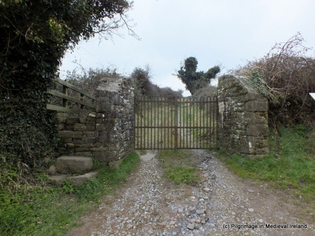
- Gate at track leading to the summit of Ardpatrick
-

- Track leading to the summit of Ardpatrick
The hill is steep but when you reach the top of the hill you will be rewarded with magnificent views of the surrounding countryside.
Today the all that remains of this once great site are the ruins of multi period church which is covered in a thick growth of ivy which makes it difficult to examine in detail. According to Ó Carrigáin (2010 131)
‘ apart perhaps from the north end of the west wall, none of its fabric seems to be medieval. It does incorporate large blocks that probably come from a per-Romanesque church.

View of the ruins of the church at Ardpatrick
A number of carved stones from windows etc are found scattered around the site and the interior of the church is filled with historic graves.
The church and graveyard are surrounded by a rectangular walled enclosure. Ó Carrigáin (2010, 131-132) points out that one of the stones in the stile at the west end of this enclosure incorporates an upside down door lintel which was part of an earlier pre-Romanesque church.

Upside down door lintel reused in stile. This stone likely came from a pre-Romanesque church that once stood at the site (Ó Carrigáin 2010, 306).
In the past a holy well stood to the southwest of the church.

1st ed. OS 6 inch map of Ardpatrick
The well is now filled in but was once circa 40 feet deep, faced with stone, and had steps leading to it. According to legend, cattle are said to have been cured by its water. People visited the well seeking cures for lameness, rickets and rheumatism also used it.
According to the Folklore Collection Schools Manuscript of 1937
There is a holy well now nearly filled up on the hill here. The water lay about 15ft from surface, people said that if on looking down you did not see your reflection in the water you would die before the current year ran out.

Carved detail of a window embrasure in the church fabric
Outside the graveyard wall are the stump of a 11th-12th century round tower built of dressed stone. Given its location it must have dominated the landscape when built. The tower collapsed in a storm in 1824 and local legend tells of a peal of 7 silver bells which once hung in the tower.
According to the Schools Manuscripts (1937) folklore about the tower said that the tower was destroyed
When Murrough the Burner was coming from Cashel his soldiers burned Ardpatrick village which my informant says stretched west by south from the old tower. A party of soldiers on guard in the tower were playing cards. They played on top of a powder keg. One of them ‘hit the keg a welt of his fist’ upsetting a candle into the powder. The resulting explosion damaged the tower which was still further damaged by lightning.
It was also said that a subterranean passage supposed to exist between the round tower & the old abbey.
Another interesting feature that survives at the site are the traces of an ancient road way.
Aerial view of site (Bing Maps) showing the line of the Rian Bó Phádraig
The old road known locally as the Rian Bó Phádraig has discussed this road in a previous post of St Patrick to find out more follow the links.

The remains of the old road known as the Rian Bó Phádraig.
References
Fleming, J. 2009. The formation of the church in Limerick’. In Limerick History and Society, 1-15.
http://www.limerickdioceseheritage.org/Ardpatrick/textArdpatrick.htm
Irish Folklore Collection Schools Manuscripts Ardpatrick Co Limerick http://www.duchas.ie/en/cbes/4922041
ÓCarrigáin, T. 2010. Churches in Early Medieval Ireland. London: Yale University Press.
Ó Danachair, C. (1955). The holy wells of Co. Limerick. JRSAI Vol. LXXXV, pt. II, pp. 193-217.
