The Rag Well Clonmel

The Rag Well  is a small well located in the townland of Knocklucas, on the southern outskirts of the town of Clonmel.  The well gives its name to the surrounding area which is generally referred to as the ‘ragwell’.  This is not a holy well   it is more of a wishing well  and there is a long tradition of people coming here and  tying rags to a white thorn tree beside the well  to make a wish .

Location map of the rag well taken from Bing Maps

Location map of the rag well taken from Bing Maps

While writing my last post on St Patricks well at Marlfield I came across some old photos of the Rag Well  in the National Library of Ireland online photographic database.  I became very curious about the well, its history,  if it had changed  or had been refurbished.

So last weekend I paid a visit to the site with my uncle Eddie who grew up in the  Old Bridge area of Clonmel town  and as a child visited the site.


The landscape of the site  at the end of the 19th- early 20th century

In 1841 John O’Donovan records that  the well  as being  known as Tobar na Gréine / the well of the sun.  Although he refers to it as a holy well, he makes no mention of pilgrimage or an association with a saint.  By the early 20th century the well was known as the Rag Well and  continues to be  known by this name  to this day.

The well is an underground stream which flows into a stone lined channel.  At the time the photo below was taken in the early 1900’s  the well was surrounded by a  low circular wall.  The enclosing wall was in poor condition and it looks like only the footings of the wall were visible when the photo was taken.

French, R., & Lawrence, W. (. M.. (18651914). Holy Well, Ragwell Glen, Clonmel, Co. Tipperary. http://catalogue.nli.ie/Record/vtls000319096

French, R., & Lawrence, W. M.. (18651914). Holy Well, Ragwell Glen, Clonmel, Co. Tipperary (Taken from http://catalogue.nli.ie/Record/vtls000319096

In the  photo the white thorn tree  beside the well is covered in rags.  The well looks directly across  at Slievenamon mountain and the mountain  is  was clearly visible in the photo above.  The modern tree coverage  is alot more  dense and the view is not as clear  but its still pretty  impressive.

French, R., & Lawrence, W. (. M.. (18651914). Slievenamon from Roguell Glen, Clonmel, Co. Tipperary. http://catalogue.nli.ie/Record/vtls000331355

French, R., & Lawrence, W. (. M.. (18651914). Slievenamon from Roguell Glen, Clonmel, Co. Tipperary. http://catalogue.nli.ie/Record/vtls000331355

A later photo,  of unknown date,  shows that the wall around the well had been rebuilt and the well  has remained unchanged to this day.

rag_well clonmel

The Rag Well photo taken some time in the 20th century ( image taken http://www.igp-web.com/tipperary/photos/oldphotos/index.htm)

The Rag well today

To get to the  Rag Well you head out of Clonmel along  the mountain road  and at  the first  junction,  on a sharp bend you take the  smaller road (see map above).   A short distance up this road you will see a small green gate that opens on to an old grassy laneway.

1-DSCF6615

Gateway leading to the path to the Rag Well

Go through the gate and the path to the well is on the right hand side  above the lane.  It is easy to miss the path  and you have to climb up to it.  The path consist of stone steps which are now  covered in leaves and dirt.  The steps  are  very slippy  so do take care climbing and if you are anyway unsteady on your feet id  give it a miss, I stumbled a few times on the way up and down.

1-DSCF6600

Stone steps leading to the Rag Well

The path is a little bit over grown in places but it will lead you to the well.  Like the path the well is neglected and  over grown.  In the older photos the well was surrounded by pasture but today the field  is covered in bracken and gorse.

1-DSCF6545

The Rag Well surrounded by bracken

The well is still surrounded by  the circular stone wall.  The wall is in a reasonable state of preservation but there are patches  in need of repair.  The well can be entered through a small opening in the south.  The interior is now very over grown,  although it is clear the interior hasn’t change since  French  photographed the well in the 1900’s see photo below. The water flows out from the ground into the stone channel which in turn flows out of the enclosure and heads down hill.

French, R., & Lawrence, W. (. M.. (18651914). Holy Well, Ragwell Glen, Clonmel, Co. Tipperary. http://catalogue.nli.ie/Record/vtls000319095

French, R., & Lawrence, W. (. M.. (18651914). Holy Well, Ragwell Glen, Clonmel, Co. Tipperary. http://catalogue.nli.ie/Record/vtls000319095

The rag tree which is a white thorn tree  is  covered in  ivy.   It looks like the ivy is choking the tree which is really sad given its history.  There  are still some rags on the tree which suggests some adventurous people still come here.

1-DSCF6570

The Rag Tree which gives the Rag Well its name.

As I said before this is not a not a holy well but a wishing well.   O’Connell in 1956  noted

There  until recently the young ladies used to tie  a bit of a rag around a branch of a tree, perhaps adding a prayer like ” Dear St Anne, send me a man….”


As a child my uncle was told the well was associated with the fairies and  he and his friends would tie rags to the tree to make wishes before heading off to the near by reservoir to go for a swim.

ragwell 2 Id love to hear from anyone who has any memories of the rag well  and I hope this post will encourage people to visit it so this magical place does not become forgotten.

1-DSCF6549

View of Slievenamon from the well today

References

French, R., & Lawrence, W. M.. (18651914). Holy Well, Ragwell Glen, Clonmel, Co. Tipperary . http://catalogue.nli.ie/Record/vtls000319096

French, R., & Lawrence, W. (. M.. (18651914). Slievenamon from Roguell Glen, Clonmel, Co. Tipperary. http://catalogue.nli.ie/Record/vtls000331355

French, R., & Lawrence, W. (. M.. (18651914). Holy Well, Ragwell Glen, Clonmel, Co. Tipperary. http://catalogue.nli.ie/Record/vtls000319095

O’Connell, P 1956. ‘St Patrick’s well Clonmel, Co. Tipperary: an early Christian sanctuary of the decies. Phamplet . Clonmel: St Patrick’s Day Society.

O’ Flanagan, Rev. M. (Complier) 1929. Letters containing information relative to the antiquities of the county of Waterford collected during the progress of the Ordnance Survey in 1841. Bray: Typescript.


St Patrick’s Holy Well at Marlfield Clonmel

St Patrick’s well is  located close to the village of Marlfield, a few miles outside of the town of Clonmel.  It is well is signposted  and can be accessed  from the Cahir to Clonmel road and from the Marlfield village.

St Patrick’s well is located beside a stream at the base of a limestone cliff.  This is a really lovely peaceful spot.  As well as being a place of pilgrimage (excuse the pun) it is also a focal point on hot sunny days for families and children who come here to hang out and paddle in the icy waters of the  man-made pond beside the well.  I had hoped to write a post about the well for St Patrick’s day  but unfortunately the time just got away from me, so better late then never.

Modern Landscape

To access the well you  climb down  modern steps  built into the side the cliff face.  The steps provide a  great vantage point for  views of the  site.

1-DSCF4876

View of St Patrick’s well from top of steps

At  the bottom  of the steps  there is a large  statue of St Patrick  who  gazes serenely across at the holy well.

1-DSCF4883

Statue of St Patrick

People often leave votive offerings at the statue and on the day I visited there was a large rosary beads  draped around the statue’s neck and children’s shoes and a candle at the base.

The rest of the site consists of a  bubbling  spring well defined by a tear shaped stone walls whose waters flow  through a small stone channel which in turn flows into a large man-made  pond.

1-DSCF4891

Interior of St Patrick’s holy well

The water flows through two long hallowed-out  granite water  spouts.  Conn Manning (2007, 13) has identified the stones as flumes from an early medieval horizontal mill.

1-DSCF4889

The water from the well flows through flumes from an early medieval horizontal mill

The water that fills the well comes from an underground stream and the force of the water is very strong and would have been sufficient to power a mill without a need of a millpond (Manning 2007, 13).  Perhaps the well had a more practical function before becoming a place of devotion.

The water from the well flows through the flumes and through a modern stone lined channel  which flows into a large pond.  At the centre of the pond is a small undecorated early medieval stone cross .

1-DSCF4877-001

Beside the large pond are the ruins of a small church of late medieval date.  This may have been used as a parish church in medieval times and appears to have been used as a place of worship until the 18th century. The building is rectangular in plan and built  of limestone rubble. The exterior has been re-pointed and the building has undergone restoration in modern times.  The church and the well belonged to the nearby Cistercian  abbey of Inishlounaght.  The abbey was founded in the 12th century by Donal O’Brien the King of Munster and dedicated to the Blessed Virgin.   The abbey no longer survives but its site is located at the first fruits Church of Ireland  on the banks of the Suir in Marlfield village.

1-DSCF4910

The church is entered through a doorway with hooded moulding  in the west gable, which has been rebuilt in modern times.

1-DSCF4913

Doorway in the west gable of the church

Within the church there is a late medieval  alter tomb which came originally from the White Mortuary Chapel in St Mary’s church in Clonmel. The tomb was brought here following the demolition of the  chapel  in 1805.

L_CAB_01294

Interior of St Patrick’s church prior to modern restorations by Robert French from The Laurence Collection National Museum of Ireland http://catalogue.nli.ie/Record/vtls000339063

Incorporated into the east gable are a number of architectural fragments  such as window heads which  came from the abbey of Inishlounaght and  also an armorial plaque .

1-DSCF4961

East gable of St Patrick’s church

The Landscape of the Well in the 19th and early 20th century

The landscape we see today at St Patrick well is a relatively new creation and has  changed drastically in the last 50 years or so.

Picture2

Photo dating to circa 1900’s showing the original landscape of St Patrick’s well. Taken by Robert French (1841-1917) in The Lawrence Photograph Collection National Library of Ireland http://catalogue.nli.ie/Record/vtls000339062

In 1914 Power described the well as a

great basin filled to the brim with bubbling crystal water.., close by it in the march is a stunted, rude and early celtic cross which marks a penitential station.

Picture1

Photo of St Patrick’s well taken by Robert French (1841-1917) in The Lawrence Photograph Collection National Library of Ireland http://catalogue.nli.ie/Record/vtls000333667

Early 20th century images of the well suggest it was originally surrounded by a low circular enclosing wall with a large ash tree growing out of the side of the well.  The site had a rather beautiful wild and natural appearance but would have been marshy underfoot.

The remodelling of the site began in the 1956 with the addition of the statue of St Patrick described above. The majority of the works took place in the late 1960’s, undertaken by the St Patrick’s day society with financial aid from the Mayor of Los Angles Sam Vorty.  Vorty’s mother was Johanna Egan formerly of Love Lane in Clonmel who emigrated to America and who often talked to her son about this well. Following her death he contacted the Society of St Patrick’s day  in Clonmel and  offered financial help in improving the well.

With the funding provided by the Mr Vorty, Mr Armand Hammer and the  Irish Israeli society from South California, the St Patrick’s day society instigated  a ‘clean up’ and  remodelling and landscaping  of the site which resulted in its current appearance.

1-DSCF4911

Plaque dedicated to restoration and landscaping of St Patrick’s well


Evidence for pilgrimage

I am a bit short of time this week so I have decided to discuss the well’s association with St Patrick in another post.

St Patrick’s well is not mentioned in any early medieval documents prior to the 12th century. The earliest direct reference to pilgrimage was recorded in 1619 when Pope Paul V granted the a plenary indulgence to all pilgrims visiting St Patrick’s church, provided they went to confession and communion and visited the church on the feast of Pentecost or on the feast day of St Patrick, any time from Vespers to sunset on the feast.

The Ordnance Survey letters written by John Donovan who visited the site in the 1840’s  notes

it  is still esteemed holy and visited by pilgrims far and near for the cure of disease especially headaches.

1-DSCF4981

St Patrick’s well

The waters of the well are renowned for healing properties. In 1813 the well was described as follows

there is an excellent mineral spring and a well which is celebrated for curing sore lips,  sore eyes, the srofula* and several chronic diseases either by drinking or washing in the  stream that issues from it. Thousands flock here in summertime from all places astound to pilgrimage in the stream.

Others who visited the well recorded that  clusters of stones within the stream along with  the early medieval cross marked the pilgrim stations.  It was also custom like at so many 19th and 20th century pilgrim sites for people to perform their pilgrimage in their bare feet.

O’Donovan’s visit appears to have coincided with the pilgrimage of a man who had developed a head ache having joined the temperance movement.   He noted the man’s ritual  washing in the waters to obtain a cure.

The day I visited it there was  at it for the cure of a headache, which he got since he joined Father Mathew. He washed his hands, head and feet in the stream at the point where it issues form the well.

L_CAB_01292

Photo dating to circa 1900’s showing the original landscape of St Patrick’s well. Taken by Robert French (1841-1917) in The Lawrence Photograph Collection National Library of Ireland http://catalogue.nli.ie/Record/vtls000339061


 Hall writing in 1842  notes

It was  once a favourite resort for pilgrims but it now quiet deserted

While the The Dublin University Magazine in 1953  states

 Pilgrims in former days resorted to this spot.

These accounts suggest the well was still visited but  by local people in the mid 19th century but the hinterland of the shrine was in decline.  The fortunes of the well change in the early 20th century with a revival in devotion at the well.

1-DSCF4895

Image of St Patrick built into enclosing well wall at St Patrick’s well Marlfield

I will  come back to St Patrick’s  well very soon and  discuss its connections with St Patrick, 20th century and modern pilgrimage to the site  and any new sources for past pilgrimage

References

*Scrofula was a swelling of the lymph nodes in the neck caused TB.

Anon. 1853. The Dublin University Magazine Vol. 42, page 332.

Farrelly, J. 2011. ‘St Patrick’s well TS083-004′ RMP Files’, http://www.archaeology.ie

Hall, S.C.  1842, Ireland its Scenery and Character etc. London: How and Parsons.

Manning, C. ‘Could well be a mill’ [St. Patrick’s Well, nr. Clonmel, Co. Tipperary & St Brigit’s well nr. Tully, Co. Kildare. Stone flumes], Vol. 21. No. 1, 12-15.

O’ Flanagan, Rev. M. (Complier) 1930. Letters containing information relative to the  antiquities of the county of Tipperary collected during the progress of the Ordnance  Survey in 1840. 3 Vols. Bray: Typescript.

Power, Rev. P. 1914. Life of St. Declan of Ardmore and Life of St. Mochuda of
Lismore. With introduction, translation and notes. London: Irish Texts Society

A flying visit to Ballymore Eustace

Last weekend I paid a visit to  a number of sites located along the  Wicklow/ Kildare border.  I began my mini road trip,  which was cut short by the rain, with a visit to Ballymore Eustace. This is a small village located  in Co Kildare.

os map bally

Ballymore Eustace village

During the medieval period Ballymore was  part of a manor under the control of  the Archbishop of Dublin and the land around the eastern edge of the village is still known as Bishop’s land.  Historical sources record that a castle was built here in the 12th century.  In the 14th century  Thomas FitzEustace was appointed by the then archbishop as the constable of the castle.  This position was held by a number of his descendant and so  began the areas association with the family.   Ballymore was no backwater and was situated in a strategic location linking Kildare and the Wicklow mountains.  A  parliament was held here in the year 1389.  The castle no longer survives but evidence for an early medieval monastic settlement and later medieval church, is found  on the eastern outskirts of the village, at the site of the  modern Church of Ireland church, dedicated to St John. The earliest historical reference to a church at Ballymore dates to  1192.  Historical sources indicate this medieval church was  dedicated to the Blessed Virgin.  The presence of two high crosses and a number of early medieval grave slabs indicate that there was an important religious settlement  located at this site  from a much earlier  date.

eustace

25″ OS Map of St John’s Church of Ireland church at Ballymore Eustace

Today the site consists of a 19th century church built in 1820  surrounded by a  historic graveyard and mature trees.  This  is a very picturesque site and I would love to come back here on a sunny day.

1-20140330_102135

St John’s church at Ballymore Eustace

The early medieval remains are scattered around the graveyard.   The most spectacular is a large granite high cross over 2m in height, located on the north side of the 19th century church.   The cross  has a narrow  shaft that  holds up  a solid ring and short arms and  it sits in a large undecorated rectangular base.

1-DSCF6115

West face of high cross located on north side of church

The west face of the cross  has a central boss located at the centre of the  ring  of the cross head and a second boss at the top of the shaft.   A secondary inscription was inscribed onto the head of the cross and reads (anticlockwise) AMEN/NO (r) THE 9 ERECTED in 16/89/ BY/ AM WALL/ IHS.  The inscription  commemorates the crosses re-erection in 1689.

1-DSCF6117

Inscription on west face of intact high cross

The east face of the cross  is plain with a boss at the top of the shaft  and moulding around the circle of the cross head.

1-20140330_103820

A second  smaller high cross is located to the southeast  of the modern church.  This plain cross is also made of granite  but is not in as good repair as the larger cross.  The head of the cross was broken in the past and all that remains today is  the rectangular   shaft  which sits in a triangular base.

1-DSCF6174

High cross at SE of graveyard at Ballymore Eustace

Traces of the medieval church  mentioned above still survive with  the footing of a wall in the south and a fragment of part of a window opening in the east wall still visible.  The  church was described as  being in good repair in the accounts of the Royal  Visitation of 1615 but it deteriorated greatly over the centuries.

1-DSCF6136

Partial remains of a window in of the east wall of medieval church. Fragments of the window mounding found beside wall.

Along with the high crosses and the church there are  seven  early medieval grave slabs located around the graveyard.  The stones are very similar to those found    in the nearby graveyard of St Kevin’s Church of Ireland church and date to  around the 12th century.  One of the nicest examples is found close to the west wall of the modern church.

1-DSCF6192

Early medieval cross slab at Ballymore Eustace

Apart from the  early medieval remains there are many interesting 18th and 19th century graves stones scattered around  the graveyard including the burial place of  the uncle of the Irish revolutionary Theobald Wolfe Tone  (1763 –1798).

1-DSCF6187

The grave of Wolf Tone’s uncle at Ballymore Eustace

There are also  a number of  distinctive granite crosses  dating to the early 19th century.  I have seen similar  examples at other graveyards in the area.

1-DSCF6111

19th century grave marker made of granite

Finally at the east end of the graveyard there  is a small stone,  located beside a large table top tomb,which looks like the base of a cross.  The water  from the stone   was used by local people as a folk cure to cure warts   (pers comm CJ Darby).

1-DSCF6151Unfortunately my  time here was brief but I look forward to returning again and spending more time looking  around . According to an information plaque at the site within the 19th century church there are additional medieval features  such as  a medieval font  which came from Coughlanstown and a  16th century effigy of a FitzEustace knight  brought here  from Old Kilcullen.  Unfortunately the church was not open on my visit but I hope to arrange a visit another day.

References

Corlett, C. 2003, The Hollywood Slabs – some late medieval grave slabs from west Wicklow and neighbouring Counties, Journal of the Royal Society of Antiquaries of Ireland, 133, 86-110.Corlett, C. 2003, The Hollywood Slabs – some late medieval grave slabs from west Wicklow and neighbouring Counties, Journal of the Royal Society of Antiquaries of Ireland, 133, 86-110.

Grogan, E & Kilfeather, A. 1997. Archaeological Inventory of County Wicklow. Dublin: The Stationery Office.


19th century murrain cross at Dunboyke Co Wicklow

I  am heading to Wicklow tomorrow  and I was  reminded of a really interesting  19th century  cross that I came across last year.   The cross is located  in a field close to the early medieval church site dedicated to St Kevin at Dunboyke Co Wicklow.

1-phone stuff 085

The cross is what is know as a  murrain cross, it is cast iron and was placed here in the 19th century as a type of folk cure.  The word murrain  is a late Middle English word.  It  comes from the  Old French word morine, which comes from the  Latin mori ‘to die’.  Murrain refers to infectious diseases that affected cattle or other animals.  This little  cross was placed here to protect animals against sickness and outbreaks of contagious disease.

St Berrihert’s Kyle Co Tipperary Part 1: The Archaeological remains

The 18th of February is the feast day of St Berrihert/Berrahert of the parish of Ardane, Co Tipperary.  An Anglo-Saxon saint, he is traditionally believed to have  come to Ireland in the seventh century following the  Synod of Whitby. To mark the saint’s feast  this two-part blog post will explore the  archaeological remains and the evidence  pilgrimage  at a site associated with the site, known as St Berrihert’s Kyle in Co Tipperary.

BH

1st ed OS map of St Berrahert’s Kyle/Berrihert’s Kyle 1840

Location

St Berrihert’s Kyle  is  one of Tipperary’s best hidden treasure.  The site is located in the townland of Ardane, in the parish of Templeneiry. It is difficult to find as there is no signposting.  It is located close to the village of Ardane.


From the main road, you will see a sign for “Golden Mile, Winner 2003”, turn left on the opposite road. Half a mile down this road is a gate with a no parking sign. Go through this gate and cross the first field (Be aware that there might be cows or bulls!). From there you will find the wooden trail that will lead you to the Kyle and the Well (visitballyhoura.com).

Who is St Berrihert?

It is suggested that St Berrihert  came to Ireland following the Synod of Whitby (Ó HÉaildhe 1967, 104).  He is  named in some documents  as brother of the Saxon saint Garailt of Mayo (Ó Riain 2011, 103).  He is associated with a number of places in the south of Ireland mainly around  Co Cork.  He is likely also to be the same saint as St Berichter the patron of an early medieval ecclesiastical site at  Tullylease in the barony of Duhallow, Co Cork.  An interesting cross slab of 8th/9th century date survives at Tullylease. The stone has an elaborate decorated cross and  the text of  with a prayer  for  Beirchachtuire an Irish version of  the Anglo-Saxon Beorhtwine.

tullylease

Tullylease Cross slab. Image taken from http://www.irishmegaliths.org.uk/crosspillars2.htm

The Annals of the Four Masters  records the death of a cleric with this name at the site in 839,

Berichtir of Tulach Leis died on the 6th of December.

The Martyrologies of Donegal and Gorman record the saint feast day as the 6th of December. His feast was honoured on the 18th of February at St Berrihert’s Kyle, the subject of this post, and at  the 15th of February in West Kerry.  The variation of feast day  perhaps  indicates ‘ that the cult had  become entwined with that of Bearach of Termonbarry‘ whose feast is on the 15th of February (Ó Riain 2011, 102).

St Berrihert’s Kyle 

St Berrihert’s Kyle  is located on farm land. To approach the site you must cross through two fields.  The land is boggy but a timber path marks the way. There are often horses or cattle in the field.

1-DSCF4316

Path approaching the St Berrihert’s Kyle

The Kyle through the years

The Kyle is the oval area enclosed by an earthen bank and contains a large number of early medieval cross slabs.  The landscape of this area has changed  in the last 100 years or so.

In 1907 Crawford described the area as  ‘a circular enclosure in a field west of the well and greatly overgrown with oak tress and thorn bushes‘.  He also noted that all the carved stones, which he counted 22 have been collected and built into a station (Crawford 1907, 61).

ber

Cross slab at St Berrihert’s Kyle in 1907 ( after Crawford 1907)

The photo above dates  to 1907, it  shows the site as very overgrown with a large number of the cross slabs placed in front of a small tree covered in rags.  Crawford( 1907, 62) mentions  the tree was a thorn-bush and  that a series of  offerings were left here including  statuettes, vases, cups and toy-teapots.

A second photo from the Limerick City Museum collection show that the cross slabs had been moved and built up into a station in front of a wall.  A large rectangular stone was placed in front of the crosses .  This photo is dated to between  1896-1910 and on the reverse image in pencil ‘Berrihert’s Kyle Co. Tipp. 1936’.

62088_ca_object_representations_media_7392_mediumlarge

Photo of Crosses at St Berrihert’s Kyle  dated 1936 ( from http://museum.limerick.ie/index.php/Detail/Object/Show/object_id/8087)

The site today

Today the landscape of the site owes much to work carried out in 1946 by  the Office of Public Works/OPW who  “cleaned up the site”.  They cleared the enclosure of bushes and vegetation. Then they collected all the crosses and built them into a circular  stone structure which incorporates a large oak tree, to protect the crosses from cattle at the south end of the site. The walls are full of cross slabs and it has an ancient look to it.

1-DSCF4372

Stone structure built by OPW in 1946

The stone structure is entered via a style,  beside a large oak tree.  Ó HÉailidhe (1967, 103)  recorded 72 cross inscribed stone at the site but only 67 were noted  by the Tipperary Survey in 2011 suggesting some may be missing.

1-DSCF4373

Interior of stone enclosure showing the stone crosses incorporated into the walls.

The majority of the crosses depict a simple Latin cross on a single face.  A small number have decoration on both faces.

1-DSCF7053

Close up of cross slabs at St Berrihert’s Kyle.

A larger rectangular stone  with one  hollow depression is found within the stone enclosure, in front of the head of a high cross which is incorporated into the  wall.  The surface of the bullaun stone is covered by trinkets left by pilgrims and includes holy statues, small toys, coins and crystals .

1-DSCF4347

Bullaun stone in interior of circular stone enclosure at St Berrihert’s Kyle

A large egg-shaped  stone sits in the hollow of the bullaun stone.  These egg stones occurs at other pilgrim sites and are known as cursing stones.

1-DSCF7070

Egg shaped stone in the bullaun stone.

A  holly tree  within the enclosure is covered rags and ribbons tied by modern pilgrims.

1-676

Rag tree within circular stone structure at St Berriherts Kyle.

The presence of such a large number of  cross slabs at the site may suggest the presence of a monastic settlement.  There are no upstanding remains of any buildings at the site.  If this was a monastic site it is  possible the buildings were built of wood.  In the 1940’s the ground surface of the Kyle was lowered and the soil  from this area was used to build a causeway across the bog to the nearby St Berrihert’s well.  The OPW recorded no trace of walls when lowering the ground level at the site.  It is impossible to know what damage this act did to any sub-surface archaeological remains that may have been present.

Around the edge of the Kyle are a number of small stone cairns surmounted by a cross slab.  These cairns were created  in 1940’s  to mark stations of the cross but there were not part of the original pilgrim stations at the site .

1-DSCF4474

Cairn with cross slab built in 1946.

The central area of the Kyle is defined by stone curbing which demarcate a children’s burial ground.

1-DSCF4361

Kerbing at the site.

St Berrihert’s holy well

The nearby holy well is dedicated to St Berrihert  and is located a short distance from the Kyle. The path is marked by a timber track through marshy ground.

1-DSCF7126

Path leading from the Kyle to the nearby St Berrihert’s holy well.

The path continues crossing over a small bridge.

1-DSCF7131

Bridge over stream to on way to St Berrihert’s holy well

The  well is a large  circular pool is found in a  surrounded by trees and defined by an earthen bank in the NE-NW.

1-DSCF4406

St Berrihert’s holy well.

Some of the trees are decorated offering left by  modern pilgrims and range from ribbons, rags, socks and toys.

1-DSCF7138

Rag tree at St Berrihert’s Kyle.

The well is formed from limestone springs  and the waters bubble forth giving it a really magical appearance. This was very likely a place of prehistoric pilgrimage.

1-DSCF4410

Bubbling water at St Berrihert’ well.

Coming soon is part II of this post, which will look at the history of pilgrimage at the site.

References

Crawford, H. S. 1907. ‘A descriptive list of the early Irish crosses’, JRSAI 37, 187-239.

ÓHÉailidhe, P. 1967. ‘The crosses and slabs at St Berrihert’s Kyle in the Glen of Aherlow’ in Rynne, E. North Munster Studies. Limerick: The Thomond Archaeology Society, 102-126.

1987.0727, Limerick Museum Catalogue, http://museum.limerick.ie/index.php/Detail/Object/Show/object_id/8087http://museum.limerick.ie/index.php/Detail/Object/Show/object_id/8087


Irish pilgrims and the medieval shrine of St Wulstan at Worcester

St Wulfstan of Worcester

The 19th of January is the feast day of St Wulfstan (also known as Wulstan or  Wolstan) an 11th century Anglo-Saxon saint associated with Worcester. This post sets out to explore the saint’s connections with Ireland.

Wulfstan was born in the year 1008 at Long Itchington, Warwickshire.  As a young man he entered the priory of Worcester as a novice, he went on to become the cathedral prior before becoming the Bishop of Worcester in 1062. He had a reputation as a pious man.

He devoted his whole life to the care of his diocese, visiting, preaching, and confirming without intermission, rebuilding his cathedral  in the simple Saxon style, planting new churches everywhere, and retaining the ascetic personal habits which he had acquired in the cloister.  His life, notwithstanding his assiduous labours, was one of continuous prayer and recollection; the Psalms were always on his lips, and he recited the Divine Office aloud with his attendants as he rode through the country in discharge of his episcopal duties (Hunter-Blair, 1912).

Wulfstan was also a vegetarian.  It was said that once while preaching he became distracted by the smell of cooking meat and from that day forth abstained from eating meat.  He was an outspoken opponent of the slave trade between Ireland and Bristol and played a large part in the ending of the practice between the two countries.

Following the Norman Conquest of England, Wulstan submitted to King William I and was permitted to retain his position as bishop. By 1075 he was the only Saxon prelate left in England.  Wulfstan died at the age of 87 in the year 1095 during his daily service of washing the feet of twelve of the poor of Worcester and he was buried at the cathedral.  A rash of miracles were recorded at Wulfstan’s tomb in the year following his death. His  cult seems to have remained local until the early 1200’s.

Shortly  after his death, Wulfstan’s Life  was composed by his former chancellor Colman. The text which was written in English has not survived but it was translated into Latin by the medieval chronicler and historian William of Malmesbury in the late twelfth century,  prior Wulfstan’s canonisation in 1203 .  This text records many miracle by the saint performed during his lifetime and in the years following his death.  Fires at the cathedral and priory in the years 1113, 1147, 1189 and 1202  left Wulfstan’s  tomb  intact and without damage. This was seen by some as further evidence of his sanctity and fanned the flames of his cult.  Wulfstan was canonized in 1203 by Pope Innocent III following a papal commission into the authenticity of his cult and miracles at  his shrine.

By 1218 the earnings from offerings of pilgrims to Worcester was sufficient to have contributed to the rebuilding of the church and a new shrine for the saint (Spencer 1988, 40).  King John (1166-1216) who had a great devotion to Wulfstan was one of the most high status pilgrims to visit Worcester. Such was his devotion to the saint he went on pilgrimage several times and requested to be buried in front of the high altar between St Oswald and St Wulfstan.

So what are St Wulfstan’s connections with Ireland?

The cult of Wulfstan would have arrived in Ireland through the long-established the trade links with Bristol and Dublin  and through settlers from Bristol (Spencer 1988, 38). Bristol was located at the edge of the diocese of Worcester the heartland  of Wulfstan’s cult.

John Comyn archbishop of Dublin, was on the panel religious appointed by the Pope Innocent III  to verify the authenticity of miracles attributed to the saint prior to canonisation (Darlington 1928, 141-3). Given his testament to  Wulfstan’s sanctity perhaps he also had a role in promoting the saints cult in Dublin.

Devotion to the saint is represented by the dedication of the  Abbey of St Wolstan’s  (a variant of Wulfstan), established near Celbridge Co. Kildare by Adam de Hereford, as a monastery in the Order of St Victor circa 1202. This was around the time  Wulfstan was canonised by Pope Innocent III  (Kildare Historical Website).  According to Cane (1918, 55) this abbey was also known as ” Scala Coeli” or ” the Ladder of Heavan” and it grew to become one of the largest monasteries in Ireland with extensive lands in Kildare and Dublin, its buildings covering an estimated 20 acres. It was the first Irish monastery to be dissolved on the orders of Henry VIII.  No physical trace of the monastery remains today but Crane states in the early 1900’s

The remains of the priory buildings consist of two large archaways which I imagine formed the north and south gates of the main enclosure, 200 yards apart, a tall square tower or keep 50 yards further.

We know of two Irish people went on pilgrimage to Worcester.  The first pilgrim was mentioned  in the Vita Wulfstani/Life of Wulfstan. The Vita records a miracle bestowed on an Irish pilgrim to Worcester.

This miracle refers to the healing of an Irishman named Pippard, whose tongue had been cut out by Hugh de Laci, Earl of Ulster from 1205 until his expulsion from Ireland in 1210. The Annals of Worcester record that Pippard built a church in Ireland in honour of St Wulfstan and gave it to the church of Worcester together, with 30 carucates of land (a carucate being the amount of land that could be tilled by a team of eight oxen in a ploughing season) (Roswell 2012; Darlington 1928, 141).

This passage implies Irish pilgrims were visiting St Wulfstan’s shrine in the late 12th/early 13th century prior to and following the canonisation although it is difficult to quantify in what numbers.  To reach the shrine pilgrims would have  travelled by ship to Bristol and  then on  to Worcester.

Evidence of a second Irish pilgrimage  and  devotion to the saint was discovered during excavations of medieval Dublin, when a pilgrim ampulla (tiny flask) from the shrine at Worcester, was found at High Street.  The ampulla  is now on display at the National Museum of Ireland at Kildare street.

Pilgrim ampulla found in excavations at High Street, Dublin in the late 1960s. The object is thought to date c.1225–50. © The National Museum of Ireland, published with permission

Pilgrim ampulla found in excavations at High Street, Dublin in the late 1960s. The object is thought to date c.1225–50. © The National Museum of Ireland (Image http://vidimus.org/issues/issue-58/feature/)

The flask is decorated on two sides, on one side there is an image of St Wulfstan dressed as bishop, the Virgin Mary appears on the other side. Worcester cathedral was dedicated to St Mary and from the 12th century  it  was in possession of a statue of St Mary which attracted great devotion and pilgrims. By the 15th century devotion to this statue suppressed that of Wulfstan and Oswald.

From the 12th century many pilgrim shrines sold specially designed souvenirs such as badges and ampullae, that depicted imagery specific to the shrine to pilgrims.  Ampullae were especially popular in England. The Dublin ampulla which dates to the 13th century was purchased by an Irish pilgrim at Worcester and would have contained holy water obtained at the shrine (Spenser 1988, 40). The Dublin find is very unique as it is the only known pilgrim souvenir from Worcester to have survived.

It’s very likely that these  two pilgrims represent only a fraction of  Irish pilgrims to who travelled Worcester.

References

Darlington, R. 1928.  (ed.), The Vita Wulfstani of William of Malmesbury, London: Royal Historical Society.

Flower, R. 1940. ‘A Metrical Life of St Wulfstan of Worcester’, National Library of Wales Journal, i/3, 119-130.

Hunter-Blair, O. 1912. St. Wolstan. In The Catholic Encyclopaedia. New York: Robert Appleton Company. Retrieved January 14, 2014 from New Advent: http://www.newadvent.org/cathen/15687a.htm

Kildare Local History. ‘History of Celbridge’, http://kildarelocalhistory.ie/celbridge/history-of-celbridge/churches-monasteries/

Roswell, R. 2012.  ‘Medieval Painted and Stain Glass at Worcester Cathedral Priory, Part II: The Priory Cloisters’ Vidimus Journal  Vol. 58, http://vidimus.org/issues/issue-58/feature/

Spencer, B 1988. ‘Pilgrim Souvenirs’, In Wallace, P (ed.) Miscellanea 1. MedievalDublin Excavations 1962-81(Series B) Vol.2 Fascicules 1-5. Dublin: Royal Irish Academy, 33-48.

St Bartholmew’s well, Garrynataggart Co. Cork

The first post of 2014 is about St Bartholomew’s well  in the townland of Garryantaggart Co. Cork. By coincidence the first post of 2013 was also about a holy well of the same name at Kinsalebeg Co. Waterford.

St Bartholomew’s well is  located close to a junction with the R639, the old road linking the towns of Fermoy and Midelton. The well is easy to find and there is  a signpost at the Ballinwillin Bridge junction.

St Barth

Location map of St Bartholomew’s well Garrynataggart taken from Bing maps

According to Power writing in 1923 the townland name Garrynataggart or Garraidh an tSagairt in Irish means ‘the priest’s garden’.  The well is dedicated to St  Bartholomew who was  one of the 12 apostles.  Following the ascension of Christ he  engaged in missionary work and is believed to have brought Christianity to Armenia, where he was later martyred. Tradition holds he was flayed alive and crucified. In the Western church his feast is commemorated in the 24th of August.

Power  (1923, 172)  noted that devotions were held here at the Garrynataggart well on St Bartholomew’s feast day in the early 1920’s

Around hang, or are deposited, votives of the usual kind, and devotions are paid on August 24th.

The well is on private land but  the site is very accessible.  A small lay-by at the side of the road  provides parking for visitors to the well.  To approach the well one must  enter a the field via some concrete steps and  then continue a short distance across the field to a small river.

1-20131222_151848

River beside St Bartholomew’s holy well at Garrynataggart.

The river is  bridged by a timber bridge with a gate.

1-20131222_151815(1)

Bridge leading to holy well

The well is located on the other side of the bridge  on a south-facing  slope.  The area is very neat and tidy and there is a bench above the well, implying the  site is still cared for by local people.

The well is a natural spring it is surrounded by a tear shaped stone wall with a rounded top.

1-20131222_151935

St Bartholomew’s well Garrynataggart is surrounded by a modern enclosing wall.

The well is entered at the south  through a door with a gable faced facade.  At the top of the gable is an iron cross and a plaque stating the dedication of the well.

1-20131222_152000

Entrance to St Bartholomew’s well Garrynataggart.

A number of  ceramic mugs are found inside the well structure  on the left is a small recess.

1-20131222_152056(1)

Cups in small recess of the interior of the well structure at St Bartholomew’s well Garrynataggart.

The well is still in use  and visited, as evident from the neatness of the surrounding area and a small number of coins left in the water.

1-20131222_152048

The water of St Bartholomew’s well Garrynataggart comes from a spring and is crystal clear.

As I mentioned above devotions were being carried out at the well on the 24th of August on the saints feast day. Power (1923, 172) also mentions people leaving offerings at the well.

  Around hang, or are deposited, votives of the usual kind…..

  Today apart from the coins in the water of the well there is an image of the saint hanging from the well structure.

1-20131222_152301(1)

Image of St Bartholomew at St Bartholomew’s well Garrynataggart.

Id love to find out more about modern traditions at the well so if anyone has any information  please get in touch either by commenting on this post or emailing pilgrimagemedievalireland@gmail.com.

(C) Louise Nugent

Reference

Power, P. 1923. ‘Place-Names and Antiquites of S.E. County Cork. Barony of Barrymore. Part III.’ PRIA Vol. 36, 164-205.

The Derrynaflan Monastery and Easter Pilgrimage

Derrynaflan is best known for its medieval metal work, including a two-handled chalice known as the Derrynaflan chalice, on display in the  National Museum of Ireland.

derrynaflan-hoard

The Derrynaflan hoard (the chalice and associated ecclesiastical objects)

The  chalice along with a paten, a liturgical strainer and basin were part of a hoard of treasure found by metal detectorist on land close to the  monastery of Derrynaflan Co Tipperary.  The complications, surrounding their discovery, helped to instigate Ireland’s current metal detecting laws which make it illegal for anyone to engage in metal detecting without a licence.

As a child I remember going on a school trip to the National Museum at Kildare St. After all these years I still remember  this visit clearly, along with  our teacher pointing out this treasure (Derrynaflan Chalice) found in my home county. I also purchased a small booklet in the museum shop on the chalice which I still have, once a nerd always a nerd.  The craftsmanship of the chalice and other objects  is  true breathtaking.

Derrynaflan

Decoration on the Derrynaflan paten (a plate used to hold the host during the celebration of the Eucharist).

Location

The hoard is associated with the monastery of Derrynflan.  The monastery  sits on an island  in Littleton  raised bog,  in the townland of Lurgoe, approx 11km from the  modern town of Thurles in Co Tipperary.

Derrynaflan_01721

Aerial shot of Derrynaflan (from the Slieveardagh Rural Development http://www.slieveardagh.com/history/towns-and-villages/derrynaflan/).

In early medieval times  it was located close to the territorial boundary of the territories of the Éile and the Éoghanact.  As you can see from the photo above much of the surrounding bog has been processed and removed by Board na Mona, giving the land a desolate and unappealing vista.  One can only imagine what his site and its surrounding landscape would have looked like in medieval times.

Although  built-in the middle of a bog, Derrynaflan was far from isolated and recent archaeological excavations in the surrounding bogland, has revealed the presence of several bog roads and trackways, some of which line up with the site.  These roads and tracks linked the monastery to the wider world.

The Irish and Latin Lives of St Ruadhán  recounts an interesting tale concerning one of these roads.  St Colmán Mac Dáirne of the monastery of  Daire Mór  decided to bring a gift of butter to St Ruadhán who at the time was residing at Derrynaflan. Conn Manning (1997) has identified the monastery of Daire Mór   as Longfordpass alias Durrihy, located north of Thurlas.   Colmán placed the butter in a vessel which was carried by two oxen and set off on his journey. We are told that he two monasteries were divided by bog but Our Lord miraculously made a road spring up through the bog so that Colmán could deliver the butter.

Founding Saints

Derrynaflan was  founded by  St Ruadhán of Lorrha in  the 6th century (Harbison 1970, 226) but the site gets its name from  two other saints who lived here during the 9th century.  In Irish Derrynaflan  is Doire na bhFlann,  in English the name means ‘the wood of the two Flanns’.  This placename  remembers two  saints both called Flann (meaning red or blood-red) who are associated with the site.  The saints were Flann son of Foircheallach and Flann son of Dubh Tuinne (Conna), both acted as co patrons of the area. The calendars of Irish saints note Flann Foircheallach died in  825 and his feast was commemorated in the 21st of December.

The monastery acquired its present name by the association with two prominent clerics of the early 9th century, Fland mac Duib Thuinne of Dairinis who died in 821 and Fland mac Fairchellaig, abbot of Lismore who died in 825 (ibid.).

Derrynaflan was linked to the Ceilí Dé movement  and the annals suggest links to other Céili Dé churches at  Lismore, Emly and Cork.  Additionally it is included in a list of sites in ‘union’  with Máel Ruain, and the asceticism practices by Flann son of Dubh Tuinne is elsewhere specified  in the rule attributed to  Máel Ruain who was the patron of Tallaght (Ó’Riain 2011, 345).

The site today

The approach to the Derrynaflan is little bit difficult but so worth the effort.  I visited here during the summer with Conor Ryan of the South Tipperary Development Company who is currently working in a project to develop an   The Derrynaflan trail  linking this site and other church sites such as Holy Cross Abbey in east Tipperary Slieveardagh area.

We approached the site from the north  the townland of Liskeveen and  followed a small  surfaced bog road  and then headed cross county  through some scrub.  It is also possible to  approach  the site from the  south.

1-DSCF8985

Approach to Derrynaflan from the south

After a little bit of  walking  we came to the base of a hill  and were rewarded with view of the ruins of the monastery sitting on top of a hill.   The monastic site  consists of a series of earth work and the ruins of a church and  a single wall of another monastic  building.  The island was originally enclosed by a bank and outer fosse (ditch) which is visible only in places and the eastern side of the enclosing bank and fosse are now covered by a build up of bog and peat (Ryan 1980, 10).

1-DSCF8990

View of Derrynaflan church

Today the most visible remains are the church. This is a nave and chancel church with two phases of construction. The nave of the church appears to be pre-Norman, a separate church in its own right. In the 13th century the chancel was added on this earlier church then became the nave of the new building.

Interior of Derrynaflan Church

Interior of Derrynaflan Church

Only the  walls of the chancel  in the north, south and east survive to any great height .  The earlier church (nave) was built of coursed Cyclopean limestone masonry (large blocks), of which only the lower courses of the south wall survive (Ryan 1980, 11).

The east gable contains two single-light trefoil-headed windows, while there are three single-light trefoil-headed windows in the south wall.  At the east end of the south wall  there is a re-used Romanesque window which was used to frame a decorated sandstone piscina.

1-DSCF9007

Romanesque window reused to frame the piscina

Within the  interior of the church  there is a triangular-shaped gable finial with socket for a cross belonging to the original roof of the 13th-century church.

1-DSCF9016

Stone roof slates

Along the top of the north side of the east gable are stone roof slates,  additional stone roof slates from the medieval chancel were also found during previous excavations (Ó Floinn 1985, 37).

1-DSCF9032

East gable of Derrynaflan church

Gobán Saor

Derrynaflan is also associated with a mythical figure called the Gobán Saor.  The Gobán  was a highly skilled smith or architect in Irish history and legend.  Tradition holds he was responsible for  building  many of Ireland’s castles and churches including Holy Cross Abbey.

Local tradition holds that the Gobán Soar was buried at Derrynaflan and the 1st edition Ordnance Survey map marks the site of  his grave to the north-east of the church.

1st ed Ordnance Survey map of Derrynaflan from http://maps.osi.ie/publicviewer/#V1,617960,649614,6,8

1st ed. Ordnance Survey map of Derrynaflan (from http://maps.osi.ie/publicviewer/#V1,617960,649614,6,8)

Farrelly (2011) notes that White writing in  1892 say

‘further down the slope to the north, are the graves of the Gobann and his wife and two children. Stones of coffin shape mark the place and bear quaint figures and curious celtic tracery. Heretofore, these relics were religiously preserved, but latterly they have suffered in some ways. A barabarian smashed one of the stones some years ago and obliterated the tracves with a chisel’. Traditionally the Gobaun was said to have been Grand Master of the ancient order of Freemasons in Ireland (ibid).

Today the area  is  an area defined by a timber fence.   Inside the fence are three  very worn medieval grave slabs one which is held to mark the Gobán’s grave. I will come back to the Gobán again in the new year as I think this very interesting character is deserving of his own blog post.

1-DSCF9035

Grave of Gobán Saor

  Easter Pilgrimage

This quiet site is transformed into an annual place of pilgrimage at Easter time when there is a celebration of a dawn mass on Easter Sunday. The tradition was started by Canon Liam Ryan, PP, Killenaule-Moyglass, in the 1990s and attracts large numbers of pilgrims from the surrounding areas.  I am hoping to attend this pilgrimage in 2014.

My friends at Abarta Heritage have a great a audio guide for this and some of the other sites in the area .

References

Byrne, F. J. 1980 Derrynavlan: the historical context. In JRSAI 110, 116-26.

Farrelly, J. 2011. ‘Derrynaflan’ http://webgis.archaeology.ie/NationalMonuments/FlexViewer/
Ó Floinn, R. 1987 ‘Derrynaflan’, Lurgoe: Monastic settlement. In I. Bennett (ed.), Excavations 1986: summary accounts of archaeological excavations in Ireland, 33. Bray. Wordwell.
Ó Floinn, R. 1988 ‘Derrynaflan’, Lurgoe: Monastic settlement. In I. Bennett (ed.), Excavations 1987: summary accounts of archaeological excavations in Ireland, 24-5. Bray. Wordwell.

Manning, C.  1997.  ‘Daire Mór identified’ Peritia 11, 359-69.
Ryan, M. 1980 An Early Christian hoard from Derrynaflan, Co. Tipperary. NMAJ 22, 9-26.

Abarta Heritage

http://www.abartaheritage.ie/product/derrynaflan-trail-audio-guide/

http://www.nationalist.ie/news/your-community/easter-sunday-dawn-mass-planned-for-famed-derrynaflan-site-1-4929037

Medieval Pilgrimage to the Relics of the Nativity

Being Christmas week this  post has a Christmas theme and provides a  brief overview of the relics of the nativity venerated by medieval pilgrims.

Nativity by Cypriot folk painter Parthenios  (image(1790(?)-1848(?)(image taken http://www.johnsanidopoulos.com/2012/12/two-cypriot-icons-of-nativity-of-christ.html)

Nativity scene  by Cypriot folk painter Parthenios (image(1790(?)-1848(?)(image taken http://www.johnsanidopoulos.com/2012/12/two-cypriot-icons-of-nativity-of-christ.html)

The Holy Land

The Holy Land was the ultimate destination for medieval pilgrims, it was here that Jesus Christ  was born, lived, died and was resurrected.   So you could say, the  pilgrims who came here were spoilt for choice,  having access to wide range of sites associated with the New and Old Testament and the life of Christ.

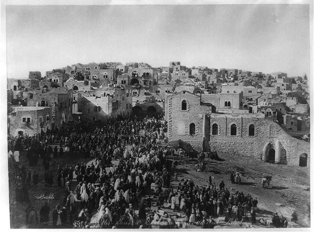
Bethlehem,  the birthplace of Jesus,  was a must see for medieval pilgrims and many would have timed there visit to coincide with Christmas.

Pilgrims coming to Bethelehm at Christmas time (circa 1875) by photographer Félix Bonfils (Library of Congress)

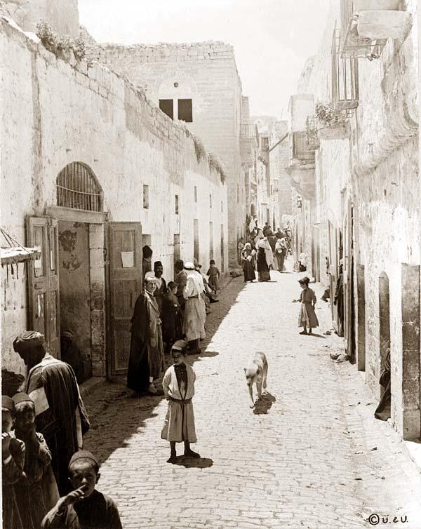
Pilgrims coming to Bethlehem at Christmas time (circa 1875) by photographer Félix Bonfils (Library of Congress)


Within the town of Bethlehem, the traditional site of the  birth of Christ was marked by the Church of the Nativity.

Interior of the Church of the Nativity 1930's  (Library of Congress)

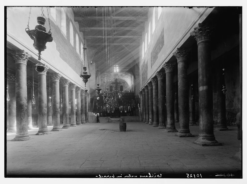
Interior of the Church of the Nativity 1930’s (Library of Congress)

The church was built over a cave that was believed to be the manger where Christ was born.

Grotto of the Nativity under the Church of the Nativity takenca. 1890 and ca. 1900 (Library of Congress)

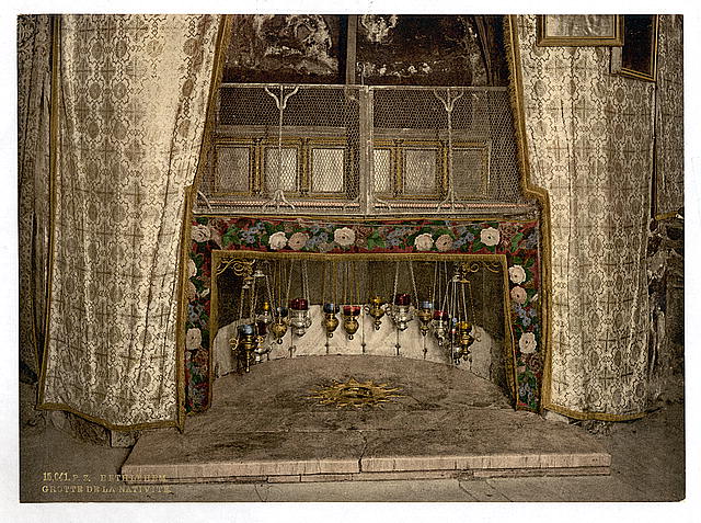
Grotto of the Nativity in  the cave  under the Church of the Nativity, Bethlehem. Image  taken ca. 1890 and ca. 1900 (Library of Congress)

Pilgrims were flocking to Bethlehem from the 2nd century AD.  The  Church of the Nativity was commissioned in 327 AD by the Emperor Constantine and his mother St Helena.  This first church was not completed  until 339 AD and  it was later destroyed during the Samaritan  revolts in the 6th century.  The current church was built on top of the aforementioned  one in 565 AD by the Emperor Justinian.  This link will take you to a  3D virtual tour to the current   Church of the Nativity in Bethlehem.

1200px-Nativity_vorobiev

View of Church of the Nativity in 1833 by Maxium Vorobiev (from http://en.wikipedia.org/wiki/File:Nativity_vorobiev.jpg)

 Today the church is a UNESCO Heritage Site.

Since early medieval times the Church has been increasingly incorporated into a complex of other ecclesiastical buildings, mainly monastic. As a result, today it is embedded in an extraordinary architectural ensemble, overseen by members of the Greek Orthodox Church, the Custody of the Holy Land and the Armenian Church, under the provisions of the Status Quo of the Holy Places established by the Treaty of Berlin (1878). (UNESCO Website)

In modern times Christmas services for Roman Catholics and Protestants are celebrated on Christmas eve and Christmas day, the 25th of December. The orthodox Churches ( Coptic, Greek, etc) celebrate on the 6th of January and the Armenian Orthodox on the 19th of January.

One of the early pilgrims to Bethlehem was St Jerome who visited here while on a pilgrimage around the Holy Land,  before taking up permanent residence  in 386 AD. While living in Bethlehem he  set up a monastery and pilgrim hostel to help provide hospitality to the pilgrims who were visiting here.

The main street leading from the Church of Nativity, Bethlehem. It was created in 1880 (http://www.old-picture.com/american-adventure/Bethlehem-Street.htm)

The main street leading from the Church of Nativity, Bethlehem circa  1880 (http://www.old-picture.com/american-adventure/Bethlehem-Street.htm)

Bethlehem was a  small quiet place and was described  circa 1231 AD as having only one street.  This must  have provided pilgrims with a nice change from the hustle and bustle of  Jerusalem. The pilgrims who travelled here often  came on donkeys  as did the English pilgrim Margery Kempe in 1413 AD ( Chareyron 2005, 102). In the late medieval period pilgrims entered the church in a processional order signing hymns and carrying a lighted candle (ibid).  The pilgrim Jean Thenaud arrived here bearing gifts of gold, frankincense and myrrh and was greeted outside the shrine by candle-sellers . He describes his visit as follows

Pilgrims entered “a small room with a vault of fine marble and mosaic”. There beneath the rock, was the place where the Lord was laid, the crib for the ox and the ass, and the rock itself the place for the nails that held the rings for tethering the animals and the hole through which the star that guided the Magi was said to have  disappeared and the place where they worshipped Him (Chareyron 2005, 103).

Irish evidence for pilgrimage to Bethlehem

Time does not allow for a full discussion of Irish pilgrimage to the Holy Land  and I do intend to come back to the topic  in another post.  So very briefly it is hard to gage how many Irish  pilgrims  visited the  Holy Land. The Irish annals record 6 pilgrimages  to Jerusalem between the years 1060 to 1231 AD and the Chartularies of St Mary’s Abbey in Dublin record the pilgrimage of  Richard and Helen de Trum (Trim in Co Meath) in the year 1230 AD.   The most detailed account of an Irish pilgrimage  to the Holy Land is that of the  Irish Friar Symon Semeonis who set forth from Clonmel in 1323 AD with his companion Hugh the Illuminator and who on his return he complied  an account of his travels. These records represent only a fraction  of Irish pilgrimages to the Holy Land and tell us little about how the Irish pilgrims experienced the Holy Land.

Nativity Relics in Europe

Pilgrims did not have to  travel  as far as the Holy Land  to venerate the birth of Christ,  as relics of the nativity, ranging from hay from the manger to the shift the Blessed Virgin gave birth in,  were to be found at shrines across European. The following   is a snapshot of some of these relics.

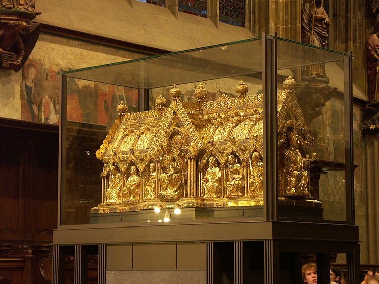
The Relics of the Magi at Cologne

The cathedral church of Cologne in  Germany held the  relics of the Three Magi  and was a major centre of pilgrimage in the late medieval period. Located on a number of important trade route including the River Rhine the city attracted vast numbers of pilgrims each year.

The reliquary of the Three Magi at Cologne Cathedral (image taken http://en.wikipedia.org/wiki/File:Cologne_Cathedral_Shrine_of_Magi.jpg)

The reliquary of the Three Magi at Cologne Cathedral (image taken http://en.wikipedia.org/wiki/File:Cologne_Cathedral_Shrine_of_Magi.jpg)

According to the Gospel of Mathew the ‘Magi’ were three Kings from the east who journeyed to Bethlehem following as star to pay homage to the ‘one who has been born king of the Jews’. The Magi were also the first Christian pilgrims.

So how did the  Three Magi end up in Germany? According to legend the corporeal relics of the Magi were discovered by St Helena (mentioned above), the relics were translated to the church of Saint Sophia at Constantinople and at a later date were brought to Milan. In 1160 AD following the sack of Milan, Frederick Barbarossa brought the relics  from the Basilica de Sant’ Eustorigo to Cologne.  Later an elaborate reliquary of gold silver and enamels and precious stone was  constructed to hold the holy relics. The reliquary was commissioned by Philip von Heinarch Archbishop of Cologne (1167-1191)  and made by Nicholas of Verdun.   Pope Innocent IV granted a plenary indulgence to Cologne in 1394 AD which was an additional attraction for pilgrims to visit here.

Chaucer’s Canterbury Tales  tells that the wife of Bath  had travelled  thrice to Jerusalem and once to Cologne implying the shrine was well-known to English  pilgrims.

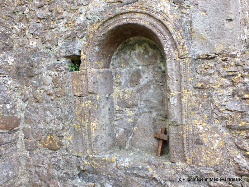
Irish devotion to the Thee Magi  is represented in Irish medieval sculpture for example the  east face of Muiredach’s High Cross at Monisterboise,  has a depiction of the Adoration of the Magi.

The Adoration of the Magi on the east face of Muiredach's High Cross (image taken http://ireland.wlu.edu/cross/Muiredach/east/5.htm)

The Adoration of the Magi on the east face of Muiredach’s High Cross (image taken http://ireland.wlu.edu/cross/Muiredach/east/5.htm)

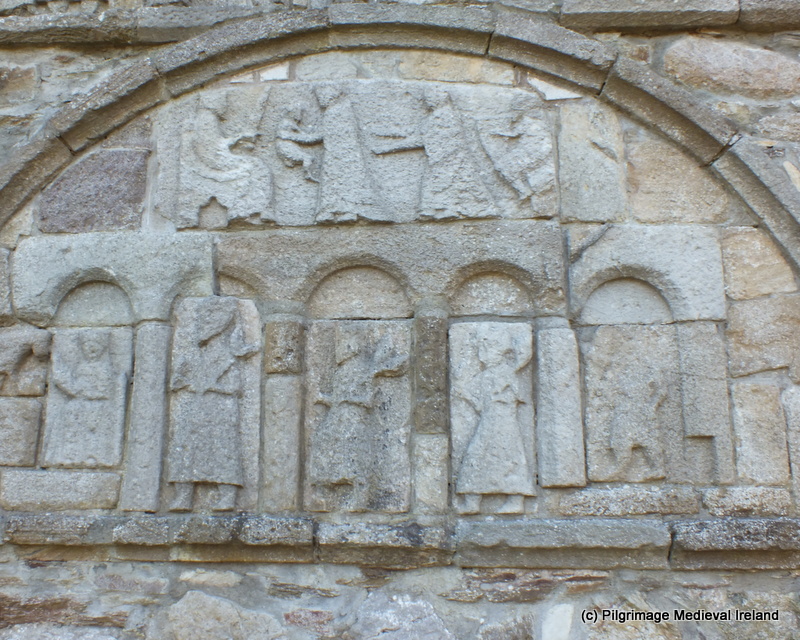
The Adoration of the  Magi is also represented  on the gable  of Ardmore Cathedral church.  Also one of the alters at the Franciscan Friary in Waterford city was dedicated to the Three Magi.

Three Magi at Ardmore Cathedral

Three Magi at Ardmore Cathedral

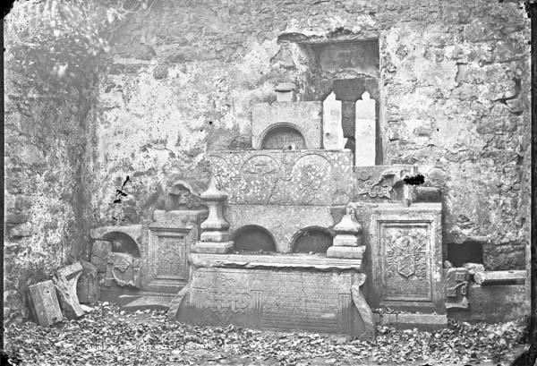
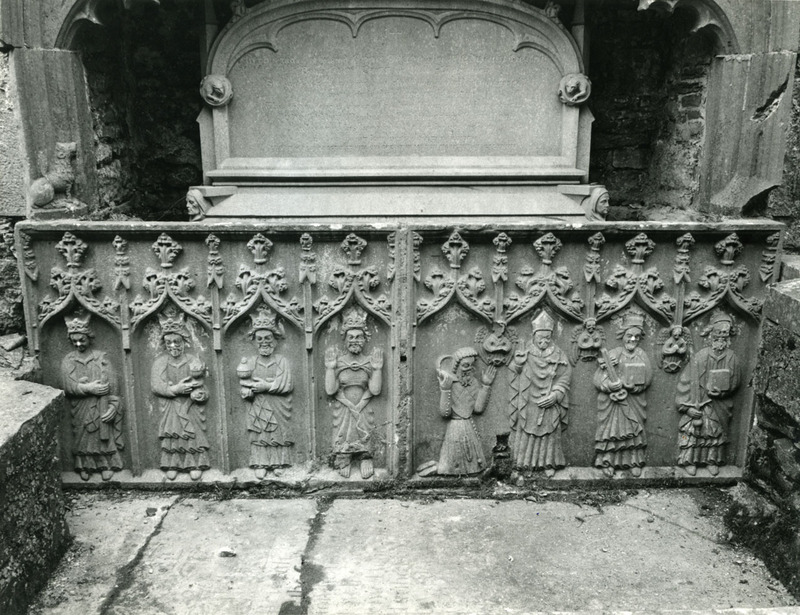
The fifteenth century tomb  at Strade abbey in  Co Mayo depicts the Three Magi, St Thomas á Beckett, SS Peter and Paul and the figure of pilgrim  kneeling. It is very likely that the iconography of the tomb  indicates the deceased had been on pilgrimage to Cologne, Canterbury and Rome.

Tomb depicting the three magi at Strade

Tomb depicting the three magi at Strade Abbey (image taken  http://hdl.handle.net/2262/39072)

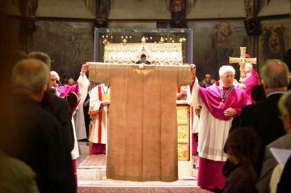
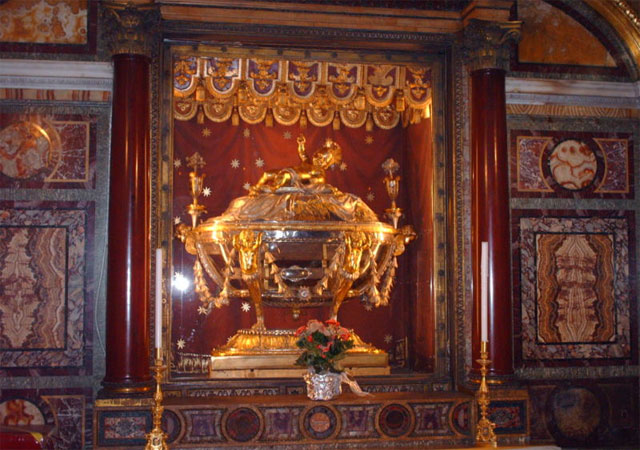
Relics of the Nativity at Aachen

Approximately 61km from Cologne is the shrine of Aachen, another very popular European pilgrim shrine.  Aachen  had a miraculous image of the Virgin Mary along with a number of relics of the nativity. The relics included the nightgown worn by the Blessed Virgin, the swaddling clothes of the Christ Child, the loin cloth of Christ and  a cloth that the decapitated head of St John the Baptist was laid on.  It was also the burial-place of the Emperor Charlemagne who was canonised in 1165 AD and the cathedral also possessed the relics of St Ursula.

 Marienschrein (1238)/The shrine of Mary, contains the relics , shift of lessed Virgin, the swaddling-clothes of the Infant Jesus, the loin-cloth worn by Christ on the Cross, and the cloth on which lay the head (image taken from http://en.wikipedia.org/wiki/File:Aachen_cathedral_007.JPG)

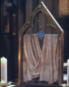
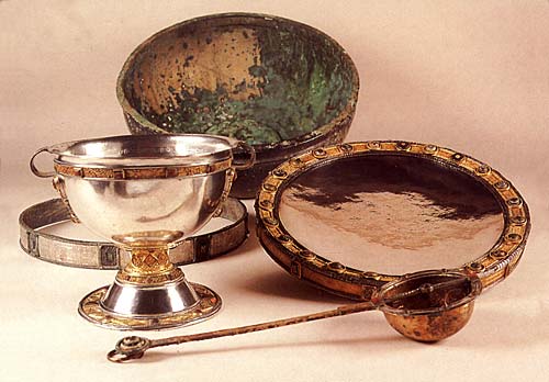
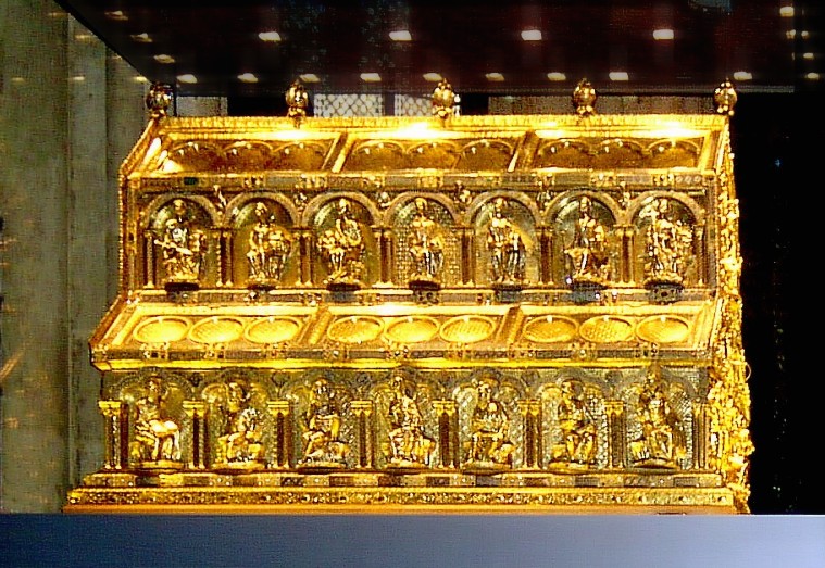
Marienschrein (1238)/The shrine of Mary, contains the relics , shift of the Blessed Virgin, the swaddling-clothes of the Infant Jesus, the loin-cloth worn by Christ on the Cross, and the cloth on which lay the head (image taken from http://en.wikipedia.org/wiki/File:Aachen_cathedral_007.JPG)

Many high status pilgrims travelled here and the Queen of Hungary came to Aachen in 1337 AD, with an escort of 700 knights.

Aachen  became an immensely popular pilgrim site and attracted so many pilgrims  it became tradition  to display the relic  every seven years for 15 days,  between the 10-24th of July, on  the Aachener Heiligtumsfahrt.  This is a tradition which continues to  present time. The first  “Heiligtumsfahrt” (pilgrimage) took place in 1349 and 2014 will be the date for the next. To give you some idea of the shrines popularity, in 1496 AD the gatekeepers counted  147000 pilgrims  entering Aachen during the 15 days the relics were on display. It was said the pilgrims left 85000 gulden at the shrine (Chunko 2009, 1-2). The shrine also offered a plenary indulgence to pilgrims.

The well known  English pilgrim Margery Kempe made pilgrimage to here in 1433 AD  when she travelled  on pilgrimage from Danzig to Wilsnack and on to  Aachen,  where she saw the ‘virgin’s smock’.

Late 15th century pilgrim badge from Aachen at Museumof London (http://collections.museumoflondon.org.uk/Online/object.aspx?objectID=object-37968&start=120&rows=1)

Late 15th century pilgrim badge from Aachen at Museum of London (http://collections.museumoflondon.org.uk/Online/object.aspx?objectID=object-37968&start=120&rows=1)

The shrine also sold pilgrim badges  depicting the relic of the Virgins nightgown/shift. These badge began to be made from the 1320s  and some of these badges have turned up in archaeological excavations in London.

Chartres in France

The cathedral church at Chartres in France possessed the Sancta Camisa the shift worn by the Blessed Virgin when she gave birth to the Christ child. The relic was given to the church in 876 AD by Charles the Bald, who had brought it here from Constantinople.  It was enclosed in a reliquary shrine called the Sainte-Chasse and many miracles are associated with this relic.  Most pilgrims came here for the Marian feast of the Presentation, Annunciation and Assumption and the feast of the Nativity of the Virgin.  As at Aachen pilgrim badges depicting the holy garment were sold to pilgrims in  the later medieval period.

The relic of the Virgins nightgown at Chatres Cathredral (image takenhttp://sites.tufts.edu/textilerelics/2011/02/08/marian-relics/)

The relic of the Virgins nightgown at Chartres cathedral (image takenhttp://sites.tufts.edu/textilerelics/2011/02/08/marian-relics/)

Other Relics of the Christ Child

From the 11th and 12th century  devotion to the Christ Child increased in Europe with SS Bernard of  Clairvaux and Francis of Assisi  actively promoting devotion to the Christ Child, and  relics of the umbilical cord, foreskin, fingernails and milk teeth of Christ were  to be found across Europe.

Rome with its vast collections of relics also had relics of the Nativity. The church of St Maria Maggiore possessed part of the crib in the form of boards from the manager. The board  are believed to have supported the crib used by Christ and  were brought here by Pope Theodore (640-649)  from the Holy Land.

Relic of the Holy Manger (Image taken www.stuardtclarkesrome.com)

Relic of the Holy Manger (Image taken http://www.stuardtclarkesrome.com)

Another Nativity relic was found at the Archbascilica of St John Lateran where a section of the ‘Holy Umbilical Cord’ of Christ was kept. The last milk tooth of the Christ Child was housed at  the abbey of Saint Médard at Soisson  in France. Finally up to 8- 14 churches claimed to possess the Holy Prepuce/ Foreskin of Christ .  These churches include Antwerp, Coulombs, Chartres, Charroux, Metz, Conques, Langres, Anvers, Fécamp, Puy-en-Velay, Auvergne, Hildesheim, Santiago de Compostela and Calcata.

Closer to home  Christchurch Cathedral in Dublin  had in its  relic collection  a fragment of the crib while  Reading Abbey in England had another  a relic of the umbilical cord and Our Lady’s Shrine at  Walsingham, also in England attracted pilgrims to visit relics of Mary’s milk.

Conclusions

The birth of Christ  was one of the most important feasts in the Christian calendar and each year it was celebrated  by  Christians with special liturgy and nativity plays.  There was great devotion to the Christ Child and the Blessed Virgin in the Medieval world.   Christmas time would have  inspired  some to take their devotion further by embarking on a pilgrimage to either the Holy Land or one of the many relics of the nativity which were scattered across Europe.  As most people preferred not to travel in Wintertime most would have stayed at home for Christmas and planned their pilgrimages for Spring or Winter.

References

Bugslag, J. 2009. ‘Chartreuse de Champol’ In Encyclopaedia of Medieval Pilgrimage. Boston: Brill, 96-99.

Chareyron, N.  2005. Pilgrims to Jerusalem in the Middle Ages.. Translated by W. Donald Wilson. New York: Columbia University Press.

Chunko, B. 2009. ‘Aachen’, Encyclopaedia of Medieval Pilgrimage. Boston: Brill, 1-2.

Donovan, S. 1908. Crib. In The Catholic Encyclopedia. New York: Robert Appleton Company. Retrieved December 22, 2013 from New Advent: http://www.newadvent.org/cathen/04488c.htm

Lins, J. 1907. Aachen. In The Catholic Encyclopedia. New York: Robert Appleton Company. Retrieved December 20, 2013 from New Advent: http://www.newadvent.org/cathen/01001a.htm

Lutz, G. 2009. ‘Cologne Cathedral’  In Encyclopaedia of Medieval Pilgrimage. Boston: Brill, 114-115

MacLehose, W. 2009. Relics of the Christ Child’ In Encyclopaedia of Medieval Pilgrimage. Boston: Brill, 601-603.

Mulcahy, E. 2012. ‘Symon Semonis The Franciscan Pilgrim.’ http://edelmulcahy.wordpress.com/2012/04/17/symon-semeonis-franciscan-pilgrim/

Aachen Cathedral . http://www.live-like-a-german.com/germany_related_articles/show/Aachen-Cathedral

Birthplace of Jesus: Church of the Nativity. http://whc.unesco.org/en/list/1433

Marian Relics 20011. http://sites.tufts.edu/textilerelics/2011/02/08/marian-relics/

http://www.medievalists.net/2013/12/09/the-holy-foreskin/

http://www.mariedenazareth.com/8137.0.html?&L=1

http://www.animatedmaps.div.ed.ac.uk/Divinity2/pilgrimages.html

he Aachen Cathedral is a major pilgrimage church and the burial place of Charlemagne and Holy Roman Emperor Otto III. The shrine to St. Mary holds the four great Aachen relics: St. Mary’s cloak, Christ’s swaddling clothes, St. John the Baptist’s beheading cloth and Christ’s loincloth. Following a custom begun in 1349, every seven years the relics are taken out of the shrine and put on display during the Great Aachen Pilgrimage. This pilgrimage most recently took place during June 2007. – See more at: http://www.live-like-a-german.com/germany_related_articles/show/Aachen-Cathedral#sthash.PcI6PX27.dpuf
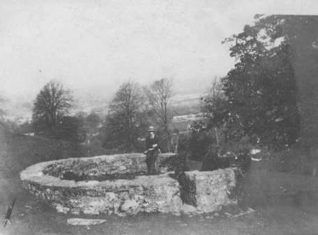
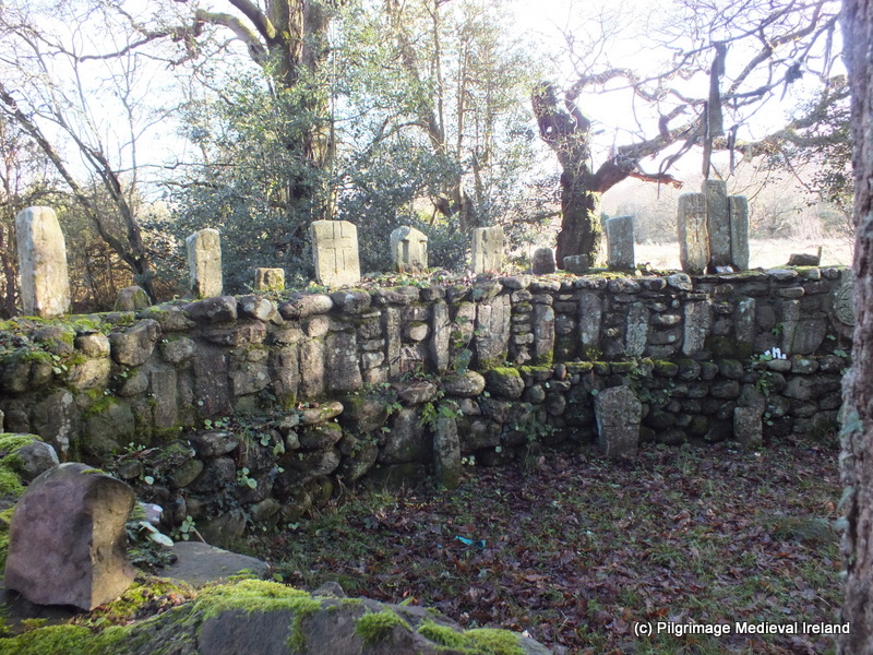
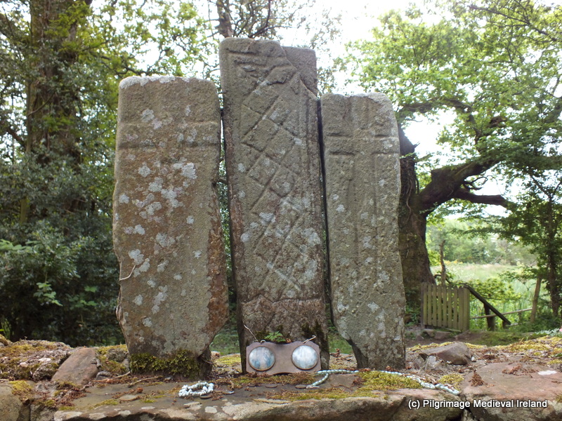
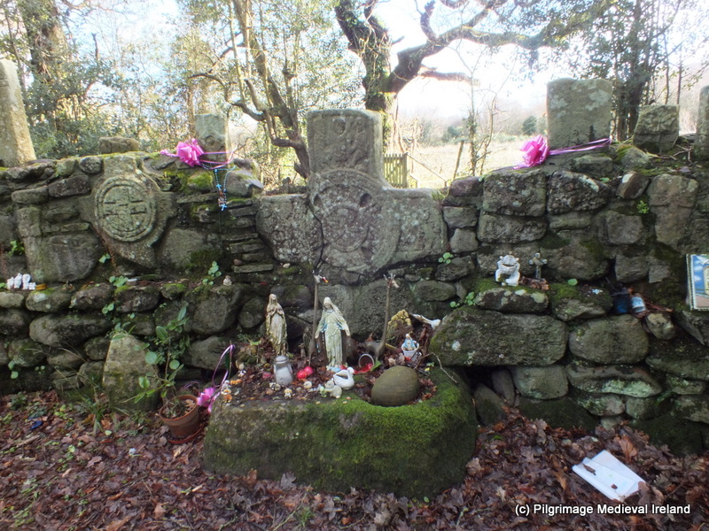
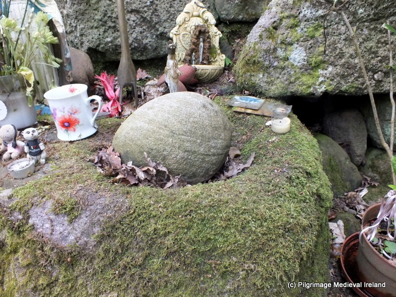
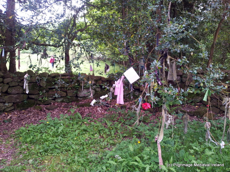
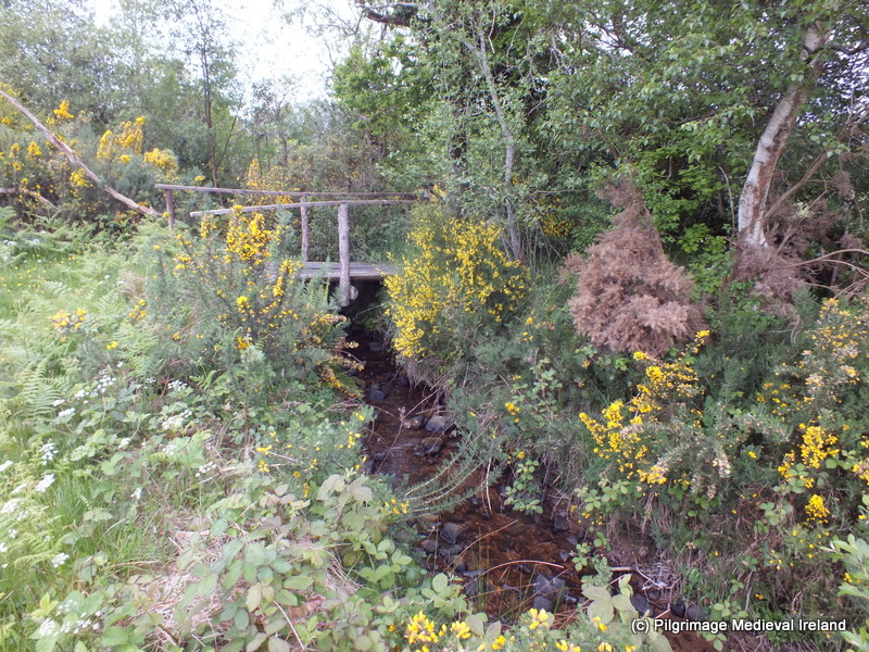
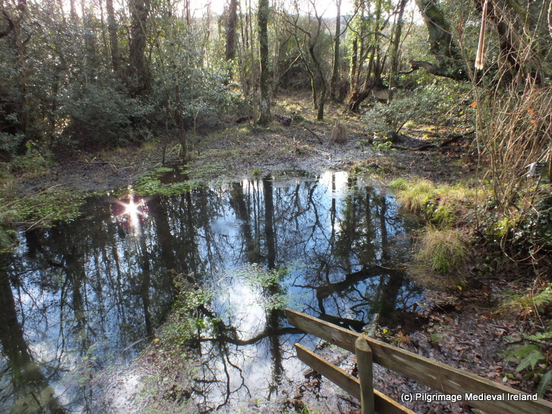
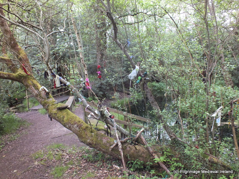
Carlow Cathedral pulpit: No. 85 on the Ireland in 100 objects trail

I am  getting a copy of Fintan O Toole’s  A History of Ireland in 100 Objects as an Xmas present,  I cant wait.  The book like the title says  tells the history  of Ireland through 100 artefacts. The chosen objects take us through the history of people in Ireland over 7,000 years, from a simple fish trap of the earliest inhabitants of the island to the first mass-produced microprocessor.

GetImage.aspx

A selection of some of the 100 objects covered in the book (image from http://www.museum.ie/en/list/history-of-ireland-in-100-objects.aspx)

Off the back of this book there is a historic trail which allows the visitor to go and see the objects at the museums they are housed at. Last week as I happened to be in Carlow for the launch of the Carlow Archaeological and Historical Society Journal Carloviana,  I  began the trail with object No 85 which is housed  at the Carlow County Museum.

Phone latest 143

Brochure for 100 Objects Trail

The trail does not demand you to start with any one object  and it really allows you to dip in and out at your own leisure.

So what is object No 85?  Well its a large pulpit approx 6m tall which once stood in the Cathedral of the Assumption in Carlow town which is coincidentally next door to the museum. The pulpit is made of oak, it was designed by CJ Buckley of Youghal and made by craftsmen in Bruges ( Belgium) in around 1898 to coincide with renovation to the Cathedral ( built in 1830s).

07-Phone latest 133

The panels are decorated with scenes of saints preaching, angels and the stair railing at the back has a very pretty tree and bird design.

03-Phone latest 129

Side panel of the pulpit showing St Laserian, Carlows patron Saint

The Museum Curator Dermot Mulligan kindly  brought me to see where the pulpit originally stood within the Cathedral church. He told me that despite a lot of objection from local people  the pulpit was removed during renovations during the 1990’s and sometime late became part of the museum collection.

10-Phone latest 136

The original location of pulpit is at the pillar close to the altar on the right hand-side.

The original location of the pulpit was on the right hand side of the church  beside the pillar nearest the altar. Close to the here is the location of the bishops  chair which has a similar style  as the pulpit.  The  chair was commissioned at the same time as the  pulpit and also made in Bruge.

11-Phone latest 137

Bishops chair at the Cathedral of the Assumption Co Carlow

It is nice to see that despite  the removal from the church there are still links to  pulpit (which is in the museum) as the   modern pulpit has miniature carvings based on figures from the  original.

14-Phone latest 140

Carved figures based on the original  pulpit at the Cathedral of the Assumption Carlow

No  85 of the Ireland in 100 historic objects is well worth a visit and if you take your time when viewing it,  you will discover  lots of stories and themes in its carvings.  I would recommend  along with the visit to Carlow County Museum that you also visit the Cathedral as it allows you to better imagine how the pulpit looked in its original location.

I am looking forward to checking out some of the other objects in the coming months.

References

Carlow County Museum http://www.museum.ie/en/list/history-of-ireland-in-100-objects.aspx

http://www.rootsweb.ancestry.com/~irlcar2/Carlow_Cathedral.htm

Ireland in a 100 Objects http://www.100objects.ie/