St Bartholmew’s well, Garrynataggart Co. Cork

The first post of 2014 is about St Bartholomew’s well  in the townland of Garryantaggart Co. Cork. By coincidence the first post of 2013 was also about a holy well of the same name at Kinsalebeg Co. Waterford.

St Bartholomew’s well is  located close to a junction with the R639, the old road linking the towns of Fermoy and Midelton. The well is easy to find and there is  a signpost at the Ballinwillin Bridge junction.

St Barth

Location map of St Bartholomew’s well Garrynataggart taken from Bing maps

According to Power writing in 1923 the townland name Garrynataggart or Garraidh an tSagairt in Irish means ‘the priest’s garden’.  The well is dedicated to St  Bartholomew who was  one of the 12 apostles.  Following the ascension of Christ he  engaged in missionary work and is believed to have brought Christianity to Armenia, where he was later martyred. Tradition holds he was flayed alive and crucified. In the Western church his feast is commemorated in the 24th of August.

Power  (1923, 172)  noted that devotions were held here at the Garrynataggart well on St Bartholomew’s feast day in the early 1920’s

Around hang, or are deposited, votives of the usual kind, and devotions are paid on August 24th.

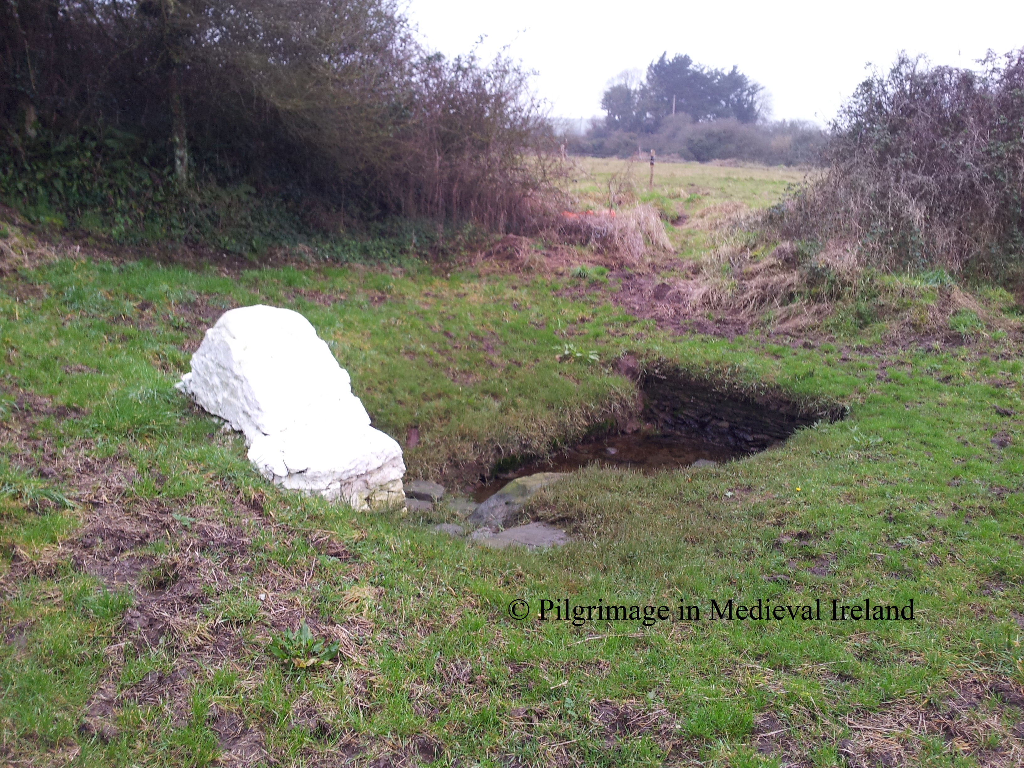
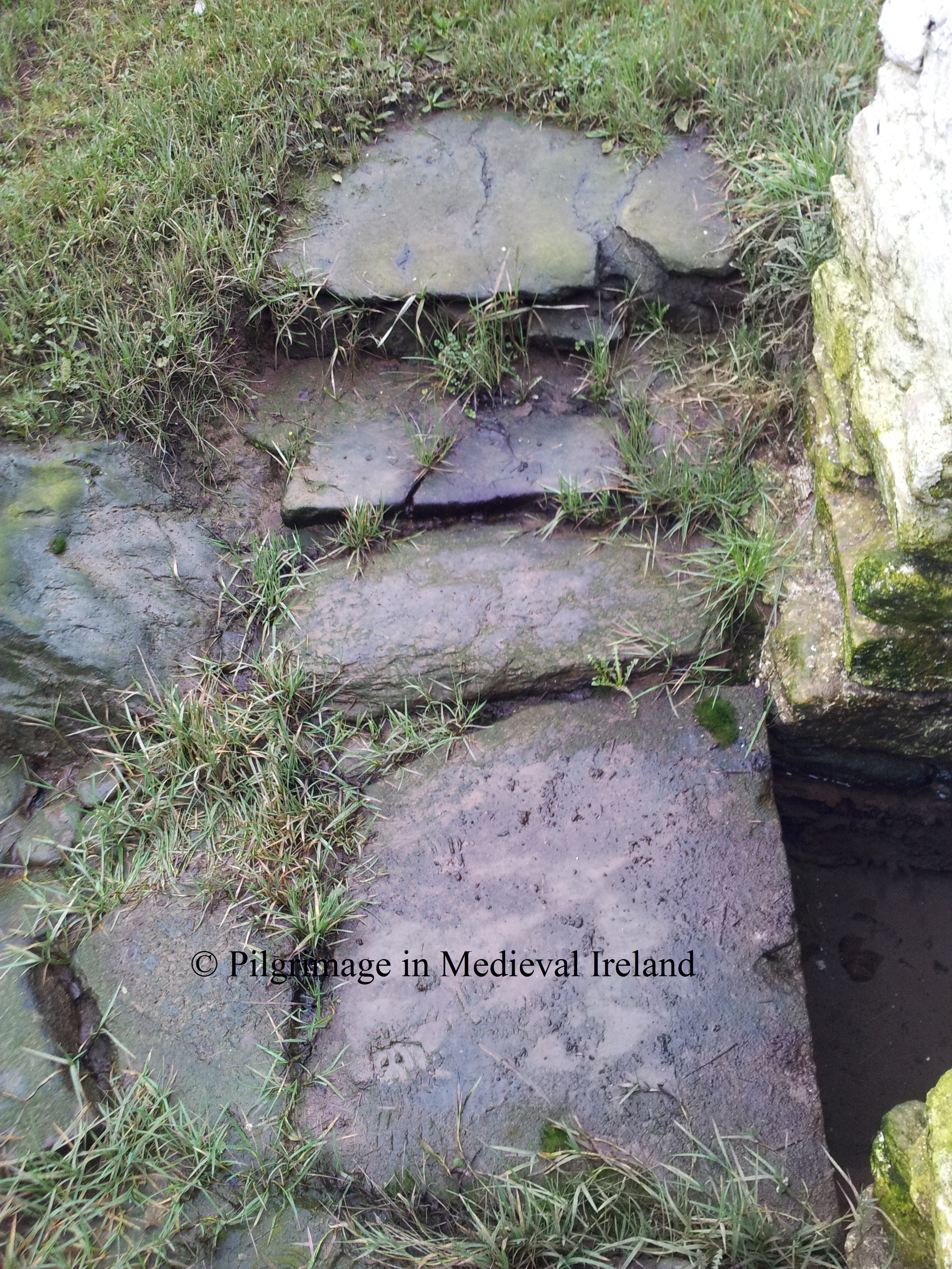
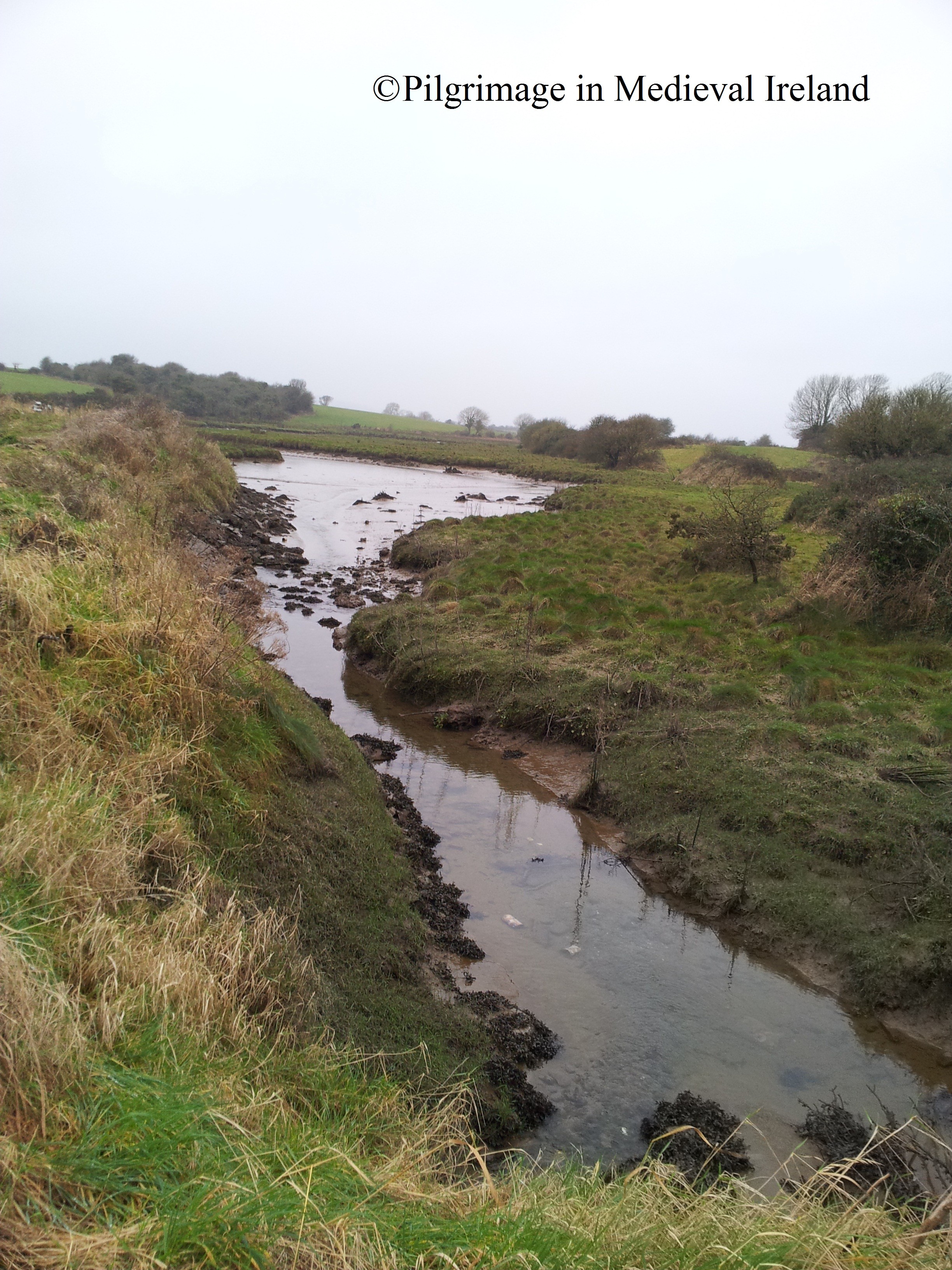
The well is on private land but  the site is very accessible.  A small lay-by at the side of the road  provides parking for visitors to the well.  To approach the well one must  enter a the field via some concrete steps and  then continue a short distance across the field to a small river.

1-20131222_151848

River beside St Bartholomew’s holy well at Garrynataggart.

The river is  bridged by a timber bridge with a gate.

1-20131222_151815(1)

Bridge leading to holy well

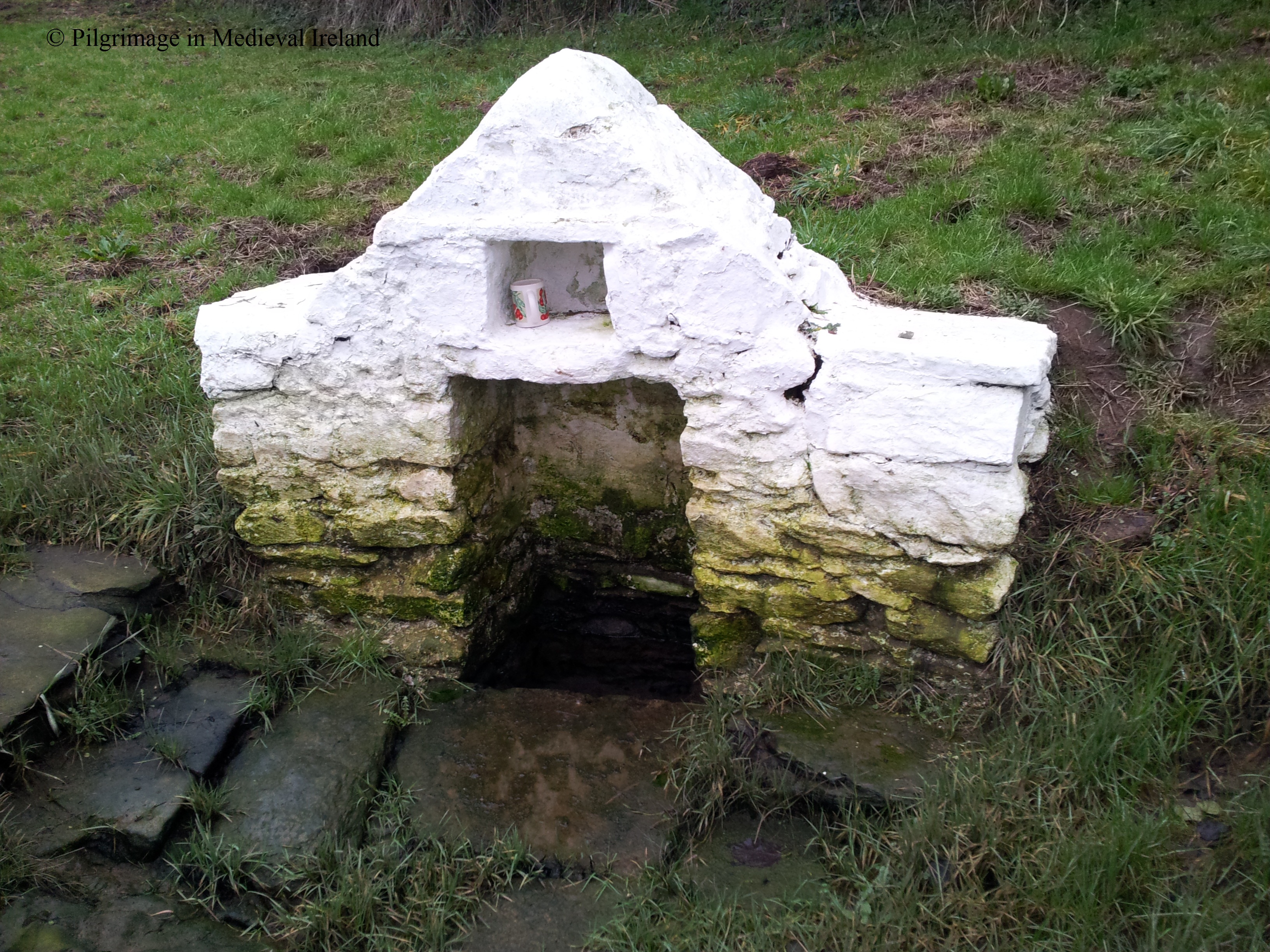
The well is located on the other side of the bridge  on a south-facing  slope.  The area is very neat and tidy and there is a bench above the well, implying the  site is still cared for by local people.

The well is a natural spring it is surrounded by a tear shaped stone wall with a rounded top.

1-20131222_151935

St Bartholomew’s well Garrynataggart is surrounded by a modern enclosing wall.

The well is entered at the south  through a door with a gable faced facade.  At the top of the gable is an iron cross and a plaque stating the dedication of the well.

1-20131222_152000

Entrance to St Bartholomew’s well Garrynataggart.

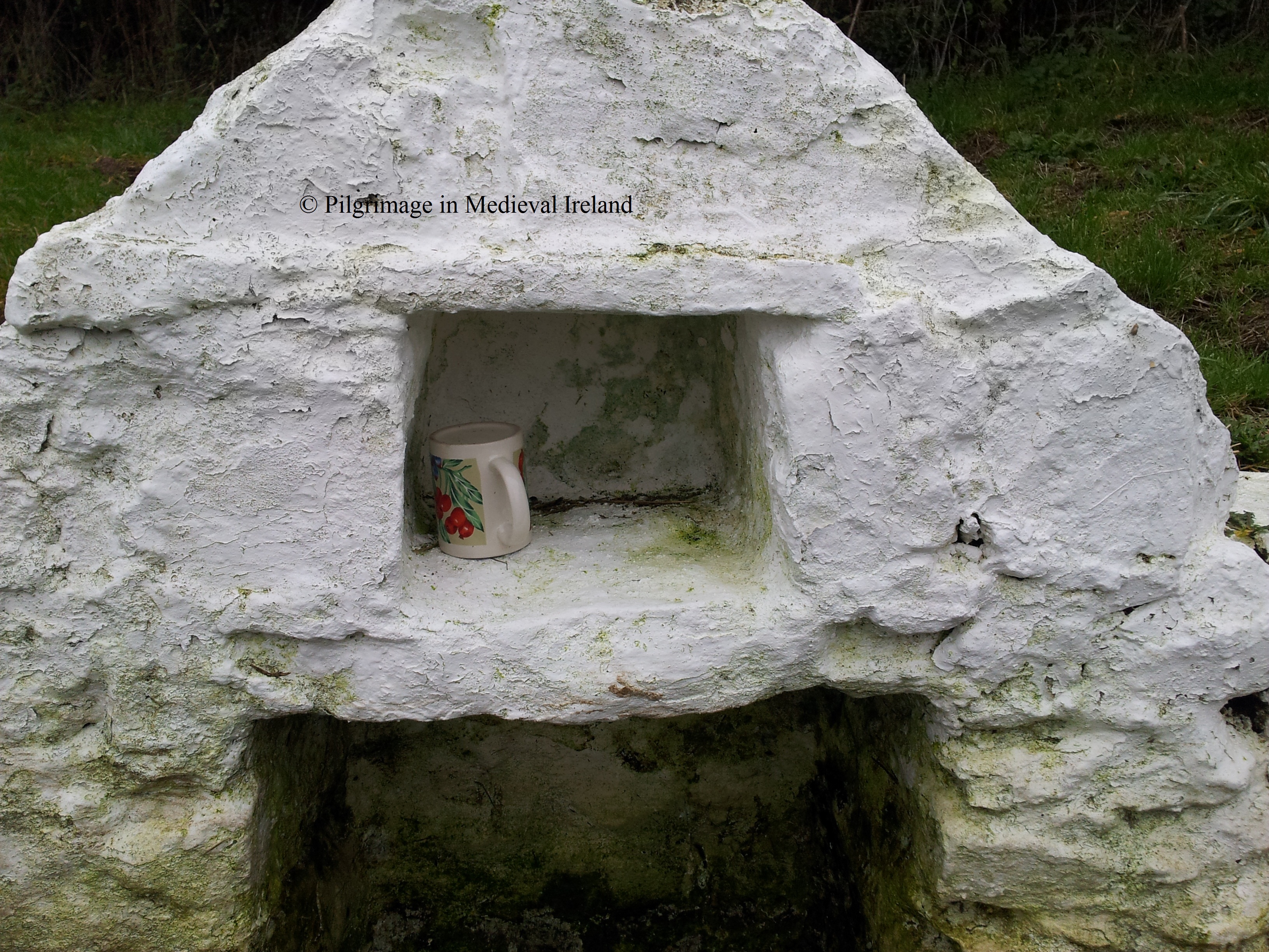
A number of  ceramic mugs are found inside the well structure  on the left is a small recess.

1-20131222_152056(1)

Cups in small recess of the interior of the well structure at St Bartholomew’s well Garrynataggart.

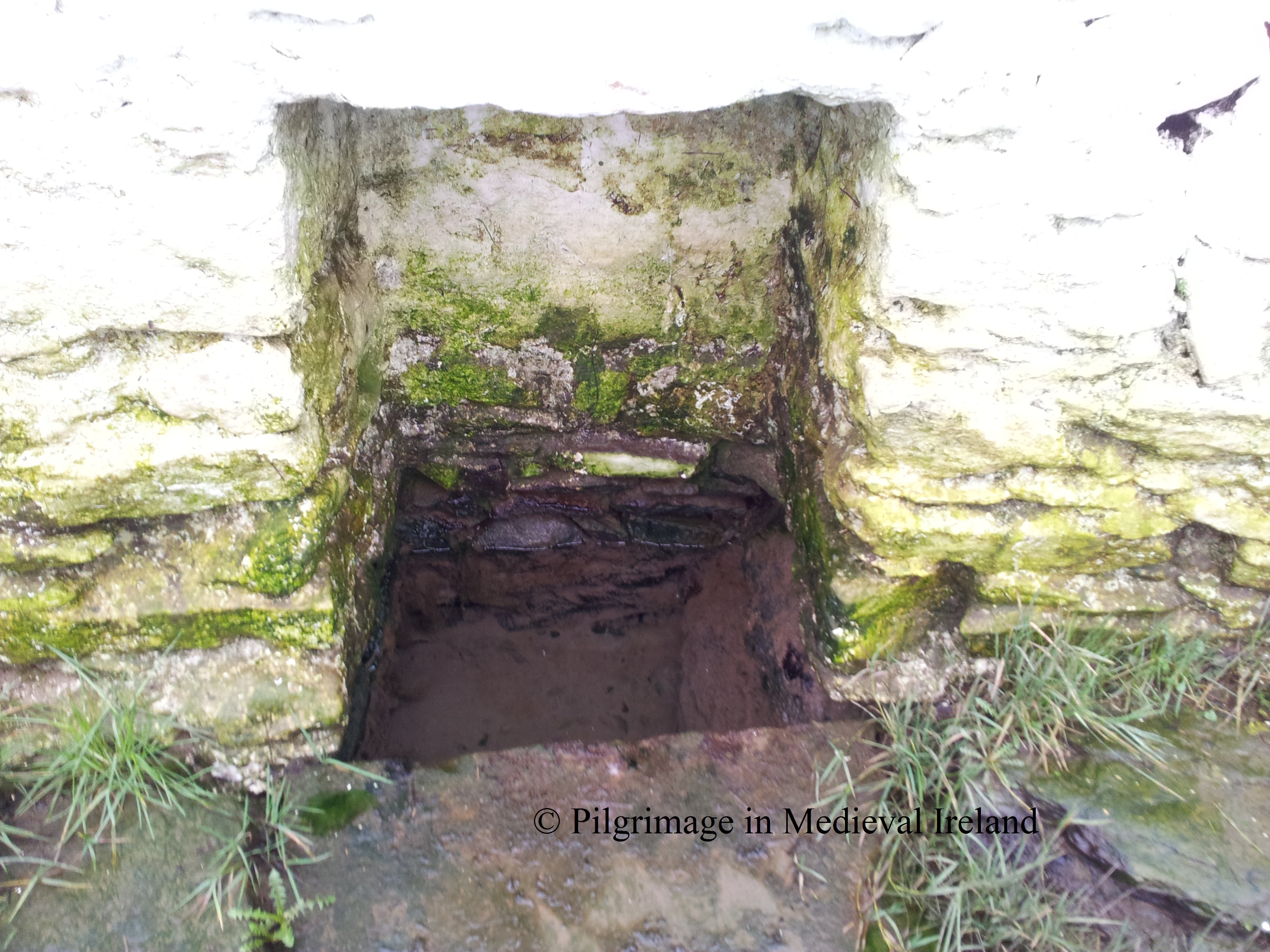
The well is still in use  and visited, as evident from the neatness of the surrounding area and a small number of coins left in the water.

1-20131222_152048

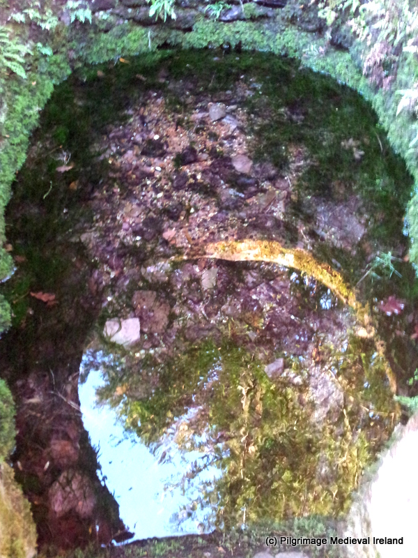
The water of St Bartholomew’s well Garrynataggart comes from a spring and is crystal clear.

As I mentioned above devotions were being carried out at the well on the 24th of August on the saints feast day. Power (1923, 172) also mentions people leaving offerings at the well.

  Around hang, or are deposited, votives of the usual kind…..

  Today apart from the coins in the water of the well there is an image of the saint hanging from the well structure.

1-20131222_152301(1)

Image of St Bartholomew at St Bartholomew’s well Garrynataggart.

Id love to find out more about modern traditions at the well so if anyone has any information  please get in touch either by commenting on this post or emailing pilgrimagemedievalireland@gmail.com.

(C) Louise Nugent

Reference

Power, P. 1923. ‘Place-Names and Antiquites of S.E. County Cork. Barony of Barrymore. Part III.’ PRIA Vol. 36, 164-205.

St Bartholomew’s Holy Well Kinsalebeg, Co Waterford.

Yesterday I visited my first pilgrim site of 2013, St Batholomew’s holy well or Tobar Phárthanáin. The well is to be found  in the  parish of Kinsalebeg in Co Waterford, a short distance from the village of Pilltown and a few miles from the town of Youghal.

Location map of Holy well

Location map of St Bartholomew’s Holy Well. Image taken from Bing maps.

The well is located in a field of rough pasture on the east side of the Blackwater estuary, close to a cross roads in the townland of  Moord/Mord,  (An Móird/An Magh Ard or  “The High Plain”) about  mile south of Piltown. It’s really hard to find, I was really lucky to meet a local man who despite being in a hurry  brought me to the well.

The well is dedicated to St Bartholomew, who was one of the twelve apostles. The saints   feast day is  on the 24th of August.  There are a number of accounts of pilgrimage to the well   in the not too distant past, on this day. According to Power  writing in  1937  St. Bartholomew was traditionally held  to be the patron saint of the parish of Kinsalebeg. He also noted that his feast was kept  by local people

on the 24th of August, by visits to the ” Blessed Well” dedicated to him and that on the Sunday nearest to the feast, a public ” pattern ” is held at the well and at the adjoining village of Piltown.

From the NE the well is hidden   in a hollow  in the field close to the boundary ditch.  A short distance to the W is a small stream running into the estuary.

20130105_140215

St Batholomew’s Holy Well

The well itself consists  of a small  of a rectangular stone and mortar built superstructure,  with a triangular-shaped top.

20130105_135630

Stone built rectuangular superstructure of St Bartholomew’s well with triangular-shaped top.

There are two rectangular recesses one at the base where the water can be accessed.

Recess for access to well waters

Recess for access to well waters

The second recess sits  just above the lower opening  and below the apex of the structure. When I visited here  a modern ceramic mug  was housed within. The structure is white washed.

20130105_135655

Upper recess in well superstructure . Note the modern mug.

Stone flags act as steps to the well and  divide it from  the large rectangular trough located beside it.

20130105_135703

The larger trough is cut into the earth and  stone faced . The eastern face appears to have collapsed in but the side is still well-preserved. The west  wall is stepped with stone facing  sitting on top of three large  flags which may have acted as steps into  the trough. Perhaps in the past  pilgrims would have taken water from the smaller trough and washed their limbs   in this one.

20130105_140027

FitzGerald writing in 1856  notes that  the well

is greatly resorted to for ‘giving  rounds’ at. It is celebrated for several cures, but especially for sore eyes.

A patron at the well is mentioned in a number of sources.  The Ordnance Survey Letters of 1840, state that a pattern was last held here in 1812 on St. Bartholomew’s Day. FitzGerald in 1856 wrote ‘there is a patron held here every 24th of August’. Power writing in  1937 notes

This is a well-known holy well at which a pattern is held and “rounds” made on August 24th.

However the I.T.A. survey of 1945  noted that

up to about 50 years ago this well was held in high repute and hundreds of people came here to “make their rounds”.Of late years very few visit it’.

This may suggest the pattern was reviewed for a time after 1840 before declining in popularity  in the early 1900’s. Today the well looks like it is maintained, the white washing of the masonry   and the presence of the mug suggests its probable still used but I wonder by how many people.  Despite the grey day it is really one of the nicest wells I have visited.

20130105_135822

Nearby stream flowing out into estuary.

Rituals  performed by  pilgrims  here in the 19th century  involved the ‘making of rounds’  a tale told by Fitzgerald in 1856 suggests that the pilgrim landscape extended beyond the well.

“ when I visited it last, a couple of months ago, a very intelligent young man of the neighbourhood  pointed out to me two houses some twenty yards from the well, which he said were built on the ground that was formerly taken in by the pilgrims in their circuit of ‘rounds’ , and that to his own knowledge the parties who made the encroachments all dwindled away to nothing – none of them ever had a day’s luck afterwards.”

I haven’t had time to consult the 1st or 2nd edition OS maps but  it is interesting to note that a short distance from the well are two small cairn of  what looks like building rubble .

The well was once associated with a rag tree which  is unfortunately no longer in existence. Fitzgerald gives the following colourful description of the tree and its associated rituals.

the fine old venerable  thorns which overshadowed  it bore a most motley appearance, actually crowded with old red, blue, and green ribbons and rags, as if torn from the dresses of pilgrims, and tied up as a finale to their ‘rounds’  and prayers.

He goes on to describe a conversation with a lady that he meet at the well  who described to him the meaning of this practice at the well.

An old crone engaged in giving her ‘rounds’ told me they were tied up by each to leave all the sickness of the year behind them.

This description of the tree sounds  so very colourful and vibrant. It makes you wonder  how many other wells also had rag tree that have disappeared.

St Batholomew’s holy well or Tobar Phárthanáin is a really peaceful and lovely well. If anyone has any other information about  the well or  modern traditions associated with  it,  I’d love to hear from them.

© Louise Nugent 2013

Bibliography

FitzGerald, E. (1856-7) Proceedings – “Jottings in archaeology”, JRSAI 4, 40-49, 289-91.

I.T.A. Topographical and General Survey of County Waterford. Ireland, 1945. [on-line] http://snap.waterfordcoco.ie/collections/efolders/155321/ita_survey.pdf [accessed 4/08/2012]

O’Flanagan, M. (Compiler) (1929) Letters containing information relative to the antiquities of the county of Waterford collected during the progress of the Ordnance Survey in 1841. Typescript. Bray.

Power, P. 1937. Waterford & Lismore : a compendious history of the united dioceses. Cork: Cork University Press, 128.