Urlaur Abbey Co Mayo

Urlaur Friary,  a Dominican foundation,  on the shores of Urlaur Lake in Co Mayo is one of Ireland’s best kept secrets.

289

Urlaur Friary Co Mayo

The friary was founded  around the year 1430 and was dedicated to St. Thomas.  The friary survived the  Reformation and in the early 17th century, the property was confiscated and handed to Viscount Dillon, a local loyal landlord. The community continued to reside here and the last friar of Urlaur, Patrick Sharkey, died in 1846. He lived in a cottage beside the ruins of friary and he sometimes said mass within the church.

The church is entered through the west gable via a pointed doorway with hooded moulding. A carved  head in poor condition sits above its apex.

DSCF2104

West gable of Urlaur Church

Above the door is a small elaborate triple light window with hooded moulding.

The interior of the church is quiet plain and the floor is covered with gravel.

298

View of interior of Urlaur church facing the east gable.

The north side of the nave of the church appears to have been extended to accommodate an aisle. The remains of an arch  on the north side of the west gable wall suggests the aisle may have been divided from the nave by arches and columns.

The east gable is also well preserved and  has the remains of  an elaborate tracery window.

The domestic buildings for the friary also survive and abutts the east end of the  south wall of the  church.

345

The east gable of Urlaur Church and domestic buildings for friary.

A pointed doorway in the south wall of the church leads into a vaulted room (part of the domestic building) abutting the exterior south wall of the church.

A second door in the middle of the  south wall provides access to the exterior of the church and the domestic buildings.

DSCF2166

View of doorway in the south wall of the church.

The remains of the domestic building consist of a north-south aligned two storey building. The ground floor has a number of vaulted rooms.

Access to the second floor of the building is provided by a stone stairs.

327

Stone stairs leading to the upper floor of the domestic buildings

The upper floor is unroofed and may have been the dormitory for the friars.

316

A square tower for want of a better word is built against the south wall. This is probably the garderobe.


During the 19th century Urlaur was the scene of a pattern day held the on 4th of August, the feast of St Dominic. A field beside the church was marked as the pattern field on the 1839 1st ed OS 6-inch maps for Co Mayo.

urlaur

1st ed. OS 6-inch map of 1838 depicts a field known as the Pattern field beside the abbey.

The pattern despite some ups and downs has continued to the present day and an  annual mass  reintroduced in 1914 is still held here each year on the  4th of August.


A stroll along the shores of Lough Derg, Co Donegal

This is Pilgrim Paths week which reminded me of a recent visit to the shores of Lough Derg, Co Donegal.  Lough Derg lake is home to St Patrick’s Purgatory (located on Station Island) one of Ireland’s oldest and most popular pilgrim sites. Each year large numbers of pilgrims travel to the Island during pilgrim season that runs from May to September  to partake in an arduous penitential pilgrimage which can last up to three days.

A modern walk skirts along the shores of the lake and is open all year round.  This walk is a part of the Pilgrim Paths network of walking routes.  The network of routes known as pilgrim paths are a group of modern Irish walking routes that in many cases incorporate sections of or follow closely the route of older pilgrim routes some of which may be of medieval date. In 2014 National Pilgrim’s Paths Day was held to promote these routes by hosting a series of organised walks. The event proved very successful and  was repeated in 2015. As interest in the pilgrim paths has steadily grown in popularity the organisers will this year  host a series of walks that will extend from the 22nd March to  29th March.

The Lough Derg pilgrim path runs for 12km (7 miles) along the edge of the lake.

20160321_094659

Guidebook for the Lough Derg Pilgrim Path

A  few weeks back on a flying visit to Lough Derg, I walked a short section of this path. The pilgrim path beings in the car park of the visitor centre.  Its worth taking the time to stand and look out at Station Island.

DSCF6130

View of St Patrick’s Purgatory on Station Island in Lough Derg from visitor car park.

From the car park the path runs along a modern forestry tracks that hugs the lake edge  until it reaches  a point opposite Saints Island. In in medieval times this island was the site of an Augustinian monastery and acted as a gateway for pilgrims  who wanted to make pilgrimage to St Patrick’s Purgatory.

DSCF6133

View of Lough Derg Pilgrim Path.

I am working on a post about the medieval pilgrimage at Lough Derg, so I wont go into too much detail.   St Patrick’s Purgatory, the focus of the  medieval pilgrimage was a deep  artificial cave or pit into which pilgrims entered for a set period of time in the belief they would experience the torments of purgatory.  The cave has since been destroyed but the tradition of  making pilgrimage here survived and evolved to its current form.

The walk is not a very challenging one but every now and then you are rewarded with views of the lake and its islands.  There are also a number of interesting spots along the way. After walking for about 1.15km,  I came to a sign for  St Brigid’s chair. At this point I  left the main the track and follow a path down to the lakes edge.  The fencing along the path and the lakes edge is in poor state of repair so care is needed.  The chair is a large  rock at the water’s edge.

This slideshow requires JavaScript.

I then return to the track  and after walking a few hundred meters or so I came to  another sign for St Daveoc’s/Dabheog’s Chair.

DSCF6151

Signpost for St Daveoc’s/Dabheog’s chair

I followed the track  leading into the forest until I came to a fence at the edge of the forestry, the chair is located on a height above this point. As I didn’t have enough time to explore properly I had to returned to the path without locating the chair. According to Harbison & Lynam St Daveoc’s/Dabheog’s chair  is   ‘partially natural, but it seems to have had one or two large blocks added to it, hinting that it may once have been a Bronze Age burial place’.   I am very grateful to Keith Corcoran who writes the Journey in Wonder blog for permission to use his image of St Daveoc’s/Dabheog’s chair.  As you can see from his photo its worth making the effort to find this site.

view-from-st-daveocs-chair

View of Lough Derg from St Daveoc’s/Dabheog’s chair taken by Keith Corcoran.

St Daveoc’s chair is located close to the point where an older pilgrimage route marked as ‘ancient road’ on the first edition OS 6-inch maps  and traced back to Templecairn,  merges with the modern path.

DSCF6142

View of Station Island from circa 1km along the path

Back on the track I continued  walking until I came to St Brigid’s holy well. The well is located just off the forest track at the edge of the lake.

St Brigid's well Lough Derg

St Brigid’s well Lough Derg

St Brigid’s well is marked by a modern metal cross  now covered in rags, socks, ribbons, religious medals and beads. It is enclosed by a circle of sandstone stonework which also has a modern appearance.

This slideshow requires JavaScript.

I went no further than this point but the  track continues from here along the edge of the lake  until it reaches a point opposite Saints Island. According to my guide-book the remains of the stones that formed part of bridge that would have brought medieval pilgrims across to Station Island, are still to be seen.

?

Map of Lough Derg Pilgrim Path from (Harbison & Lynam 2004)

From Saints Island the path continues swinging around in a loop before joining back with the original track.  I really enjoyed my walk  and  I looking forward to  returning and walking the  path in its entirety in the future.

References

http://journeyinwonder.com/2013/05/08/walking-the-pilgrims-path/

Harbison, P. & Lynam, J. 2004. ‘Lough Derg. The Shore by Saints Island, Co Donegal. Medieval Irish Pilgrim Paths No. 3. Heritage Council.


Ardpatrick Co Limerick

St Patrick is associated with many wonderful sites around Ireland,  Ardpatrick Co Limerick is one of my favourite. Located on the edge of a village of the same name, the site is about six miles south of Kilmallock on R512, on the road to Kildorrery in the county of Cork. Sitting on top of a large hill  the site consists of  the ruins of an early medieval  ecclesiastical settlement,  consisting of a ruined church surrounded by a modern rectangular graveyard and the stump of a round tower.  The site is held to date to early medieval period and the partial remains of  large  enclosure that once surrounded the site is still visible. Within the enclosure are earthworks of possible buildings, fields banks, enclosures and a road.

ard - Copy

View of Ardpatrick from the air ( Bing maps)

The name Ardpatrick comes from the Irish ‘Ard Phádraig’  which means the ‘Height or Hill of Patrick’.  According to local tradition St Patrick founded a monastery here in the 5th century.

A story in the late 9th century work Bethu Phátric, The Tripartite Life of St Patrick, tells us that when Patrick sought a site for the church on Ardpatrick, Derbhall, the local leader, opposed him. He told him that he would believe only if St Patrick removed part of the mountain wall to the south so that he could see Loch Long in the land of Fir Muí Féinne. St Patrick prayed and the mountain melted forming a gap, Bealach Leáite, the Pass of the Melting (Dowd 1896, 49; Limerick Diocesan Heritage).

In the ensuing centuries the  Ardpatrick was ruled by abbots drawn from the Déisí, the ruling Sept of An Déis Bheag, the territory in which the monastery was situated. The church became a very important and powerful site. It had strong links with Armagh and collected Munster contributions to Armagh. Torlogh O’Connor plundered the church at Ardpatrick in 1127AD and in 1129 Cellach, bishop of Armagh, died at Ardpatrick  on Monday 1 April.  The O’Langans were hereditary coarbs of Ardpatrick and the lands here remained in their possession and a group  known as the ‘Clerks of Ardpatrick’,  up to the 16th century (Fleming 2009 ,6).

Ardpatrick Archaeological remains

As the name suggest the ruins  at Ardpatrick sit at the top of a large hill to get to the summit you follow  a small track from the edge of the  village.

The hill is steep but when you reach the top of the hill you will be rewarded with magnificent views of the surrounding countryside.

This slideshow requires JavaScript.

Today the all that remains of this once great site are the ruins of multi period church  which is covered in a thick growth of ivy which makes it difficult to examine in detail.  According to Ó Carrigáin (2010 131)

‘ apart perhaps from the north end of the west wall, none of its fabric seems to be medieval. It does incorporate large blocks that probably come from a per-Romanesque church.


IMG_5756

View of the ruins of the church at Ardpatrick

A number of carved stones from windows etc are found scattered around  the site and the interior of the church is filled with historic graves.

The church and graveyard are surrounded by a rectangular walled  enclosure.  Ó Carrigáin (2010, 131-132) points out that one of the stones in the stile at the  west end of this enclosure  incorporates an upside down door lintel which was part of an earlier pre-Romanesque church.

077

Upside down door lintel reused in stile. This stone likely came from a pre-Romanesque church that once stood at the site (Ó Carrigáin 2010, 306).

This slideshow requires JavaScript.

In the past a holy well stood to the southwest of the church.

map ap

1st ed. OS 6 inch map of Ardpatrick

The well is now filled in but was once circa 40 feet deep, faced with stone, and had steps leading to it.  According to legend, cattle are said to have been cured by its water. People visited the well seeking cures for lameness, rickets and rheumatism also used it.

According to the Folklore Collection Schools Manuscript of 1937

There is a holy well now nearly filled up on the hill here. The water lay about 15ft from surface, people said that if on looking down you did not see your reflection in the water you would die before the current year ran out.

DSCF2167

Carved detail of a window embrasure in the church fabric

Outside the graveyard  wall are the stump of a 11th-12th century round tower  built of dressed stone. Given its location it must have dominated the landscape when built. The tower collapsed in a storm in 1824 and local legend tells of a peal of 7 silver bells which once hung in the tower.


This slideshow requires JavaScript.


According to the Schools Manuscripts (1937) folklore about the tower said that the tower was destroyed

When Murrough the Burner was coming from Cashel his soldiers burned Ardpatrick village which my informant says stretched west by south from the old tower. A party of soldiers on guard in the tower were playing cards. They played on top of a powder keg. One of them ‘hit the keg a welt of his fist’ upsetting a candle into the powder. The resulting explosion damaged the tower which was still further damaged by lightning.

It was also said that a subterranean passage supposed to exist between the round tower & the old abbey.

Another interesting feature that survives at the site are the traces of an ancient road way.

ard - Copy

Aerial view of site (Bing Maps) showing the line of the Rian Bó Phádraig

The old road known locally as the Rian Bó Phádraig has discussed this road in a previous post of St Patrick to find out more follow the links.

DSCF2245

The remains of the old road known as the Rian Bó Phádraig.


References

Fleming, J. 2009.  The formation of the church in Limerick’. In Limerick History and Society, 1-15.

Holy Cow. The Miraculous Animals of the Irish Saints. Part three, St Patrick’s Cow and the Rian Bó Phádraig.

http://www.limerickdioceseheritage.org/Ardpatrick/textArdpatrick.htm

Irish Folklore Collection Schools Manuscripts Ardpatrick Co Limerick http://www.duchas.ie/en/cbes/4922041

ÓCarrigáin, T. 2010. Churches in Early Medieval Ireland. London: Yale University Press.

Ó Danachair, C. (1955). The holy wells of Co. Limerick. JRSAI Vol. LXXXV, pt. II, pp. 193-217.


A Cure at St Patrick’s Holy Well Clonmel in 1913

St Patrick’s well at Marlfield, Clonmel  is one of my favorite places and  I have discussed the history and modern pilgrimage tradtions of the holy well in previous posts. This post details a cure that occurred in 1914 at the well which made the national newspapers at the time.
1-DSCF4981

St Patrick’s Holy well Marlfield

During the early 1900’s the well underwent somewhat of a revival and became a very popular place of pilgrimage.  Like many other wells its waters are said to have curative powers and the story of one cure was recounted in The Irish Independent and Irish Examiner  newspaper in  April, 1914. The newspaper articles tells the story of a boy called John Sullivan from West Douglas Cork.  In 1914 John was aged 13 years old.  The article states he had hurt his leg some years previously  and was in great pain which resulted in surgery. Following  the second operation on his leg, John’s mother brought him to St Patrick’s well. The child visited the well three times first in August 1912, then a year later August 1913 and finally on St Patrick’s Day 1914. On each visit the mother and son recited ‘Five decades of the Rosary of the Blessed Virgin’ followed by seven Hail Marys, in honour of St Patrick. They also visited the ruined church beside the well  where‘ fervent prayers were said before the site of the altar’ (Anon b 1914). A week  after his last visit he has discarded his crutches and was walking with a stick  and soon afterwards was walking unaided. Many people visited wells in search of healing because they knew someone who had been healed or had heard stories of people being healed.
The Examiner tells us  that John was brought to Clonmel, as his mother a native of Tipperary town had 30 years previous herself been cured from the wells waters.  As a child her finger was in danger of being amputated. Her aunt sent her a jar of water from St Patrick’s well and following use of the water and prayers to St Patrick her finger was cured. Hence her confidence the well would be of benefit to her son.

This slideshow requires JavaScript.

References

Anon a. ‘ Clonmel Holy Well Cure’, Irish Indepenent Thursday, April 23, 1914

Anon b. ‘Clonmel Holy Well. Cork Boy Remarkable Cure’. Irish Examiner Wednesday, April 22 1914, 5


Some traditional St Patrick’s Day customs: Part 2

Continuing on from last years post on St Patrick’s Day Traditions that looked at the origins of wearing the shamrock and the St Patrick’s day cross, this post adds some new information about St Patrick’s day traditions some of which  are long forgotten.   A quick search through the Irish Folklore  Schools Manuscripts essays  written in 1937 revealed some alternatives to wear the shamrock.  It is  clear that by 1937 the wearing of the shamrock  was a nationwide  tradition and  the shamrock had replaced the wearing of other types of plants.  People at the time would also send the shamrock to friends and family outside of Ireland.

DSCF1029

Man wearing the shamrock

In the parish of Gortnessy Co Donegal  as well as wearing shamrock people would also  send shamrocks to their Irish friends in America to wear on St Patrick’s. This practice was widespread in Ireland. Also in the parish there was a saying that you should throw your candle and candle-stick away on St. Patrick’s Day.

In the parish of Windgap, Co Kilkenny, St Patrick’s Day was known as ‘Cross Day’,  long ago people

put a cross of a furze cipper on the shoulder and wear crosses.

In the  parish of Shankill Co Tipperary while people wore the shamrock in 1937

long ago they used to wear a black sally cross on the right shoulder.

In Coshmore & Coshbride are of  Co Waterford one custom which was dying out in 1937

the making of a cross on the left sleeve with a stick that had been partly burned. The blackness of the stick is used  to trace out a cross. It is called St Patrick’s cross.(West Waterford Branch I.N.T.O (roll number n/a)

This tradition was also found the parish of Ballyragget Co Kikenny.

On that day in years gone by people used to burn the hazel rod and the head of the family marked the sign of the cross on each persons arm. This was because  St Patrick put the serpent out of Ireland with a hazel rod.

The Schools manuscripts also provide more information on the making of the  St Patrick’s Day Cross. In south Tipperary at Ardfinnan School  the process of making of the St Patrick’s Cross is detailed.

PageProxy.aspx

Ardfinnan (B.), Cahir (roll number 16077) p197 http://www.duchas.ie/en/cbes/4922259/4865047/5022180

The day before Patrick’s day each child brought an egg to school. The yolk was used to get the yellow colour for the badge and the juice of a green plant used to  achieve the green. At the school at Curragh also in the same parish  the green to colour for the cross was  made from the juice of the pennyworst plant. The cross itself was  a Maltese style cross was drawn on circular piece of  white paper. The cross was coloured green with yellow at the top of each arm. In both school any left over eggs were sold and the money used to buy sweets for the children.  Interestingly the essays for Ardfinnan school say in this parish men wore shamrock in their caps from St Patrick’s Day till Palm Sunday.

From my brief search it is clear that prior to the 20th century there was some regional variation of the St Patrick’s day traditions and I have no doubt that a more extensive search of the Schools manuscripts will turn up many more traditions.

References

Irish Folklore Collection Schools Manuscripts Windgap, Thomastown (roll number 5698)http://www.duchas.ie/en/cbes/4758523/4751523/4957156

Irish Folklore Collection Schools Manuscripts Shankill, Roscrea (roll number not listed)  p181 http://www.duchas.ie/en/cbes/5017943/4859151/5018341

Irish Folklore Collection Schools Manuscripts, West Waterford Branch I.N.T.O (roll number n/a) http://www.duchas.ie/en/cbes/4428107/4378906/4460314

Irish Folklore Collection Schools Manuscripts Ballyragget Convent p46 http://www.duchas.ie/en/cbes/4742033/4729769/5010675

Irish Folklore Collection Schools Manuscripts Gortnessy (roll number 7235),p351.http://www.duchas.ie/en/cbes/4428265/4389716/4477953

Irish Folklore Collection Schools Manuscripts Ardfinnan (B.), Cahir (roll number 16077) p197 http://www.duchas.ie/en/cbes/4922259/4865047/5022180

Irish Folklore Collection Schools Manuscript An Churrach (Crogh), Árd Fhionáin (roll number 7911)http://www.duchas.ie/en/cbes/4922265/4865639/5055255

shttps://pilgrimagemedievalireland.com/2015/03/16/some-traditional-st-patricks-day-customs-part-1/

A Heart Shaped Masons Mark at Lynch’s Castle Galway

Lynch’s Castle is an iconic landmark in Galway city. Works on the Abbeygate Street Upper Frontage discovered a previously unnoticed masons mark.

The masons mark was found carved onto  the cusped spadrels of a small blocked Gothic window at 1st floor level on the Abbeygate Street Upper side of the building. This  is one of the few windows in their original location.

006

Heart shaped masons mark at Lynch’s Castle (image Jim Higgins)

The masons mark is a small incised heart. I wonder has anyone come across anything similar?

Reference

Higgins, J. 2014. A Mason with a Heart: A Newly Discovered Masons’ Mark At Lynch’s Castle, Galway.  Galway Heritage  Vol. 37, p9.


Contemporary depictions of the Irish saints

Over the course of my research I have come across many  modern depictions of the Irish saints. These statues are in stark contrast to the more formal  religious statues dating to the 19th/early 20th century and in most cases portray with more human qualities. This post highlights a few of my favorites.

Saint Brigid

Limestone Statue of St. Brigid at  St Brigid’s holy well Mullingar Co Westmeath. I think this is my favorite representation of the saint.

St Gobnait

Seamus Murphy statue of St Gobnait at Ballyvourney Co Cork.  Gobnait was also the patron saint of bee keepers and kept her own bees.  There are a number of  legend  in which she unleashes her bees to attack enemies. The statue incorporates a number of bees at its base to represent this tradition.

006
Statue of St Gobnait at Ballyvourney Co Cork

Another very lovely depiction of the saint is found at Tober Ghobnait/St Gobnait’s well  Dún Chaoin/ Dunquin Co Kerry, where a bust St Gobnait carved by the artist Cliodhna Cussen is incorporated into the wall of the  holy well.

St Flannan

Carving of St Flannan  set into well house at St Flannan’s holy well, Inagh, Co Clare.

160
Carving of St Flannan set into well house at St Flannan’s holy well, Inagh, Co Clare.

Carving of St Flannan’s head at the holy well at Kilaspuglonane Co Clare.

St Fanahan

Statue of St Fanahan at St Fanahan’s  well holy  Mitchelstown Co Cork. The saint is standing over an eel, local folklore state an eel resides in the well and if you are fortune to catch a glimpse you will be healed.

DSCF5392-001
Statue of St Fanahan, at St Fanahan’s well holy Mitchelstown Co Cork.

St Killian

Statue of St Killian at St Killian’s church in Mullagh Co Cavan . The saint is shown as an old man with a book and staff. Born in Cloughbally in the seventh century he later became an Irish missionary in what in is northern part of Bavaria, Germany.

Satue of St Killian outside the St Killian’s church in Mullagh Co Cavan

St Patrick

Statue of St Patrick’s at St Patrick’s holy well at Glassely Co Kildare.

DSCF1045

Our Lady

Seamus Murphy carving of the Madonna and child inspired by the medieval plaque of Our Lady of Graces at Abbey Street Youghal Co Cork.

4.1B Seamus Murphy's statue in Yougal inspired by Our Lady of Graces
Seamus Murphy carving of the Madonna and child inspired by the medieval plaque of Our Lady of Graces.

The Medieval Pilgrimage to Our Lady of Graces

Our Lady of Graces is a small ivory plaque that depicts the Madonna and Christ child of 14th century date. Standing at a mere 3 inches/ 7.5 cm in height  it is hard to imagine that  during the late medieval period it was the focus of  a very popular pilgrimage.

4.1A Our Lady of Graces encased in a silver shrine

Our Lady of Graces

The image  originally belonged to the Dominican priory of Youghal Co Cork. The priory of Youghal, was founded in the 13th century and  was rededicated to ‘Our Lady of Graces’ in the late 15th century, reflecting the fact  the image was the focus of very popular  Marian cult and pilgrimage.


There are a number of legends and folk traditions pertaining to the origin of Our Lady of Graces and its arrival in Youghal all of which are detailed in the book Wells, Graves, and Statues: Exploring the heritage and culture of pilgrimage in medieval and modern Cork city.

This small plaque was said to have performed many miracles, attracting a constant stream of pilgrims. Following the reformation the priory of Youghal was destroyed by Walter Raleigh in 1578. The plaque of Our Lady of Graces managed to survive perhaps due to its diminutive size which made it easy to conceal.

There are sporadic references to the image in the historical sources  suggesting it continued in the possession of the Dominicans, and was still venerated and received offerings from pilgrims in the ensuing years.  In the seventeenth century the image along with a chalice from the Youghal priory was brought to the nearest Dominican priory, in  Cork city.

Although Our Lady of Graces has been gone from Youghal for over 400 years, the image continues to have a connection with the town of Youghal and several modern artworks commemorate this link. The most impressive is a large stone statue depicting the image by famous Cork sculptor Seamus Murphy (1907-1975). This modern statue was erected in 1953 as part of a grotto of Our Lady of Graces, at South Abbey Street. It is carved from Portland stone and stands at over 1.5m in height dwarfing the minute original.

4.1B Seamus Murphy's statue in Yougal inspired by Our Lady of Graces

Seamus Murphy (1907-1975) statue of Our Lady of Graces was erected in 1953 as part of a grotto at South Abbey Street Youghal.

Today the  plaque of Our Lady of Graces  can be viewed at St Mary’s  church at the Dominican priory at Popes Quay in Cork City.

dominican

Dominican Priory Popes Quay Cork City

To find out more about the history and miracles of the Plaque of Our Lady of Graces see

Wells, Graves, and Statues: Exploring the heritage and culture of pilgrimage in medieval and modern Cork city

available  in a number of places around  Cork City & County:

Sunday’s Well Post Office

Liam Ruiséal Bookshop Oliver Plunkett Street

Beneditus Bookshop North Main Street

Midelton Bookshop

For those of you  outside of Ireland  our book  can be purchased through amazon

Amazon.fr (€), Amazon.co.uk (£), or Amazon.com ($), and as an e-book on Kindle from Amazon.co.uk (£) or Amazon.com ($)


Holy Cow. The Miraculous Animals of the Irish Saints. Part three, St Patrick’s Cow and the Rian Bó Phádraig.

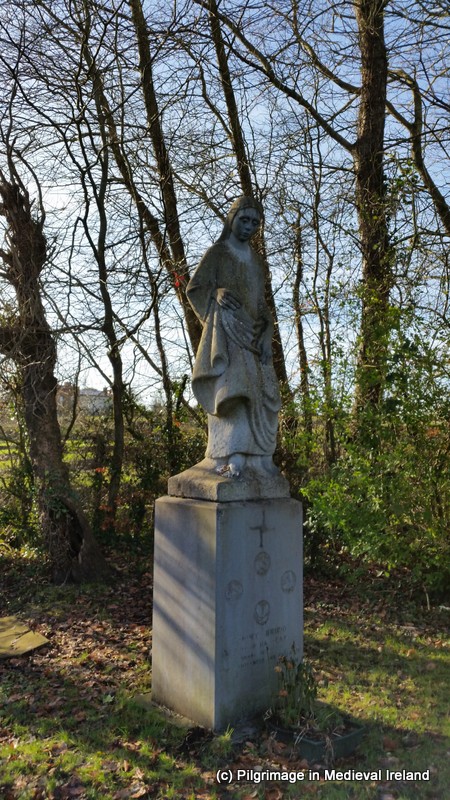
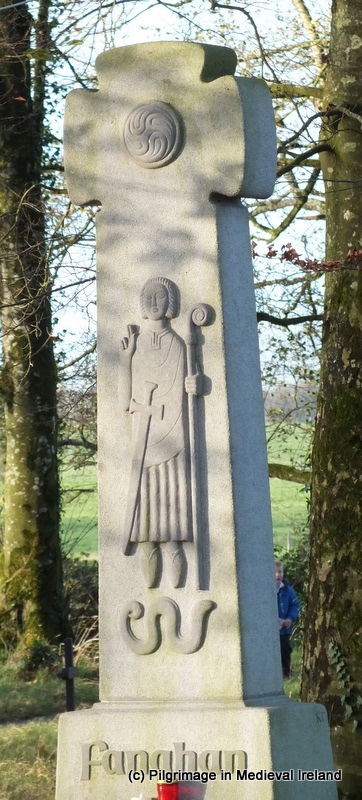
St Patrick and his cow are the focus of  part three of my series of post on the saints and their animals.  Like SS Ciarán of Clonmacnosie and Manchan of Lemanaghan, St Patrick is also associated with a cow.  Unlike the previous two cows, Patrick’s cow could not  produce an endless supply of milk however she did have some magical abilities namely the strength to plough a deep trench across two counties.  The route of the trenches made by the cow’s horns are said to have created the ancient road  known as the “Rian Bó Phádraig” or “Track of St Patrick’s Cow”.  Aspects of the route of this road are now incorporated into the modern walking route St Declan’s Way.  The road itself is a complex topic and I will discuss this in full at a later date.  Briefly the road is said to have run from Cashel through Ardfinnan, crossing the River Tar near Goatenbridge, heading south over the Knockmealdown Mountains in to Co Waterford,  passing close to eastern side of the town of Lismore,  crossing the River  Blackwater and Bride  before terminating in the townland of Fountain in the parish of Kilwatermoy.


rian

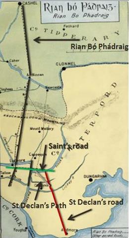
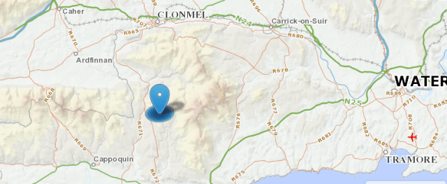
Map showing the Rian Bó Phadraig & St Declan’s road

  In the course of  my research I came across second road also associated with Patrick and his cow,  known by the same name but located  in Co Limerick. This post will just  focus on the  creation myth of the two roads. I will explore the  route of both roads another time.

Legend of the St Patrick’s Cow and the Creation of the Rian Bó Phádraig in Tipperary & Waterford.

The earliest written account of the story of St Patrick’s cow and the Rian Bó Phádraig dates to the 18th century when it was recorded by antiquarian Charles Smith in 1746.

Smith recounted that local people referred to a double trench in Co Waterford  that they called the Rian Bó Phádraig, he believed  that the trenches were the remains of an ancient highway linking Cashel to Ardmore. In 1746 the trench was clearly visible in the Barony of Coshmore and Coshbride, Co Waterford.  Smith also says that the ‘…country people affirm that it might be traced from its entrance into this County[Waterford] as far as Cashel into the County of Tipperary‘.


irishmoiledcowcalf

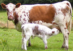
Traditional Irish breed of cow called the moiled cow, with her calf.

According to Smith

They [Irish peasants] affirm, that when St Patrick was at Cashel, a cow belonging to that saint had her calf were stolen and carried off towards Ardmore, which she pursued, and with her horns made this double trench the whole way; others say it was the cow was stolen , and that she returned home of herself and in the same manner plowed up the ground with her horns… (Smith 1746,  355).

In 1877 Richard Brash  provided an account of the tradition from the Ardmore area . In this account we are told the saints cow was white and her calf was stolen from Cashel by people from Ardmore.

It is fabled that St Patrick when living at Cashel had a favorite white cow, whose calf was stolen and carried off to Ardmore; the animal, furious at its loss, followed the robbers, tearing up the ground with its horns as it rushed along, and forming two trenches which can be traced in many places to the present day. This track is name by the peasantry, Rian-bo-Phadrig, that is, the track of Patrick’s cow.

Brash also makes reference to some other  variations of the legend which stated that

…the cow was stolen from Cashel and brought to Ardmore, from, whence it made its escape, and facing homewards, tore up the tracks….


20th Century Folklore of the Rian Bó Phádraig in Tipperary

Power in his 1905  article  called ‘The “Rian Bó A Phádruig” (The Ancient Highway of the Decies)‘ recounts a synopsis of  folklore for the road that was at this time ‘told from Ardfinnan to Ardmore’.

St. Patrick’s cow, accompanied by her calf, was grazing peacefully on the alluvial flats by the side of the Tar river, in the extreme south of Tipperary, when the calf was abducted by a wily cattle-thief from Kilwatermoy, or somewhere to the south of the Bride, in the County Waterford. The robber, with his booty, started in haste for his home, eighteen or twenty miles distant, and shortly afterwards the cow, having discovered her loss, commenced a distracted pursuit. In her fury, as she went, she tore up the earth with her horns….till she overtook the robber, to whom she promptly gave his deserts (Power 1905, 121).

kerry cow

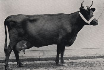
A Kerry cow another traditional Irish breed of cow.

During Power’s fieldwork on this ancient road (Rian Bó Phádraig) it was discovered that in the area around Lismore some of the fields where the route of the road passed through were called by names such as  páirc a’ Rian  the field of the Rian.

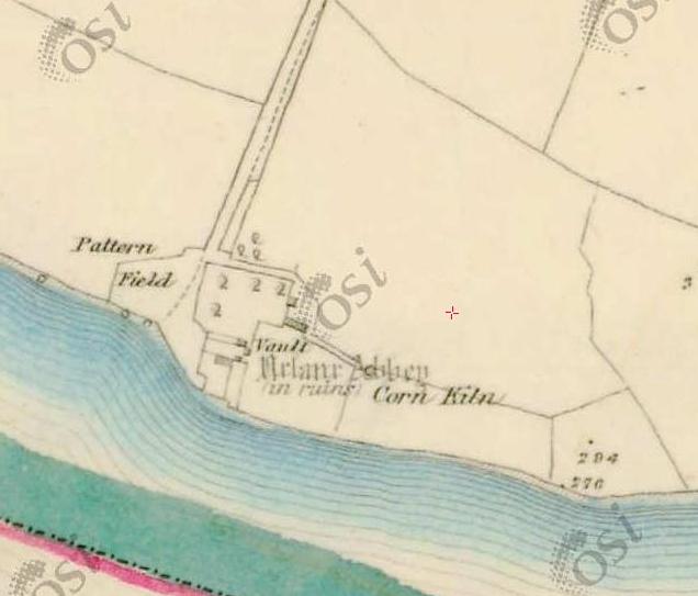
The spot where the cow  took her revenge  was said to be on the south side of the Bride, and adjacent to the Camphire Tallow road, in the modern townland of Fountain.  The spot was said to be in  a field known as Clais a’ Laoigh  or ‘the trench of the calf’, in which a depression was pointed out as the spot where the cow took her revenge. This spot was marked on the 1927 ed. of the OS 6-inch map but not earlier maps of the area and may noted in 1927 as a result of Power’s article published some years earlier.

OLYMPUS DIGITAL CAMERA

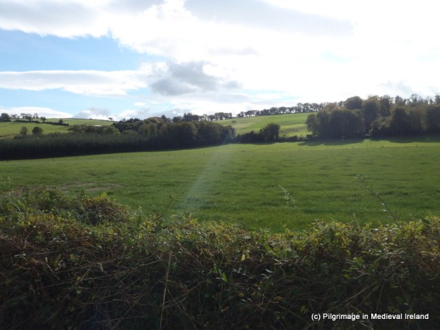
The field known as Clais a’ Laoigh the trench of the calf at Fountain Co Waterford

Over the last 100 years or so the  field has been intensively cultivated and no physical traces above ground are visible.

20th Century Folklore of the Rian Bó Phádraig from Waterford

Early 20th century folklore from Kilwatermoy and Cappoquin  in Co Waterford provides further  variation of the tale, with St Patrick having a greater involvement in the story but it is still the cow who is the main actor of the tale. Interestingly cow was said to have been carried off by people from outside the parish of Kilwatermoy.

The Schools Manuscripts Essays for Kilwatermoy (roll no. 5385, 322 ) records that when Patrick and his cow were visiting the parish his cow was stolen.

An incident in connection with Saint Patrick’s visit to the parish. The story is told by the oldest people that when Saint Patrick visited  this parish he took with him a cow and calf. When he had been some time there, it is said that the calf was stolen by some of the neighboring people. Afterwards they buried the calf in a field near Sapperton.

The cow then searched everywhere for the calf and finally scented it to the field where it was buried. She then in a great, rage, and rooted up the ground furiously.  There is still  to be seen in this field a big hole, which shows the  burial-place of the calf.

Sapperton  townland is located on the eastern side of Fountain townland where Power’s research identified the field known as Clash na Laoigh.   Power in 1905 noted  the legend of the Rian was very much associated with the  Kilwatermoy area  and he goes on to say

So generally known was the legend, and so intimately did popular belief associate the robber with this district south of the Bride, that, half a century ago, natives of Kilwatermoy parish, when away from home, would not very willingly admit their birth-place (Power 1905, 121-122).


The Schools Manuscripts  essays  for the nearby town of Cappoquin ( roll no. 15457  page 125)  recorded another version of the tale where St Patrick and his cow were visiting Cappoquin.  Again the cow creates the road while in pursuit of her stolen calf.

Long ago when St Patrick was  passing through Cappoquin he went by Mt River because in his time  there was a ford across that way. He had a cow and this cow was after having a calf.  The calf was stolen one night. The cow went along a path to find the robber and at last found him at the end of  the bohereen and it is said that she knew it by instinct.  That path is now called ” the Path of St Patrick’s Cow”.

mount rivers

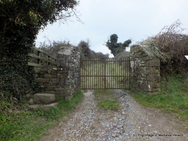
1st ed. OS 6″ map depicting the Casán na Naomh at Mount Rivers

Mount Rivers is an estate on the east bank of the River Blackwater. Power recorded  a ford here called Áth Mheadhon – the middle ford across the River Blackwater. The 1st ed OS 6″ maps  record  the route of a road called  Cassaunnanaeve  or Casán na Naomh – ‘the Saint’s path’.  Power believed  that this was  an ancient road linking Lismore with Affane (Power 1905, 123). This road was  part of a network of roads that included the Rian Bó Phádraig and St Declan’s road. I wonder had the distinction between the two roads blurred by the 1930’s.

Physical Traces of the Cow’s Journey

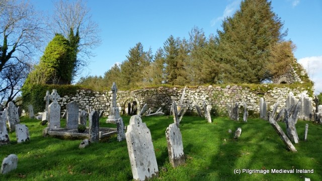
Like stories associated with St Manchan’s cows  and St Ciarán’s cow St Patrick’s cow left a visible physical mark on the  landscape.

In 1746 by Charles Smith described the route of the cow as ‘a large double trench’,  in the mountainous parts of the Barony of Coshmore and Coshbride ”  Co Waterford.

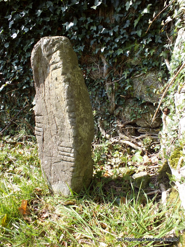
In 1905 Rev P Power carried  out a  detailed survey of the entire route of the Rian within the two counties of Tipperary and Waterford using local folklore and fieldwork he traced the Rian from Ardfinnan over the Knockmealdown mountains via  Carraig a Bhuidéal pass,  down across the Blackwater, over the River Bride to  Kilwatermoy parish where it ended in the townland of Fountain, beside the Camphire –Tallow road.  As mentioned above Power  had found that in many of the  townlands in Co Waterford where the road passed through field names reflected the route of the  road. He was also able to located sections of intact physical remains as well as  the location of sections of the road more recently destroyed.

Unicode

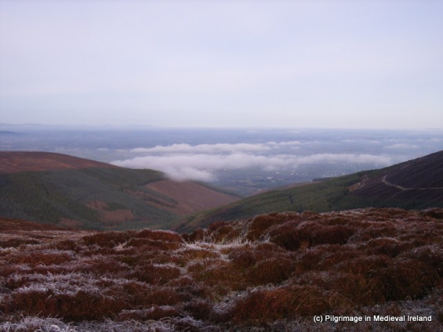
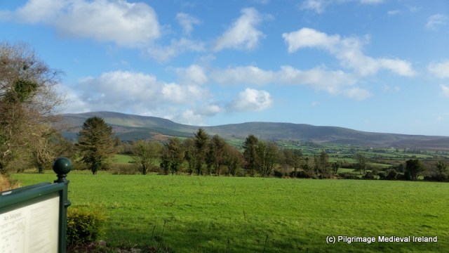
Facing North towards Cashel from Beárna Cloch na Bhuidéil on the Waterford Tipperary County Boundary line

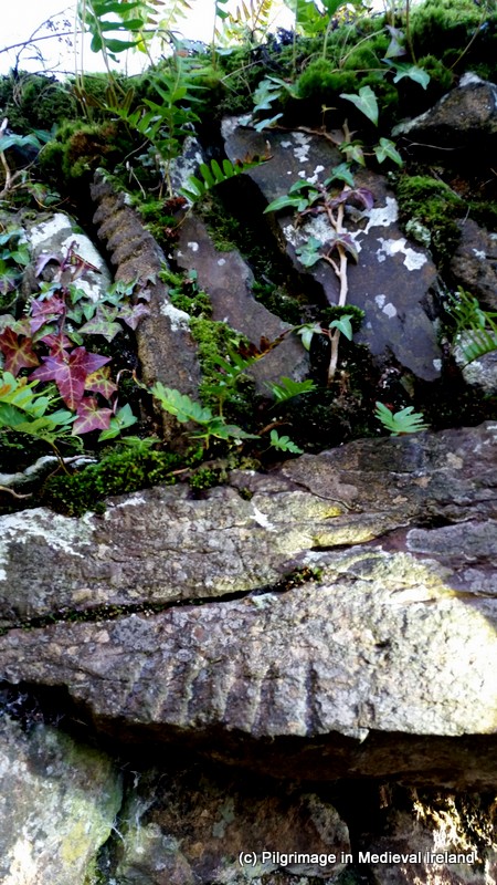
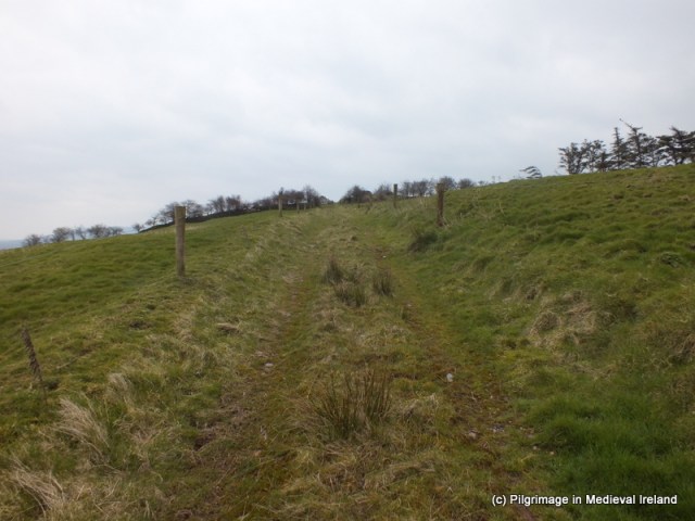
When I carried out fieldwork on the route of the Rian in 2000  the road was  still traceable on the southern slopes of the Knockmealdowns where it was represented as a 3m wide sunken road, in the ensuing years this section of  road has deteriorated.

The Rian Bó Phádraig in Co Limerick

Another road also called the Rian Bó Phádraig is to be found in the Co Limerick. The  road is found beside the ecclesiastical site of Ardpatrick  which according to local tradition was founded by St Patrick.

Although the road bears the same name as the Waterford/Tipperary road it has a different origin legend.   The Limerick Diocese website makes note that the  parish of Ardpatrick was previously called Ballingaddy,  ‘Baile an Ghadaihe’ or the ‘Town of the Thief’.  There is however  no connection with the theft of the saint’s cow and the formation of this road.  The Ardpatrick Rian was also created by the physical actions of the cow.  It was said  the ‘slug of St Patrick’s Cow’s Horn’, Leaba Rian Bó Phádraig and it was said the road and stones at the entrance to the hill of Ardpatrick were the remains of what was once a road that linked Armagh to Ardpatrick.  It was also said the Abbot of Armagh used this road to travel to Ardpatrick to collect his dues (see http://www.limerickdioceseheritage.org/Ardpatrick/hyArdpatrick.htm).

I am only beginning researching the Limerick road and I hope to find out more in the coming months. Like the Waterford Rian the Limerick road was not recorded on the 1st ed OS  6″ map for Limerick. The National School Essays (1939) for Ardpatrick  make brief reference to the site of the road located on the west of Ardpatrick  running up the hill to church. The essays record little folklore associated with the road only that the saint came here along the road and the old people of the area knew the road by the name Rian Bó Phádraig.

DSCF2245

The Rian Bó Phádraig running to Ardpatrick

The earliest reference to road I have come across so far dates to 1866

Another great curiosity was the “slug of the horn of St Patrick’s little cow”. This animal it was that supplied the saint with his daily milk; and the cow might be seen painted on many a signboard’ (Lenihan 1866 721)

Westropp noted that in  1877 local people said

The “Slug of St. Patrick’s Cow” made when the unruly beast ran away from Ardpatrick, was called by Irish speakers Rian bo Phadhruig…

The latter is perhaps the closest tale to the Waterford/Tipperary road. Westropp also made note of the similarities in appearance between this road and the Waterford one.

Conclusion

I will be continuing my research on both  roads in the coming months and I am planning to walk the surviving sections of roads in the Spring. Although St Patrick  doesn’t really feature too much in the folklore of either roads,  I have a great fondness for the Waterford/Tipperary tale with the feisty cow in pursuit of her calf . In my minds eye I can see a small white cow frantically ploughing her way across the land of Tipperary and Waterford at great speed, in a cloud of dust spurred on by the bellows of her calf.


References

Brash, R. 1877. The ecclesiastical architecture of Ireland, to the close of the twelfth century : accompanied by interesting historical and antiquarian notices of numerous ancient remains of that period.Dublin : W. B. Kelly: [etc., etc.]

DEPARTMENT OF FOLKLORE, U.C.D  The Schools’ Collection, Cappoquin Volume 0637.

DEPARTMENT OF FOLKLORE, U.C.D The Schools’ Collection, Kilwatermoy Volume 0637.

DEPARTMENT OF FOLKLORE, U.C.D  The Schools’ Collection, Ardpatrick Volume 0509.

Lenihan, M. 1866. Limerick; Its History and Antiquities, Ecclesiastical, Civil, and Military: From the Earliest Ages, with Copious Historical, Archaeological, Topographical, and Genealogical Notes. Dublin: Hodges Figgis.

PhD research undertaken by myself.

Power, Rev. P. 1905. ‘The “Rian Bó Phádruig” (The Ancient Highway of
the Decies)’, JRSAI Vol. VI. XV, Fifth series, 110-129.

Smith, C. 1746. The antient and present state of the county and city of Waterford. Dublin: A. Reilly.

Westropp, T. 1916/1917. ‘On Certain Typical Earthworks and Ring-Walls in the County Limerick. Part II. The Royal Forts in Coshlea (Continued)’ PRIA,  444-492, 4


Seskinane Church at Knockboy Co Waterford

The medieval  church of  Seskinane/Seskinan is located in the townland of Knockboy Co Waterford about 3/4 mile from Bearys cross, just off the Clonmel-Dungarvan road.  Although a little out-of-the-way the site is signposted from the Clonmel-Dungarvan road so can be found relatively easily.

map seskinan

Location map showing the site of Seskinane church

In medieval times this church functioned as the parish church for the parish of Seskinane and was part of the prebend of Lismore. It is located in the ancient territory of  Sliabh gCua. By the late sixteenth century it was in a state of ruin and was recorded as derelict in 1588.
According to Power (1952, 56) the placename  Seskinane signifies “Little Sedgy Moor. The  townland today is made up of rough pasture.

516

View of mountains from carpark

Medieval Parish Church

 The church is found at the end of a long  narrow winding bohereen.  It is surrounded by a historic graveyard enclosed by a modern earth and stone bank.

521

Seskinane medieval parish church surrounded by a historic graveyard


The graveyard  surrounding  the church  is filled with graves ranging in date from the 18th century to the present and it possesses  quiet a number of  very finely carved 18th and early 19th century gravestones. The interior of the church is also filled with gravestones of 18th and 19th century date.

This slideshow requires JavaScript.

 The church has a rectangular plan  without any internal division. The west gable had a double belfry with pointed arches.  The belfry was badly damaged in storm in the early 1990s and what remains   is covered in ivy. The majority of the wall is still standing although without some intervention it is difficult to know for how much longer.  The west gable wall is in poor condition and slightly bowed,  the ivy that covers it is probably holding it together. The wall has a sign ‘danger falling stones from church building’ . The sign tells of the risk to anyone approaching the church. Those who access the site and enter the church do so at their own risk.

531

One of several signs at the sight illustrating the dangers of falling masonry from the church walls.

The  west wall is lit by two ogee-headed windows, placed one above the other.

The east gable of the church is  lit by a central ogee head window and the lower section of  this window has been turned into a small shrine incorporating a  statue of the blessed virgin.

 The walls of the church are built of rubble stone with dressed stones  used for windows and doors.  Two  opposing pointed doorways  provide access into the interior of the church in the north and south walls. At present door in the north wall is partially blocked with masonry from the church.

DSCF3649

Doorway in the south wall of the church


Windows survive at the eastern end of the  north and south walls.  Other features include a  cut water stoup inside the south door and an amubrey at the east end of the south wall.


DSCF2681

View of the south door in the interior of the church and holy water stoup.

Ogham Stones

This little ruined church is very special as it incorporates six ogham stones within its fabric.
The presence of these ogham stones  has led some  to suggest the  church stands on the site of an earlier church. In the late 19th century traces of a possible ecclesiastical enclosure, no longer  upstanding, were recorded in the field to the south of the church and within the graveyard (Brash 1868-9, 127; Power 1898, 84). There is also very pronounced curve in the field boundary  to the east of the church that along with the 19th century evidence may tentatively suggest the presence of an enclousure.
The majority of  ogham stones at  Seskinane were reused as lintels  and are found in the windows in the north, south and west walls and  in the south door. Two other free-standing stones were also found at the site only one of which is still present at the site. The inscriptions  from the stones were transcribed by Brash (1868-9) and Macalister (1945, vol. 1, 286-9).

The South Wall 

A large greenstone ogham stone acts as the lintel of the southern doorway.  The ogham script is visible along the lower edge of the stone.  A circular hole  pierces the stone at the western end it appears to post date the ogham script as it cuts the some of the ogham letters. Macalister (1945, 287) records the inscription as
Q[E]CC[IAS] M[U]C [OI   B] R[O] E[ NIONAS]

DSCF3770

Ogham stone used as a lintel in the southern doorway. The ogham script is found on the lower edge of the stone.

 seskinane ogham

This slideshow requires JavaScript.

A second ogham stone has been used as a lintel in the southern window beside the east gable. Macalister (1945, 286)   transcribed the inscription as
…]RG[…]BRENE [….
One of the voussoirs that make up relieving arch above this lintel also features some ogham script which Macalister transcribed as   CROB (Macalister 1945, 287).

DSCF3731

Ogham stone used as lintel in the southern window beside east gable. The second voussoir on the left also has ogham script.

025

Close up of ogham script on the lintel and voussoir in the southern window.

 The North Wall

The  window at the east end  of the north wall of the  church also incorporates a ogham stone of as a lintel. Macalister (1945, 286)recorded the inscription as
…]ER[A]T[I] M[U]C[OI] NETA-S [EGAM] ONAS

The West Wall

The west wall  of the church is covered in thick ivy at present. It contains two windows both of which have ogham stones as lintels.
Macalister (1945, 287-288) noted the upper stone of the  top window had the inscription
…]CIR   MAQI   MUC[…..
and the lower window had the inscription
VORTIGURN

A seventh ogham stone is  located in the northwest corner of the church. Macalister (1945,  286)  recorded the inscription as
…]ER[A]T[I] M[U]C[OI] NETAS[EGAM]ONAS

DSCF3693

Ogham stone in the northwest corner of the church

There was an eight ogham stone at the site, in the past it was moved to a house near Cappoquin but it  has since been lost. It was read by Redmond (1885-6, 418-19) as OMONG EDIAS MAQI MUI BITE, and by Macalister (1945, vol. 1, 289) as [MAQI?] MOnEDIAS MAQI MUIBITI

 The Church and Community in modern times

 The parish of Seskinane was dedicated to the Blessed Virgin.  In the past a pattern was held here, it was known locally as La Féilé Mhuire Chnoc Bhuí  and it was celebrated on the 8th of September but over time the tradition died out.
Since 1978 the local community has celebrated mass outside the ruins of church on or as close to the 8th of September (the feast of the nativity of the Blessed Virgin) as possible. It is also a time for the local communities to visit their graves.

This slideshow requires JavaScript.

Local Folk Tale:  Seskinane Church and the Bell

A local folk tale recounts that when this the church  was  built it lacked a bell
  to call the faithful to Mass.  It was decided to take a bell from the nearby church at Kilkeany (this church has not survived to the present although its location is still remembered) and  use it at Knockboy. Thus the bell was removed from the belfry of Kilkeany church  and brought to the church at Knockboy.
However, when the bell was brought to Knockboy, it was found that no matter  how hard it was rung the well would not chime. It was  said  that the bell broke from where it was hung and made its way back to Kilkeany, in the middle of the night, chiming the length of the journey and that shrieks of mocking laughter could be heard (Keane 2015, 36).

 To sum up

Seskinane church  preserves  physical evidence of medieval devotional practices within the medieval parish of Seskinane.    The presence and survival of such a large collection of ogham stones is culturally significant at a local and  national level. The presence of the ogham stones within the fabric of the church also tells us a little about medieval ideas of re-use and recycling. Given the state of the fabric of the church and the constant barrage of storms our country is currently experiencing, I do worry for the  future of the site, I really feel that this site is significant to warrants a program of conservation.
If anyone is interested in finding out more about ogham stones check out the wonderful Ogham in 3D website. The site  details the work of the Ogham in 3D project  that is currently  carrying out a  laser-scan  of as many as possible of the approximately four hundred surviving Irish Ogham stones and to make these 3D models available online.  The results of the project to date can be seen on the website.
References
Brash, R. R. 1868-9 ‘On the Seskinan ogham inscriptions, County of Waterford’, JRSAI 10, 118-30.
Keane, T. 2015. ‘Churches Old and New ‘ Sliabh gCua Annual  No.21, 35-36.
Macalister, R. A. S. (1945) (reprint 1949) Corpus inscriptionum insularum Celticarum, 2 vols. Stationery Office, Dublin.
Moore, F. 1999. Archaeological Inventory of County Waterford. Dublin: Stationery Office.
Ogham in 3D:  https://ogham.celt.dias.ie/menu.php?lang=en&menuitem=00
Power, Rev. P. 1898 ‘Ancient ruined churches of Co. Waterford’, WAJ 4, 83-95, 195-219.
Redmond, G. 1885-6. Proceedings – ‘Remarks on an ogham stone lying in Salterbridge Demesne’, JRSAI 17, 418-9.