On a recent visit to Tyressspass I stumbled across a roadside holy well dedicated at the edge of the village on the side of the L1024 Killavally road.
The holy well, like the parish church, is dedicated to St Stephen, a rare dedication for an Irish holy well.
St Stephen’s Holy Well, Tyrellspass, Co. Westmeath
The well is a natural spring that is now defined by circular stone wall. The upper section of the well is incorporated into a U-shaped enclosing wall, part of which shows signs of more recent rebuilding.
St Stephen’s Holy Well, Tyrellspass, Co. Westmeath
The interior of the well accessed through a small metal gate and several steps that lead down to the water.
Interior of St Stephen’s Holy Well Tyrellspass Co. Westmeath
I’ve not been able to find any information on the well’s history but if you find yourself in Tyrrelspass to take the time to visit this charming holy well.
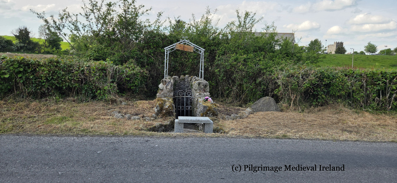
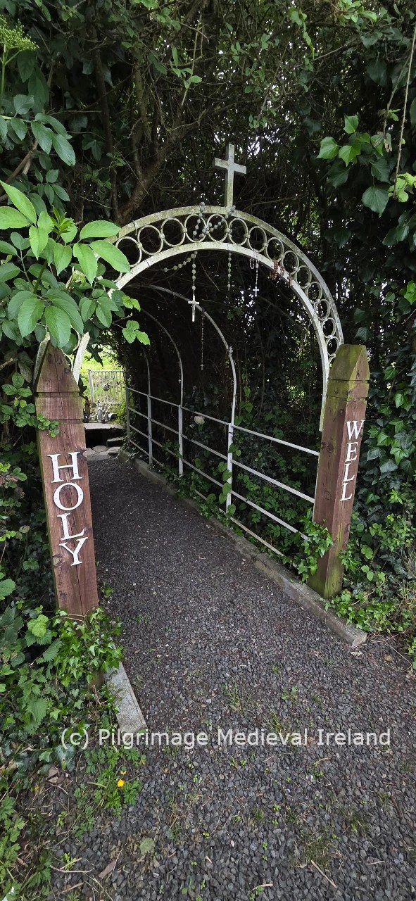
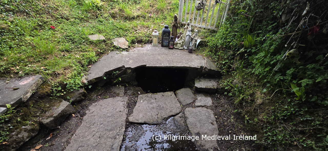
This short blog is about St Patrick’s holy well, at Ardrass Upper, in Co. Kildare, a lovely well that I stumbled across one rainy Sunday on my way to Dublin.
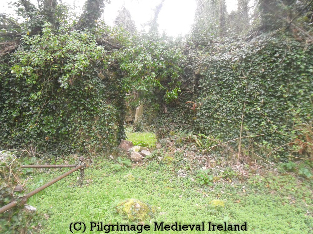
This roadside holy well, is easy to miss being located on sharp bend on the R403 road to Celbridge. Parking is just about possible at the entrance to the well.
The holy well is accessed via a small gravel path framed by a metal arch that leads to an open space.
Entrance to St Patrick’s holy well, at Ardrass Upper, Co. Kildare.
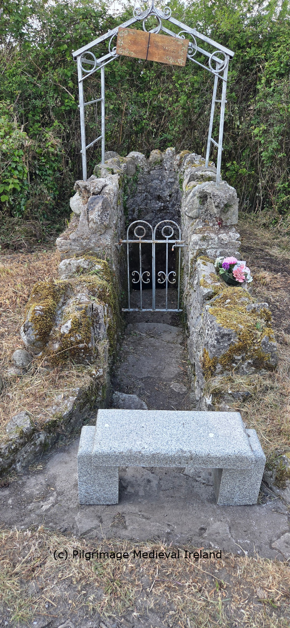
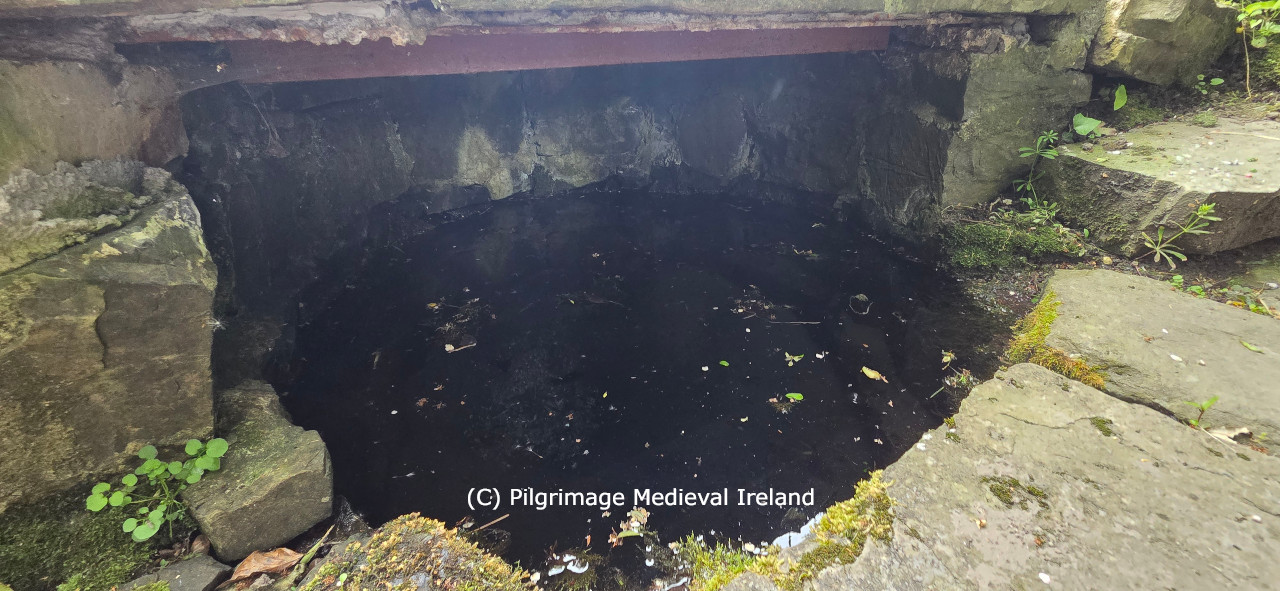
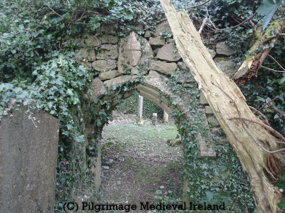
The well is a natural spring that sits within a ciruclar stone lined depression, covered by a large flagstone. The area infront of the well is also paved with flat flags.
St Patrick’s holy well, at Ardrass Upper, Co. Kildare.
Like many Irish holy wells, it is difficult to know how long the well has been venerated. There are few historic records. The well is not marked on the 1st edition Ordnance Survey 6-inch map of 1839. It is record on the later 25-inch Ordnance Survey map of 1910 as St Patrick’s holy well. Interestingly this map records the hill directly behind the well as St Patrick’s Hill. The 25-inch Ordnance Survey map also records a circular feature called St Patrick’s Bed close to the summit of the hill. This map suggests a larger pilgrim landscape once existed here. The antiquity of this landscape is tentatively strengthened by the presence of a medieval church dedicated to St Patrick which sits within an earlier ecclesiastical enclosure, located 300m to the southwest.
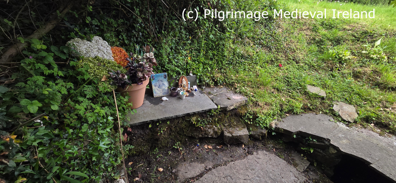
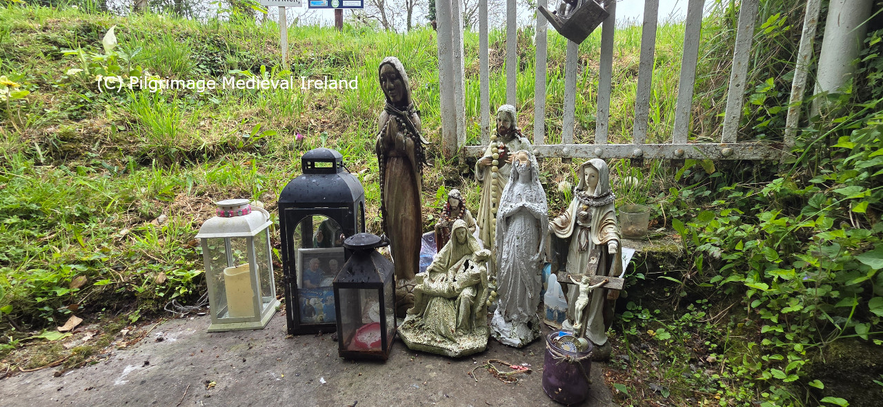
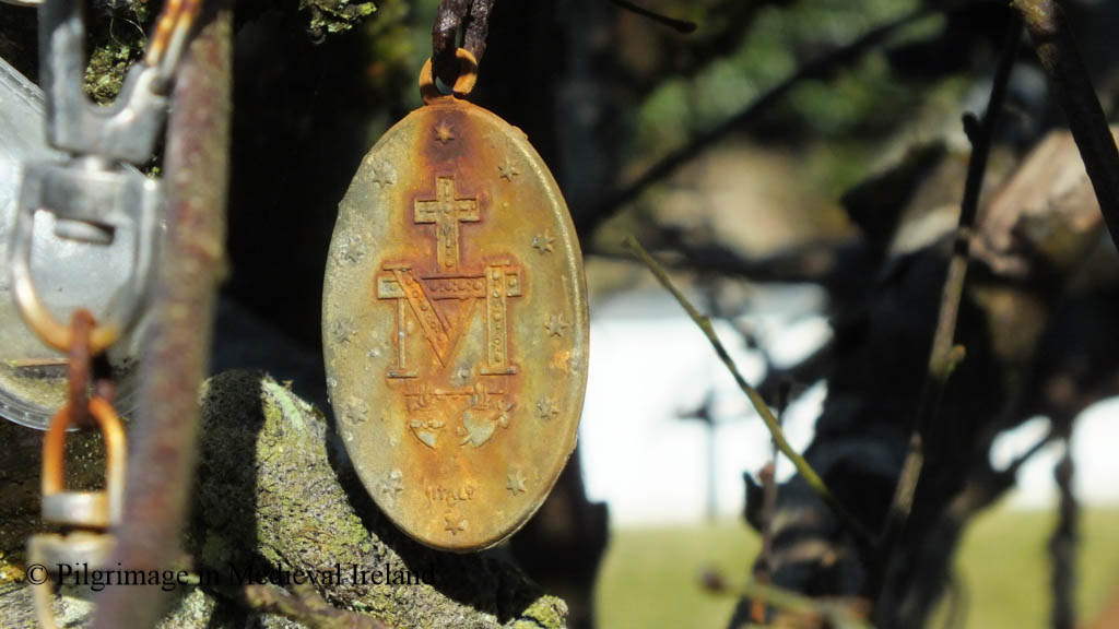
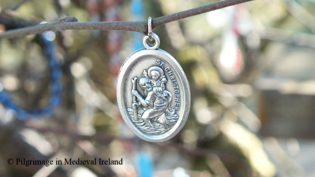
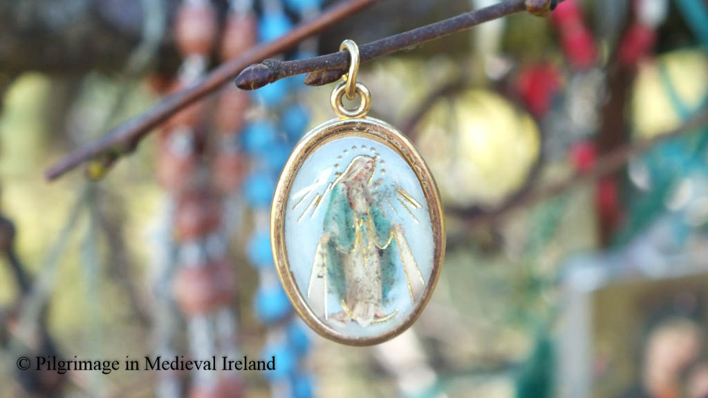
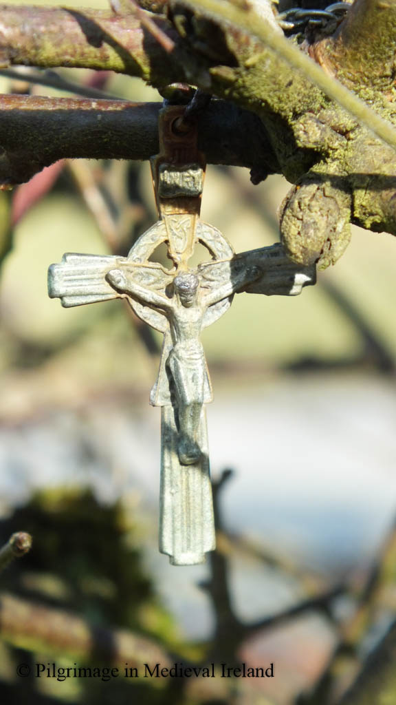
Like many pilgrimage sites St Patrick’s holy well, at Ardrass Upper, went through an ebb and flow of popularity. Pilrimage is now focused solely on the holy well. The Holy Wells of County Kildare A pilgrimage to the sacred sites of County Kildare 2023 notes the well was ‘found to be dirty in 1979’. Today the well is clearly cared for and evidence of pilgrimage is also present, represented by several rosary beads tied to the metal arch, along with lanterns and holy statues including one of the Pieta sitting on top of the flag that covers the well.
Votive offerings at St Patrick’s holy well ArdrassVotive offerings at St Patrick’s holy well Ardrass
The earliest written record of the well is found in the Ordnance Survey Letters Kildare 1837-39, where the well is named. The text unfortunately provides no other details about the well or the pilgrimage (Herity 2002, 14).
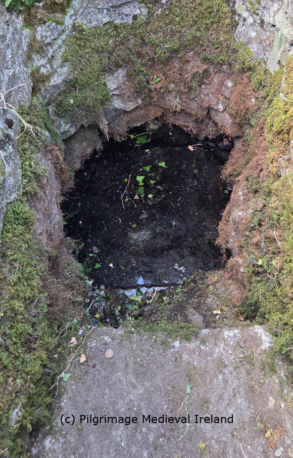
Interior of St Patrick’s holy well
Fr. J. F. Shearman in his article ‘Loca Patriciana: An identification of localities, chiefly in Leinster, visited by Saint Patrick’ notes the St Patricks well was
still frequented by pilgrims who hang up votive offerings of rags on an ancient thorn which overhangs the well. (Shearman 1874-5, 306).
The folklore collections schools essays for Clane (Pres. Convent)
“At Ardrass near Straffan there is a holy well named Saint Patrick’s well. Old tradition says if you pay three visits to the well you get cured of your illness. Some leave medals, pennies and even pieces of string in thanksgiving. These can be seen hanging on the bushes over the well even to the present day.” The Schools Collection, Volume 0773, Page 478
For anyone planning to visit the holy well be careful when parking and getting in and out of your car as the R403 road which leads to the town of Celbridge a commuter town, is very very busy.
References
Giacometti, A. and Boazman, G. 2023. Holy Wells of County Kildare. A pilgrimage to the sacred sites of County Kildare 2023. Kildare County Council.
Herity, M. ( ed . ) 2002,, Ordnance Survey letters Kildare letters containing information relative to the antiquities of the county of Kildare during the progress of the ordnance survey in 1837 , 1838 and 1839. Dublin , Fourmasters Press
Sherman, Rev. J. F. 1879.’LOCA PATRICIANA.-No. VII.-ST. PATRICK’S VISITATIONOF LEINSTER, DRUIM URCHAILLE, NAAS. BAPTISM OF IOLLAN, AND OILILL, &c. FORACH PATRICK. THE SONS OF LAIGHIS FIND. THE UI-ERCAN, &c. VISITS HY-CINNSELACH. BAPTISM OF CRIMTHAN AT RATHVILLY, VISITS DUBHTACH AT DOMNACHMORE MAGH CRIATHAIR.’ The Journal of The Royal Historical and Archaeological Association of Ireland: Originally Founded as The Kilkenny Archaeological Society in the Year M.DCCC.XLIX. Vol. III Fourth Series, 279-206.
I just wanted to let you all know about the really interesting symposium on pilgrimage called ‘Spirituality, Resilience and Regeneration’ Pilgrimage routes of Europe and Japan thats taking place on Thu 19 & Fri 20 May, 2022. This free event can be attended online and tickets can be obtained from https://prilgrimage-routes-europe-japan.peatix.com/
All paper will be translated in to English, Japanese, Spanish (with simultaneous interpretation) so its a great chance to learn more about pilgrimage in other countries.
I will be presenting a paper on Day 1 of the symposium on Pilgrimage in Medieval Ireland and the Tóchar Phádraig.
Symposium Day 1 will provide a historical overview and philosophical perspectives of Pilgrim routes in EU and Japan. Speakers will present and discuss routes in Japan (Shikoku Henro, Kumano Wakayama) and EU (Camino de Santiago, Spain, Famita Route Portugal, Tóchar Phadraig and Croagh Patrick, Ireland and more).
Symposium Day 2 Looks at sustainable long term relations between local communities and visitors along Pilgrimage Routes in Europe and Japan. Speakers from each country will present projects related to art, tourism, health, participatory politics, etc.
The symposium is organised by: Instituto Cervantes Tokio, Embassy of Ireland in Japan, Embassy of Portugal in Japan – Camões I.P. In Collaboration with Wakayama Prefecture, NPO InVisible, Turismo de Portugal, Akogi Village of Hidden Christians, Centro Nacional de Cultura, NPO Network for Shikoku Henro Pilgrimage and Hospitality, Tanabe City Kumano Tourism Bureau.
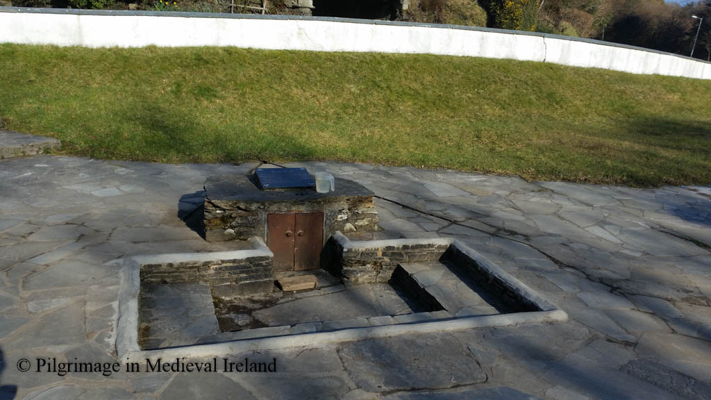
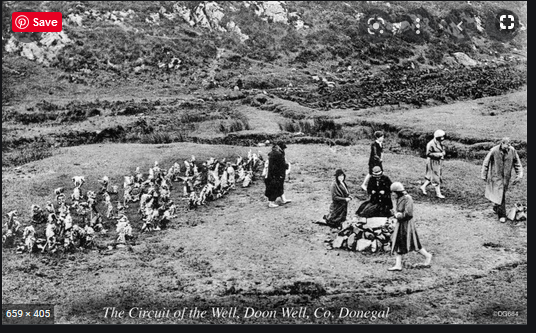
Doon holy well is one of the most popular wells in Co Donegal. The well
…..was established by a Lector O’Friel who is reputed to have lived in the Fahans area and had remarkable curative powers. When the locals asked him what they would do once he was gone from them, his answer was the creation of Doon Well. According to tradition, he was supposed to have fasted for 18 days and on each of these days he walked from Fahans to Doon a distance of some four miles. On the 18th day he blessed the well promising that if the people believed in the holy water then they would receive the same cures and blessings that he had imparted to them. According to local tradition it was a Fr. Gallagher in the 1880’s who blessed the well and he is still prayed for as part of the turas.
The schools collection record a similar origin story in the 1930s.
The well was founded by Father O’Friel about thirty years ago, and it was blessed by Father Gallagher. When any person goes to Doon well, they have to say one our father and one hail Mary for the intentions of these priests. It was people named Gallagher’s who put the shelter around it. When we go to Doon well, we have to go to the people that are in charge of it and get a penny ticket from which to say the prayers.
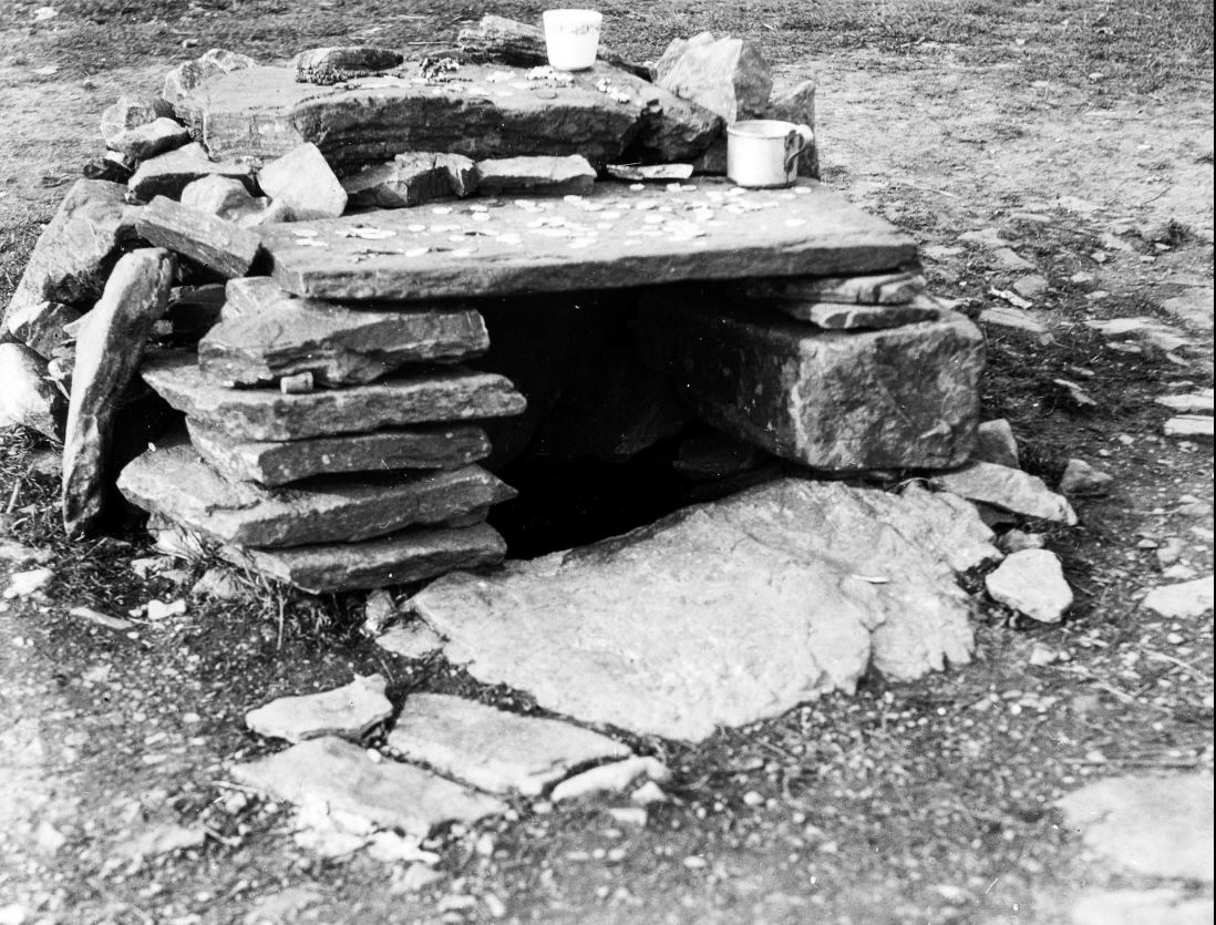
Doon well is situated in the front yard of a farm house. The holy well is covered by a small stone walled rectangular structure, with a large flat flagstone roof. The area around the well is paved and a series of steps provide access to the interior of the well. The well and its surrounding are very well maintained.
Doon holy well photo taken in 2016
There are two small rag trees beside the well. The trees are covered in a wide variety of offerings left by pilgrims. The offerings include religious medal, hair ties, rosary beads, religious statues and scapula. The volume of offerings show how popular the spot is still with pilgrims.
Rag trees at Doon holy well photo taken in 2016
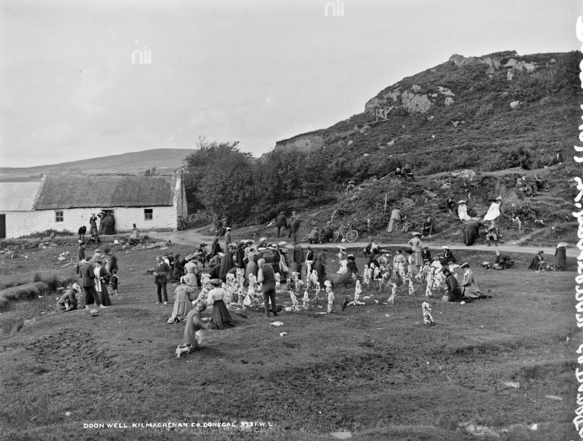
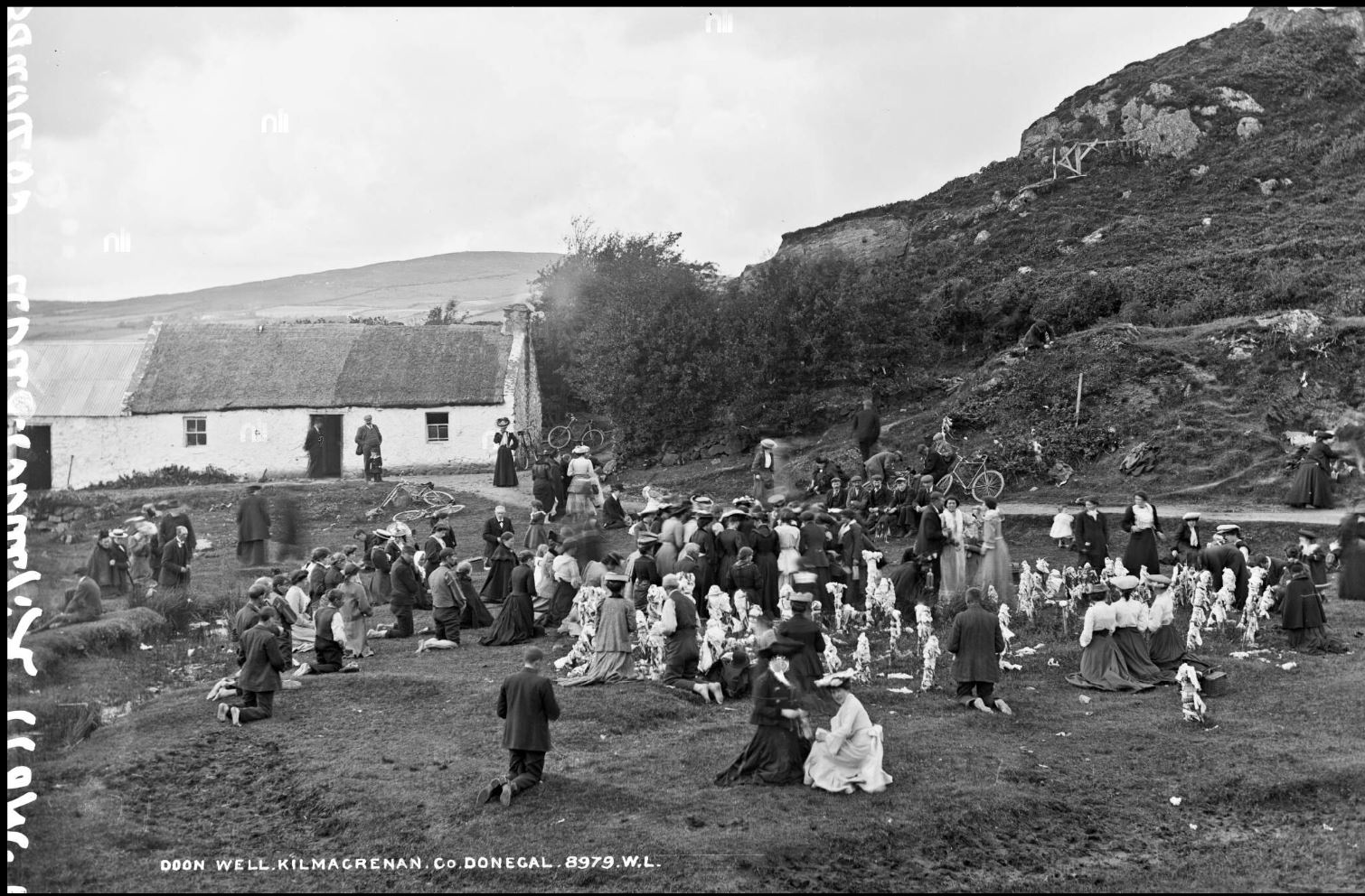
Doon holy well it is a living landscapes ever evolving. Its current vista was created in the early 2000s. This photo essay uses images of Doon holy well from the photographic collections in the National Library of Ireland (NLI) and the National Museums Northern Ireland (NMNI) to show how the well has changed over time and to provide a glimpse of how pilgrims experienced Doon well over a 100 years ago.
Landscape surrounding Doon holy well photo taken in 2016
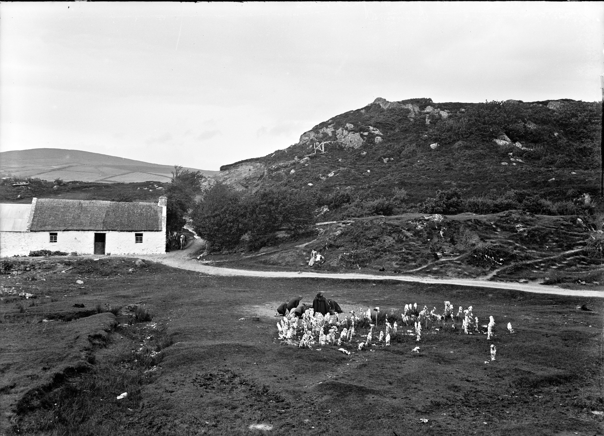
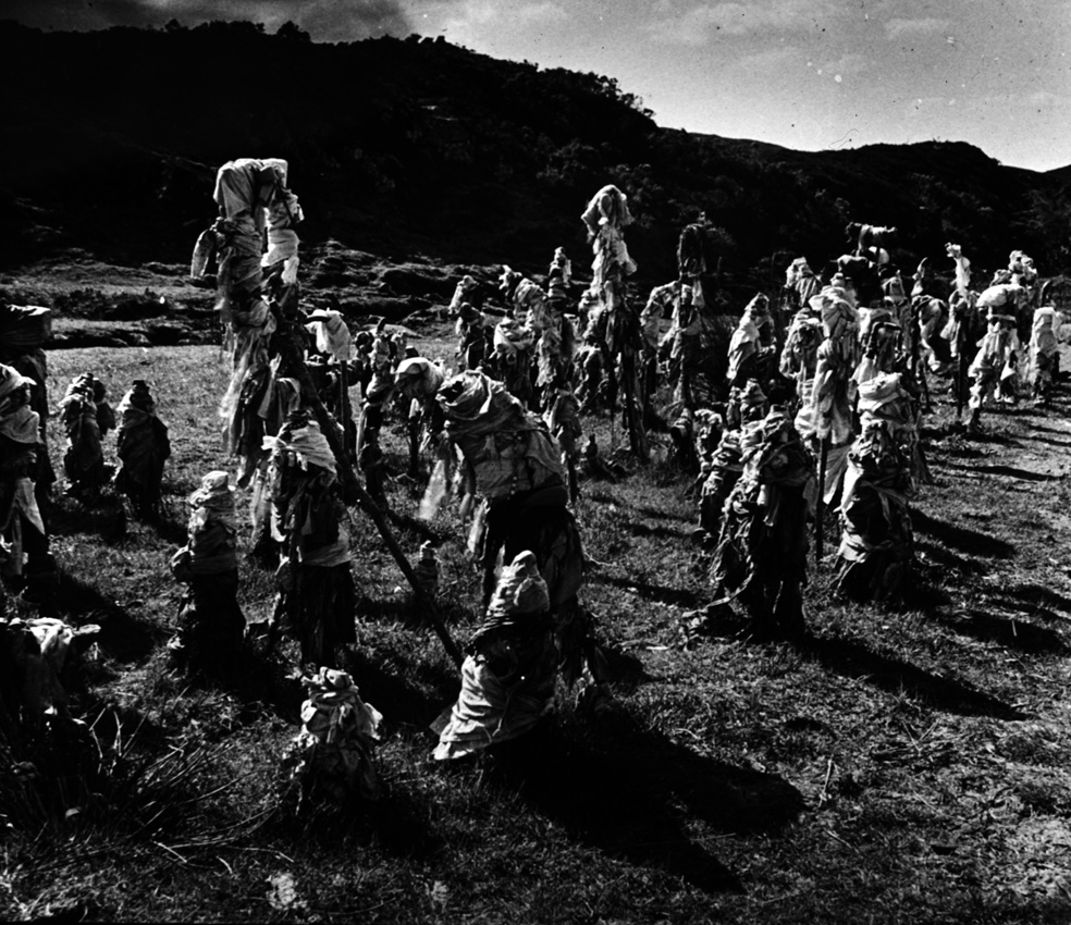
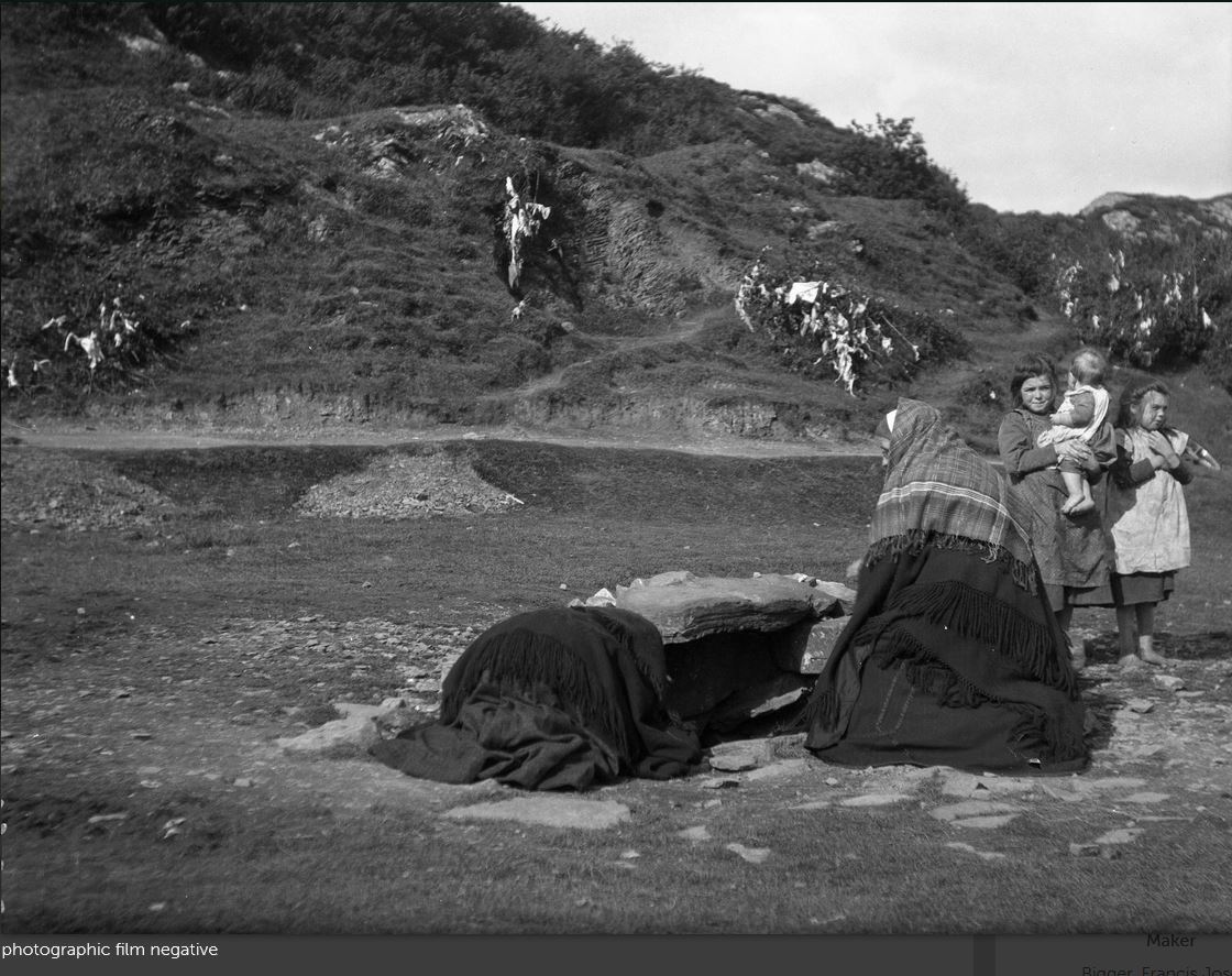
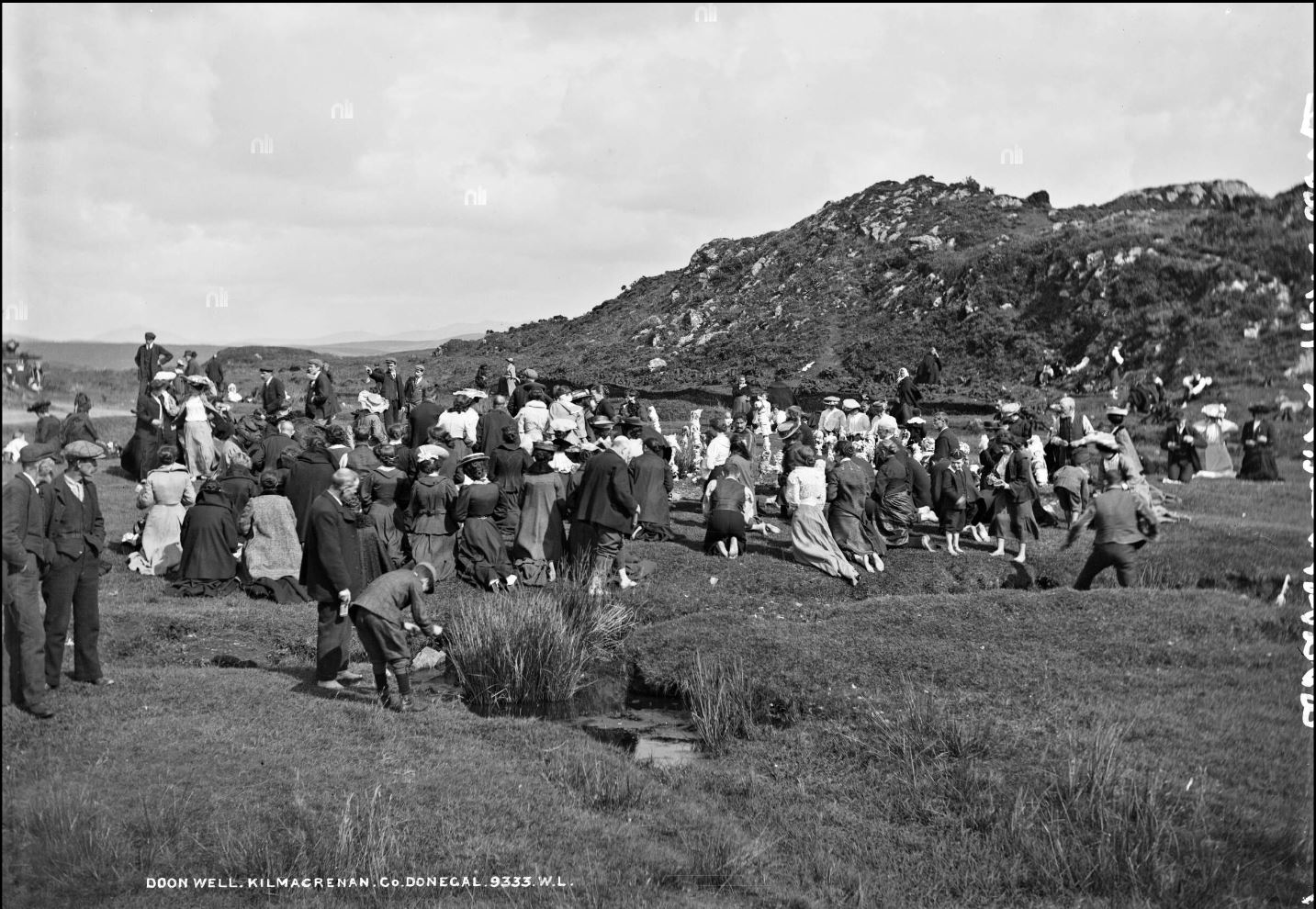
At the turn of the twentieth century the well was located in an open marshy landscape.
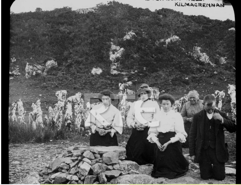
Doon well is situated in the parish of Kilmacrenan. It is situated in a green field by the roadside. It is a hilly rocky place, and there are a lot of hills and rocks around it. There is white and purple heather growing on the rocks, and people when they go to the well, go in search of the White heather, as it is very scarce around our district.
The well was originally an open natural spring. It was covered with stones to keep the waters clean some time in the 1800’s.
It is a long time since the well was first sheltered by stones which are built around it to keep the water clean and a large flat stone known as a flag was placed on top.
The Schools’ Collection, Volume 1083, Page 036
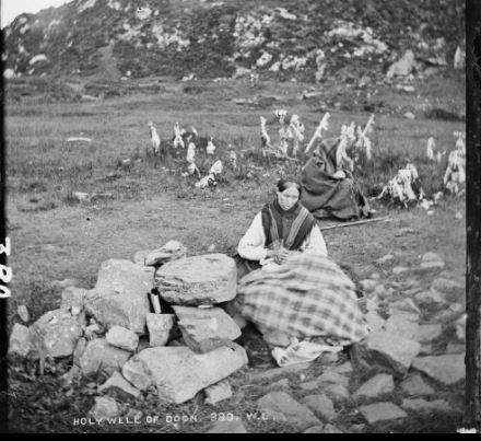
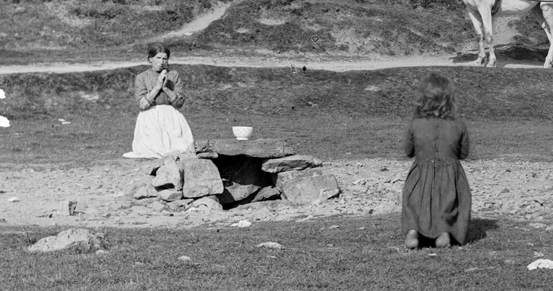
A photo of two women praying at the well from circa 1870-1890 shows the well covered by a collection of large stones stacked on top of each other.
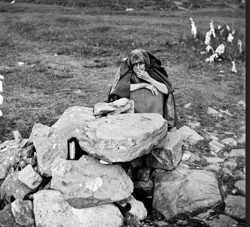
Another early image of the well also in the National Library of Ireland (NLI) collections shows the well in a similar state. The photo show an elderly woman crouch in prayer beside the well. The woman’s expression is incredibly soulful and haunting.
Doon Well at Kilmacrenan in Co. Donegal. Date: 1860-1883 NLI Ref.: STP_1720
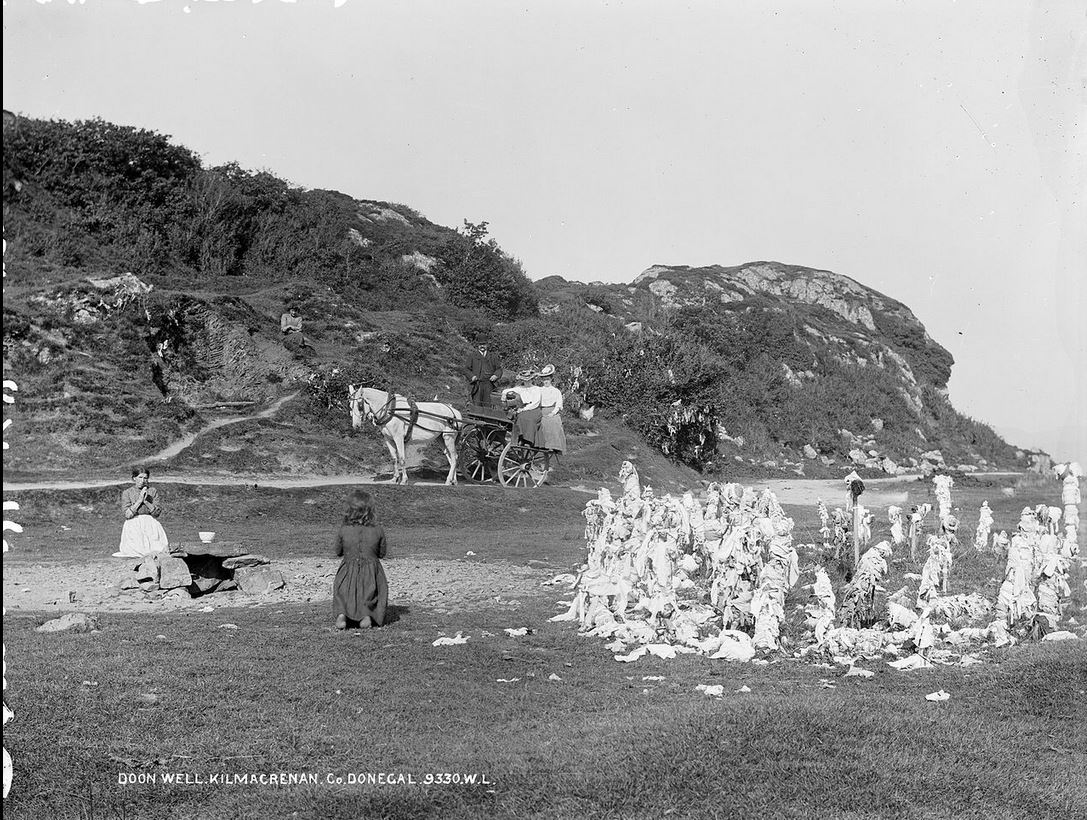
In later images the well has a more formal covering, with a large flat flag stone used as a roof. A photo was taken by Robert French in the late nineteenth-early twentieth century and shows the well surrounded by low wall on three sides covered with a large flat flag stone. The walls are made up by irregular shaped stones of different sizes. The area surrounding the well is without grass pointing to continuous traffic of pilgrims, who made “rounds” of the well.
Doon holy well at the turn of the 20th century taken by Robert French of Lawrence Photographic Studios, NLI Ref.: L_ROY_09330Doon holy well at the turn of the 20th century taken by Robert French of Lawrence Photographic Studios, NLI Ref.: L_ROY_09330
A photo in the NMNI collections, from the 1930s shows additional changes to the well superstructure. In the photo the superstructure has been extended and a second flat stone used as part of the roofing of the well.
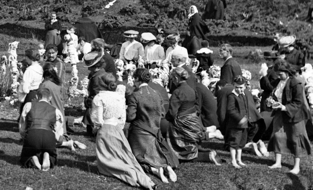
Modern visitors may be surprised that the rag tree beside the well are a more recent addition to the landscape. In times past the well was surrounded by crutches and sticks covered in bandages and cloths. Rags were also tied to bushes close to the well.
In the past it was common for pilgrims who believed they had been healed to leave behind their crutches and bandages and rags at the the well. Interestingly when I visited Doon well in 2016 there were 2 crutches left at the rag trees.
A boy from the Ross’as was cured at Doon well. He was lying for seven years before that. It was his aunt that took him to Doon well at first. The first thing that a person notices at Doon well are the two new crutches that he left behind him when he was cured.
The people drink it and wash the affected parts with it. They also take bottles of water home with them. You have to wash your feet in moss water and lift the water while still on the bare feet.
The Schools’ Collection, Volume 1085, Page 126-7.
The tradition of leaving behind offerings at the well is a long standing tradition. In the 1930s pilgrims left handkerchiefs and strips of cloth along with religious medals (The Schools’ Collection, Volume 1085, Page 126 (Woodland, Co. Donegal).
Two shawled woman kneeling in prayer at Doon holy well the NMNI the Bigger collection BELUM.Y10247
It is the custom always to leave something behind you at the well, some leave a hanky, others leave little things belonging to themselves. People take the water home with them from Doon Well.
The Schools’ Collection, Volume 1076, Page 431
Doon holy well is visited throughout the year. Two main vigils are held here, one on New Year’s Eve and the other on May Eve.
People go to Doon well on St Swithin’s day, St Patricks day, and Easter Sunday. They very often go on any week day, but usually on a Saturday or a Sunday.
The Schools’ Collection, Volume 1084, Page 036
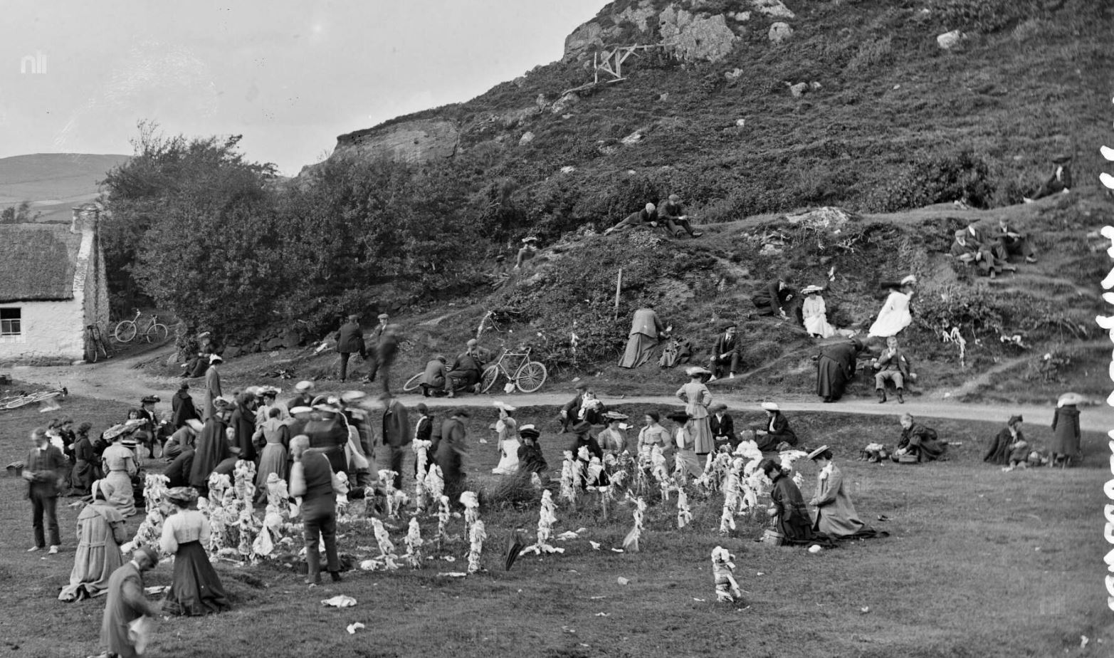
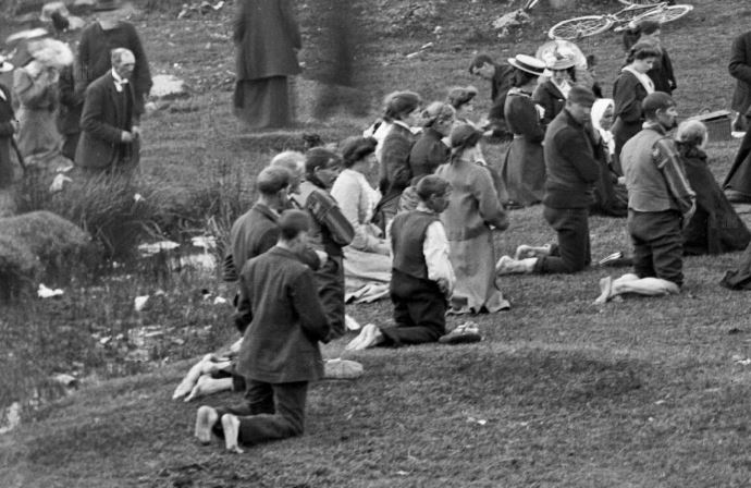
Pilgrims at Doon holy Well taken circa between 1865-1914 L_ROY_09332
A plaque at the well details the prayers made by modern pilgrims. Modern pilgrims say five Our Father and Hail Mary and the Apostles Creed for their intention. These prayers are repeated if the pilgrim decides to take water from the well. Pilgrims also say an Our Father and Hail Mary for Father O’Friel and also an Our Father and Hail Mary for Father Gallagher who blessed the well. An additional Our Father and Hail Mary is recited for the person who put the shelter around the well. Pilgrims throughout the decades have made their prayers in their barefeet while walking in circles around the well.
Plaque detailing pilgrim prayers at Doon holy well.
There are many photos from the late nineteenth and early twentieth centuries with pilgrims making their prayer and barefoot at the well.
Pilgrims making round at Doon well barefoot in the early twentieth century
In the 1930s the pilgrim rituals are described as follows
To make a pilgrimage correctly one has to fasting and when he comes in sight of the well their shoes must be taken off as it is believed the ground is blessed. He washes his feet in the water, which is to be got all around. Then the prayers are proceeded with Five Our Fathers, Give Hail Mary’s, and Five Glorias in honour of Father O Gallagher and Father O Friel, and the same for the person who sheltered the Holy Well. Also a creed for every bottle of Holy water lifted.
The Schools’ Collection, Volume 1083, Page 036
I hope this post inspires some of you to visit Doon well, its such an interesting place. Its also located close to Doon Rock the former inauguration site of the O’Donnells. The Voices from the Dawn blog has a very interesting blog post on the Rock of Doon.
Its been a while since I added to my series of blog post on the Irish saints and their miraculous animals. This post tells the tale of St Sourney.
St Sourney (Sairnait in Irish), is the patron saint of the holy well and medieval church at Drumacoo, Co Galway. Sourney was a holy woman who lived in Ireland during the sixth century, little is known about her life. She is also the patron of the small early medieval church of Teampall Asurnaí (St Sourney’s Church) at the village of Eochaill on Inismore. Tradition recalls she also founded a monastery at Drumcoo during lifetime. Her feast day was celebrated on the 3rd May.
Folklore recorded in the 1930’s in the schools essays from Ballinderreen Co Galway tells the following tale relating to St Sourney and a pig. The tale showcases the saint’s ability to miraculously bring an animal in this case a pig back to life after the animal had been eaten. Regeneration of special animals, even after they had been butchered and eaten, through the prayers of a saint, is a common theme in the folklore connected to the Irish saints. In this case the saint hoped to collect all the bones from a pig that had been eaten and to put it back together again. The saint’s plan for the pig was foiled by a dog who ate one of the bones from the animal. In anger the saint cursed the people of Drumcoo so that pig or a hound would never live together in Drumacoo.
Two Irish Pig from the Irish Pig Society Facebook page
It seemed Saint Surney ran short of meat one day and she told the girl to kill a pig and so she did. When they had the pig eaten she told the girl to collect all the bones so that she would put the pig together again, she kept a hound and hound ate one of the joints of the tail and the people say that is why every pig has a curl in his tail. Saint Surney was vexed then and she said that a pig or a hound would never live together in Drumacoo and they say for a fact they would not live together either in Drumacoo.
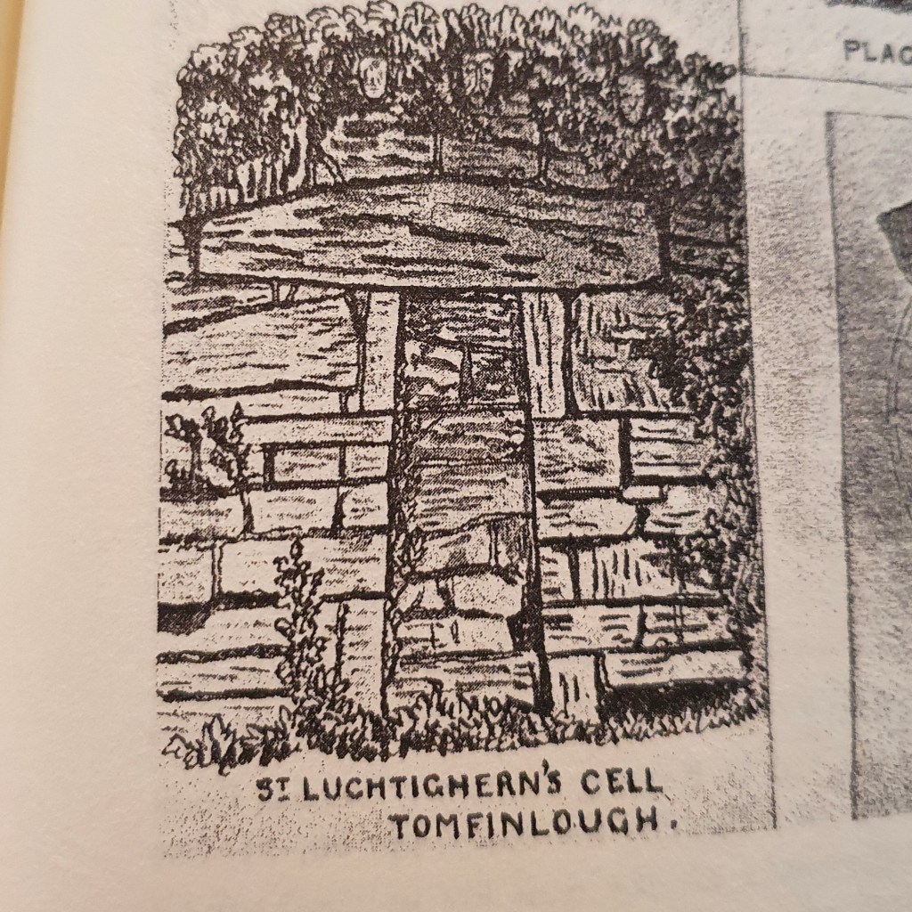
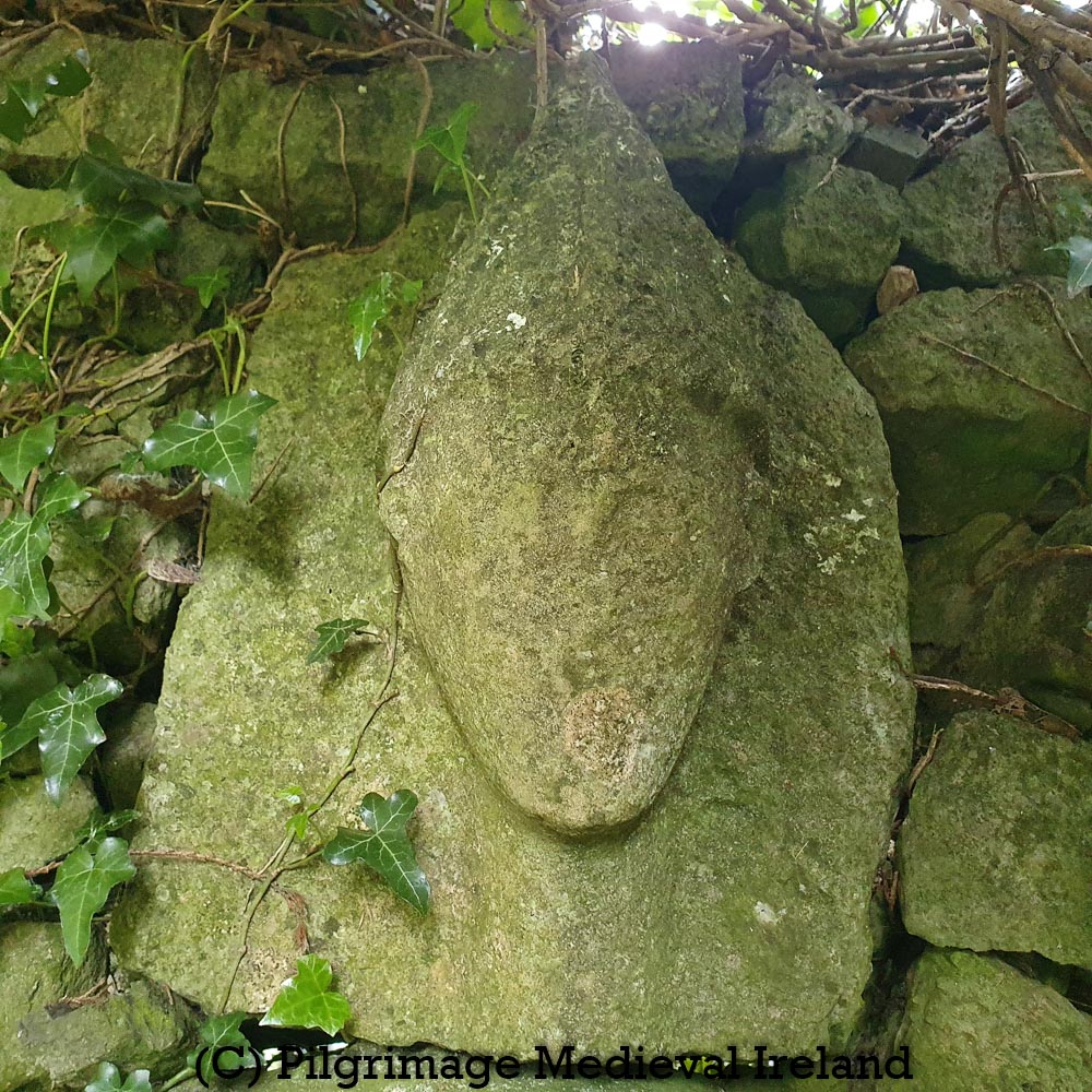
Many years ago I came across an intriguing antiquarian account of a miraculous stone from Co Clare, known as the Tomfinlough Plague Stone.
Image of the Tomfinlough plague stone taken from the book Folklore of Clare (Westropp, 2003, 93)
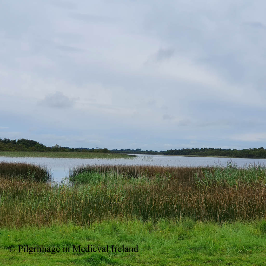
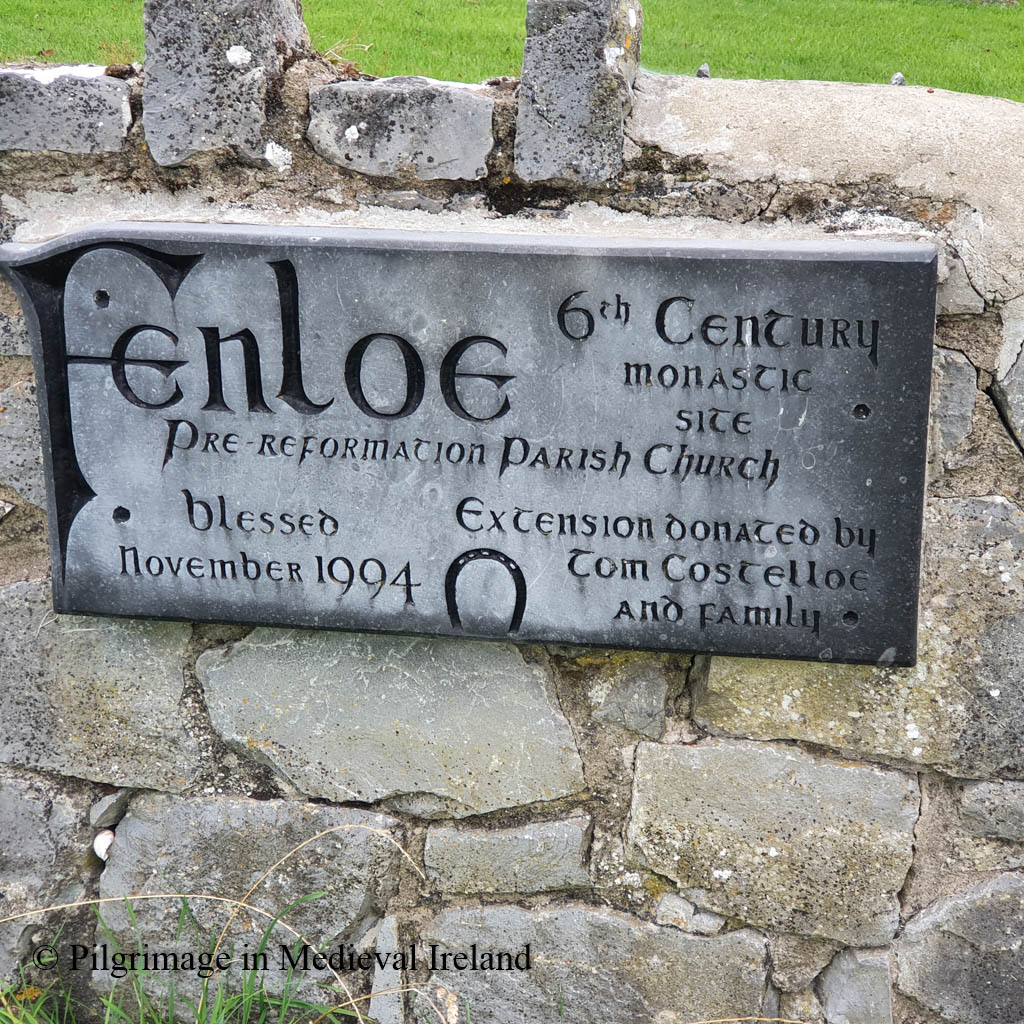
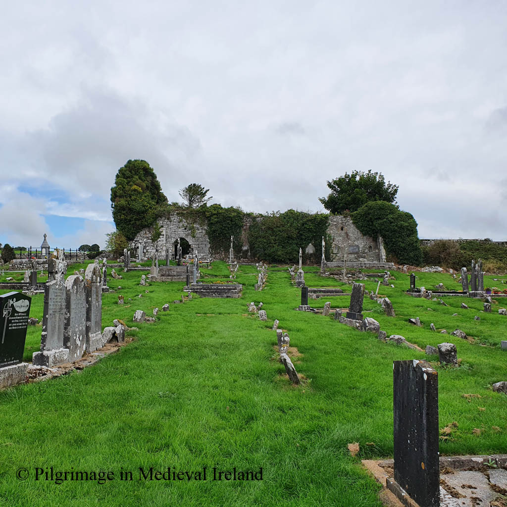
The plague stone is located at the ruins of Fenloe/Tomfinlough church (townland of Finlough/Tuaim Fhionnlocha) and historic graveyard in east Co Clare, n a scenic location overlooking Fenloe lake. Folklore records the lake was once home to a mermaid.
Long ago the mermaid used to be seen in Fenloe Lake and she combing her hair with a golden comb. In summer time. All the people used to see her.
The Schools’ Collection, Volume 0599, Page 244
View of Fenloe Lake
Fenloe church is located at the site of an early medieval monastery which was founded in the sixth century by St. Luchtighern. The Dictionary of Irish Saints tells us the saint belonged to the Tradraighe tribe, whose lands ‘were almost co-extensive with the barony of Bunratty’. The saint’s feast was traditionally commemorated on the 28th April.
Eugene Curry who visited Fenloe in 1839, noted there was no patron saint within the parish but Luchtighern’s memory seems to have been revived at a later date and by the 1930s the saint was mentioned by name in the schools essay.
Modern plaque at Fenloe church
Little is known of the history of the early medieval monastery, except for a handful of entries that are to be found in the Irish annals from the late tenth and eleventh century. For example, the Annals of the Four Masters recorded the death of the abbot of Fenloe monastery in A.D 944:
The church was also attacked by Turlough O’Brien the King of Munster, in the company of the men of Connaught, in A.D 1054.
Toirdhealbhach O’Briain, accompanied by the Connaughtmen, went into Thomond, where he committed great depredations, and slew Aedh, son of Ceinneidigh, and plundered Tuaim-Finnlocha.
By the twelfth century Tomfinlough had become a parish church. Apart from some masonry in the present church, no trace of the early monastery can be seen above ground today.
The current church is a multi-period building with
evidence of building and refurbishment over three separate phases. Large blocks of masonry around the door area represent the earliest phase, and may date to between the tenth and the twelfth century. During the Anglo-Norman occupation of this area in the late thirteenth and early fourteenth centuries, the church was restored and some fine cut sandstone windows were inserted into the south wall and east gable….Finally, in the fifteenth century, the triple light east window was blocked up and a double light trefoil-pointed limestone window was inserted. The doorway was also inserted in the fifteenth century. A buttress has been erected against the southeast corner to support the leaning east gable.
Rian na Manach p 49
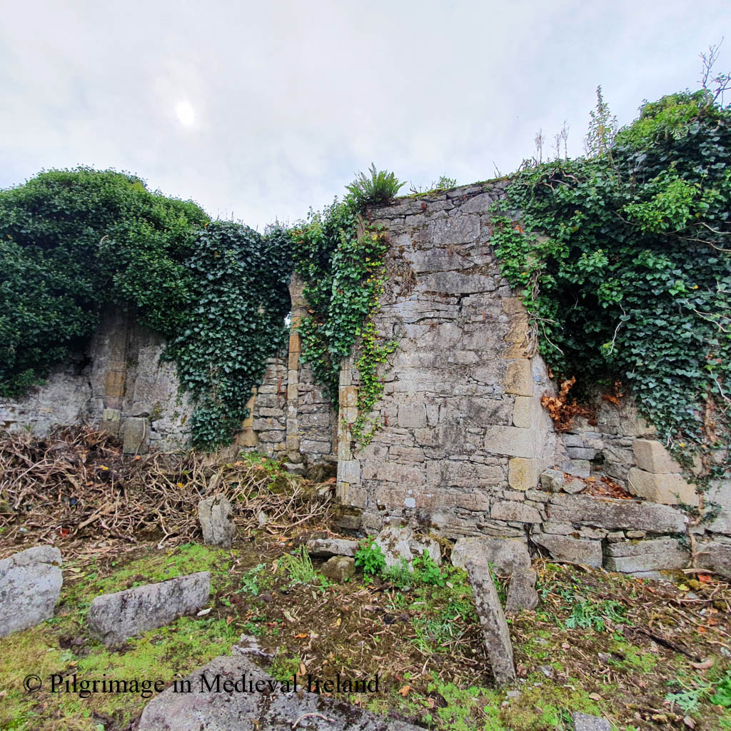
Today the church is in poor conditions. The walls are covered in thick ivy that obscures much of the surviving windows and other features. The north wall of the church fell in 1907 and the east gable was blown down by strong winds in January 2007.
View of the north side of Fenloe churchView of the south wall of Fenloe churchWest wall of Fenloe churchDoorway in the south wall of Fenloe churchBlocked up windows found in the interior of the southeast end of the south wall of Fenloe churchArchitectural fragment at Fenloe church- probably from door
The church is surrounded by a rectangular graveyard. The north and west walls are quite tall and were formerly boundaries to gardens connected with nearby Fenloe house. Curry, when he visited here in 1839 noted the remains of a second church built into the garden wall.
Fenloe church and graveyard
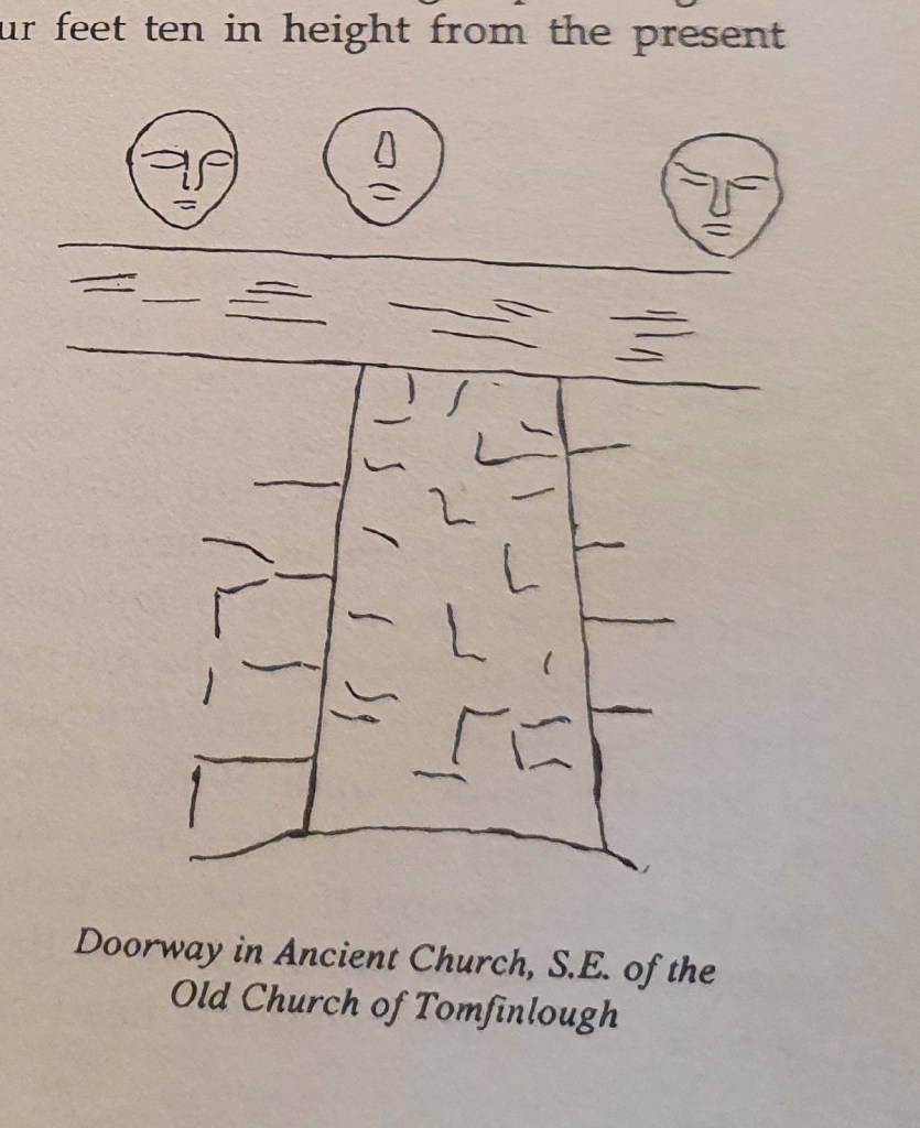
About sixty yards south from the east angle of the Church and included in a kitchen garden wall, is a pieces of a wall nine feet high and twelve feet three inches long, finished at the extremities with large cut stones, like the angles of the gable of a house, and having a quadrangular doorway in the centre measuring four feet ten in height from the present level of the ground, one foot nine and a half inches in breadth at top and two feet two inches at bottom, covered by a lintel stone five feet long and ten inches thick, but what the condition or appearance of this piece of wall may be on the other side I was not able to ascertain as it forms part of the wall of a gentleman’s kitchen garden, to which I could not at the time gain access.
O’Donovan & Curry p 201
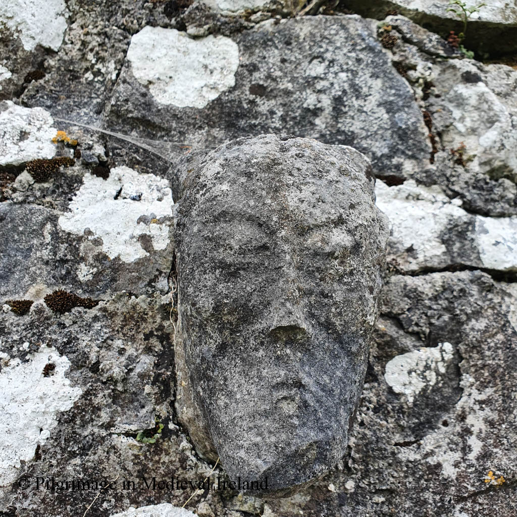
Curry recorded and illustrated three carved head sitting over the lintel in the door described in the wall.
Over the doorway are placed three heads (human), sculptured in stone…
O’Donovan & Curry p 201
Westropp in 1910-13 provides a second account and drawing of the door and heads.
Drawing of lintel doorway in the kitchen garden door, drawn by Curry in 1839.Drawing of lintel doorway in the kitchen garden door, drawn by Westropp in the 1900s
During my visit I didn’t see any further indications of the ancient building. The medieval heads described by Curry are still present but no longer sit over the lintel door, suggesting the wall must have been rebuilt since Westropp’s visit.
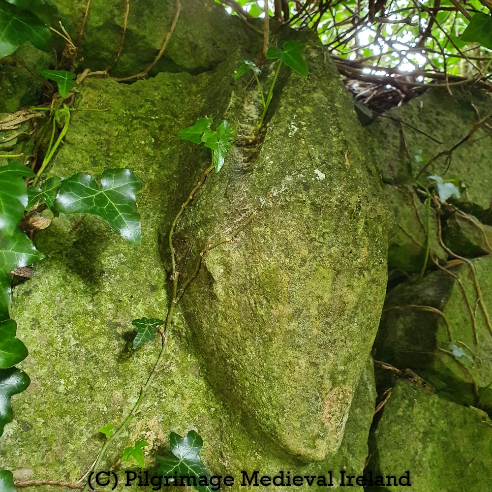
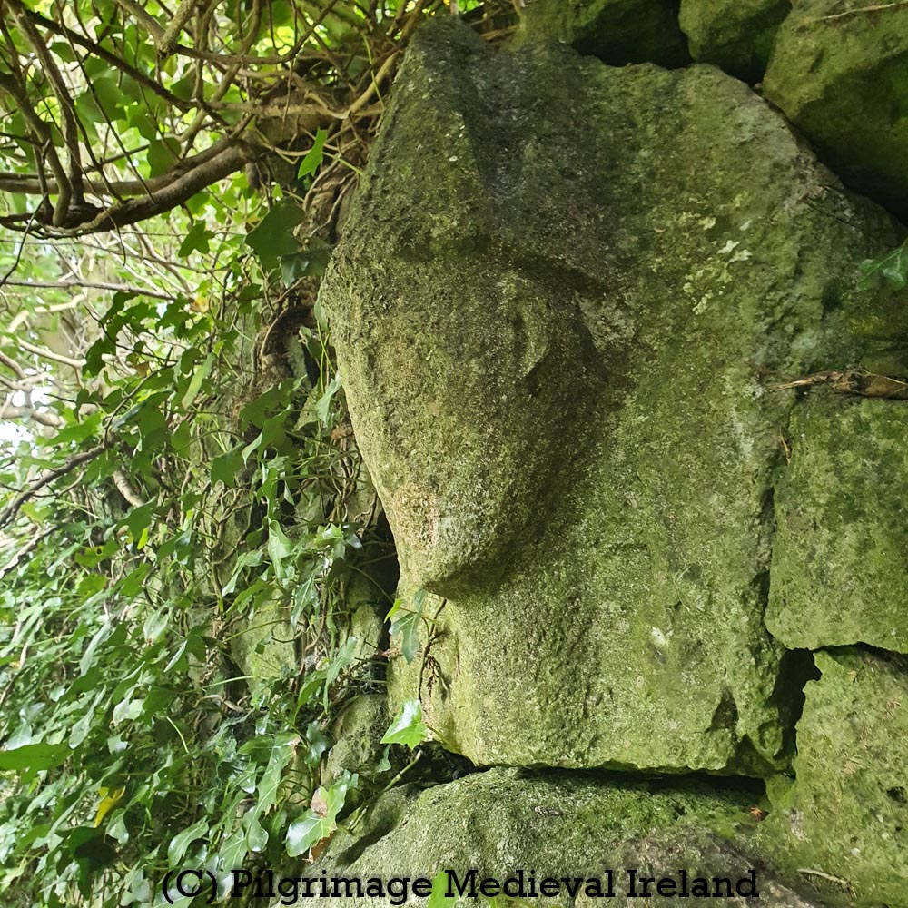
Stone Heads
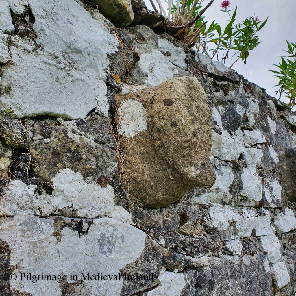
The three carved heads are be found in the south-east corner of the graveyard, built in a line into the upper course of the wall. All three heads are medieval in date. The central head is the best preserved and is carved from limestone; two weathered sandstone heads sit on either side of it.
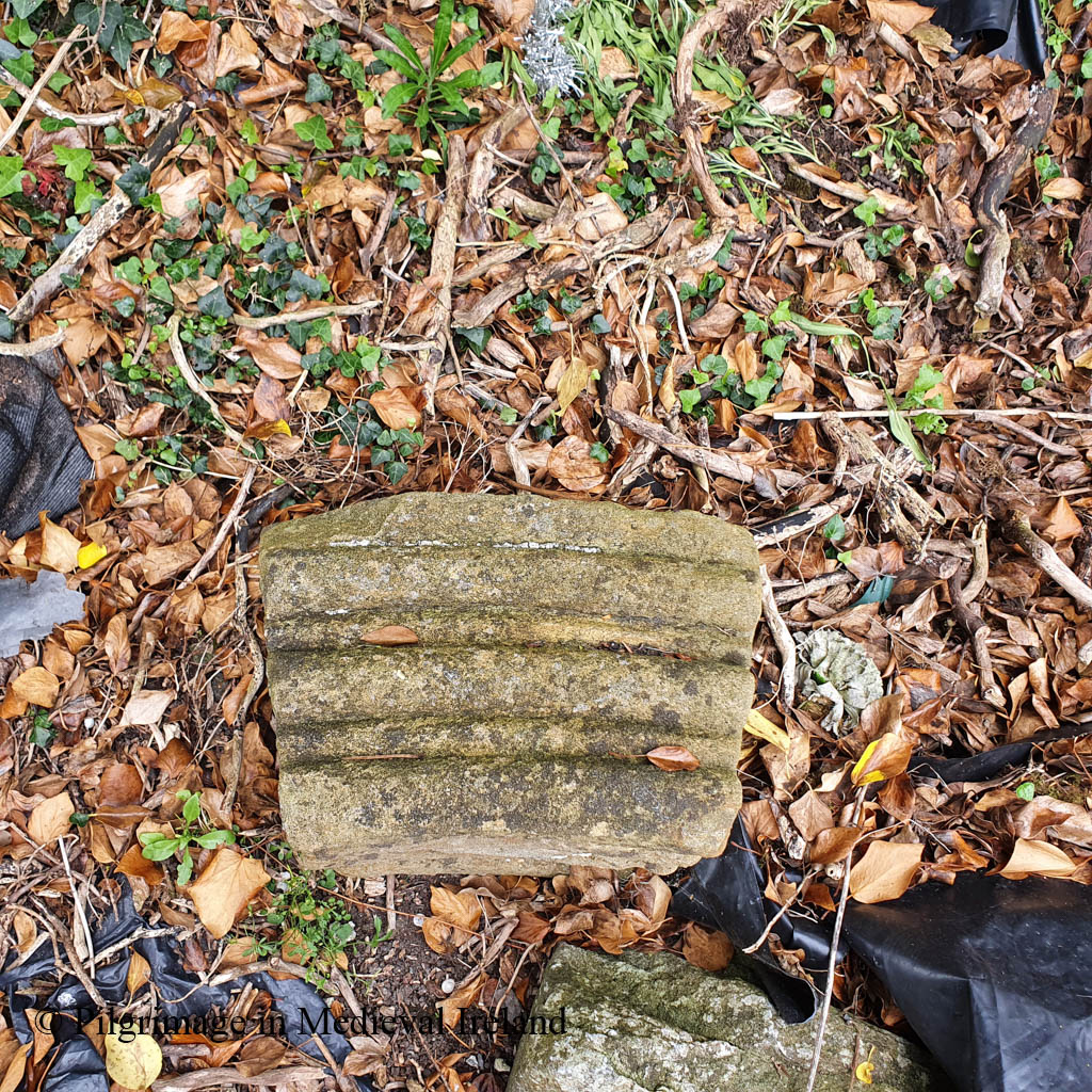
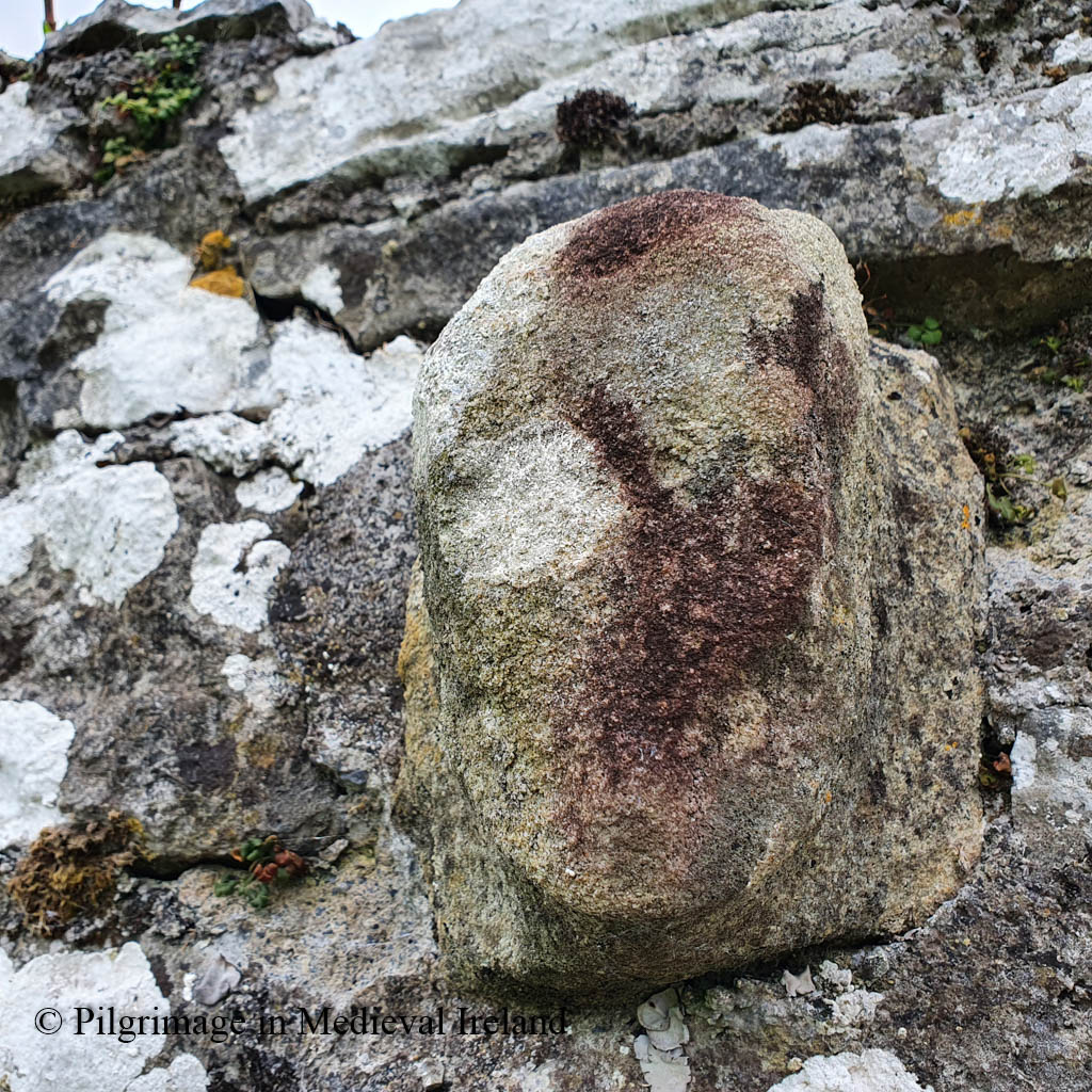
The Plague Stone
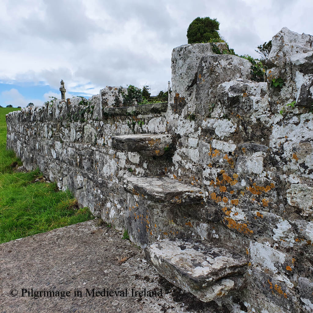
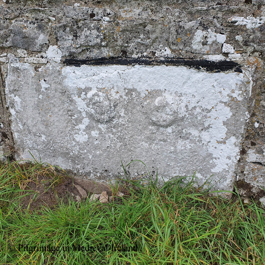
A carved stone as the ‘plague stone’ is located on the exterior of the west wall of the graveyard and is accessed by a stile in the wall. The stile incorporates a coffin rest. Clare historian Michael Houlihan defines these interesting features as follows
These rests are sections of the cemetery wall that are slightly lower than the parapet, with a reasonably wide and level section about a metre in length, fashioned to allow a coffin to rest without disturbance. These remaining rests usually have one or two stiles or stepping stones on either side to allow the bearers to enter with the coffin.
The plague stone is a little difficult to find. When you climb over the stile, head south towards the holy well and the road, and you will see the stone set in the lower course of the graveyard wall. It comprises a large block of stone that is slightly lighter in colour then the rest of the wall. Two circular projections are to be found at the top of the stone: the southern-most example was depicted in the early 1900’s as having a simple Latin cross carved in its centre (Westropp 2003, 93).
Tomfinlough Plague Stone
Folklore connected with Fenloe tells of a mysterious plague which was ravaging the country. The abbot of Fenloe cured the first local person who contracted the disease and banished the plague into a large stone, which became known thereafter as the plague stone. Variations of this tale are found in the schools collection and there was a reference to people visiting the stone to obtain healing. The oldest known account of it is to be found in the Ordnance Survey Letters of 1839 outlined below
Long ago a great plague raged all over Ireland and the people were dying in thousands from it every day. It made its appearance in large lumps or boils on the head and no medieval or surgical skill was found to prevail against it. It first broke out in the north of Ireland and soon extended its ravages to the other parts of the Island. When the old Priests of Toomfenlough had heard of its near approach to that part of the Country, he called his flock together, exhorted them to make their souls and requested that the first person in his Parish who should be afflicted with the disease would come to him without a moment’s delay.
In a day or two afterwards as he with two other ecclesiastics of his establishment were making lay in the little meadow near the Church, he had caught the plague and begging of him to come near her. He ran forward the plague then was; she pointed at once to two large lumps and dashed them against the stone, upon which one of them broke and its contents escaped, while the other one remained unbroken. (The broken on is represented on the stone by the figure of the inverted saucer, and the unbroken one by the other figure). The woman was cured immediately of her distemper and after returning many thanks and prayers to the good old Priest set off about her business
O’Donovan & Curry , p203.
The schools essay from Ballycar, Co. Clare note that the stone was visited by people suffering from swollen joints, who would rub the effected limb against the stone making the sign of the Cross.
There are two round prints on the stone. When the people go to visit Fenloe well on the 28th of April, they go to this stone and rub their legs against it three times, blessing themselves at the same time. There was a stone near the well in Fenloe called the Cholera stone and if any person had a sore leg and rubbed it to the stone the person would be cured.
The Schools’ Collection, Volume 0598, Page 463
The school essays for Newmarket records similar healing properties for the stone.
There is a large partly oval stone forming the corner stone of the boundary wall of Fenloe Burial ground Newmarket-on-Fergus Co Clare. There are marks on the stone – one is a misshapen cross, and the shape of a large circle can be traced on the margin of the stone. People that do the pilgrimage to The Blessed Well of St Lutigern quite convenient, never neglect visiting the stone, and rub their legs to the stone making the Sign of the Cross with them whilst doing so. It is said that when St Lutigern lived, the cholera was very brief in Newmarket and surrounding districts. People came to the Saint to be cured. There were so many people afflicted by the disease, and St Lutigern was so occupied ministering to them, that he blessed this large stone and ordered all people afflicted with the cholera to rub their legs to the stone, making the sign of the Cross on it with them, whilst doing so. People possessed of the proper Faith were always effectually cured. At the present day people affected with swollen joints believe that by rubbing them to the stone and making the sign of the Cross with the injured joint that the swelling will disappear. Some people attach a symbolic meaning to the markings on the stone. They say that the circle indicates eternity and that the Cross signifies Salvation.
The Schools’ Collection, Volume 0599, Page 213
The schools essays for Stonehall Co Clare tell a different story.
Here also is a ‘plague-stone’. Sufferers from the Cholera touched this stone and were cured. One day a cholera victim was digging his grave in the churchyard. A stranger came in and questioned him. The man told the stranger he was digging his own grave as he expected to die from the disease. The stranger pounced upon him and removed two pieces of his flesh which he threw against a stone in the wall. He then told the man to touch the stone. He did so and was cured.
The Schools’ Collection, Volume 0599, Page 316-317
Folklore relating to the three medieval stone heads
The medieval heads mentioned above also have a rich folklore connected to them.
Near the south-east corner of the graveyard there are three stone heads on the boundary wall and their story is connected with that of the plague stone. The story goes that there were three on lookers at the incident of the miraculous cure and one of them was very sceptical. The abbot had three heads carved and mounted over the church door. He placed the head representing the unbeliever in the middle, saying it would gradually yield to the elements while the other two heads would forever remain unaffected by weather
Another story from the schools essays from Ballycar
There is a story told about the images of three priests which are to be seen on the boundary wall opposite to that of the cholera stone. The three images are side by side. he centre image represents a martyr of the faith. The image on the right is a repentant martyr and the other one is a traitor which is effaced.
The Schools’ Collection, Volume 0599, Page 294-295
Northern stone headCentral stone headsSouthern stone headThree stones heads in wall of Fenloe graveyard
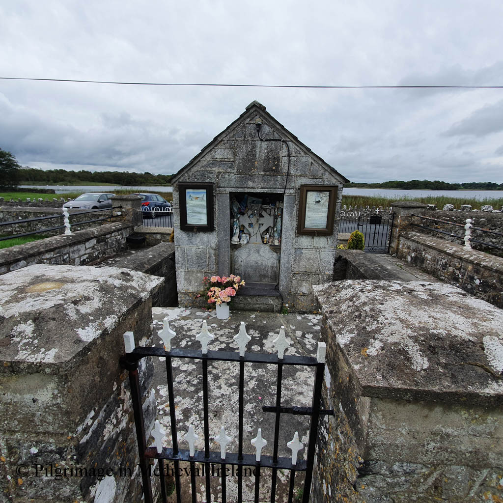
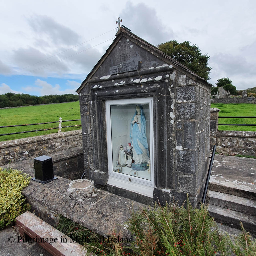
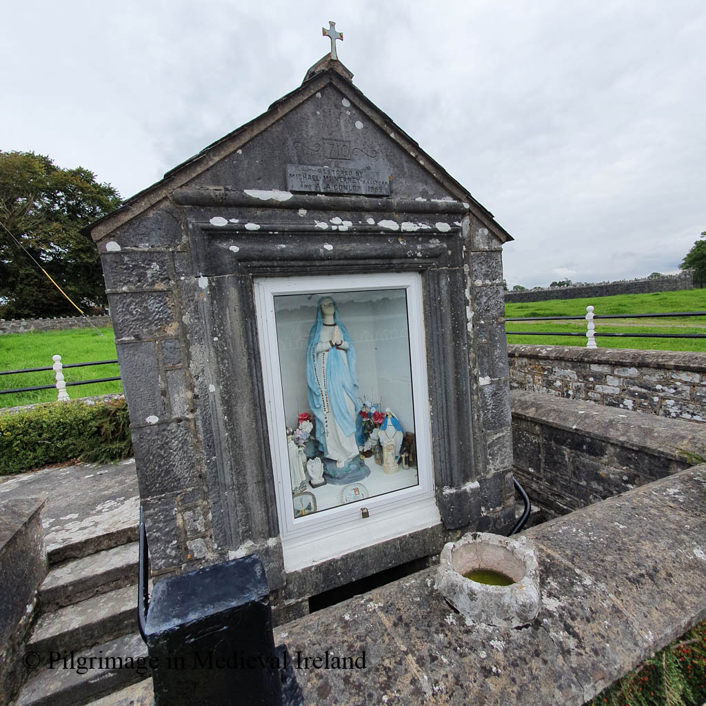
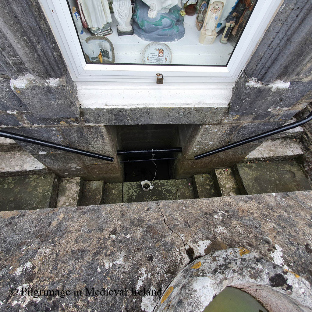
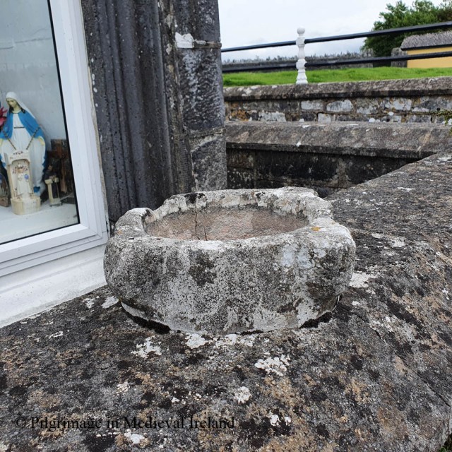
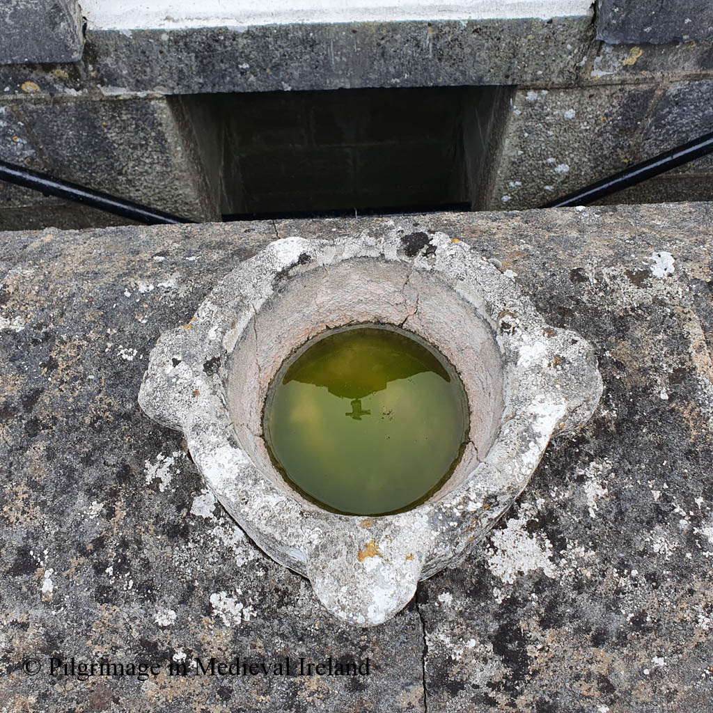
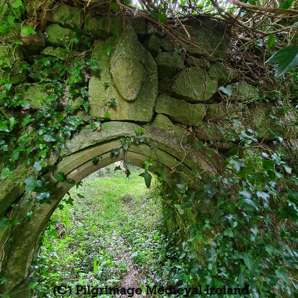
Fenloe holy well
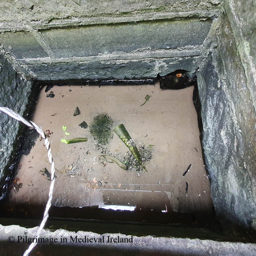
Another interesting feature at the site is a holy well at the roadside near the edge of the graveyard. The well sits within a small rectangular area enclosed by a low stone wall and it is covered by well-house which incorporate statue niche and gravestone. A series of steps lead down to a water-filled rectangular recess.
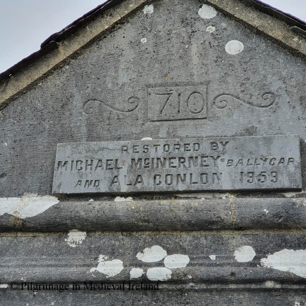
Fenloe Holy WellFenloe Holy Well c,1938. The Photographic Collection, F025.19.00225Fenloe Holy WellFenloe holy Well was rebuilt in 1959 by Michael McInerney and Ala Conlon
The well house was restored and rebuilt in 1959 by Michael McInerney and Ala Conlon.
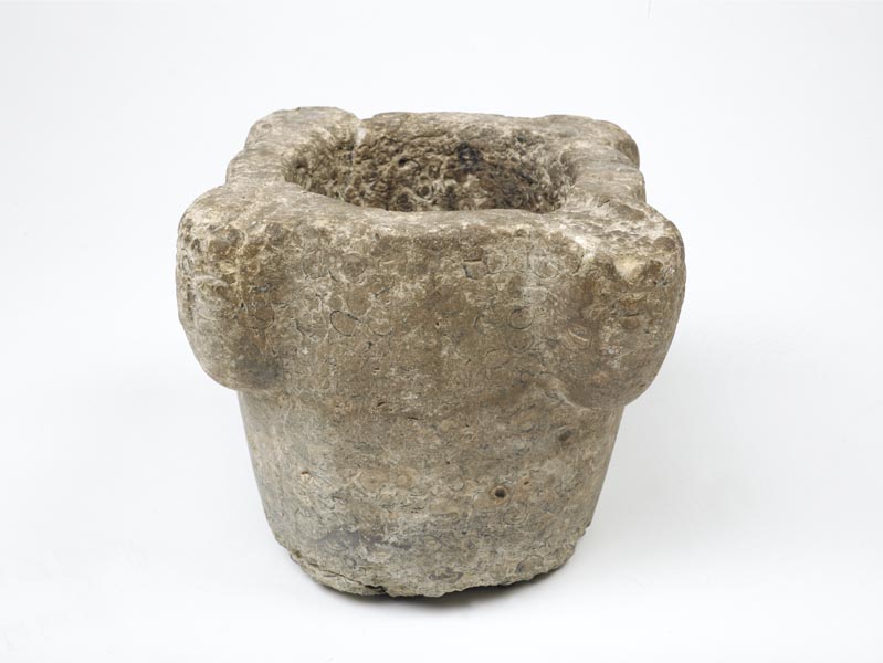
A medieval stone mortar, which has been incorrectly described as a bullaun stone, sits on the wall above the well. recess. Mortars were used with a pestle for grinding food and herbs for cooking or medicines. A similar mortar dated to the 13th century is part of Museum of London catalogue.
Rounds were performed at the well in the 1930s on St Luchtigern’s feast day and offerings left at the well to this day show it is still visited by pilgrims.
pilgrimage is made on April 28th. Five decades of the Rosary are recited. Pictures, medals, crucifixes are left at the shrine, and rags and pieces of cord [?] are attached to a bush nearby. The Schools’ Collection, Volume 0599, Page 316
The waters from St Luchtigern’s well was said to have curative power and was especially favoured for a cure for sore eyes (The Schools’ Collection, Volume 0598, Page 463)
They say the Rosary there. They also drink some of the water and rub it to the diseased part. They bring some of it home but they do not use it for ordinary household purposes.
St Sourney (Sairnait in Irish), is the patron saint of the holy well and medieval church at Drumacoo, Co Galway (Gwynn and Hadcock 1970, 34). Sourney was a holy woman who lived in Ireland during the sixth century, little is known about her life. She is also the patron of the small early medieval church of Teampall Asurnaí (St Sourney’s Church) at the village of Eochaill on Inismore. Tradition holds she also founded a monastery at Drumcoo during lifetime. Her feast day was celebrated on the 3rd May.
The schools collection for Ballinderreen, Co. Galway record an interesting folk tale relating to the saint.
Saint Surney sent one of her servants to Island Eddy for a coal, the servant went and she got the coal from the woman of the house who put it into her pinafore and as she was coming home the coal burned ahole in her pinafore. The saint was vexed when she saw the hole and she cursed Island Eddy and she said that anyone would come from island Eddy to Arran with a dry feet and the sea came between Island Eddy and Arran and the people never come out without a boat. Saint Surney was a very holy woman and she never cursed until she cursed Island Eddy. A little girl always stayed with the saint till after her death. The saint used to pray for hours every day and every one knew she was a saint because she used to pray very often.
The Schools’ Collection, Volume 0033B, Page 03_004
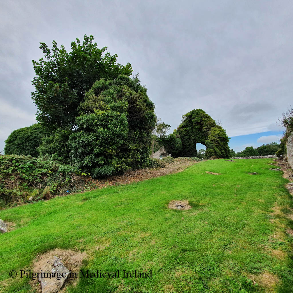
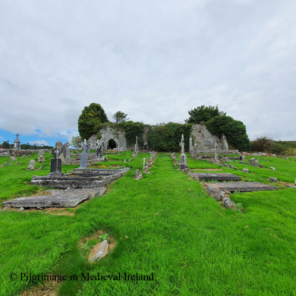
The modern visitor to Drumcoo will find a multi-period church surrounded by a later historic graveyard.
View of St Sourney’s Church, the site of an early medieval monastery at Drumacoo, Co Galway
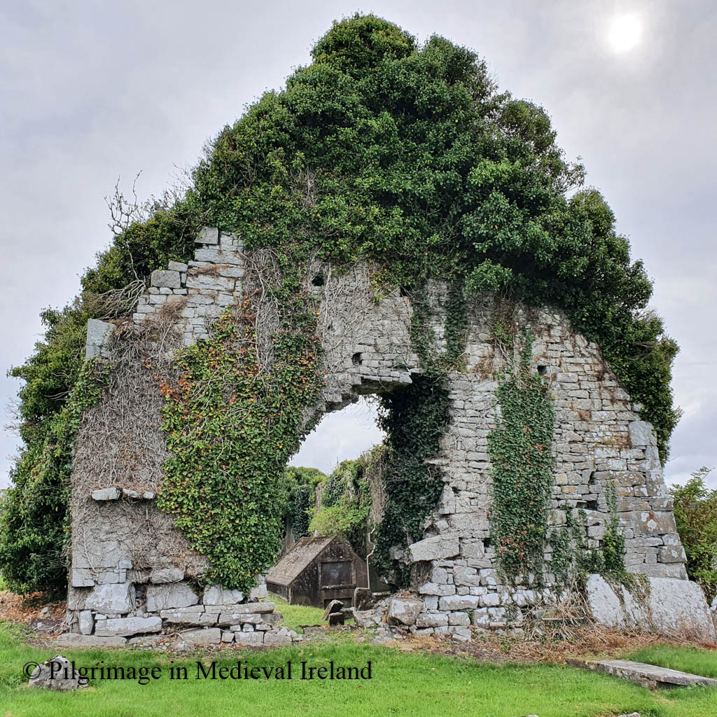
The oldest part of Drumcoo church can be seen in the north wall and the west gable. The style of masonry and the flat lintel doorway (trabeate doorway) suggest the presence of a simple pre-Romanesque style stone church that was later modified.
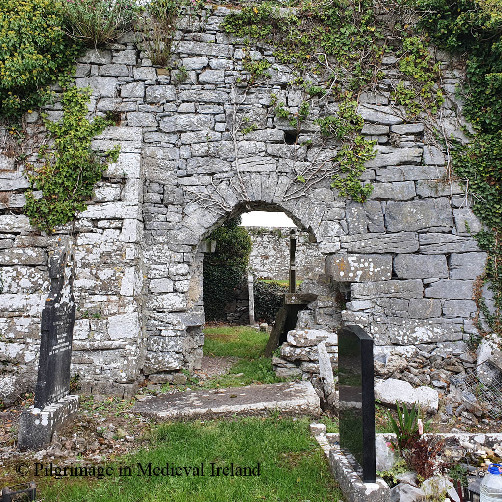
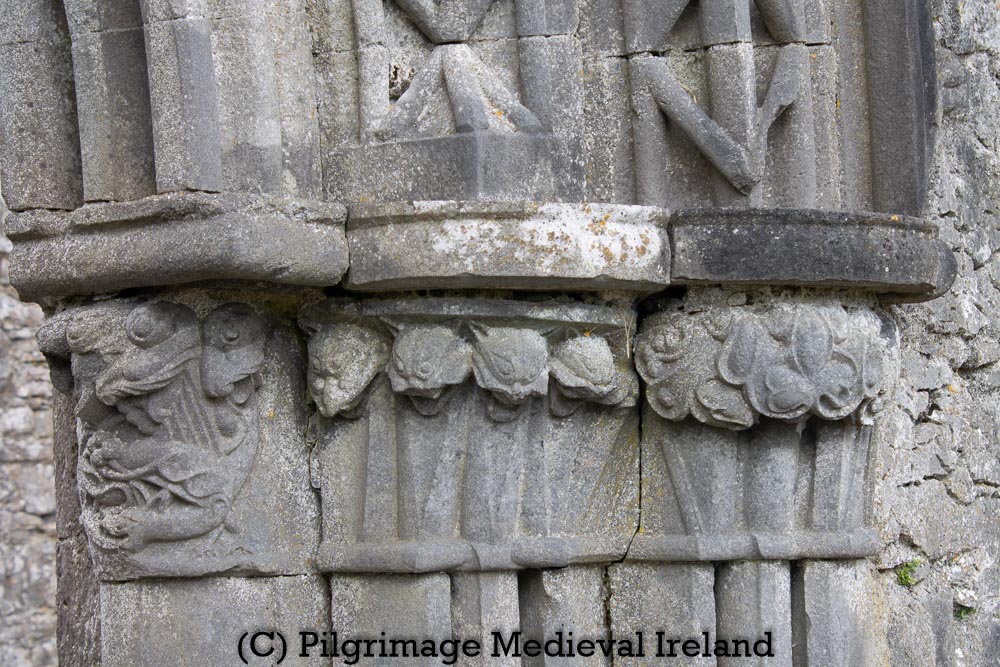
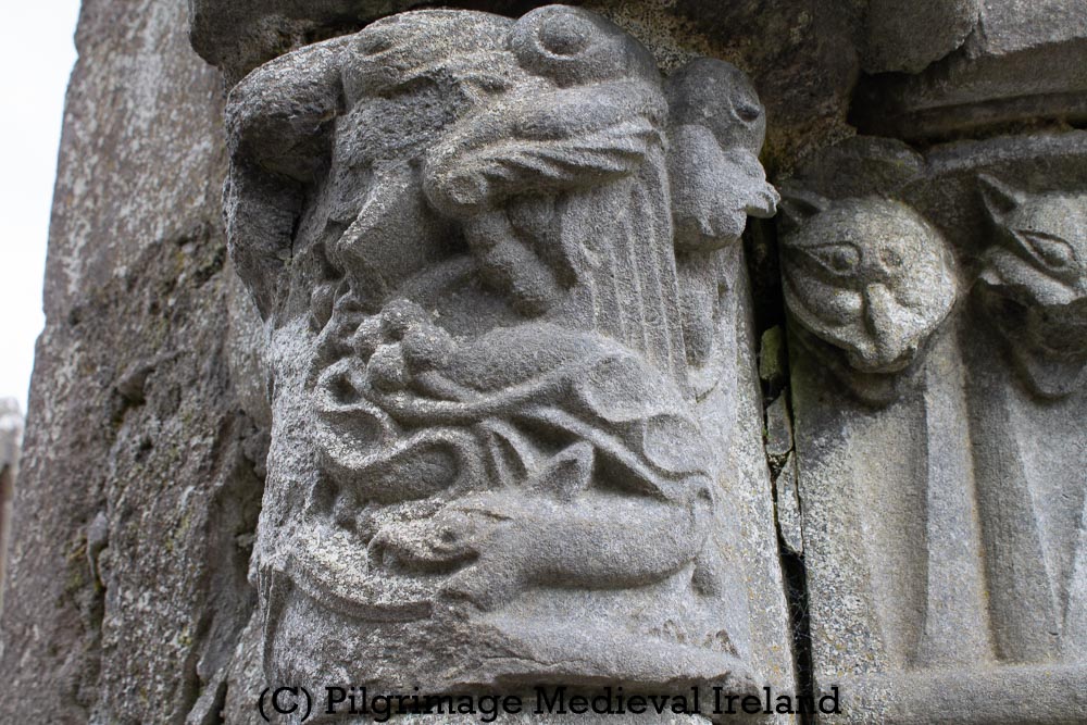
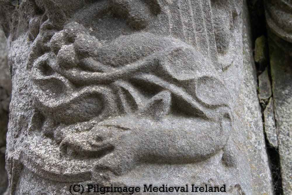
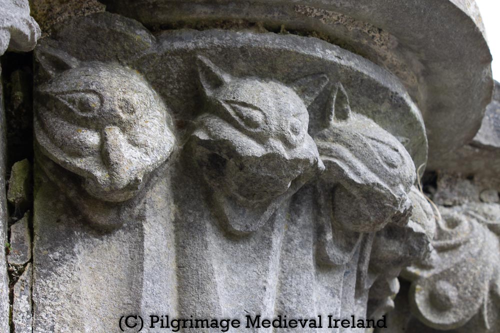
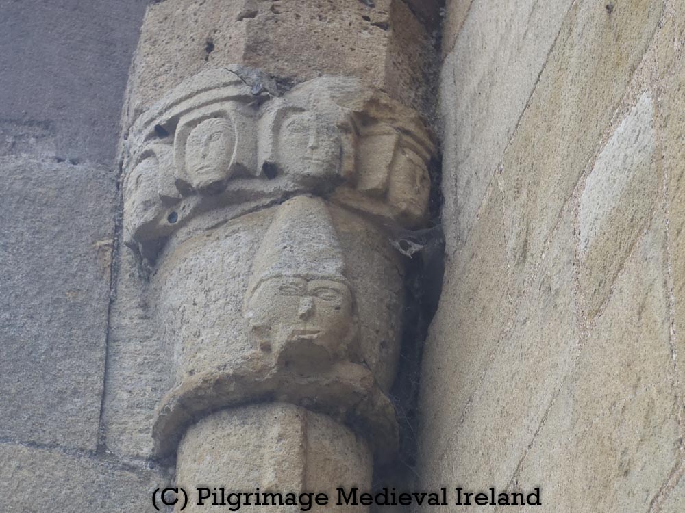
The southern wall is later and dates to around the mid thirteenth century. This wall has a very fine pointed doorway with intricately carved features including the heads of a number of cats. The door is the work of a very skilled crafts person.
The beautiful S. door is one of the minor masterpieces of the Connacht Transitional style and seems, like the E. windows, to be the work of the Boyle-Cong-Knockmoy-Corcomroe school of masons.
(Killanin & Duigan 1967, 318).
The east gable of the church has two fine carved single-light windows, one of which was blocked up. On either side of the windows are finely carved pointed aumbry.
View of the east gable in the interior of Drumcoo Church
The earliest recorded evidence of pilgrimage at Drumcoo dates to the nineteenth century, but its likely the tradition of pilgrimage was much older.
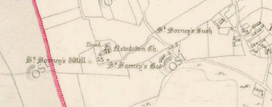
The 1st edition Ordnance Survey map shows an extensive pilgrim landscape surrounds the church, a holy bush, a saints bed and the holy well, all were dedicated to St Sourney.
1st edition Ordnance Survey map for Drumcoo
The contemporary Ordnance Survey Letters Co Galway (1838) also records these religious stations.
Sórnach [Sourney] whose Bed (Leabaidh), bush (tseach) and well (tobar) are shewn in the townland of Drumacoo.
(Herity 2009, 75)
St Sourney’s bush does not appear on later ordnance survey maps suggesting devotions and local interest in the tree ceased after this time.
St Sourney’s bed was described in 1890 as
one of those stone cells in which many of our early Saints loved to do penance. It measures about 6 feet [1.83m] in length by 4 [1.22m] in width externally.
(Fahey 1893, 33)
In 1980’s the bed was described as
completely ivy-covered and consisted of a rectangular mass of stone (L 2.6m; Wth 2m; H 1.7m) aligned N-S. According to local information, it was subsequently destroyed during a graveyard clean-up.
Galway Archaeological Survey, UCG
Only St Sourney’s holy well has survived, although it was rebuilt in the 1980’s using stones from St Sourney’s bed.
The well was recently rebuilt by a work crew who unfortunately took the stones to build it from what was reputedly St. Sairnait’s cell or ‘bed’
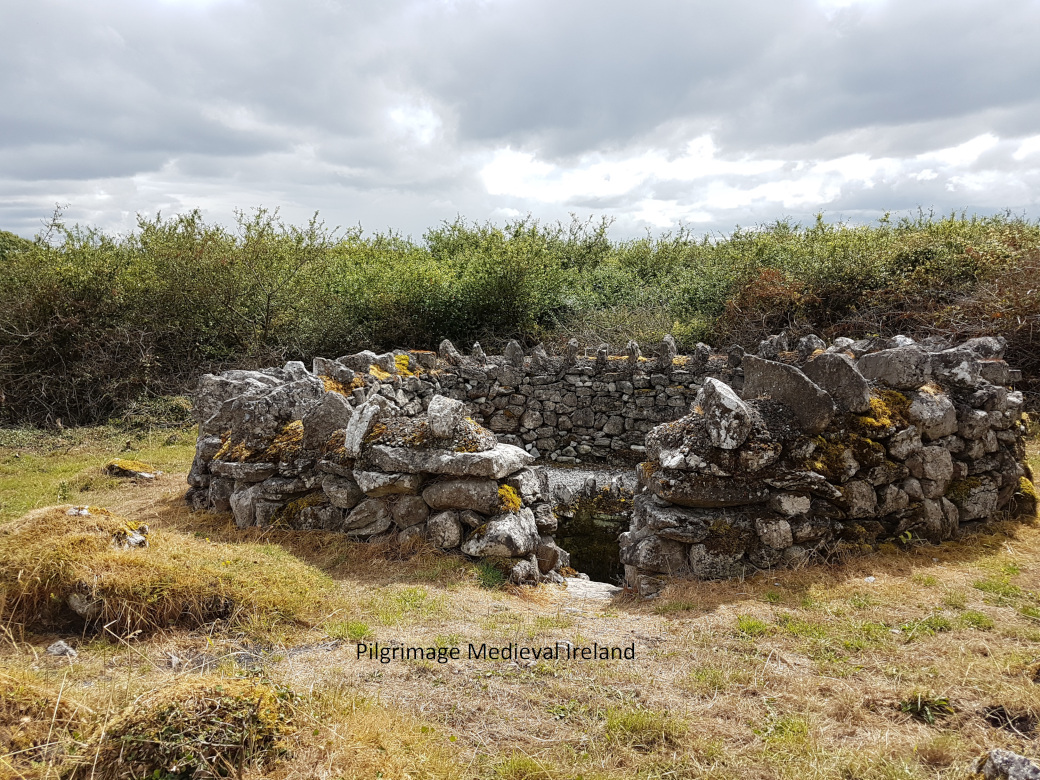
The holy well is located a short distance to the southwest of the medieval church. The well is enclosed by a circular stone wall.
St Sourney’s Holy Well Drumcoo Co Galway
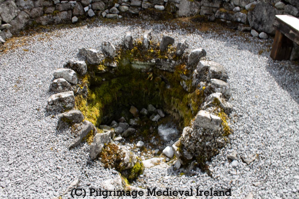
A gap in the wall provided access into a circular area covered by gravel. The holy well sits at the centre, below ground level. Stone steps provide access to the stone lined interior of the well. When I visited the well it was dry.
Interior of the Sourney’s Holy Well Drumcoo
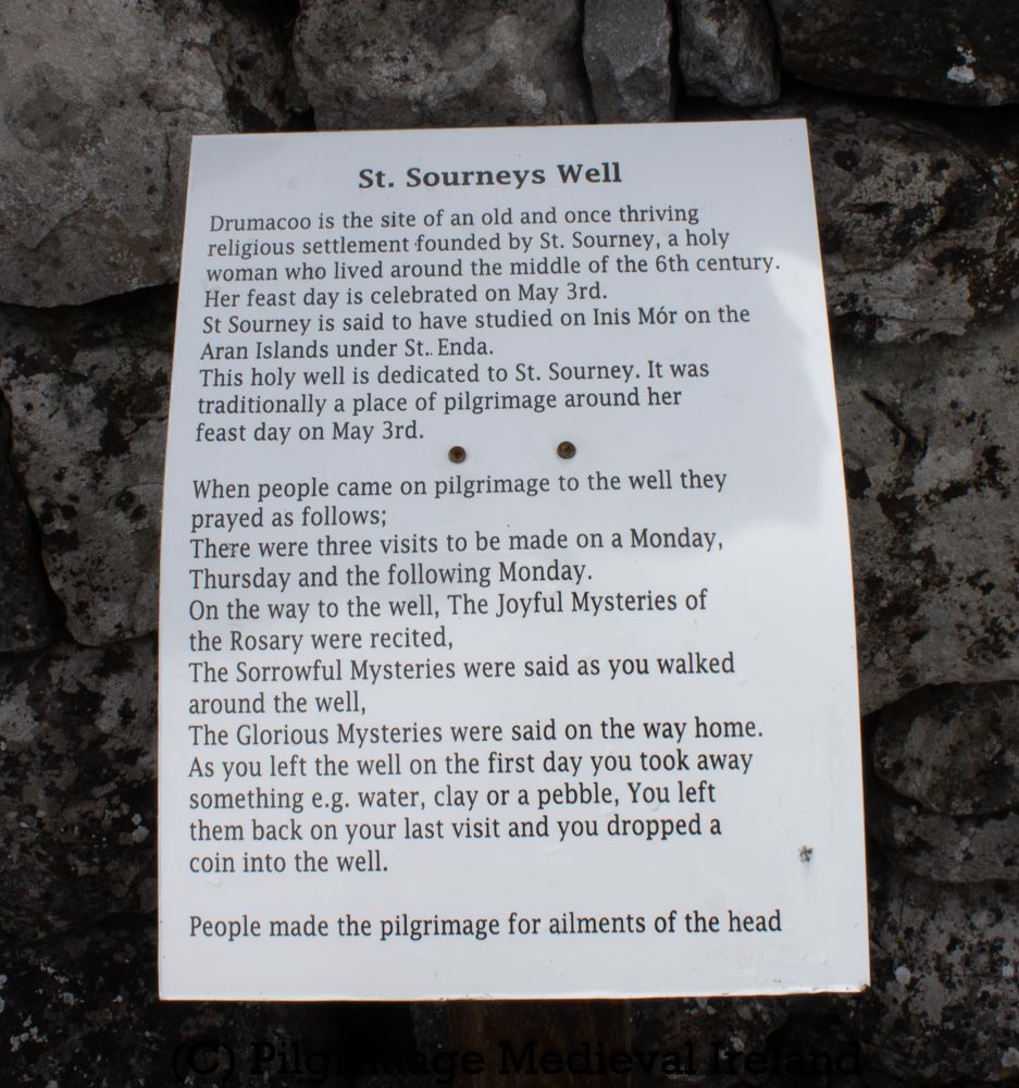
Its was said that the wells water was an effective cure for a pain in the head. In the 1930’s those in search of healing would visit the holy well and devotions performed on two consecutive Mondays and the intervening Thursday.
If a person is subject to a constant headache he goes to this well for a cure. He goes to the well three times, on Monday,Thursday and the following Monday. Every time he visits the well he should leave something, if only a button, on a bank of earth which is raised beside the well. He says certain prayers at the well, then he brings a bottle of water from the well and washes his forehead with it every day.
The Schools’ Collection, Volume 0033B, Page 01_047
Details of the pilgrim rounds at St Sourney’s Holy Well
Bibliography
Fahey, J.A. 1893 (Reprint 1986) The history and antiquities of the diocese of Kilmacduagh. Galway. Kenny Gallery.
Higgins, J.G. 1987 The Early Christian cross slabs, pillar stones and related monuments of County Galway, Ireland, 2 vols. British Archaeological Reports, International Series 375. Oxford.
Herity, M. 2009. Ordnance Survey Letters Galway. Dublin: Fourmasters Press
Killanin, M.M. and Duignan, M.V. 1967 (2nd ed.) The Shell guide to Ireland. London. The Ebury Press.
Harbison, P. 1970 (Reprint 1992) Guide to the national monuments in the Republic of Ireland. Dublin. Gill and Macmillan.
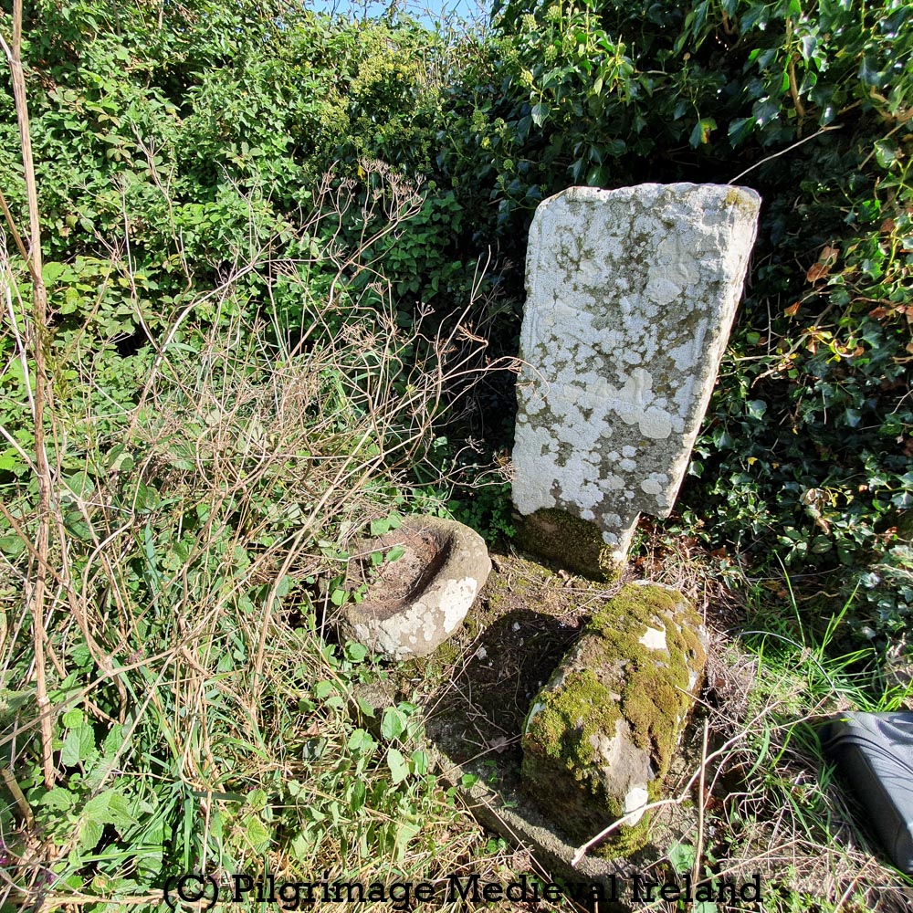
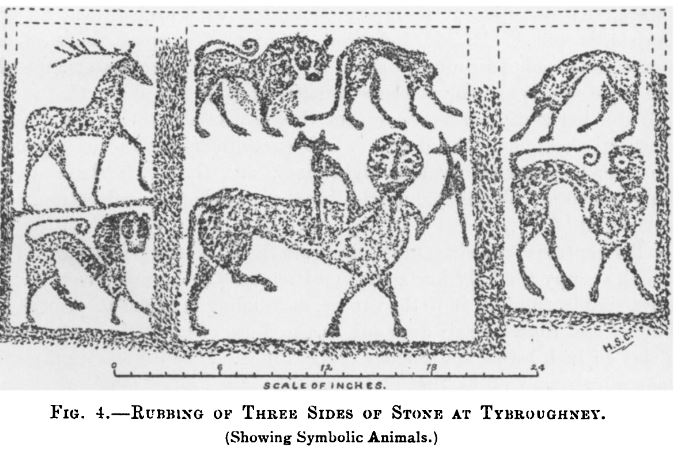
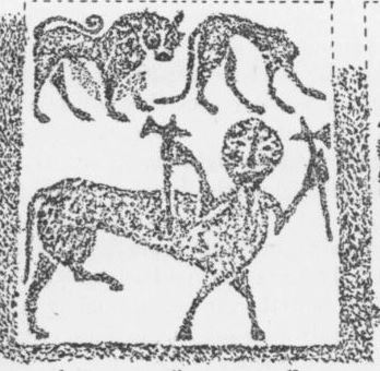
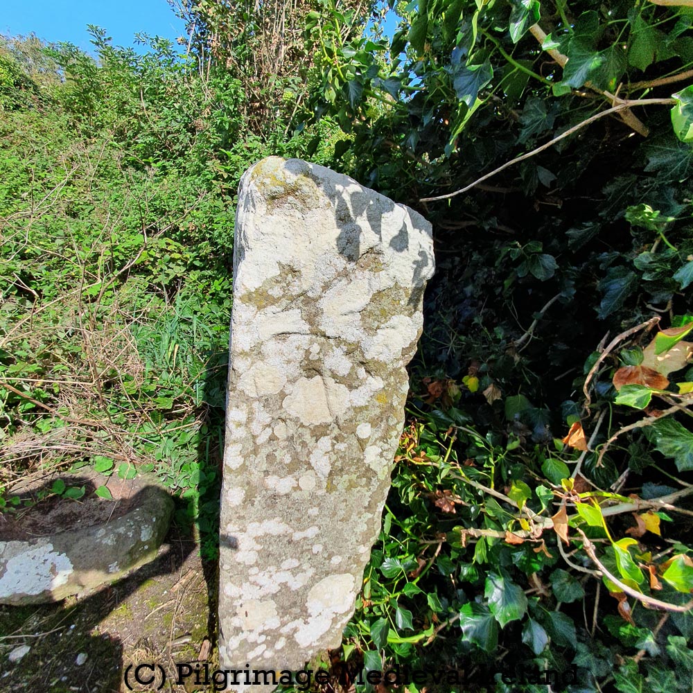
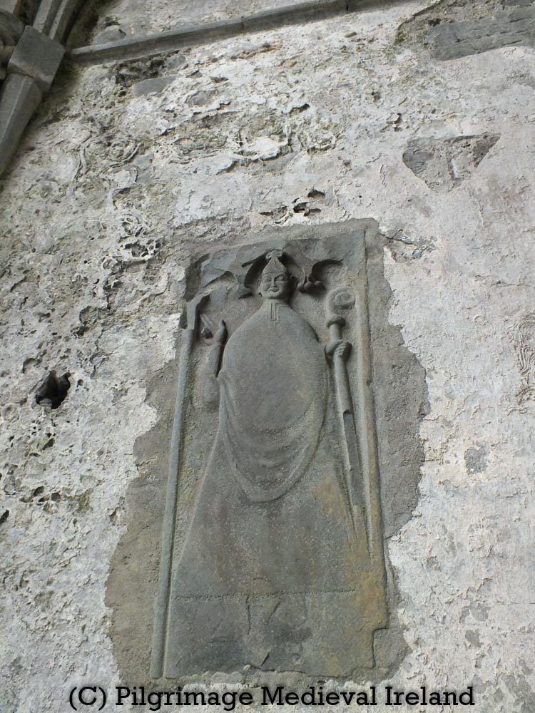
The Tybroughney pillar, an early medieval pillar stone in the townland of Tybroughney/Tibberaghny, Co Kilkenny is one of the most interesting early medieval carvings in Ireland.
The townland of Tybroughney is associated with two saints. The first is St Fhachna, who is tthe patron of a holy well that gives its names to the townland. The name Tybroughney Tiobra Fhachna translates as St Fhachna’s holy well.
The second saint is St Modomnoc a hermit who founded a monastery here in the sixth century. The former monastery is said to be located at the ruins of the medieval church of Tybroughney.
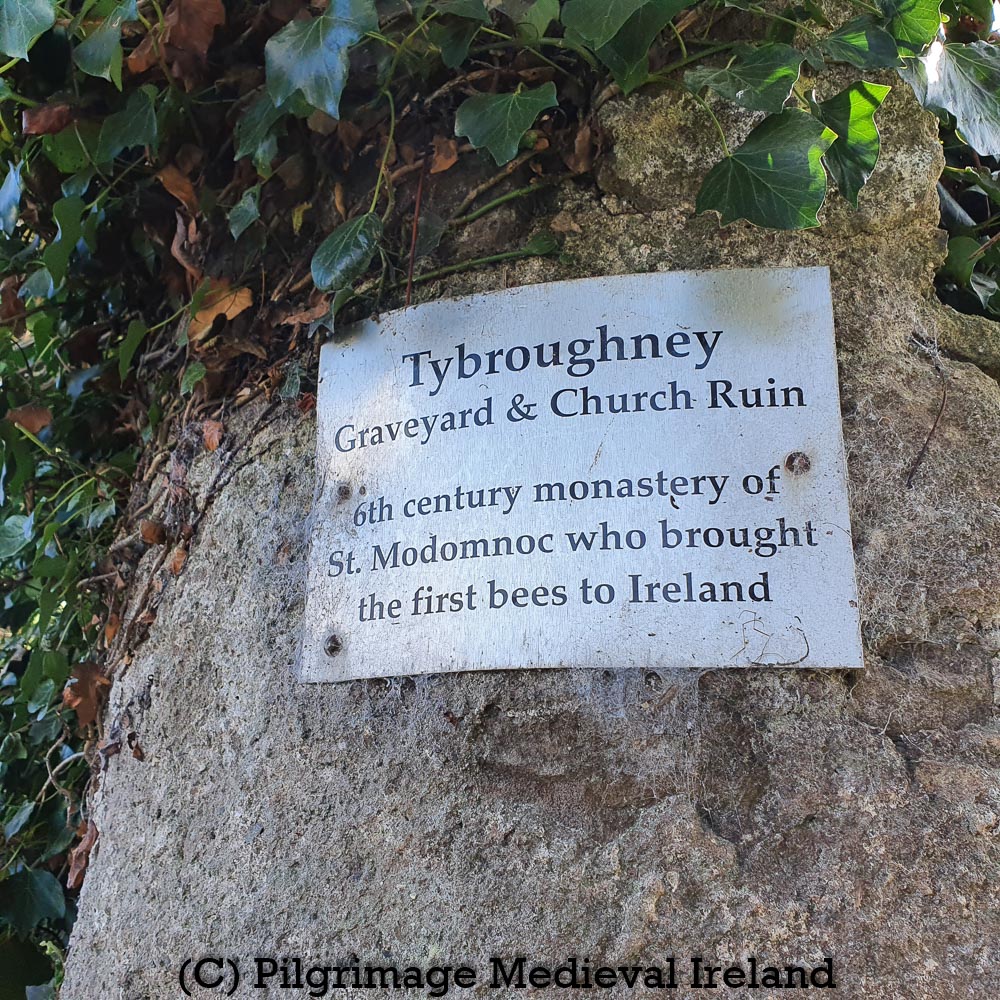
Tybroughney church is located close to the site of a medieval castle and the main Waterford-Clonmel railway line. You have to cross a field to get to the church and graveyard. A fine stone gateway into the field has a plaque on commemorating St Modomoc,
Tybroughney Graveyard and Church in Ruin. 6th century monastery of St Modomnoc who brought the first bees to Ireland.
Information sign of the on pillar leading to Tybroughney church and graveyard.
Like St Gobnait,St Modomnochas a strong connection with bee keeping and bees.
The patron saint of Tybroughney is St Modhomhnoc. He is said to have been the first to introduce bees into Ireland. During his sojourn with St David, in Menevia, he had charge of the bees of the monastery, and attended them with the greatest care, so much that they were fruitful of honey in his hands. When he was returning thence to Ireland, and had biddin farewell to the holy abbot and monks, and had entered the coracle, to set sail, the bees, forming a large swarm came and settled in the boat along with him. Modhomhnoc, unwilling to the monastery of this treasure, brought them back to their hive. A second time, however, as he again entered the boat, they followed him, and, when he again brought them back, they repeated the same a third time. St David hearing this told him to bring the bees with him to Erin
The Schools’ Collection, Volume 0843, Page 345
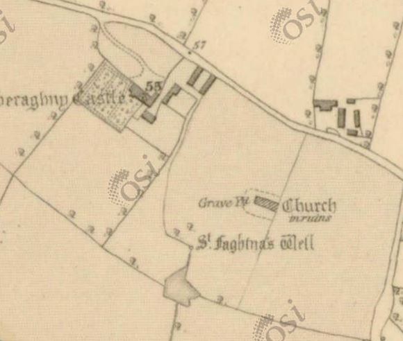
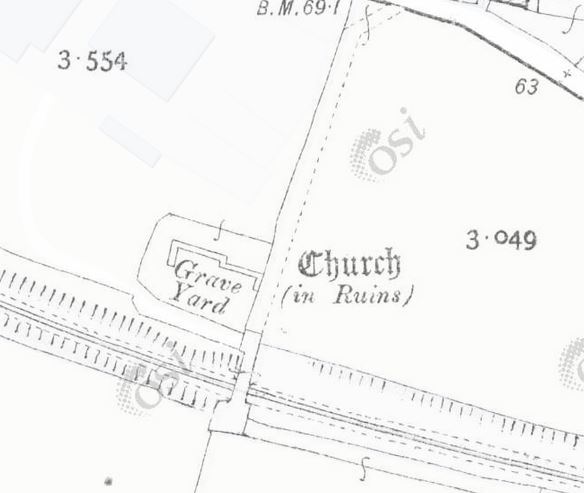
The church is found beside railway gates. It is difficult to examine the church and surrounding graveyard as it is very overgrown. The 1st edition Ordnance Survey map dating to the 1840s, shows the church as a rectangular building while the later 25″map shows it as a nave and chancel church.
The Ordnance Survey Letters of Kilkenny 1839 described the church
The ruins of the church of Tiobtrait Fachtna (Note added: Tybroughney) stand in the Townland of that name and consist of Nave and Choir, the former 50 feet 8 inches by 30 feet 10 inches, the Choir 28 feet 9 inches by 18 feet 10 inches. The northern half of the west gable remains to about the height of 20 feet and half the north wall attached to it about 14 feet high, south wall and middle gable level with the ground…..The walls of the Nave are built of middle sized limestown and mortar, 2 1/2 feet think and not older I should think the 16th century, but the wall of the Choir are built of very large well formed, tho irregularly laid blocks of granite, and 3 feet 2 inches thick, very much resembling the wall of the Church of Kilcroney near Bray, in the County Wicklow.
(Herity 2003, 155).
Manning (2012, 154) describes the church as a medium-sized with antae. The west gable is still upstanding but it is very hard to say much else about the church.
Tybroughney medieval parish church is covered in thick vegetation
Part of the graveyard that surrounds the church was destroyed in 1851 when the by railway line was built. This event was clearly remember decades later locally. The Schools Collection for Piltown School,
The railway line now runs through this old graveyard. It was constructed in 1851. When it was being made the workmen came upon a large number of human skeletons. The skeletons lay along under the surface in single file and were so close together that there were no coffins used in their interment. This shows there was an ancient monastery here or if not it was the resting place of warriors slain in some local battle.
The Schools’ Collection, Volume 0842, Page 288
View of Tybroughney medieval church and graveyard from across the railway tracks
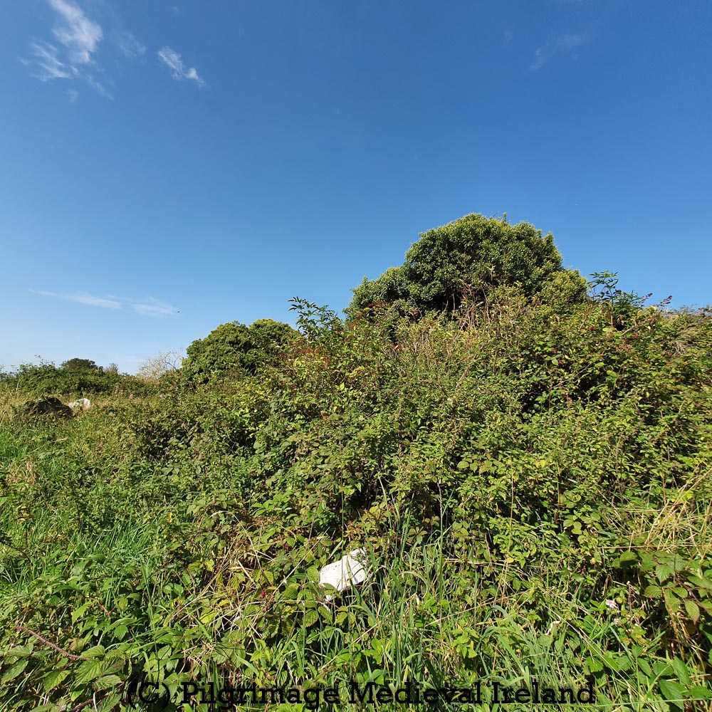
The holy well which gives its name to the townland is located on the other side of the railroad tracks in scrub. I didn’t have time to search for the well on my visit here but will hopefull get back there soon. In the early nineteenth century a pattern day was held here on the13th February (Herity 2003, 157).
The Tybroughney pillar stone sits beside the church ruins, on a small patch of ground defined by low curbing. This area also contains a plain undercoated stone with an oval shaped hollow and seems to be font. There is also a rectangular stone covered in moss.
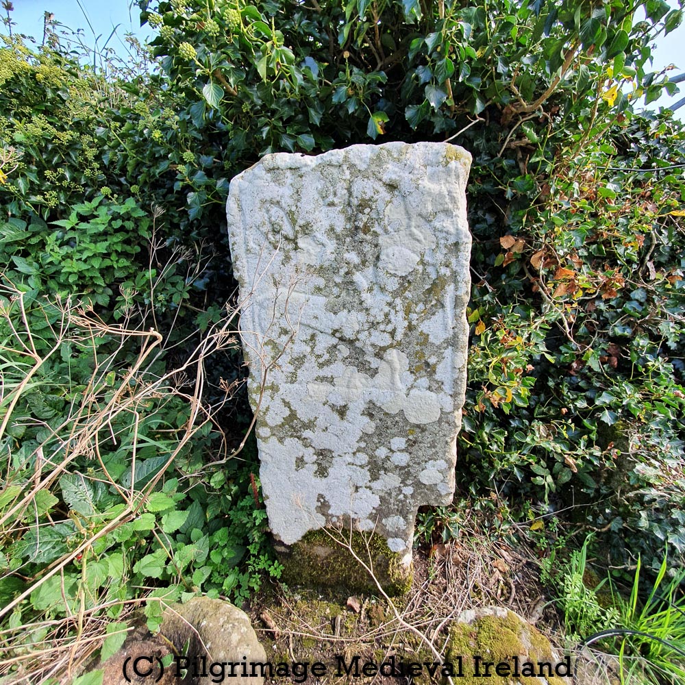
Carved pillar and font at Tybroughney medieval church
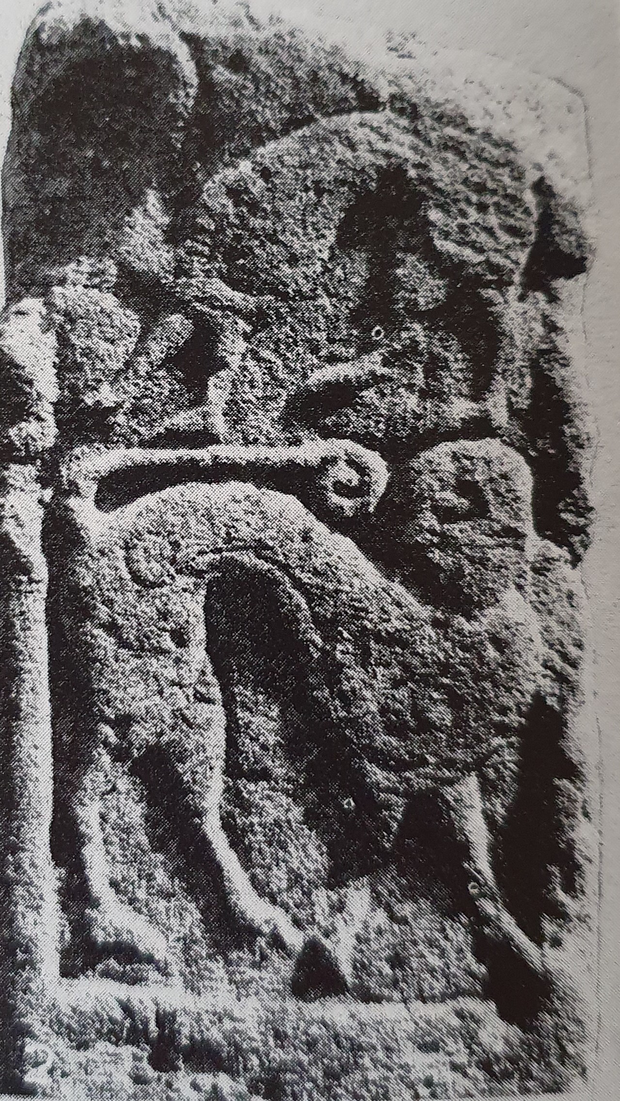
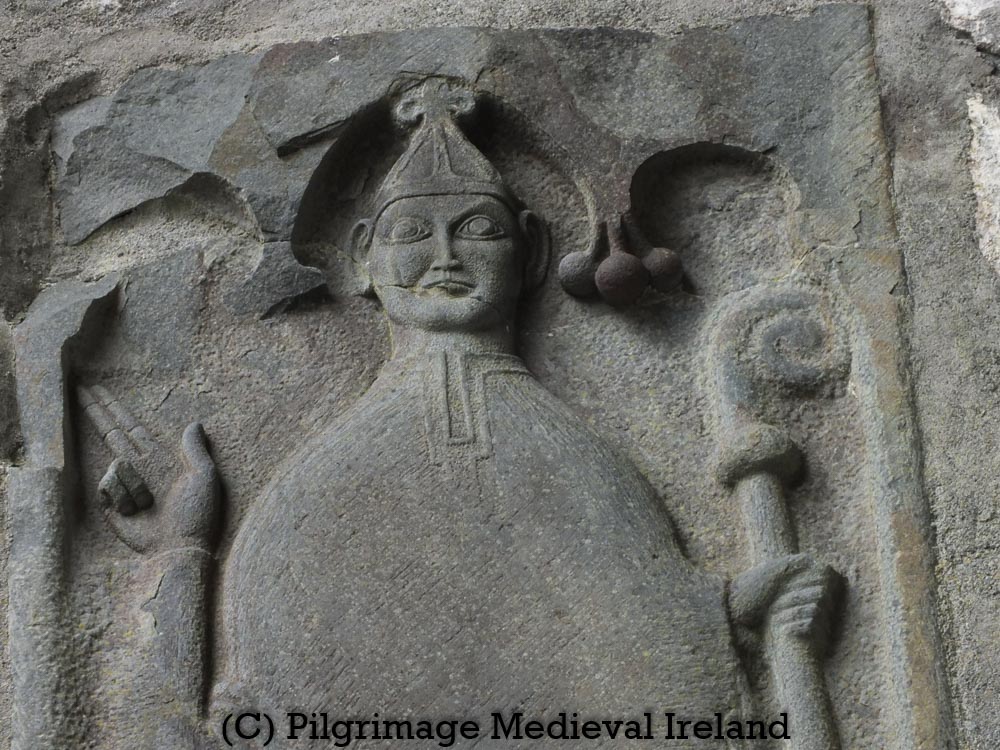
The pillar stone is decorated on all four sides with very elaborate and unusual carvings. The top of the stone appear to have been damaged in antiquity. Unfortunately my photos don’t do justice to the carving on the pillars but at different times of the day the light does brings out many of its details.
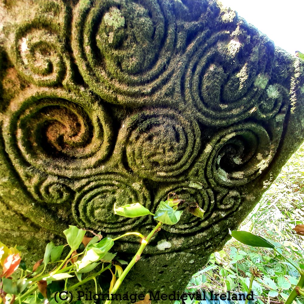
The east face face of the pillar decorated with an elaborate pattern of spirals. The pattern brings to mind spiral designs on one of the carpet pages in the beautiful Book of Durrow.
Similar spiral patterns also appear on the nearby early medieval high crosses at Ahenny Co Tipperary and Kilkieran Co Kilkenny.
The pillar was drawn in 1908 by Henry Crawford for his article ‘Description of a Carved Stone at Tybroughney, Co. Kilkenny.’ The pillar was also photographed by Helen Role for the book The High Crosses of Western Ossory.
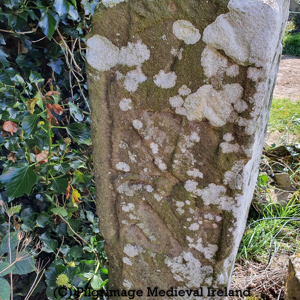
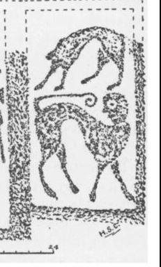
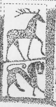
The west face of the Tybroughney pillar has a large creature possible a centaur – a half man and half horse- holding an axe in both its hands. A centaur ‘ by his dual nature was held to symbolise the conflict between Good and Evil’ ( Roe 1962, 33).
Two smaller creatures stand above the main figure, one is a lion and the other is whippet like creature.
The southern side of the pillar closest to the railway tracks, his two mythical creatures. The lower figure is a manticora – the body of a lion and the head of a man- above the manticore is a ‘whippet-like creature’ ( Roe 1962, 33).
This may possibly be the Hyaena of the Bestiary, which scavenges in burial places and consequently was taken as a symbol of the Devil who battens the flesh of sinners.
(Roe 1962, 33)
The north face of the pillar has two figures, a stag and a lion. The stag ‘has various association, chief of which is as a symbol of Christ and his victory over Satan’ (Roe 1962, 33).
I really think this pillar would be a great candidate for photogrammetry. I hope to pay another visit here again soon to see the holy well so will keep you posted.
Bibliography
Crawford, H. (1908). Description of a Carved Stone at Tybroughney, Co. Kilkenny. The Journal of the Royal Society of Antiquaries of Ireland,38(3), fifth series, 270-277.
Manning, Conleth. “Kilferagh, Co. Kilkenny: a Medieval Parish and Its Church.” The Journal of Irish Archaeology, vol. 21, 2012, pp. 139–156. JSTOR, http://www.jstor.org/stable/jirisarch.21.139. Accessed 10 May 2021.
O’Kelly, O. 1985. The Place-Names of County Kilkenny- The Kilkenny Archaeological Society Rothe House Kilkenny.
Roe, H. M. 1962. High Crosses of Western Ossory. Kilkenny: Kilkenny Archaeology Society,
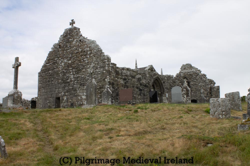
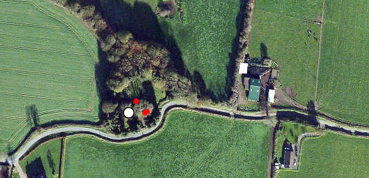
The medieval parish church and graveyard at Tullaghmelan is one of my favorite places to visit in south Tipperary. The name Tullaghmelan means the hillock of Maolán. Tradition holds that Maolán was a saint who had founded a church here in the early medieval period.
There is no visible early medieval features sat the site although a pronounced curve in the road that borders the graveyard may perhaps preserve an earlier enclosure.
Aerial view of Tullaghmealan church and graveyard.
The church is listed in a dispute between the Archbishop of Cashel and the Bishop of Lismore in 1260. In 1302-1306 it is recorded in the ecclesiastical taxation records of the diocese of Lismore (CPL; CDI).
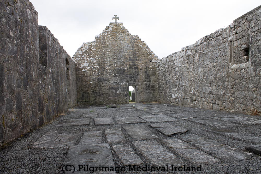
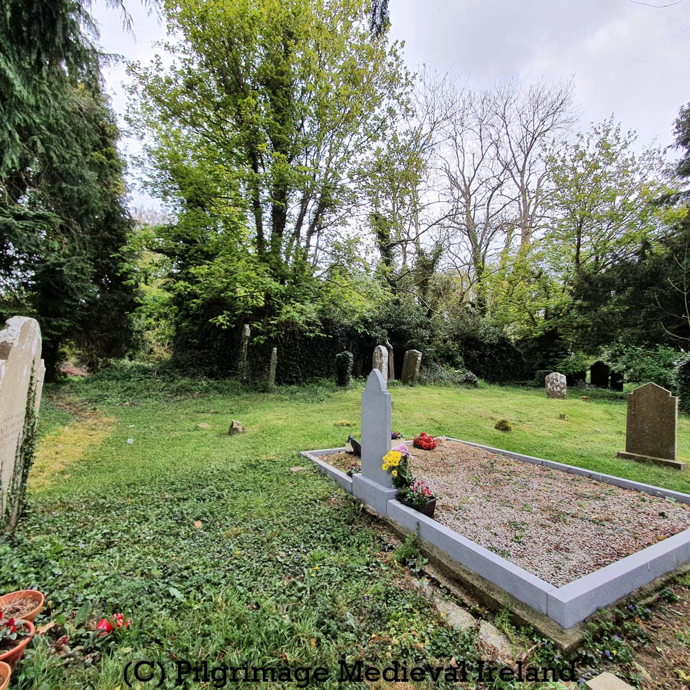
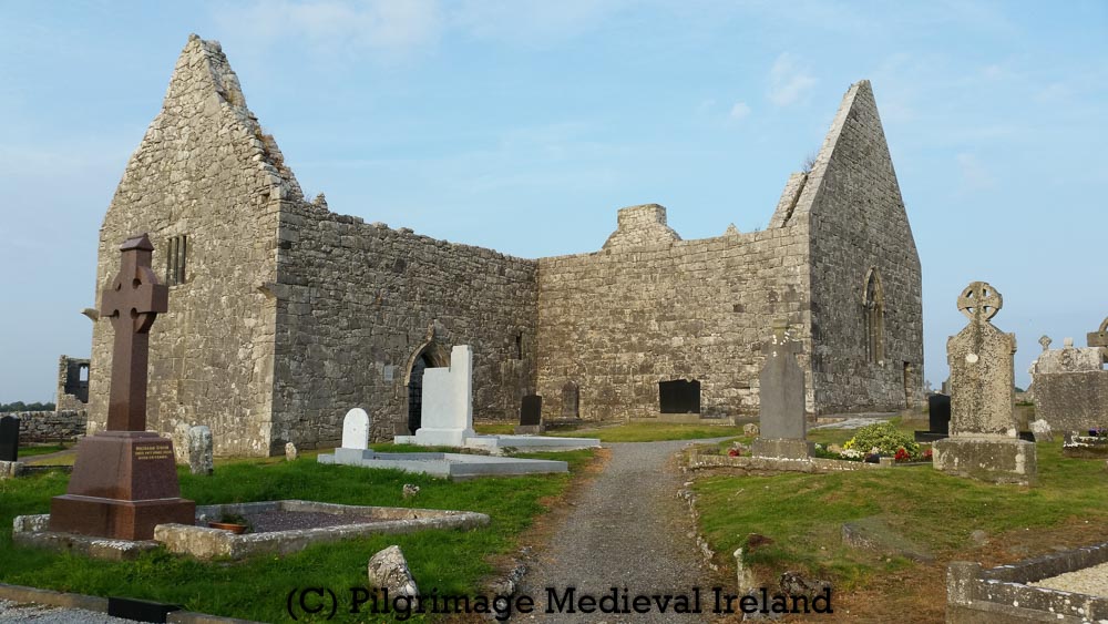
At first glance Tullaghmelan is a typical medieval parish church a with rectangular plan, surrounded by a historic graveyard.
View of Tullaghmealan medieval parish church and historical graveyard (photo taken 2021)
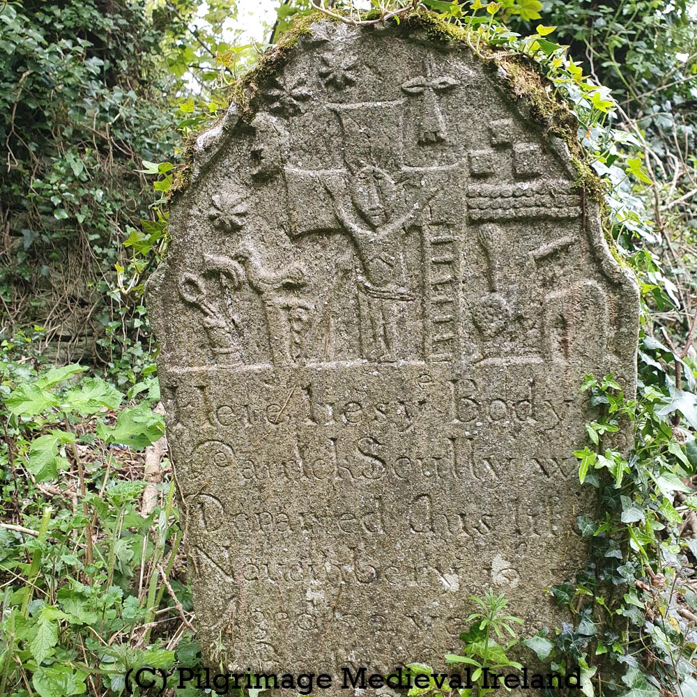
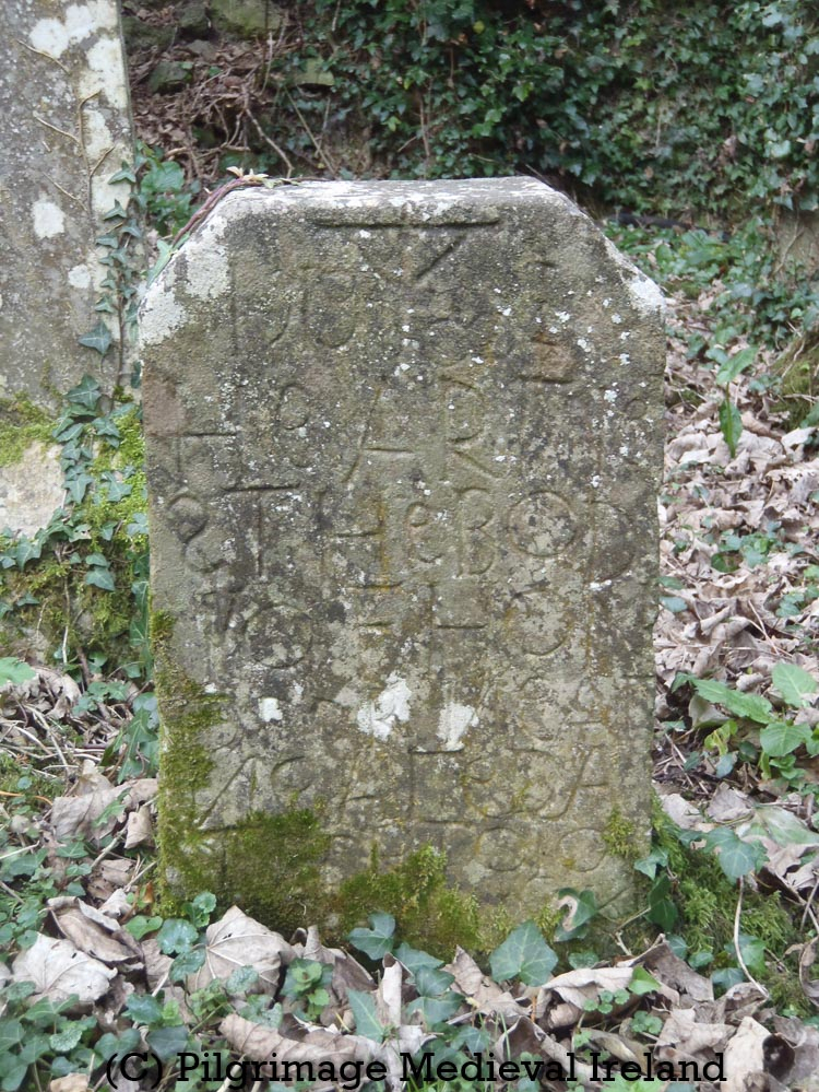
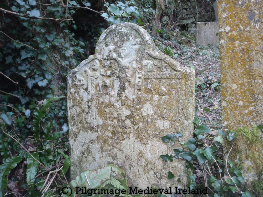
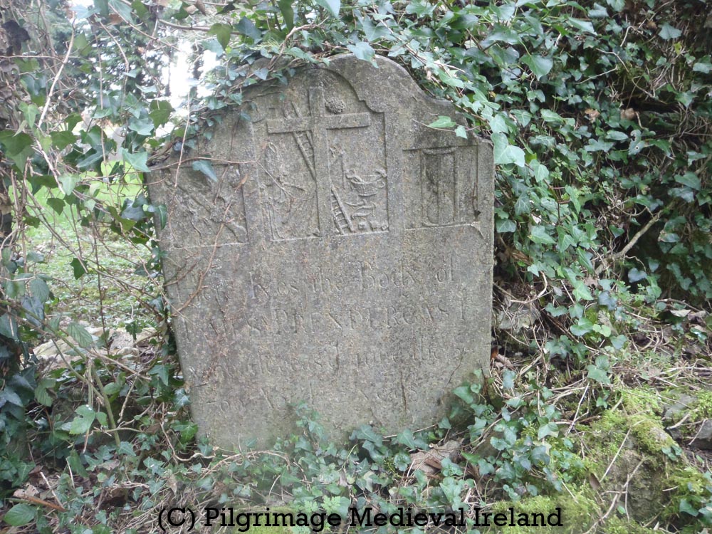
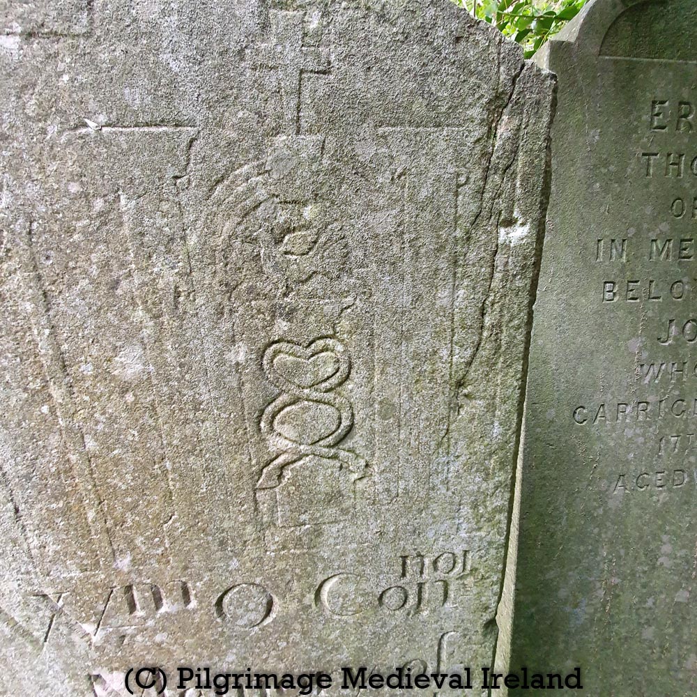
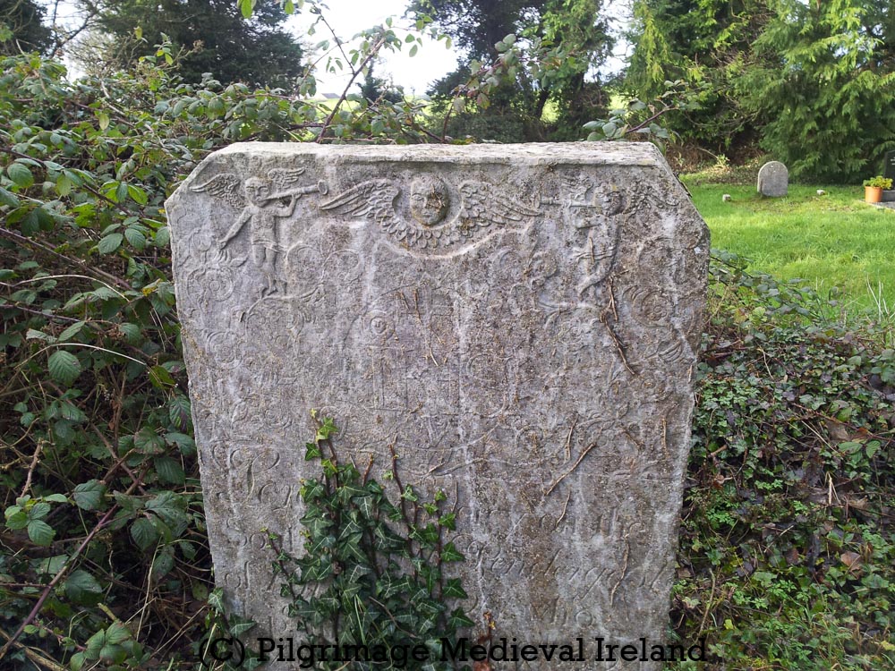
This lovely place is anything but ordinary. The graveyard is filled with some extraordinary eighteenth and early nineteenth century gravestones.
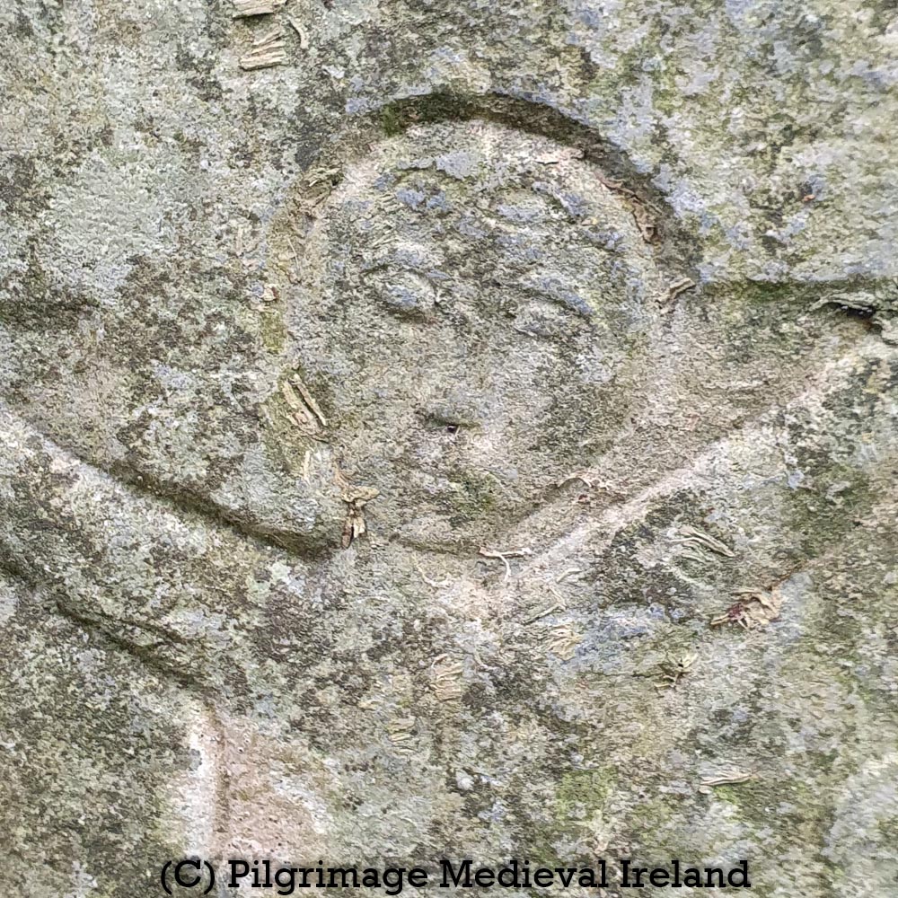
Detail of crucifixion of gravestone at Tullaghmelan graveyard
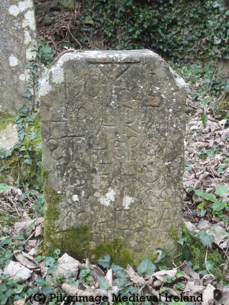
Eighteenth century gravestone at Tullaghmelan graveyard
Eighteenth century gravestone at Tullaghmelan graveyard, with crucifixion and symbols of the passion
Eighteenth century gravestone at Tullaghmelan graveyard.
Eighteenth century gravestone at Tullaghmelan graveyard.
Eighteenth century gravestone at Tullaghmelan graveyard, with crucifixion and symbols of the passion.
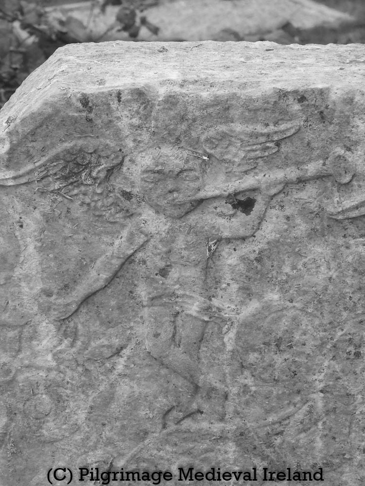
Angel with horn on eighteenth century gravestone at Tullaghmelan graveyard.
Eighteenth century gravestone at Tullaghmelan graveyard, located inside the medieval church , with symbols of the passion
Eighteenth century gravestone at Tullaghmelan graveyard, with crucifixion and symbols of the passion
Eighteenth century gravestone at Tullaghmelan graveyard, symbol of passion cock standing on stylized pillar
Eighteenth century gravestone at Tullaghmelan graveyard
Eighteenth century gravestone at Tullaghmelan graveyard
Eighteenth century gravestone at Tullaghmelan graveyard
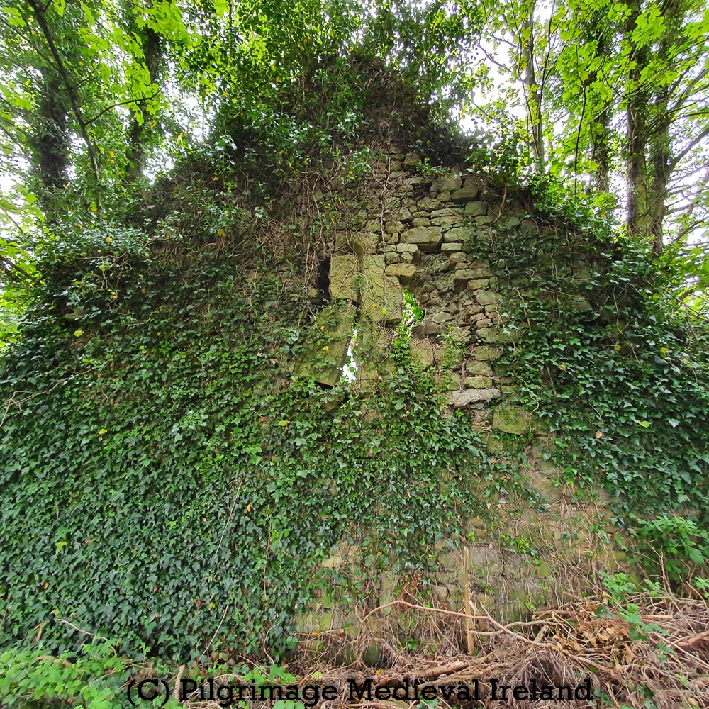
The east gable has largely collapsed and a number of mature trees are growing out of the wall. The west gable is still standing and still retains a central ogee-headed window, now in very poor condition. I’m not sure how much longer the window will survive as the surrounding wall is very damaged.
The church fabric is built of roughly coursed limestone and sandstone rubble (Farrelly 2014). It is hard to examine the fabric of the church as it is covered with think ivy. The church is entered by two opposing doorways in the north and south walls. Opposing doorways are also found at the nearby medieval parish church at Newcastle and are a common feature in medieval churches.
Unfortunately much of the northern doorway had collapsed but the lower section of the door still preserves carved stones hidden under the ivy.
Northern doorway at Tullaghmelan parish church (photo taken 2012)
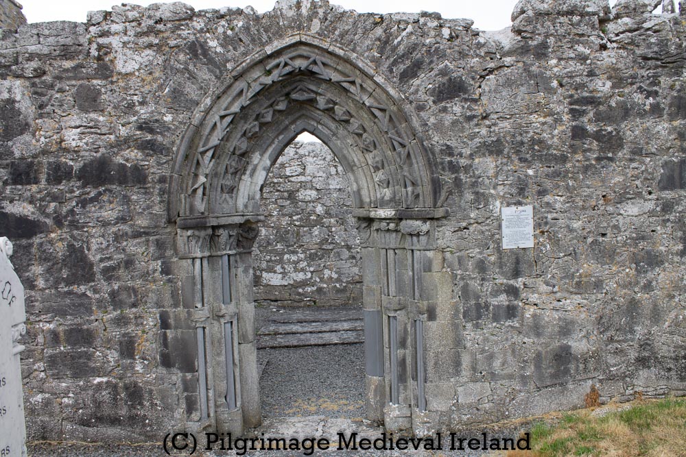
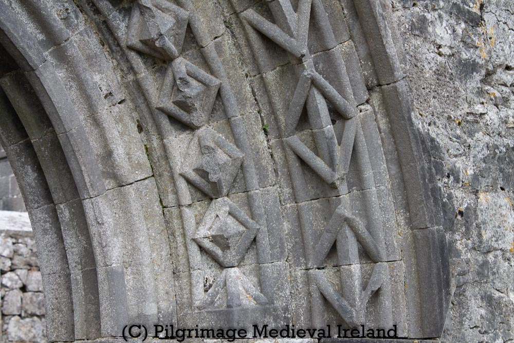
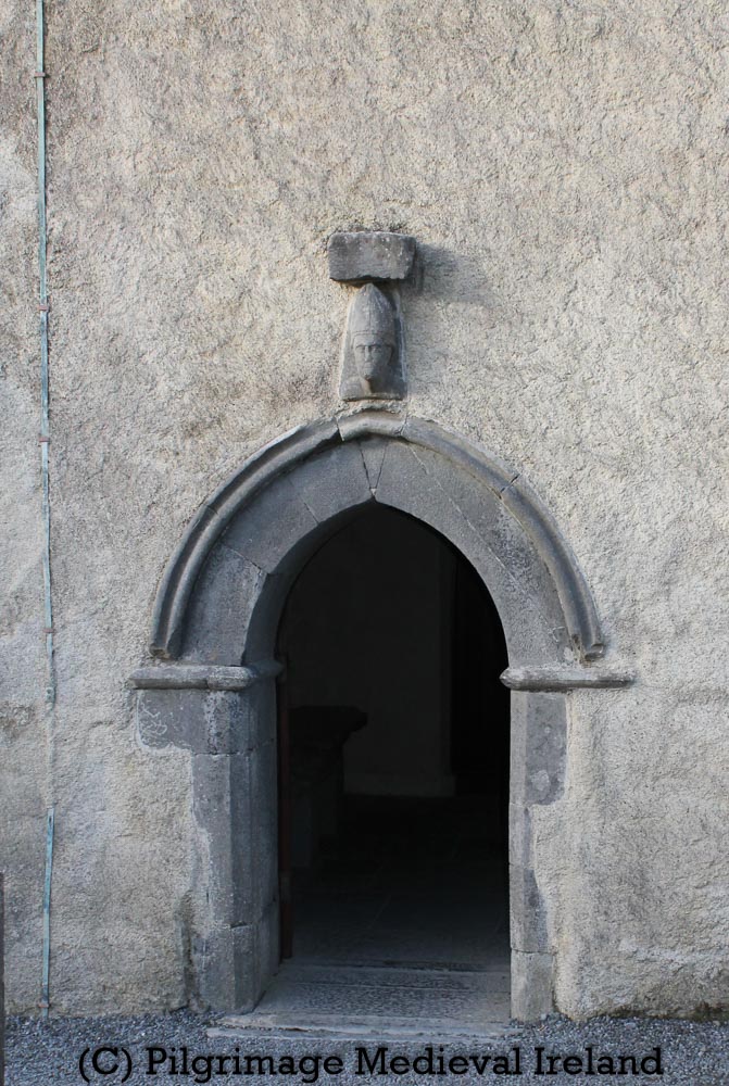
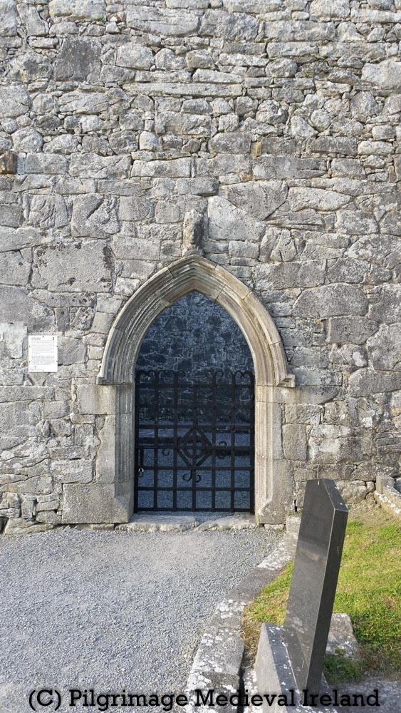
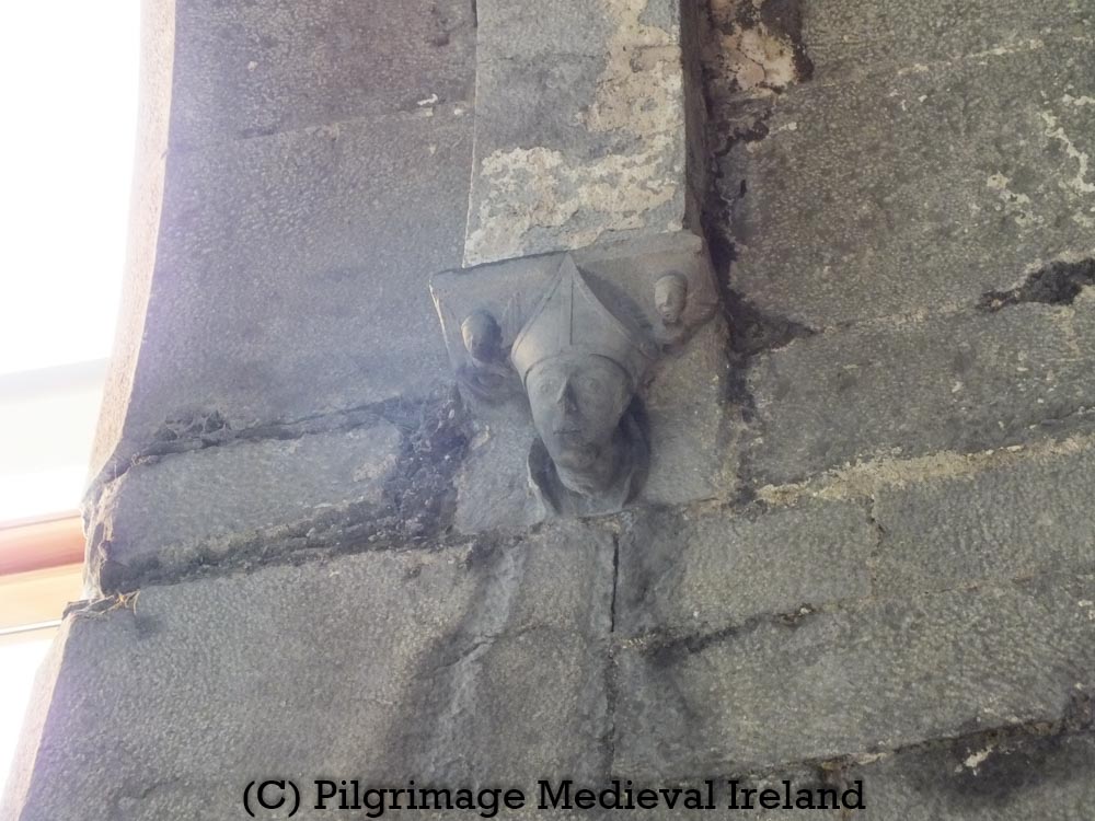
The door in the southern wall is in a much better state of preservation. The doorway is finely carved pointed doorway, with hood-moulding. Hood-moulding dates to between the fifteenth to seventeenth centuries and is a common architectural feature of later medieval buildings.
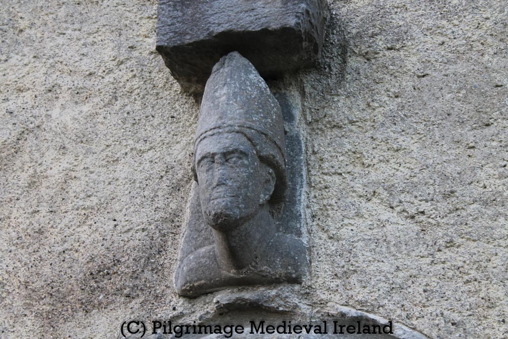
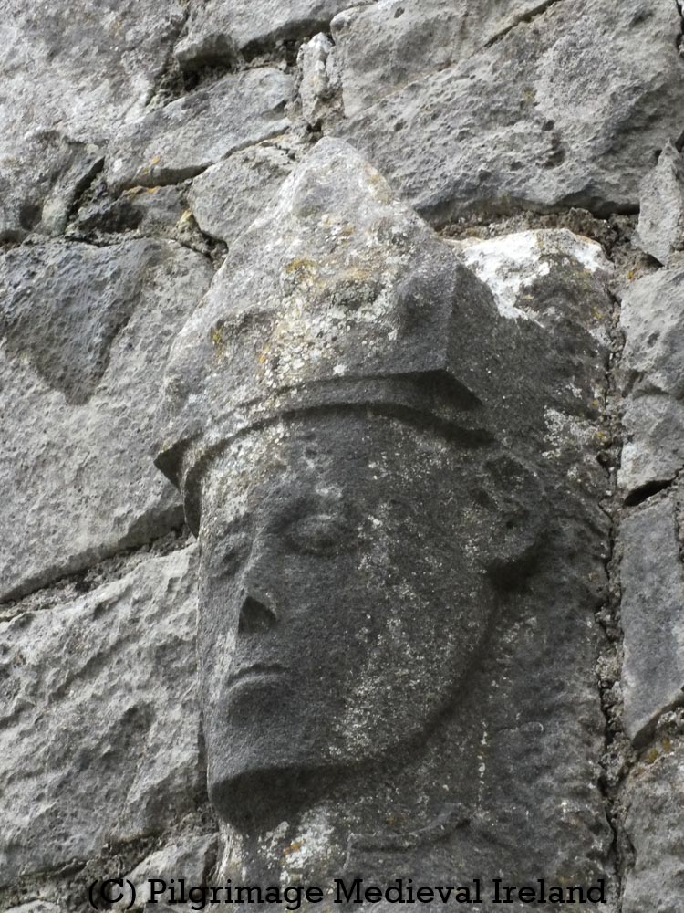
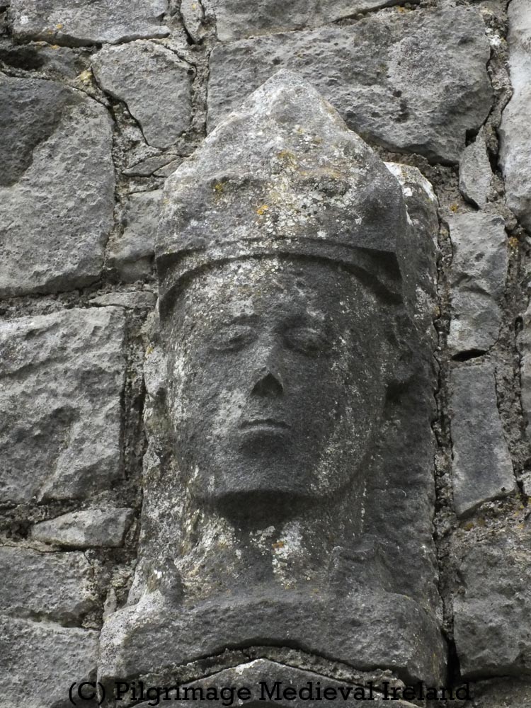
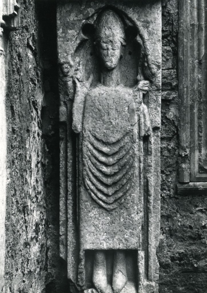
Sitting above the doorway is a carving of a medieval bishop’s head.
The head is elongated with a pointed chin and small lug ears. It is held up be a long narrow neck. On top of the head is a type of head dress/hat worn by a bishop called a mitre.
The bishops face is badly weathered. It is still possible to see the almond-shaped eyes of the face. In the right light you can still just about make out the nose and mouth. The mitre has a conical in shape, with three vertical ridges running to the point at the top. There is a thick band with a herring-bone pattern, running around the base of the hat.
Carving of bishops head at Tullaghmelan medieval parish church.
The head was recorded by Gary Dempsey of Digital Heritage Age. Gary produced a in a 3D photogrammetery model which can be view on sketchfab with the Tipperary3D page.
3D Model of the bishops head at Tullaghmelan medieval parish church.
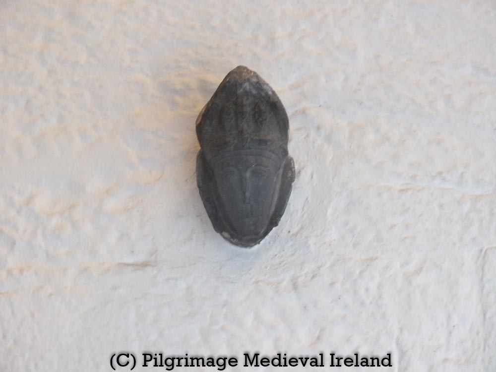
Portrait heads like the Tullaghmealan bishop are found at other ecclesiastical sites in Ireland. The parish church of St. Molleran in Carrick-on-Suir was built in the nineteenth century on the site of a Franciscan Friary. The building, incorporates the tower, part of the north wall and west doorway of the original friary church. The west gable retains fourteenth century pointed doorway. The head of a bishop wearing a conical mitre is carved in the column on the north side of the door.
Carved head of bishop’s head in column beside the doorway at St. Molleran’s church formerly the Franciscan friary, founded in 1336 by James Butler, first Earl of Ormond.
Two carved heads of bishop’s heads are found in at medieval ecclesiastical site at Kilfenora Co Clare. One of the heads, a stern looking figure, sits above a pointed door way in the west end of the southern wall of what was the nave of the cathedral church. The door leads into a porch where there are three effigial tombstones also depicting bishops and clerics.
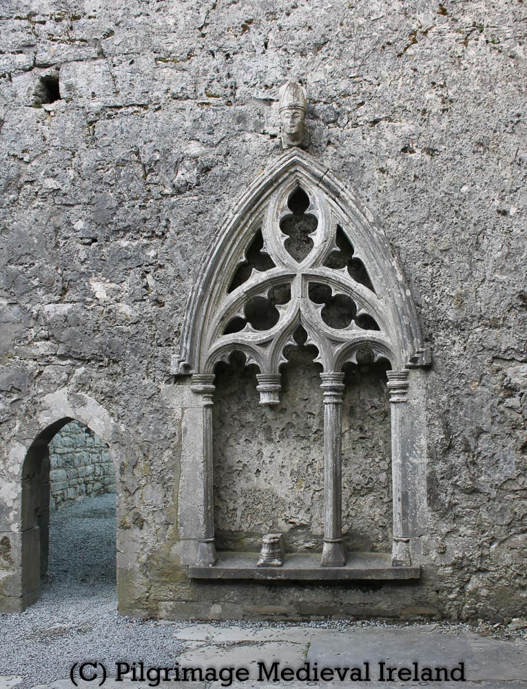
The second carved head is found in the north wall of the cathedral chancel. The head sits above a sedilia with a very elaborate tracery design.
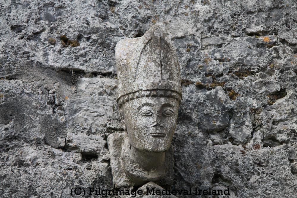
Another medieval carved head of a bishop is found at the cathedral church of Kilmacduagh, Co Galway. The carving is very similar to the head over the sedila at Kilfenora, perhaps the two stones were carved by the same mason. The Kilmacduagh head sits over a finely carved pointed doorway in the south wall of nave of the cathedral church.
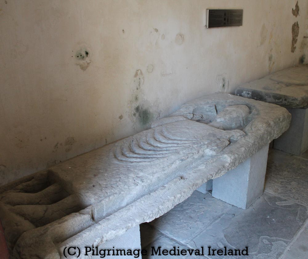
A large effigy of a bishop is found in the wall of the presbytery in the church at Corcomroe Cistercian monastery, Co Clare. The figure is built in the wall above the tomb of Conor na Siudaine O’Brien, King of Munster (d. 1267).
At Ennis Friary, Co Clare, a finely carved head of bishop forms a corbel/supports of the central tower in the church. According to the Monastic Ireland website
Images of bishops, abbots and archbishops in this location are often intended to depict the prelate who presided over building works. The presence of flanking angels suggests that the individual in question was deceased at the time of carving.
A carved head of a bishop also graces one of the corbels on the wall of the church at Holycross Abbey in Co Tipperary.
Bishop’s head in monastic church at Holycross Abbey Co Tipperary
Its very interesting that all of the examples of portrait carvings of bishops listed above are found at monastic and cathedral churches. Tullaghmealan was not a particularly wealthy parish church. Perhaps it enjoyed a wealthy patron at the time the carved stone and doorway were made.
The Tullaghmelan bishop was drawing by George Du Noyer in the 1800s. He wrote the following about the stone
This drawing is offered as a characteristic example of the doorways of most of our old churches, which are so plentifully scattered over the eastern and south-eastern portions of Ireland. It is taken from the old church of Tullaghmelan, near Knocklofty, Co. Tipperary; the arch is of the depressed pointed form, the drip-moulding very prominent and broad; the entire door-head consists of only six stones, viz., two for the principal arch, and four for the drip moulding surmounting it. At the apex of the arch is a somewhat rude representation of the head of a bishop, crowned with a mitre of an exceedingly old form, and which was most generally in use during the twelfth century. The mitre looks as if formed of an external framework of metal, the ribs of which stood prominently out, and within which was the cap or head covering. The helmets most commonly in use in England, as well as on the Continent, during the thirteenth century, as we find in Stoddart’s “Vetusta Monumenta,” and from the Painted Chamber at Westminster, were constructed on this principle; the framework is mostly coloured yellow, as if to re present brass or metal, the intervening spaces being red or purple, as if to indicate the inner cap, called by the Romans “cudo” or ” galerus,” of dyed leather, cloth, or felt. I should not be surprised if on research we found that many of the mitres of our medieval ecclesiastics were constructed on precisely this principle.
Du Noyer 1857, 312-313;
The carving is also mentioned in the Ordnance Survey Letters where it is noted that the head is ‘supposed to represent ‘Maolan, Eapscop. [Bishop] 25 Dec‘ (O’Flanagan 1930, vol.1, 26).
I am by no means an expert of medieval building or architecture but I find it odd that the Tullaghmelan bishop is carved onto a flat stone (the back of the stone is visible in the interior wall). I would have expected the stone should have more of a wedge shaped if designed to be as an architectural feature. This makes me wonder if it could be a recycled fragment of a sepulchral effigy. I am struct by the similarity between this carving and one of the graveslabs at St. Fachtna’s Cathedral, at Kilfenora. The top of the stone also looks broken. I wonder if the carving could be a recycled graveslab? I really think this bishop requires further study.
Unfortunately the church building and the door have deteriorated structurally since my last visit and I worry that without some sort of intervention, the door and other parts of the church will collapse in the coming years. At the moment the ivy is holding the structure together. Sadly this is a common problem for medieval building across the country. I hate the thought of the bishop over the door not being there greet visitors to the graveyard into the future.
References
Du Noyer, George V. “Description of Drawings of Irish Antiquities Presented by Him (Continued).” Proceedings of the Royal Irish Academy (1836-1869), vol. 7, 1857, pp. 302–316. JSTOR, http://www.jstor.org/stable/20489878. Accessed 3 May 2021.
Hunt, J. 1974 Irish medieval figure sculpture 1200-1600, 2 vols. Dublin. Irish University Press.
Nugent, L. ‘A note on medieval figure sculpture at the medieval parish church of Tullaghmelan, Co Tipperary’ Decies 68, 17-23.
O’ Flanagan, Rev. M. (Compiler) 1930. Letters containing information relative to the antiquities of the county of Tipperary collected during the progress of the Ordnance Survey in 1840. Bray.
I have always had a great interest in folklore and folk customs, so I was delighted to get a copy of the newly published Irish Customs and Rituals published by Orpen Press for my Christmas reading.
This is a wonderful book that details the rituals and customs carried out by past generations living in Ireland. Its a perfect book to dip in and out of or read cover to cover as I did with a pot of tea in front of the fire. I’m delighted that the book’s author Marion McGarry has agreed to share her knowledge relating to Irish Christmas traditions and has kindly answered a series of questions about how our ancestors in past generations celebrated Christmas. I hope you find this interview as interesting and informative as I do.
Marion, many congratulations on this wonderful book. How did you first become interested in Irish customs and traditions?
Thanks Louise. I grew up with some of these customs and rituals, and was aware of many more of them. But I became really interested in them when I was writing the book The Irish Cottage: History, Culture and Design. In parts of that book I discussed the house as a space to be safeguarded from supernatural activity and where rituals were performed at specific times of the year. The research for Irish Customs and Rituals really expands that and looks at common calendar customs, rituals of daily life and beliefs of important life occasions such as births, marriages and deaths, all from the 19th to mid twentieth century.
What also drove me on was the realisation that many people are not aware of these customs, but there is a huge interest there. And I thought that a well-researched but readable book would inform and entertain people.
As Christmas is almost upon can you tell us what a typical Irish Christmas was like? How did people in the past prepared for and celebrate Christmas?
Advent was a time of great preparation for Christmas in Ireland. First of all, people would go and do a massive spring clean of their house, and any outhouses, barns and so on. Inside and out would be pulled apart, tidied and given a fresh coat of whitewash. WE see this big spring clean is a feature of many Irish festivals, people cleaned their homes in advance of St Brigid’s day, and Halloween, too. Fuel was stockpiled. Decorations of holly and ivy were foraged and brought back home and used to decorate the house (and even the animals barns). This was the children’s’ job, and supplemented with their own handmade decorations. The Christmas tree usually comprised of a branch from a Christmas tree potted up, so that it was considerably smaller than what were used to today. This approach to decorating is much more sustainable, too. So was the approach to food – most things on the Christmas dinner menu in rural Ireland was grown or raised by the person eating it, and if not it came from the local community, goose, bacon, potatoes, winter vegetables.
Like all Irish festivals the big celebration started on sunset on the eve of the festival day, so on Christmas Eve in Ireland past candles were lit in windows (in a ritual manner, either by the youngest child or the mother of the house). This was to be a sign to show the Holy Family they were welcome to the house, as they sought an inn. Also, on Christmas Eve night, the door was left unlocked so the dead could return to the household, this custom was practised by many on Halloween for example. Greenery was placed on graves, too, over Christmas to remember the dead.
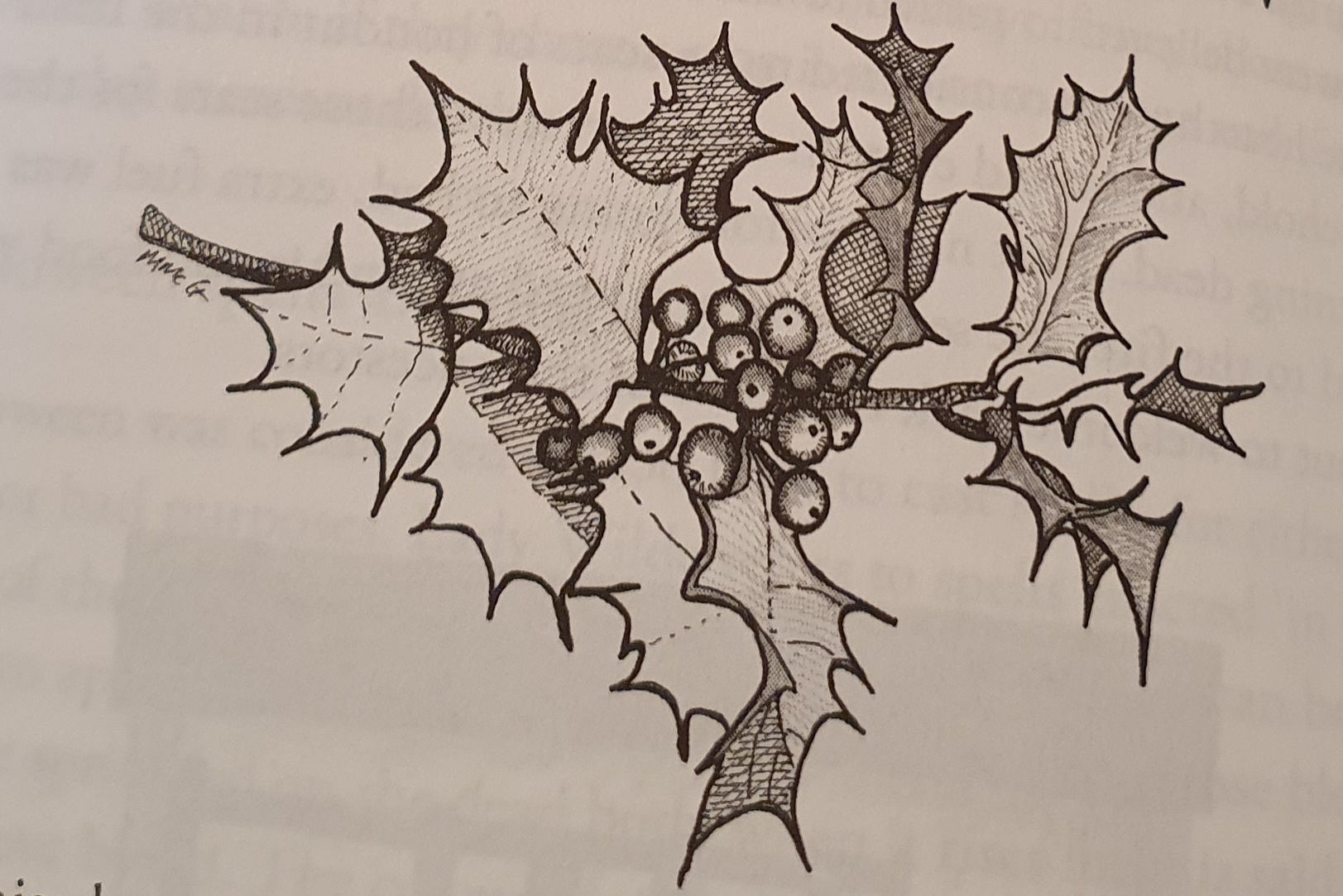
Christmas holly- an illustration from the book Irish Customs and Rituals
What are the main changes in how we celebrate Christmas today from how out grandparents would have celebrated it?
When I was growing up, I would hear my grandparents and people of their generation saying ‘sure its Christmas every day now’ as if to say that people had it good all the time. Christmas was a time for a bit of indulgence for people who had otherwise frugal lives. Decent food, sweet cake, a bottle or two of porter, a respite from work and a chance to wear the good clothes were all welcome diversions of a festival celebrated at a dark and cold time of the year. Today we can do these things any evening of the week. To people of my grandparent’s generation, luxuries, even small ones, were a huge novelty and you can imagine that Christmas was keenly anticipated. And they had a much humbler Christmas than we do today.
Nollaig na mBan or women’s Christmas is a very Irish tradition that has been embraced by Irish women in recent years, can you tell me us more about this tradition?
Occurring on 6th January (the Epiphany), there is an old tradition in certain parts of the country (mainly Munster) that it’s a day off for women. Roles are meant to be reversed, so the men have to do the housework while the women get a chance to socialise with their female friends, usually to have tea and cake. Death divination customs were practised on this day, where candles are lit and named for family members – the idea is that the candles burning out indicated the order in which death will occur.
Many people in modern Ireland will travel to ancient sites aligned with the winter sun for the solstice such as Knockroe and Newgrange passage tombs. Have you come across any customs relating to the winter solstice in the course of your research?
Not specifically. As most Irish calendar customs were appropriated by the Christian religion (a good example is Imbolc which became St Brigid’s day) one can imagine that whatever midwinter celebrations on 21st that occurred migrated across to December 25th. What’s interesting is that there are older non Christian (perhaps even ancient) customssurviving in there, the celebrations starting on the eve before, the spring clean, the death divination rituals, the appearance of wren boys on Stephen’s Day, the remembrance of the dead.
Marion this is a wonderful read and would make a great Christmas gift for anyone interested in Irish folklore and traditions.
Delighted you liked it Louise, it would make a great birthday gift too! The e-book is coming out soon which will make it even more accessible for readers and researchers.
Both The Irish Cottage: History, Culture and Design and The Irish Cottage: History, Culture and Design can both be purchased from Orpen Press and Irish bookshops