St Non’s chapel: a destination for Irish pilgrims to Wales in medieval times

During  medieval times  Irish pilgrims  travelled on pilgrimage to British shrines.  One of the most popular destinations was the shrine of St David located in Pembrokeshire in Wales.  It not surprising St Davids was such a popular destination given it possessed the corporeal relics of St David and in the later medieval period two pilgrimages to St Davids  was equal to one to Rome.  For Irish pilgrims a trip to Wales was a lot less expensive and time-consuming  then one to Rome.

1-Trip wales Galaxy S5 033

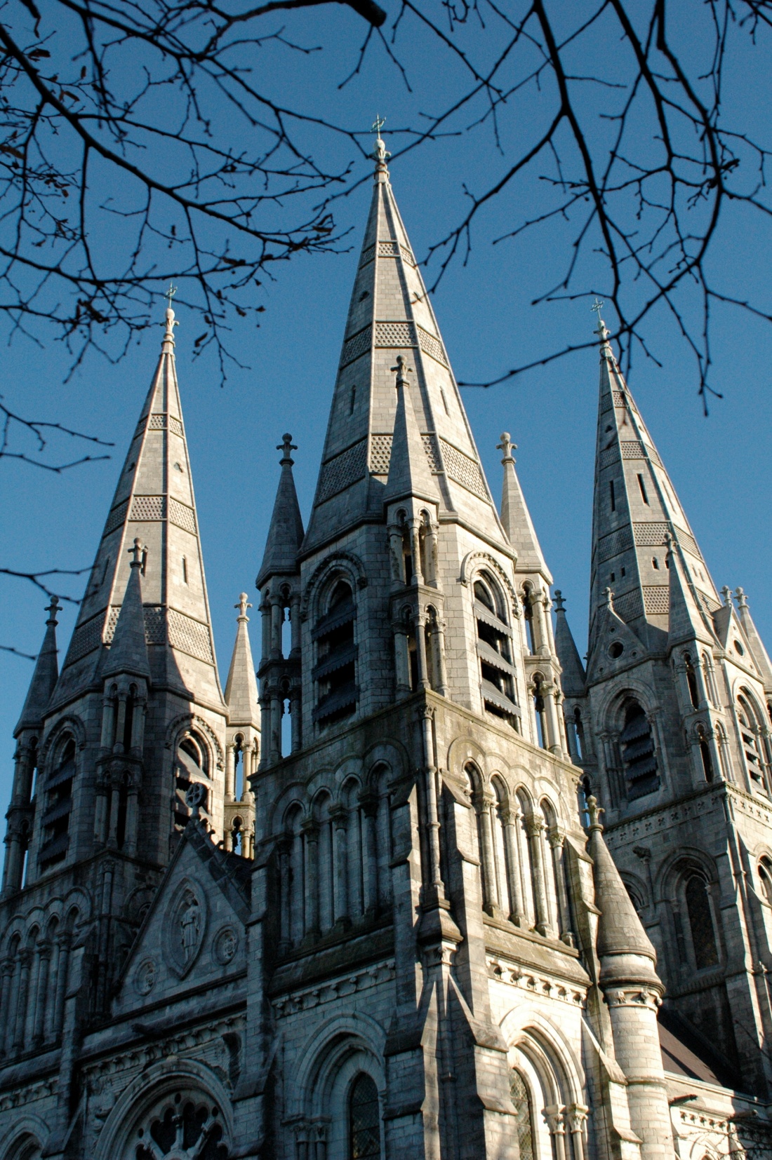
St David’s cathedral in Wales

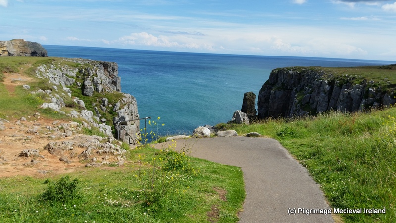
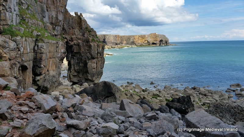
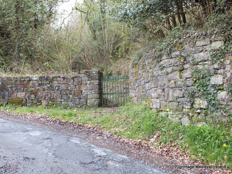
Like many  important pilgrim sites  St Davids was at the centre of an extensive pilgrim landscape composed  of minor outlying pilgrim shrines/foci connected to the saint.  As well as praying at the relics of St David,  pilgrims would have also visited some of these minor shrines more often than not prior to visiting the primary shrine.  This post focuses on one such site namely the chapel of St Non’s.  This site is located in a field  over looking St Non’s Bay approximately  a mile from St Davids.

1-Trip wales Galaxy S5 101

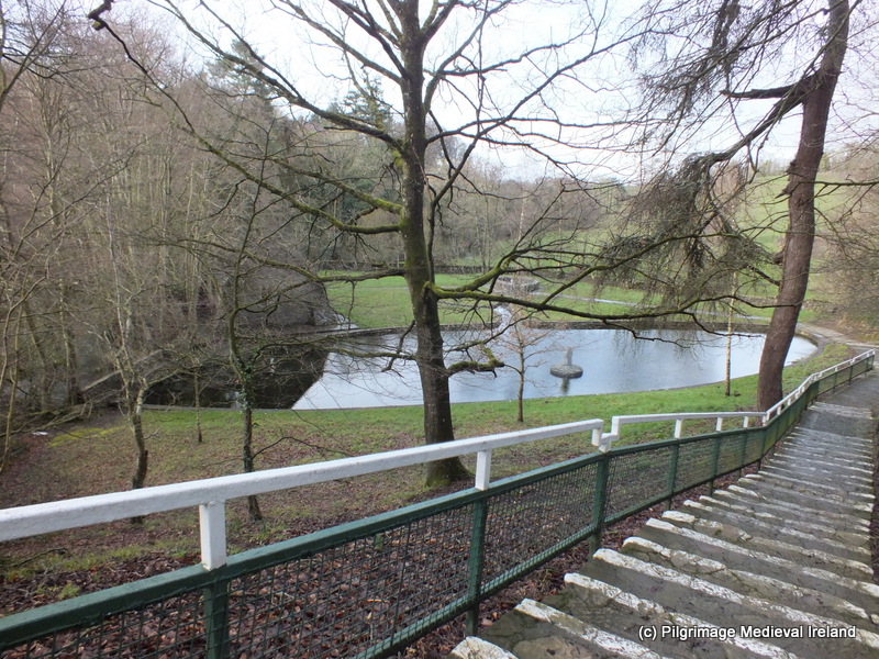
View of St Non’s  Bay.

St Non (also known as Nonna or Nonnita) was the mother of St David.  Her feast day is the 3rd of March and her cult spread to  Wales, Cornwall and Brittany. The daughter of Lord Cynyr Ceinfarfog, she was born around AD 475.  As a young woman she  became  a nun at Ty Gwyn near Whitesands Bay (Dyfed).  St David was conceived when  she was raped by  Sanctus, a king  of Ceredigion.  Tradition hold that the  chapel was built on the site  where she gave  birth to St David.  St Non’s chapel is one of a number of sites which claim to be the location of St David’s birth.

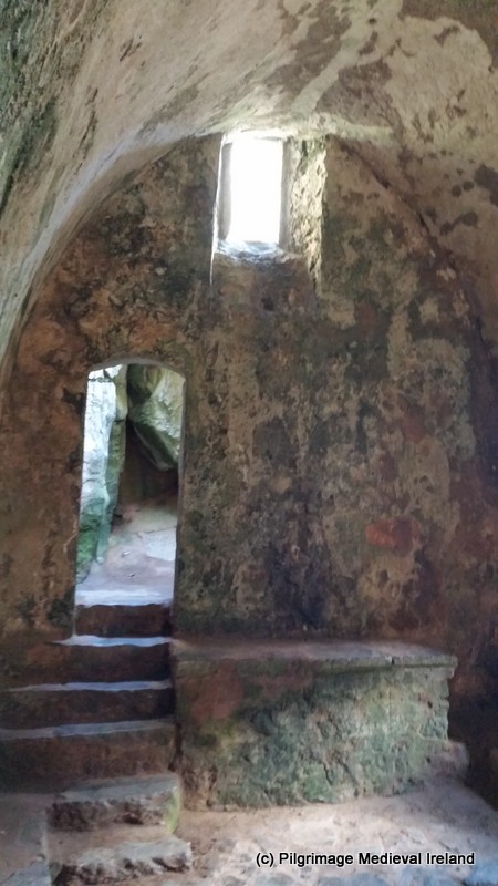
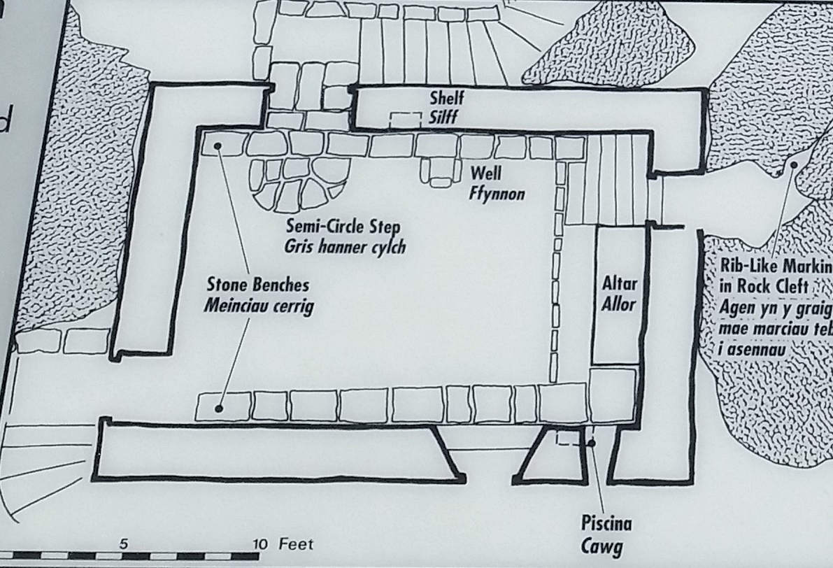
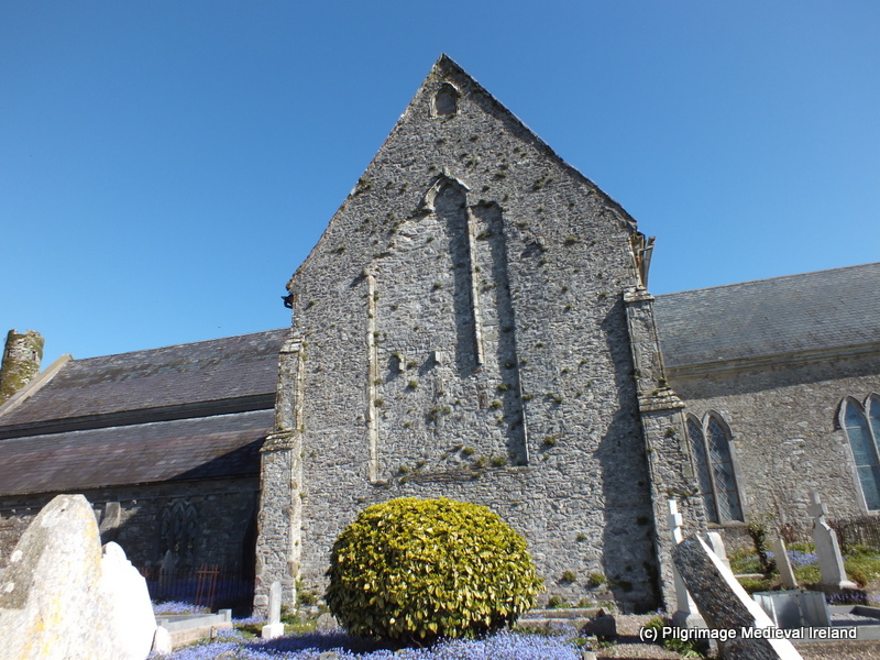
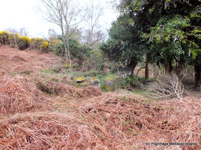
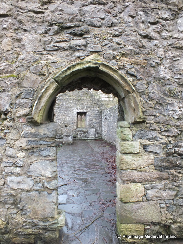
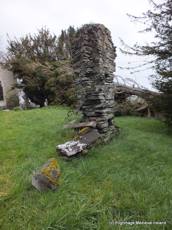
Today the site consist of  the ruins of  a  single room building aligned north-south. The walls do not survive to any great height and  the present structure cannot be dated easily as there are not  any  distinguishable features. The alignment of the building  is very unusual as churches  are normally aligned  east-west.
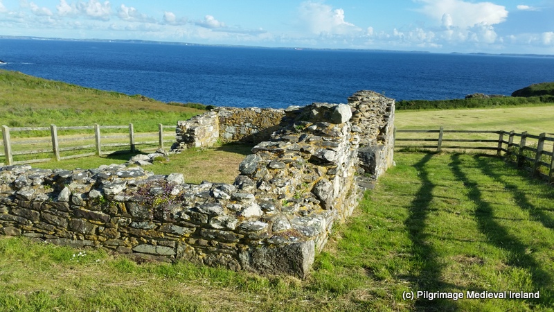
1-Trip wales Galaxy S5 133

St Non’s Chapel.


Fenton writing in 1818 states

In digging for earth within the walls of the chapel, stone coffins were found, and part of a curious image of pottery glazed, being the head and shoulder of a male figure.  It was hollow, and filled with a prodigious hard cement, and is now in possession of Mr Archdeacon Davies.


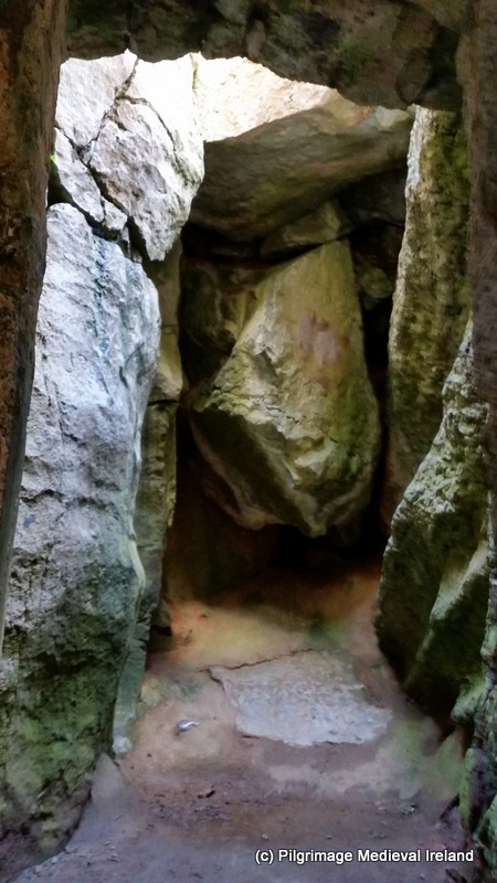
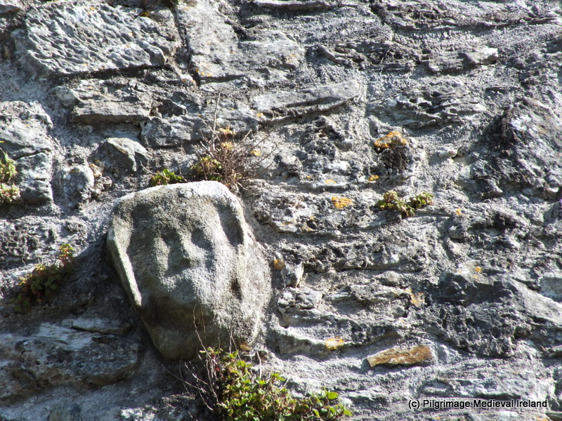
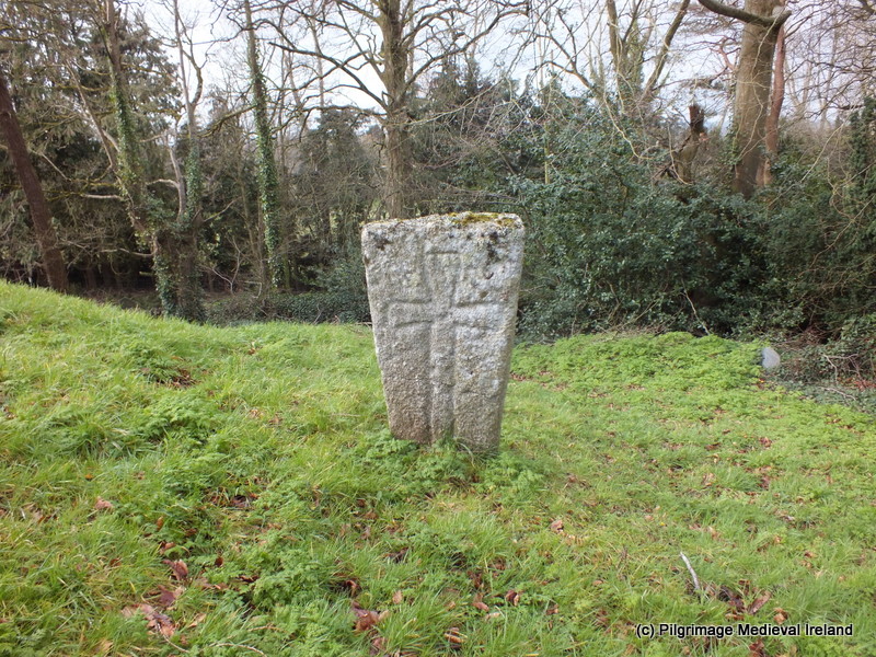
An early  medieval cross slab, of 7th/8th century date,  is located in the corner of the interior of the chapel.  When I visited the site in late June there were a number of  beach pebble with names written on them, left in front of the slab perhaps  as modern votive offerings.


1-Trip wales Galaxy S5 110

Early medieval cross slab at St Non’s Chapel.

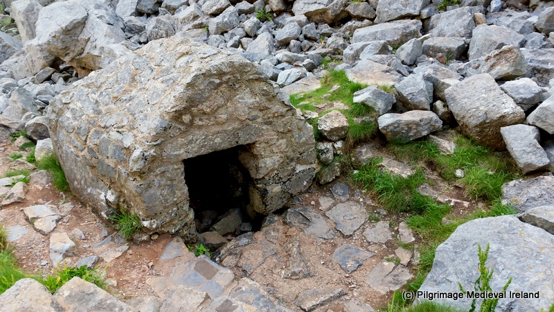
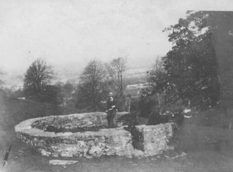
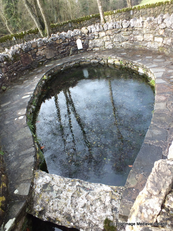
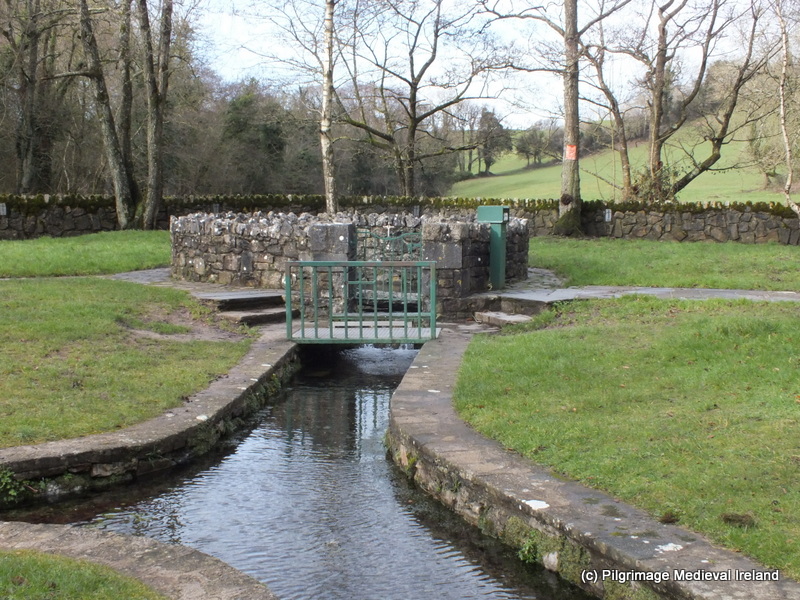
A holy well also dedicated to the saint is located  very close to the chapel. The  waters of the well  flow into a rectangular chamber  covered with  superstructure with a rounded top.  The water then flows into a second  rectangular stone  trough.

1-Trip wales Galaxy S5 141

St Non’s well

Local tradition holds that the well burst forth from the ground upon the birth of St David.

1-Trip wales Galaxy S5 146

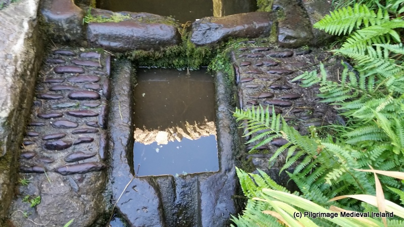
The water from St Non’s well flows into a stone rectangular trough.

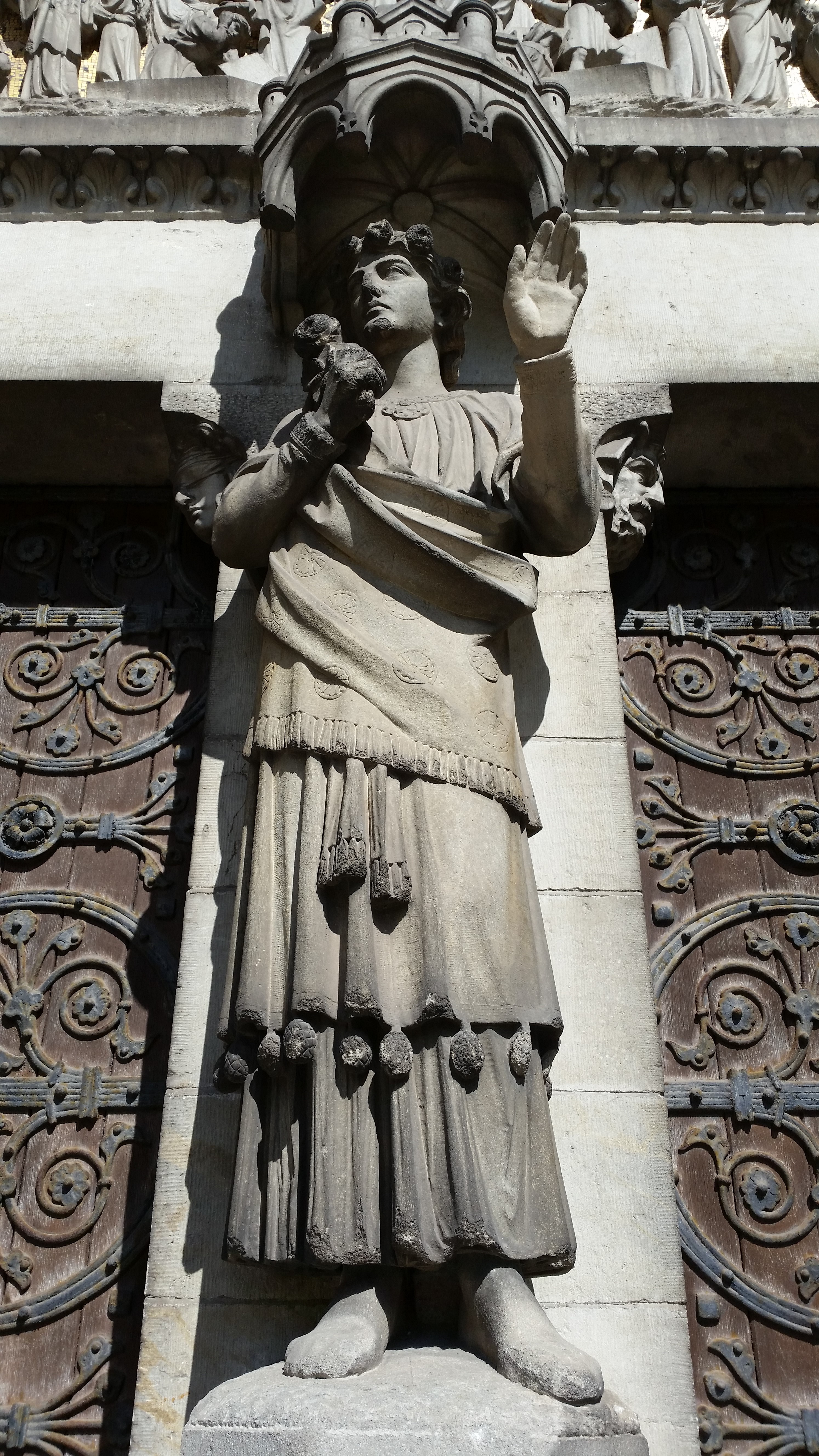
The well and a small area around it  are enclosed with a stone wall.  A niche  in the wall opposite the well holds a small statue of St Non with out stretched arms. Modern pilgrims have left a number of offering at her feet including a brown  scapula , money and rosary beads.

1-Trip wales Galaxy S5 137

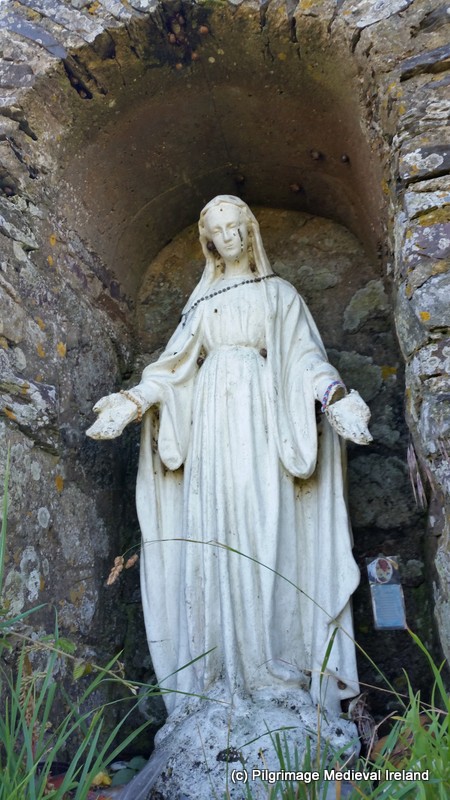
Statue of St Non at St Non’s well

The oldest written account of pilgrimage  here is found in a 15th century poem and concerns the pilgrimage of Edudful ferch Gadwgon and her sons.  The text records that Edudful  visited St Non’s chapel and holy well on her way to St Davids. When she  arrived here she washed her head in the holy water.  She also prayed at an image  of the St Non, most likely a statue and lit candles before the altar in the chapel. When her pilgrim rituals were complete she proceeded to her primary destination St David’s where as part of her pilgrim rituals  she left an offering of wax and money (Cartwright 2007, 190).

On Sunday Edudful comes

to pray sincerely to God;

puts her head in the well,

raises her hands merrily,

worships the holy image,

lights the large, yellow candles,

and puts all of them on the altar;

From there she passes to

the good close of St David’s church;

makes an offering of crimson wax

and money and kisses the saint; ( ibid after Johnson 2007, 371)

Browne  Willis (1717)  writing in the 18th century quotes an early 16th century description of the well by George Owen of Henllys

There is a fine Well beside it , cover’d  with a Stone-Roof and inclosed within a wall, and Benches to sit upon round the Well  (ibid., 190).

Cartwright (2007) suggests  the superstructure over the well was  more substantial than it is today. The present covering may date to the 19th century  but it was  extensively restored in 1951.

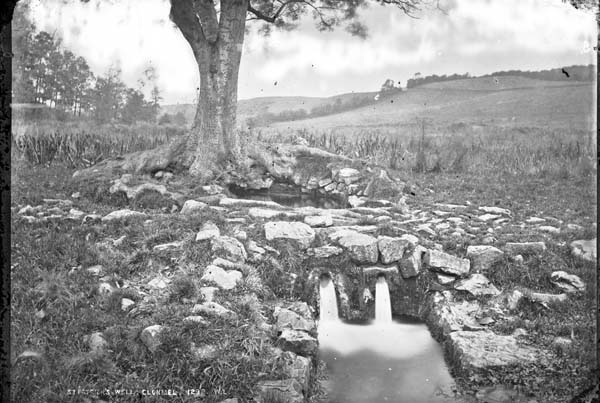
The waters of the well are said to have healing powers and to be of particular use for eye complaints. In 1811  the following account of the well is given in Fenton’s Historical Tour Through Pembrokeshire

…a most redundant spring arched over, and at one time inclosed with a wall. The fame this consecrated spring had obtained is incredible, and still is resorted to for many complaints. In my infancy, as was the general usage with respect to children at that time, I was often dipped in it, and offerings , however trifling , even of a farthing or a pin, were made after each ablution, and the bottom of the well shrone with votive brass.

The immersion of children in the waters of holy wells were carried out at many Irish sites in the 19th and 20th century such as at St Moling’s well at Mullens in Co Carlow and at St Keeve at Glendalough.

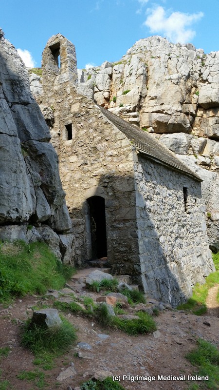
A second chapel can be found a  short distance from the well,   in the grounds of St Non’s Retreat house . This chapel which has an ancient appearance was built-in 1934 by Mr Morgan-Griffith a solicitor from  Carmarthen who had it built for his wife who had converted to Catholicism.

The building was constructed with  recycled stones from cottages and possibly also from monastic buildings at Whitehall.

1-Trip wales Galaxy S5 204

Our Lady and St Non’s Chapel built-in the 1930s.

The modern chapel is dedicated to Our Lady and St Non.  Within are a number of beautiful stain glass windows of the William Morris school  depicting Welsh saints including St Non see image below.

1-Trip wales Galaxy S5 186

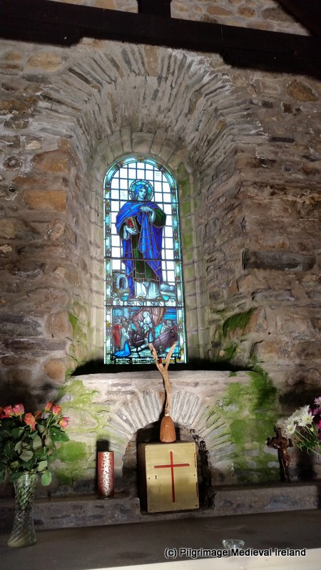
Stain glass window of St Non

The base of this window depicts a scene of  St Non and her son St David arriving in Brittany by boat.


1-Trip wales Galaxy S5 196

St Non and St David arriving in Brittany by boat.

Another interesting feature within the chapel  is the altar which incorporates numerous pieces of medieval architectural fragments.

1-Trip wales Galaxy S5 183

Altar incorporating pieces of medieval architectural fragments.

Today the  Passionists are the owners of the property and they have granted the Sisters of Mercy a licence to occupy and manage St Non’s Retreat Centre and chapel.

1-Trip wales Galaxy S5 194

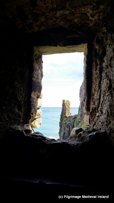
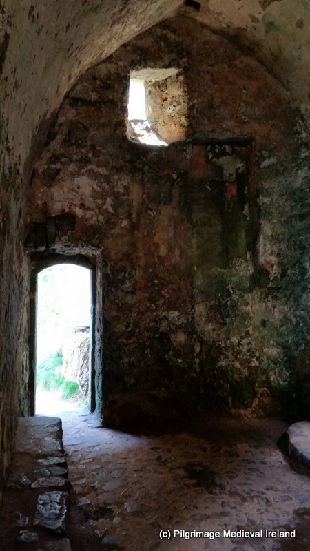
Looking out from the interior of Our Lady and St Non’s Chapel.

The ruins of St Non’s Chapel and holy well has a long tradition of pilgrimage. The stunning scenery and peaceful setting at the site makes it a must see for modern pilgrims. The modern church of Our Lady and St Non is also a lovely place to spend some time.  Although there  are no accounts of Irish pilgrims travelling here I suspect the majority of Irish pilgrims to St Davids would have also visited the site.


References

Cartwright, J. 2007. ‘The Cult of David’, In (eds.) Evan, J. W. & Wooding, J. St David of Wales Cult Church and Nation. Woodbridge: The Boydell Press, 182-206.

Fenton, R. 1811. Historical Tour Through Pembrokeshire Printed for Longman, Hurst, Rees, Orme & co., 112-113

Johnston, D (ed)   Gwaith Lewys Glyn Cothi. Walse: Welsh University Press.

Rees, N. 1992. St David of Dewisland. Llandysul: Gomer Press, 21-24.


St Fin Barre’s Cathedral: unlocking the hidden meaning the western doorway

In June of this year I went on  a  tour of St Fin Barre‘s Cathedral in Cork.  This was an amazing experience. During the tour the symbolism  and the meaning  behind the carvings and statues of the building was explained and in turn I saw the building in a very different light.  I was so impressed  by the tour that I asked my guide  Martin Dier the Cathedral Administrator  to write a post  about the Cathedral.  So I am delighted to  introduce this guest post by Martin which focuses on the  central doorway of the west gable of the  building.

 St Fin Barre’s Cathedral the western portico doorway

The Cathedral of St. Fin Barre  is a masterpiece of engineering. It was created  by the famous British architect William Burges and built-in the Neo-Gothic style and completed in 1879.   The current building is the latest in series on the site, with early Christian roots going back 1400 years to the year 606AD. Tradition holds this was the site of an early monastic settlement of St Fin Barre.

FB 1

St Fin Barre’s Cathedral

The current building was built-in the style of the French  Gothic structures popular in medieval times. The Cathedral is unusual on many levels and importantly all of its designs spring from a single mind giving a uniformity of style, which few other Cathedrals can boast. Everything from the super structure to the stained glass, the door hinges to the communion table are all from Burges.

st findbarr galaxy s5 070

Western gable of St Fin Barre’s Cathedral

Symbolism and hidden meaning

The secret language of symbolism is built into the fabric of the building and every part of the Cathedral is placed there for a reason, nothing is as it seems, nothing is random. There are several iconographic themes running throughout the building and the front of the building contains a wealth of symbolism that can be read like a book.

Looking at the magnificent western portico the eye is initially lost in the carvings, the tracery and the sculpture. However, if one pauses certain images will seem familiar and one thing leads to another which can lead one on a spiritual exploration of one’s own soul.

This post explores the central doorway in the western wall of the Cathedral which tells the tale  of the five wise and the five foolish virgins (Matthew 25:1-13) which relays the story of how living the wise and prudent life is rewarded in eternal life.

st findbarr galaxy s5 072

Central doorway in the western wall depicting the story of the wise and unwise virgins.

This was a very popular story during the medieval period and had several mystery plays, carvings and works of art associated with it. The wise virgins all have their heads covered as a display of their purity and hold their lights aloft in flame. They are on the right hand side of the bride groom, the side associated with strength, virtue and favour.

FB 3

The five wise virgins on the right side of the doorway.


In contrast the foolish virgins are bare headed and look despondent after wasting all their oil for their lamps.

FB 4

Five foolish virgins on the left side of doorway.

The Virgins all stand on decorated pedestals. The  decoration in turn contains symbolism connected to the story. Beneath the feet of the first wise virgin the doors to the wedding party/heavens doors  are open.

FB 5

The pedestal under the feet of the 1st wise virgin  showing the doors to the wedding party/heaven are open.

In contrast the first  unwise virgin  (on the left hand side of the bride groom) stands on a pedestal which depicts the same doors  but this time it is closed. Indicating those who do not prepare for death and live just lives may find the gates of heaven closed to them.

FB 6The next niche on the side of the wise virgins  depicts a phoenix rising from the flames a symbol of resurrection and ever lasting life.


FB 7

Phoenix rising from the flames.

In contrast  on the left hand side of the bride groom the flames are crossed and inverted.

FB 8

Flames are crossed and inverted.

Then on the side of the wise you have the organ whilst on his left you have the music of the lute which is a frivolous “pub” type music, leading one away from salvation.

FB 9

The Organ.

Next on the side of the wise you have the pelican who in medieval mythology became a symbol for Christ as it was thought to prick its own breast to feed its blood to its offspring so that they might live.

FB 11

Pelican who in medieval mythology became a symbol for Christ.

This is contrasted with a locked treasure chest showing us that the way of the foolish leads us to the place where we become locked out of the treasures of heaven.

FB 12

Closed chest symbolising heaven being closed to the unworthy.

And finally on the side of the wise you have the cup of eternal life, the eternal spiritual food contrasted against the earthly bread and wine that when consumed do not satisfy the soul.

FB 13

The cup of eternal life under the feet of the 5th wise virgin.

FB 14

Earthly bread and wine under the feet of the last unwise virgin.


Standing  between  the wise and foolish  virgins is the figure of the bridge groom who symbolises Christ. His face is turned away from the foolish virgins.

st findbarr galaxy s5 005


The imagery of death and judgement is  again picked up in the tympanum above the door with the dead rising from their graves and being met with life ever lasting on the side of the wise virgins or damnation on the side of the foolish. Notice the angles are helping those on the right rise to heaven while pushing those on the left into  hell.

The original idea by Burges was that the dead would be naked and that the fires of hell would be extending half way across the façade, but Victorian prudishness forced the fires of hell into a whisp of smoke and the dead to be fully clothed before judgement.

FB 16

Burges  originally designed the  tympanum so that the dead would be naked and that the fires of hell would be extending half way across the façade ( Sketch by Burges from the Cathedral Archives).


FB 17

Tympanum depicting the judgement of souls.

The place of this doorway in the west is also significant as the west-facing aspect of the carvings is also the direction in which the sun sets every night thus linking the idea of death and rebirth to the rhythm of the daily cycle.
The journey of the wise soul continues inside the building in an almost linear progression with the narratives in the windows from the old and new testaments illuminating the path to heaven which culminates at the high altar. Here the image of the fishing net is used to signify that heaven is like a net cast into the sea that gathers all types of fish/people (Matthew 13:47). The stylised fishing net not only shows the fish but the different classes of man from rich to poor.
So the exploration of ones soul progress from the outside to the inside and from judgement to salvation happens symbolically at the Communion Table through Christ who is again referenced in allegorical form as the fish.


FB 18

Mosaic beneath high altar

The above  text was written by Martin Dier.

This post highlights just one of the many  hidden themes that run through  this stunning building.  If you visit here and I hope you  will,  do consider taking a guided tour as it will  really bring the building to life.  Below are  the opening times and contact details for the cathedral.

Opening hours: 9:30 to 17:30 Monday-Saturday, 13:00 to 17:30 Sundays. Admission: €5/€4/€3 Group rates available.
Guided tours available too

St Govan’s chapel Pembrokeshire

A few weeks ago I had a fantastic holiday exploring parts of  Wales  and England. One of the  most amazing places I visited  was a tiny medieval chapel called St Govan’s chapel in Pembrokshire, Wales.

1-Trip wales Galaxy S5 452

St Govan’s Chapel Pembrokeshire Wales

St Govan’s chapel is located at the base of a cliff, a short distance from the village of Bosherston. The site  has an Irish connection as   Govan is  supposedly an Irish saint.

1-Trip wales Galaxy S5 410

Cliff top above St Govan’s church

The present chapel dates to c.  the 13th century and it may have been built on an earlier structure.  The chapel can be accessed from  the top of the cliff by climbing down a series of steep steps.

1-Trip wales Galaxy S5 413

Steps leading to St Govan’s chapel

The church is a small single single cell room built into a rock cleft  and it has  a vaulted ceiling.

1-Trip wales Galaxy S5 430

West wall of chapel

A stone altar  is built against the west wall and a number of steps lead into a small recess in the cliff face . Folk tradition says the marks of the saints ribs are visible  on the rock face (see plan church below). 1-Trip wales Galaxy S5 427

The interior of the church is very plain,  in the south wall there is a piscina  and a window.

1-Trip wales Galaxy S5 424

View out of window of the south wall.

Traces of plaster remain on the north wall.

Trip wales Galaxy S5 404 - Copy

Plan of church taken site notice board

1-Trip wales Galaxy S5 489

East wall of chapel

Tradition holds that an Irish monk called St Govan founded a hermitage here in the 6th century. While sailing across the sea  he was attacked by pirates.  During his escape  the cliff opened up  enough for him to hide until the pirates left. In gratitude, he decided stay here and live as  hermit.  St Govan lived within a small cave in the cliff. The current church is thought to be built over the cave and the saint’s body is reputedly buried under the altar.

1-Trip wales Galaxy S5 442

Exterior of St Govan’s chapel showing the east and south walls

The chapel floor once had a holy well which has dried up. Below the church  are  the remains of a  second holy well also dedicated to the saint.   The spring is now dry. In the past pilgrims visited the site as the  waters of the wells were reputed to cure eye complaints.

1-Trip wales Galaxy S5 456

St Govan’s holy well

1-Trip wales Galaxy S5 452

View of chapel from holy well

The location of St Govan’s chapel is amazing and there are spectacular views of the sea and coastline. I really recommend a visit  it is a truly special place and I know you wont be disappointed as this site has really got a “whow factor” that you dont find too often.

1-Trip wales Galaxy S5 466

View of St Govan’s Bay from the holy well.

References

Site Notice Board.

http://www.pembrokeshirevirtualmuseum.co.uk/content.asp?nav=101,3530,3566,3569,3574

http://thejournalofantiquities.com/category/st-govans-chapel-at-bosherston-in-pembrokeshire/

2013 Pattern day at Old Leighlin Co Carlow

Last year I attended the pattern/patron day celebration in honour of St Laserian  at Old Leighlin, Co Carlow.  I had planned to write this post the following day but life got in the way as it so often does, and before I new it days, weeks, months and over a year had gone by.  So better late than never.

Old Leighlin is a small sleepy village  a short distance from Carlow town.  St Gobban founded a monastery here in the  7th century.  He was succeeded by St Laserian  also known as Molaisse , who became the patron saint of the site and surrounding area.  In 630 AD, during Laserian’s  rule, a synod was held here to consider the correct time for the celebration of Easter (see my post on the Easter Controversy). Laserian died in AD 639 and tradition holds he was buried  here  and it is likely his grave was visited by pilgrims from an early date, although the site of his grave has long been forgotten.

Following Laserian’s death the  settlement  prospered and grew in strength and influence, becoming one of the foremost churches in Leinster.   By the 12th century it became the see of the diocese to which it gives its name. All that remains of the  medieval settlement are  the medieval Cathedral church, a holy well, bullaun stone,  two early medieval cross slabs and early medieval stone cross.  Following the reformation the Old Leighlin Cathedral came into the possession of the Church of Ireland and  it continues to function as a place of worship.  I will discuss the medieval and post-medieval evidence for pilgrimage  at a later date.

1-DSCF5038

St Laserian’s Cathedral church at Old Leighlin, much of the fabric dates to the late 13th century.

Modern Pilgrimage

Today as in  medieval times St. Laserian is the focus of a yearly pilgrimage at Old Leighlin  on the 18th of April.  The modern pilgrim celebrations at Old Leighlin  takes place each day  on the saint’s feast day, when an ecumenical  service  is held at  the Church of Ireland Church (medieval cathedral of Old Leighlin) followed by a procession to the nearby holy well dedicated to St Laserian. This year in 2014 the feast day fell on Good Friday and it was held Easter Sunday.

The service is normally presided over by two bishops,  the Anglican Bishop of the United Diocese of Cashel , Ferns, Leighlin, Lismore, Ossory and Waterford and the Catholic  Bishop of Kildare and Leighlin, highlighting the importance of St Laserian within both diocese.

1-DSCF4271

Doorway in the south wall of the cathedral nave.

In 2013 the ecumenical service was held  in the evening  at around 7.30pm.  The Cathedral which is dedicated to St Laserian  is a very beautiful structure.

1-032

The cathedral with a magnificent stained glass window behind the alter.

The Cathedral has many interesting features such as a  magnificent stain glass  window designed  by Catherine O’Brien, in the east gable.  The window depicts Irish and Universal saints  Moling, Bridget, Fiach, Canice, Patrick, John, Paul and  Laserian.

The 2013  service was presided over  by Right Reverend Michael Burrows, the Anglican Bishop of Cashel, Waterford, Lismore, Ferns, Ossory and Leighlin, as the Catholic diocese of Kildare and Leighlin was without a Bishop at the time.  As well as commemorating St  Laserian  with prayers and hymns, 2013 marked a special occasion for Old Leighlin, with the unveiling of an icon of St Laserian that had been specially commissioned for the Cathedral.

1-DSCF4287

The unveiling of the icon of St Laserian in 2013

The Old Leighlin pilgrimage is one of only a handful  of modern Irish pilgrimages that incorporates a procession.  Following  service all of  those present lined up and walked behind  by the bishop(s) and clergy of both churches in a  processional walk, from the Cathedral along the main road which skirts alongside the north wall of the Cathedral graveyard  to St Laserian’s  holy well.

1-DSCF4290

Pilgrims leaving the church following the ecumenical service.

The procession began outside the church leaving via the main church gates and on to  St Laserian’s  holy well a  few hundred metres to the west of the church.

1-DSCF4293

2013 processional walk to St Laserian’s holy well.

As the procession approached the holy well a  band who had been waiting patiently in the car park, beside the holy well, began to play music as the pilgrims approached.

1-DSCF4301

Procession as it approached the holy well.

The well is located within a landscaped green  field that slopes  sharply to the south.   The  clergy gathered at the well, located at the base of the slope.  Most pilgrims  gathered at the top of the slope  with a second group  standing around the rag tree near the holy well.

1-DSCF4304

Pilgrims begin to gather for the blessing of the waters.

Once everyone was assembled a short prayer service then took place and the waters of the wells  were blessed.

1-271

Blessing of the waters of St Laserian’s holy well.


1-DSCF4308

Pilgrims gathering for the blessing of the well.

Following the blessing of the water, and despite the rain  most of the pilgrims  assembled at the well to drink  or take home its water.  Many pilgrims had brought plastic bottles with them to carry the water home.

1-049

Pilgrims taking water from St Laserian’s holy well.

1-047

Pilgrims taking water from St Laserian’s holy well.

The  evening ended  on a very social note  with most people  heading to the nearby local community hall for a very welcome cup of  tea, cake and a chat.

Each summer from mid June until the end of August  the Old Leighlin Cathedral is  open to the public from  Monday-Friday from 10.a.m. until 4 p.m  so I hope this post might encourage some of you to visit, as it is an amazing place.    I plan to write another post about  history of the Cathedral the  more ancient  pilgrimage traditions at the site  later in the year so watch the space.


Links to information on Old Leighlin

http://www.carlowcountymuseum.com/carlow-county/pages/old-leighlin-cathedral.aspx

http://carlowtourism.com/st-laserians-cathedral-3/

http://cashel.anglican.org/information/diocese/cathedrals/leighlin.html


The Pattern day at Durrow Co Offaly

Last Monday the 9th of June I  attended the pattern day celebrations in the parish of Durrow Co Offaly.

1-durrow samsung s5 306

Banner of St Colmcille/Columba.

Durrow is a small village about 5-7 km outside of Tullamore town.   St Colmcille/Columba is the patron saint of the parish  and the local community celebrate his feast day on the 9th of June each year.  Tradition holds the saint founded a monastery here in the 6th century close to the holy well.  Durrow was an ecclesiastical settlement of great importance  and part of the  early medieval Columban federation of churches.  I will discuss the  history, the archaeological  remains at Durrow and the medieval evidence for pilgrimage in more detail in a later date.  This post will focus  only on this years pilgrimage.

Modern pilgrimage

Each year  the people of Durrow continuing on a centuries old tradition,  commemorate the feast day of  St. Colmcille.  It is also the traditional day that   the children from the parish make  their first communion.

This year the communion mass  was held at 10 am and a second mass in honor of Colmcille was held at 12am.  Following mass the community walk in procession to St. Colmcille’s holy well and  after  all the religious celebrations  a sports day  was held in the afternoon .

Procession durrow

Processional route from Durrow Roman Catholic Church to St Colmcille’s holy well ( map taken google maps)

When I arrived in Durrow  it was about 12.2o and mass was underway.   The church  was decorated in bunting and flags.

1-DSCF8557

Roman Catholic Church at Durrow.

Following mass  everyone assembled  at the church gates and  fell into line  behind a banner with an image of the saint.  The parish priest and other  clergy from the diocese and two musicians walked in front with the rest of the pilgrims following.

1-DSCF8562

Pilgrims beginning to assemble outside the church gates for the procession.

1-DSCF8561

Musicians John Buttivant and Dick  relaxing before the procession. There are normally joined by a piper who was unfortunately not able to attend this year due to illness.

1-durrow samsung s5 210

The procession as it leaves the church and turns soutj down the N52.

The procession heads from the church gates south along the N52 road .  The event  literally stops traffic as the community walk along this busy road.   St Colmcille’s day is very important to the local community and one lady told me that  many people will take the day off work  to attend.

Everyone was in good spirits  as they walked along  oblivious to the lorries and cars behind them, thankfully the an Garda Síochána were  also present to regulate the traffic.

1-DSCF8584

The procession as it heads down the N52.

After walking for approximately  0.5 km the procession leaves the N52 road and heads  into Durrow Abbey Demesne.

1-durrow samsung s5 216

The procession as it enters the N52.

The next stage of the procession, which is about 0.6km in lenght,  could not be more different from the first section of the walk.  The pilgrims  proceeded down a leafy driveway that leads to the St Colmcille’s Church of Ireland and Durrow Abbey House.

1-DSCF8600

Pilgrims walking along the road within Durrow Demesne.

The procession continued past  St Colmcille’s Church of Ireland

1-DSCF8403

St Colmcille’s Church of Ireland at Durrow.

and  along a small  trackway which leads  to a D shaped , tree covered marshy area known as the island.

1-DSCF8615

Pilgrims walking down the trackway leading to St Colmcille’s holy well.

St Colmcille’s  holy well is located at the center of this area.

1-durrow samsung s5 140

St Colmcille’s holy well at Durrow.

Everyone  congregated around the well and tried to avoid the more marshy areas.  Some boards had been placed towards the entrance to make access easier.  Once everyone had arrived a  number of prayers were recited blessing the well and those present.

1-DSCF8637

Prayer being said at St Colmcille’s holy well.

Following prayers many people  went to the holy well to take home water in plastic bottles and milk cartons.   A young man  and woman  stood by the well and  filled bottles with water for the pilgrims .

1-DSCF8639

Pilgrims taking water from St Colmcille’s holy well at Durrow.

Durrow was certainly one of the most stylish pilgrimages I have attended, probably because it coincides with communion day and everyone looked great in their suits and dresses.   This  event has such a great community feel and its really a  great social occasion too.

1-durrow samsung s5 265

Pilgrims chatting at St Colmcille’s holy well.

As I headed back up the trackway towards the church, which houses the 9th century high cross (will discuss in another post),  I could hear singing  and when I went to investigate further   I found a fantastic choir  who were singing within the church.

1-DSCF8656

The choir singing within the church at Durrow.

I really enjoyed my time at Durrow and it was really lovely to attend such  a vibrant pilgrimage.

References

http://www.tullamoreparish.ie/durrow-mainmenu-177%5B/embed%5D


19th century graffiti on the graveyard wall of Cloyne Cathedral

Last summer  while working on the  Spike Island Archaeological Project a colleague  told me about some old graffiti in the town of Cloyne, Co Cork.  I had visited Cloyne   a few weeks previous and had been singing its praises.  At the time  I was also undertaking a small social history project supervising  a group  students in the  recording and documenting of the prison graffiti left by the  modern inmates at the education block known as  Mitchell Hall on Spike Island.   I was immediately curious and took  another trip to Cloyne  later in the summer.

The Cloyne  graffiti looks like it  dates to the 19th century. It is  found on the exterior of the eastern graveyard wall. The wall defines the edge of a small little laneway that runs alongside the graveyard.  The graffiti is found on various stones from the top of the lane beside Church Street to where the lane starts to bends.  Many Irish medieval monuments  such as castles and churches  have graffiti left by people who lived in the 18th/19th century  such as  Trim Castle Co Meath.

1-DSCF9823

Lane on the southern side of Cloyne Graveyard

My visit here was only a short one but  I noticed most graffiti consisted of people’s names.  I also noticed a possible maltese style cross design on one of the stones.

1-DSCF9777

I could make out the initials J B; R B; W F on this stone

Below is a stone located towards the east of the lane, with the initials N R.

1-DSCF9818

Stone towards the east of the lane with the initials N R.

Some of the stones have a surname followed by the placename Cloyne which suggest much of this was written by people native to the area.

1-DSCF9788

Cloyne is written in the bottom right hand corner of the photo.

The stone below has the inscription J. Barry Cloyne

1-DSCF9779

Inscription J. Barry Cloyne

Some of the inscriptions are more difficult to read and will take some patient deciphering.

1-DSCF9764

Two stones with graffiti

I hope to come back during this summer and do some more detailed photographing and recording. As I walk down the lane I couldn’t help wonder about the people who wrote on this wall. Why did they do it? Did they sneak out  at night?  Did anyone get caught while writing?  These carving which were  probably seen as vandalism at the time provide a lasting link to past and individuals who lived in the town such J Barry of Cloyne.

1-DSCF9754

Large stone with a lot of graffiti mostly initials such as JB Ed and a circle at the centre found at the western end of the laneway

I will keep you posted on any further discoveries.  If you are interested in ancient graffiti  I have put some links to some really interesting project happening in Ireland  and Britain that are worth checking out.

References Medieval Graffiti Projects

About

http://www.medieval-graffiti.co.uk/


A day trip to Medieval Cloyne

I started this post last summer but I am only now getting time to finish it I can’t believe its been a year already!!!!

Last May I headed to the town of Cloyne which is in my opinion is one  of the best hidden gems of east Cork.   This sleepy town  was once the centre of a large early medieval monastic settlement  and  in the later medieval period the seat of the bishop  of the medieval diocese of Cloyne.

1-DSCF5624

Round Tower on Church Street in Cloyne

The  placename Cloyne  which is  Cluain in Irish, means meadow or pasture (logainm.ie).  In medieval texts the  area  is often referred to as Cluain Uamha  or  the  meadow of the caves  This name derives from an extensive limestone cave system in the surrounding countryside.

The  early monastic settlement at Cloyne was founded by  St Colmán mac Lénín in the 6th century.  According to the annals Colmán was born around AD 530.  He had trained as a poet before  joining the church.  He was rewarded with the lands around Cloyne by the then King  of Munster Coirpre mac Crimthan, whom he had accompanied into battle and for whom he had  cursed the King’s enemies (Cotter  2013, 6).  Colmán found a monastery at Cloyne and resided here until his death.  In the following centuries Cloyne grew in size and strength and the annals tell that the monastery was plundered a number of times by the Viking between AD 822 and 916.

During the reorganisation of the Irish church in the 12th century, Cloyne was recognised as  an ecclesiastical see at the synod of Kells-Mellifont, in 1152 and it have jurisdiction over 133 medieval parishes. The first Norman bishop of Cloyne was Nicholas of Effingham (1284-1321) (Gwynn and Hadcock 1988, 65).   In the 15th century  the Diocese of Cloyne  expanded further when it was united with the see of Cork, a union which lasted from  AD 1429 to  1747.

Following the reformation the cathedral church at Cloyne came into the ownership of the Church of Ireland and the  centre of the Catholic diocese moved to Cobh. Since 1769 the Bishops of Cloyne, with the exception of Dr. Murphy, resided at Cobh (formerly Queenstown) on the north side of Cork Harbour. For a full discussion of the history of Cloyne diocese see the excellent book   A History of the Medieval Diocese Of Cloyne by  Paul MacCotter.

Edward_Gennys_Fanshawe,_Ancient_tower_at_Cloyne,_Feby_1856_(Ireland)

Ancient tower at Cloyne  1856 by Edward Gennys Fanshawe ©National Maritime Museum, Greenwich, London. All rights reserved. http://www.nmmimages.com

As you approach Cloyne the skyline is dominated by a large early medieval round tower.  The tower  is 30m tall with seven storeys  and  is located on Church Street, separated from the  footpath  by a low wall. The tower is the only upstanding evidence for  an early medieval church settlement  to have survived.

1-DSCF5626

Round Tower on Church Street

The tower is entered through a square-headed door at the 1st floor level and wooden floors within are access by ladders at each level. Unfortunately due to insurance costs the tower  it’s not open to the public but it can be admired from the street.

1-DSCF5627

Square headed doorway in Round Tower

The  top of the tower has a vaulted roof with battlements which were added after the tower was struck by lightning in 1748/9.

St Colman’s Church of Ireland  sits across the street. This building   has a modern appearance  but much of its fabric dates to the  medieval period.  The church was originally built c.1270-80.  It has a cruciform plan with an aisle-less choir, a nave with two aisles, two transepts and a chapter house projecting from the north side of the choir.

1-DSCF5734

West wall of St Colman’s Cathedral Cloyne

The chancel/choir area of the church is still used for public  worship. The east window with its elegant reticulated tracery  could be early 14th /15th century in date but the stain glass in the window is  modern.

1-DSCF5669

Chancel of Cloyne Cathedral with its eastern window with reticulated tracery.

The nave is very spacious and has two  aisles with five bays .

1-DSCF5692

View of nave of church facing towards chancel

In 1642 the building was extensively repaired,   over the centuries additional  alterations were carried out with the building being repaired and restored on  at least five occasions between 1644 and 1893-4. If you look around there are still many medieval feature to be seen within and outside of the building.

Within the church there is  a double piscina (a shallow basin placed near the altar of a church, or else in the vestry or sacristy, used for washing the communion vessels) close to the entrance to the chancel.

1-DSCF5657

There are numerous funerary memorials within the church   including  an alabaster effigy  George Berkeley former Church of Ireland bishop of Cloyne and renowned philosopher, located  in the  north transept.

1-DSCF5659

Effigy of George Berkeley by Bruce Joy 1890.

A memorial to Bishop John Brinkley (c.1763-1835)  a celebrated astronomer and bishop of Cloyne is located  in the north aisle of the church. Also in the nave a large  carved limestone font and two late medieval grave slabs.

1-DSCF5676

Limestone baptismal font

The  stone font was removed here from near Aglish, in Muskerry; it has an octagonal base, shaft and font, with plain panels and it is possibly late 14th/15th century in date ( Roe 1968, 13).

The grave slabs are set in the  floor of nave.  One has a  Latin cross, the second has a floriated cross  with  inscription and date 1577.   Local folklore holds that the marks of the devils feet are to be seen on the latter.

1-DSCF5678

Late medieval grave slabs in nave of church

As you walk around the outside of the building more medieval feature become visible, two examples of which are  described below.  In the  north wall there is a pointed  hooded doorway of 13th/14th century date which provides entry into the church.

1-DSCF5698

The door has a number of carvings including human face and  a flower located towards the apex of the door.

1-DSCF8141

The exterior of  south wall of the south transept has  an elaborate  medieval window now blocked up. The remains include hood mouldings, foliate label stops and carved heads, all still visible if you look closely.

1-DSCF5720

South wall of the south transept

The carved medieval heads includes what appears to be a bishop wearing a mitre

1-DSCF5721

Below the bishop are  the  heads of a woman with a medieval head-dress and a man wearing chain mail perhaps representing  patrons of the cathedral.

1-DSCF5723

Above Possible head of woman wearing headdress, Below   head of a knight.1-DSCF5724

Surrounding the cathedral  is a very fine  historic graveyard, with some lovely 18th and 19th century gravestones, many of which have  elaborate decorations. The graveyard has been recorded by Historic Graves  and you can find information about the inscriptions on gravestone at this link in the reference section.

1-DSCF8115

Grave stone of William Leahy died 1805 aged 63


1-DSCF8116

Grave stone of Michael Cralty who died April 2nd 1787


Reference

Power, D., Lane, S. et al. 1994. Archaeological Inventory of County Cork. Volume 2: East and South Cork. Dublin: Stationery Office.

Killanin ,L. & Duignan, M. 1967. The Shell Guide to Ireland.  London: Ebury Press.

MacCotter, P. 2013. A History of the Medieval Diocese of Cloyne. Dublin: The Columba Press.

Cloyne Connections

http://historicgraves.com/graveyard/st-colmans-cathedral/co-sccc

http://www.cloynediocese.ie

http://www.buildingsofireland.ie/niah/search.jsp?type=record&county=CO&regno=20826015

The Rag Well Clonmel

The Rag Well  is a small well located in the townland of Knocklucas, on the southern outskirts of the town of Clonmel.  The well gives its name to the surrounding area which is generally referred to as the ‘ragwell’.  This is not a holy well   it is more of a wishing well  and there is a long tradition of people coming here and  tying rags to a white thorn tree beside the well  to make a wish .

Location map of the rag well taken from Bing Maps

Location map of the rag well taken from Bing Maps

While writing my last post on St Patricks well at Marlfield I came across some old photos of the Rag Well  in the National Library of Ireland online photographic database.  I became very curious about the well, its history,  if it had changed  or had been refurbished.

So last weekend I paid a visit to the site with my uncle Eddie who grew up in the  Old Bridge area of Clonmel town  and as a child visited the site.


The landscape of the site  at the end of the 19th- early 20th century

In 1841 John O’Donovan records that  the well  as being  known as Tobar na Gréine / the well of the sun.  Although he refers to it as a holy well, he makes no mention of pilgrimage or an association with a saint.  By the early 20th century the well was known as the Rag Well and  continues to be  known by this name  to this day.

The well is an underground stream which flows into a stone lined channel.  At the time the photo below was taken in the early 1900’s  the well was surrounded by a  low circular wall.  The enclosing wall was in poor condition and it looks like only the footings of the wall were visible when the photo was taken.

French, R., & Lawrence, W. (. M.. (18651914). Holy Well, Ragwell Glen, Clonmel, Co. Tipperary. http://catalogue.nli.ie/Record/vtls000319096

French, R., & Lawrence, W. M.. (18651914). Holy Well, Ragwell Glen, Clonmel, Co. Tipperary (Taken from http://catalogue.nli.ie/Record/vtls000319096

In the  photo the white thorn tree  beside the well is covered in rags.  The well looks directly across  at Slievenamon mountain and the mountain  is  was clearly visible in the photo above.  The modern tree coverage  is alot more  dense and the view is not as clear  but its still pretty  impressive.

French, R., & Lawrence, W. (. M.. (18651914). Slievenamon from Roguell Glen, Clonmel, Co. Tipperary. http://catalogue.nli.ie/Record/vtls000331355

French, R., & Lawrence, W. (. M.. (18651914). Slievenamon from Roguell Glen, Clonmel, Co. Tipperary. http://catalogue.nli.ie/Record/vtls000331355

A later photo,  of unknown date,  shows that the wall around the well had been rebuilt and the well  has remained unchanged to this day.

rag_well clonmel

The Rag Well photo taken some time in the 20th century ( image taken http://www.igp-web.com/tipperary/photos/oldphotos/index.htm)

The Rag well today

To get to the  Rag Well you head out of Clonmel along  the mountain road  and at  the first  junction,  on a sharp bend you take the  smaller road (see map above).   A short distance up this road you will see a small green gate that opens on to an old grassy laneway.

1-DSCF6615

Gateway leading to the path to the Rag Well

Go through the gate and the path to the well is on the right hand side  above the lane.  It is easy to miss the path  and you have to climb up to it.  The path consist of stone steps which are now  covered in leaves and dirt.  The steps  are  very slippy  so do take care climbing and if you are anyway unsteady on your feet id  give it a miss, I stumbled a few times on the way up and down.

1-DSCF6600

Stone steps leading to the Rag Well

The path is a little bit over grown in places but it will lead you to the well.  Like the path the well is neglected and  over grown.  In the older photos the well was surrounded by pasture but today the field  is covered in bracken and gorse.

1-DSCF6545

The Rag Well surrounded by bracken

The well is still surrounded by  the circular stone wall.  The wall is in a reasonable state of preservation but there are patches  in need of repair.  The well can be entered through a small opening in the south.  The interior is now very over grown,  although it is clear the interior hasn’t change since  French  photographed the well in the 1900’s see photo below. The water flows out from the ground into the stone channel which in turn flows out of the enclosure and heads down hill.

French, R., & Lawrence, W. (. M.. (18651914). Holy Well, Ragwell Glen, Clonmel, Co. Tipperary. http://catalogue.nli.ie/Record/vtls000319095

French, R., & Lawrence, W. (. M.. (18651914). Holy Well, Ragwell Glen, Clonmel, Co. Tipperary. http://catalogue.nli.ie/Record/vtls000319095

The rag tree which is a white thorn tree  is  covered in  ivy.   It looks like the ivy is choking the tree which is really sad given its history.  There  are still some rags on the tree which suggests some adventurous people still come here.

1-DSCF6570

The Rag Tree which gives the Rag Well its name.

As I said before this is not a not a holy well but a wishing well.   O’Connell in 1956  noted

There  until recently the young ladies used to tie  a bit of a rag around a branch of a tree, perhaps adding a prayer like ” Dear St Anne, send me a man….”


As a child my uncle was told the well was associated with the fairies and  he and his friends would tie rags to the tree to make wishes before heading off to the near by reservoir to go for a swim.

ragwell 2 Id love to hear from anyone who has any memories of the rag well  and I hope this post will encourage people to visit it so this magical place does not become forgotten.

1-DSCF6549

View of Slievenamon from the well today

References

French, R., & Lawrence, W. M.. (18651914). Holy Well, Ragwell Glen, Clonmel, Co. Tipperary . http://catalogue.nli.ie/Record/vtls000319096

French, R., & Lawrence, W. (. M.. (18651914). Slievenamon from Roguell Glen, Clonmel, Co. Tipperary. http://catalogue.nli.ie/Record/vtls000331355

French, R., & Lawrence, W. (. M.. (18651914). Holy Well, Ragwell Glen, Clonmel, Co. Tipperary. http://catalogue.nli.ie/Record/vtls000319095

O’Connell, P 1956. ‘St Patrick’s well Clonmel, Co. Tipperary: an early Christian sanctuary of the decies. Phamplet . Clonmel: St Patrick’s Day Society.

O’ Flanagan, Rev. M. (Complier) 1929. Letters containing information relative to the antiquities of the county of Waterford collected during the progress of the Ordnance Survey in 1841. Bray: Typescript.


St Patrick’s Holy Well at Marlfield Clonmel

St Patrick’s well is  located close to the village of Marlfield, a few miles outside of the town of Clonmel.  It is well is signposted  and can be accessed  from the Cahir to Clonmel road and from the Marlfield village.

St Patrick’s well is located beside a stream at the base of a limestone cliff.  This is a really lovely peaceful spot.  As well as being a place of pilgrimage (excuse the pun) it is also a focal point on hot sunny days for families and children who come here to hang out and paddle in the icy waters of the  man-made pond beside the well.  I had hoped to write a post about the well for St Patrick’s day  but unfortunately the time just got away from me, so better late then never.

Modern Landscape

To access the well you  climb down  modern steps  built into the side the cliff face.  The steps provide a  great vantage point for  views of the  site.

1-DSCF4876

View of St Patrick’s well from top of steps

At  the bottom  of the steps  there is a large  statue of St Patrick  who  gazes serenely across at the holy well.

1-DSCF4883

Statue of St Patrick

People often leave votive offerings at the statue and on the day I visited there was a large rosary beads  draped around the statue’s neck and children’s shoes and a candle at the base.

The rest of the site consists of a  bubbling  spring well defined by a tear shaped stone walls whose waters flow  through a small stone channel which in turn flows into a large man-made  pond.

1-DSCF4891

Interior of St Patrick’s holy well

The water flows through two long hallowed-out  granite water  spouts.  Conn Manning (2007, 13) has identified the stones as flumes from an early medieval horizontal mill.

1-DSCF4889

The water from the well flows through flumes from an early medieval horizontal mill

The water that fills the well comes from an underground stream and the force of the water is very strong and would have been sufficient to power a mill without a need of a millpond (Manning 2007, 13).  Perhaps the well had a more practical function before becoming a place of devotion.

The water from the well flows through the flumes and through a modern stone lined channel  which flows into a large pond.  At the centre of the pond is a small undecorated early medieval stone cross .

1-DSCF4877-001

Beside the large pond are the ruins of a small church of late medieval date.  This may have been used as a parish church in medieval times and appears to have been used as a place of worship until the 18th century. The building is rectangular in plan and built  of limestone rubble. The exterior has been re-pointed and the building has undergone restoration in modern times.  The church and the well belonged to the nearby Cistercian  abbey of Inishlounaght.  The abbey was founded in the 12th century by Donal O’Brien the King of Munster and dedicated to the Blessed Virgin.   The abbey no longer survives but its site is located at the first fruits Church of Ireland  on the banks of the Suir in Marlfield village.

1-DSCF4910

The church is entered through a doorway with hooded moulding  in the west gable, which has been rebuilt in modern times.

1-DSCF4913

Doorway in the west gable of the church

Within the church there is a late medieval  alter tomb which came originally from the White Mortuary Chapel in St Mary’s church in Clonmel. The tomb was brought here following the demolition of the  chapel  in 1805.

L_CAB_01294

Interior of St Patrick’s church prior to modern restorations by Robert French from The Laurence Collection National Museum of Ireland http://catalogue.nli.ie/Record/vtls000339063

Incorporated into the east gable are a number of architectural fragments  such as window heads which  came from the abbey of Inishlounaght and  also an armorial plaque .

1-DSCF4961

East gable of St Patrick’s church

The Landscape of the Well in the 19th and early 20th century

The landscape we see today at St Patrick well is a relatively new creation and has  changed drastically in the last 50 years or so.

Picture2

Photo dating to circa 1900’s showing the original landscape of St Patrick’s well. Taken by Robert French (1841-1917) in The Lawrence Photograph Collection National Library of Ireland http://catalogue.nli.ie/Record/vtls000339062

In 1914 Power described the well as a

great basin filled to the brim with bubbling crystal water.., close by it in the march is a stunted, rude and early celtic cross which marks a penitential station.

Picture1

Photo of St Patrick’s well taken by Robert French (1841-1917) in The Lawrence Photograph Collection National Library of Ireland http://catalogue.nli.ie/Record/vtls000333667

Early 20th century images of the well suggest it was originally surrounded by a low circular enclosing wall with a large ash tree growing out of the side of the well.  The site had a rather beautiful wild and natural appearance but would have been marshy underfoot.

The remodelling of the site began in the 1956 with the addition of the statue of St Patrick described above. The majority of the works took place in the late 1960’s, undertaken by the St Patrick’s day society with financial aid from the Mayor of Los Angles Sam Vorty.  Vorty’s mother was Johanna Egan formerly of Love Lane in Clonmel who emigrated to America and who often talked to her son about this well. Following her death he contacted the Society of St Patrick’s day  in Clonmel and  offered financial help in improving the well.

With the funding provided by the Mr Vorty, Mr Armand Hammer and the  Irish Israeli society from South California, the St Patrick’s day society instigated  a ‘clean up’ and  remodelling and landscaping  of the site which resulted in its current appearance.

1-DSCF4911

Plaque dedicated to restoration and landscaping of St Patrick’s well


Evidence for pilgrimage

I am a bit short of time this week so I have decided to discuss the well’s association with St Patrick in another post.

St Patrick’s well is not mentioned in any early medieval documents prior to the 12th century. The earliest direct reference to pilgrimage was recorded in 1619 when Pope Paul V granted the a plenary indulgence to all pilgrims visiting St Patrick’s church, provided they went to confession and communion and visited the church on the feast of Pentecost or on the feast day of St Patrick, any time from Vespers to sunset on the feast.

The Ordnance Survey letters written by John Donovan who visited the site in the 1840’s  notes

it  is still esteemed holy and visited by pilgrims far and near for the cure of disease especially headaches.

1-DSCF4981

St Patrick’s well

The waters of the well are renowned for healing properties. In 1813 the well was described as follows

there is an excellent mineral spring and a well which is celebrated for curing sore lips,  sore eyes, the srofula* and several chronic diseases either by drinking or washing in the  stream that issues from it. Thousands flock here in summertime from all places astound to pilgrimage in the stream.

Others who visited the well recorded that  clusters of stones within the stream along with  the early medieval cross marked the pilgrim stations.  It was also custom like at so many 19th and 20th century pilgrim sites for people to perform their pilgrimage in their bare feet.

O’Donovan’s visit appears to have coincided with the pilgrimage of a man who had developed a head ache having joined the temperance movement.   He noted the man’s ritual  washing in the waters to obtain a cure.

The day I visited it there was  at it for the cure of a headache, which he got since he joined Father Mathew. He washed his hands, head and feet in the stream at the point where it issues form the well.

L_CAB_01292

Photo dating to circa 1900’s showing the original landscape of St Patrick’s well. Taken by Robert French (1841-1917) in The Lawrence Photograph Collection National Library of Ireland http://catalogue.nli.ie/Record/vtls000339061


 Hall writing in 1842  notes

It was  once a favourite resort for pilgrims but it now quiet deserted

While the The Dublin University Magazine in 1953  states

 Pilgrims in former days resorted to this spot.

These accounts suggest the well was still visited but  by local people in the mid 19th century but the hinterland of the shrine was in decline.  The fortunes of the well change in the early 20th century with a revival in devotion at the well.

1-DSCF4895

Image of St Patrick built into enclosing well wall at St Patrick’s well Marlfield

I will  come back to St Patrick’s  well very soon and  discuss its connections with St Patrick, 20th century and modern pilgrimage to the site  and any new sources for past pilgrimage

References

*Scrofula was a swelling of the lymph nodes in the neck caused TB.

Anon. 1853. The Dublin University Magazine Vol. 42, page 332.

Farrelly, J. 2011. ‘St Patrick’s well TS083-004′ RMP Files’, http://www.archaeology.ie

Hall, S.C.  1842, Ireland its Scenery and Character etc. London: How and Parsons.

Manning, C. ‘Could well be a mill’ [St. Patrick’s Well, nr. Clonmel, Co. Tipperary & St Brigit’s well nr. Tully, Co. Kildare. Stone flumes], Vol. 21. No. 1, 12-15.

O’ Flanagan, Rev. M. (Complier) 1930. Letters containing information relative to the  antiquities of the county of Tipperary collected during the progress of the Ordnance  Survey in 1840. 3 Vols. Bray: Typescript.

Power, Rev. P. 1914. Life of St. Declan of Ardmore and Life of St. Mochuda of
Lismore. With introduction, translation and notes. London: Irish Texts Society

A flying visit to Ballymore Eustace

Last weekend I paid a visit to  a number of sites located along the  Wicklow/ Kildare border.  I began my mini road trip,  which was cut short by the rain, with a visit to Ballymore Eustace. This is a small village located  in Co Kildare.

os map bally

Ballymore Eustace village

During the medieval period Ballymore was  part of a manor under the control of  the Archbishop of Dublin and the land around the eastern edge of the village is still known as Bishop’s land.  Historical sources record that a castle was built here in the 12th century.  In the 14th century  Thomas FitzEustace was appointed by the then archbishop as the constable of the castle.  This position was held by a number of his descendant and so  began the areas association with the family.   Ballymore was no backwater and was situated in a strategic location linking Kildare and the Wicklow mountains.  A  parliament was held here in the year 1389.  The castle no longer survives but evidence for an early medieval monastic settlement and later medieval church, is found  on the eastern outskirts of the village, at the site of the  modern Church of Ireland church, dedicated to St John. The earliest historical reference to a church at Ballymore dates to  1192.  Historical sources indicate this medieval church was  dedicated to the Blessed Virgin.  The presence of two high crosses and a number of early medieval grave slabs indicate that there was an important religious settlement  located at this site  from a much earlier  date.

eustace

25″ OS Map of St John’s Church of Ireland church at Ballymore Eustace

Today the site consists of a 19th century church built in 1820  surrounded by a  historic graveyard and mature trees.  This  is a very picturesque site and I would love to come back here on a sunny day.

1-20140330_102135

St John’s church at Ballymore Eustace

The early medieval remains are scattered around the graveyard.   The most spectacular is a large granite high cross over 2m in height, located on the north side of the 19th century church.   The cross  has a narrow  shaft that  holds up  a solid ring and short arms and  it sits in a large undecorated rectangular base.

1-DSCF6115

West face of high cross located on north side of church

The west face of the cross  has a central boss located at the centre of the  ring  of the cross head and a second boss at the top of the shaft.   A secondary inscription was inscribed onto the head of the cross and reads (anticlockwise) AMEN/NO (r) THE 9 ERECTED in 16/89/ BY/ AM WALL/ IHS.  The inscription  commemorates the crosses re-erection in 1689.

1-DSCF6117

Inscription on west face of intact high cross

The east face of the cross  is plain with a boss at the top of the shaft  and moulding around the circle of the cross head.

1-20140330_103820

A second  smaller high cross is located to the southeast  of the modern church.  This plain cross is also made of granite  but is not in as good repair as the larger cross.  The head of the cross was broken in the past and all that remains today is  the rectangular   shaft  which sits in a triangular base.

1-DSCF6174

High cross at SE of graveyard at Ballymore Eustace

Traces of the medieval church  mentioned above still survive with  the footing of a wall in the south and a fragment of part of a window opening in the east wall still visible.  The  church was described as  being in good repair in the accounts of the Royal  Visitation of 1615 but it deteriorated greatly over the centuries.

1-DSCF6136

Partial remains of a window in of the east wall of medieval church. Fragments of the window mounding found beside wall.

Along with the high crosses and the church there are  seven  early medieval grave slabs located around the graveyard.  The stones are very similar to those found    in the nearby graveyard of St Kevin’s Church of Ireland church and date to  around the 12th century.  One of the nicest examples is found close to the west wall of the modern church.

1-DSCF6192

Early medieval cross slab at Ballymore Eustace

Apart from the  early medieval remains there are many interesting 18th and 19th century graves stones scattered around  the graveyard including the burial place of  the uncle of the Irish revolutionary Theobald Wolfe Tone  (1763 –1798).

1-DSCF6187

The grave of Wolf Tone’s uncle at Ballymore Eustace

There are also  a number of  distinctive granite crosses  dating to the early 19th century.  I have seen similar  examples at other graveyards in the area.

1-DSCF6111

19th century grave marker made of granite

Finally at the east end of the graveyard there  is a small stone,  located beside a large table top tomb,which looks like the base of a cross.  The water  from the stone   was used by local people as a folk cure to cure warts   (pers comm CJ Darby).

1-DSCF6151Unfortunately my  time here was brief but I look forward to returning again and spending more time looking  around . According to an information plaque at the site within the 19th century church there are additional medieval features  such as  a medieval font  which came from Coughlanstown and a  16th century effigy of a FitzEustace knight  brought here  from Old Kilcullen.  Unfortunately the church was not open on my visit but I hope to arrange a visit another day.

References

Corlett, C. 2003, The Hollywood Slabs – some late medieval grave slabs from west Wicklow and neighbouring Counties, Journal of the Royal Society of Antiquaries of Ireland, 133, 86-110.Corlett, C. 2003, The Hollywood Slabs – some late medieval grave slabs from west Wicklow and neighbouring Counties, Journal of the Royal Society of Antiquaries of Ireland, 133, 86-110.

Grogan, E & Kilfeather, A. 1997. Archaeological Inventory of County Wicklow. Dublin: The Stationery Office.